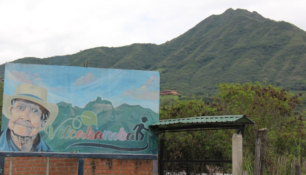
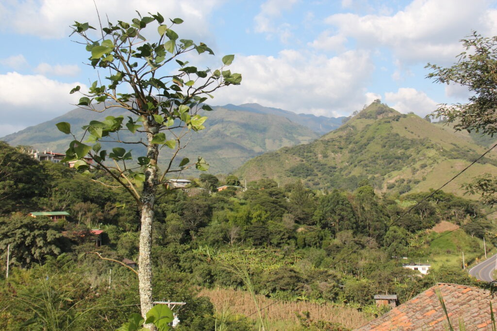
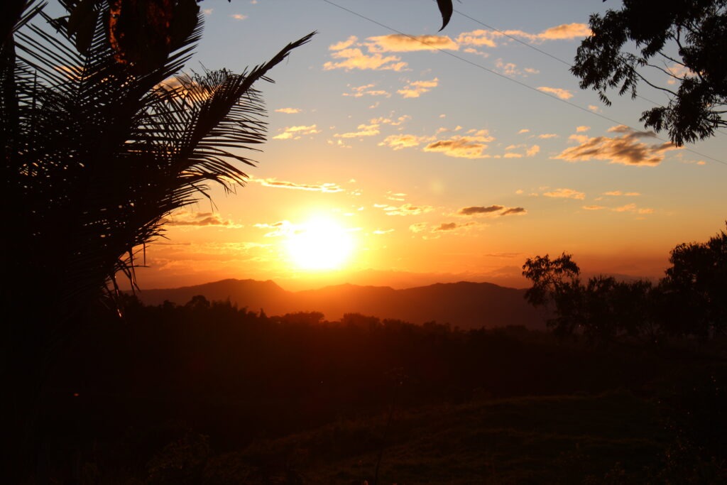
Four hours south of Cuenca and at a considerably lower altitude lies the bucolic Ecuadoran town of Vilcabamba. Like Cuenca, Vilcabamba ( or San Pedro de Vilcabamba to be precise ) is somewhat of a haven for North American retirees. Not so much, it seems, in the “snowbird” sense ( as in those who spend just the northern winters there ) but more the permanent type – folks who have retired and have permanently relocated there. Drawn by Ecuador’s reputation for great weather ( the climate truly is near perfect ), good medical care, an established expat community and overall affordability, Vilcabamba seems to attract those looking for a very slow, substantially rural, and – dare I say it – a somewhat more “granola” vibe. The kind of place where organic food, vegan restaurants, morning yoga routines and composting toilets are the norm.
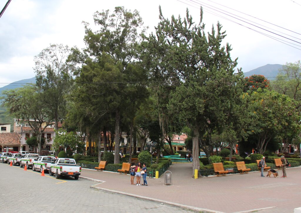
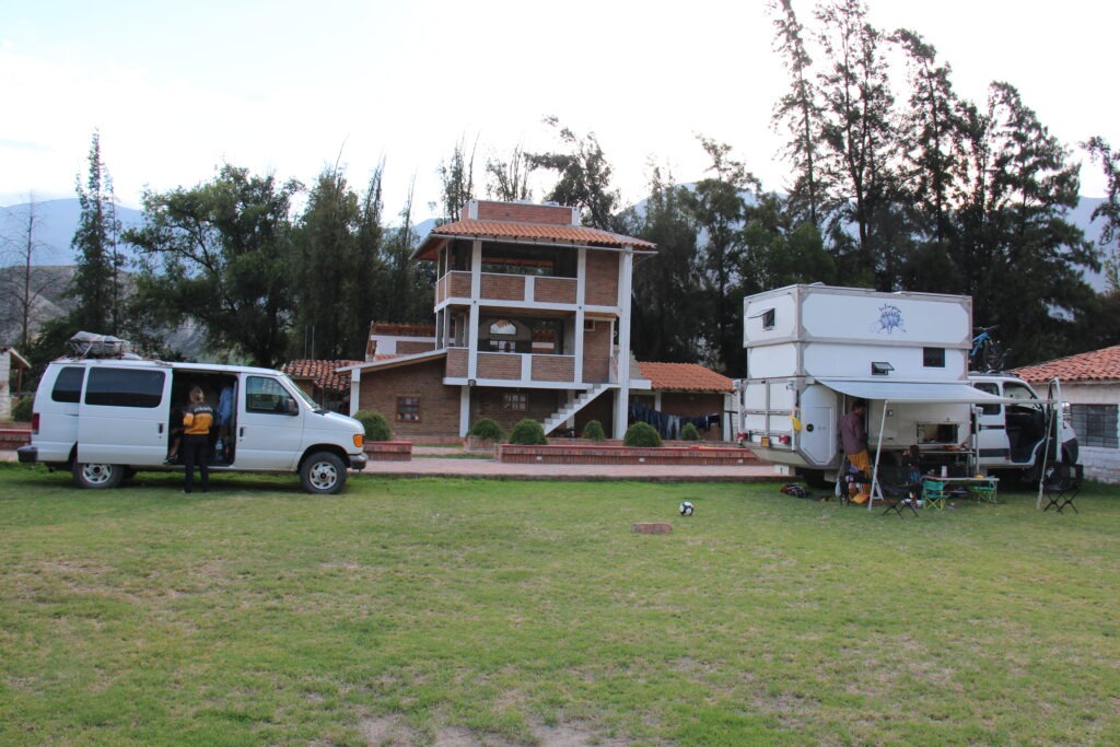
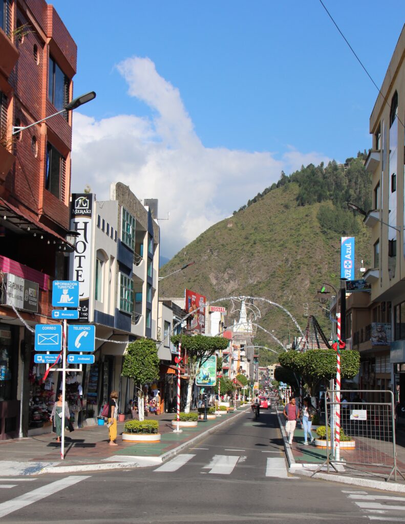
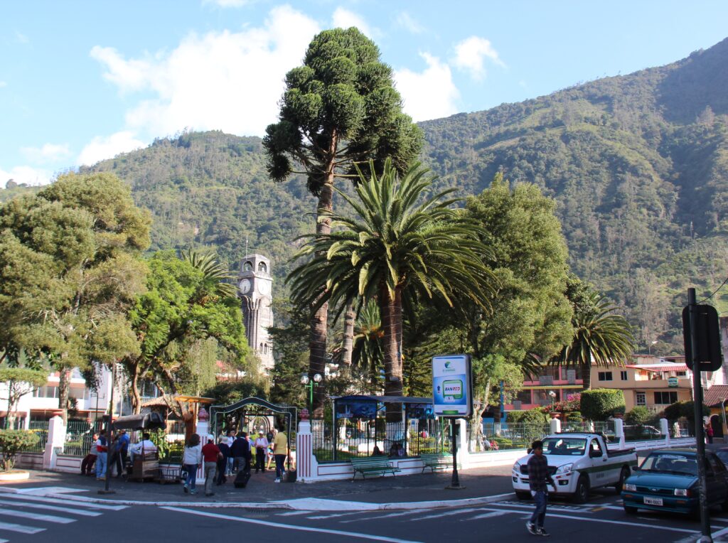
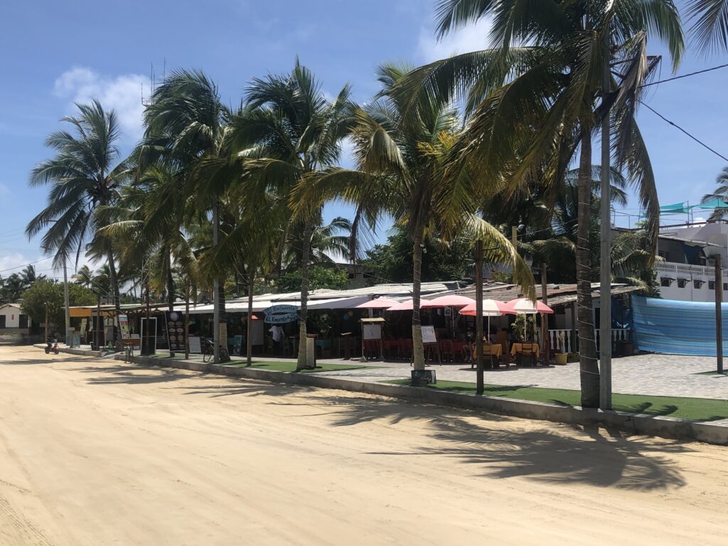
Our route this past week Vilcabamba, in southern Ecuador, is not only a delightful town in a beautiful valley but has a reputation for longevity among its citizens Coffee shops around the main squareVilcabamba, main town square
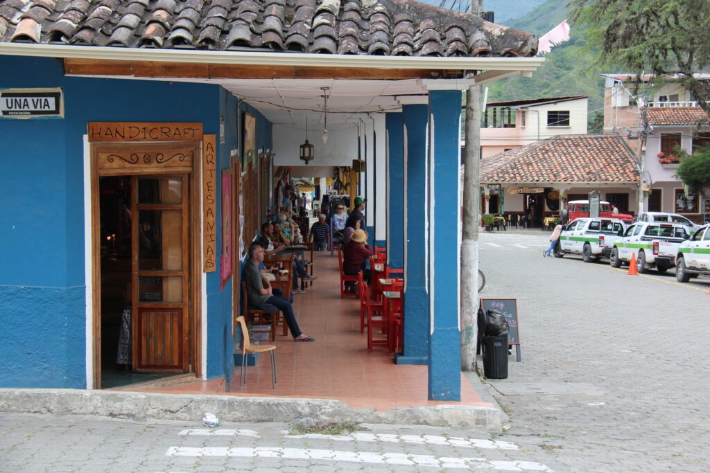
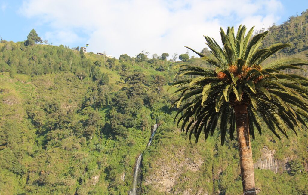
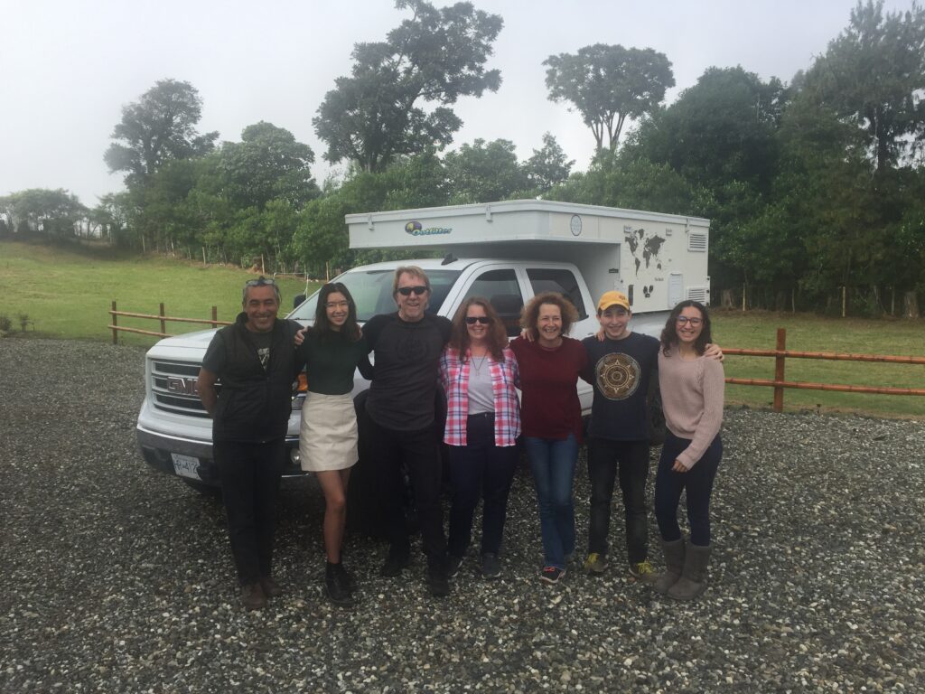
We enjoyed a couple of days there, wandered the small town centre, sampled the food, did a long overdue re-pack/re-org of the vehicle, learned much about Ecuador from Beatrice and Nathan ( our Swiss/American hosts ) and just soaked up the views and mountain air from their delightful hilltop retreat. A most enjoyable way to spend our last serious stop in Ecuador.
View from our campground, VilcabambaLooking the other way – pretty in every direction
One can drive immediately south of Vilcabamba and eventually cross to Peru however we weren’t looking for more rough and windy roads than necessary and like most overlanders, detoured back north, around Loja, west through Catamayo and on to the border town of Macara – away from the Andes down to lower elevations, better roads and hotter weather as you transit the generally uninspiring north-western interior corner of Peru.
Crossing from Ecuador to Peru was fast, friendly and painless. That said, the customs/border guys can be funny sometimes – they asked about fruit and veggies, checked our fridge then ignored the apples and bananas inside. They asked about plants – we had none except a faded Valentine’s Day red rose for Lois but they insisted that could not enter Peru. Conveniently for us they ignored the extra 80 litres of cheap Ecuadoran gasoline we were ( very obviously ) carrying externally – so we didn’t make an issue over the rose !
The Valentine’s rose that never made it to Peru
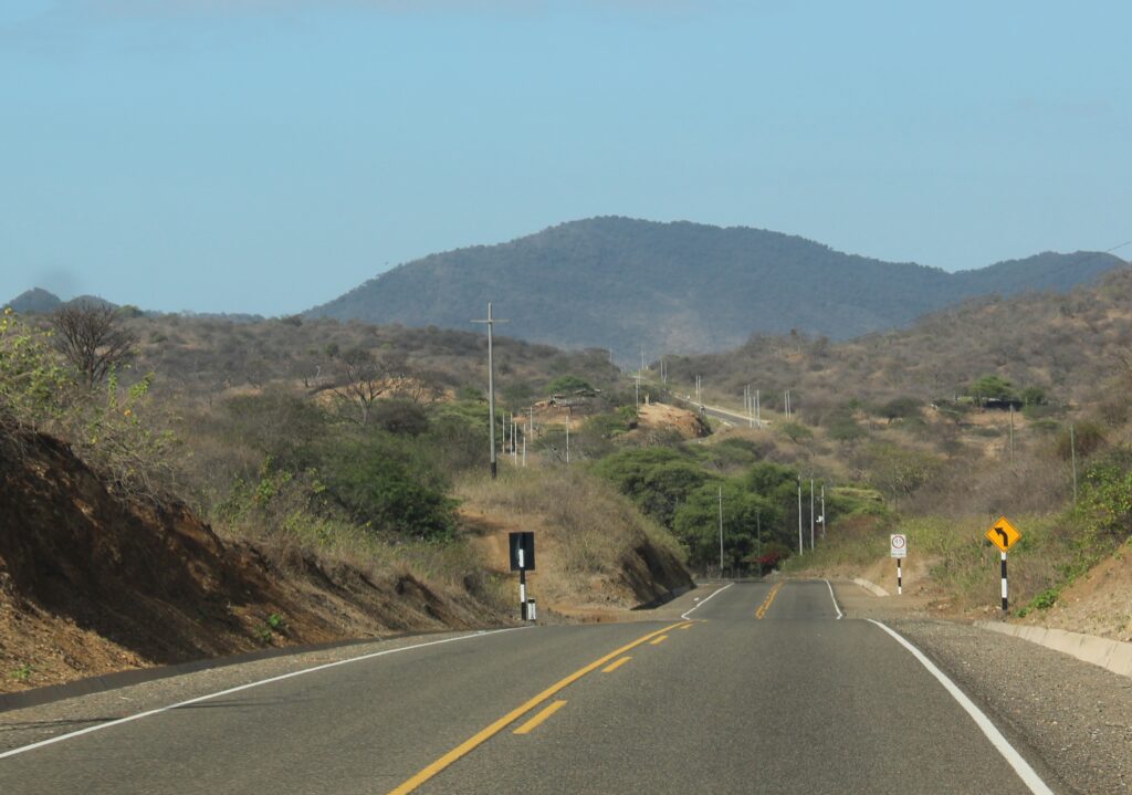
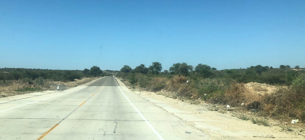
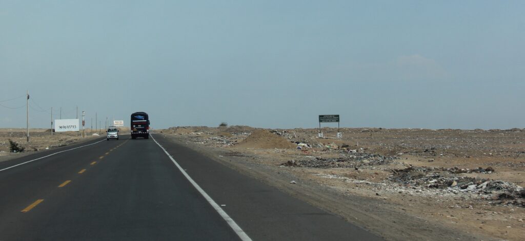
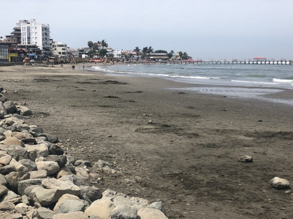
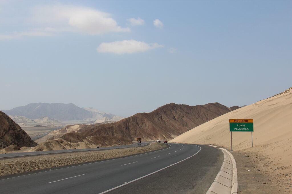
If only inland north-western Peru were just uninspiring. Sadly, it is also very hot, dry, dusty and is extensively littered- there is garbage everywhere. First impressions from the north were not good and it was in some respects fortunate that from the outset we simply planned to transit this area – in fact, due to the absence of notable attractions, dearth of camping opportunities and higher incidences of vehicle robberies and motoring scams, most overlanders do likewise. Peru’s big attractions lie much further south which is where our time would be focused.
First few miles in northern Peru and the landscape is already getting more aridSoon it becomes very flat, much hotter and, sadly, more littered While the roads are good, there is litter everywhere, just by the road, here between Piura and Trujillo. Not a great first impression when you enter from the north
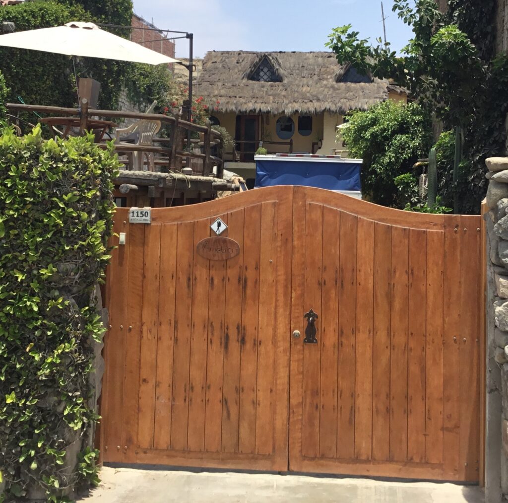
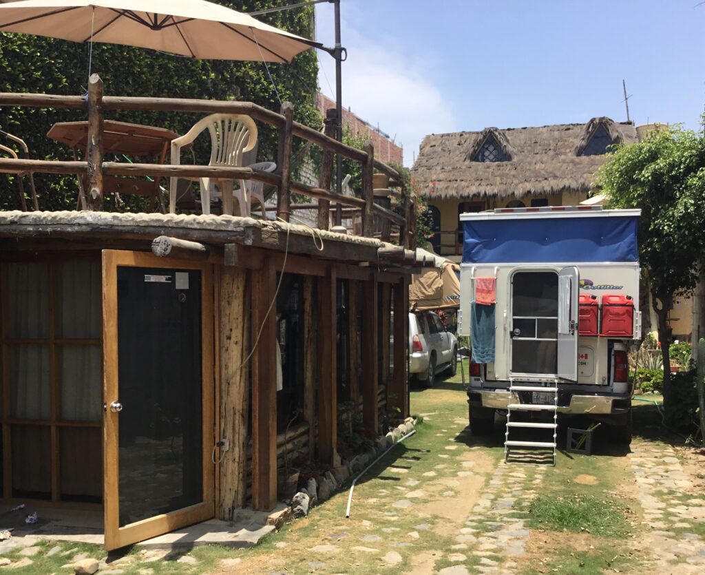
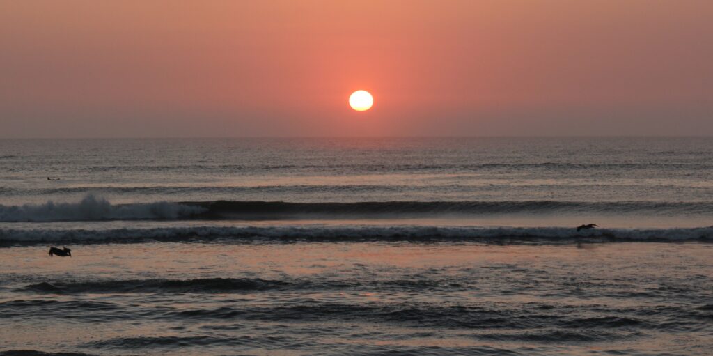
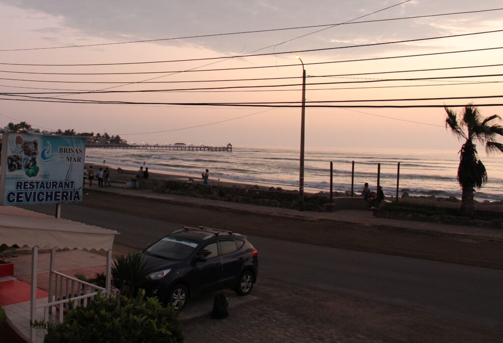
The small beach-side community of Huanchaco, just north of Trujillo was a great place to recover from an exhausting long haul through the northern desert and fortunately offered up a great camping spot right across from the ocean. “Casa Amelia”, another of South America’s “driveway” campgrounds was a relaxing place to rest up, compare notes with other travelers from France and Hungary who were there with us and plan our next moves into Peru’s famed Cordillera Blanca ( white range ). Part of the Andes that run along the spine of South America, many of these mountains offer stunning hikes, turquoise lakes and snow capped peaks – all in the 4,000 metre plus range.
“Casa Amelia” looks cosy from outside…..…but has room for 3 campers inside – comes with a sundeck, gentle sea breezes and evening Pacific sunsets. We shared it with a French couple in a 4Runner and roof top tentSunset, Huanchaco beachJust after sunset, Huanchaco beach, TrujilloWhile the sound of crashing waves and view of evening sunsets was relaxing, it was hard to get excited about the quality of Peruvian beaches in this area – just something about black sand we can’t get used to. They are better up north
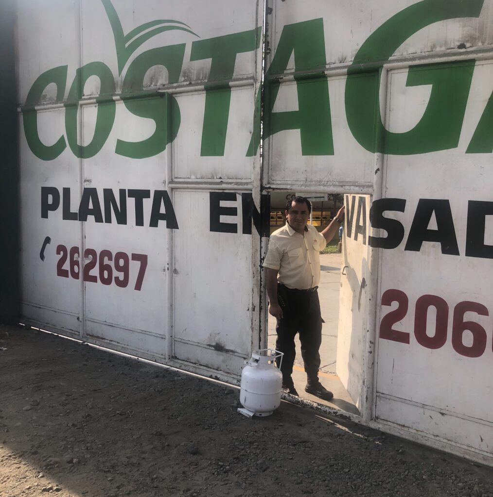
Leaving Huanchaco, the route towards Caraz and Huaraz took us south down the coast then inland. A quick stop at a Costagas outlet in Trujillo allowed us to refill our propane tank – while a seemingly mundane task ( finding propane ), finding propane sellers with a North American adapter is a real challenge across South America. Most overlanders simply top up when they come across one and so did we. Should be good to cook for a few months now !
Happiness is – finding a propane outlet that’ll refill a North American tank !Desert highway leaving Trujillo
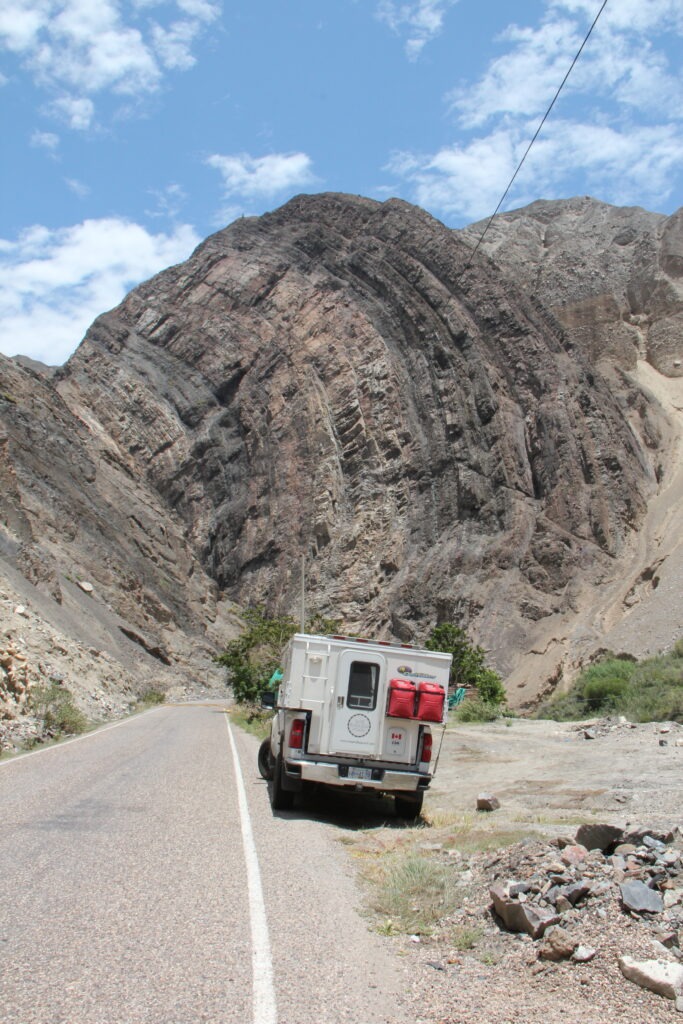
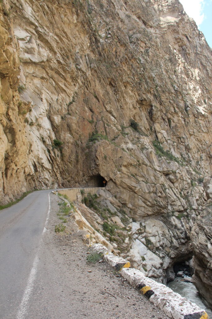
The desert quickly gave way to stoney mountains with narrow single lane roads cut into the rock. More dark tunnels than we could count and always a thrill when you meet a big truck and bus at the end – someone has to back up. Fortunately on our scariest moment ( with just inches of clearance) we were on the cliff wall side, not the canyon side !
Getting into the rocky canyons inland – a most unusual formation seen hereWe exited this tunnel to meet a large truck and bus – they squeezed into the single lane paved part with their outer wheels on the un-paved cliff edge
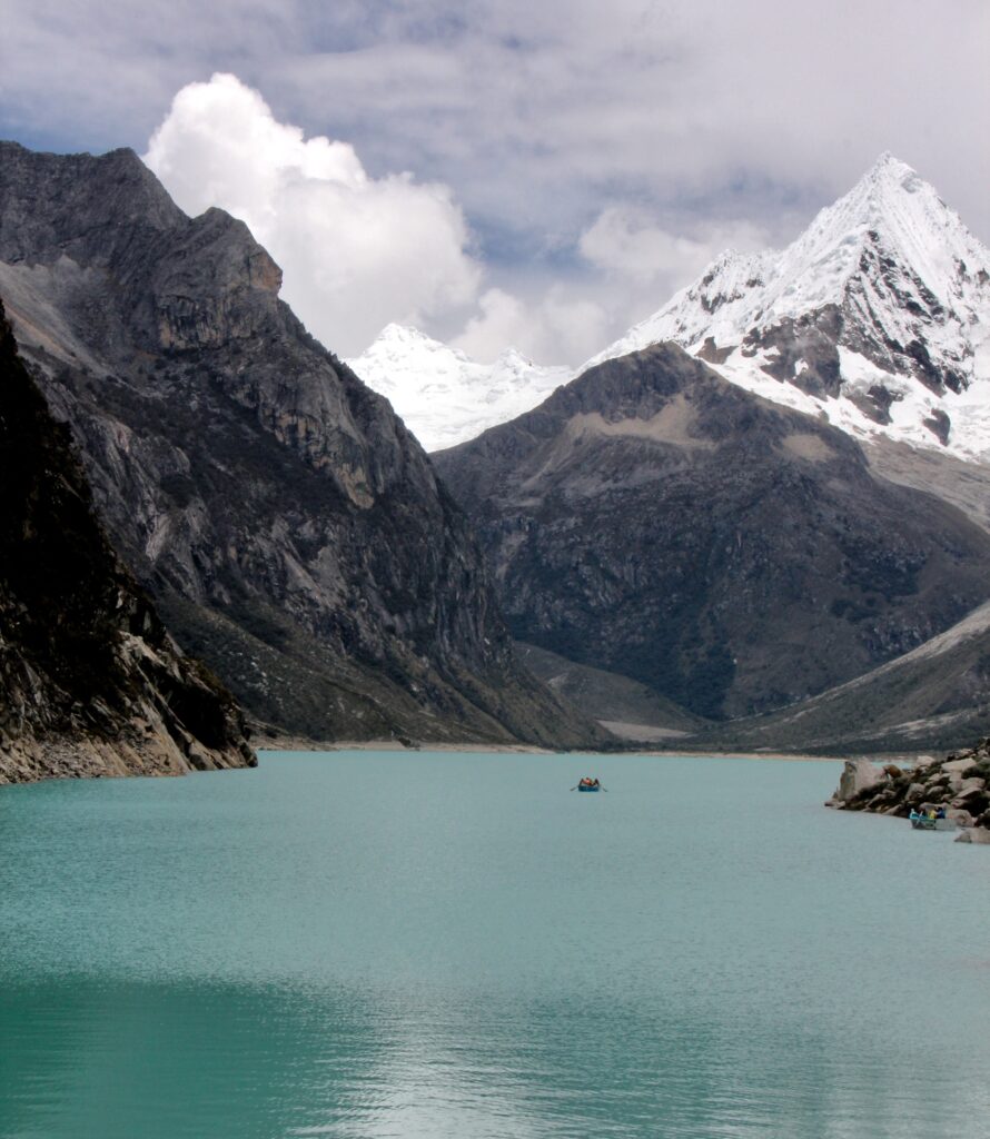
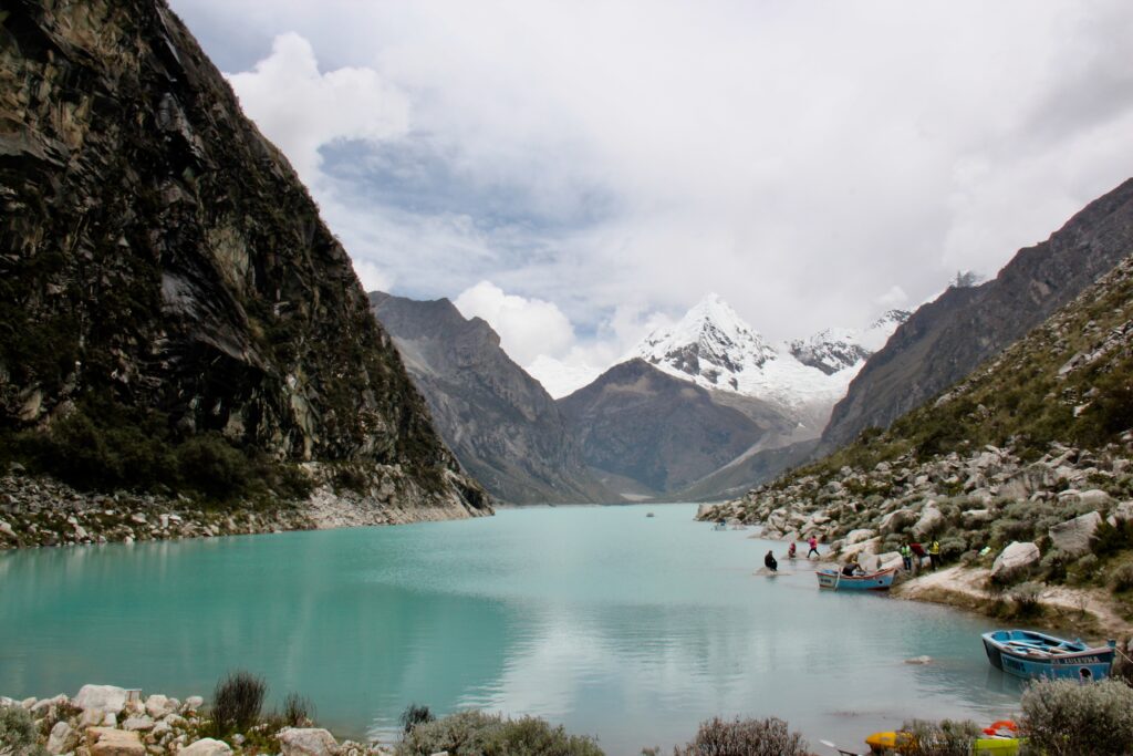
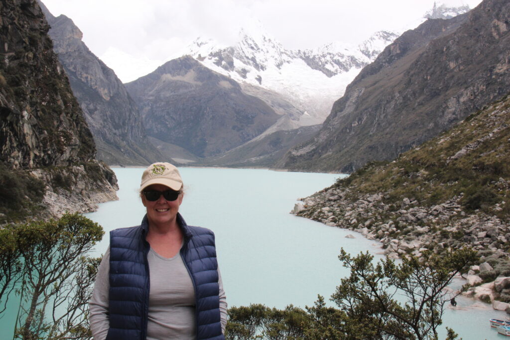
The six hour wild ride to get up into the Peruvian cordillera was, in the end, totally worthwhile – the views once up high are stunning. Many choices of places to stay but most choose Caraz (as we did ) or Huaraz. One thing we did did learn about altitude acclimatization is that simply going up high in advance does not do much for you – one must spend time up there of course in order to mitigate the effects of altitude on the body. The problem with travelling here of course is that you tend to go up and down a lot !
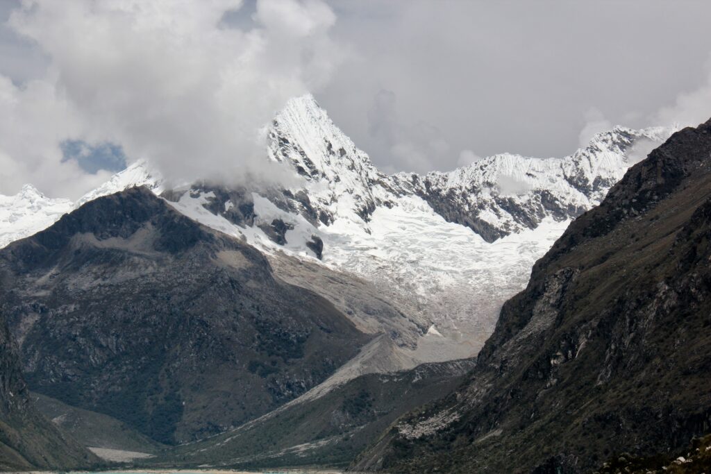
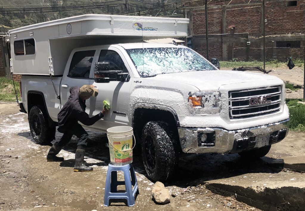
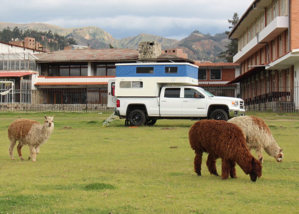
View from the road on the climb to 4300 metres to see Laguna ParonMountain backdrop at Laguna Paron, near CarazThe beauty of Laguna Paron – typical of the many similar high altitude lakes all through the valley around Huaraz Another view to the turquoise waters of Laguna Paron, near Caraz Lois at the Laguna Paron lookoutCamping in Caraz. A Belgian couple in the Ford van and a Canadian/Colombian couple ( with 3 kids ) in a home-built camper camped near us.Long overdue truck wash at a roadside “lavaderia” in Huaraz – the man took great pride in his work….…even polished the rims and tires – a very nice job and totally unexpected !Authentic Peruvian camping ! Here with 3 friendly llamas in the overlander area of the Real Huascaran Hotel, Huaraz. Reception guy said they were llamas, the security guy insisted they were alpacas !
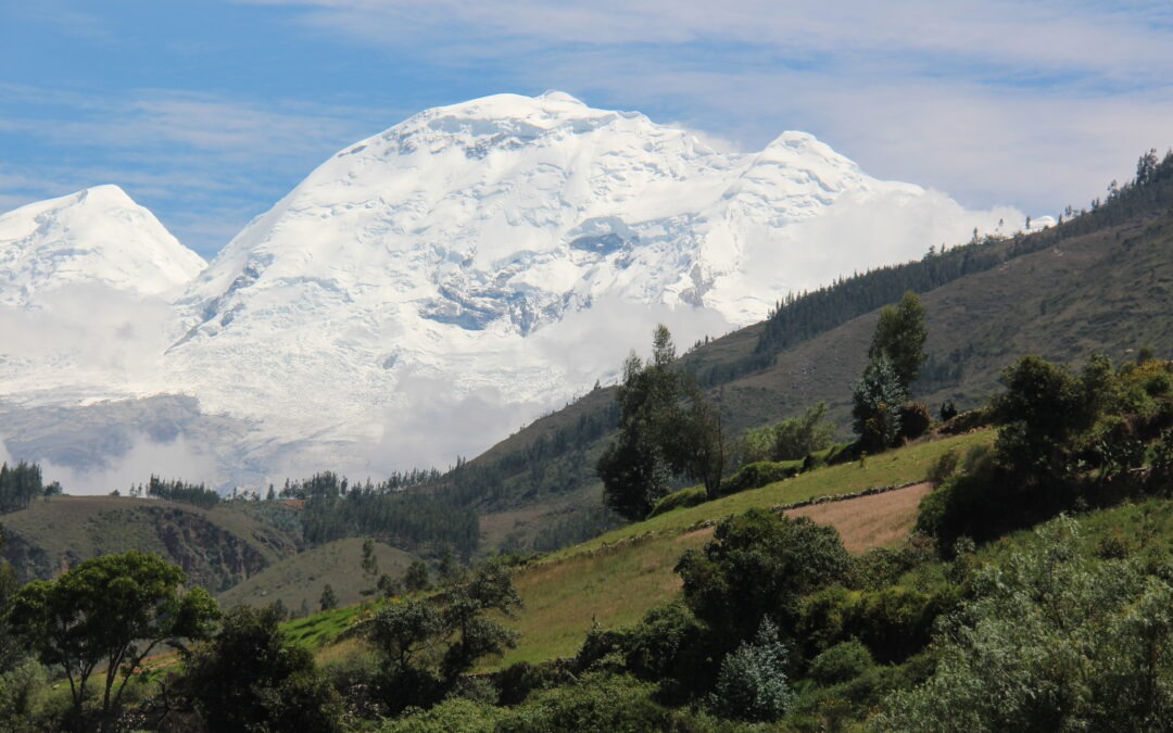
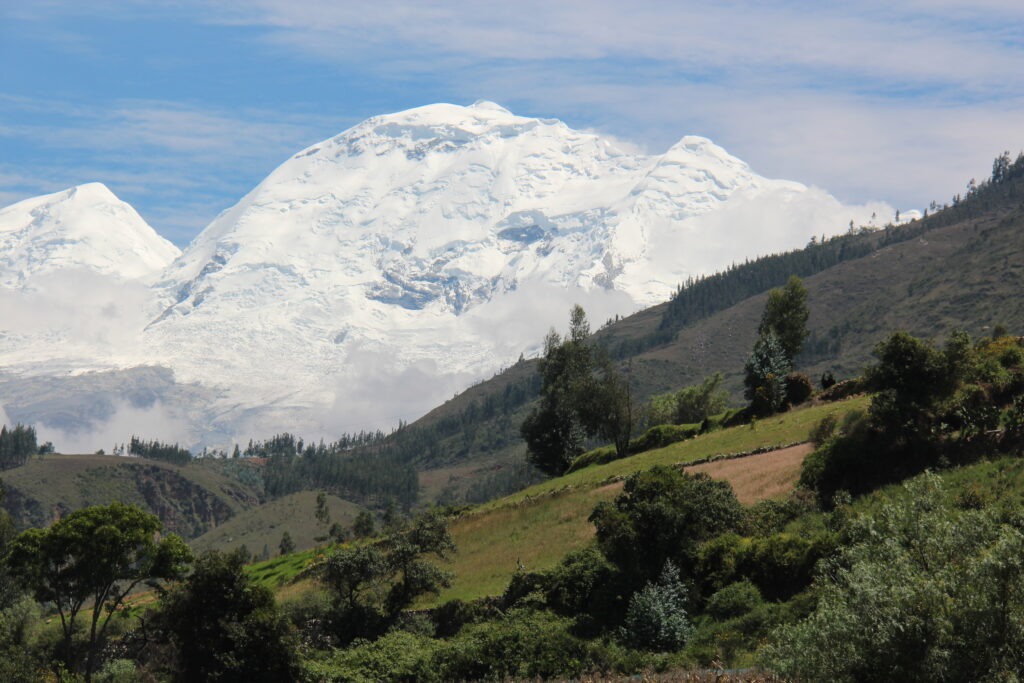
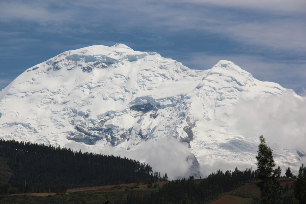
Our week closed out in the town of Huaraz right in the middle of the beautiful Cordillera Blanca. Travelling through the Huascaran valley had provided some amazing views of the best of Peru’s immense Andean mountains; in this area alone 30 peaks tower above 6,000 metres ( 19,685 feet ), the highest of which, Mt Huascaran, at 22,204 feet, was clearly visible on a beautiful sunny day. Simply stunning !
Stunning view of Peru’s highest mountain, Mt Huascaran, towering 6,768 meters ASL, just outside HuarazClose up of Mt Huascaran
We regularly refer to a Facebook group called the Pan American Travellers Association – with over 24,000 members it’s a bit of a bible for anyone doing the PanAmericana and full of all kinds of useful information and travel updates. Check it out here:
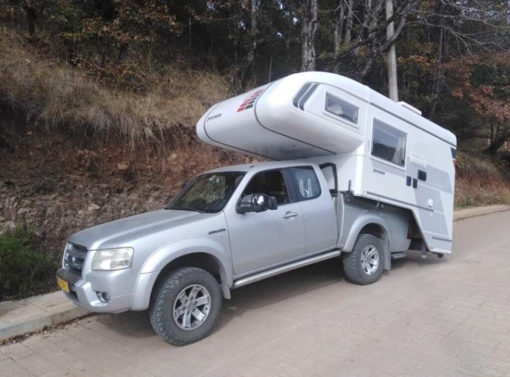
Sadly, I’m finishing this post with a picture from their Facebook site that was shared recently – it kind of hit home since we have a truck camper. A Dutch couple with what appears to be a camper that’s a bit too big, or truck that’s a bit too small ( or both ) after hitting a Mexican “tope” ( speedbump ) – hard. They are all over Latin America – lots here in Peru, too. Not a fun thing to happen on an overland trip far from home.
Having seen this we’ll be a little more vigilant on the speedbumps going forward !
What happens when the truck is too small, the camper too big, and you hit a speed bump hard – sad outcome for some Dutch overlanders in Mexico
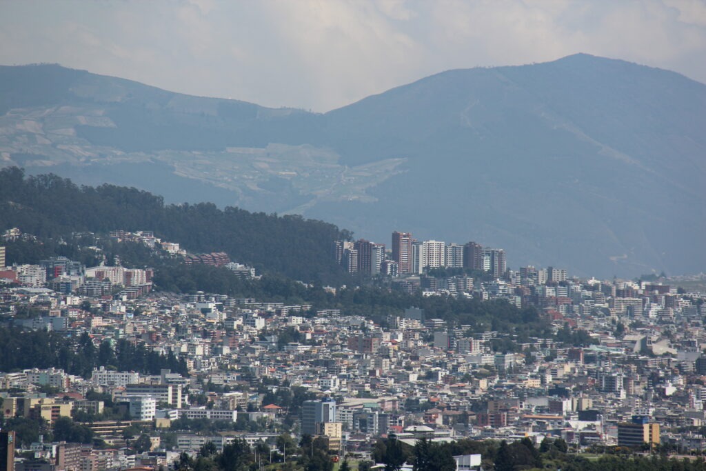
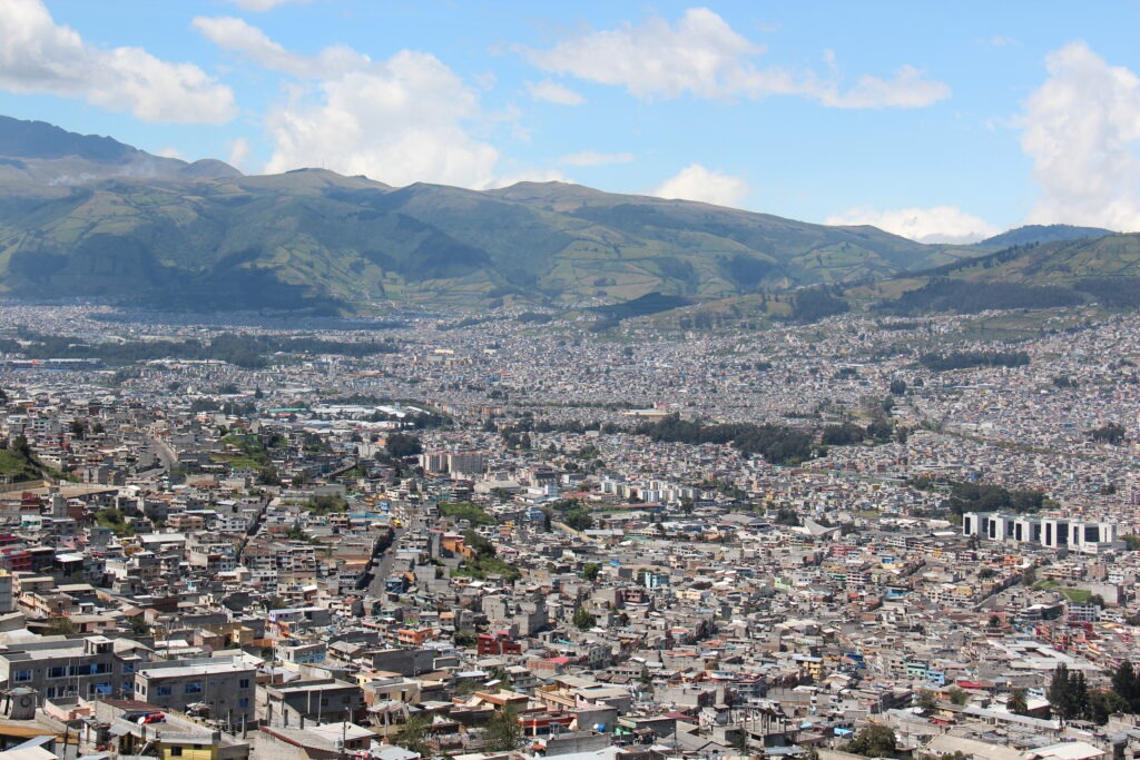
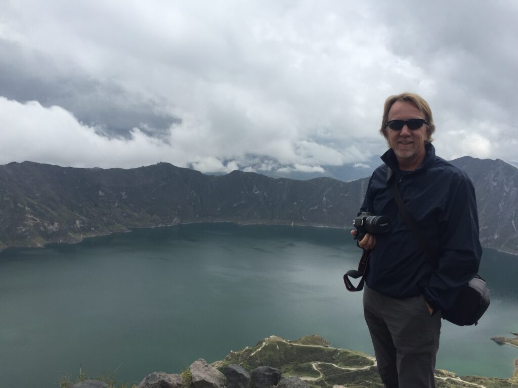
It’s probably fair to say from a sightseeing perspective that the bar was high after a week in the Galapagos. Suddenly, we thought, the rest of Ecuador was looking a lot less interesting. Banish that thought ! While we would not be seeing more stunning underwater marine life, quirky birds or Jurassic-like reptiles, the route south from Quito to Cuenca ( sometimes referred to as “Volcano Alley” ) in fact had much to offer.
Route through EcuadorView of the sprawling city of Quito, EcuadorMore of Quito
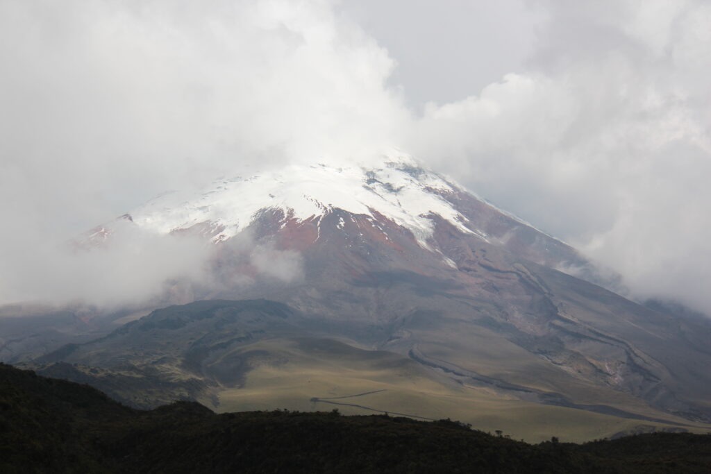
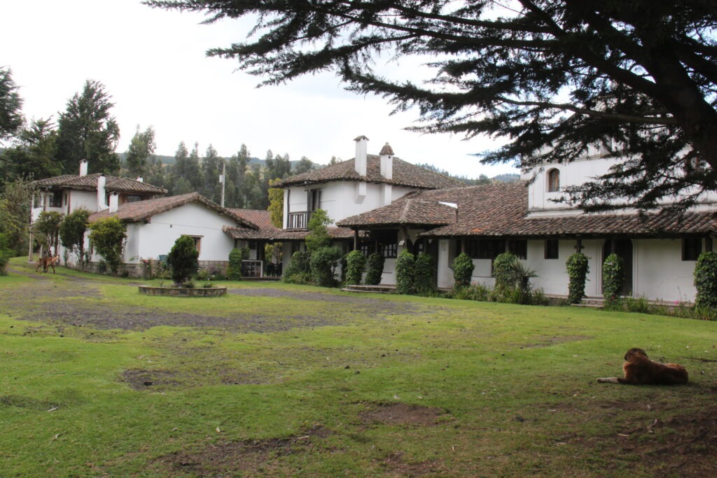
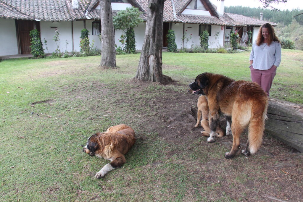
Ecuador’s second highest mountain, Cotopaxi, was our first port of call and is one of the worlds top 10 most active volcanoes. We had hoped to see it in all its glory and do a short hike, however the weather was just not cooperative. Cotopaxi was, for the most part, shyly hiding behind clouds though we did get a brief view of its distinctive snow capped peak. Drizzling rain on the drive down put paid to any hiking notions. Making up for some of the disappointment at Cotopaxi was the excellent evening spent with Adrian and his Swiss/Ecuadoran family at their delightful Cotopaxi hacienda/farm campground, Cuello de Luna. A favorite of hiking groups, this secluded spot was one of our favorites so far. The alpacas and gentle St. Bernard’s just added to the appeal.
Road to Cotopaxi volcano – washboarded all the wayView of Cotopaxi, Ecuador’s second highest mountainCuello De Luna, hacienda/campground, near CotopaxiLois with Adrian’s St. Bernards
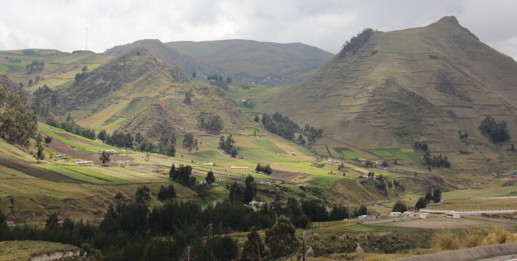
On our route south to Banos, Adrian had recommended a visit to Quilotoa Crater Lake, a 2 hour detour for us but ultimately well worth the drive – at almost 13,000 feet just walking from the car park to the viewpoint was exhausting, however the view at the end made the exertion worthwhile
Ecuador countryside, en route to Quilatoa Crater Lake. We got to just under 13,000 feet on the way here ( not quite 4,000 metres ). Good practice acclimatizing for even higher passes in Peru !Quilotoa Crater Lake
One of Ecuador’s favorites, the thermal spa town of Banos has been a standard overlander stopover for years. Fond memories of an earlier visit fresh in our minds we made straight for the thermal pools which were very relaxing. Banos also offers an array of exciting outdoor activities for those so inclined ( it was all about the pools for us ) along with great restaurants and coffee shops where we whiled away our time.
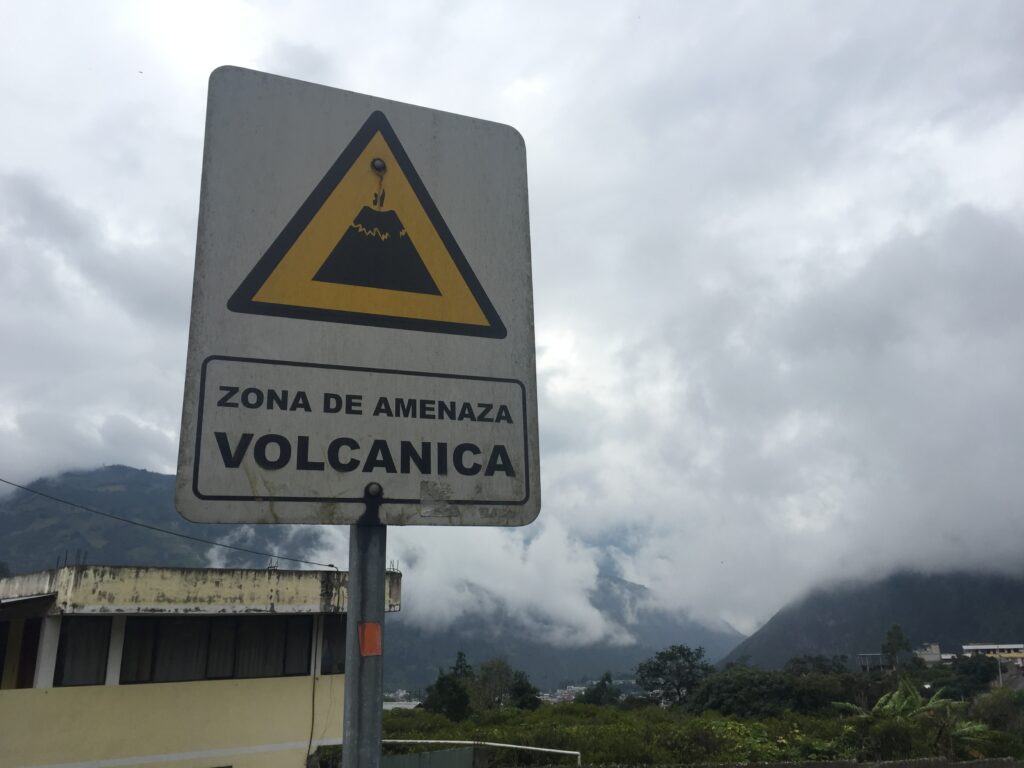
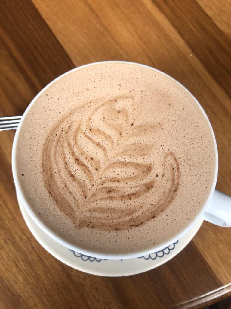
Banos downtownBanos downtownBanos waterfallEl Salado thermal pools, BanosA reminder that all of Banos is in a volcanic threat zone – Volcano Tungurahua towers over the townBest hot chocolate in a long time – Banos !
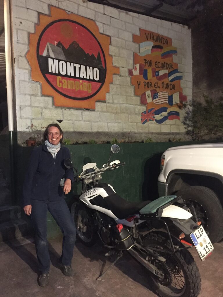
Seems to have been a week for meeting motor-cycling overlanders and Banos was no exception. After meeting two Americans, Thomas and Shane, at Quilotoa who were en route to Ushuaia like us, we spent time in Banos sharing information with Tina, a solo German, and 4 Czech riders who were also going south. The Czechs had also ridden down the west coast of Africa and up its east coast so were full of useful tips for us ( should our plans for Africa pan out down the road ). We did experience some rain in Banos and while we’ve ( well, at least I’ve ) often thought a two-wheeled overland adventure would be fun, watching them pitch tents in the rain, pack away wet equipment for a long day’s ride and then ride off getting drenched again, I must admit that some of the allure has worn off.
Tina, a solo female biker from Germany doing parts of the PanAmerican Highway, here in Banos. She was riding a 350cc bike, small by the standards of most overland bikers we have met. The Czech’s all had 1200’s !Zbynek, one of 4 Czech motorcyclists that pulled into Montano campground where we stayed in Banos. He had previously ridden up and down Africa on a motorcycle and gave us great tips should we make it there – one day we hope
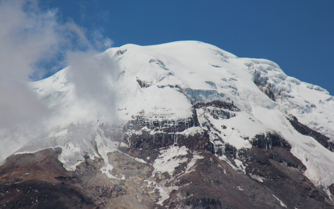
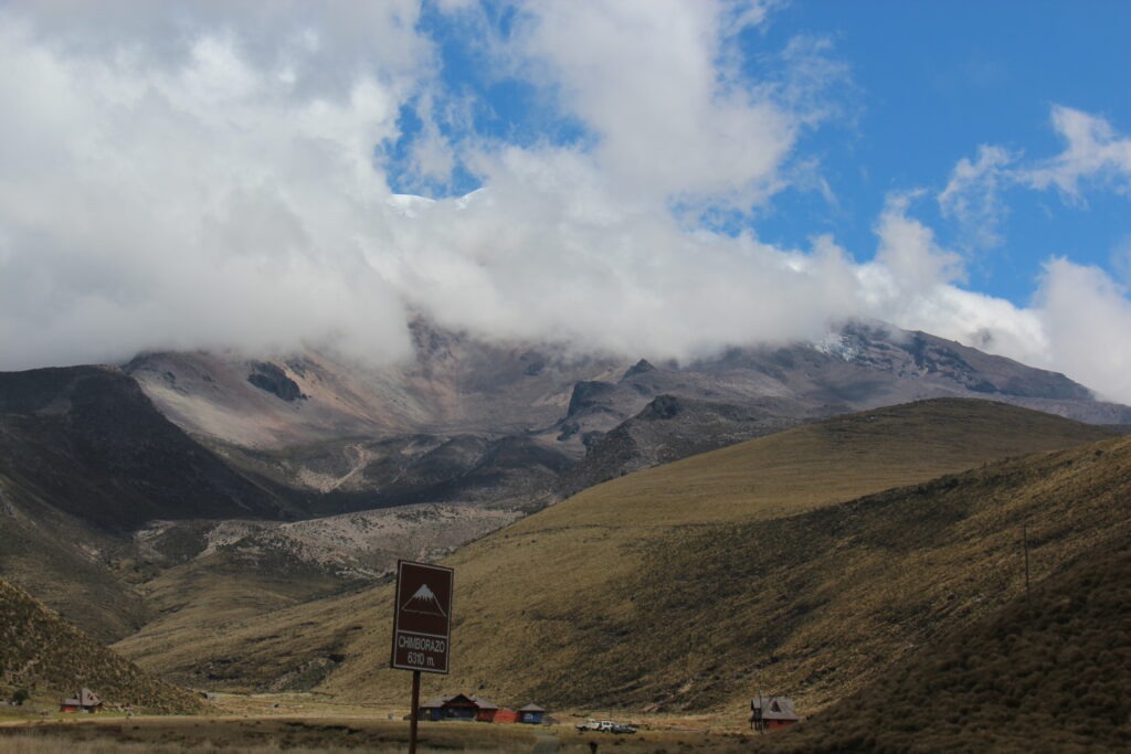
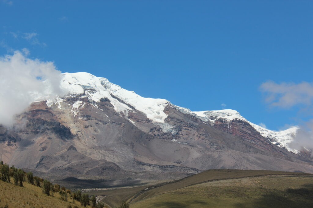
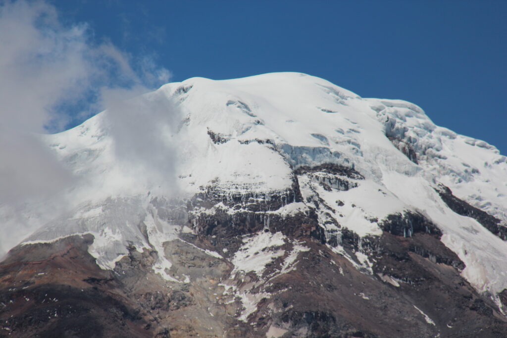
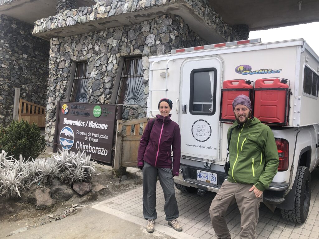
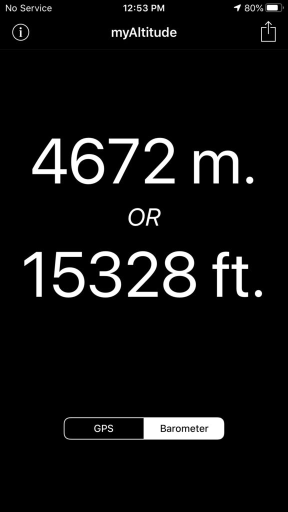
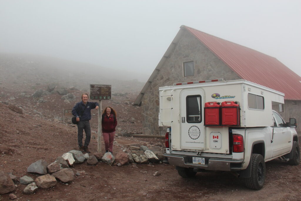
Chimborazo is Ecuador’s highest peak – higher, in fact, than any other peak north of it in all of the Americas. Getting to it ( up close ) involves a drive on good ( if somewhat pot-holed ) roads to just over 4,000 metres ( 13,200 feet ) and then an extremely wash-boarded dirt track to a climbers refuge at 4,700 metres ( 15,400 feet ). While the challenge of the drive and then just walking around in such low oxygenated air was an experience, the best views were actually down much lower. We had been warned Chimborazo can be temperamental ( for viewing ) up close. A few hardier types were trying to hike at that elevation but it was very slow going.
Our first view of Chimborazo from a lower elevation – substantially obscured…..then the clouds parted….revealing this – the peak at 6,310 metres. Stunning !
Spending time at the high elevations not only brought us some great sights and challenging drives but helped prepare us for Peru and Bolivia where we will be experiencing several mountain passes in the high 4,000 metre range and one even nudging 5,000 metres. No altitude sickness for either of us but definitely felt a bit wobbly when we got up too quickly or exerted ourselves too much. The best views of Chimborazo were actually nearer to the entrance of the park but we still we wanted to tackle the last 8 kilometres – all rough, badly washboarded road, just to see how we felt at that elevation if nothing else.
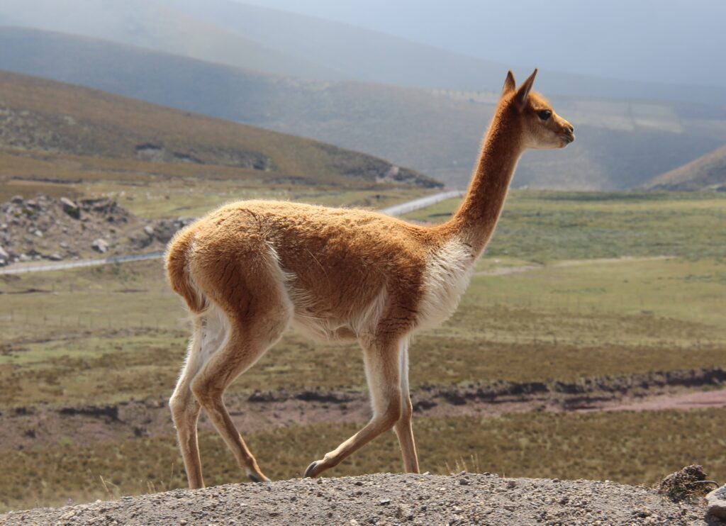
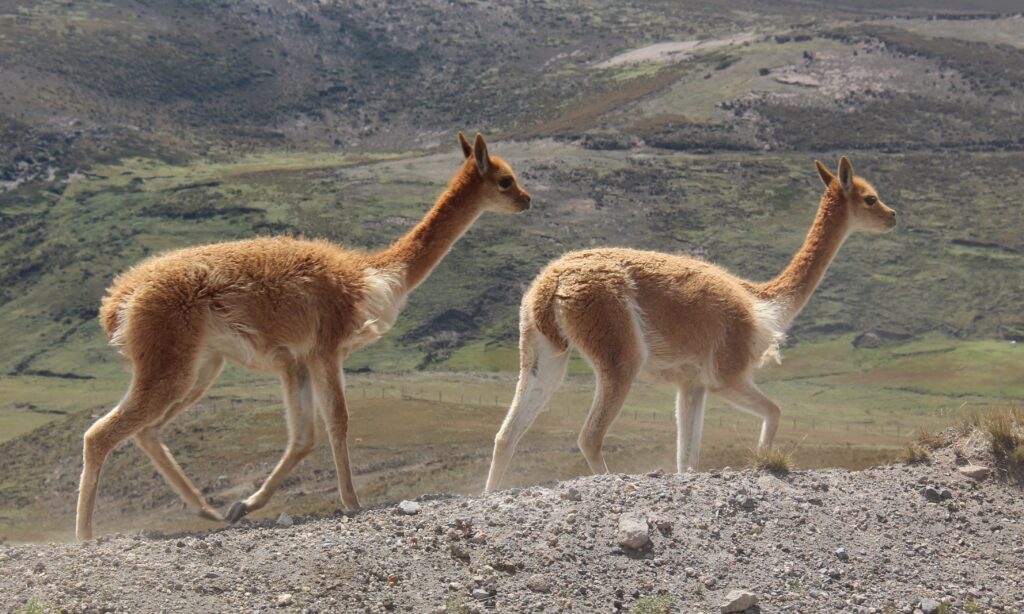
We passed this French couple trying to walk the last 10 kms to the entrance to Chimborazo National Park. No room in the truck but they happily accepted dinette seats in the camperAs high as we could go on the road the Chimborazo and at this height breathing was tough for us – and the truck ! Normally aspirated gasoline engines lose 3% of their power for every 1,000ft gain in altitude. At over 15,000 feet our big V8 only had the power of a 4 cylinderOne of the many vicuña we saw on the way to ChimborazoMore vicuña Here we finally made it to the refugio ( refuge hut ) !
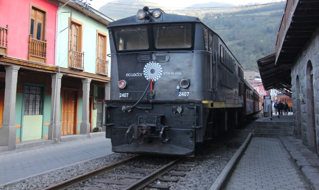
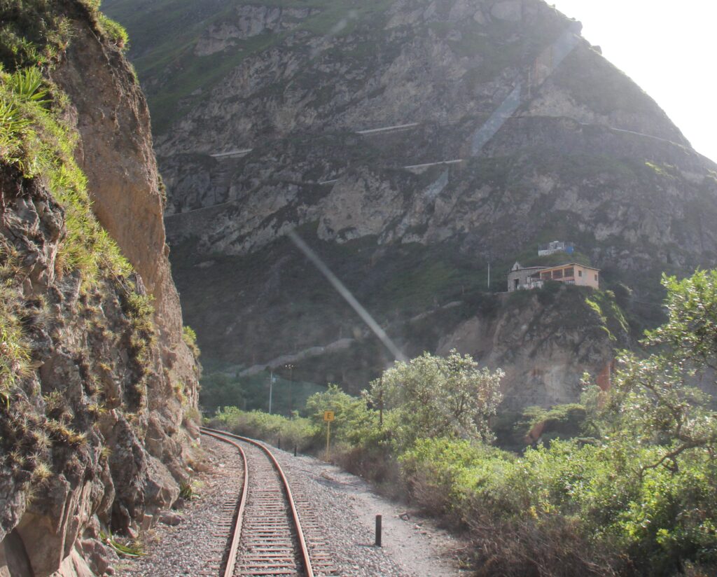
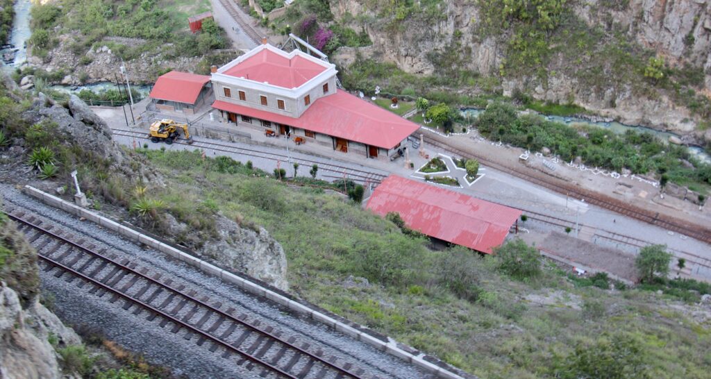
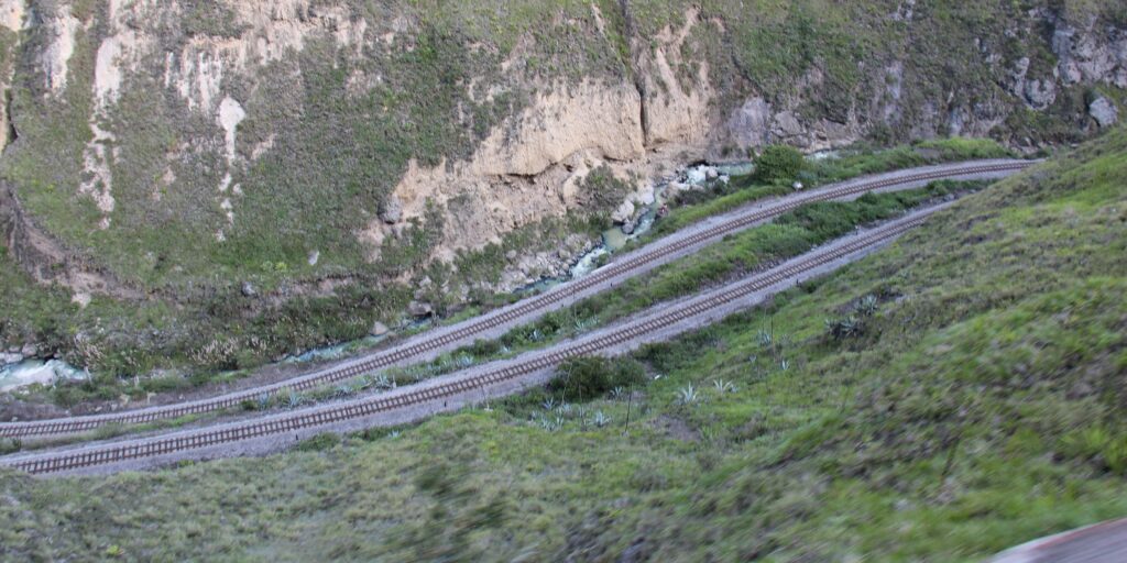
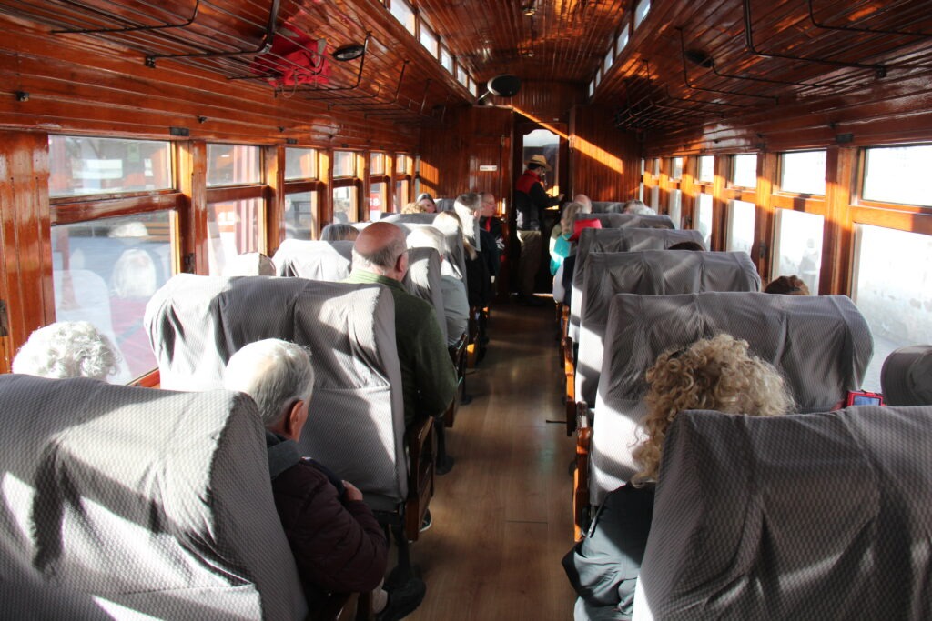
Just a two hour drive south of Chimborazo is the town of Alausi, famous as the jumping off point for the “Nariz Del Diablo” or Devils Nose train, to Sibambe. Completing the track in 1902 was an astonishing feat of engineering that allowed the train to navigate very steep descents/ascents and almost perpendicular walls in the high Andes via a unique zigzag system. The ride was truly spectacular, considered Ecuador’s finest, and is popular with train buffs the world over. There is a great story on the history of the train here:
The Nariz Del Diablo train waiting at Alausi stationShot through the rear window of the Nariz Del Diablo train – just visible above the houses are two levels of the zig-zagging track that hug the steep sides of the mountainThe destination station of Sibambe, shot from two track levels aboveTypical track “tiering” on this very steep incline/declineThe carriages are old classics and restored beautifully
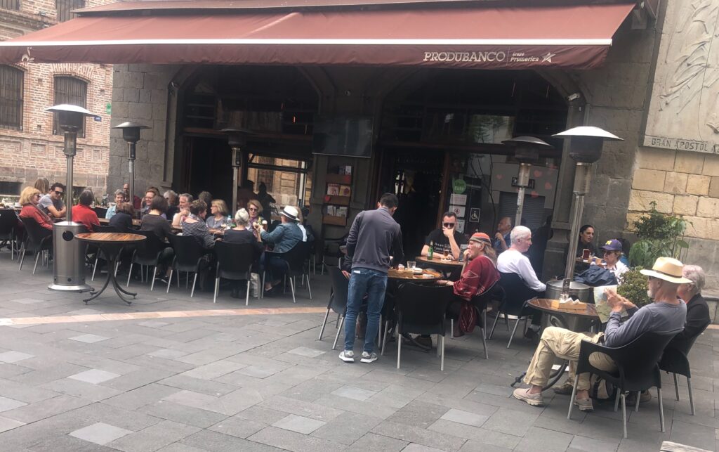
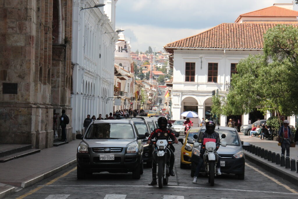
Ecuador’s 3rd largest city, and arguably its most beautiful would be our last stop for the week. Cuenca, set at 2500 metres, has a year round mild climate that makes it not just popular with Ecuadoran’s but also a haven for North American retirees ( as well as others ) – the number of foreign residents is obvious after just a short walk around this very pretty riverside city, or a stop in any coffee shop.
There really are a ton of expats living in Cuenca. A cafe we visited during our stay and barely a local in sight
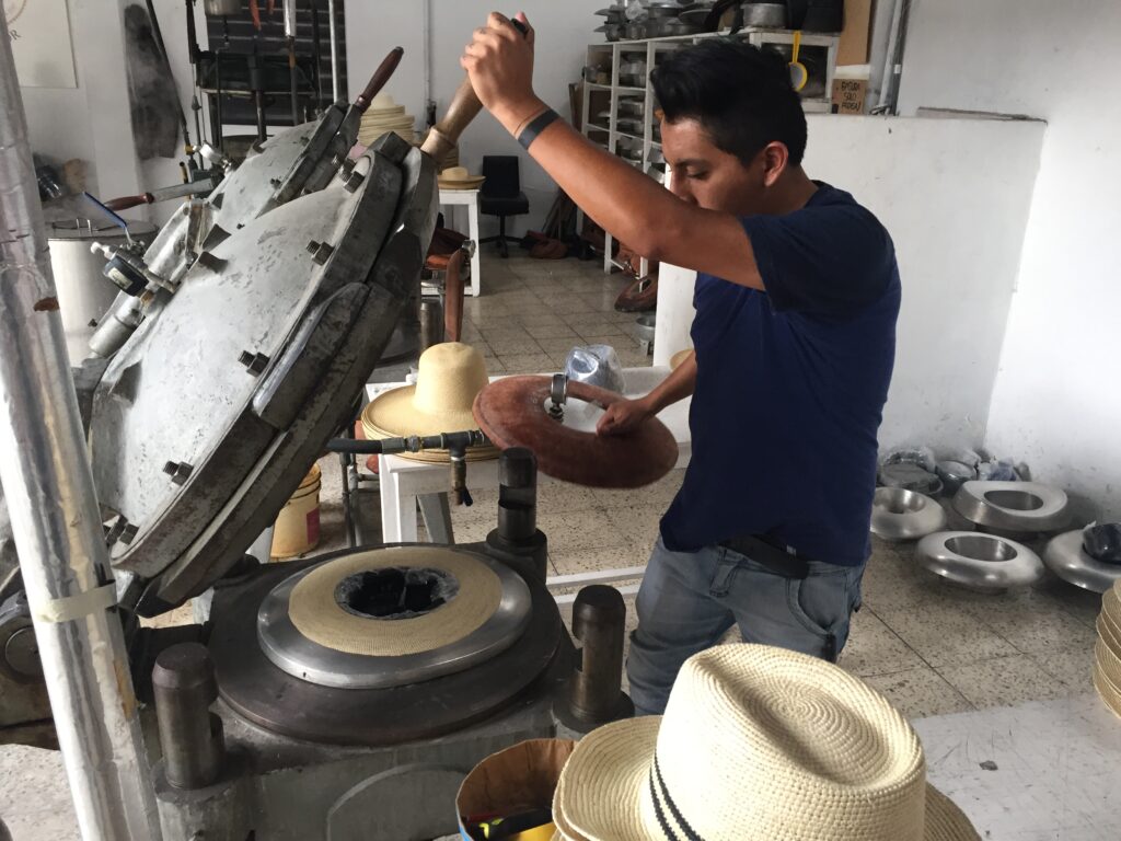
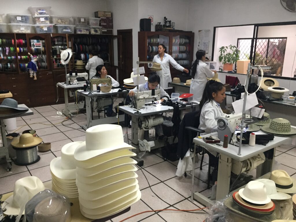
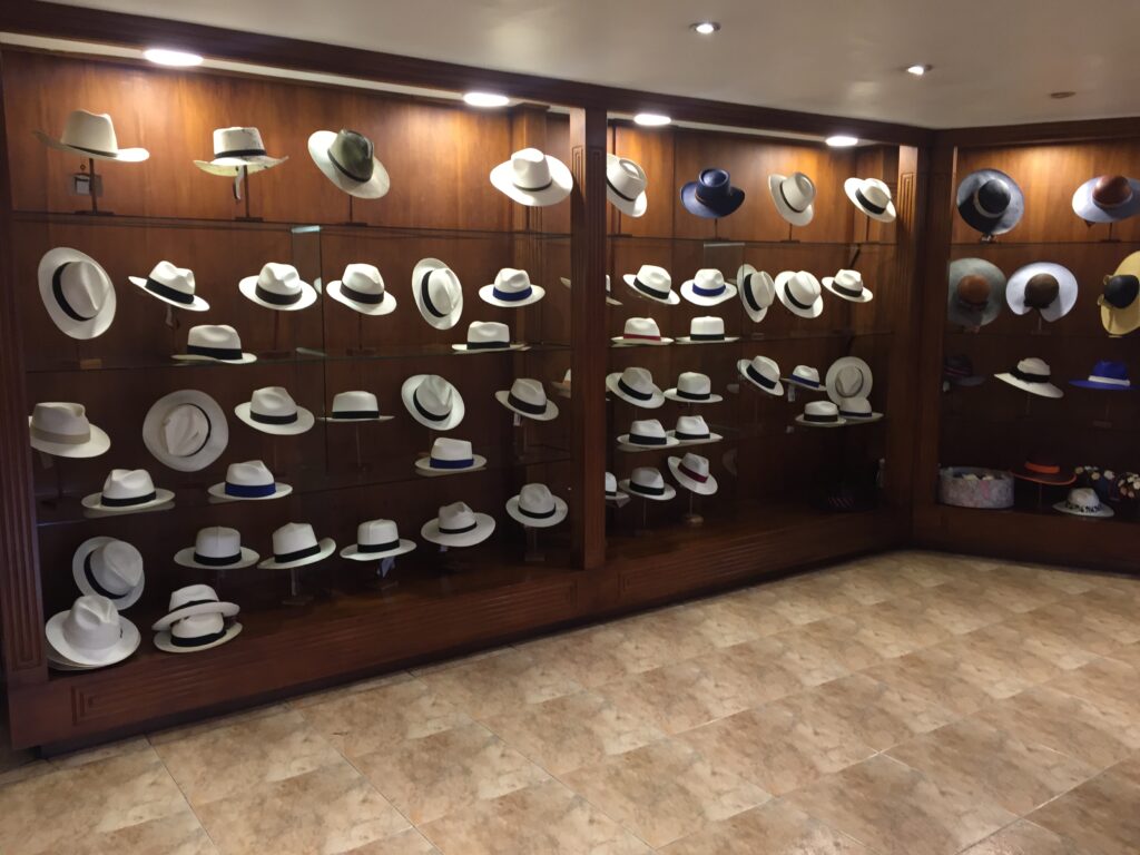
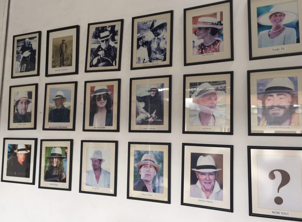
Cuenca is famed the world over for production of original “Panama” hats. While that may seem a tad oxymoronic, as one of our regular readers ( Charlie Harris ) pointed out when I did an earlier post from Panama, “Panama” hats are not actually from Panama. There’s an interesting background to that story and we got it when we visited the Homero Ortega factory right here in Cuenca. A fascinating tour, and some beautiful product to choose from – yes, we bought one ! More detail on the origins and history of the Panama hat can be found here:
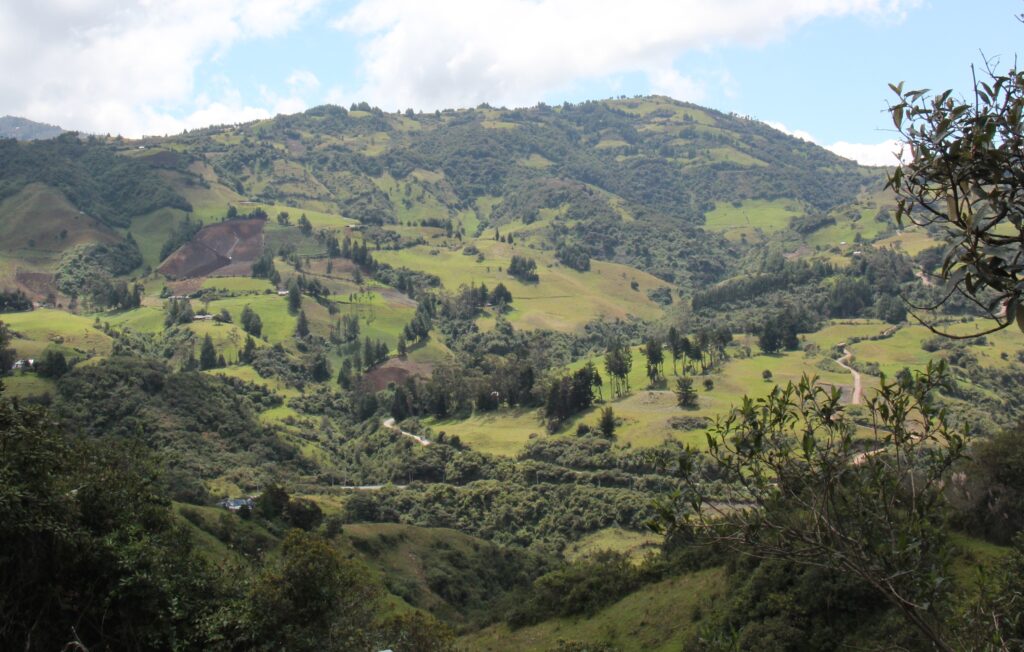
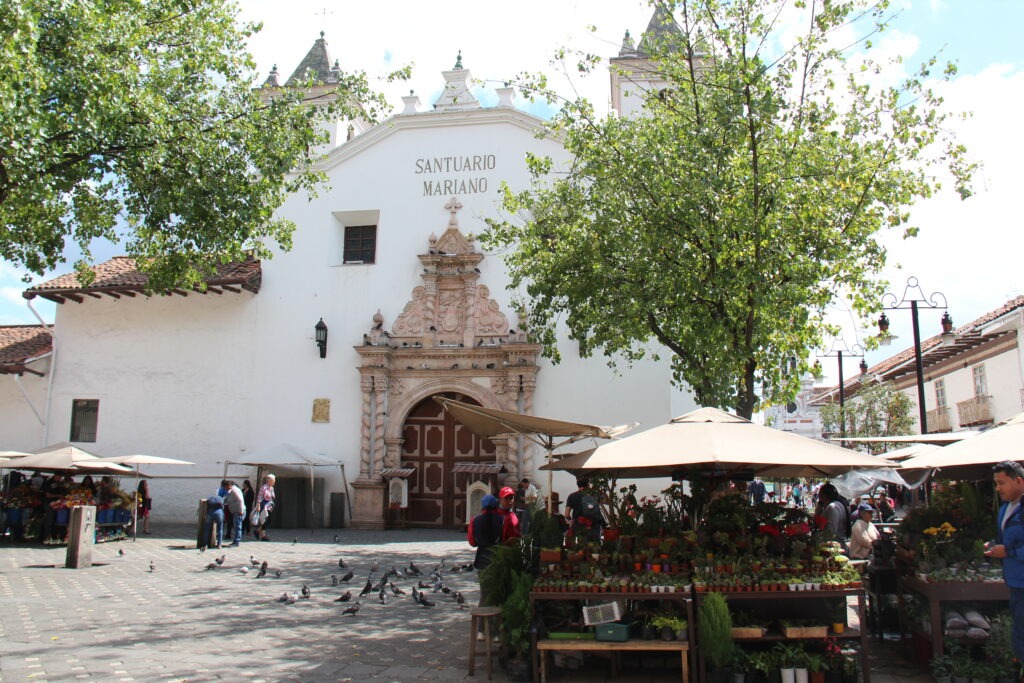
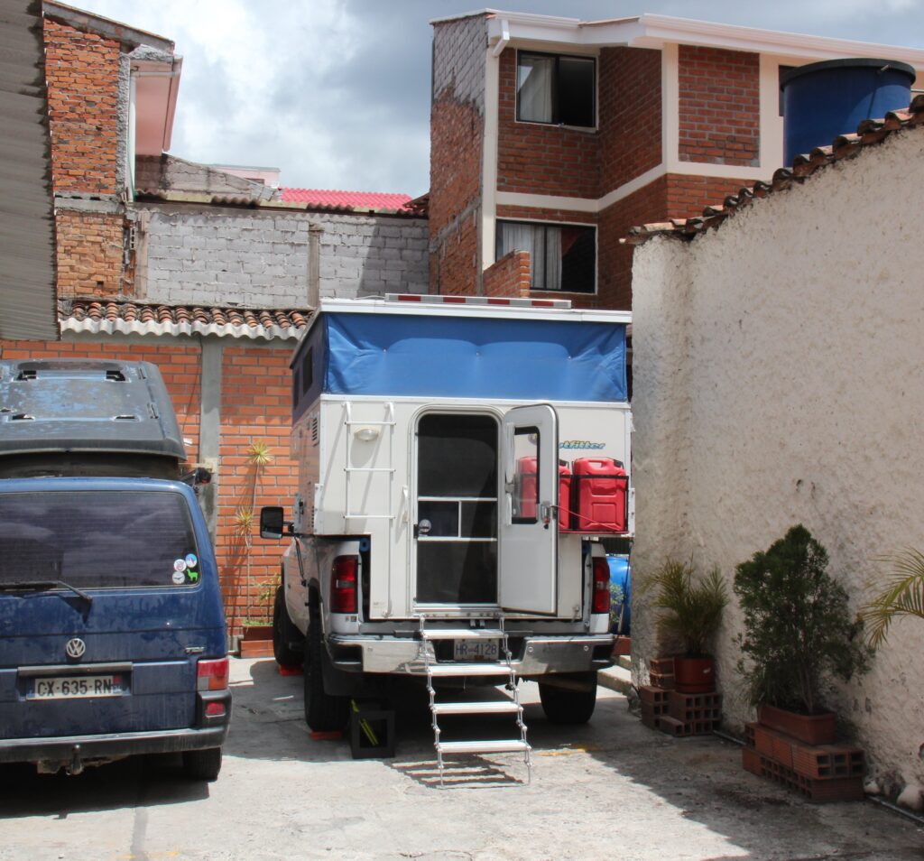
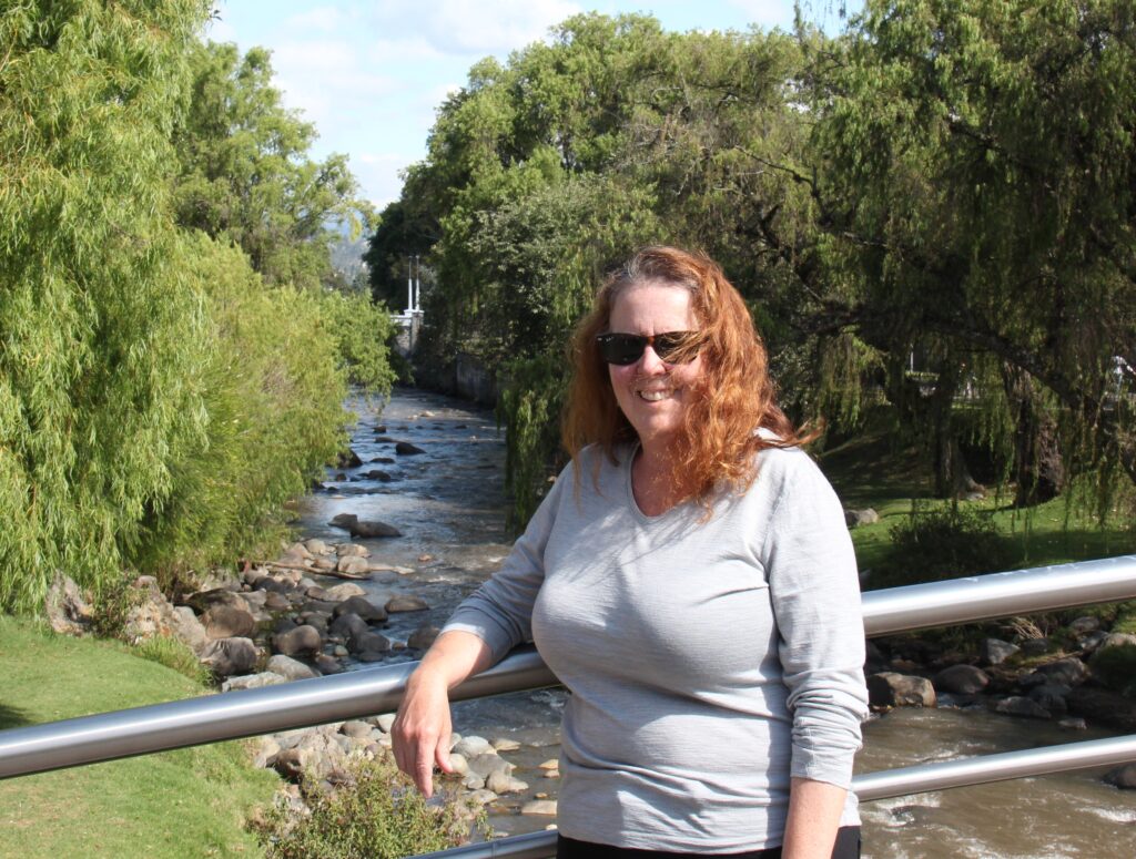
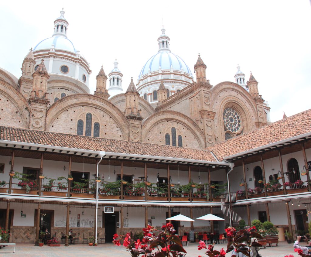
Ecuadoran scenery en route from Alausi to CuencaFlower stalls doing a roaring trade ahead of Valentine’s Day, Cuenca A French couple ( VW ) and ourselves – squeezed into Tu Parada campground, downtown Cuenca. More of a secure, gated private driveway than a true campground, we enjoyed incredible hospitality from our host, Miriam, right in the heart of townLois, on a bridge over the Rio Tomebamba in CuencaDowntown Cuenca – the many white buildings, terracotta roofs and parks make for a very pretty cityThe famous 3 blue domes of the Catedral Nueva seen here behind a plaza of boutique restaurants and coffee shops in CuencaThe Homero Ortega Panama hat factory, CuencaThe finishing roomAnd the showroom – for menAnd for the ladies – mostly high-end product it seemedWho could forget Julia Roberts’ outfit in “Pretty Woman” . While she wore a Panama hat she is obviously not the only star partial to them
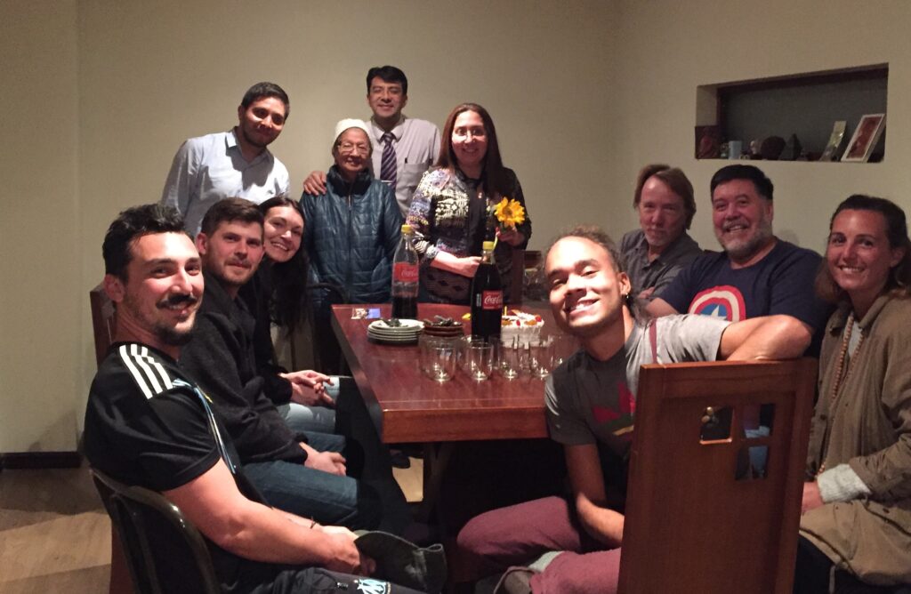
Our host in Cuenca, Miriam, turned 48 on the day we arrived. With visitors from Canada, France ( the couple in the van pictured beside ours ) and 4 other visitors from the US and Chile staying in the house ( she runs an AirBnB as well ), Miriam invited us all in to join her family and share in her birthday celebrations – a great time was had by all and it was a wonderful end to another week in Ecuador.
Celebrating our camping hosts 48th birthday in Cuenca with family and fellow overlanders
Mere mention of the Galápagos Islands conjures up images of otherworldly giant reptiles, rare and colorful oddly named birds and a profusion of amazing undersea creatures. Few would not jump at the chance to go there and while it is remote and far from almost everywhere, not so when you are already in Ecuador. Having passed up that opportunity when we were time-restricted once before there was no such hesitation this time around. Once our Galapagos week was booked from Quito, both of us were like kids at the gates to a theme park while sitting in the airport lounge waiting to depart.
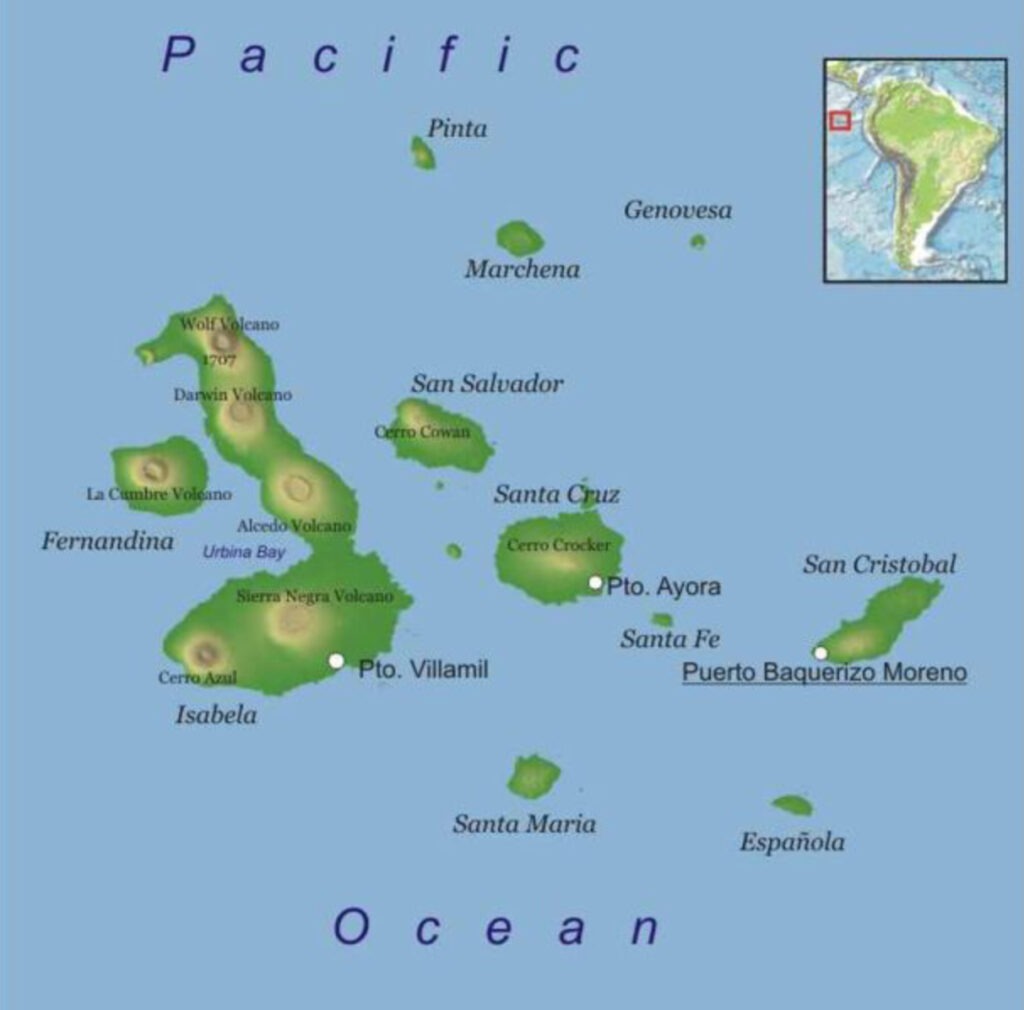
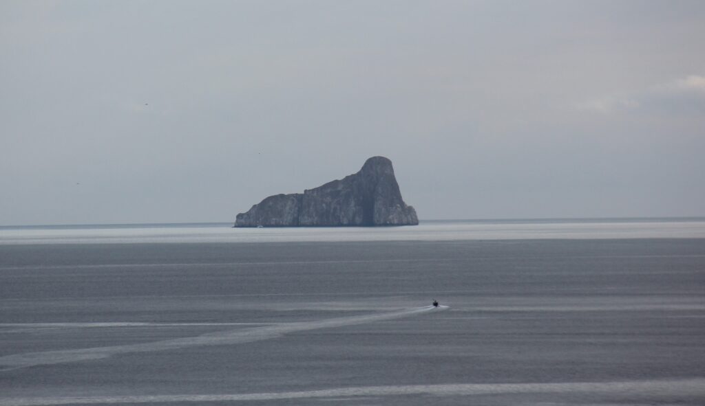
The Galápagos Islands – we flew to Santa Cruz, then took ferry’s, first to Isabela, then to San Cristobal. Returned to the mainland from San Cristobal
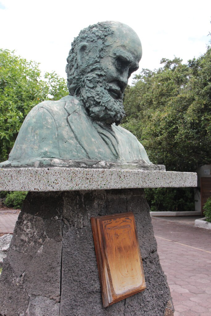
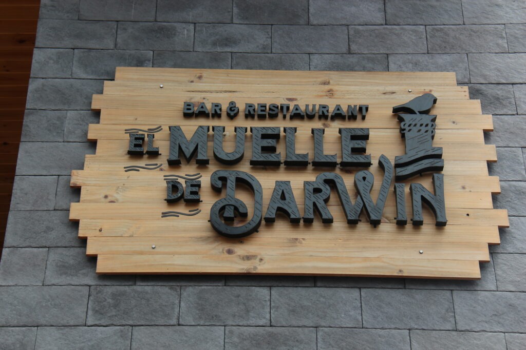
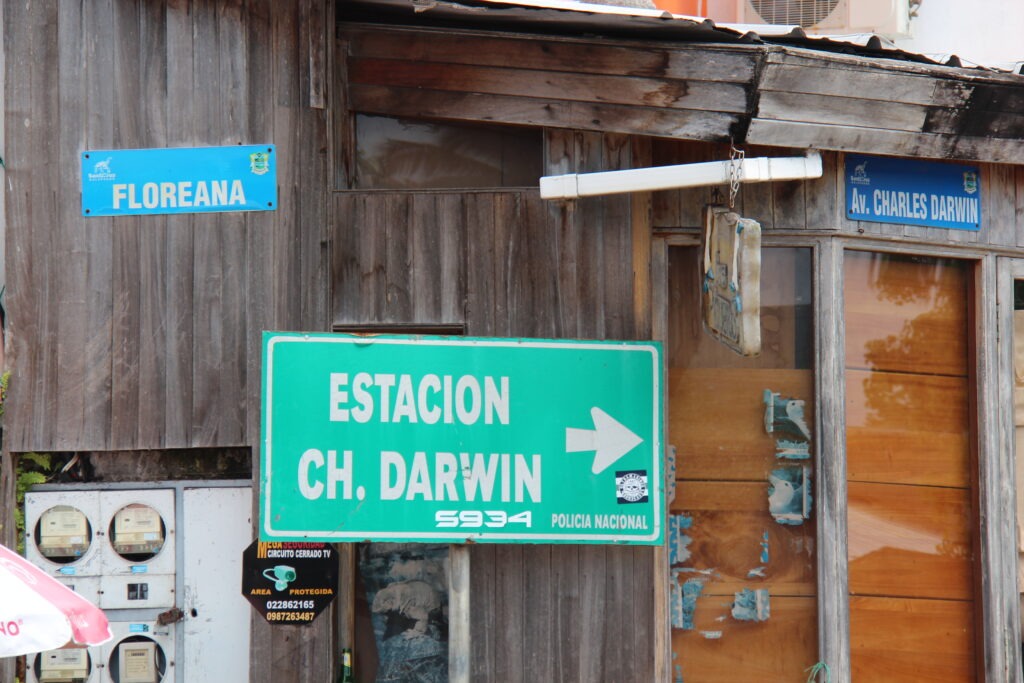
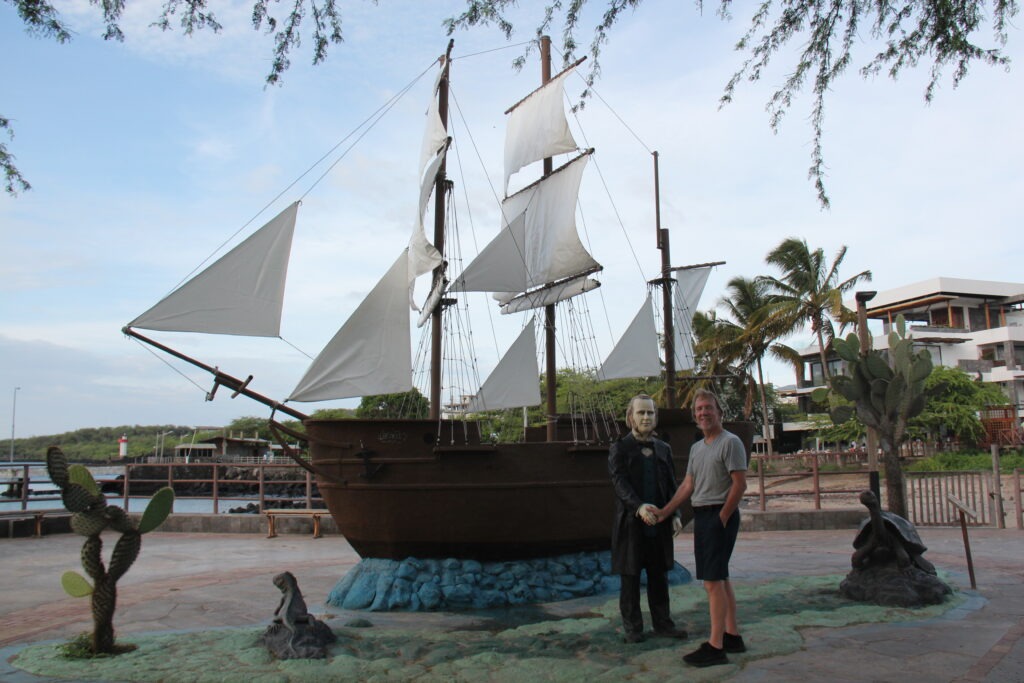
Straddling the equator, this province of Ecuador lies about 1,000 kms west of the South American continent. Because of its relative isolation, the archipelago contains an unusual abundance of plants, animals and marine life not found anywhere else in the world. Famed British naturalist Charles Darwin visited in 1835 on the HMS Beagle ( much reference to Darwin can still be seen all over the Galápagos) and what he observed here contributed significantly to his theory of evolution.
A bust of Darwin, near the dock in Santa CruzWe had a beer in this bar named after DarwinThe main street in Santa Cruz is named after Darwin….as is the scientific research station….and you can even shake hands with the man in San Cristobal
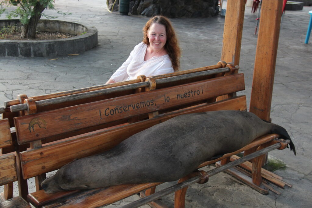
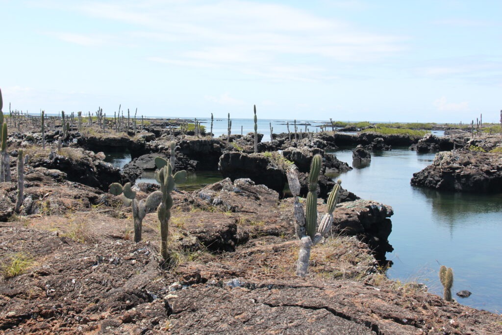
The islands truly are unlike any other place we have been and their impact is immediate. Just driving in to town from the airport in Baltra – a 25 minute trip – we’d already seen 3 giant tortoises. Simply walking around the islands – before we even ventured underwater – we were constantly surrounded by unusual and exotic ( to us anyway ) wildlife. In many cases you had to be careful not to tread upon, or trip over, them ! That, and the fact that almost no animal we saw exhibited the slightest fear of humans. Combine the uniqueness of the wildlife and it’s accessibility and you have a mecca for wildlife enthusiasts that deserves every bit of its reputation for being an experience like no other.
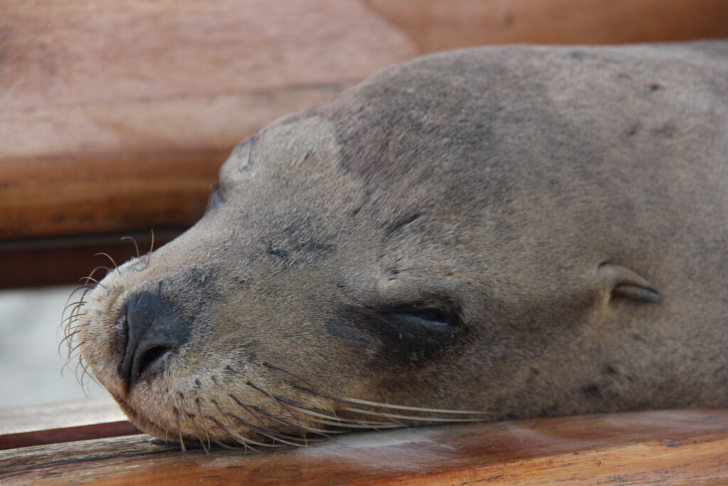
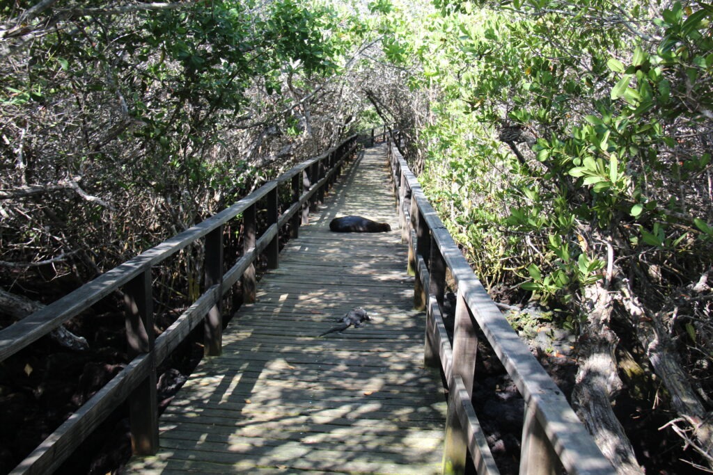
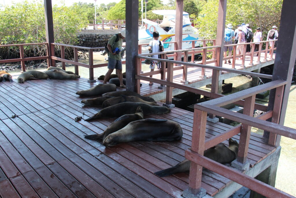
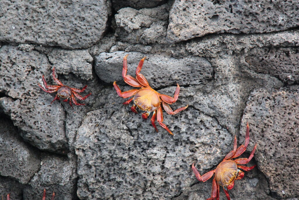
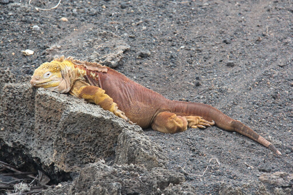
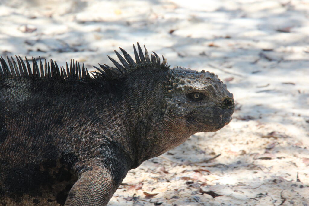
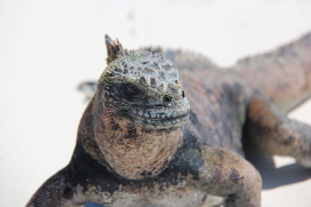
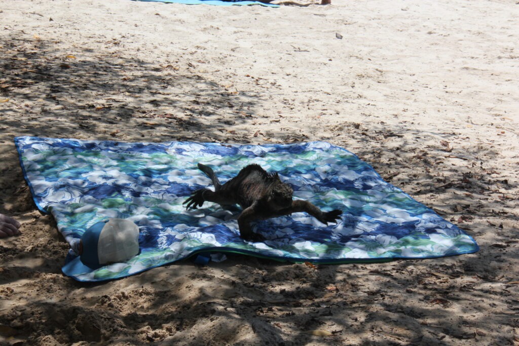
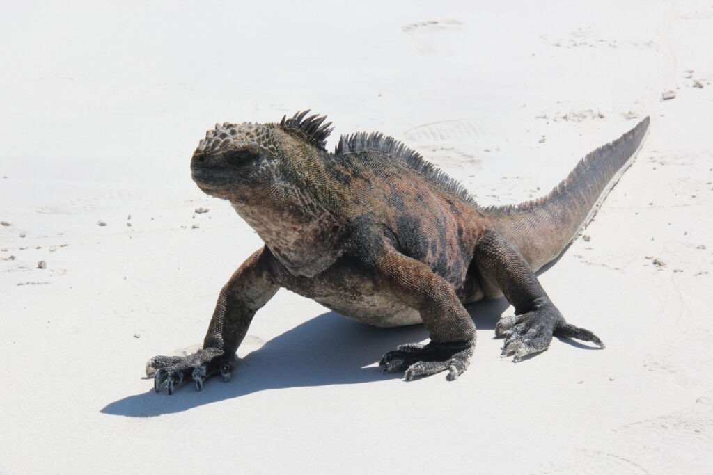
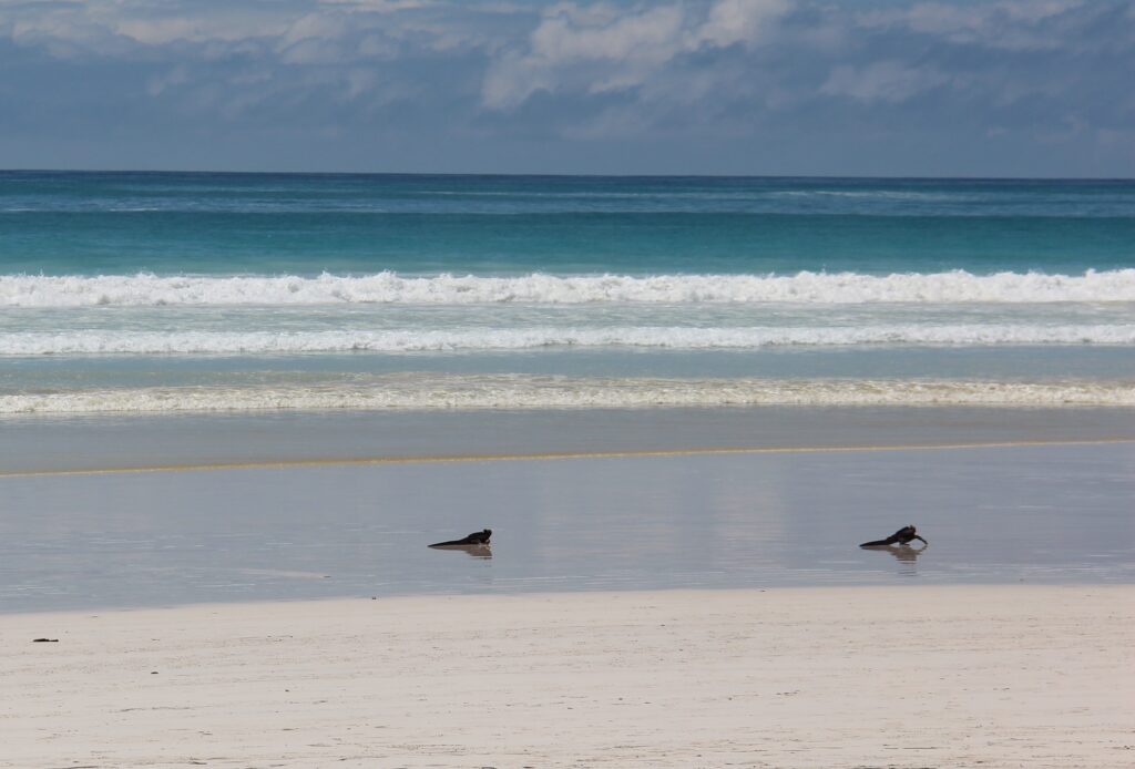
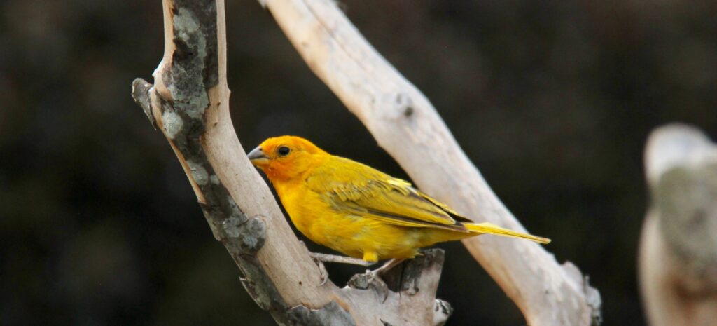
Lois took a break on San Cristobal – and then realized she had companySame sea lion, up close !Sea lions and marine iguanas could be found lounging around on almost every walkway….and on every pier, sometimes by the dozenColorful crabs, Santa CruzWe did not see many terrestrial iguanas, but loved the colors of them, one seen here on Santa CruzA typical marine iguana- on or near every beach- their face reminded us of Godzilla !Up front view – they had no fear of tourists. They were everywhere…this one on the beach at Tortuga Bay, Santa Cruz…..….and quick to claim your beach towel if you went swimming for too long !Marine iguana, Tortuga Bay, Santa Cruz
We’d heard many warnings about the expense of the islands – and sure, the $10-20 “tax” paid to enter each island was annoying ( if not budget breaking ), and the $100 USD ( per person ) Galapagos National Park Fee was exhorbitant by any global measure but beyond that we did not find that living in, and travelling around, the Galápagos Islands to be much more expensive than anywhere else in Ecuador. Somewhat more, but not much. Considering it’s huge international appeal, its remoteness, its uniqueness and the fact that most people will only ever visit once, based on our own experience we’re glad we just bit the bullet – if you are thinking about going, our advice is just do it !
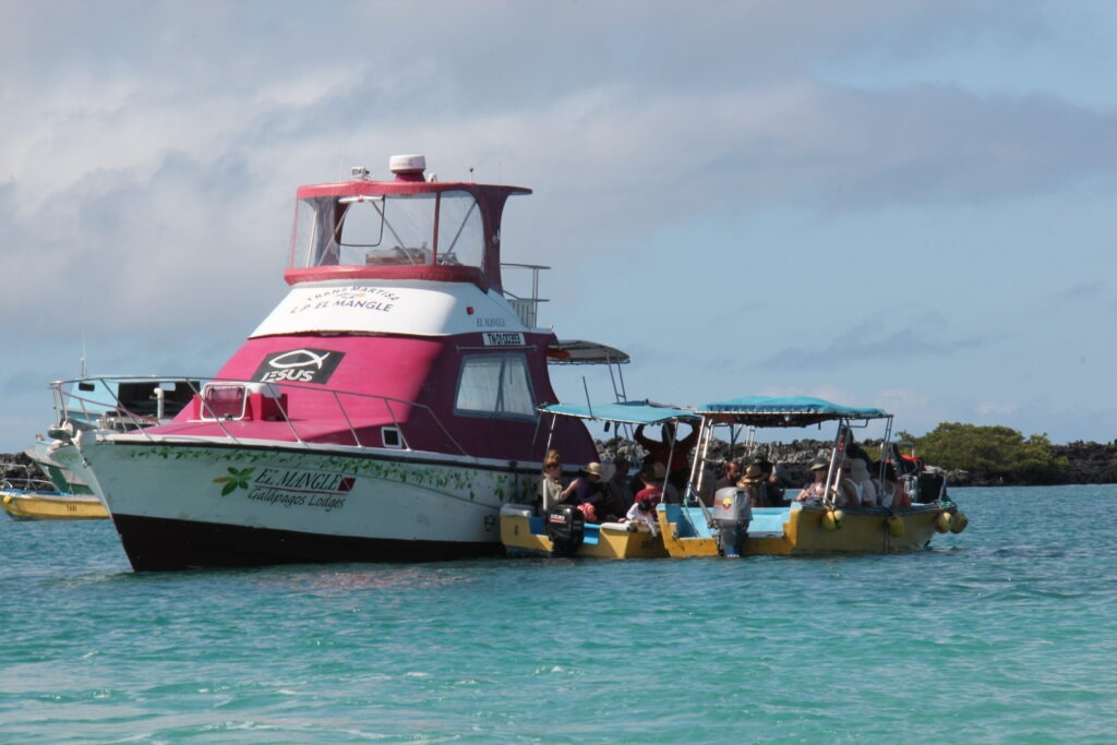
Typical inter-island “ferry”. Smaller water taxis seen here take passengers out to the ferries. Just $25 to transfer between the islands
Getting between the islands was easy with regular ferries taking just a couple of hours, and tours, where needed ( they weren’t always ) were easy to book. While all-inclusive, luxury (and thus expensive) Galapagos cruise boats could be seen visiting all islands and are popular for those wanting the 5 star treatment, “doing your own thing” ( as more and more do now ) is also very simple and takes much of the financial sting – and none of the pleasure – out of the Galapagos experience.
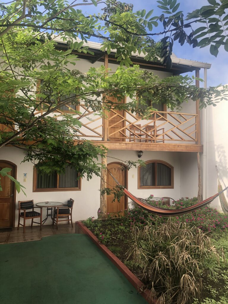
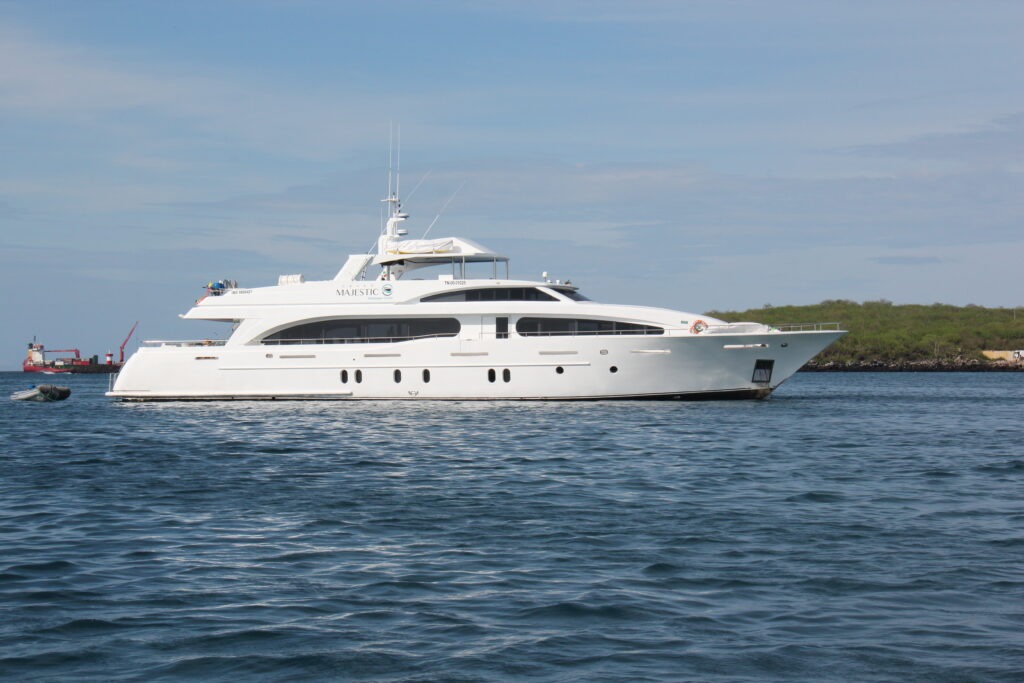
Typical of boutique, 3 star hotels on the Galapagos, widely available at very reasonable prices. This one on Santa CruzOr one can spend many thousands of dollars living aboard cruisers like this – must admit they did look pretty nice ! Either way everyone sees the same sights
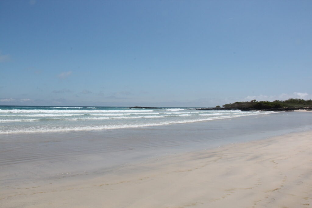
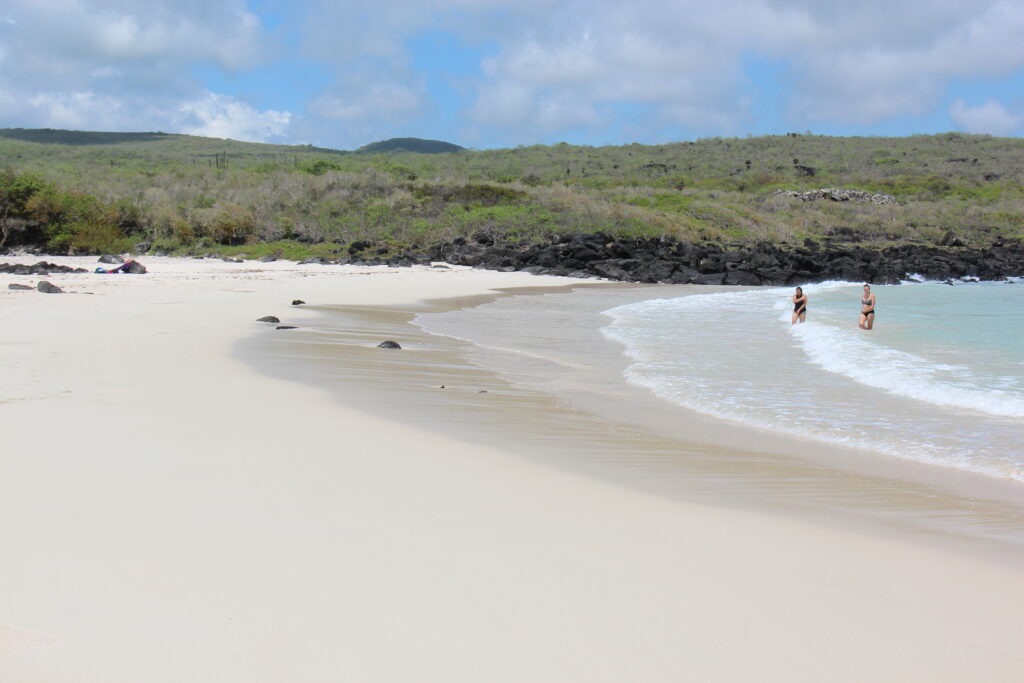
Like most, our trip was for a week and covered the three main islands. Each had its own distinct appeal, though our favorite was unquestionably Isabela. Miles of long white sand beaches, easy access to the sights, and a quaint main village with sandy streets gave it a very “South Pacific island” feel. Add to that wildlife that was easy to see and one of the best tours we have ever experienced made Isabela the most memorable for us.
Typical street on Isabela, our favorite of the three main Galápagos IslandsLong white sandy beach, IsabelaMarine iguanas coming out of the surf, Tortuga Bay, Santa CruzAt Playalita, Isla Isabela
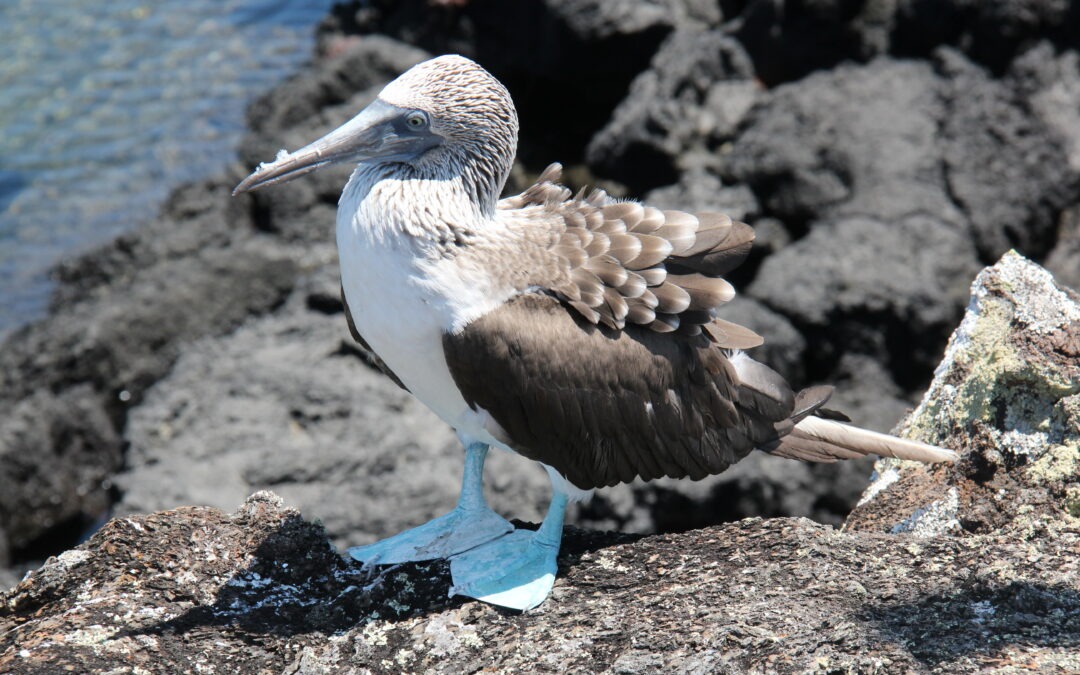
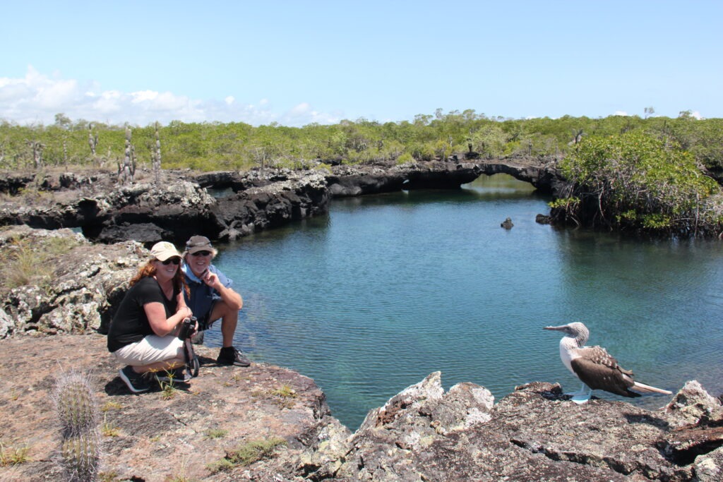
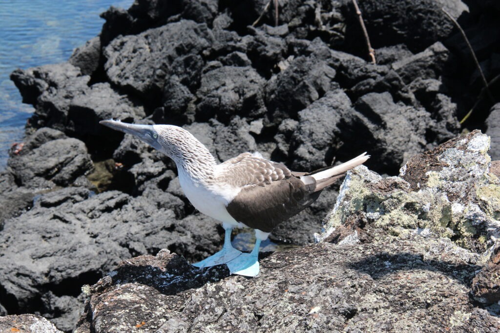
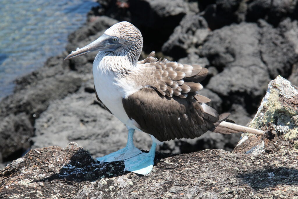
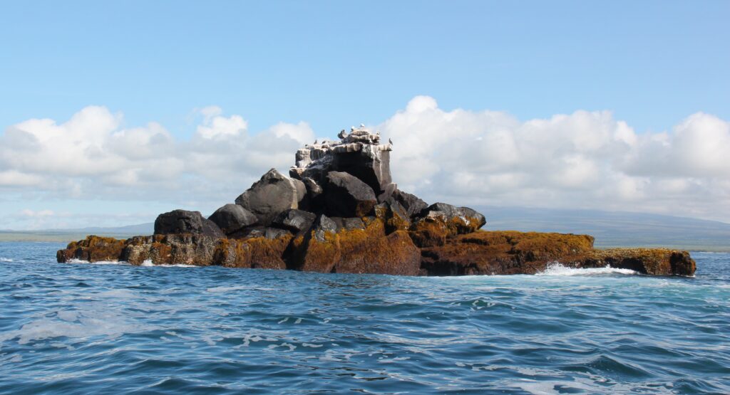
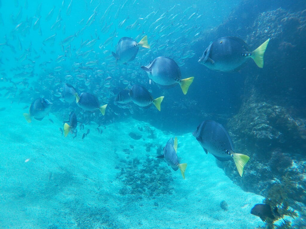
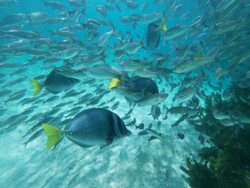
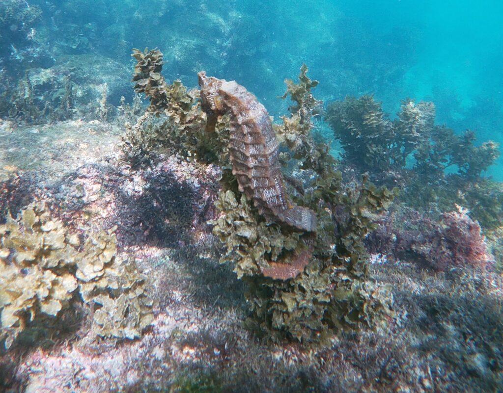
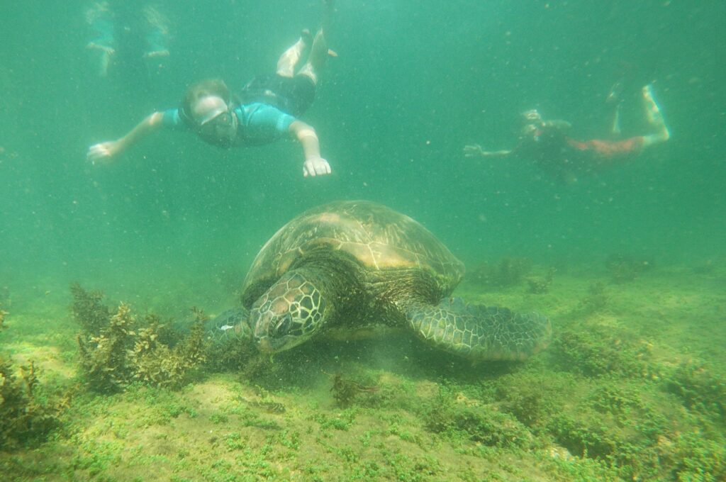
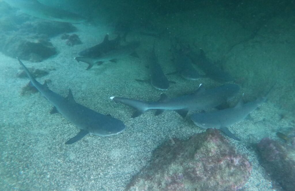
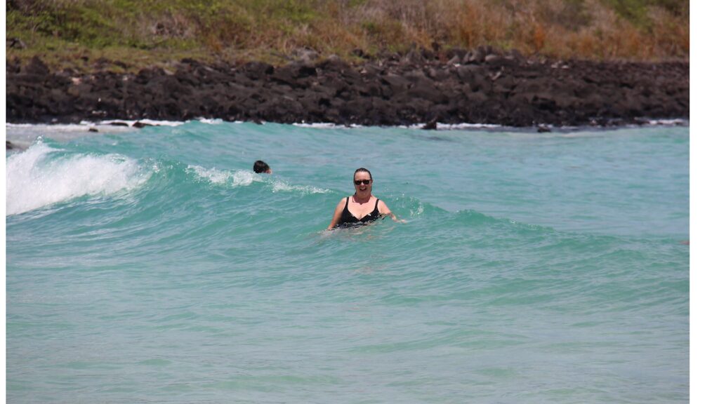
Countless others who went before us had recommended the “tuneles tour” ( tunnels tour ) and it was unquestionably the highlight of our time in the Galapagos. On this 5 hour boat/land tour we swam with giant marine turtles, sharks, sea horses, penguins, countless tropical fish and saw several Blue Footed Boobies up close. Simply magical ! That’s not to say that giant land tortoises, countless marine iguanas and sea lions weren’t appealing ( they were ) but there were so many of them roaming wild ( the latter two at least ) that you almost stopped noticing them. The boobies, sea horses and penguins were harder to find.
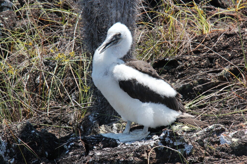
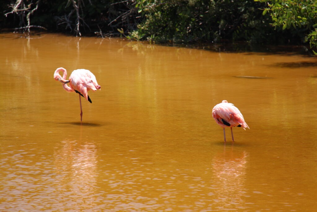
On Isla Isabela, close up with an elusive Blue-Footed Booby. The blue color comes from the food they eatBlue-Footed Booby, Isla IsabelaClose up, with a Blue-Footed Booby, Isla IsabelaA baby Blue-Footed Booby ( feet have not yet turned blue )The “tunnels” area on Isla Isabela where we snorkeled and spotted the boobies. It all came from volcanic eruptions long agoA rock outcrop near Isabela, favoured by the boobies and other marine birdsSnorkeling in the “tunnels”, Isla Isabela, shot with a Go-Pro by our guide while we snorkeledMore of the same Up close with a sea horse – we saw several on the Tunnels tourThere was a penguin up on the rocks and a couple underwaterGot to swim alongside Giant Marine Tortoises…..amazing !……and a pack of White Tip SharksFlamingos are often seen on Isabela…there were 4 feeding when we there. They have two legs, of course, but often stand on just one
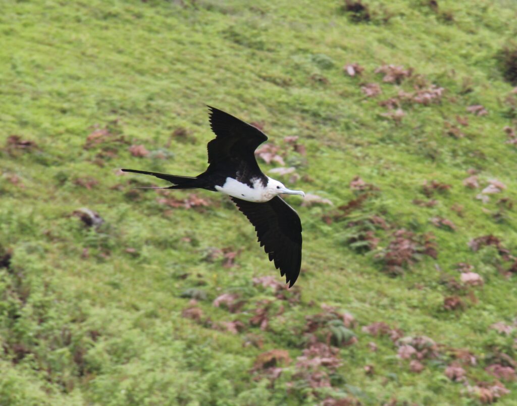
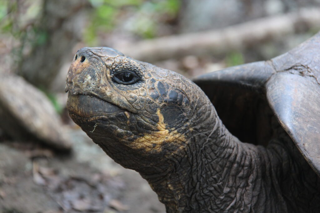
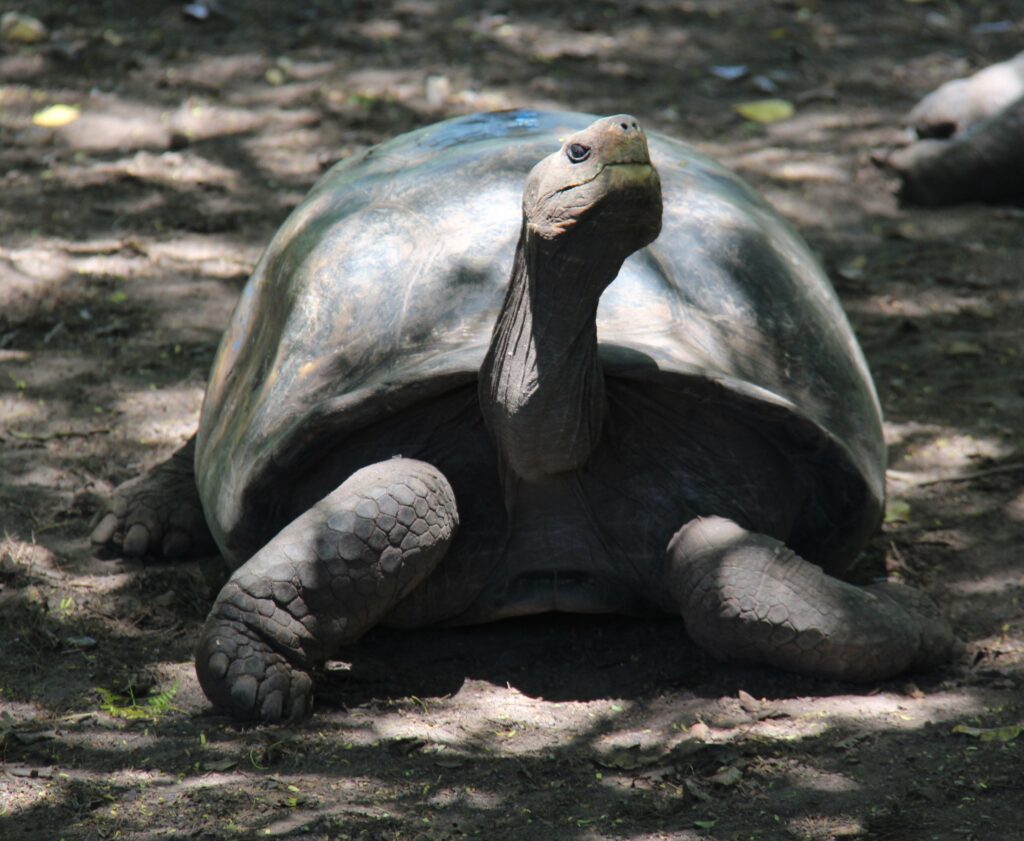
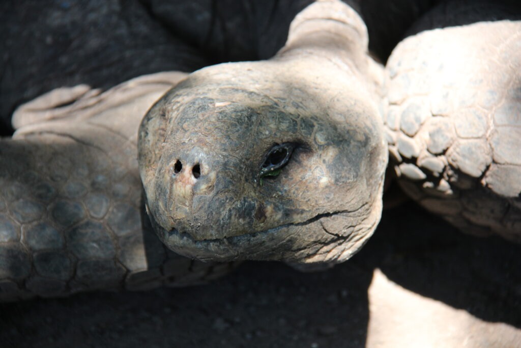
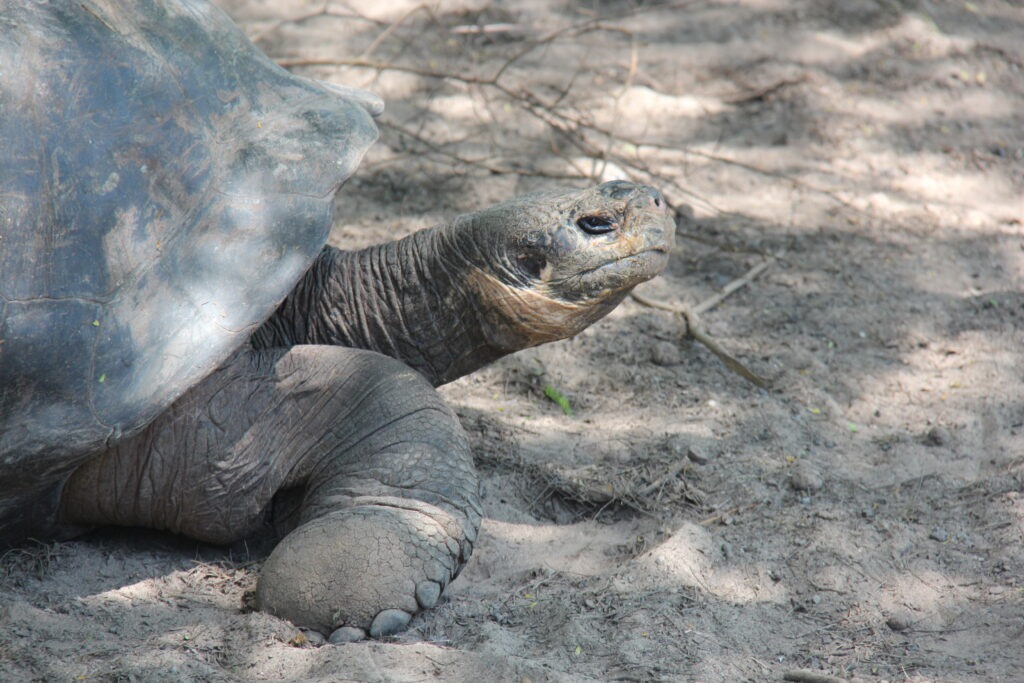
San Cristobal had one of the nicest beaches on the Galapagos, Playa Chino. A little tougher to get to so we hired a taxi and took a tour there and on the way visited Junco lake ( home to many frigate birds ) and one of the better Giant Tortoise rehabilitation centres. There is one on each of the main islands where the species, which is endangered, are kept in a protected area to ensure the populations continue to recover.
Frigate bird in flight, this one an adult female ( white chest )Chino beach, San CristobalLois, Chino beach, San Cristobal Giant tortoise, San Cristobal View from San CristobalGiant tortoise, Isla San CristobalUp close….they look so old, and move soooooo slowly !Side view, Giant Tortoise, San Cristobal
However you want to see them, the Galápagos Islands offer an otherworldly natural experience – we’re certainly glad we carved a week out of our overland trip to make it possible and would highly recommend a visit to anyone considering it.
Check out our One Endless Road YouTube channel for some live video clips of our time on the Galapagos:
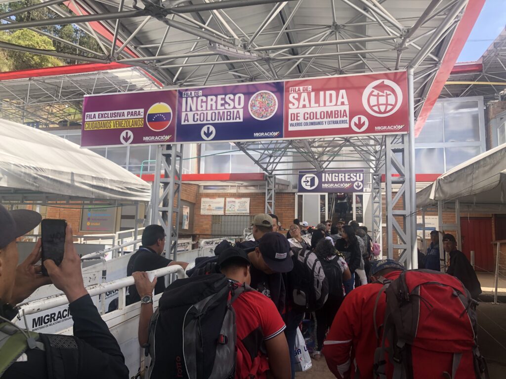
Crossing from Colombia to Ecuador proved reasonably trouble-free and in the space of two and half hours we were stamped out of Colombia, stamped into Ecuador, and had the requisite TIP ( temporary import permit ) for the truck. While somewhat crowded the border was notable for the abscence of the many parasitic “helpers” that besiege travellers at all the Central American crossings. It’s one of the busiest crossings in the area and the UN ( UNICEF ) fortunately have staff there to assist with the many refugees from Venezuela. There are at times so many that they have a dedicated line at the border just for processing Venezuelans.
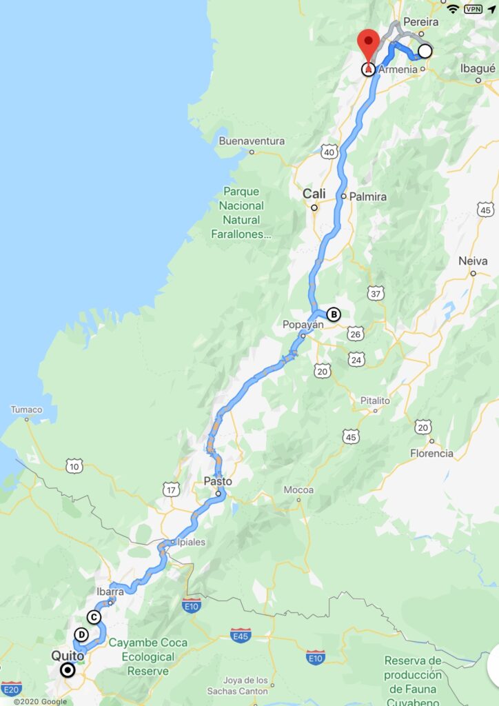
Route through southern Colombia and northern EcuadorColombia/Ecuador border
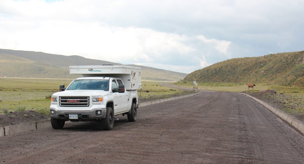
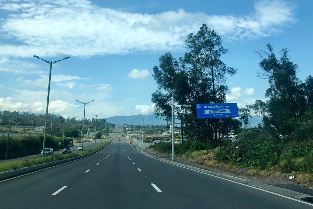
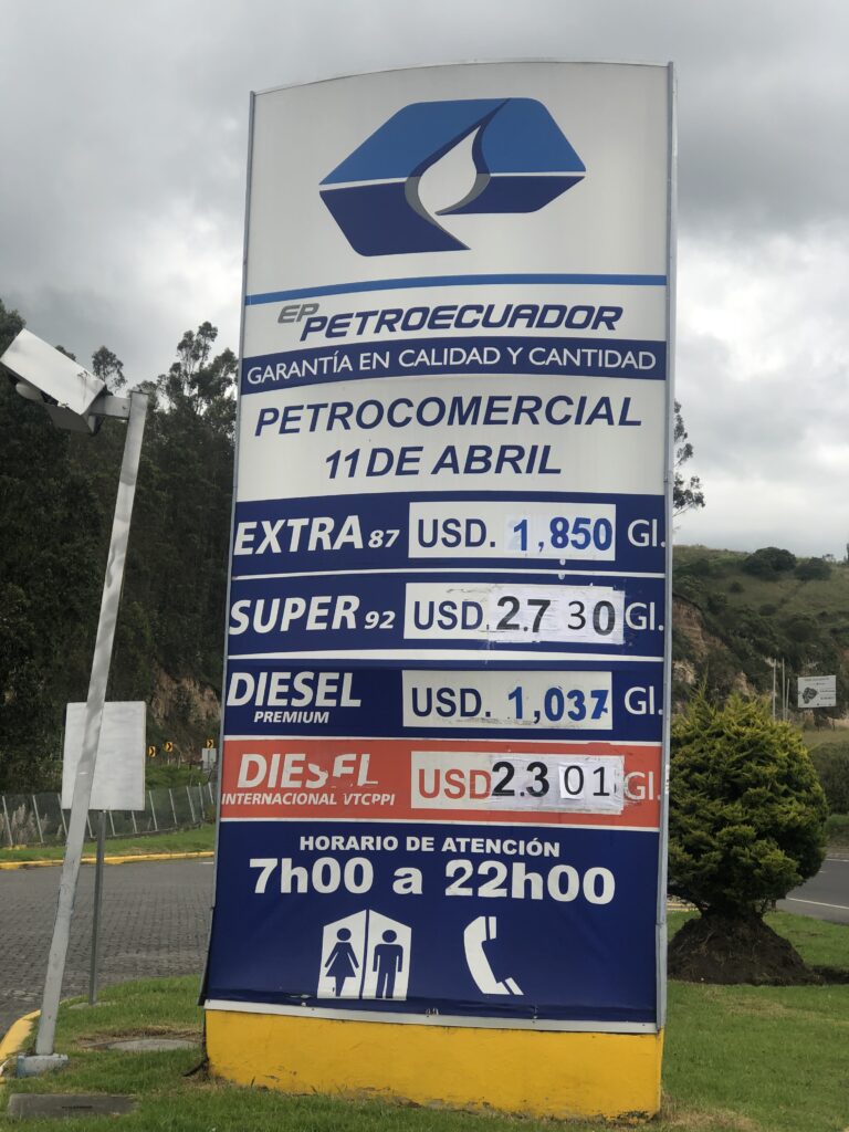
Two things immediately impress when one drives into Ecuador – the amazingly good roads ( far improved from 17 years ago and better than those in Colombia ), and how cheap fuel is. Since ours is a fairly heavy vehicle with a thirsty 5.3 litre V8 the saving is immediately noticeable. Very happy to pay $1. 85 US per gallon ( about 64 cents Canadian a litre ) – mind you we were envious of our diesel powered fellow travellers getting an even bigger break; just $1.04 a gallon ! Sadly, Ecuador is not that big – too bad fuel is not quite as affordable in Chile and Argentina where distances are far greater.
Typical of the high quality roads in Ecuador – very different than we remembered, this one near OtavaloEcuador – cheapest fuel in South America !
This area of South America seems to be a very popular part of the world for expats to come and set up campgrounds, with 3 of the last 4 visited being foreign owned. Hardly surprising – a wonderful climate, low cost of living and very laid back lifestyle all being attractions. As with La Bonanza, we’d heard much about Finca Sommerwind in Ibarra, owned by the very affable Hans, from Germany. A delightful hillside setting, by a lake, with a wide selection of excellent German beers, meals and bread – as a result, a real crossroads for all overlanders on the PanAmerican Highway.
Finca Sommerwind, IbarraHans also stores overland vehicles, both bikes and trucks. Here, a custom built MAN overland truck favoured by many GermansImpressive setting overlooking the lake and mountains, Finca Sommerwind here at sunset
While at Finca Sommerwind the decision was made to visit the Galápagos Islands – we may not be back in South America for some time and since we’d never get closer ( the islands are Ecuadoran ), it seemed like as good a time as any. Many overlanders we had met coming north provided great tips and with airfares from Quito being very reasonable, we booked – so, Wednesday we are off !
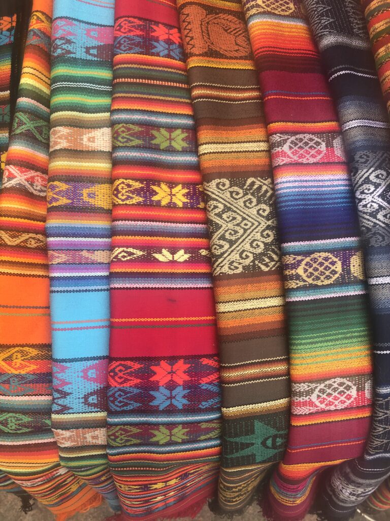
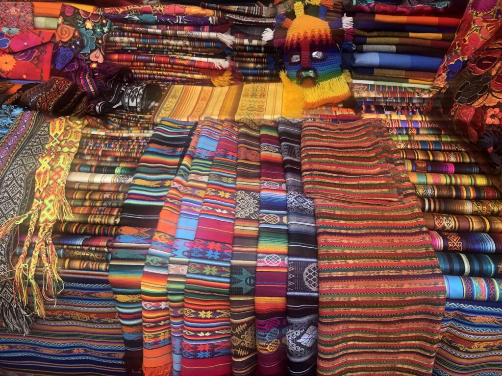
Between Ibarra and Quito was the famous Ecuadoran market town of Otavalo and with a bit of time on our hands now we revisited this most colorful of markets – much as we recalled it and still an easy place to enjoy an afternoon.
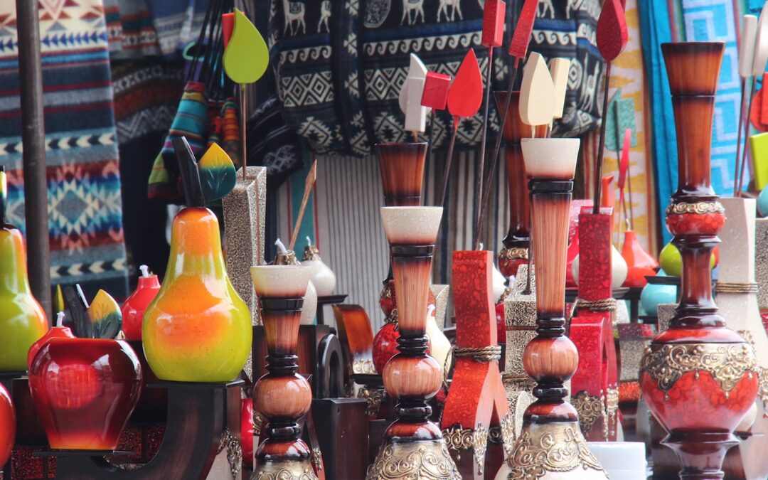
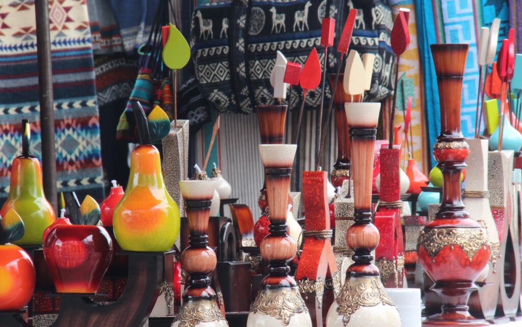
Artisan products for sale, Otavalo marketFabric colours at Otavalo market More bright colours, here some fabrics on display at Otavalo market
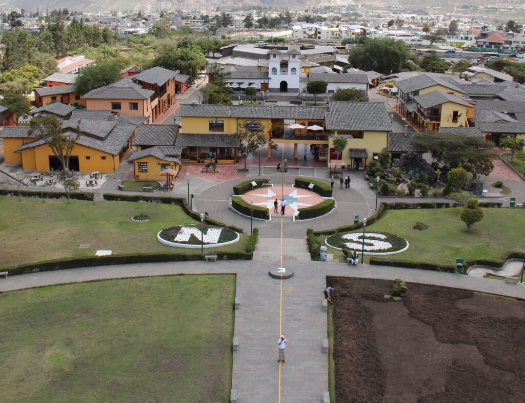
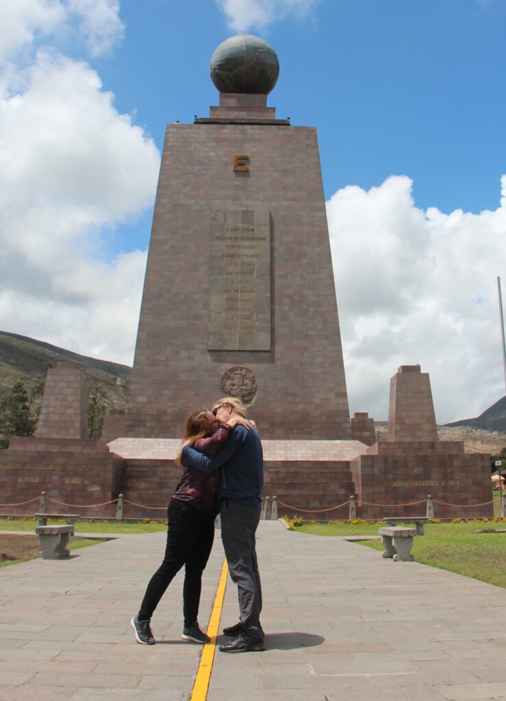
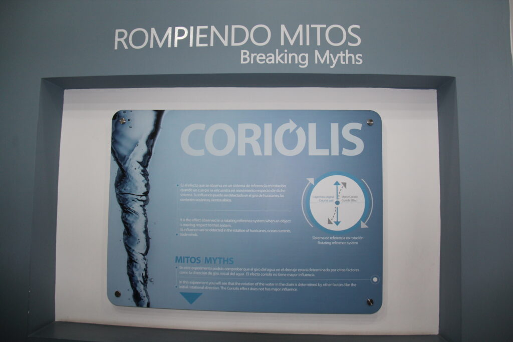
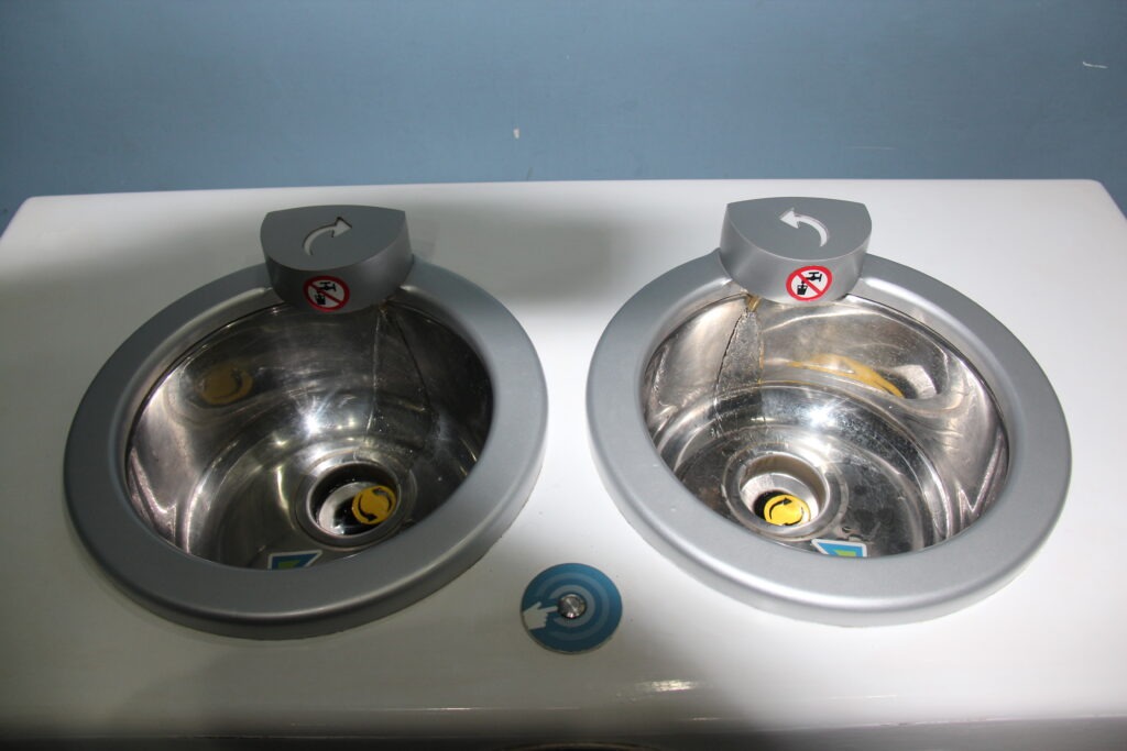
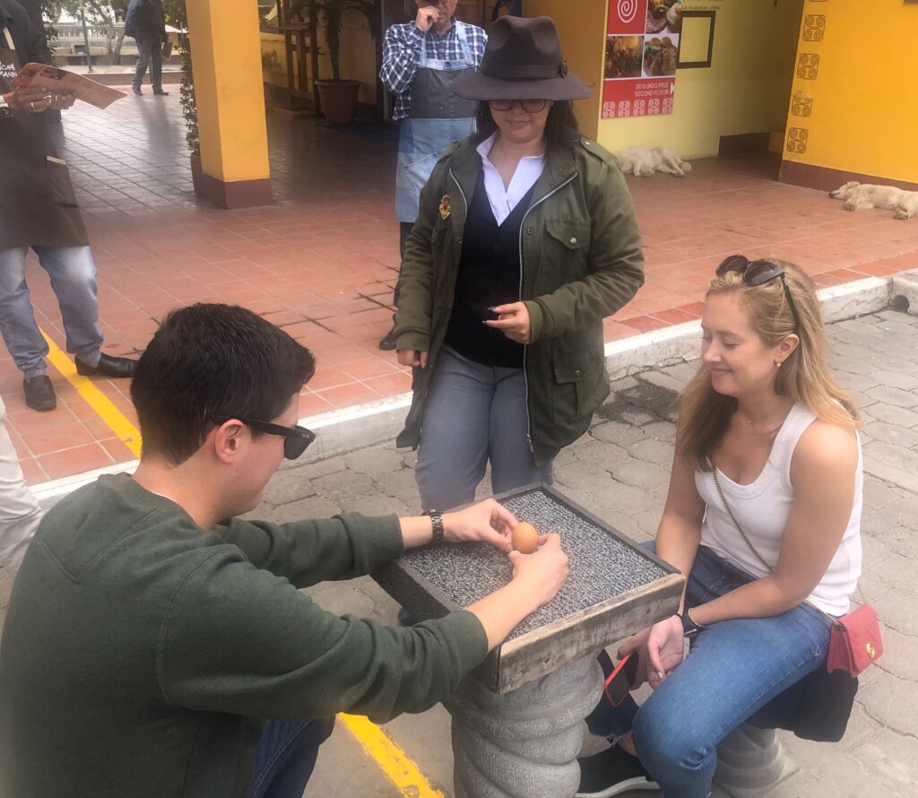
Just north of Quito, our jumping off point for the Galapagos, lies the somewhat kitschy village of Mitad Del Mundo ( literally, “Middle of the World” ), providing an unmistakable reminder that you are now right on the equator. In addition to its geographic significance, scientific relevance ( the Corolius effect and all that stuff ! ) and obvious appeal to all travellers, given the number of foreign visitors to the site the Ecuadorans use it to promote all things Ecuadoran – coffee, chocolate, the Amazon, the Andes, indigenous peoples and on and on. Apart from the sensory overload it was a very worthwhile pit stop before Quito.
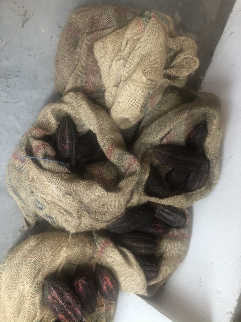
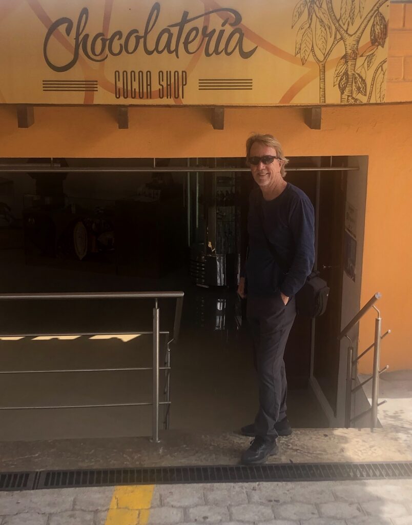
The view from up high at Mitad Del Mundo, looking east – the yellow line marks the equatorEveryone else had “a foot in both the northern and southern hemispheres”, but we thought being able to kiss from “one side of the world to the other” was also pretty cool.One could see the “Corolius effect” first hand at the equator…..…..and water going down a sink really does change direction right at the equator ( I’d always wondered ! ) While balancing an egg on end on the equator is theoretically possible, no one seemed to be able to do it !Cacao beans, from which chocolate is derived. Ecuador is a huge exporter of the product This could be dangerous…!While the science may be a tad self-serving, apparently, it’s a fact – eat chocolate, live longer !
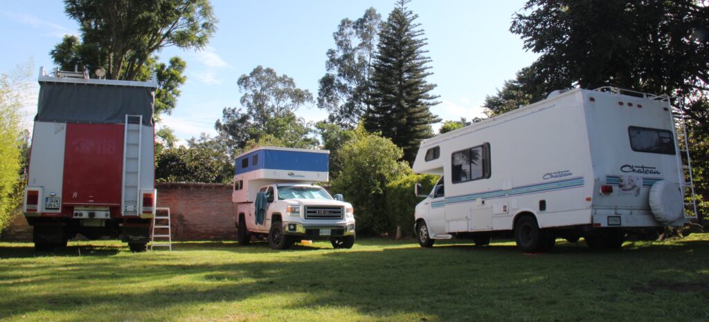
Quito provided us yet another foreign-run campground, this time by another Dutchman. Arie made us feel right at home and after 25 years in Ecuador was a veritable fount of information on Quito and the many other attractions that lay ahead on our route south. Realized as a result there is a bit more to Ecuador than we had expected.
Aries campground in Quito. A family of Germans in a converted Swiss fire truck on the left and a Chilean/Guatemalan family on our right
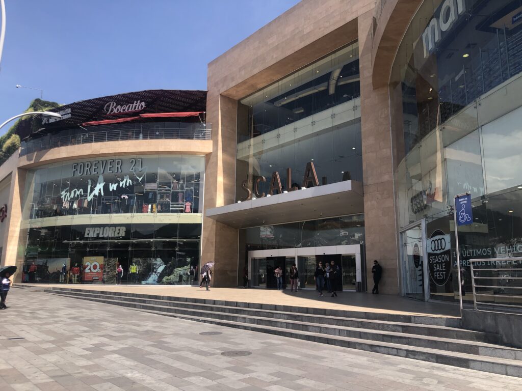
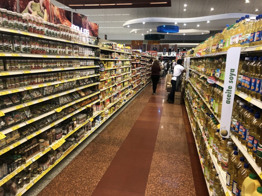
Our last days of the week had us doing a little routine maintenance work on the vehicle, and exploring some of the shopping centers in the area – goggles, snorkels and fins were the order of the day in preparation for our visit to the Galapagos. While that search went in vain we did discover some other great shopping – very impressed with the Scala mall in Quito; it will be a great place to re-stock the camper when we get back.
Scala mall, QuitoThe supermarket had everything – “just like home”
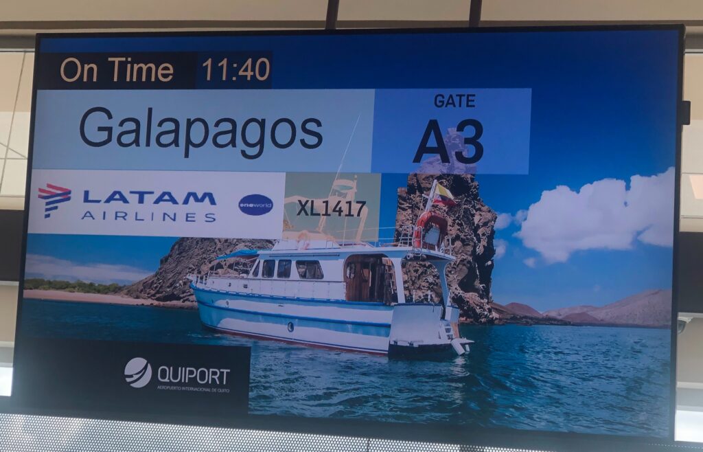
Arie kindly delivered us to Quito’s very impressive new airport and our departure for the Galapagos went off smoothly – seldom do we get excited by the name of the destination city plastered above the departure gate at the airport, but hey, it’s not everyday one gets to go somewhere as unique as the Galapagos.
All aboard for the Galapagos
Full Galapagos report on our next blog – stay tuned ……!
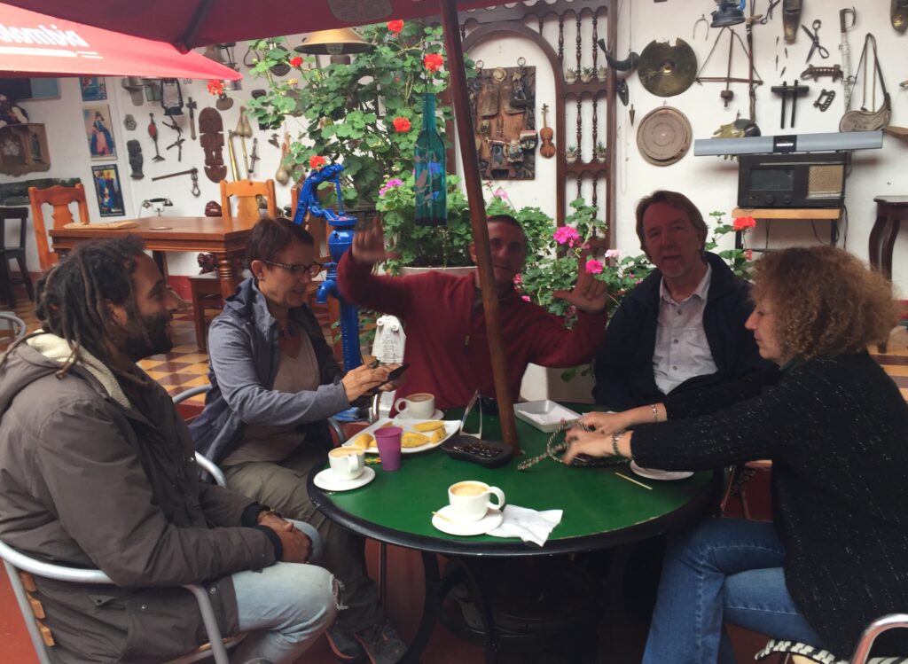
Sometimes it’s the places you visit and sometimes it’s the people you meet. While this past week did not take us through particularly notable places, it did bring us into contact with some incredibly interesting people – always one of the great delights of travel.
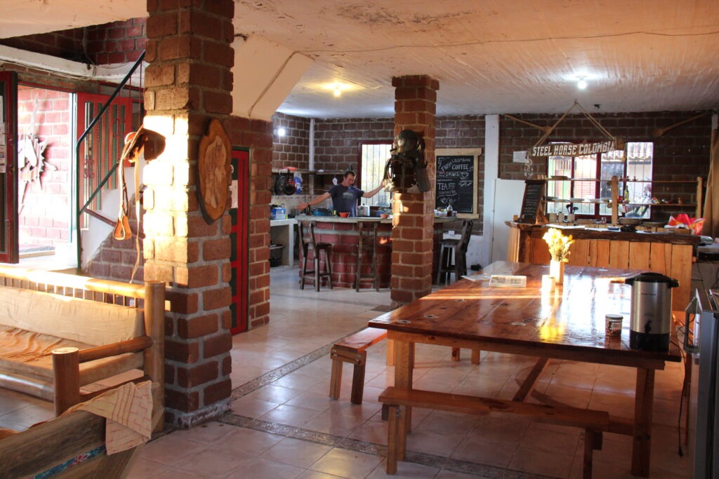
Allen ( Canada ) and Rik ( Holland ) who we met in Filandia. Both, like us, en route to Ushuaia, ArgentinaOur last sunset at FilandiaA farewell to Paul/Yvette – we would miss their amazing cooking at Finca Steel Horse !
At Finca Steel Horse we had met Felix and Tina, a Swiss couple who were 3 years into their global overland trip. She, a retired teacher and he a semi-retired “computer guy” still doing consulting one day a week from the road – in fact, that has been a bit of a pattern we have noticed. Quite a few overlanders are still keeping their hand in at something. For some it is simply because their craft lends itself to working on-line and remaining mobile, and for others it’s personal interest or to supplement the cost of their travels.
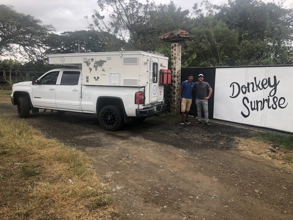
Tim and Jon at Donkey Sunrise, La Union
Leaving Filandia took us down from the mountains to the valley that more or less runs the length of Colombia ( north to south ). On the advice of our Steel Horse host, Paul, we took the scenic route to the small town of La Union where a young Dutch fellow, Tim ( as gregarious a character as you are ever likely to meet ) was the perfect overlander host at his new “adventure campground” – Donkey Sunrise. Focused primarily on motorcyclists, Tim nonetheless offers a very warm welcome to all overlandanders regardless of their means of transportation.
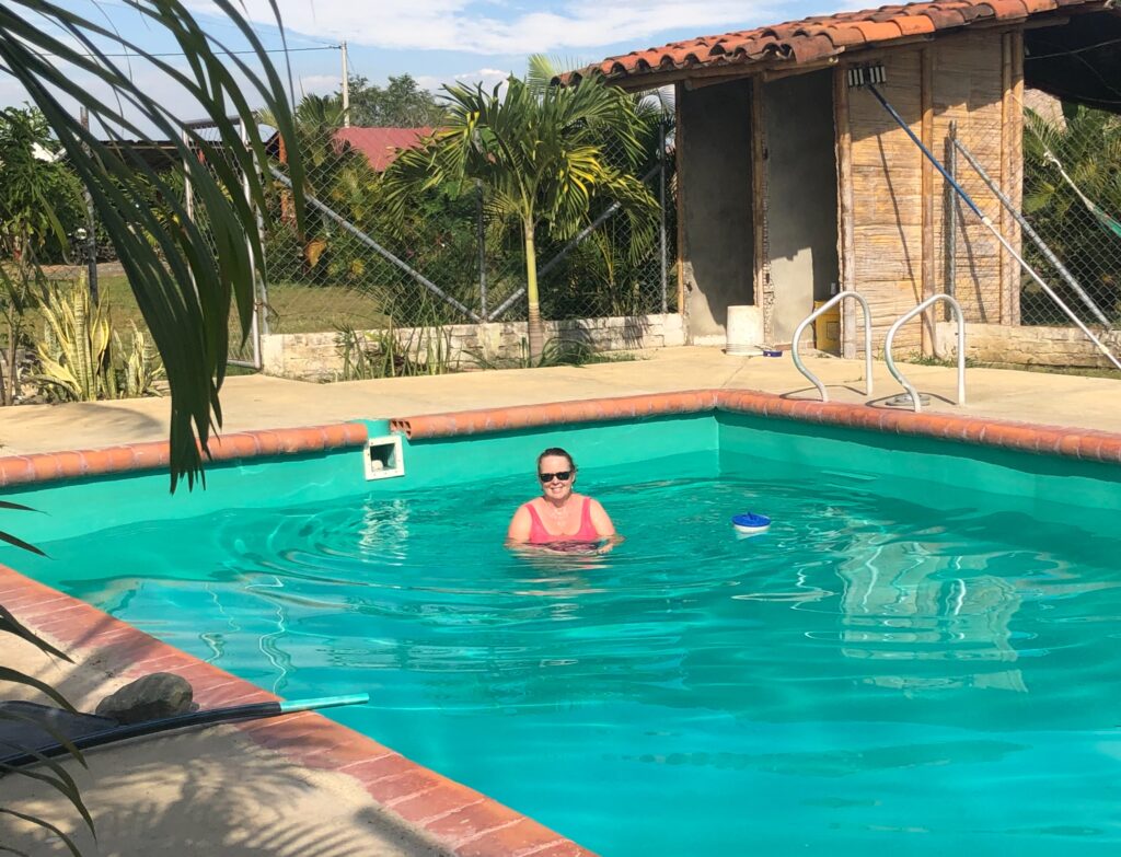
Lois enjoying the pool at Donkey Sunrise – it was 35 degrees thereEven the birds are brightly colored – one here at La Union
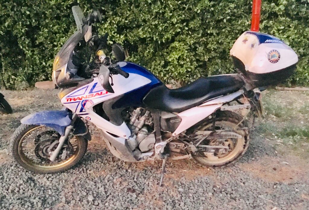
Among Tim’s guests was Freddy, a younger British guy who hopped on his Honda Transalp motorcycle for a one month ride from the UK to Morocco and ended up riding the whole west coast of Africa – all the way to Cape Town.. ! Not just is that a hell of a long ride but the west coast of Africa is considered one of the world’s toughest overlanding routes (95% of people who overland Africa go up or down the east coast – much easier, and with more well known attractions to see ). Once he got to the bottom of Africa he shipped his bike to Montevideo ( Uruguay ) and has now substantially completed a route around South America. Sort of the reverse of our own plans.
Freddy’s African and South American overland bike, a Honda Transalp
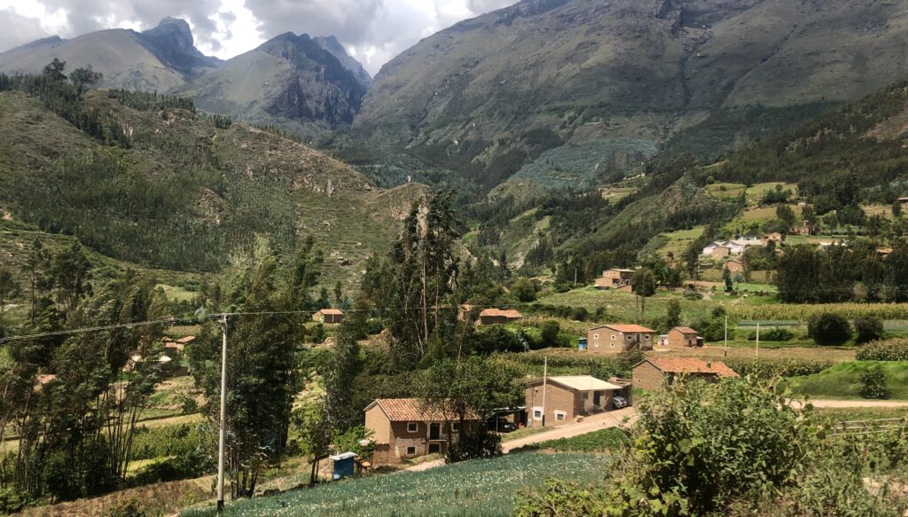
From La Union we were now headed straight south towards Ecuador and had heard much about an amazing campground just north of Popayan, near the famous indigenous market town of Silvia. People had raved about it and iOverlander was full of very favourable reviews. With the GPS set for “Camping La Bonanza” we headed south. A nice relief to be driving on longer, straighter, mostly four-lane highways in the valley of central Colombia as opposed to the tortuously winding mountain roads we had been travelling on recently. An easy 4 hour drive later and we were at the La Bonanza gate.
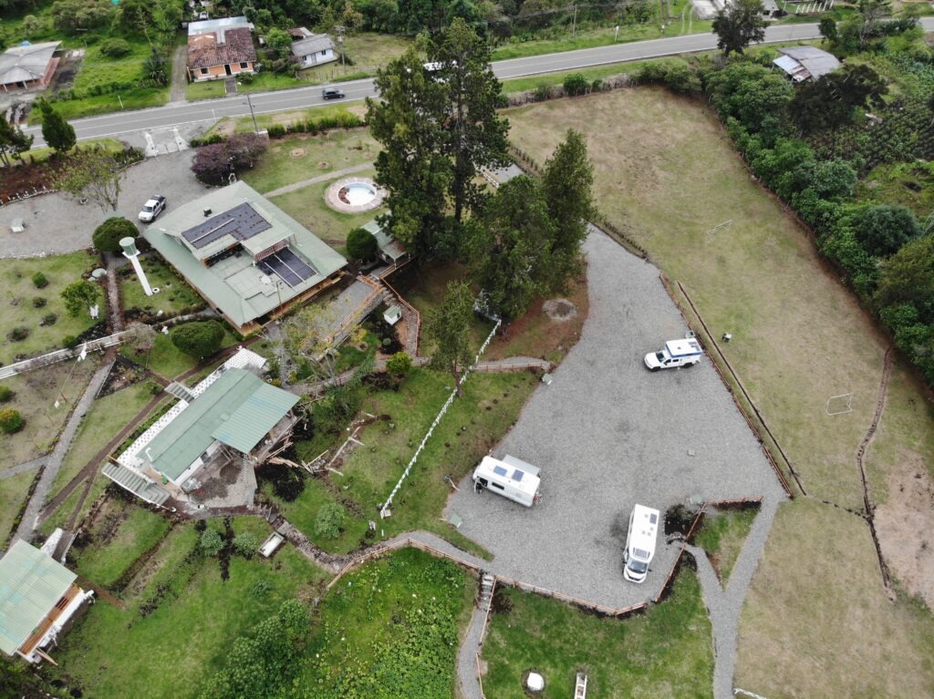
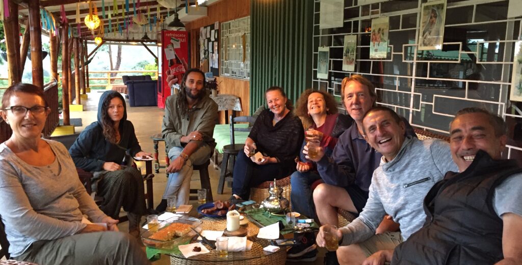
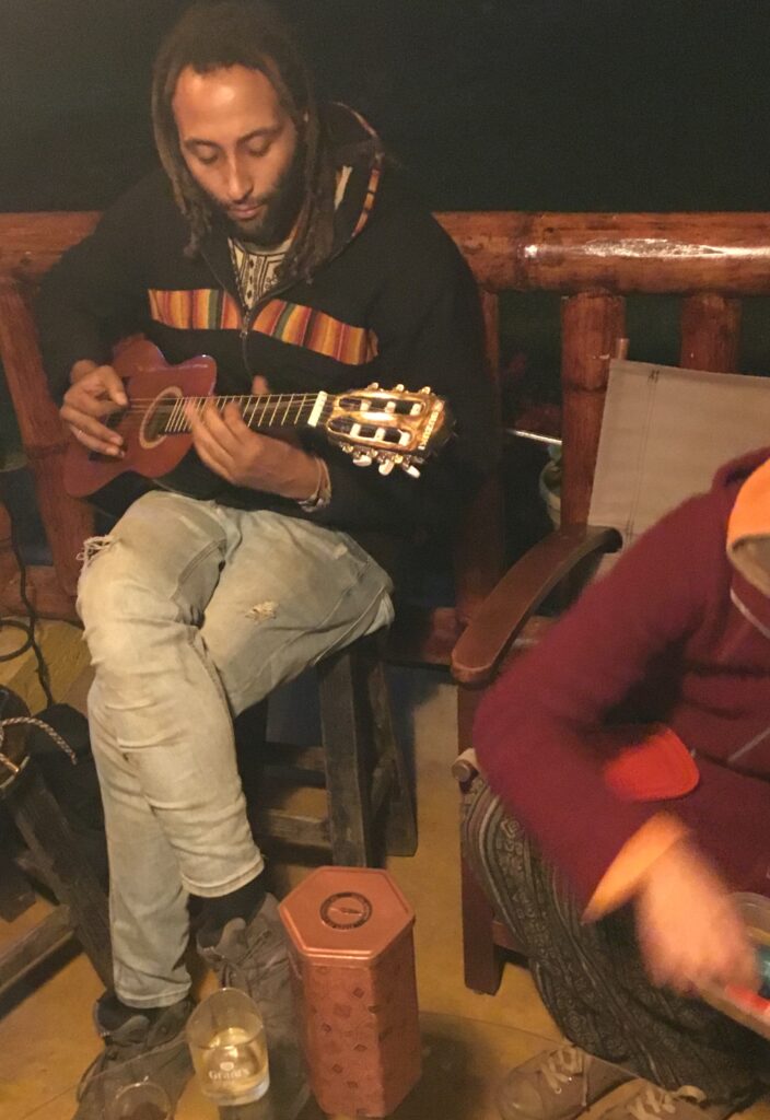
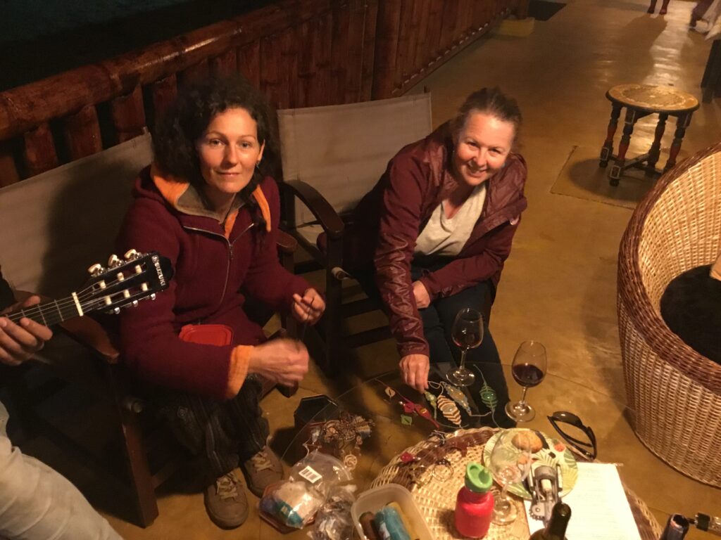
Drone shot of La Bonanza campgroundAfternoon drinks at La Bonanza – our hosts ( from Morocco), a French couple heading north, a German couple heading south and ourselvesMehdi, originally from Morocco, playing us some tunesMehdi’s wife, Nina showing Lois her handicrafts. They travel with two small childrenOccasionally our camper can seem small for two – at La Bonanza we met a French family of 4 ( two were teenagers ) travelling around the world in this small VW. Now THAT is cozy !
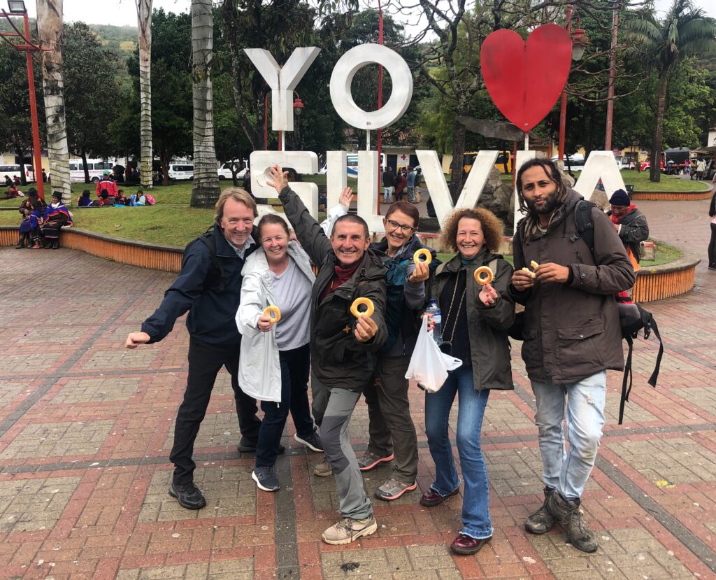
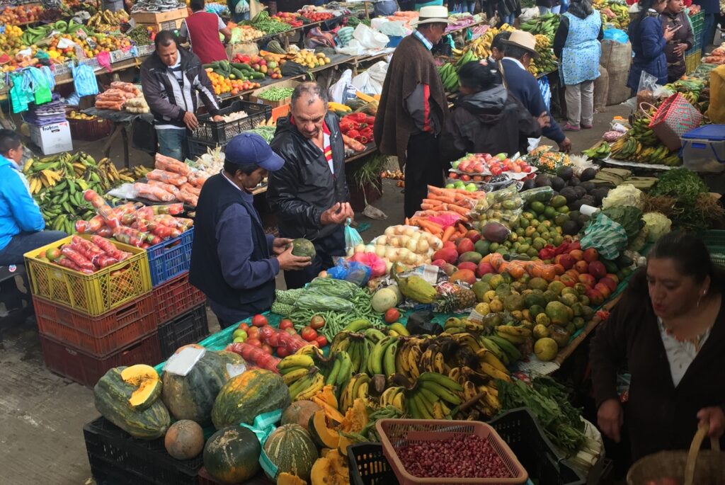
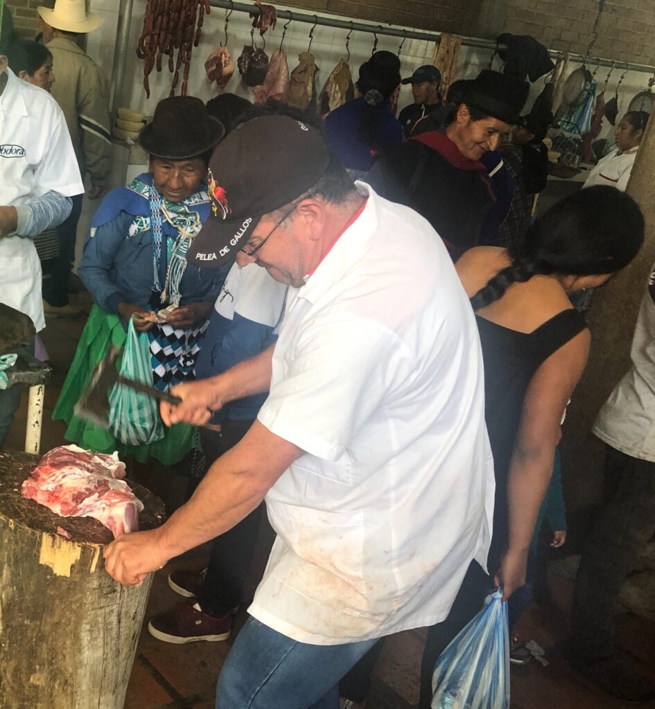
Travel in these parts certainly brings you into contact with those whose background story can be somewhat “exotic” and you would go a long way to find a more interesting story than that of Anouar and Kika, the Moroccan owners of La Bonanza. Passionate overlanders themselves, they had purchased a motorhome and packed up their life in Morocco along with their three young children and set off on a journey around South America. Falling in love with the continent and specifically Columbia, they decided to settle here and establish a small farm/retreat dedicated to accommodating overlanders. Read about their story here ( www.campinglabonanza.com ). Absolutely one of, if not THE, best campgrounds we have seen so far, They have not only thought of everything that an overlander needs, but they’ve topped it off with the type of legendary Morrocan hospitality that makes everyone feel very much at home. We, along with fellow guests from France and Germany had the most wonderful few days with them – arriving on Monday, there was an opportunity to experience Silvia on market day – Tuesday – an experience not to be missed. As recently as just a few years ago it was an area considered dangerous due to the presence of armed guerillas but that issue has been settled and the town is attracting tourists again. Very traditional, very colorful and very worthwhile.
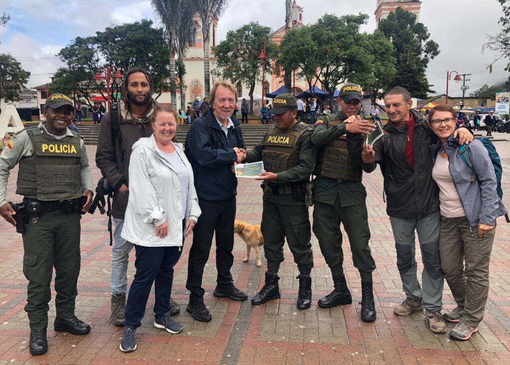
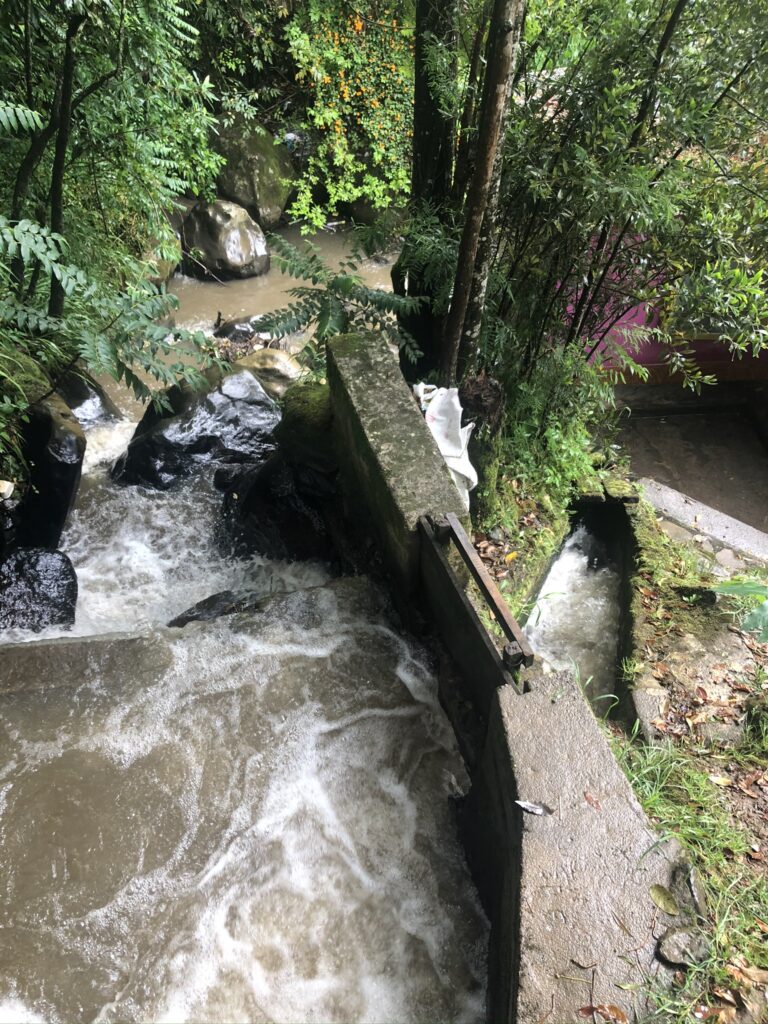
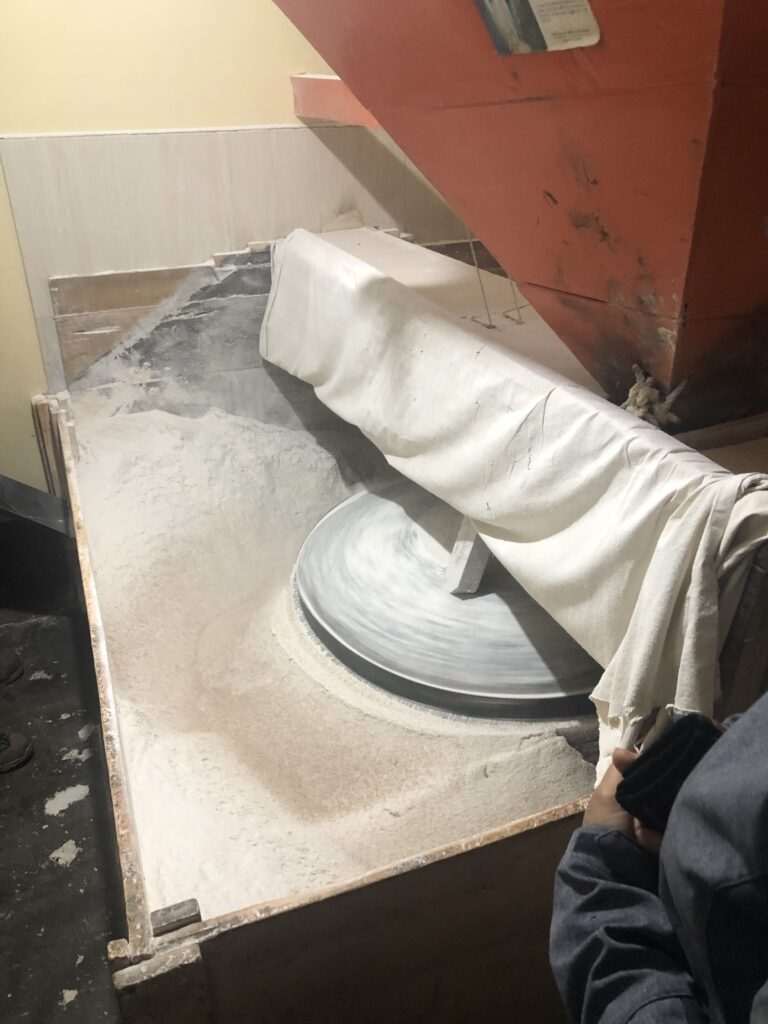
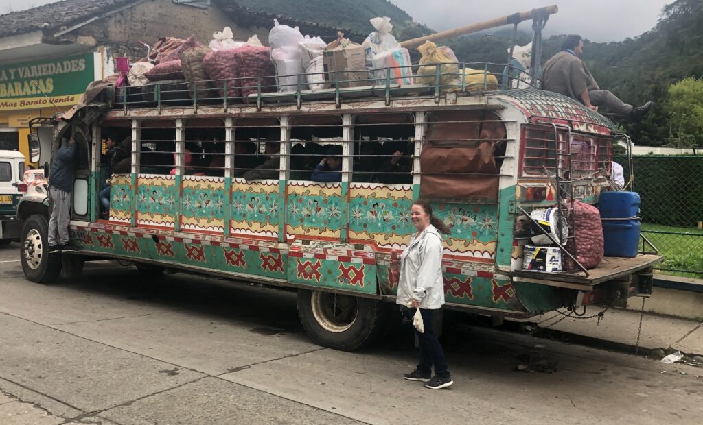
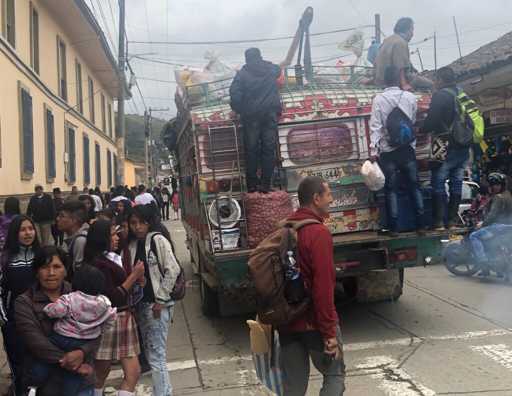
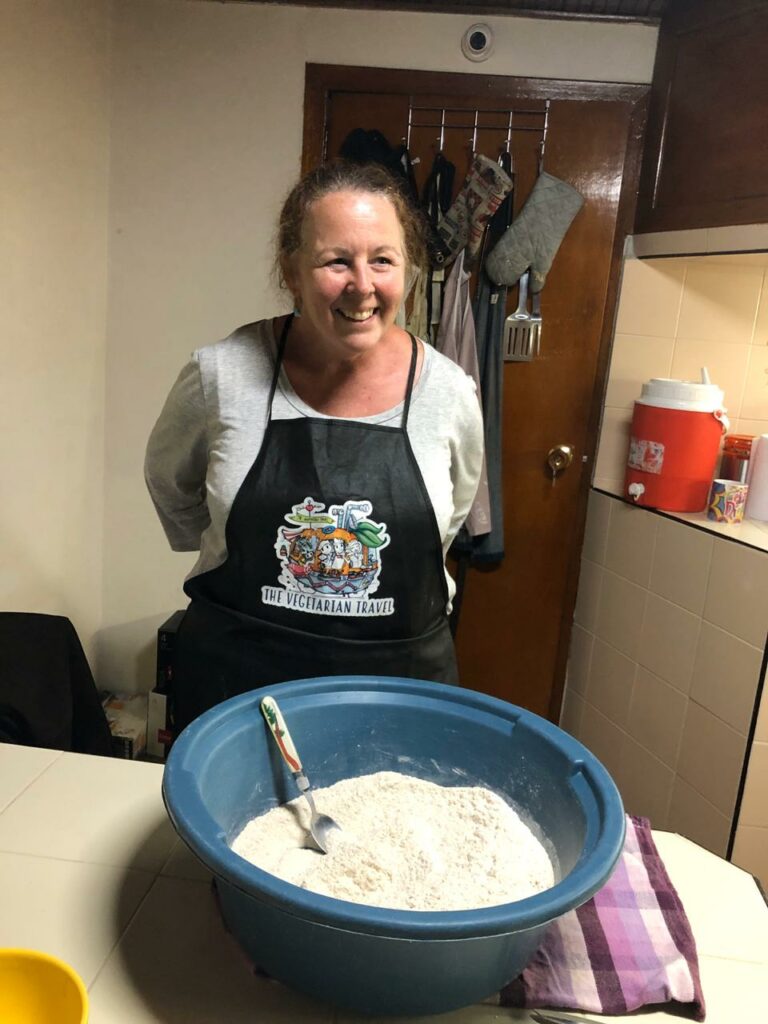
Arriving in SilviaThe local police saw us and wanted some pictures- we said yesThe flour mill at Silvia, still powered by falling water as in days gone by… …and produces excellent flourThe ever colorful Silvia market on Tuesday – we bought lots of veggies…..but passed on the meatA local “Chiva” bus, brightly colored and …..……always heavily overloaded, is a common means of transportation in the areaA typically colorful Silvia coffee shopThe coffee inside was as good as well. Resting up after market day, SilviaColorful building in Silvia Ditto Lois took bread-making lessons from Anouar at La Bonanza – she looks like a Master Chef contestant facing the judges ! Her bread was deliciousOur Morrocan hosts gave us a full family farewell from La Bonanza
Alas, all good things come to an end and mid week saw us leaving La Bonanza to continue down the central valley of Colombia towards Ecuador. A look at the map and the distances to Ecuador don’t seem great – however the dramatic elevation changes and windy, often narrow, roads (with regular construction delays) made progress slow. Gone was the four lane highway from further north !
Typical terrain and roads in southern Colombia – here near Pasto
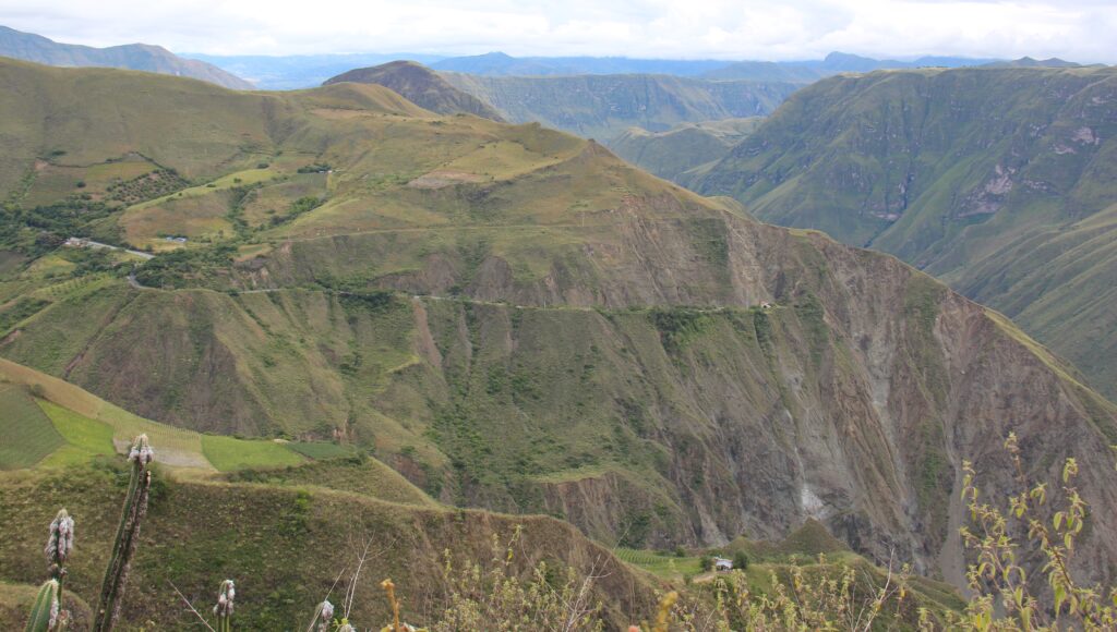
Over the next two days driving we passed Popayan, Pasto and numerous smaller villages, then finally made the border town of Ipiales, noting an increased roadside police presence the further south we got. During our visit to South America in 2003 this road was a no-go area due to rebel activity and we had to fly over it. Yet, it was safe back then to travel through Venezuela ( you wouldn’t now ! ) and we are glad we did. Fast forward to 2020, Venezuela is more or less a failed state, Colombia is safe and prospering with Venezuelan refugees flooding in here – we saw hundreds travelling down this very road with us today. A sad an very tragic irony.
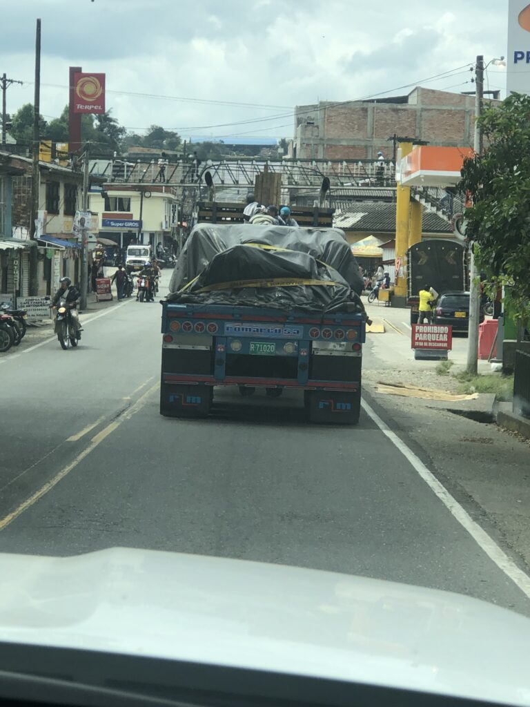
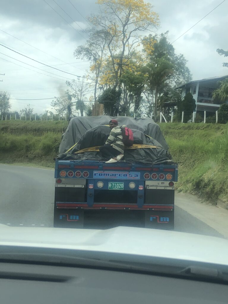
We noticed 4 young Venezuelan males “hitching” a ride on this truck ( they always stay in the middle so drivers can’t see them in their side mirrors ). A very common sight. All was going well for them until…..…a cop noticed them during a routine traffic inspection and signaled them to get off. Notice the one guy in a striped jersey on the leftAs the policeman looked away he jumped back on and smiled at his friends – who now had a long walk ahead to Ecuador
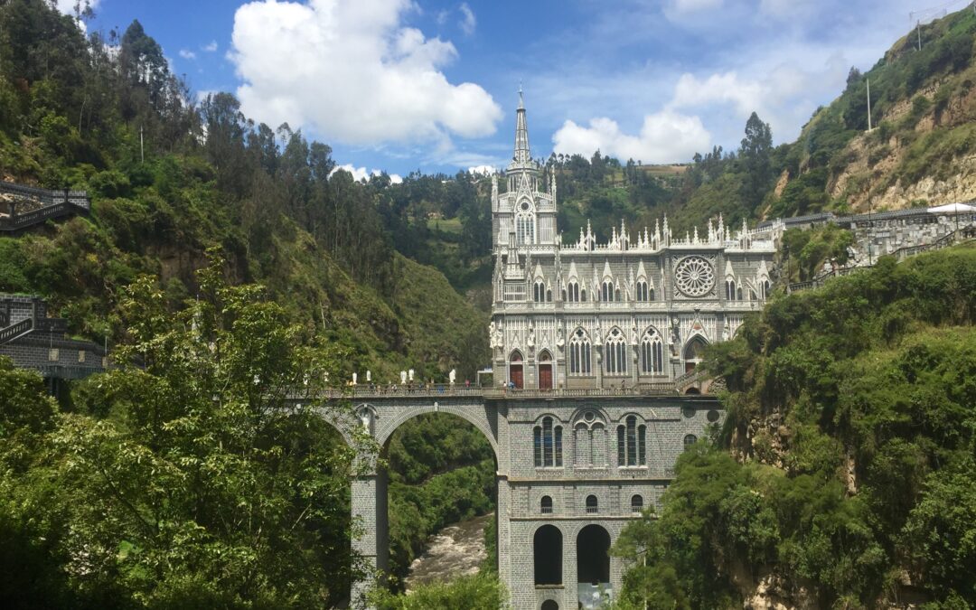
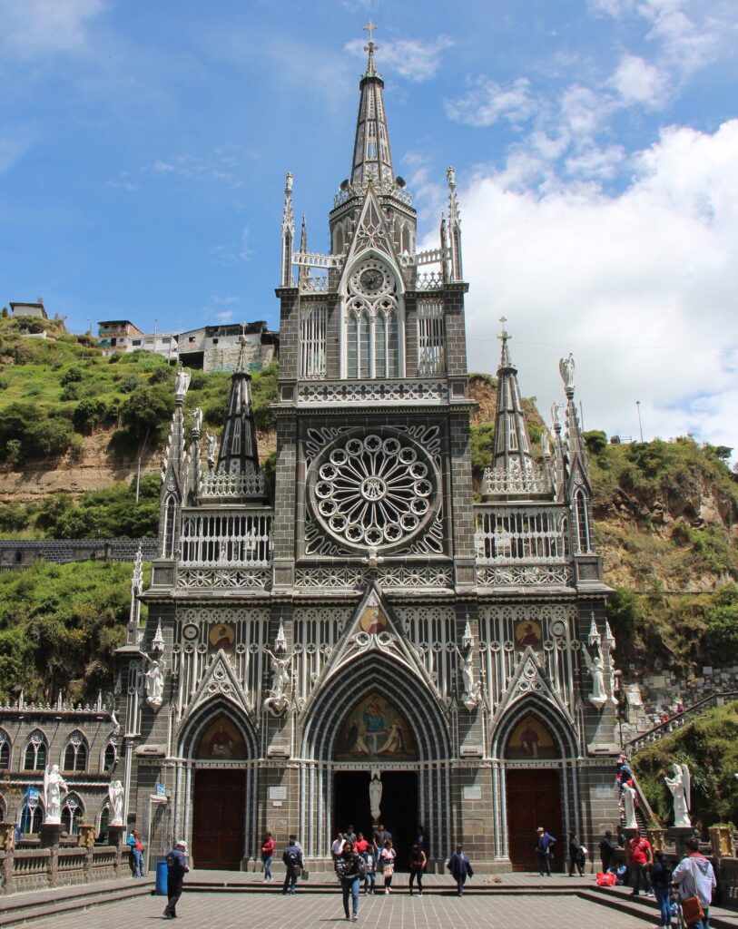
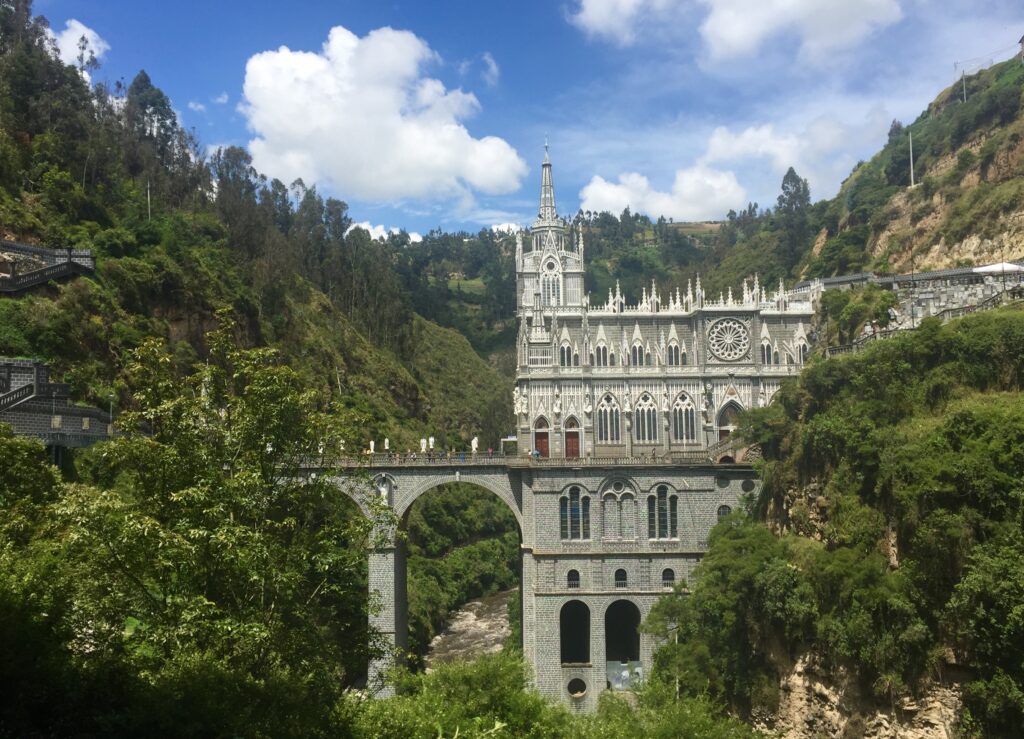
We could not leave Colombia without a visit to the famous Las Lajas Sanctuary, a stunningly located and beautiful basilica church just outside the border town of Ipiales. Simply put, an ornate church built on a bridge in the bottom of a valley. A steep walk down to get there and killer climb back up at such altitude, but well worth the effort – and thus, our feature image this week.
Las Lajas SanctuaryLas Lajas Sanctuary
Next week, we cross ( literally ) to the middle of the world – Ecuador !
The PanAm completed in April, 2022 and with the truck camper sold, we shipped our new Sprinter van to Australia in late 2022. We travelled there through all of 2023 and into 2024 before shipping it up to North East Asia where we travelled for 4 months between Korea and Japan, before shipping it back to North America. It’s our plan to continue exploring the world in 2025.