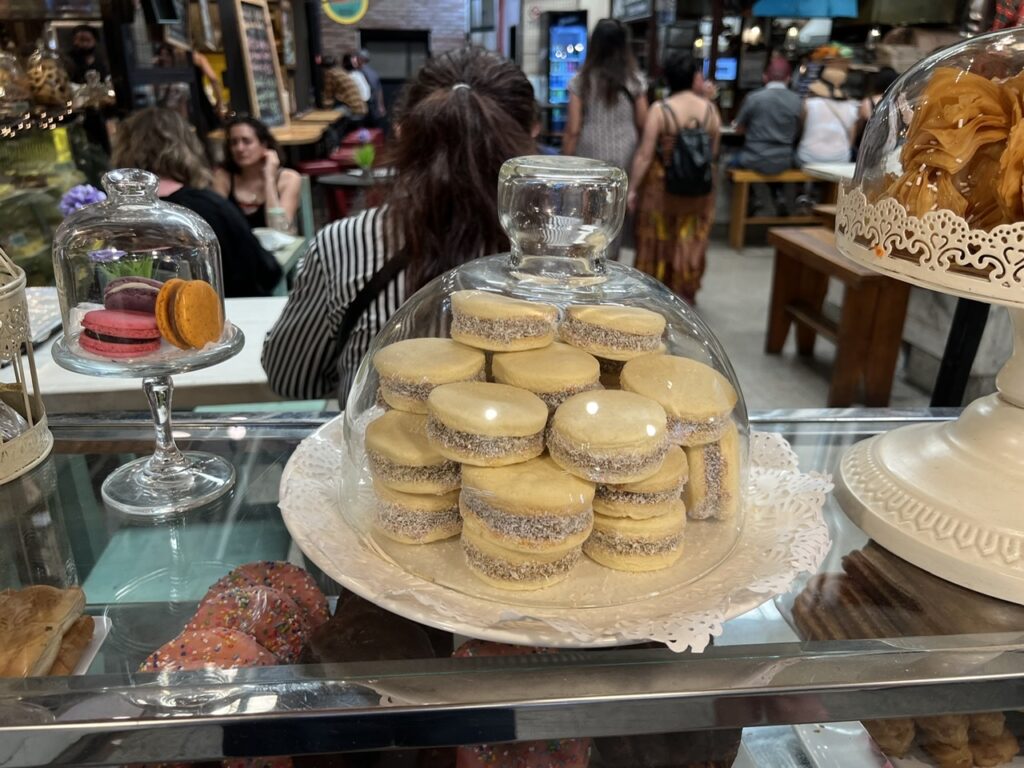
It’s been a bit of a balancing act for us here in Buenos Aires. The plethora of delightful cafeterias, panaderias, pastelerias, heladerias, chocolaterias, authentic pizzerias and simply countless great restaurants ( for which the city is renowned ) represent a constant ( and I mean constant ! ) temptation. And, with no truck camper, well, we just had to eat out all the time. Every which way you turn there is one or more of these tantalizing food options- but how to keep it all from adding pounds ( or kilos ) in precisely the wrong places, all the while staying fit to explore the city ?
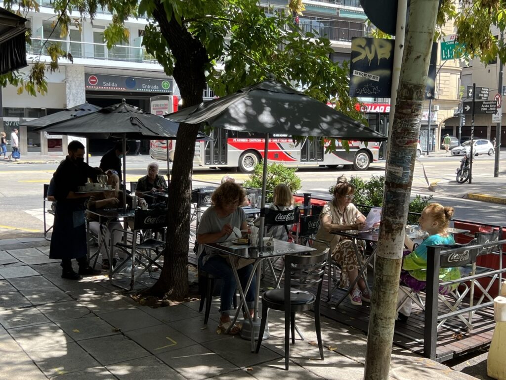
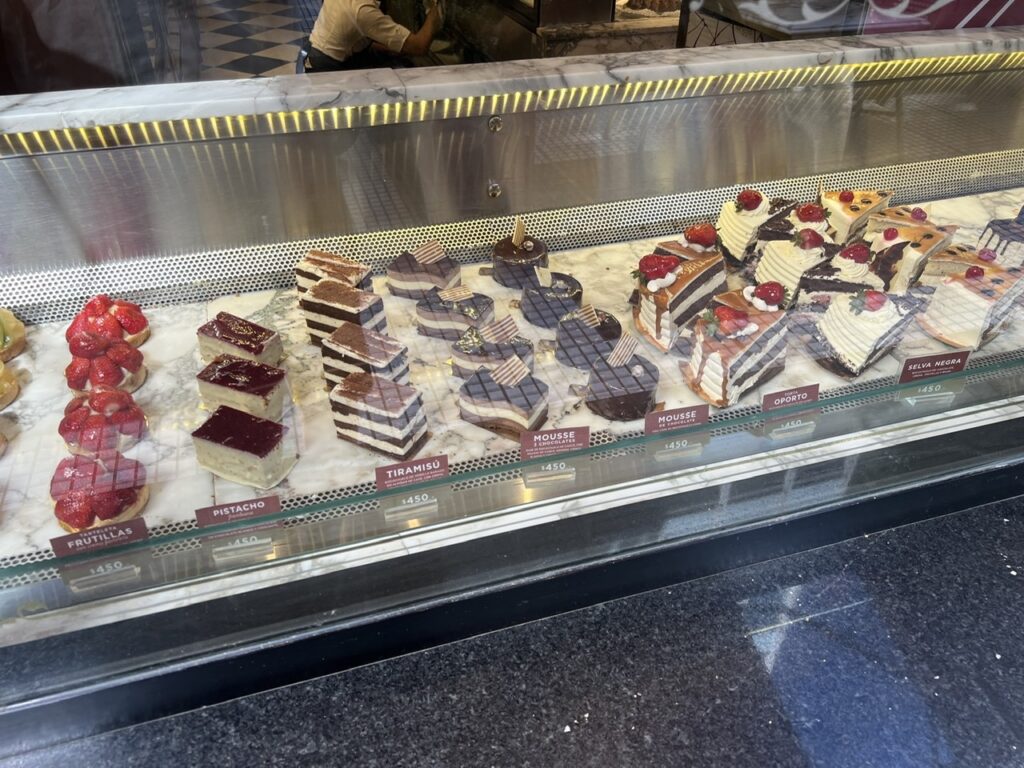
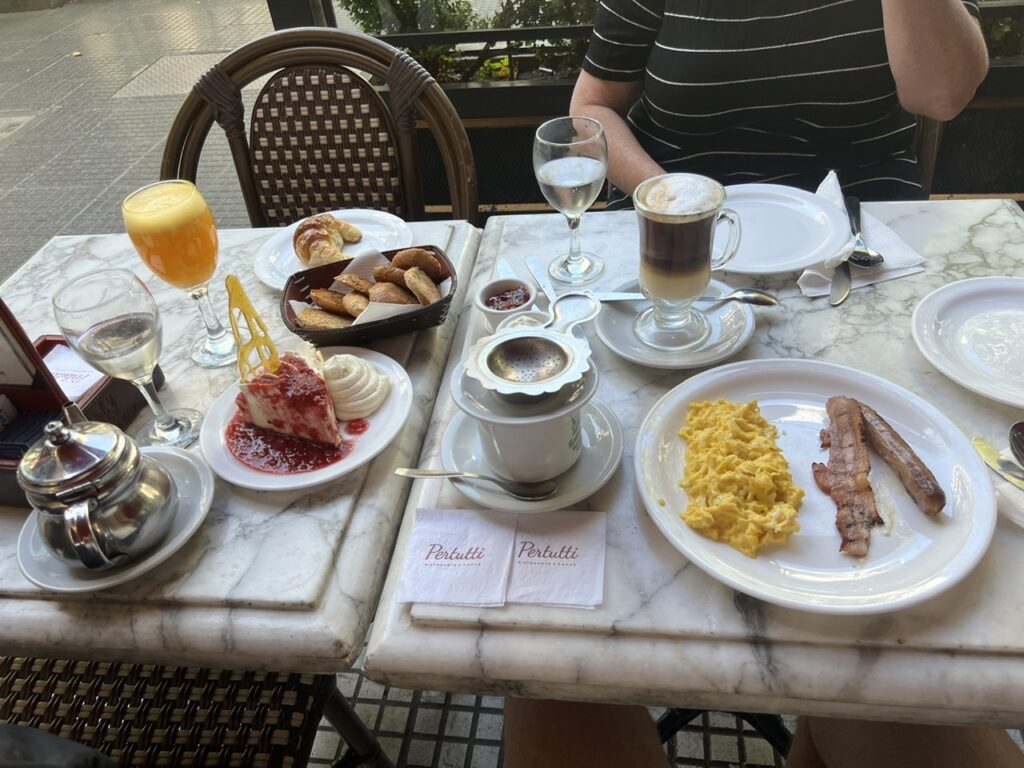
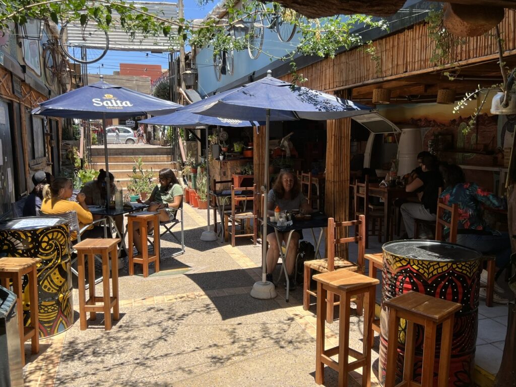
Sidewalk cafe’s are everywhere, and served not only coffee/tea and the like. A cold beer or wine could be had whenever !Cake display at “London City” one of BA’s well known cafeterias on Avenida de Mayo. Very decadent ! We’ve never eaten as much of it as we have here.
Simple, we decided. We’d enjoy Buenos Aires’ edible temptations daily, though in moderation, and we’d walk everywhere we possibly could when sightseeing. Not only was walking good for us but it gave us a close up view of the city that one sometimes misses in a taxi, bus, subway or an Uber. Excuse the pun but perhaps we really could ( quite literally ) have our “cake” and eat it too !
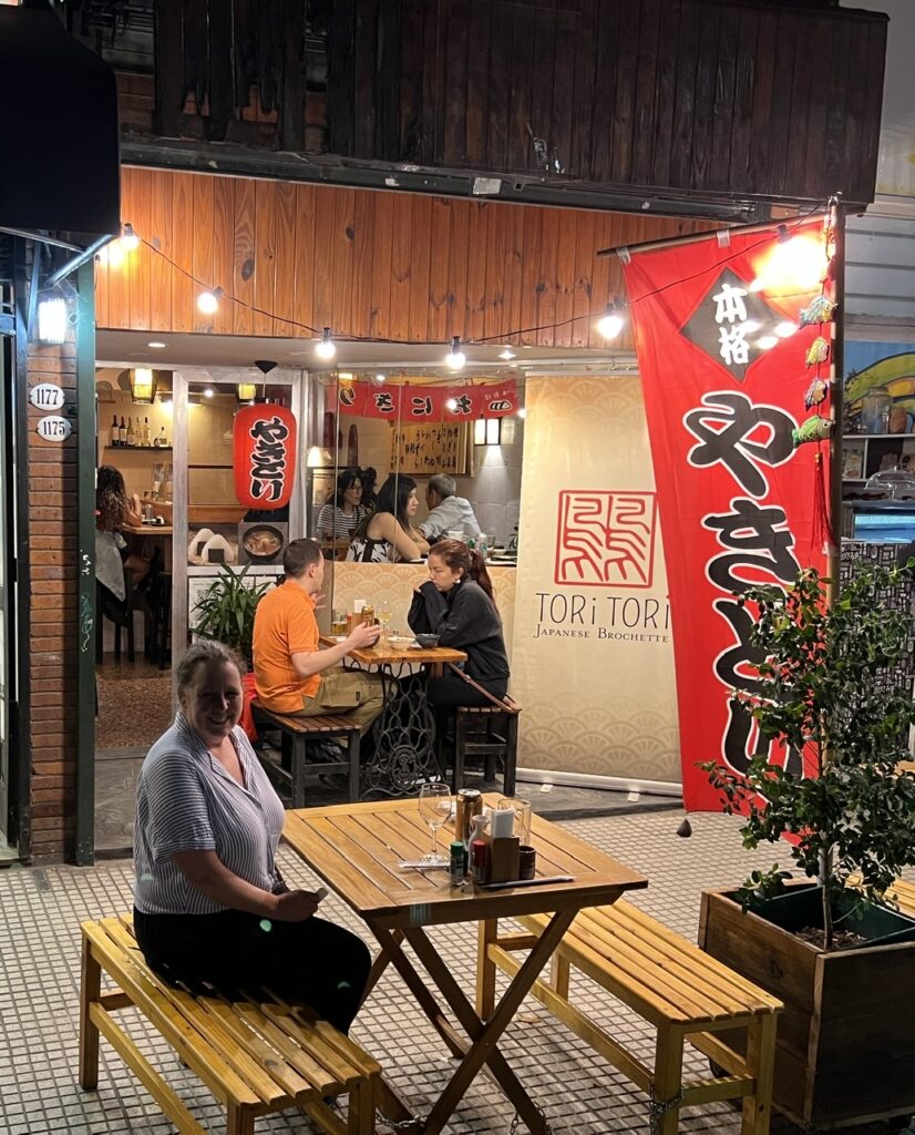
The sweet biscuits were very popular.Even breakfast had a ”sweet” emphasis. Here, breakfast at London City. This was the Americano and included ( incredibly ) an extremely generous portion of strawberry covered cheesecake. First time we have eaten cheesecake for breakfast !One of the great things about Recoleta is the abundance of great little ”boutique” restaurants. This one, ”ToriTori”, was a favourite of ours. Best beef brochettes we’ve ever had !
With Covid trending significantly lower here as it is in most countries (but still a threat), more walking ( masked up of course ) would also minimize the risk of any possible infection. In fact, and perhaps we are a bit paranoid about it, we have not taken a bus or subway (which are generally very crowded ) since we came back in November. So far so good on that count…..fingers crossed. Gastronomic temptations aside there has been no shortage of sights and attractions in this enormous city. Below are some of the places of interest we’ve been exploring of late.
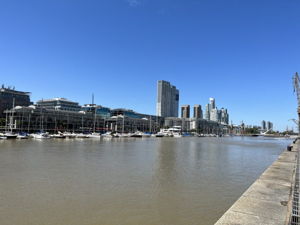
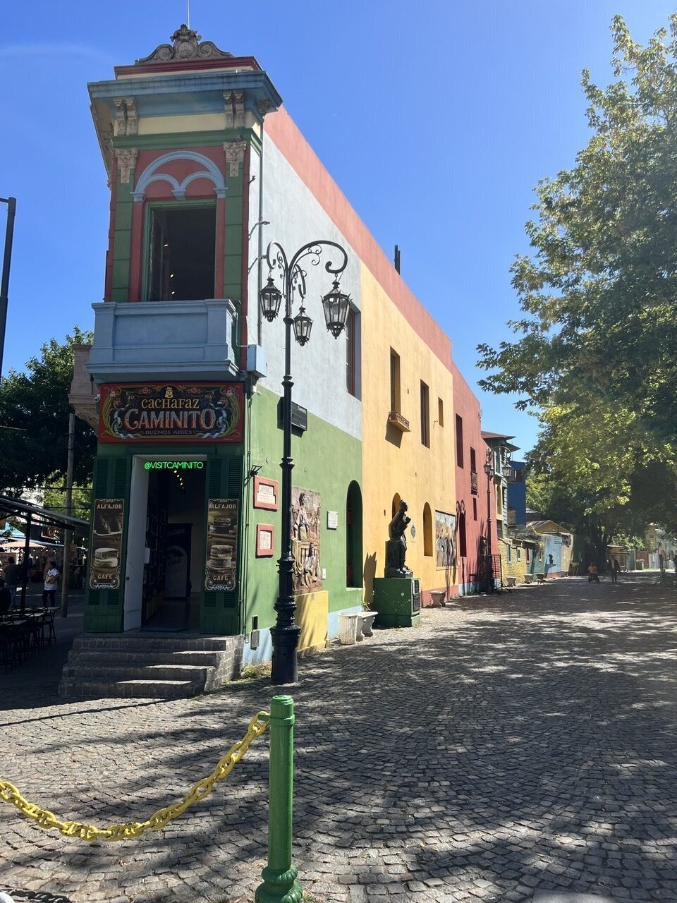
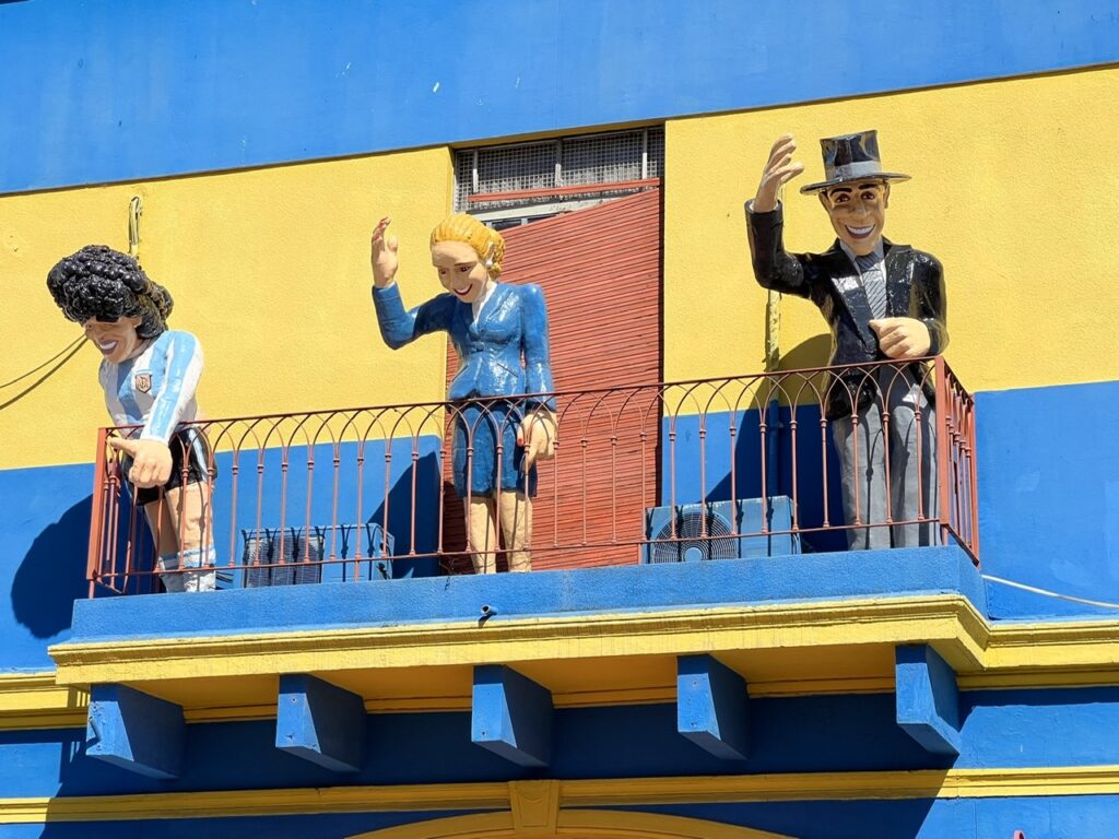
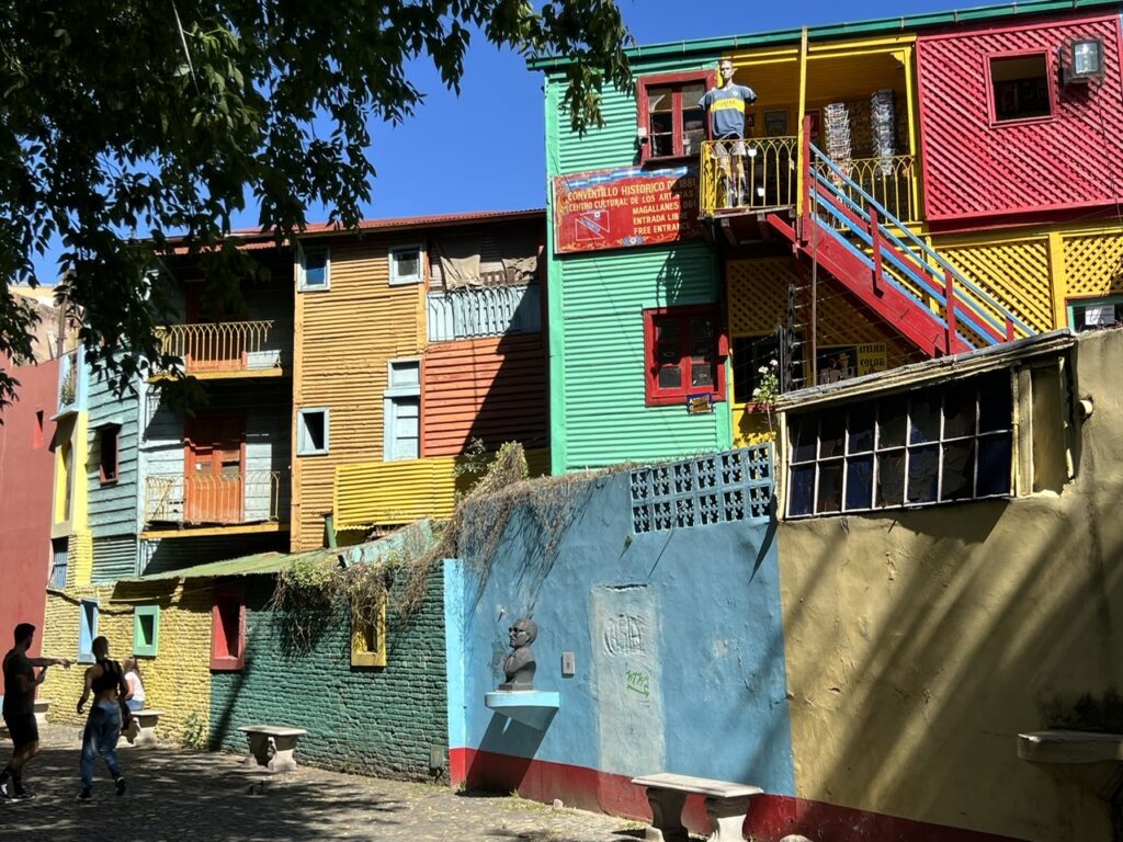
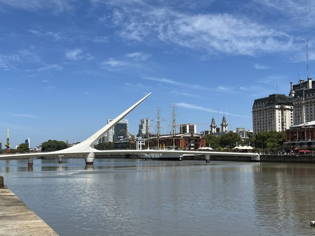
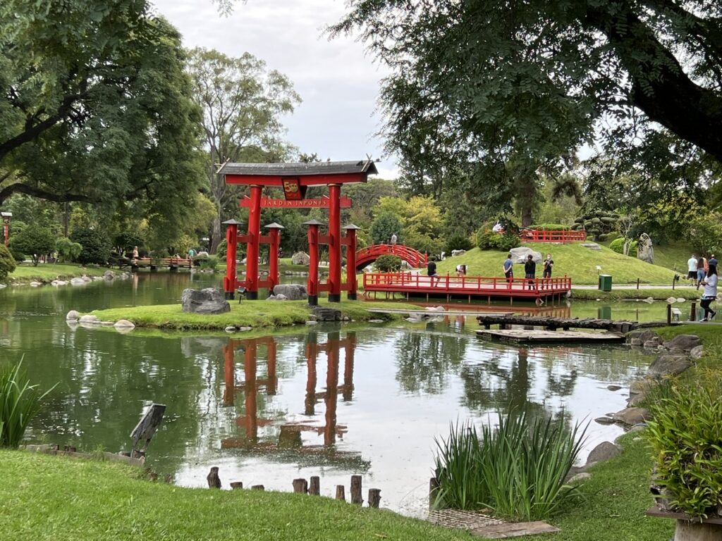
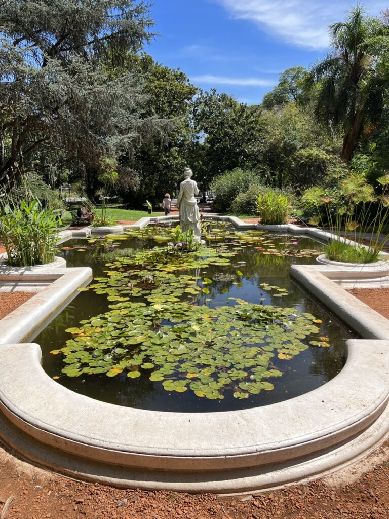
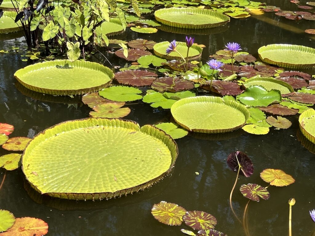
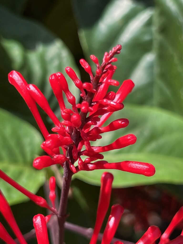
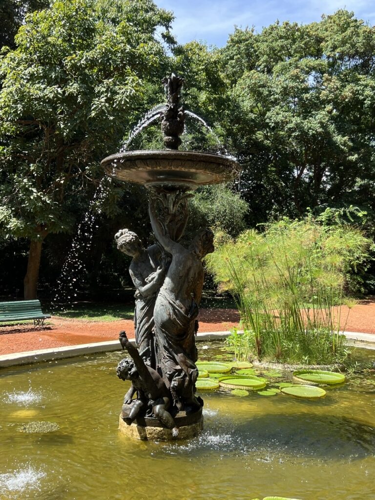
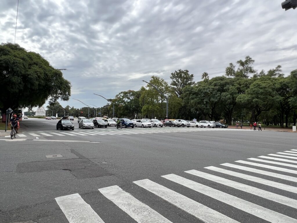
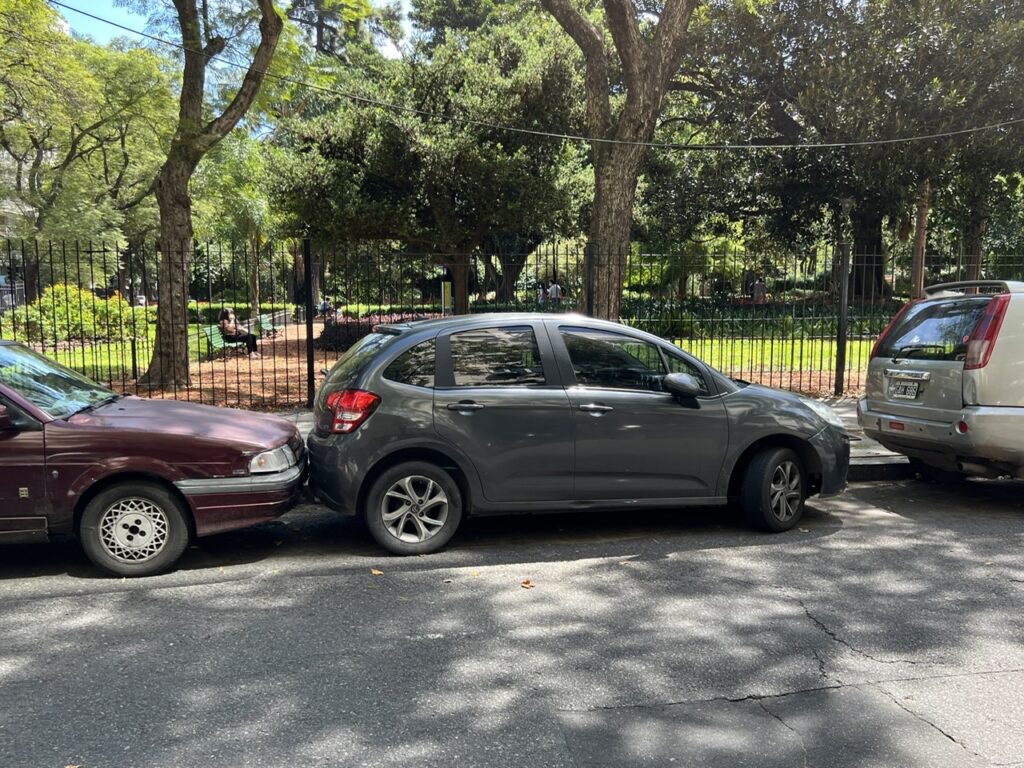
Puerto Madero, a redeveloped riverside neighborhood in BA. Some good shopping, a great park and good eateries in this part of town.Caminito, a colorful street in La Boca ( literally, ”the mouth” ), a gritty neighborhood in Buenos Aires. Famous not only for the colorful buildings, La Boca’s eponymous football club ( Boca Juniors ) claims legendary Argentine player Diego Maradona as its favorite son.Maradona, Eva Peron, and Carlos Gardel ( who significantly influenced the tango ), La Boca.Another street in La Boca.Puente de la Mujer ( Woman’s Bridge ), Puerto Madero. It’s angled design was intended to evoke an image of tango BA has one of the nicest Japanese gardens we have seen anywhere – a place of solitude and quiet contemplation in the middle of a busy city.BA also has a beautiful botanical garden not far away. Some very exotic………and very colorful…..and both colorful and exotic plants could be seen in the Jardin Botanico ( Botanical Garden ) !Many statues too. Some like this, in the garden……….and others, evoking the struggle for independence, such as this on Avenida LibertadorAvenida 9 de Julio is wider ( but runs both ways ). We counted 12 lanes ( just one way ) on Avenida Libertador !Often when sitting at an outdoors cafe we would be entertained just watching people park. Often bumper to bumper ( sometimes at both ends ). Seemingly little thought is given as to how people would get out !
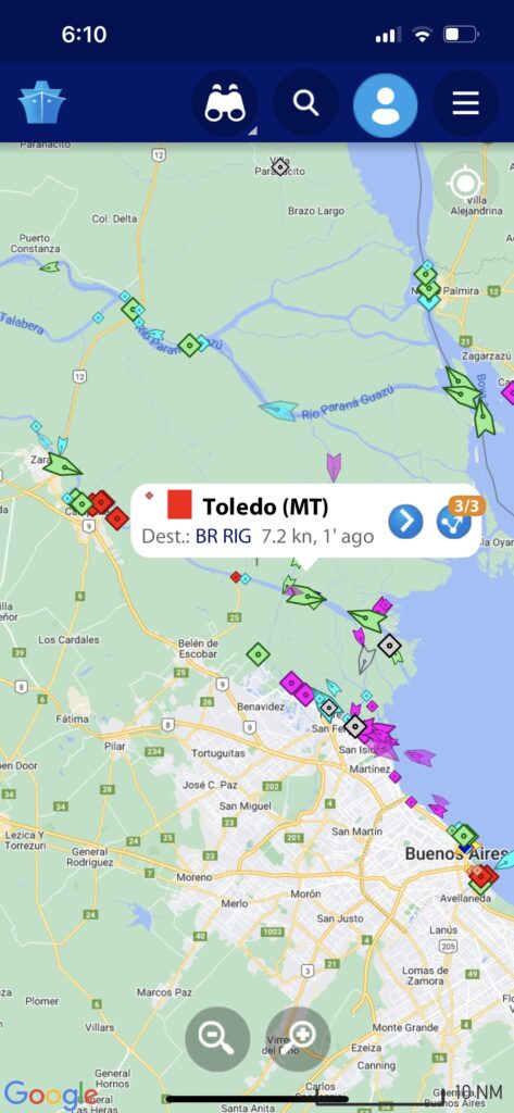
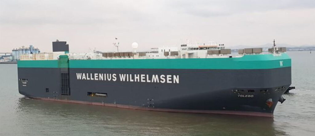
The sights of BA have been enjoyable and there are many more still to see. In the background, meanwhile, we are keeping a close eye on the “Toledo” as it steams north to the US. As of the close of this blog it appears not to have fallen any further behind in its schedule and seems to be making steady progress up the coast of Brazil en route to Panama.
Here’s hoping for continued smooth sailing over the next few weeks.
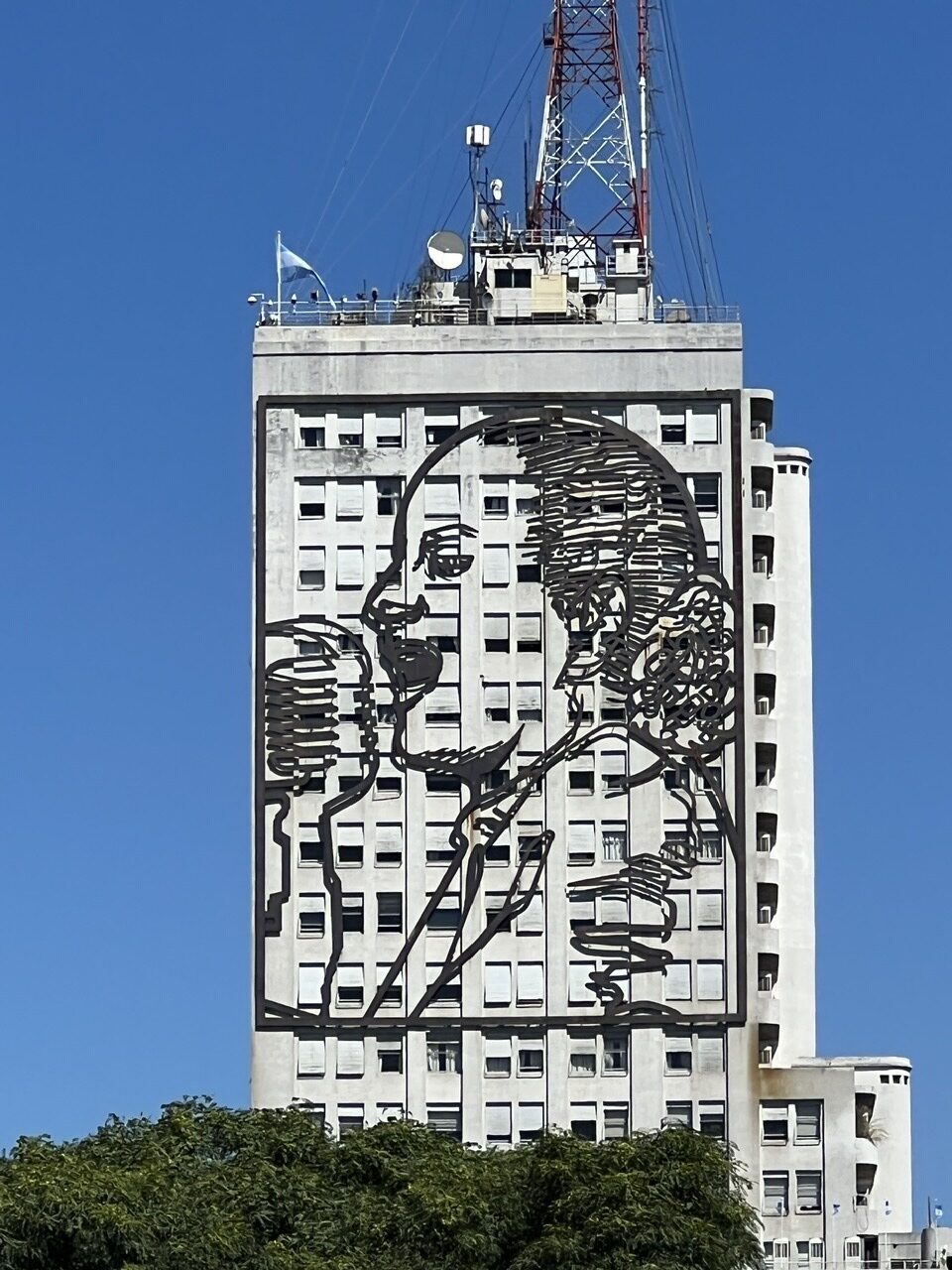
Port congestion seems to be the main reason for shipping delays. Our ship made two stops in Brazil ( at Rio Grande and Santos ) and in this image ( at Santos ) you can see how many ships are waiting to berth. Typical these days.Forever watching over the nation – a giant mural of Evita on the side of a high rise overlooking the massive Avenida 9 de Julio.
I want to begin this week’s blog by saying its wonderful to have ALL our “@gmail.com” subscribers back with us effective last week’s blog. For some reason, known only to the technical gurus at Google, for several weeks in February many subscribers with Gmail accounts saw our www.OneEndlessRoad.com blog go directly to their junk/trash folders ( if you are a Gmail subscriber and missed the last few week’s blogs, that’s where they went ). In any case, all seems to be well again as of the last blog – just wanted to assure folks it was nothing we did at our end. Thanks to all the gmail subscribers who pointed this out to us.
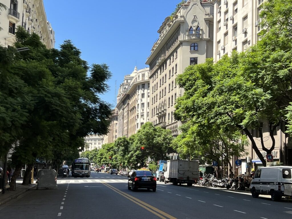
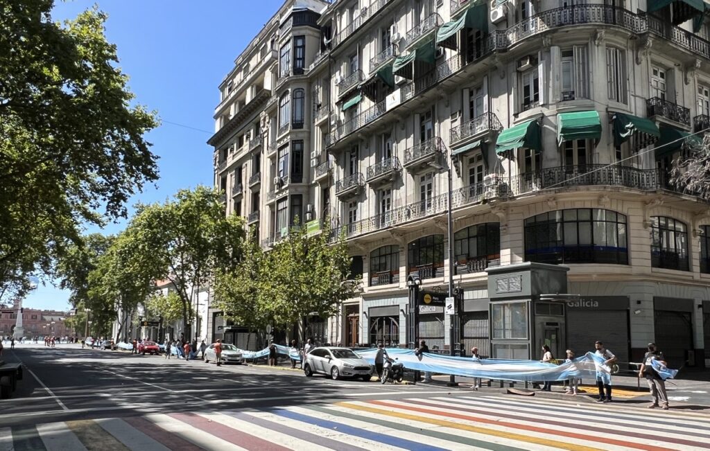
Downtown Buenos Aires
It’s been surprisingly easy to adjust to life with no “wheels” due largely to the fact that we are very comfortably ensconced here in beautiful Buenos Aires, in the heart of downtown and with everything we need literally at our fingertips. Someone else makes the bed each day, cleans the room, and generally attends to anything we need – feels totally luxurious and we are enjoying being just little a bit spoilt….!
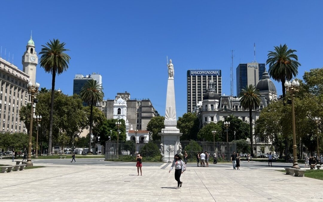
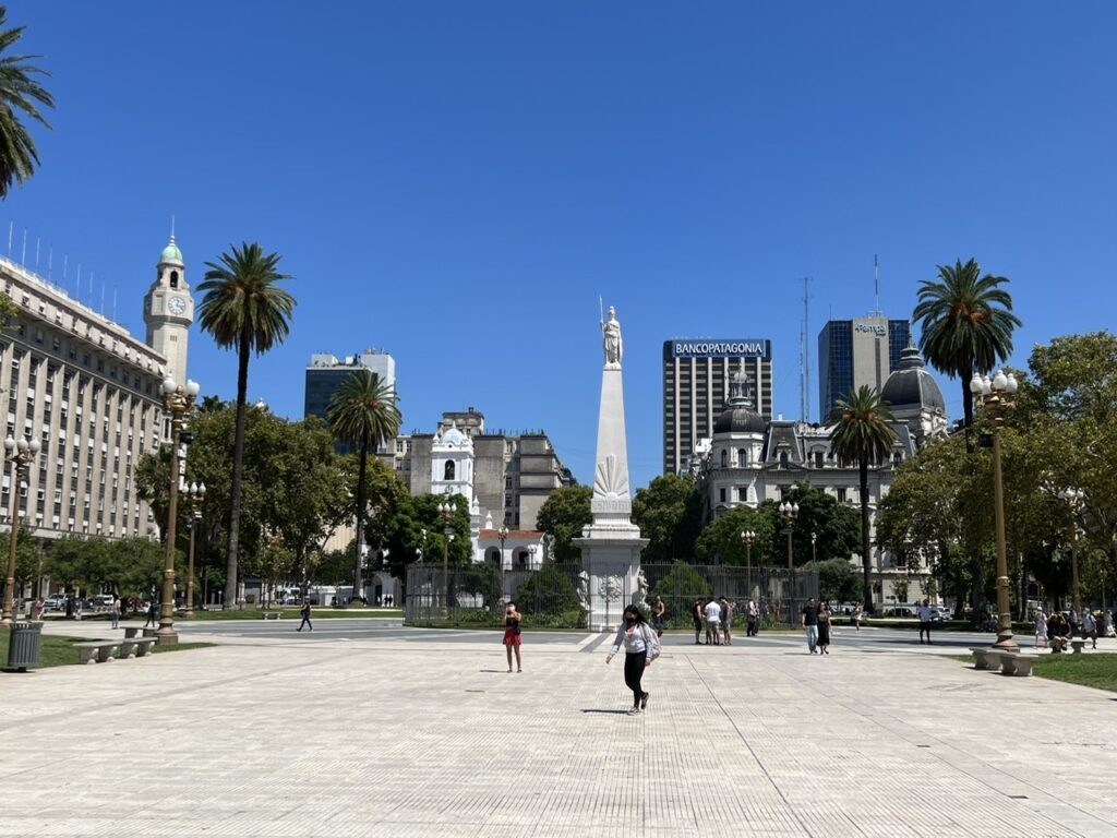
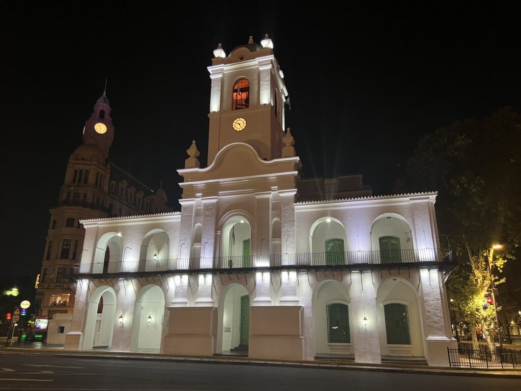
Plaza de Mayo, downtown Buenos Aires – the bright white building in the background is the restored Cabildo ( town hall )Cabildo at night
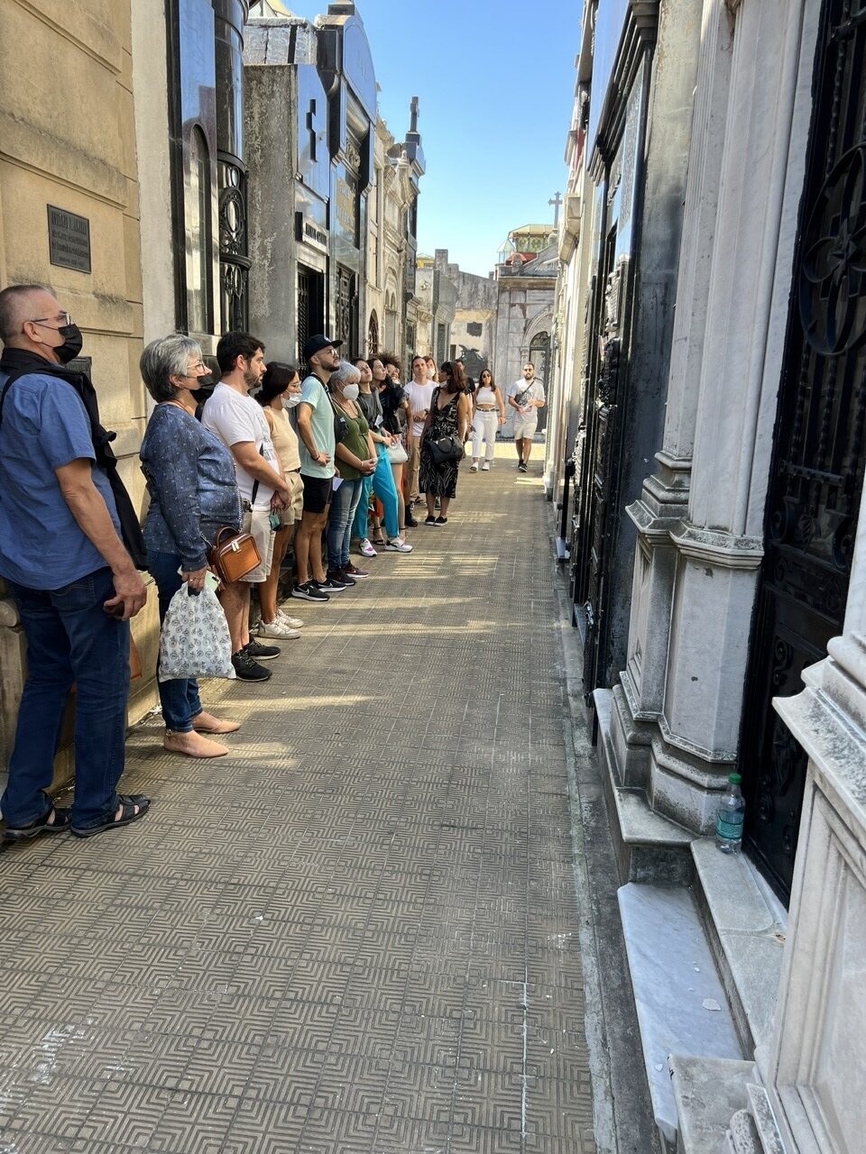
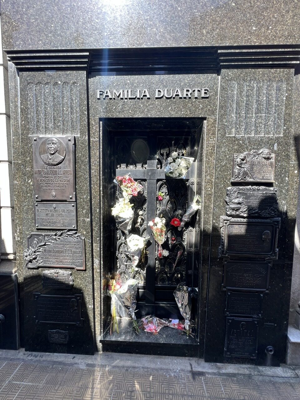
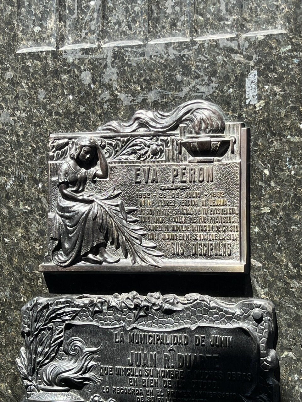
Buenos Aires must be one of very few cities where the cemetery is a major tourist attraction in itself. There are many famous Argentines buried in “La Recoleta Cemetario” but surely none more globally recognized than Eva Peron – better known as “Evita” and Argentina’s one time First Lady. Revered here, she died young, at just 33, and ( after a somewhat tortuous journey to her final resting place ) is now buried in the Duarte family crypt in Recoleta. Beyond Evita’s grave the cemetery is like a mini city within a city with some of the most ornate resting places imaginable – perhaps appropriate given that Recoleta itself is probably the most desirable suburb in Buenos Aires – there is no shortage of wealth here.
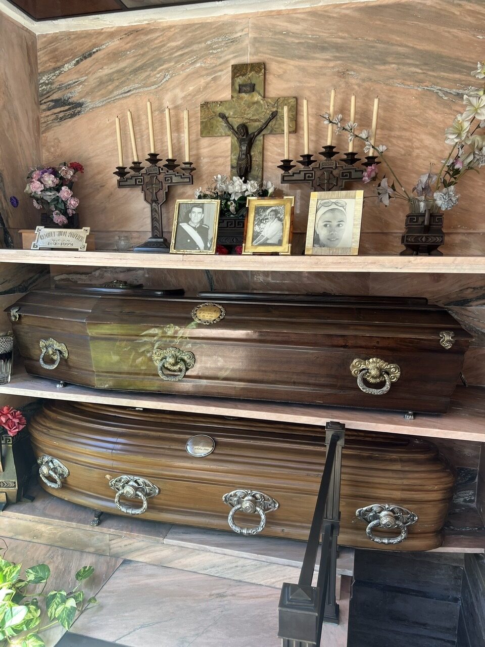
Argentines line up for a close up view of Evita’s family mausoleumEvita was born Maria Eva Duarte to a poor family in the Argentine Pampas. She left home for the city to study theatre and it was at a performance where she met her future husband, Juan Peron. Her continuous support for the working class and particularly her support for women endeared to all Argentines. Almost 3 million attended her funeral.Nowhere on her gravesite could we see reference to her birth date – she was rumoured to have have had it changed.This picture is not of the Duarte family mausoleum but it does show that in some Recoleta mausoleums the coffins remain exposed and set above ground. We found this a bit creepy.
For the first few days in the city we’ve been tending to some administrative matters that were overdue, catching up with other travellers we’d recently met and simply ambling around and starting to explore this vast city. Coincidentally, as I was typing this sentence, a note popped up in my email – from the shipping company – advising us that “Your vehicle was successfully loaded on the ship”. At least we now know it’s on its way.
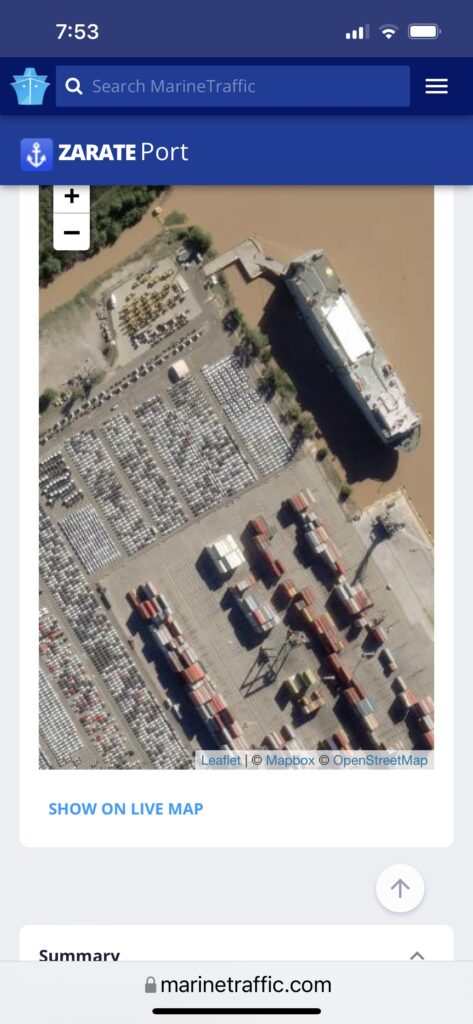
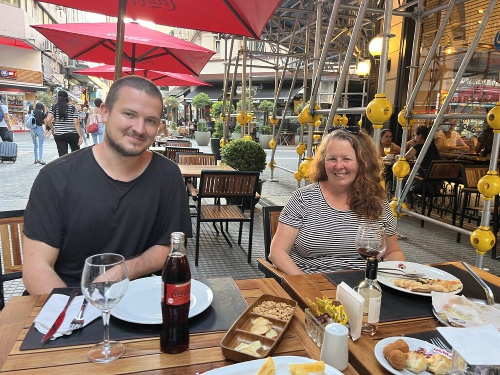
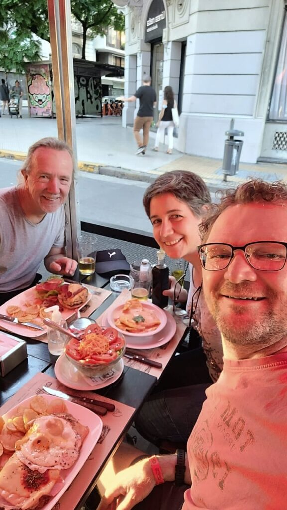
Our ship, the Toledo, getting ready to load in Zarate ( port of Buenos Aires )Our ship leaving port – with this app we can track the ”Toledo” as it makes its way to the US.Lunch with Vincent, who is shipping his Sprinter on the Toledo with us.Out for dinner with Peter and Nicole from Switzerland. Lois a bit unwell on this day so just the 3 of us.
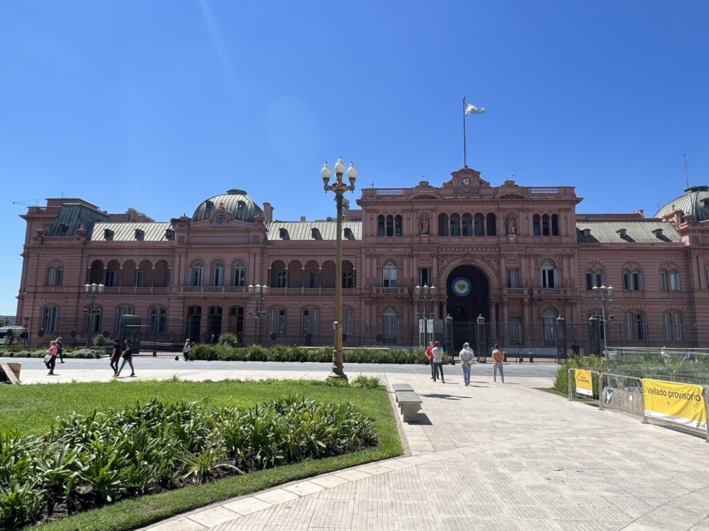
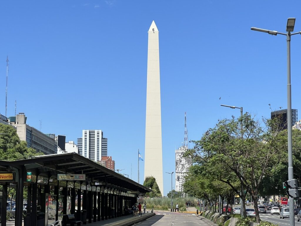
There were a few places of note that we visited this first week in the city ( beyond the Recoleta cemetery). Just as the US has the “White House” and the South Koreans have the “Blue House”, the Argentines have the “Pink House”, or Casa Rosada. We may even have caught the President coming and going since a very official looking blue and white (the national colors) helicopter landed and then later took off from the helipad adjacent to the Casa Rosada while we were walking by – lots of police in the area and protesters nearby, so something significant was going on at least. Our hotel is located close to the “Obelisk” a giant BA landmark, located in the middle of Avenida 9 de Julio, generally considered the widest street in the world. With dedicated bus lanes in the middle I think there are 20 lanes on this crazy wide street – there are 3 or 4 pedestrian traffic lights sequentially timed just so you can cross it but almost always with a significant wait in the middle. As grand boulevards go this one is indeed impressive. Wandering around the city there are countless historic buildings, chic neighborhoods, leafy parks, and famous restaurants so we are trying to spread our visits to them all over the time we are here.
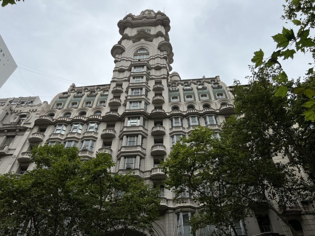
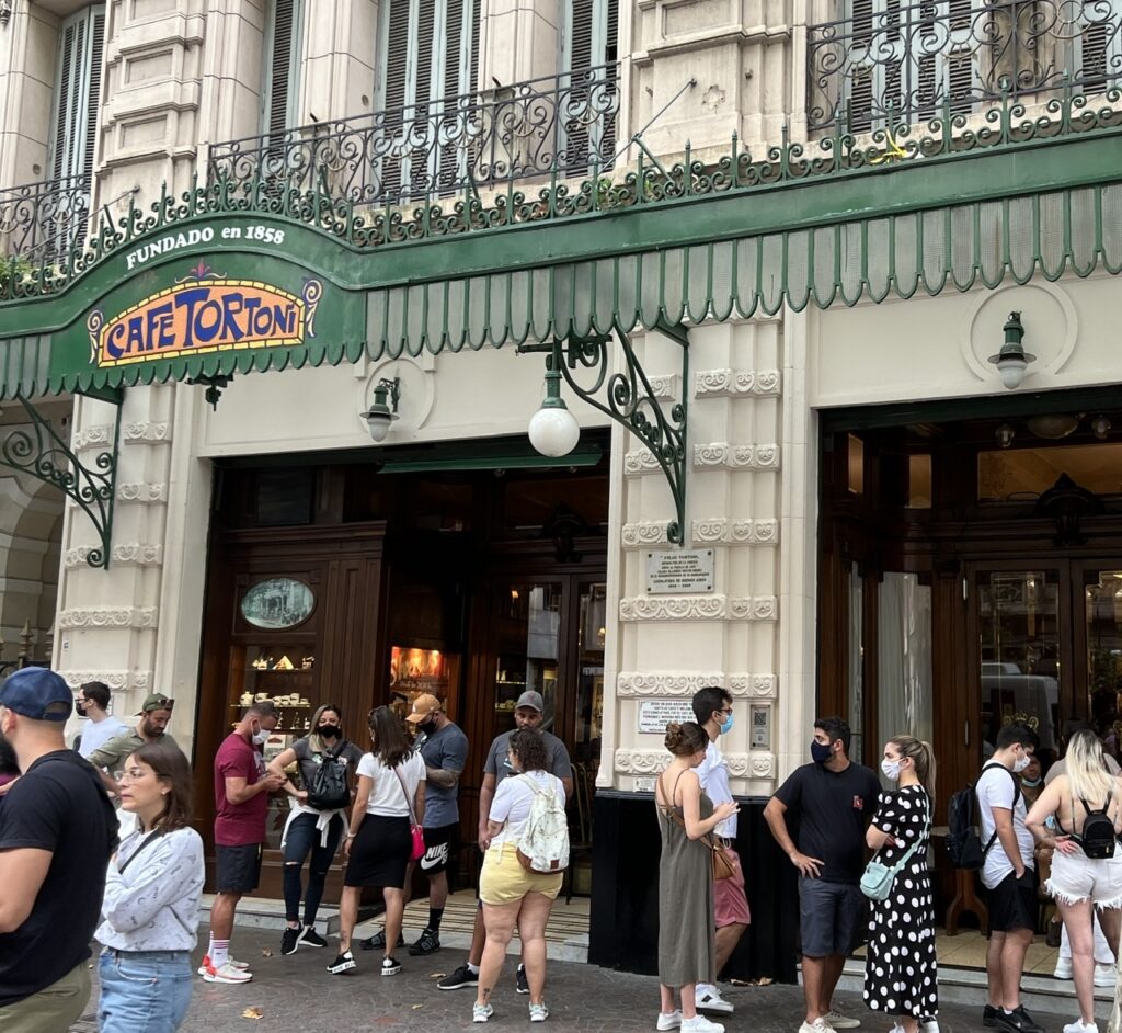
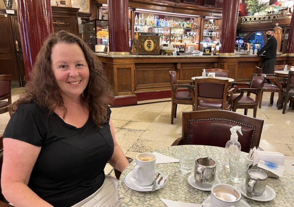
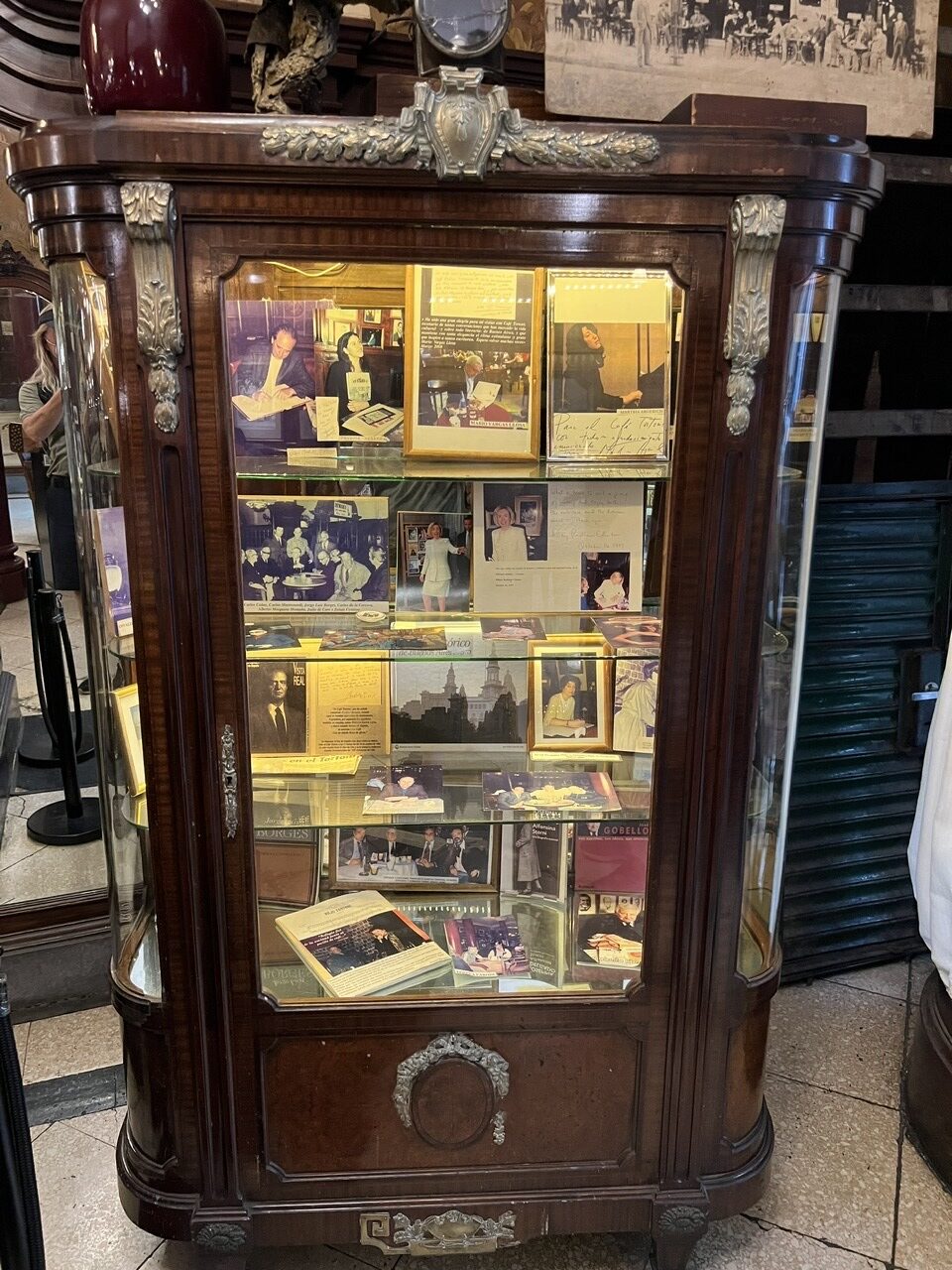
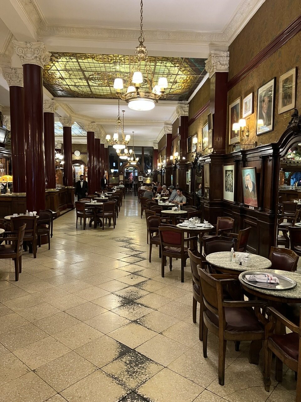
The Casa Rosada, or Pink House, home of the Argentine president.The Obelisk, shot from the middle of Avenida 9 de Julio. The Obelisk was built over 73 days in 1936 to commemorate the 400 year anniversary of the founding of BA.Palacio Barolo, an eclectic mix of gothic and hindu influences built in 1923 – then the tallest building in South America.Lois, in the park at Puerto Madero, a river-side suburb of BA.Cafe Tortoni – a Buenos Aires landmark, hugely popular attraction, and the oldest cafe in the city. We tried several times to get in but there was always a long line up.On the third attempt we saw no line up, so went inside. Enjoyed a cappucino, tea ( served, of course, the old fashioned way ) and a few medialunas ( Argentine style croissants ).A display in the foyer shows pictures of both Argentine and foreign luminaries who have graced its tables; Hilary Clinton, Albert Einstein, Robert Duvall, and more recently Katy Perry among them.The Cafe Tortoni decor evokes feelings of a bygone era. It’s been ranked among the 10 most beautiful cafes in the world.
I’ve mentioned before that for most people who travel extensively in South America, BA is easily the most popular big city. It certainly is ours. The impressive architecture, the distinctly European feel, it’s vibrant cafe culture, a very pleasant year round climate, relative affordability, it’s ease of getting around …..one could go on and on. One thing is certain – with 15 million out of 45 million calling BA home, the city dominates the rest of the country like no other in South America. More than 1in 3 Argentines live right here.
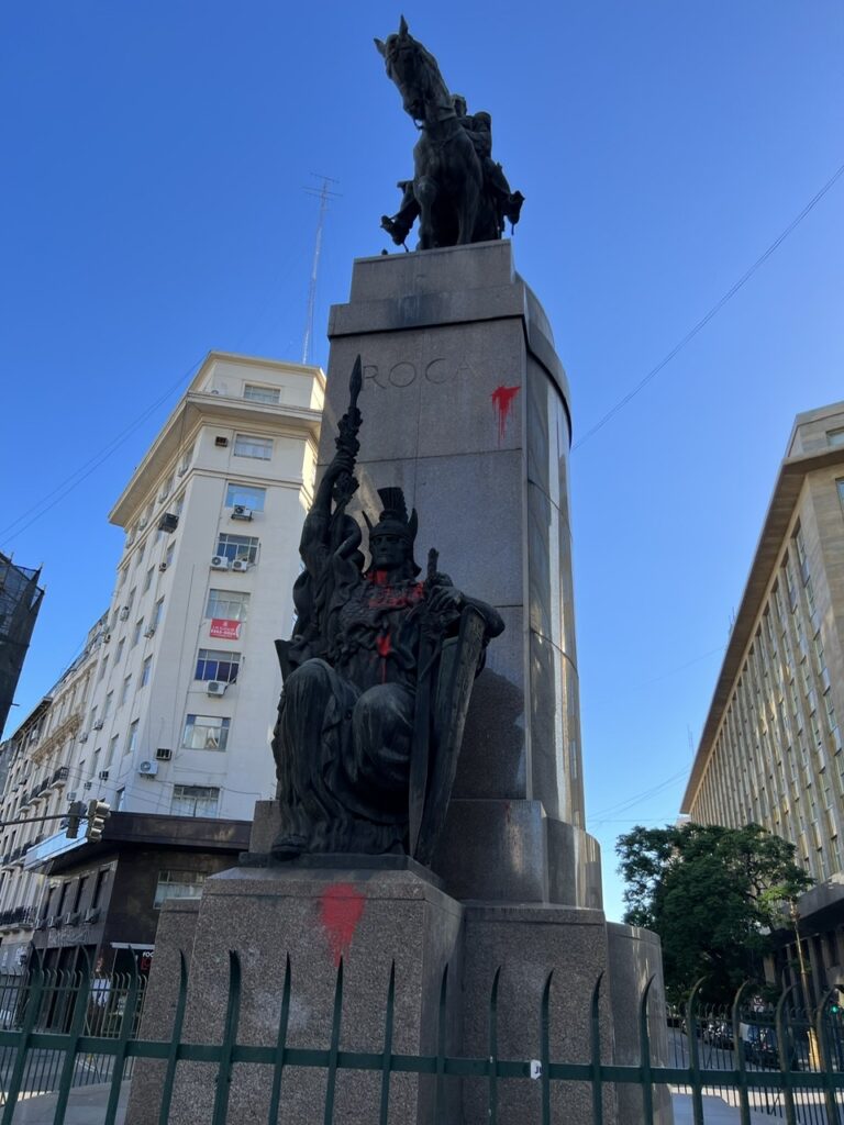
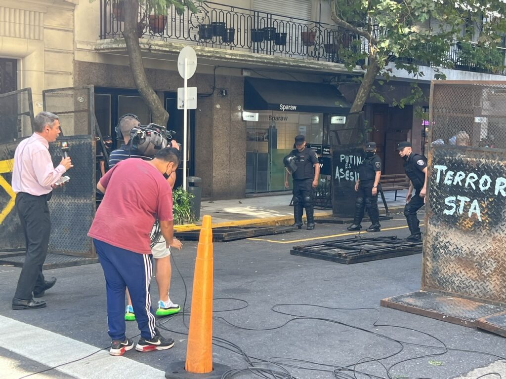
Like all big cities though, it does have its dark side and you don’t need to be here long to come face to face with it. Argentines we’d met before coming to BA warned us about crime in general and to be wary of specific parts of the city and walking at certain times of the day – warnings we have obviously heeded. Two things so far though have stood out – graffiti and homelessness. The graffiti is everywhere and sadly it’s not just contained to the usual political messaging spray painted on a blank wall ( that, tragically, exists in many countries ). We’ve also seen many of their grand buildings vandalized with it and even centuries old iconic statues of heroic independence figures ( of which there are many ) are not left unscathed. Absolutely heart-breaking.
Even the revered General Roca was not spared the stain of graffiti-artists. Tragically, both paint and ( now erased ) slogans can be seen on this beautiful monument. As with many others it is now fenced off.Wonderful to see the Argentines were joining in the global condemnation of the Russian invasion of Ukraine. Here a TV crew was filming police installing some barricades to manage a planned protest.A protest we passed on Avenida de Mayo. Apparently there is almost one every week.
Homelessness seems more visible here than elsewhere in the country but I am sure its an issue everywhere. It’s tragic to see and more so when you see young kids sleeping in the street as we sometimes did. With the homelessness comes begging and it was unusual not to be accosted while eating dinner ( restaurant seating here often flows on to the sidewalk and we often sit outside to reduce the risk of a Covid infection ). Most are polite and leave when their overtures are declined. But, I have to give credit to one particularly creative woman who approached us one evening while we were sitting in an outdoor cafe with our Swiss friends. She’d gotten declined by all the Argentines she’d approached and then spotted us. Either she couldn’t speak or just preferred to hand out a crumpled note describing her plight – written, of course, in Spanish. We’ve often handed over a small donation in such cases but we don’t always. Having made a donation to another such cause earlier in the day I decided to politely decline this one and when asked for a donation, responded with our stock ”Solo Ingles” – very abbreviated, and deliberately grammatically incorrect, meaning we only speak, ( and thus only read ) English. No sooner had the words left my lips than she smiled and turned over the scrap of paper…………..there, in perfect English, was a translated version of her tale of woe. Trapped now, as they realized I obviously was, our Swiss friends could not contain their laughter ( I thought it was pretty funny myself).
Needless to say I made a second donation that day ……😊
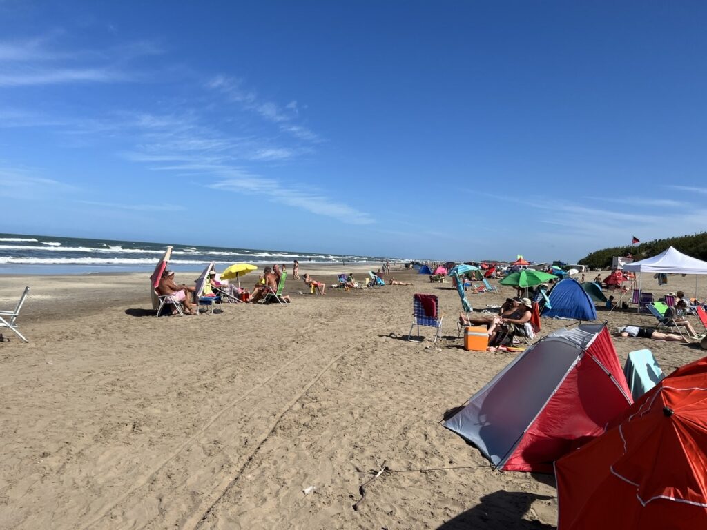
In the time remaining until we put our vehicle on a ship in Buenos Aires ( BA ) we decided some relaxing beach time was in order. We had not seen a lot of the ocean in the last 4 months, and the beaches in Mar Del Plata had sadly disappointed, so we decided to give it another shot and check out a couple of the smaller beach communities up the coast between Mar Del and BA. In short, we failed miserably on the first but “scored” on the second.
It was fun to watch the kite surfers at Villa Gesell but the motor bikes and quads on the beach ( till all hours ) made for a difficult night of sleep at the campground.
Villa Gesell is a somewhat upscale weekend getaway spot for affluent folks from BA so we expected a nice campsite, a peaceful evening and some nice local cafes. On the latter issue we did fine, on the former – well, it was more of a train wreck ! El Pucara Camping was well recommended and indeed the location was fine right by a nice beach. What we had not counted on was the trail bike/dune buggy/quad convention that seemed to be going on at the time…! That and the usual Friday night shenanigans made for one of the worst nights we have encountered on the trip. The noise ran late – till almost midnight, and then started up again at 4.00 am ! Worse, our immediate camping neighbours ( who had 5 quads ) were some of the worst offenders. We have often surmised that the Argentines either have an incredible tolerance for noise or a basic unwillingness to complain. Surprisingly the campground owners did absolutely nothing about it. Needless to say we beat a hasty retreat the next morning.
Camping neighbour at Villa Gesell and his ”fleet” of noisy quads.
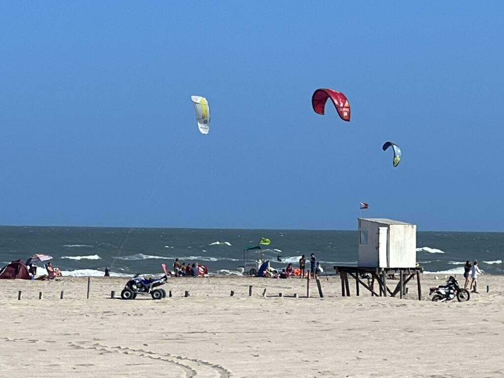
Further up the coast however ( La Costa ), we scored – the campground was excellent, facilities awesome and it was even closer to the ( uncrowded ) beach. Peaceful, with great neighbours, and good privacy – exactly what we had expected. What a difference 50 kms makes. A very pleasant way to spend our last days before heading the Buenos Aires to put our truck on the ship.
A nicer, quieter beach at La Costa just to the north. The water was warm – could even do a little body surfing.Campground Nueva Atlantis, La Costa – right on the beach and one of the nicest, most peaceful we stayed at.
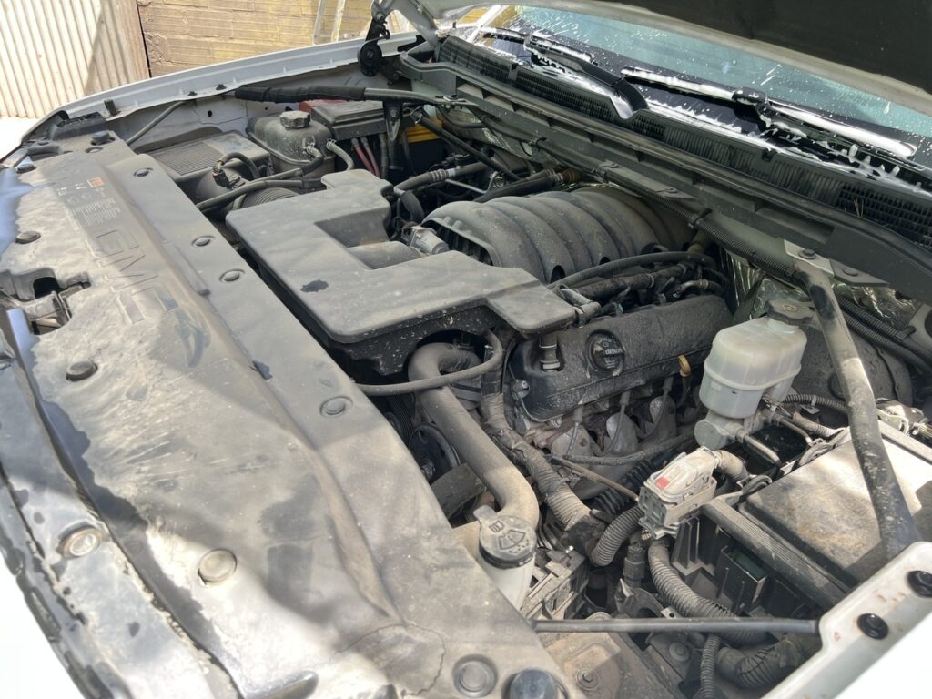
Before getting to BA though we had a few major “chores” as it were – start unpacking the vehicle, give the truck a final thorough wash ( including the rather filthy engine bay ) and purge the propane tank. The former two were quite easy, the latter item took some doing – no one seemed willing to purge it and state in writing that it was purged. Finally we came upon one that would do it, and that happened to have a North American compatible purge valve fitting to actually get the job done. Phew !
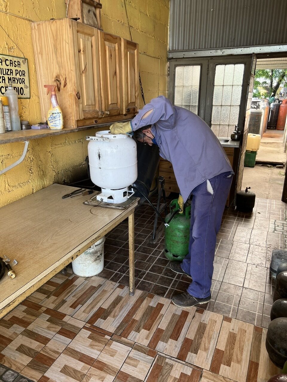
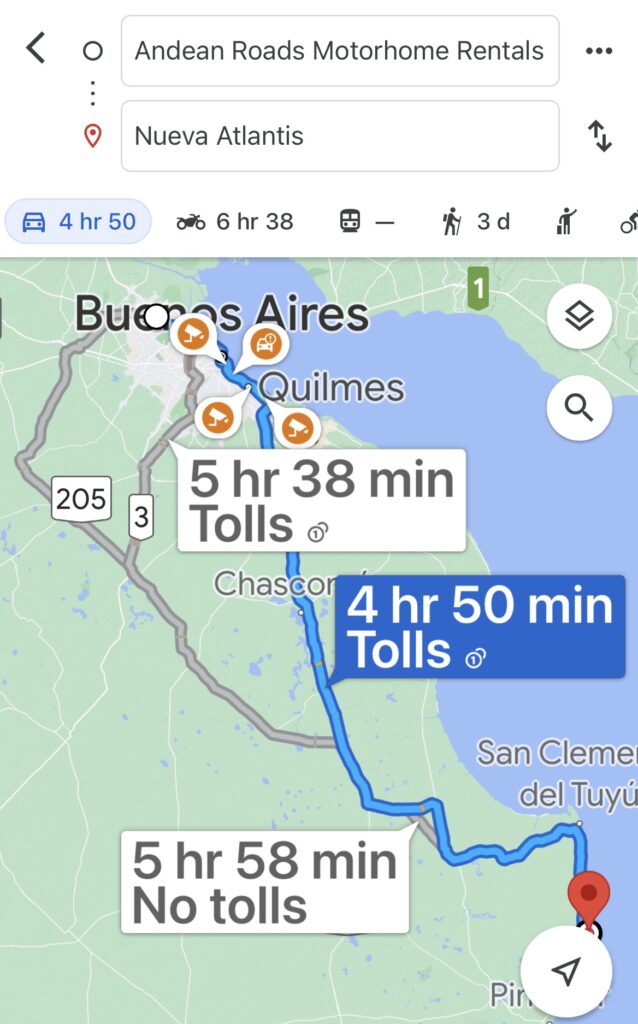
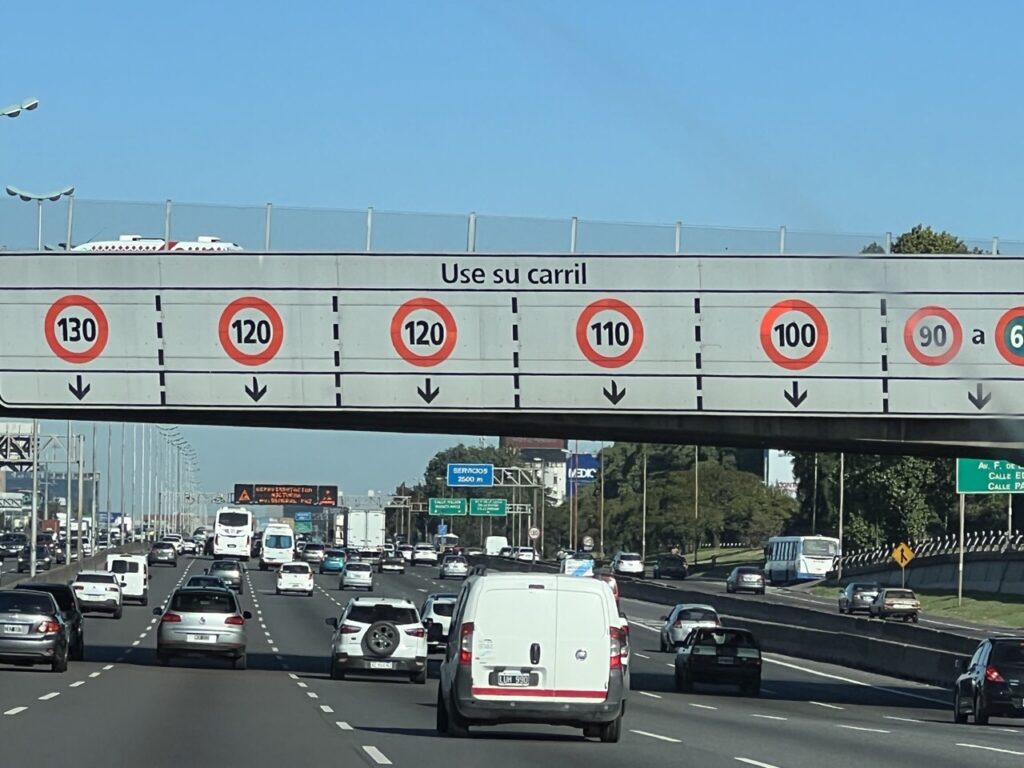
Started to think about cleaning the truck, including the engine bay ( quite dirty after almost 3 years without a clean ). Apparently a clean vehicle is appreciated when clearing the agricultural inspections in the US. So, we took it to ”a guy”…..…..who got it looking almost like new ( and washed our truck one final time as well ).Another ”project” prior to getting to BA (and shipping the truck ) was to purge the propane tank. Found these helpful guys in the small town of Monte, just south of BA from an iOverlander recommendation.After some initial confusion ( he could not understand why I wanted NO PROPANE in the tank and at first tried to fill it ) I watched ( and filmed ) as he purged every last drop from the tank.From La Costa, Google Maps presented a few route options to Buenos Aires, the shortest, curiously, suggesting right through the heart of BA would be quickest. It’s a city of 15,000,000 people – we went the slower back way and dodged the worst of it !Saw this interesting highway signage en route. It says ”Use Your Lane”, and yes, supposedly you pick the speed you expect to travel and stay in that lane. Good in theory – but no one stayed in the same lane for long !
Buenos Aires is big. Actually, 15,000,000 people big… ! That’s about 3 times the size of Sydney or Toronto and ranks right up there with some of Asia’s biggest. Needless to say the thought of driving right through the heart of it (which was the route to our campground suggested by Google Maps ) was, I’ll admit, just a tad intimidating. We‘d handled some of Latin America’s big cities before ( Lima, Guadalajara and La Paz were some of the toughest ) but none this size. Was there possibly an alternate route ? Fortunately yes. Naturally it was somewhat more circuitous, but we managed to safely navigate our way to the Andean Roads campground in Tigre ( a BA suburb ) without any fuss at all. Not even a single wrong turn ( Lois suggested it was all in the navigating 😊).
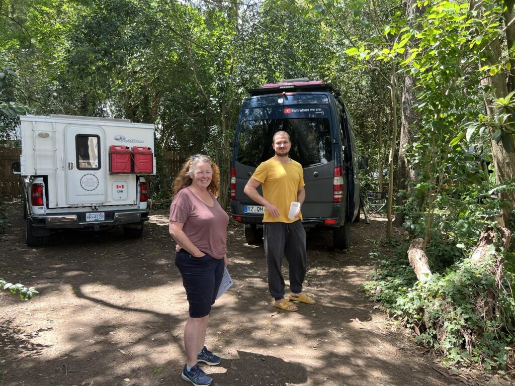
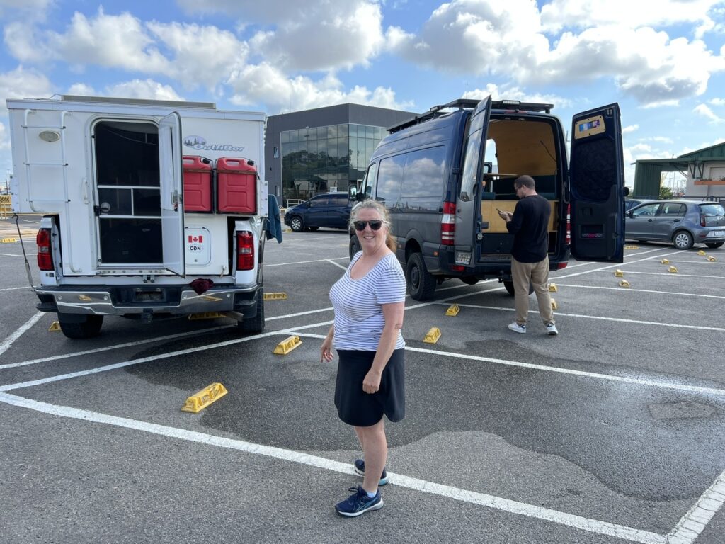
During our shipping enquires we had crossed ( virtual ) paths with Vincent, a young German, also with a vehicle, who tipped us off to the shipping company that ultimately managed to get us passage for our truck to the US. He had already reached BA and was preparing his rig ( a Sprinter ) for shipping. Our rigs would depart Buenos Aires at the same time ( Feb 28 ), on the same ship, but his would be going all the way to Baltimore whereas we would be meeting our truck in Brunswick, Georgia ( just north of Jacksonville, Florida ).
At Andean Roads we connected with Vincent from Germany who would be putting his Sprinter on the same ship to the USA.Vincent made the mistake of leaving too much diesel in his tank ( the shipping company insisted it be no more than a 1/4 full ). The mechanic at Andean Roads helped siphon some out, but it was all for nought – in the end no one checked at the port.
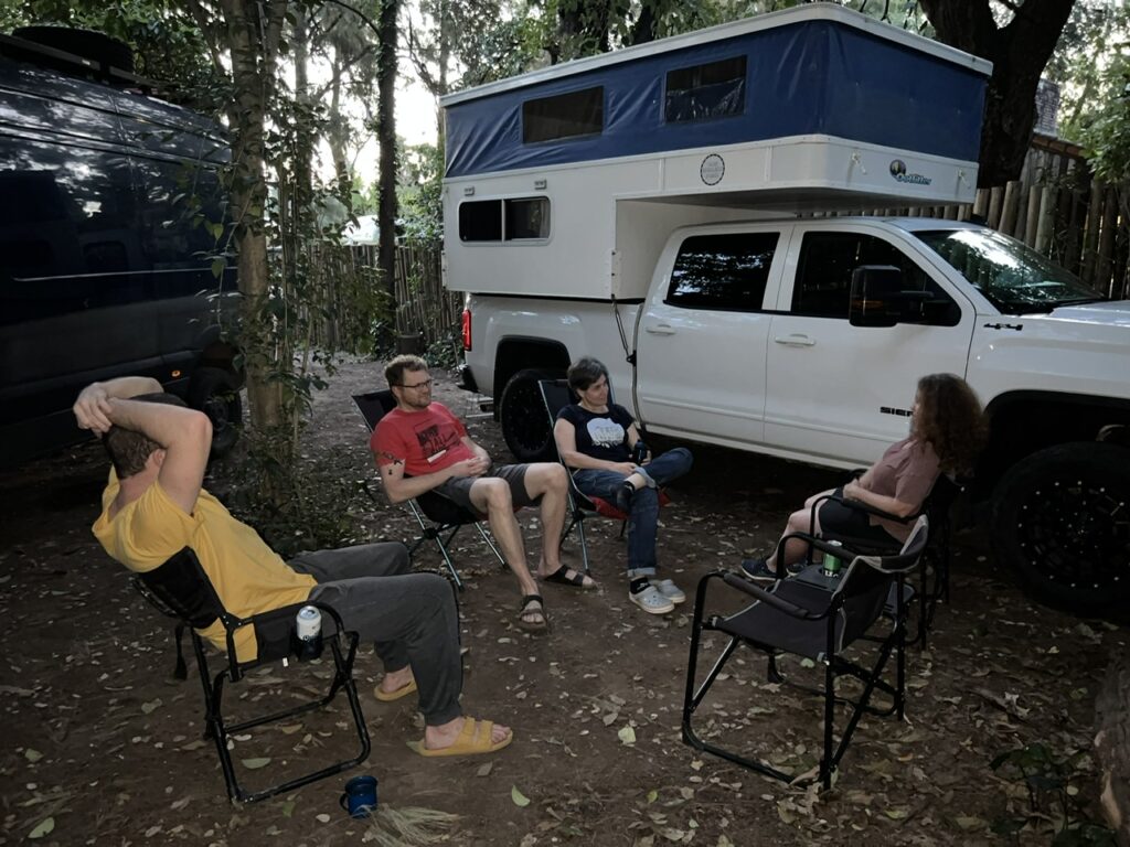
Our time at the Andean Roads campground was enjoyable – it was our last few days with our vehicle and we shared it with Vincent and a Swiss couple, both of whom had actually spent much of the pandemic stuck in South America. Interesting to hear of their experiences here during that time ( we were glad we left ! ).
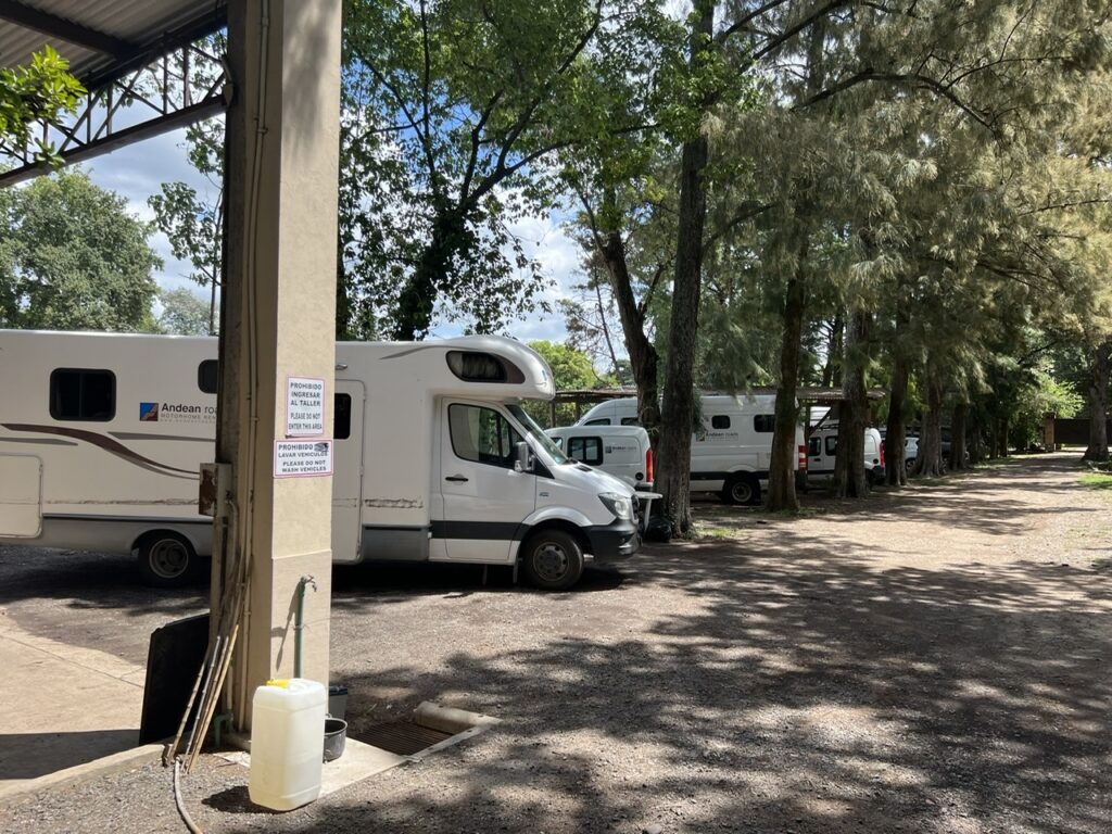
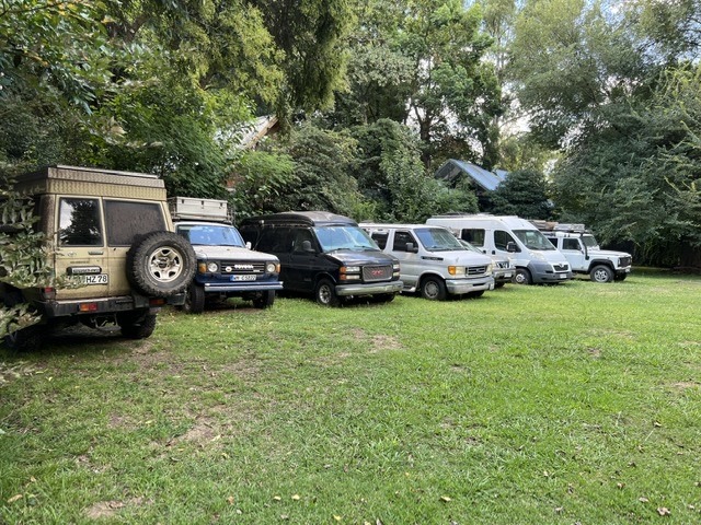
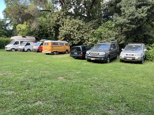
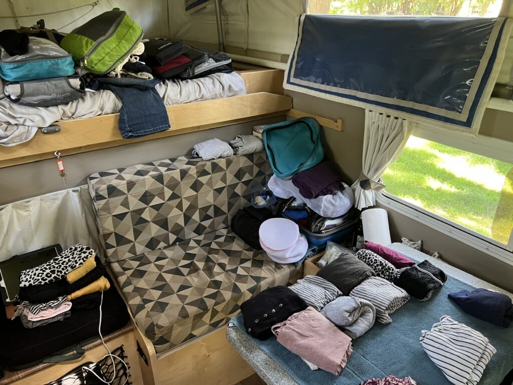
Our last night camping in Buenos Aires. With our food all tossed out, our propane tanks dry, and our vehicles cleaned spotlessly for shipping the next day, our friendly Swiss neighbors put on a memorable risotto dinner for us all.We had carried a small 1lb emergency propane tank for almost 3 years. Came in handy on the last few days after we had purged the main tank. Andean Roads campground in Tigre ( between BA and the port of Zarate ). They are the ”go to” campground in BA and somewhat of an Overlander crossroads. They also rent nice motorhomes for those who want to travel around Argentina but are not staying long enough to justify the cost of shipping their own vehicles in and out.During the pandemic they stored dozens of vehicles for stranded Overlanders.Many of the vehicles are still there, some now not worth the current high cost of shipping back home.Much of our time at Andean Roads involved packing, unpacking and repacking the vehicle, splitting what we would need with us for a month with no vehicle and what could go in the truck on the ship.
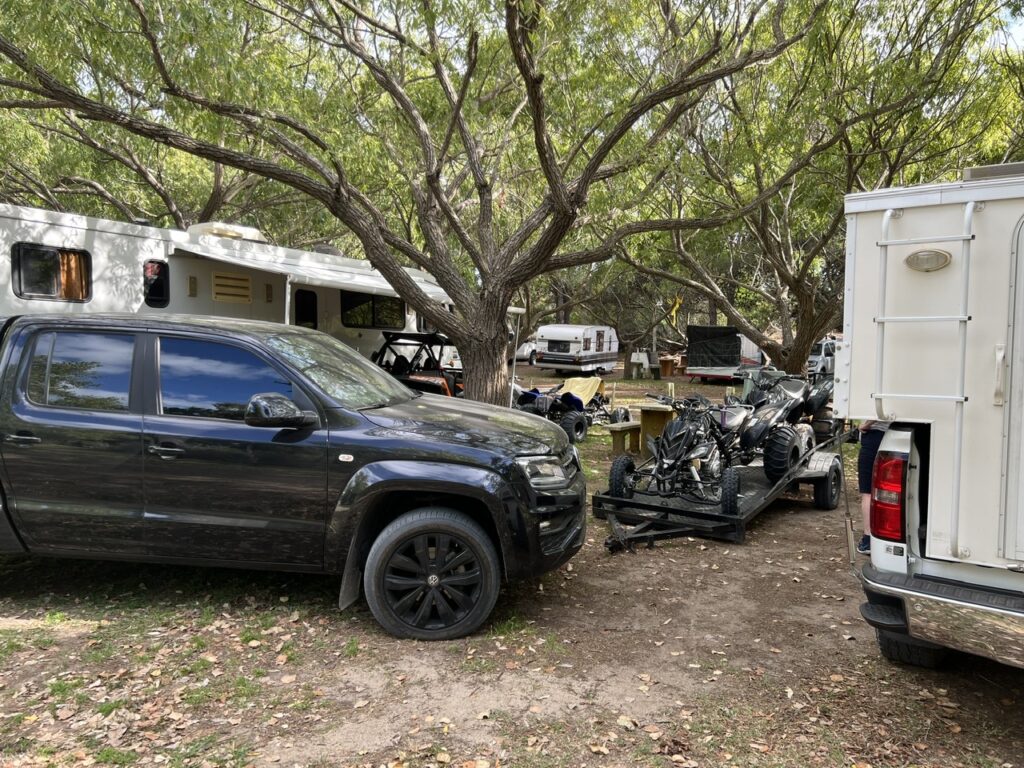
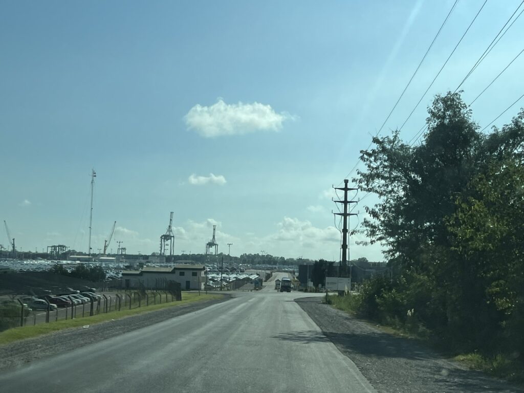
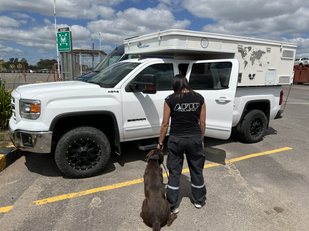
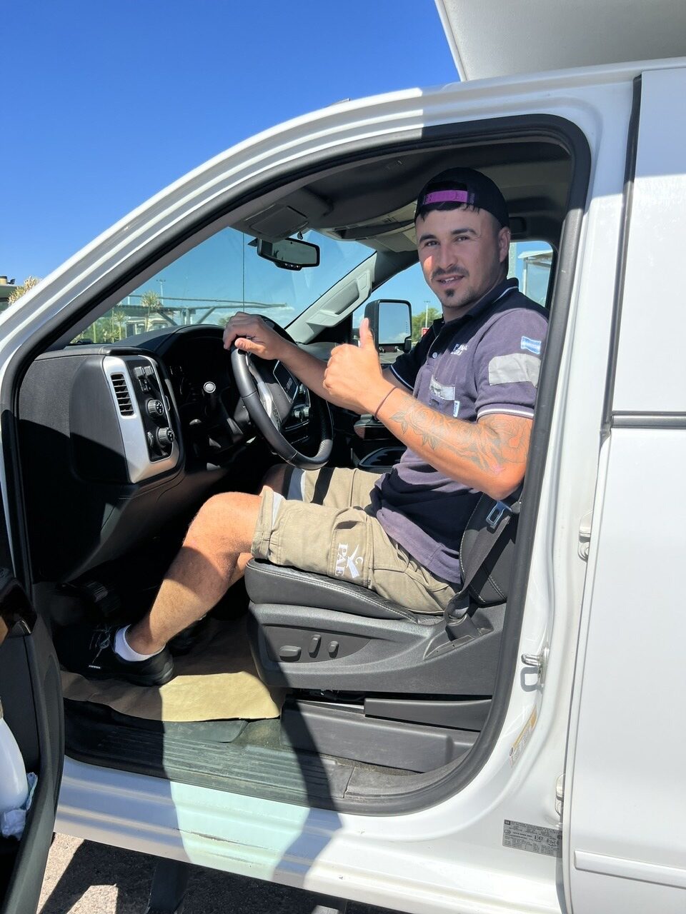
Having spent days unpacking, sorting and re-packing the camper it was finally time to leave Andean Roads and drive to Zarate, the port of Buenos Aires. A good hour’s drive west of BA, the port is massive and is actually on the Parana River, not on the harbor of BA. We’d been warned it would be a long day and indeed it was. Arriving at 10.00 am, we did not leave the port till 4.30. The paperwork, the long waits, the X raying of the vehicles, the customs searches, the dog sniffers….we had it all. Our shipping agent, Francisco, was an invaluable help – could not have navigated the labyrinthine maze of Argentine export procedures without him. It was tedious though all fairly logical- and finally when it was all done we left the port with our customs clearance certificates, and most importantly our amended “TIP” ( temporary import permit ); that’s a document that we will need when we fly out in a few weeks and tells the folks at the airport that the vehicle we brought INTO the country has actually already gone OUT of the country. We were advised not to lose it.
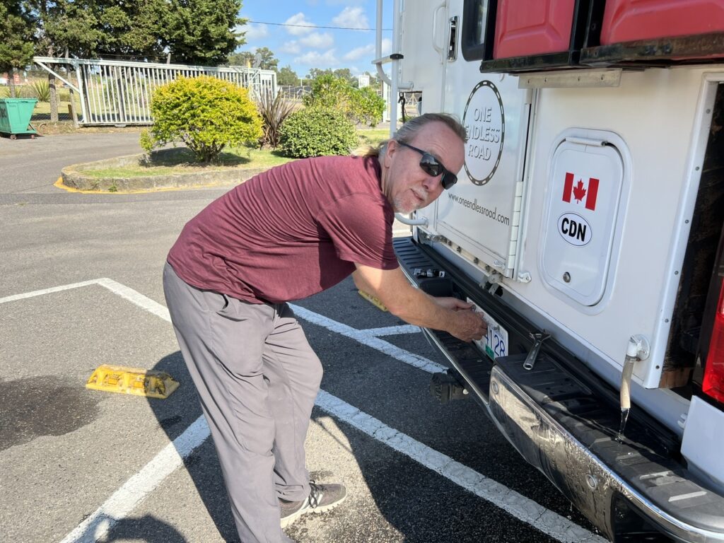
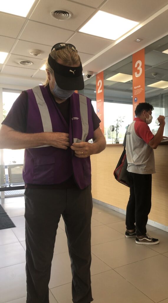
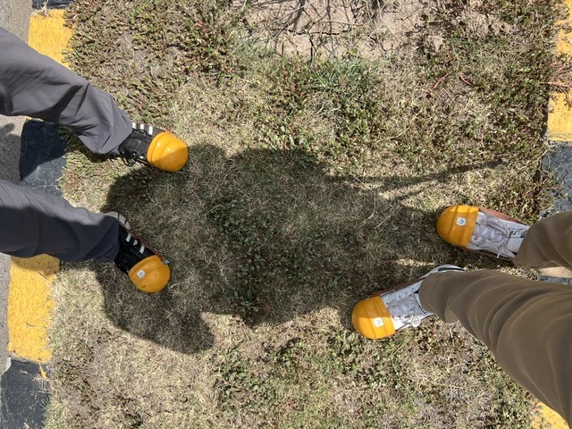
Driving into Zarate port it was hard to gauge how big it was. Once inside we realized it was massive, with thousands of containers, cars and trucks on the way into and out of Argentina. Security was tight, we could only take photos when expressly permitted ( so did not get many ).Parked just inside the port waiting for our agent to meet us.We’d been told to remove the license plates prior to shipping – they tend to disappear en route if left on, being very popular as ”souvenirs”. Not something we had to worry about when using a container. We will carry them with us to the US.Administration office kitted us both up with ”high viz” vests. That, we could live with…..……but the ”Ronald McDonald”- style hard toe caps for our shoes looked ridiculous !After the rigorous customs inspection ( with sniffer dog ), one of the inspectors allowed us a photo but only from behind . No photos of port infrastructure allowed ( inside the port ).And the dog even left us a little souvenir………
A few observations about the shipping process.
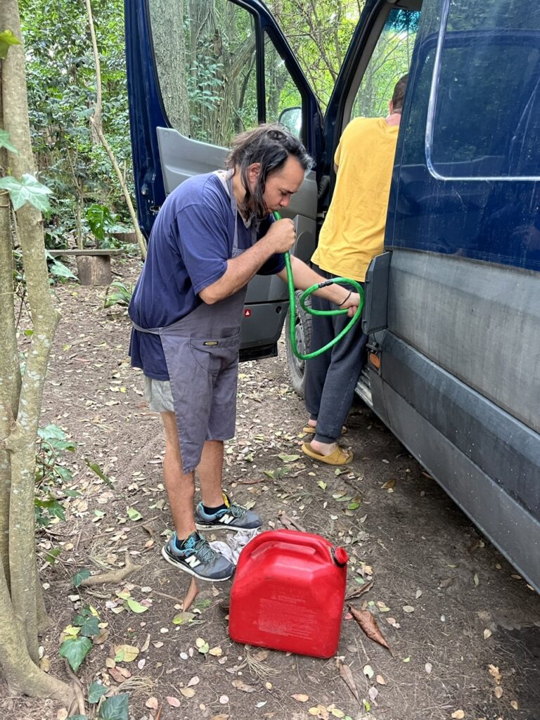
One is supposed to leave with no more than a 1/4 full tank of fuel – both Vincent and I obsessed a bit about this given it’s hard to exactly estimate how much fuel you will use driving to the port. We need not have bothered – no one checked at any point ( so we both lamented not filling up on one last full tank ). We will sorely miss Argentine fuel at less than 50 cents a litre !
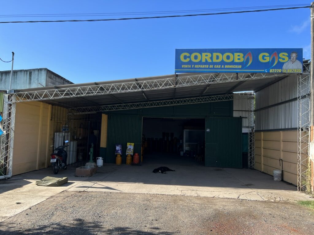
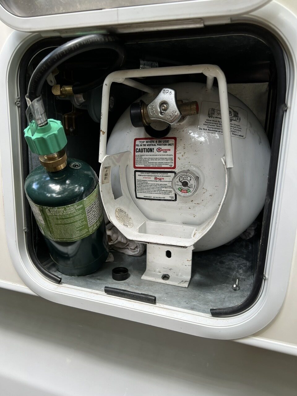
One is also sometimes asked to leave portable / removable propane tanks behind and I was very worried about this. If ours was a normal 9kg ( 20lb ) vertical tank that would not have been an issue – they are cheap and widely available in the US. Ours, however, is a rather less common ( and vastly more expensive ) ‘horizontal’ tank which is now, due to COVID supply chain challenges, virtually irreplaceable. Not something we wanted to give up. I’d gone to extraordinary lengths to empty it prior to shipping and to getting certification of such, both of which proved more problematic than I expected. I had finally found a propane guy that could empty it ( it’s otherwise incredibly slow to just burn it off ) and who was willing to give me a receipt saying he had done it – somewhat short of a professional certification but it would suffice. Our tank also had a gauge ( many don’t ) which now showed it as empty and I had filmed and photographed the gas guy doing his thing lest there was any doubt it was totally empty. Turned out that the shipping rep from Wallenius ( who usually checks for dangerous goods and potentially explosive materials ) never appeared at the port but instead accepted the customs folks’ verification that there was nothing dangerous in the camper ( they had looked, seen the tank was totally empty and were happy with that).
The floor area was left clear. Anyone poking their nose around the truck would see an ostensibly ”empty” vehicle. It stops in 7 ports between Zarate and Brunswick and it is in port stops en route that most thefts can occur. No guarantees but we did all we could to reduce the risk of it.When it was all said and done we handed the key ( to the vehicle only ) to the port staff to move it to a waiting area for the ship ( which had not yet arrived in Zarate ). It would sail 5 days later.
The shipping cost has three components : port charges in Argentina, the shipping ( freight ) cost itself, and then port charges in the US where we pick up the camper. Following the port process on Wednesday we visited the Argentine agent’s offices in downtown BA the next day to pay them. All went smoothly. Once the ship is underway our global shipping agent ( from Germany ) will bill us for the freight component. We pay the US fees when the ship docks in the US before we get the truck back. Curiously, you pay nothing up front – no deposit even. Different than shipping by container. That said, It’s a pretty watertight process for these guys – you don’t pay, you don’t get your cargo !
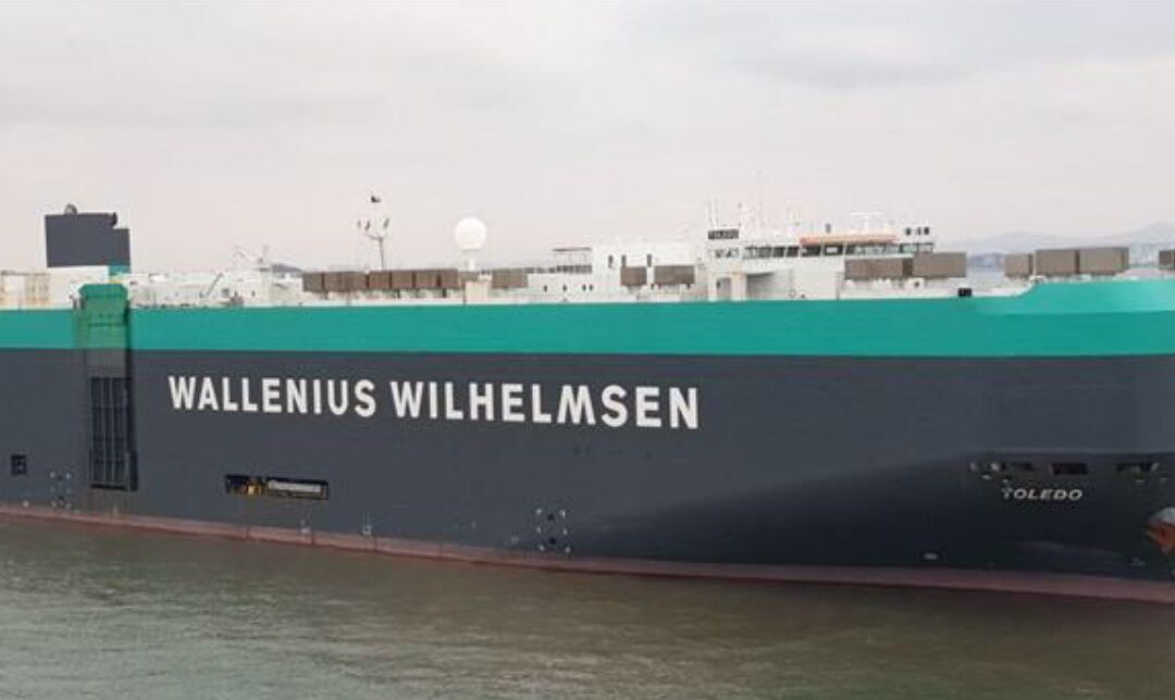
The ”Toledo” , of the Wallenius Wilhelmsen line, a large vehicle carrier, was our ship. Hoping it delivers both our rigs safely to the USA. I say that because only days before we loaded our vehicles just such a vehicle carrier caught fire in the middle of the Atlantic with some very precious cargo ( many exotic European cars ) on board. Rare, but it happens. And yes, we are insured !
So now we have a few weeks to enjoy Buenos Aires ( and hopefully Uruguay ) before we leave for the USA ourselves. Following a little separation anxiety as they drove our truck away at the port, we checked into a nice downtown Buenos Aires hotel. We’ll certainly miss the freedom of having ‘wheels’ but will also appreciate the comforts of a hotel – the simple things like bathrooms WITH toilet paper, toilets WITH toilet seats, and showers that run CONSISTENTLY hot ( none of which can be assumed in a South American campground ! ). Of course we’ll still have to throw used toilet paper in the waste bins provided ( a standard process in EVERY Latin American country) – one of the things here I think we’ll just never get used to !
Had we realized just how long and tedious the drive would be from northwest Argentina all the way to Iguazu Falls in the far northeast corner, I’m not sure we would’ve actually made the effort. Frankly it just seemed to take forever. Perhaps it was the monotony of the scenery – for the most part flat scrub and cattle ranches – and it didn’t really get interesting until the jungle-like to terrain of Misiones province ( it’s that little bit of Argentina in the northeast that is tucked up between Paraguay on the left and Brazil on the right).
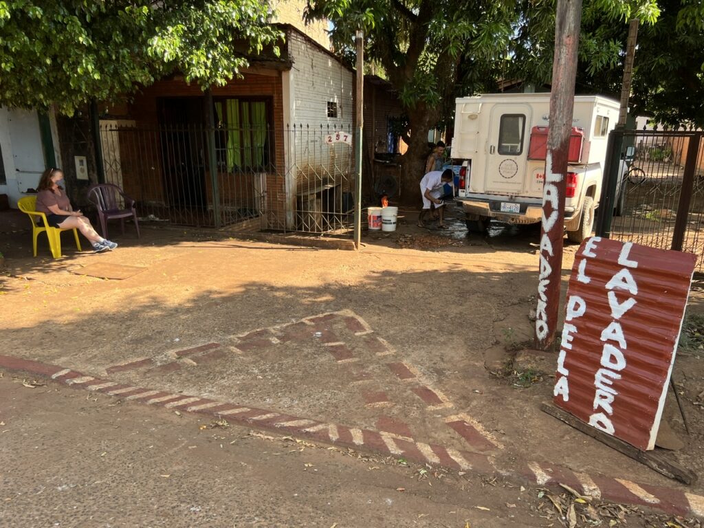
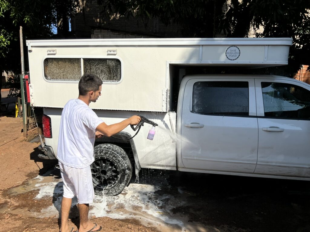
Desperately needed a truck wash. Drove all over Iguazu looking and found these two young guys running a front yard “Lavadero” ( common in Argentina ).They spent over an hour on it – the best clean the truck has ever had !
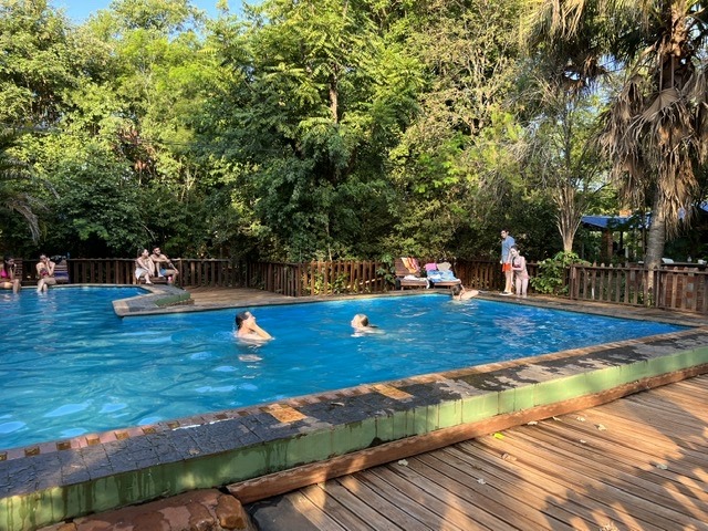
Having made the long haul to get there we were of course glad to have done it, though the humidity there was intense. Our previous visit almost 20 years ago had been in the middle of the southern winter which, I would suggest, is actually a far more ideal time to visit Iguazu falls ! At least the campground had a pool – it got lots of use.
The refreshing pool at Camping MaRi in Iguazu.
Iguazu straddles the border between Brazil and Argentina ( with Paraguay only a stones throw away ) and most visitors take the opportunity to see the falls from both sides. We’d done that on our previous visit when there were no Covid border restrictions but this time such a seemingly simple thing was far more complicated. Crossing into Brazil would have been easy – visitors need only show proof of a double vaccination, however getting back into Argentina required yet another PCR test. We have no fear of a PCR test itself nor do we have any concern about getting Covid since we are both triple vaccinated and any infection would likely generate only mild symptoms. Those aren’t the issues. A positive Covid test around this time, however, would seriously limit our ability to cross borders in the next two weeks and thus seriously interfere with our ability to ship the vehicle back to North America ( planned for later this month – more on that below ). Needless to say we stayed on the Argentine side !
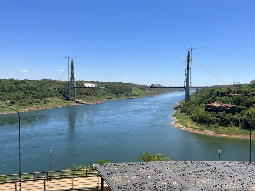
“Tres Fronteras” ( Three Borders ), the point where Argentina, Brazil and Paraguay meet. The falls are about 15 kms down river.We briefly considered viewing the falls from Brazil. Went to the Brazilian border post in Iguazu to ask about re-entry requirements to Argentina. While the news we got was good ( no PCR test needed ) we later found out it was completely wrong ! Lucky we did not cross.
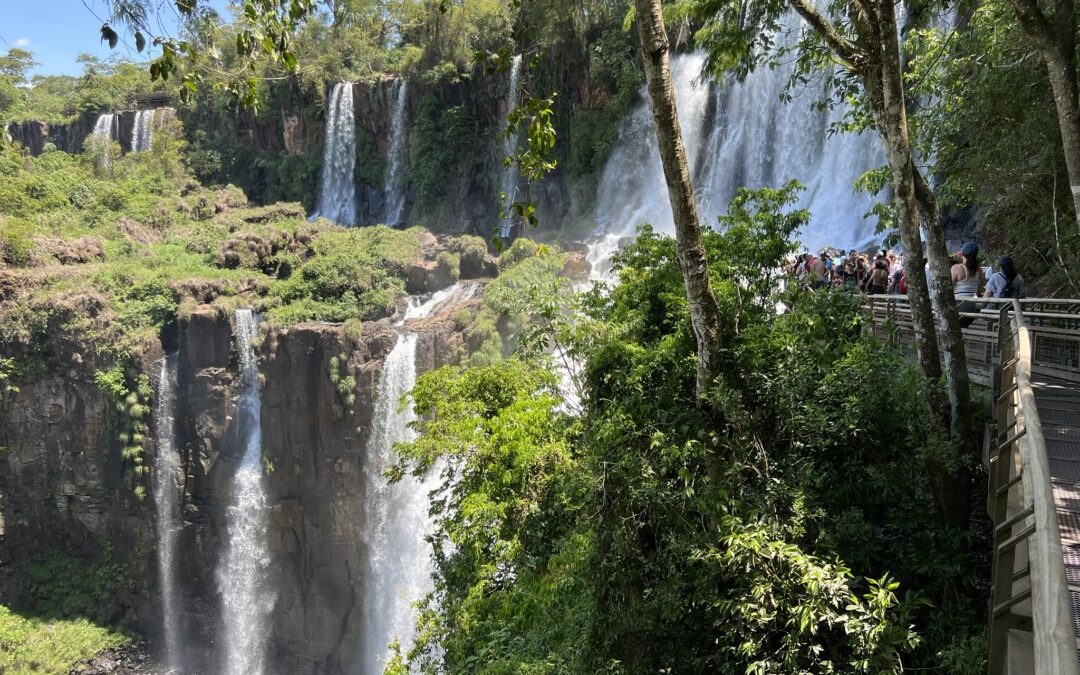
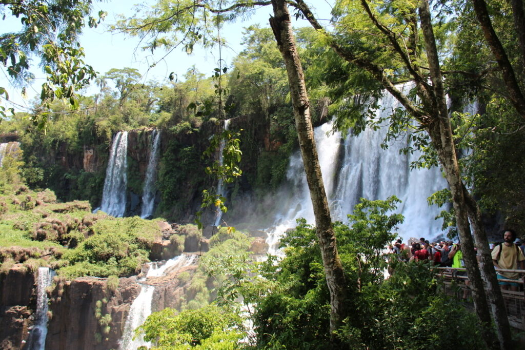
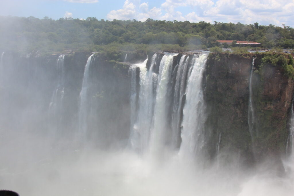
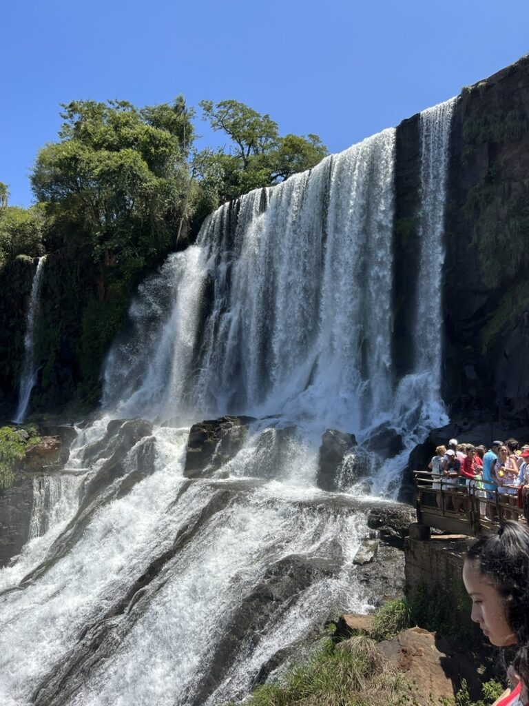
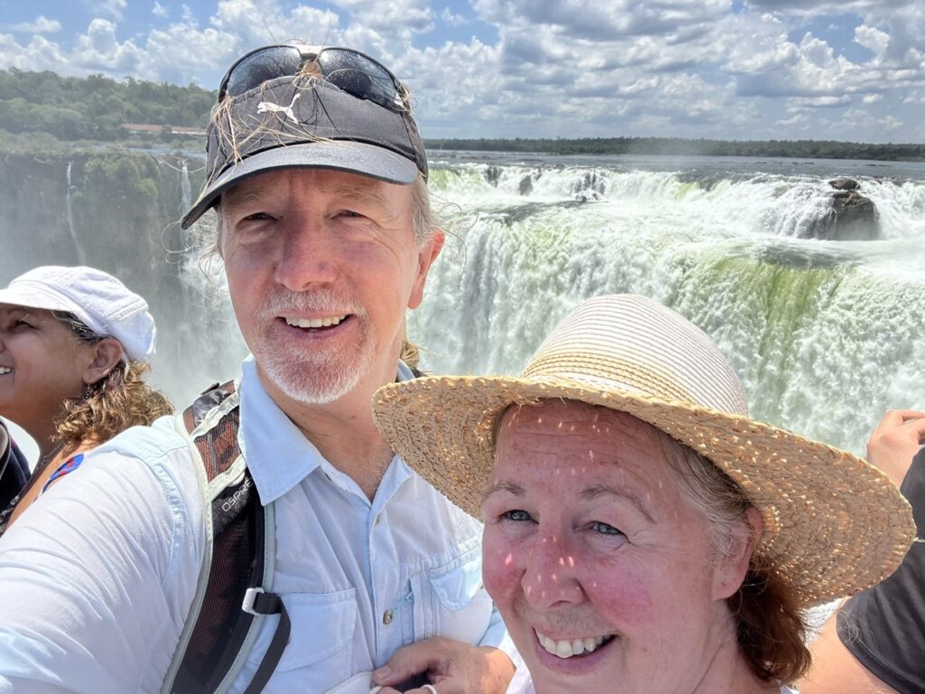
With January and February being absolute peak season in South America, the crowds at Iguazu falls were unbelievable. It was actually difficult sometimes to take photographs because there were just so many people around and in a situation like that the social distancing that we have been practicing fairly rigorously was also rather difficult to maintain. Add to that the fact that while some Argentines wear masks religiously there’s a fairly significant percentage of the population that does not – not the kind of situation you want to be in in a very crowded spot. Regardless, Iguazu Falls has lost none of its majesty and, crowds or not, is an incredible sight ( and one of the Seven Wonders of The World ). They are truly amazing no matter which side you see them from and the setting, with the jungle backdrop, only adds to the allure.
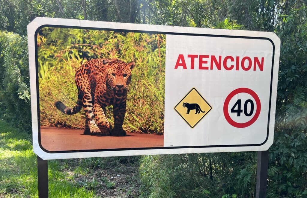
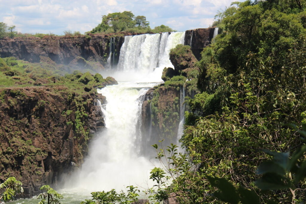
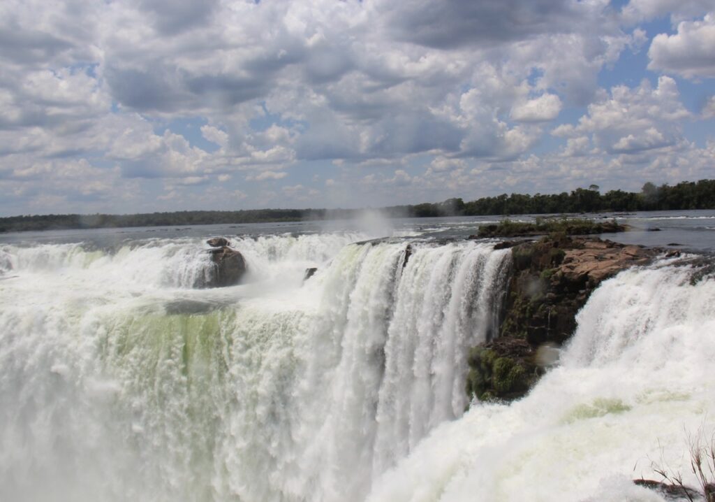
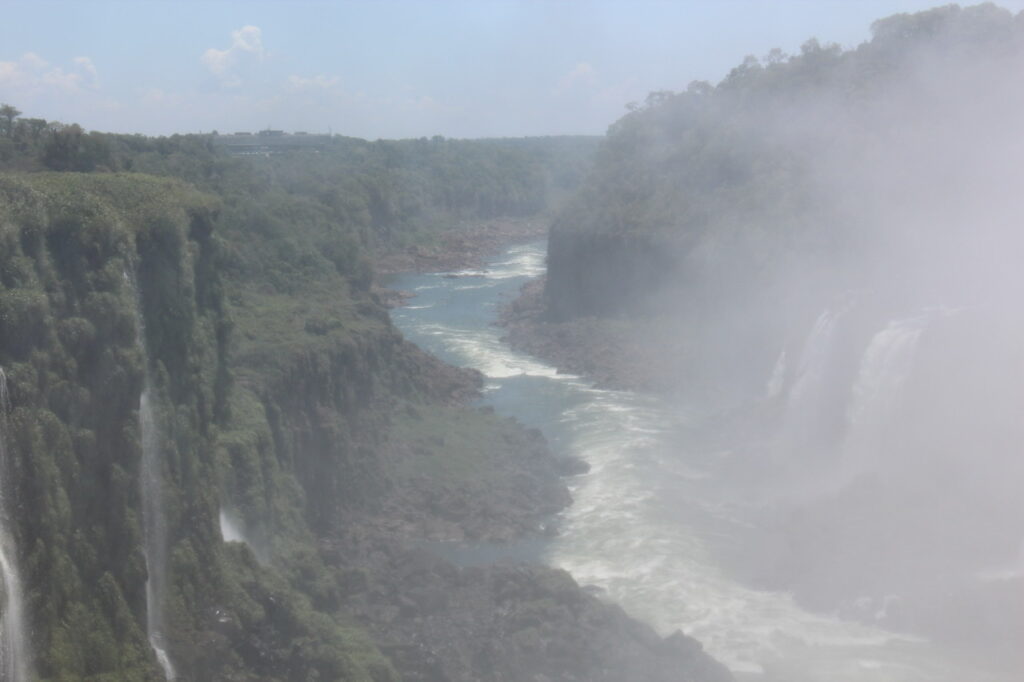
Sign at the entry to Iguazu National Park. We thought this was overkill until we later read that a park ranger’s son had been mauled to death by a jaguar back in the early 2000’s !Iguazu FallsIguazu FallsClose up of Garganta Diablo ( Devil’s Throat ), Iguazu Falls. While it does not show the height of the Falls, we caught it in a moment with little mist so the image was at least reasonably clear.
Despite the heat it was a pleasant few days in Iguazu and we spent much of the time with a young Argentine fellow who spoke impeccable English and who was about to set off for two years to my home country of Australia. He had many questions for us, and that gave us an opportunity to ask many of him in return – we whiled away the evenings talking about our respective countries, our different cultures, and various assorted problems of the world. Not sure we solved any, but we enjoyed the robust discussions !
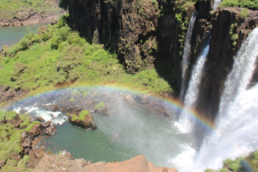
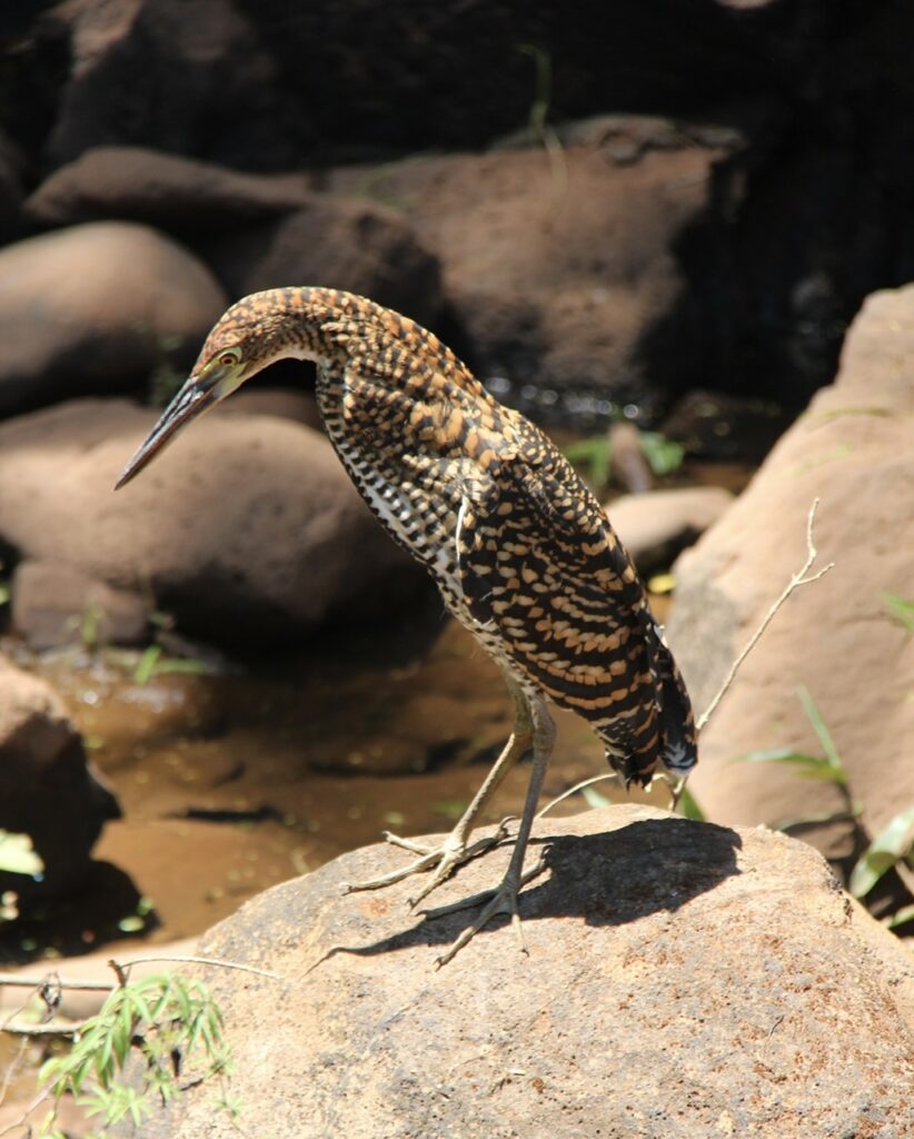
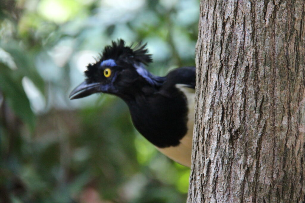
Sadly, this image and the next were somewhat blurred due to spray from the Falls.Ditto for aboveManaged to catch a rainbow in this part of the Falls.One of the great things about Iguazu is how close you can get – from above and from below.Selfie time ! Everyone, including us, was drenched from the spray and it made picture taking difficult.The park had some neat wildlife as well – the area is known for colorful birds…….…..and weird-looking birds !
.From Iguazu we headed to Mar Del Plata, Argentina’s famous seaside city a few hours south of Buenos Aires with plans to relax for a few days at “Mardel” ( as the locals call it ) before winding our way up the coast to Buenos Aires. The weather looked good and as we had not been near the sea in a long time we appreciated the breezy coastal climate ( and no humidity ! ). The change of scenery was a welcome relief.
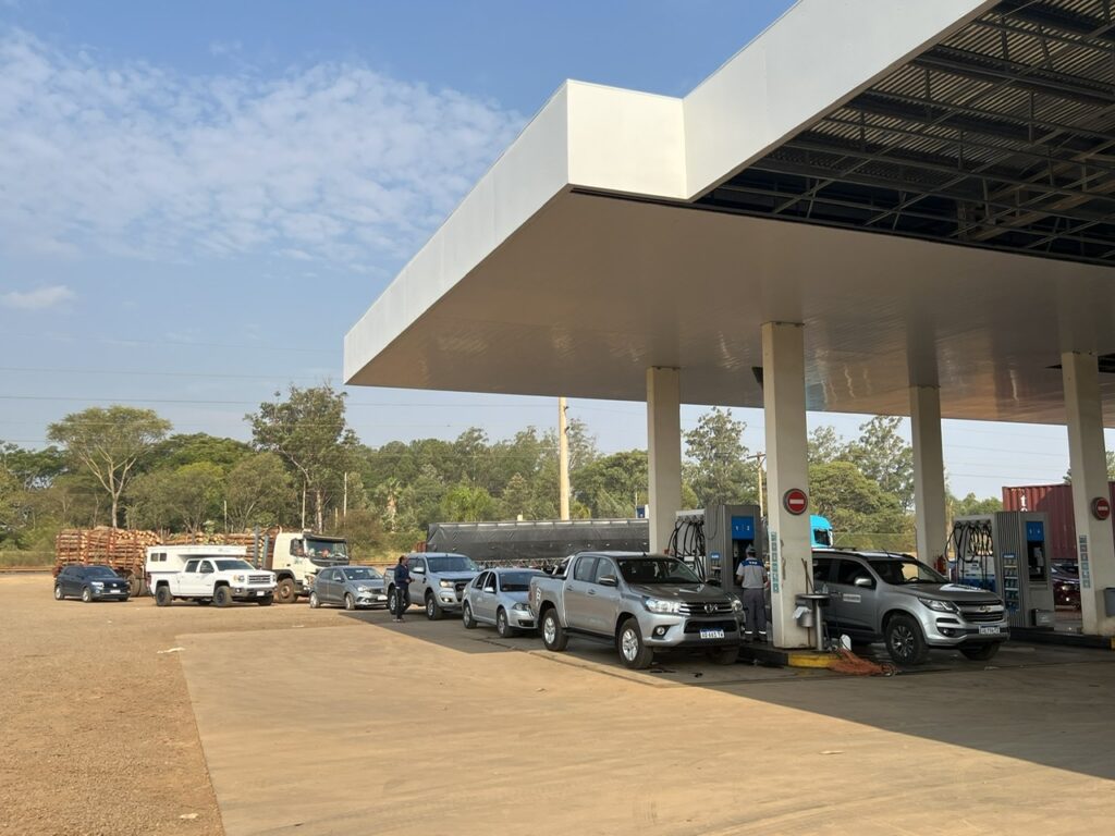
Note to self – don’t get stuck needing fuel in a border area when you are in the country with the cheap fuel. Brazilians and Paraguayans flock to Argentine border towns to get fuel for less than half the cost they pay at home. Makes for long line-ups ! And we saw many line ups MUCH longer than this one.
The roads were good, mostly 4 lanes, but it was still a long haul from Iguazu to Mar Del Plata. It took us 3 days.
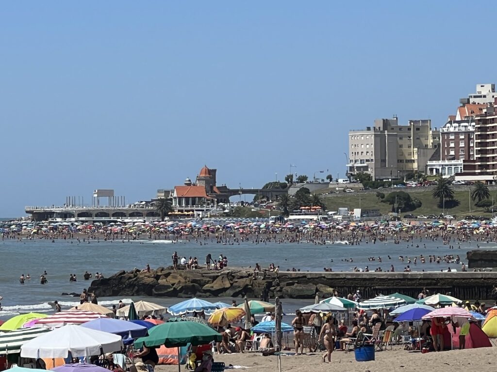
Mardel itself was really nice. We enjoyed the city, it’s sights, cool sea breezes and the whole gastronomic experience, but found the beach ( for which it’s rather famous ) a tad underwhelming. It did not help that it was absolutely packed with people ( summer holidays- I suppose we should not have been surprised ! ) but the number of vendors was incredible, the sand was not the golden stuff that I had expected and the water was rather murky. Perhaps it will be better at the smaller seaside communities we plan to visit as as we head north to Buenos Aires. I can think of many better places than Mardel for a beach holiday !
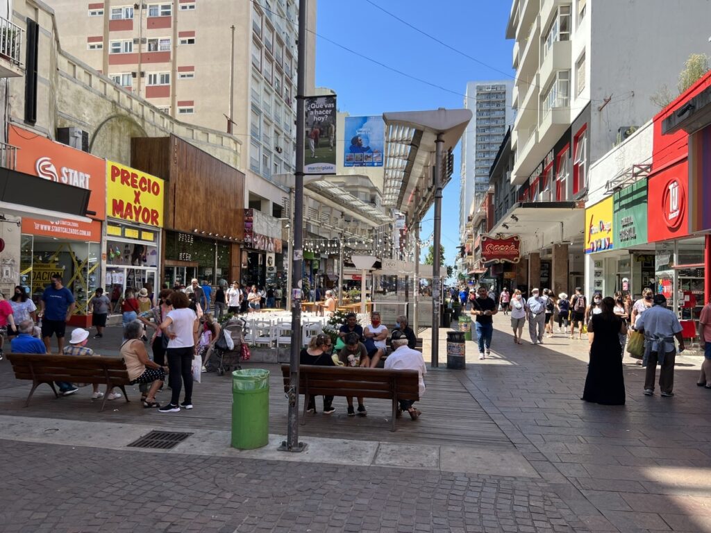
Downrown Mar Del Plata, pedestrian street.
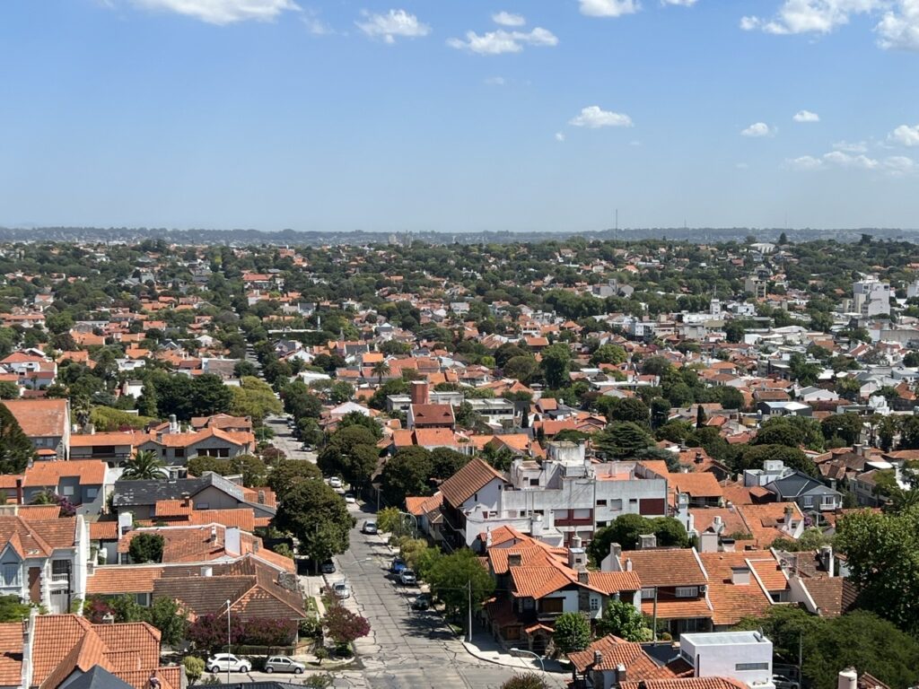
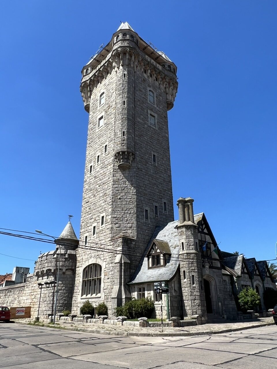
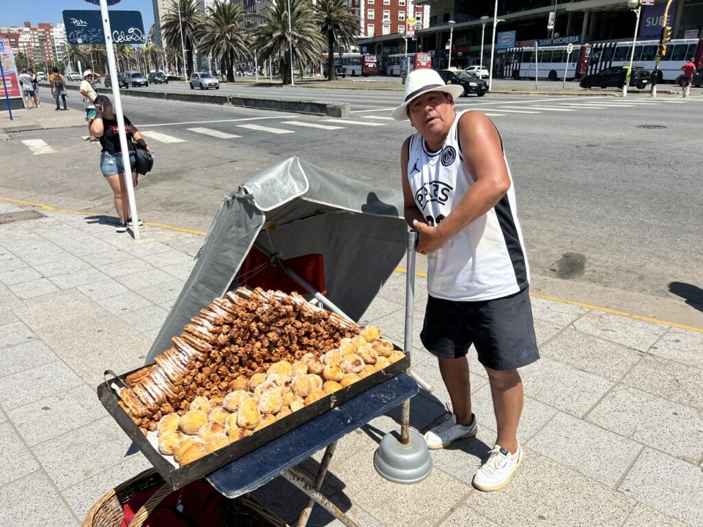
View of Mar Del Plata from Tanque Torre. It looked a bit like Sydney, Australia with so many red tiled roofs.Tanque Torre ( Tank Tower ), a Mar Del Plata landmark. It’s actually a water tank – but very elegantly disguised !The massively crowded beach at Mar Del Plata. It was a bit disappointing.A ”churro” vendor setting at up at the beach. Churros are hugely popular snacks in Latin America.The architecture in Mar Del Plata was varied. Highrises everywhere but some funky smaller homes dotted among them as well.
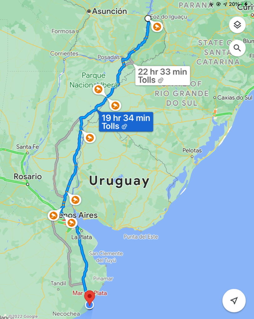
Upon returning to South America in November last year, our goal was to complete the Carretera Austral in Chile, get to the bottom of the continent, then work our way back up through Argentina to Iguazu, before wrapping up our trip in Buenos Aires or Montevideo, Uruguay. Fortunately that ( so far ) has gone as expected and pretty much in the 4-5 month time frame we thought it would require. We planned to then ship the vehicle back to the USA and drive it home to Canada by April/May at latest. While in Iguazu, and after many weeks of searching, we finally got passage confirmed for our truck/camper back to the USA. We can’t overstate what a huge relief that was ! Unlike when we shipped across the Darien Gap in Panama ( where we shared a 40 foot container ), this time the vehicle will go “RoRo” ( Roll on Roll off ) – essentially put on a giant vehicle carrier. In the last couple of months as we started exploring container shipping options, we got some nasty surprises. The whole process has been a bit stressful actually. Containers are in very short supply and Covid has played havoc with the global shipping industry – costs have tripled and in some cases even quadrupled. We had one quote to ship the vehicle back to North America in a container that ran to almost US$12,000. That’s over three times what was once normal and what we had expected ! With so few overlanders travelling down here at the current time there was also no hope of sharing one ( as we had before ) so we had started looking at the other alternatives. RoRo is a bit cheaper, but considered less secure. RoRo prices are higher than they were, but not nearly as bad as containers. In any case, unless there’s a curveball that we don’t expect, we’ll be loading the truck on the ship in the middle of next week for the 30 day sailing to the US East Coast. We will pick it up early April and then plan to drive it home it to Canada.
What will we do for 30 days with no ”home” ? While the ship is en route, we hope to split most of the “shipping time” between Buenos Aires ( in a hotel or an AirBnB ) and travelling around Uruguay ( likely in a rental car – it will be so weird with no truck camper ! ). We’ll also be trying to avoid getting covid at what would be a most inopportune time. Our plan would then be to fly to the US a week or so before the ships arrives to meet up with the truck.
So, while we wont be in the truck camper much longer, you’ll still be hearing from us for a little while yet. We hope to provide a full account of the RoRo loading experience in next week’s blog…..stay tuned !
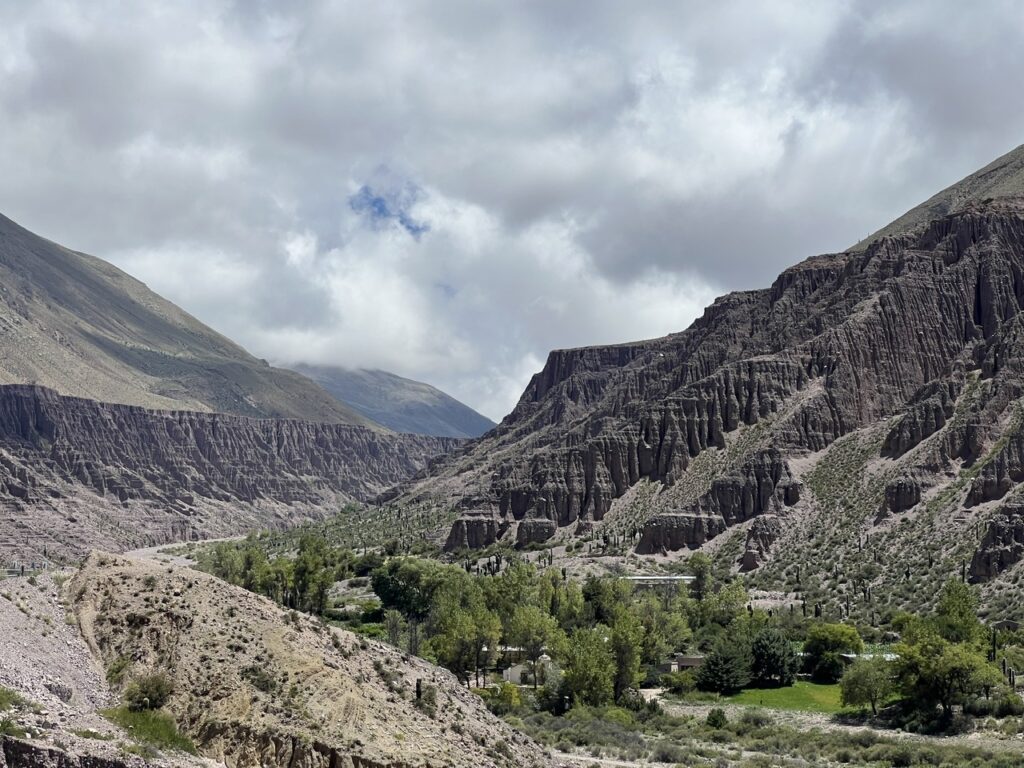
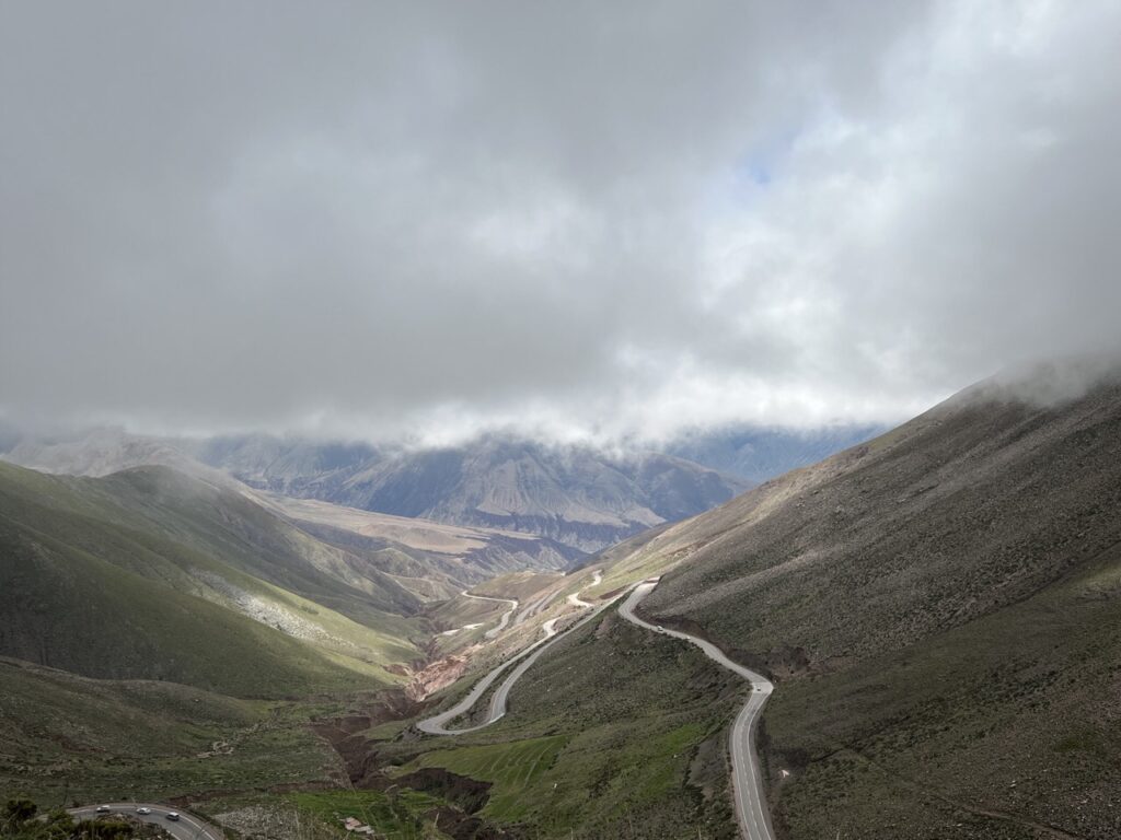
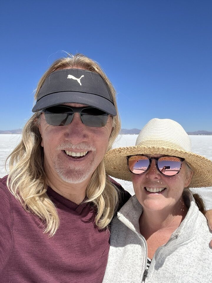
From “Utopia” our route north took us back through Salta, via Route 9 to Jujuy, and on to the primarily indigenous villages of Purmamarca, Tilcara and Humahuaca. At this point, getting close to Bolivia, things began to have a strongly “Andean” feel….a completely different vibe than further south. When staying in Purmamarca, a popular detour west ( towards Chile ) is to visit the salt flats at Salinas Grande – as they were close, albeit at a considerably higher altitude, we decided to take a look. Worth it ? Probably not, and certainly not if you have seen the world’s biggest in nearby Bolivia. The Salinas Grande salt flats in Argentina simply pale by comparison. Frankly, the drive, crossing peaks at well over 4,000 metres ( 13,500 feet ) was more interesting than the salt flats.
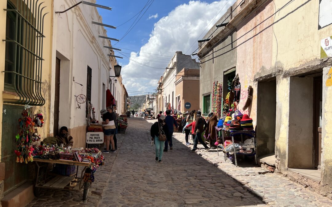
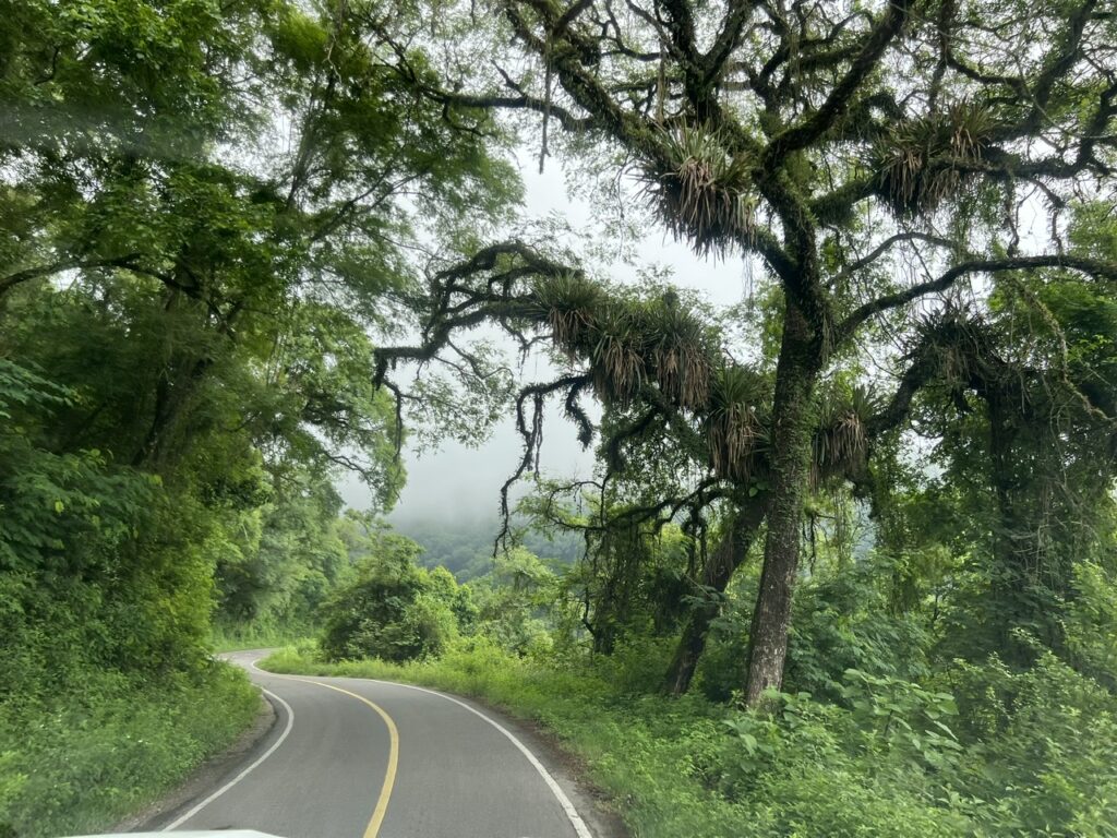
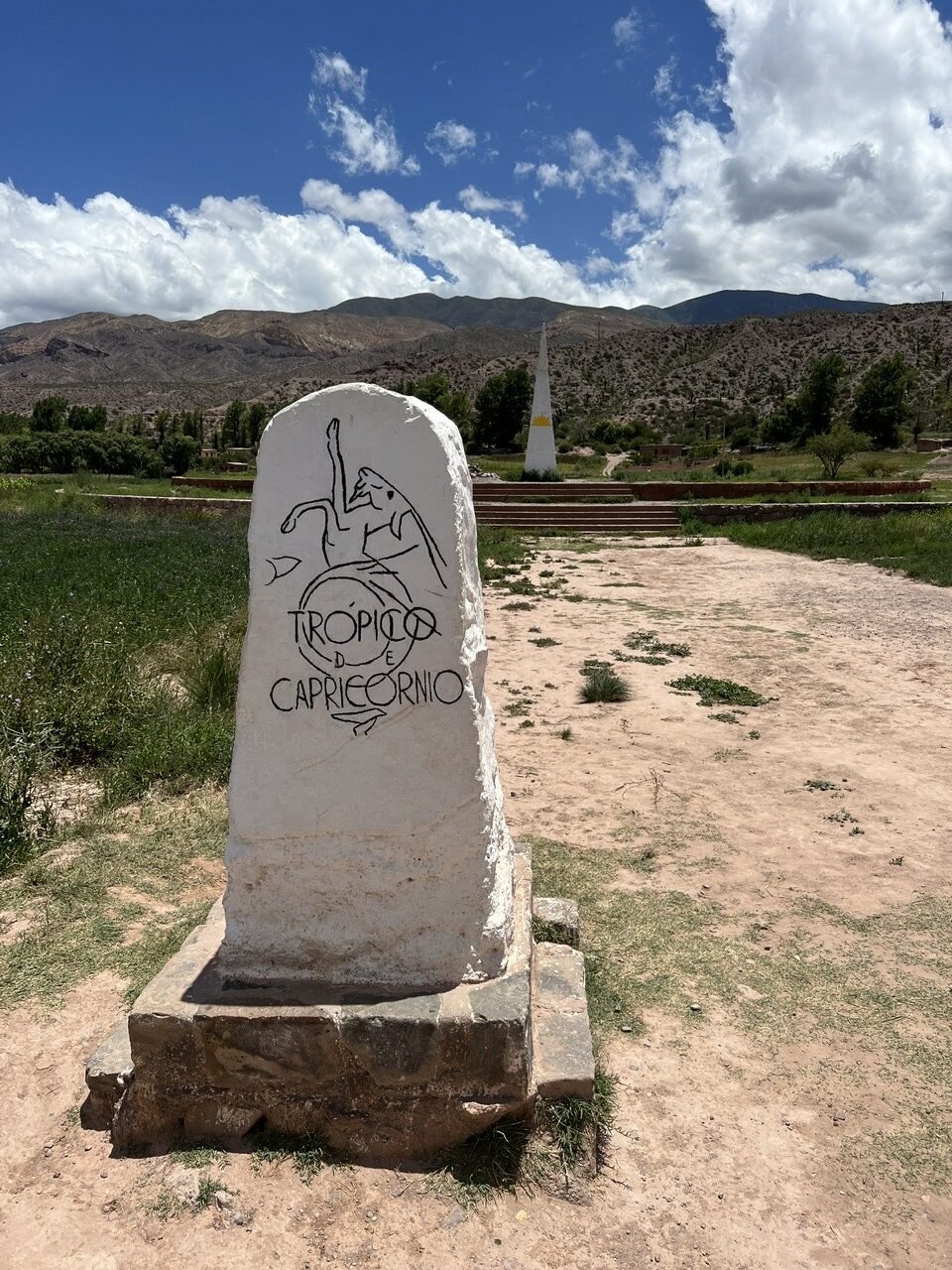
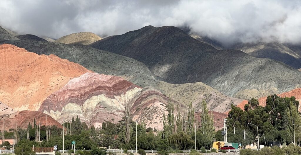
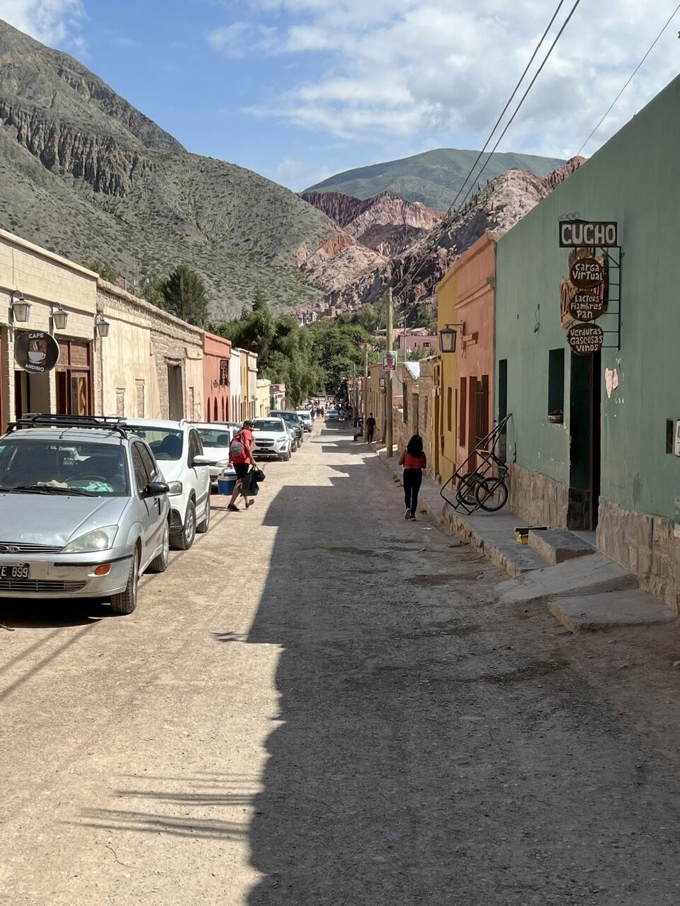
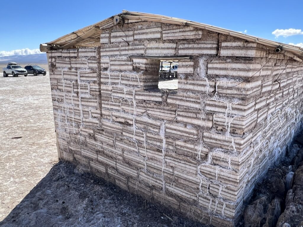
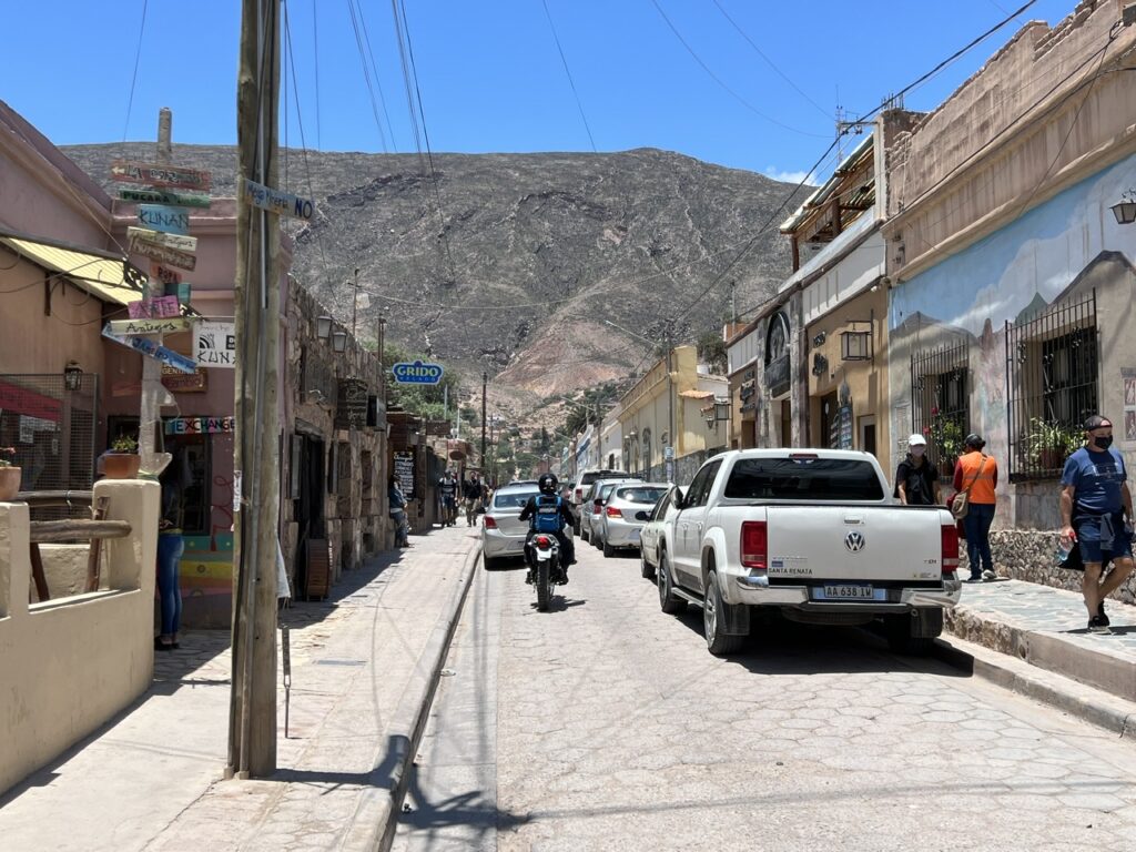
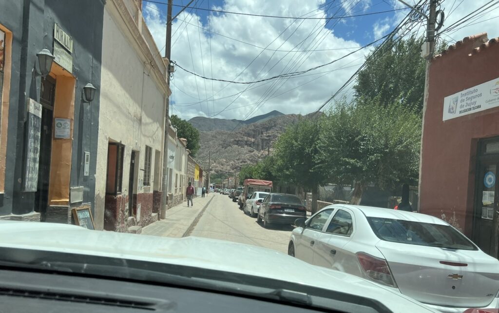
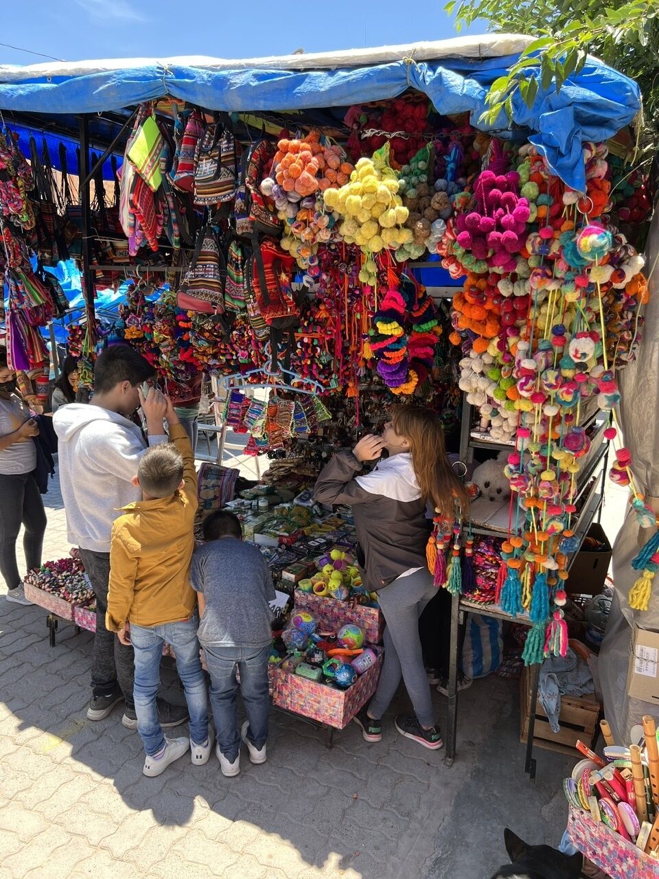
Route 9 to Jujuy was scenic, but windy and narrow. I can confirm it was an “adventure” passing oncoming traffic on this road.How narrow are the roads sometimes ? This narrow ! Route 9 on the way to Jujuy.Crossed the Tropic of Capricorn heading north. Not much of a marker, it was easy to miss.Colored mountains of Purmamarca.Back street, Purmamarca Typical scenery near Purmamarca – once in a while, an oasis appears in the desert-like landscape.The windy, high mountain pass en route to Salinas Grande.Selfie, Salinas Grande Salinas Grande – nice, but nowhere near as good as the Salar de Uyuni in Bolivia.Buildings made of salt, Salinas GrandeA narrow street in Tilcara – we had been warned about them, but decided to soldier on anyway…..I had gotten a bit ahead of myself…..no way could our truck fit down this street so we ended up putting the driver side wheels up un the sidewalk ( much to the amusement of the locals ).Tilcara was very pretty…..but in places a bit ”tacky touristy”Tilcara had some renowned restaurants – we found this funky bicycle themed ”Resto Bar” which served great food.An Argentine favourite – empanadas.Street scene, HumahuacaRelaxing, taking in the view at the campground in Humahuaca.
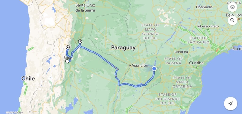
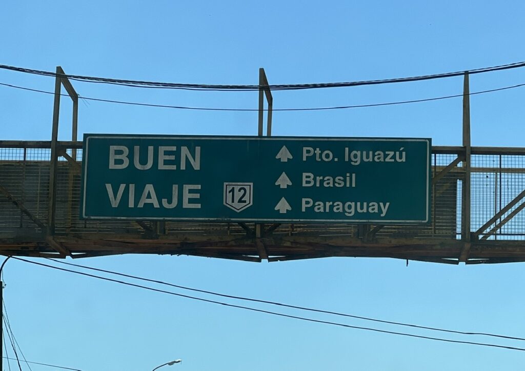
At this point in our journey there were some critical route decisions to make, given our final “big” destination in Argentina was Iguazu Falls ( it’s in the north east, and we were in the far north west ). One route route was to zip across the south east corner of Bolivia, cut into Paraguay and drive drive more or less straight, across the Paraguayan Chaco, on to Asunción and then Iguazu. Option two ( much longer – and we were NOT looking for more long drives ! ) was to reverse south slightly, drive across Route 81 in Argentina and do the big loop around Paraguay before driving up Route 12 along the skinny neck of Argentine territory that allows you to get to Iguazu without crossing borders. Given the COVID situation and the risk of getting it at any time, crossing borders is a fraught process with implications for getting back into Argentina. That said, we still had time to deal with that should it materialize.
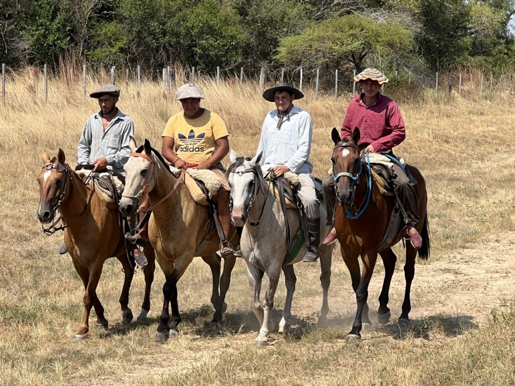
Some gaucho-like horsemen. it was quite common to see them in the north.
Decision made – we’d head to the Bolivian border ( at Tartagal ), see how easy it was to cross and try that route first. Sadly, it turned out, the Bolivians ( usually fairly lax with rules ) required a PCR test ( neither Paraguay nor Brazil do ) and results would take at least two days. Not only was any time and driving distance saving now lost, but so too was any hope that we could use the 72 hour PCR test window to cross Bolivia and Paraguay before briefly taking a look at Iguazu Falls from the Brazilian side and then returning to Argentina. In normal times, almost all visitors to Iguazu view the falls from both the Brazilian and Argentine sides ( as we had done in 2003 ). Bummer ! We’d now driven further, wasted more time, and STILL faced a circuitous route around Paraguay to get to Iguazu. Well, we had the time, so just decided to get on with it !
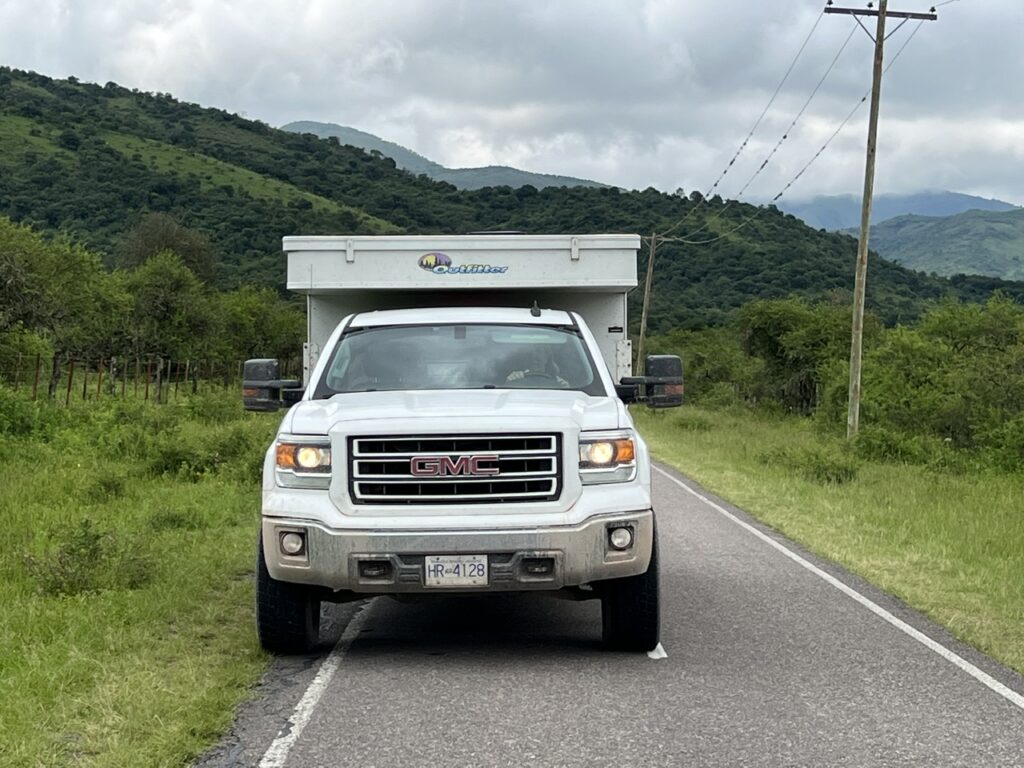
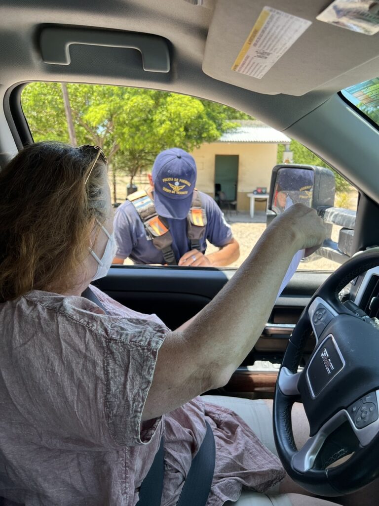
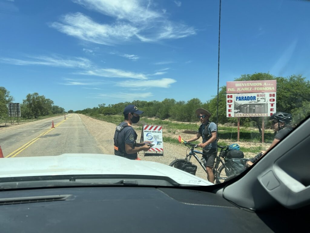
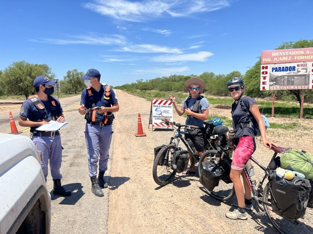
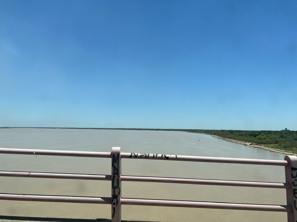
The route we took this past week. Some backtracking required and the circuitous route we ended up taking to Iguazu.Lois always navigates and drives ”relief” only. We pass police checks multiple times a day without incident but on this occasion they wanted to see all our papers. Here the cop is trying to read our documents, struggling with English…..Then some French cyclists pass by. He stops them too – and then asks if they could help translate our documents.All done, all is well…….until he then tries to return all our papers – to the French cyclists !!!!With no campgrounds available, we parked up ( once again ) at a remote YPF has station on Route 81. Unusually there were no dogs to come and watch over us this particular night. Then we noticed someone else was keeping an eye on us……Crossing the massive Parana river near Corrientes.
What was notable as we drove across the north of Argentina and then up the eastern corridor towards Iguazu was a distinctly changing landscape – and very different than the rest of Argentina. The northwest landscape resembled the very dry, “Andean” appearance of Bolivia, the flat Chaco area in between was different again being much greener, and the north east ( unsurprisingly due to its proximity ) seemed very much like the Brazil that we recalled from our visit there almost 20 years earlier. We were reminded again that Argentina really is an enormous, and very diverse country.
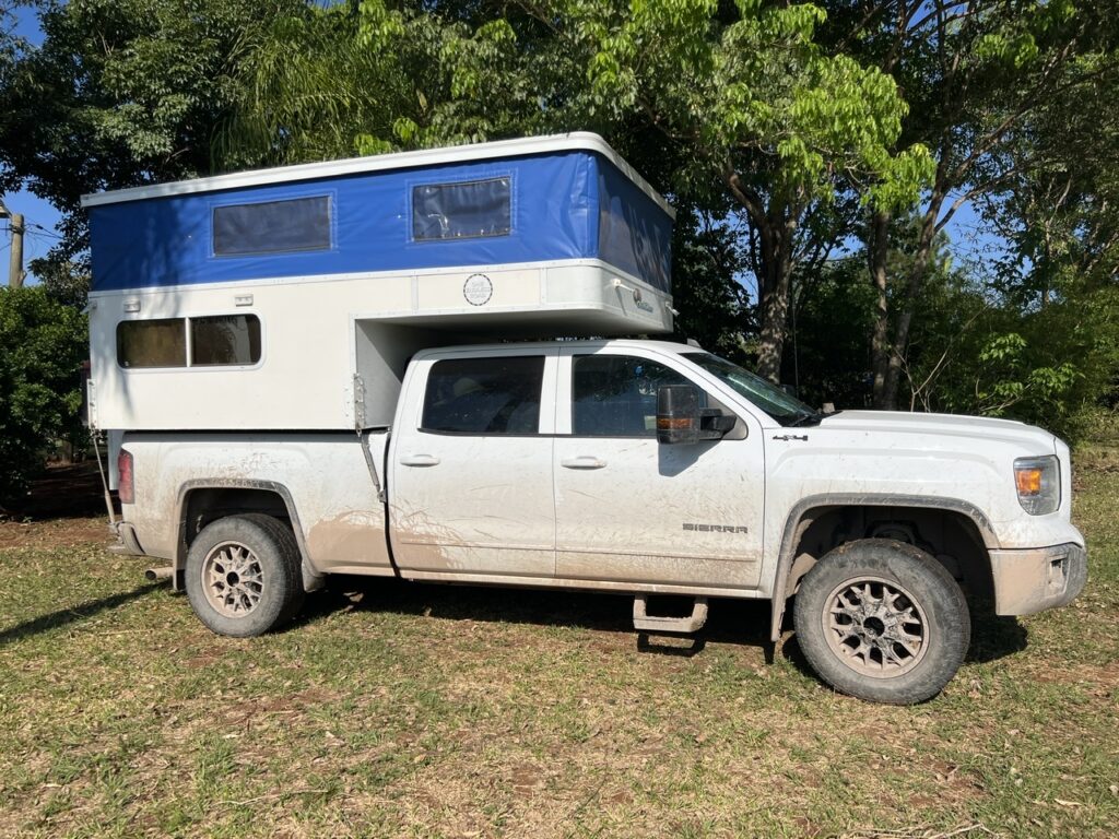
Truck, parked at campground in Posadas, definitely in need of a wash ! We used 4×4 more in the past 2 weeks than we had in a long whileIt seemed like it took an eternity to get there but by the end of the week we had made it to Iguazu Falls
Throughout the past week some serious kilometres were covered but as I wrapped up this blog we had finally made it to Iguazu. Iguazu would represent the northern extremity of our Argentine travels and we’d soon be turning south again and thinking about our possible route to Buenos Aires from where we had always intended to complete our South American odyssey before shipping the vehicle home. We’ll be pondering the Brazilian and Uruguay route options ( both are en route ) although the risk of getting Covid at precisely the wrong time could really screw up our ability to cross borders ( and thus our return to Argentina ) just when we need to and also delay us getting on a plane home. Not a pleasant prospect.
Like the rest of the world we’ll be thrilled when this Covid complication is a thing of the past !
The PanAm completed in April, 2022 and with the truck camper sold, we shipped our new Sprinter van to Australia in late 2022. We travelled there through all of 2023 and into 2024 before shipping it up to North East Asia where we travelled for 4 months between Korea and Japan, before shipping it back to North America. It’s our plan to continue exploring the world in 2025.