Funny how we’d no sooner done a one-off blogpost on van living and a Sprinter van review ( just last week ) than we met up with fellow travellers who are themselves about to trade their camper trailer in for a new Sprinter – needless to say all that information proved quite timely ! More on that later.
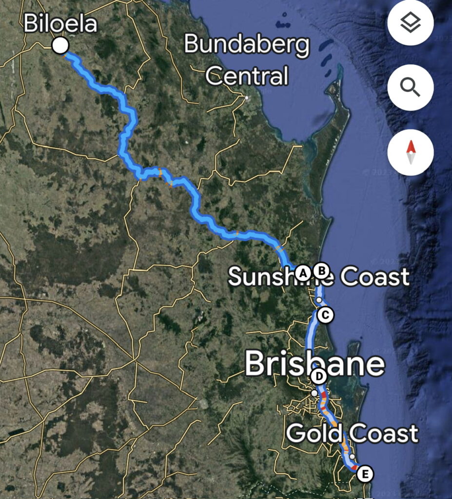
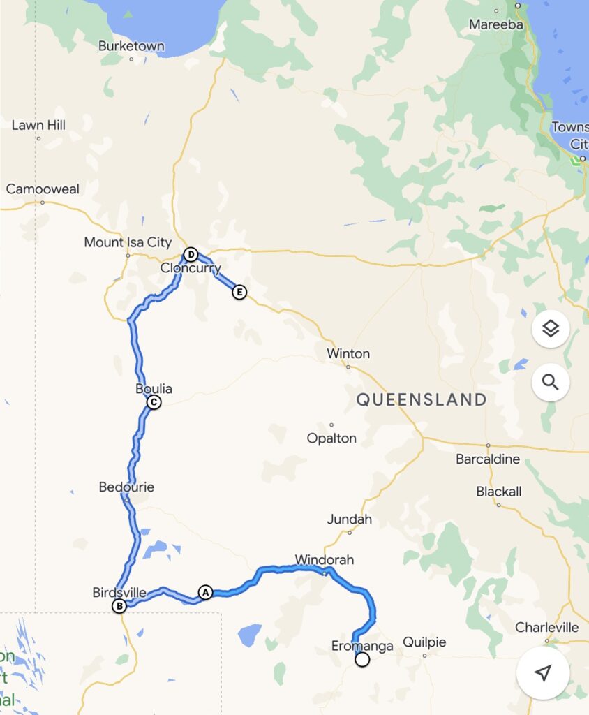
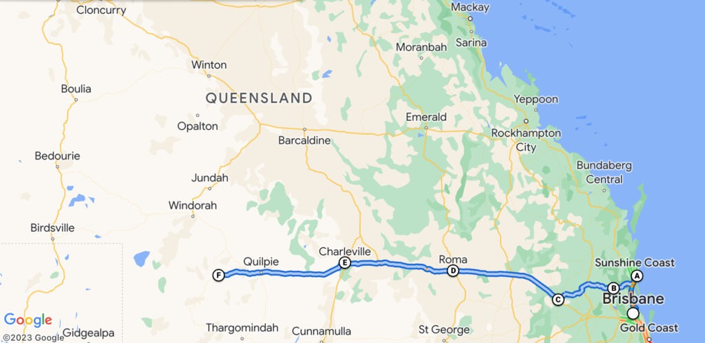
Our route during this blogpost.
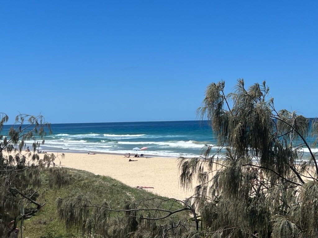
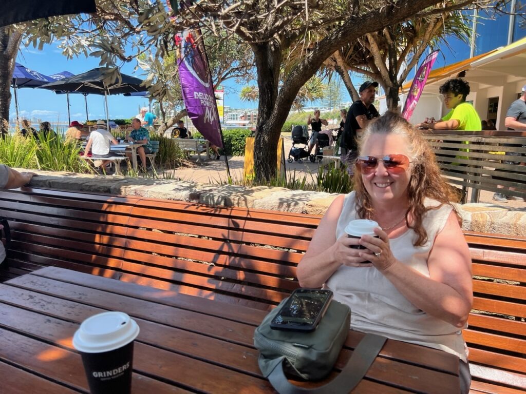
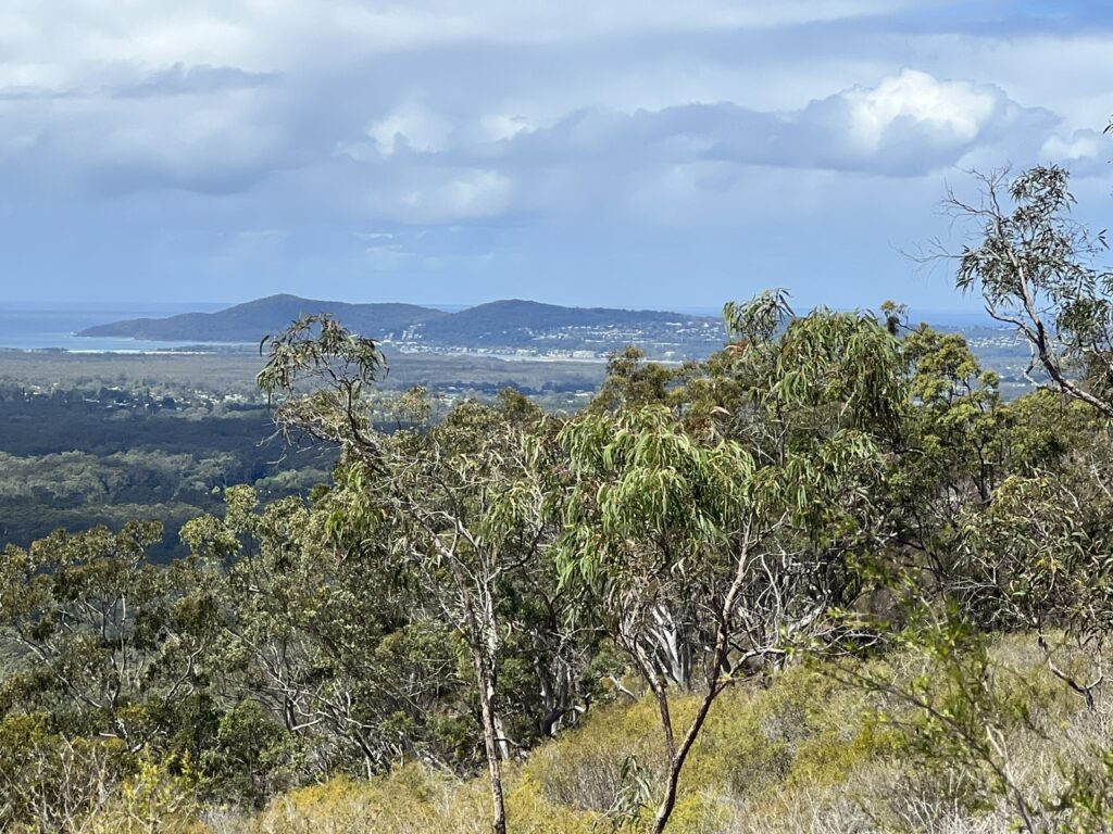
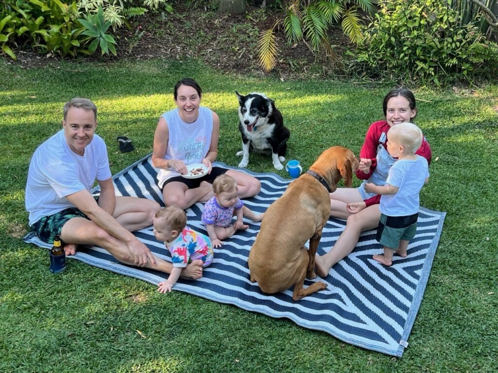
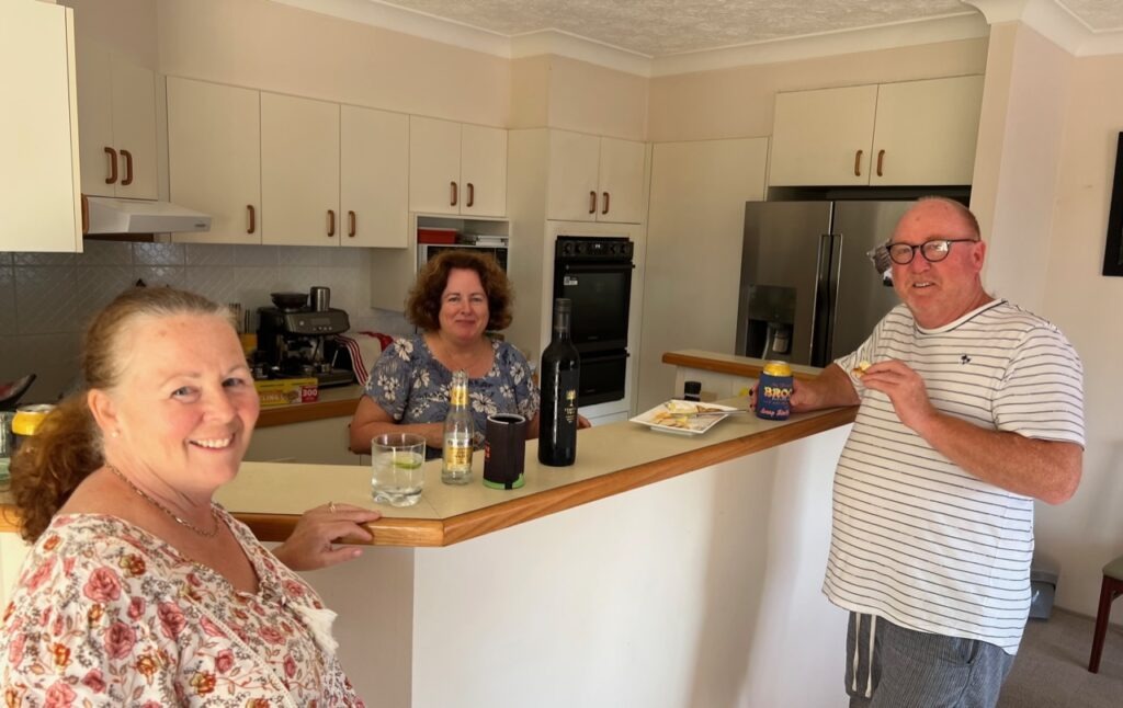
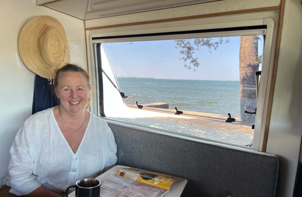
Alas, back to where we left off on our last travel blog – leaving Biloela we’d come in to the coastal part of South East Queensland after some less than exhilarating drive time further west and were very happy to see the scenery change up and feel those beautiful coastal breezes again, the days further west having started to become uncomfortably hot. Great to be back in the Sunshine Coast area and after a few days in the north end ( Noosa and Cooroy ) swung down to Dicky Beach to spend the rest of the week with my brother, Tim, and his family. Bit of a bonus there since two of his three kids (and their own small children) were visiting so got to enjoy spending time with them all. The beauty of visiting with your own accommodation is you can be there but also be out of the way ! Just to be more or less stationary again for a bit was certainly nice after the long distances we’d driven in the past month.
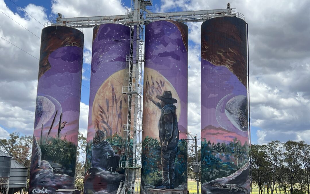
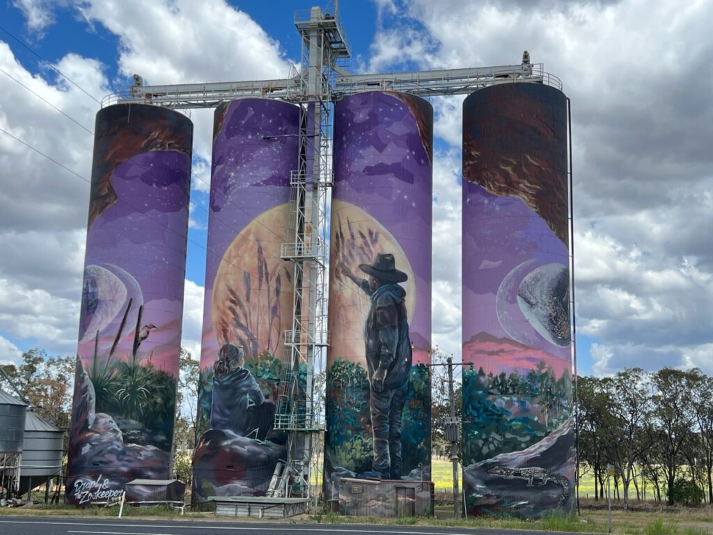
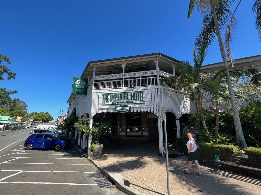
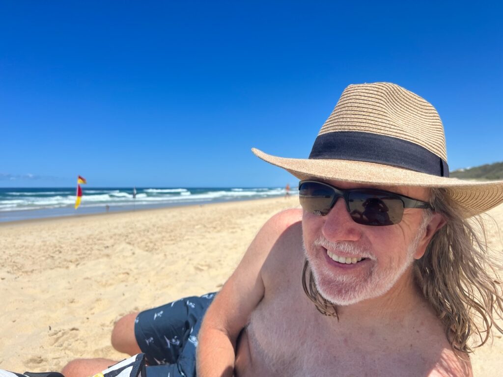
Some nice silo art near Biloela, just before the Sunshine Coast.Delightful old Imperial Hotel in Eumundi. Went to Eumundi for its famed Wednesday market – it was so busy we could not even find a park ! Consoled ourselves with a drink at this classic old Eumundi pub.Beach at Noosa. A perfect day….hot, sunny, no wind and no crowds !At the beach.Lois, Sunshine Beach, Noosa.Latte time- near Maroochydore, Sunshine Coast.View to Noosa from the hinterland.Caught up with Tim’s kids ( and their wives and kids ) while in Dicky beach.
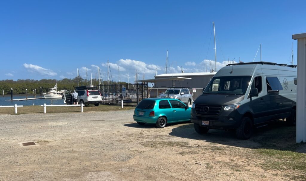
South of the Sunshine Coast was the seaside community of Sandgate where we got the chance to try yet another form of camping – the first time we’d ever stayed at what was more or less a yacht club. The variety of camping venues in Oz continues to amaze and delight us – a really nice stay, right on the water, all facilities and just 3 groups camping with a neighbourhood “fish and chips” shop an easy walk away just along the sea front. Bliss !
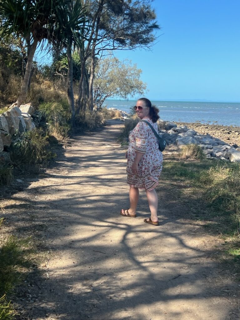
Yet another varied camping experience – yacht club in Sandgate. Right on Moreton Bay..Coastal walk, Sandgate.
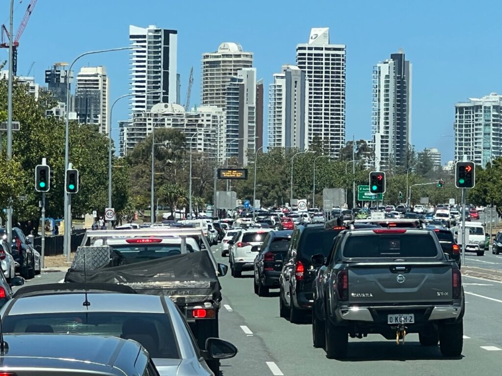
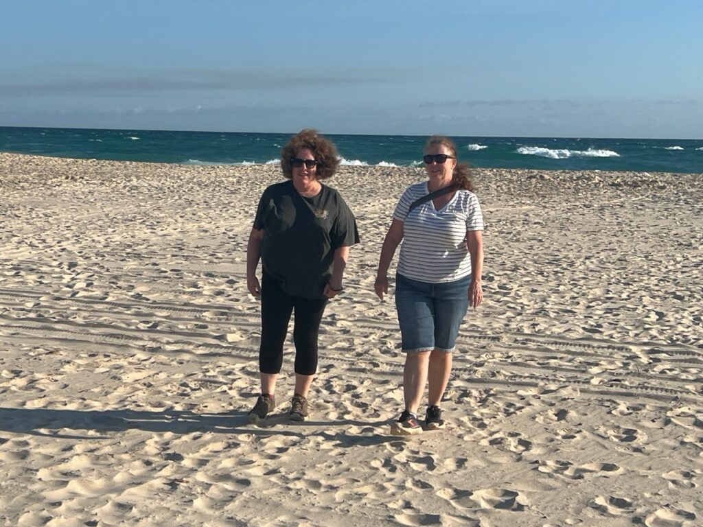
Continuing south we skirted around Brisbane this time and drove directly to Australia’s famous Gold Coast ( Surfers Paradise ). Could not believe how much it had grown and how crowded it was, certainly the Surfers Paradise area at least, traffic as we drove through was just insane. We’d been very much looking forward to seeing the famous Currumbin Wildlife Sanctuary and to a visit with my old school friends, Matt and Judy, who lived near Coolangatta at the quieter southern end of the Gold Coast, just north of the NSW border. They’d recently bought a unit right by the beach – their beautiful slice of paradise away from the hustle and bustle further north ! Lots of fun doing beach walks, making dinners and generally reminiscing. I’ve always felt it’s the great thing about catching up with old friends – while the gap between visits may be long and the physical distance between us significant, we still always seem to pick up right where we left off last time we were together. And when I say long, I mean long – Judy and I started kindergarten together.
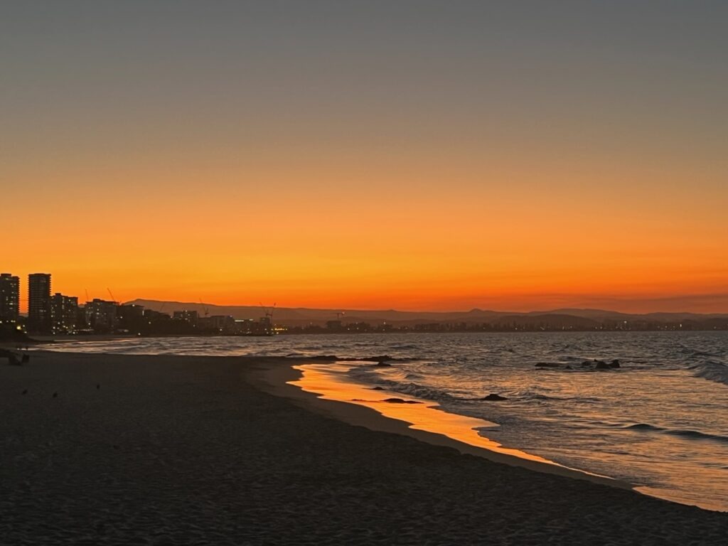
Traffic, entering the Gold Coast from Brisbane.Finally, relaxing with Matt and Judy at their home near Coolangatta.Judy and Lois, returning from a beach walk.Lois and JudySunset walks on the sand , Kirra beach.
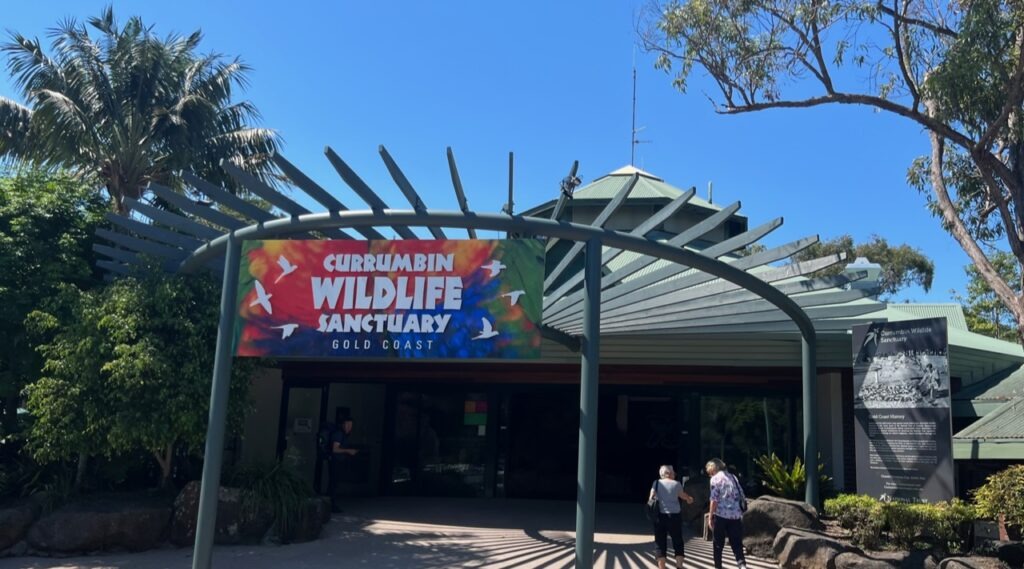
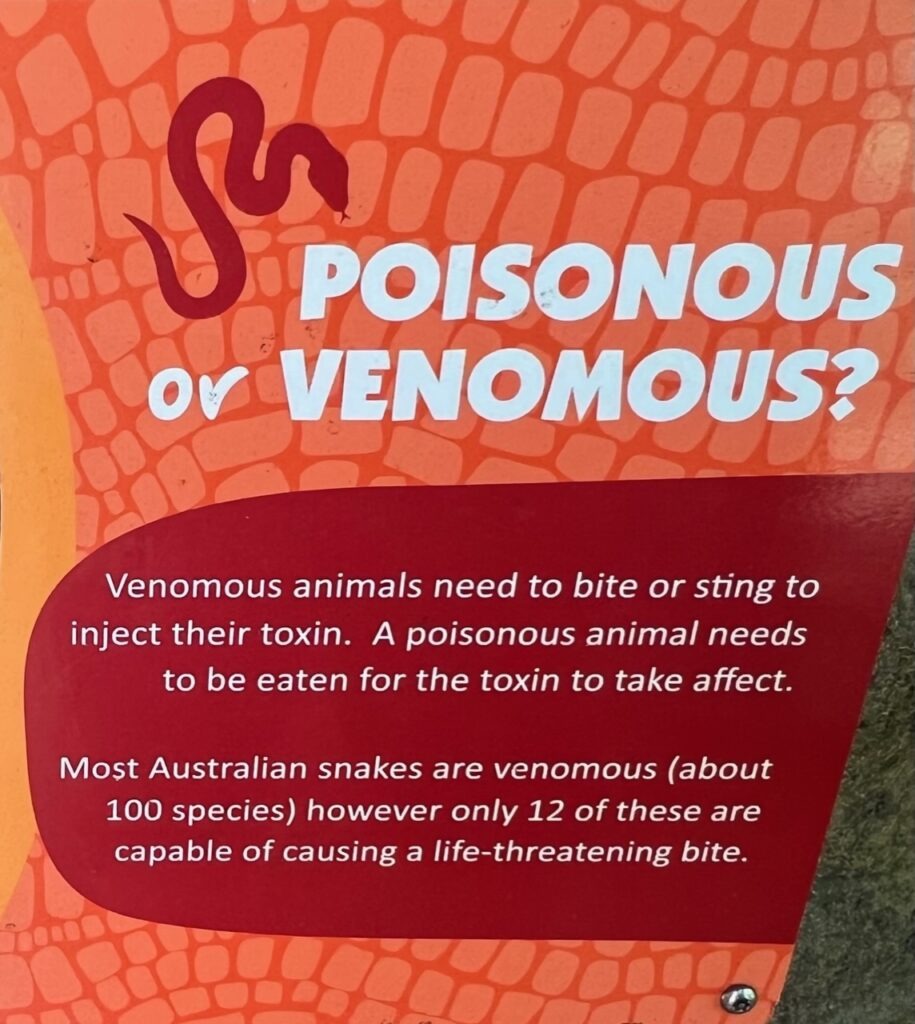
Just before leaving Matt and Judy, and indeed the state of Queensland, we had one famous sight we’d both wanted to visit and which neither of us had seen before : the Currumbin Wildlife Sanctuary. Home to all manner of Australian wildlife it draws visitors from around the globe. We had of course seen many of the animals in the wild while travelling, but certainly not all ( thankfully some of our many venomous snakes, especially ). Well worth a visit.
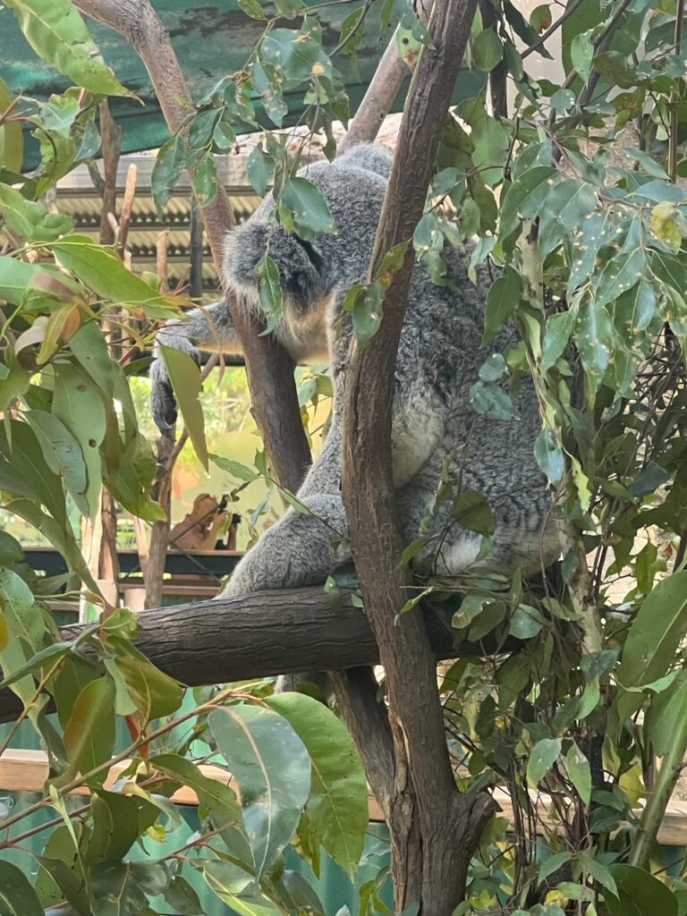
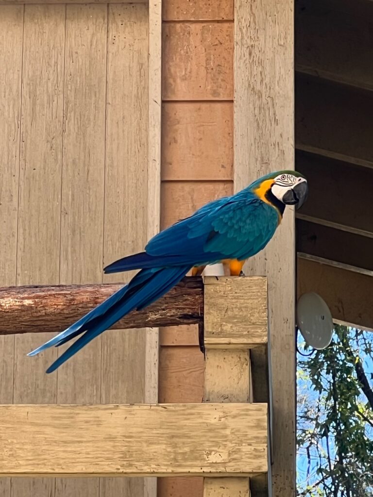
Queensland’s famous Currumbin Wildlife Sanctuary.Kangaroo, with an itch !The koalas were priceless.They are so adorable.One of the beautiful birds.A little learning while visiting – easy to confuse the two terms. Either way we have lots of venomous snakes in Oz !
Next week we cross into New South Wales – my home state and where we arrived in Oz back in January. Lots to explore !
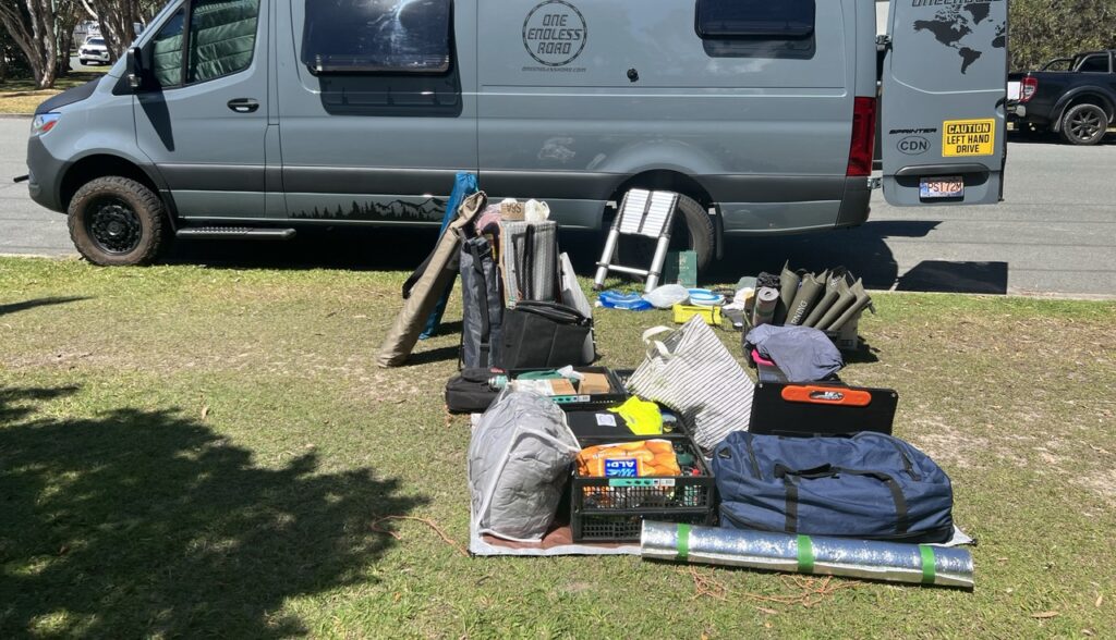
At the end of next month it will be a full year since we pulled out of our driveway in Kelowna, BC, headed ( ultimately ) for Melbourne, Australia. With our time travelling in the van across North America ( in the dead of winter ), and now around Australia ( where it’s been mostly summer-like ) we’ve had almost 8 months full-time living in it to really test it out. Ample time, it would seem, to provide a review of sorts, both of the van itself, and how we are handling this extended time living “on the road”. I’ve put together a one-off blog this week to answer some of the common questions we get ( but if you have one that we have not answered here, by all means send us a comment ). I know we have quite a few readers that are getting ready to buy/build out vans so this edition may be of particular interest to them.
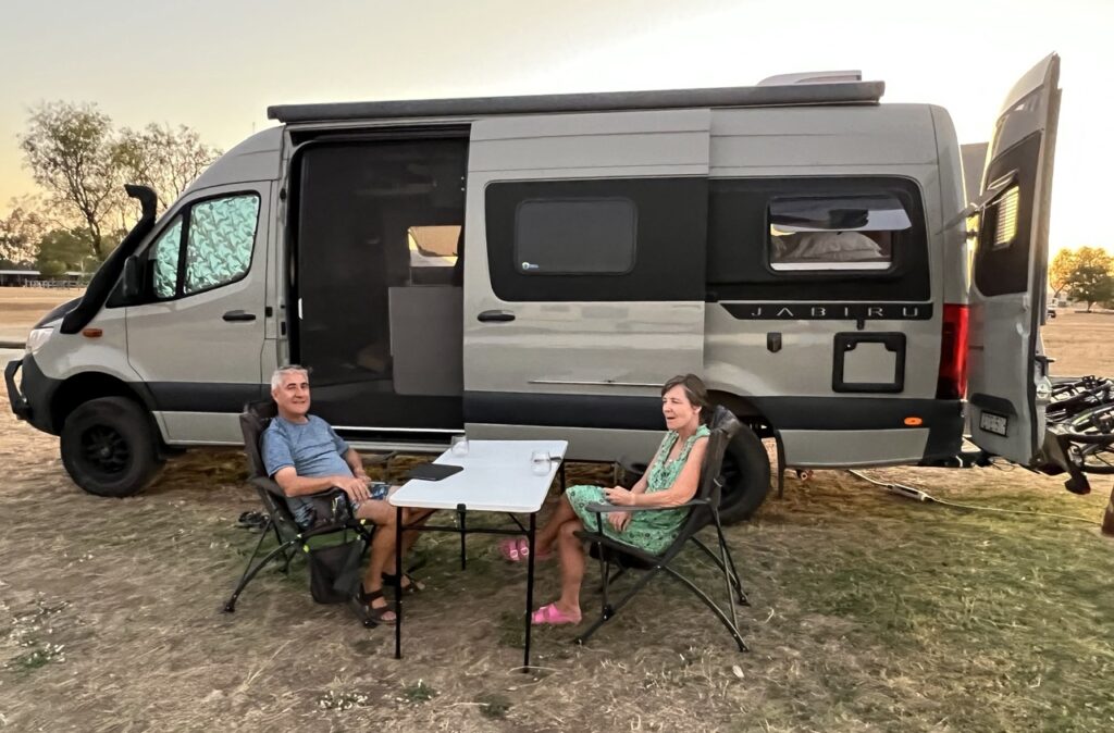
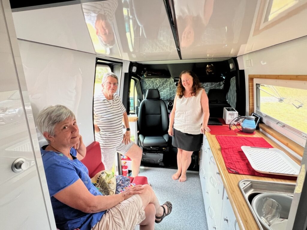
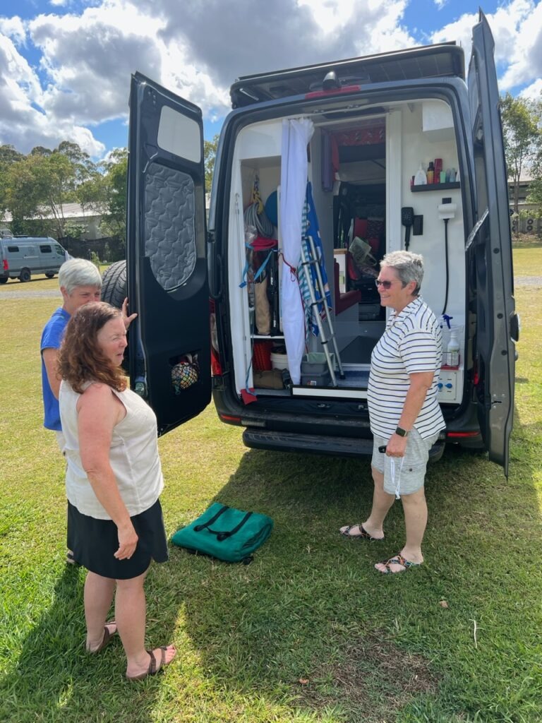
Met this friendly couple in Biloela – first time we’d come across a Sprinter of the same specifications and fitted out pretty similarly to our own. Theirs by an Aussie company called Trakka. They also loved their van and like us would not change much.Sadly, we do not have this cool feature that they have !Met Barb and Deb ( short wheel base Sprinter) in Cooroy. They made excellent use of considerably less space than the long wheel base version, but gave up headroom to have an elevating bed. Everything is a compromise !Same van – they opted for a shower/ toilet in the back of the van since their bed is up front.
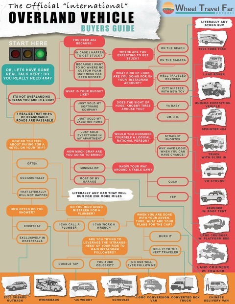
An oldie but a goodie : a very tongue in cheek look at how to choose the “right” overlanding vehicle !
One of the really enjoyable parts of being on the road in the van is that there seems to be an almost insatiable curiosity among Sprinter owners about other people’s Sprinters ( and other vans in general ) – no different than checking out someone else’s house ! The specification options are myriad – short wheel base or long ? A 4×4 drivetrain or not ? Diesel or gasoline ? Four cylinder or V6 ? Beyond those questions folks are extremely interested in the layout ( interior design ), there being so very many options there as well. The two different Sprinter owners (above) were among the many we’ve met, all of whom have shared their thoughts on priorities and “must have” features – one of the above, quite like ours, but the other ( also a beautifully made van ) totally different.
Here, in no particular order, are some of our thoughts ( first, the van itself ):
A great deal of thought, based on our own personal lived experiences in previous recreational vehicles ( spanning more than 35 years) combined with feedback from others who have travelled in similar circumstances, went into the choice of vehicle and van design. I am pleased to say that, overall, we are thrilled with it; both with the build and overall with just how it has performed. Bottom line, there is very little we would change if we were to do the whole thing over. It’s easy to drive, powerful, roomy and reasonably economical for a bigger van ( we average 13-14 litres/100km ). We’ve really tested it out on some of Australia’s most rigorous outback tracks and been truly impressed with what this big 4×4 is capable of – few thought we’d survive the rigors of the Gibb River Road, or get to the very top of Cape York – yet we did.
Things We Love:
Skylight over the bed is practical – always bright, airy and provides egress in case we ever needed out it an emergency. A must have for us, used every day and often at night.
The full queen bed is very comfortable. It’s north-south in configuration (which, admittedly does take up more space in the van), but given ours is the longer “170” (LWB) model it’s a “space” luxury we can afford. No climbing over each other to get in and out – would never have it any other way. For us an absolute “must have”.
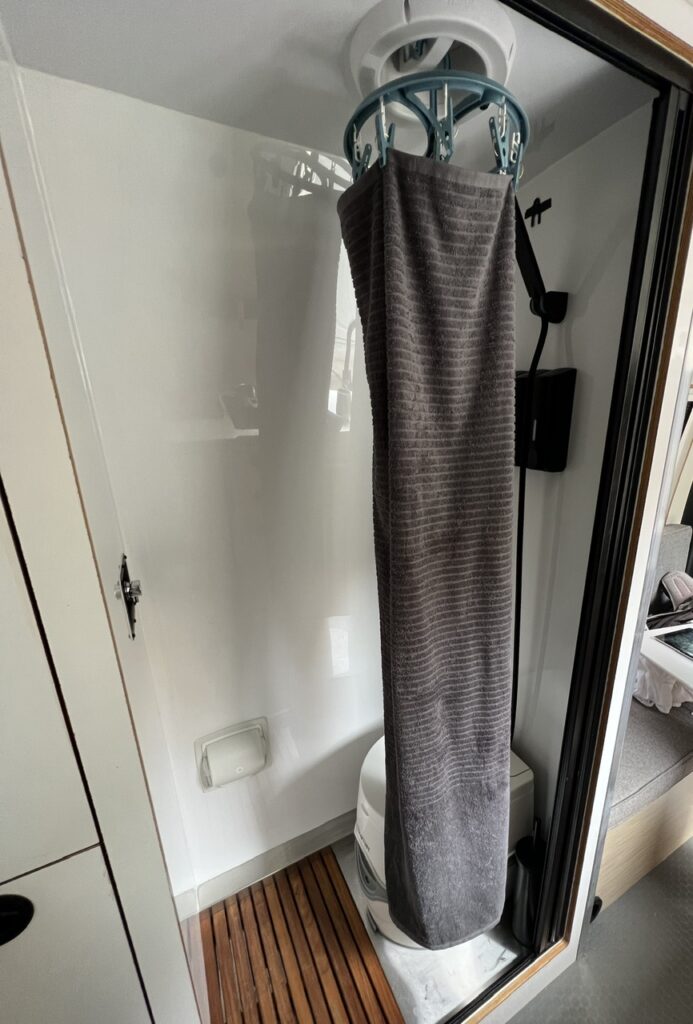
The shower/toilet is used always ( the latter more so, obviously ) and both work very well – we appreciate that it’s in a dedicated space and the fact that nothing has to be disassembled to use it. Again, probably a luxury afforded only by choosing the long wheel base version of the van. Really glad to have both for the independence it gives to avoid campgrounds.
Shower/toilet doubles as a drying room. Here a wet towel hangs to dry. Heat is ducted into the shower area ( behind toilet ) and is vented through the ceiling fan. With the sliding door closed, on a cold/wet day we can dry wet clothes ( or just get in the shower with the room already warm – ok, so we spoiled ourselves just a bit with that feature ! ).
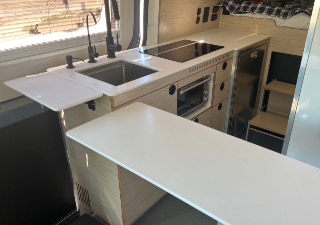
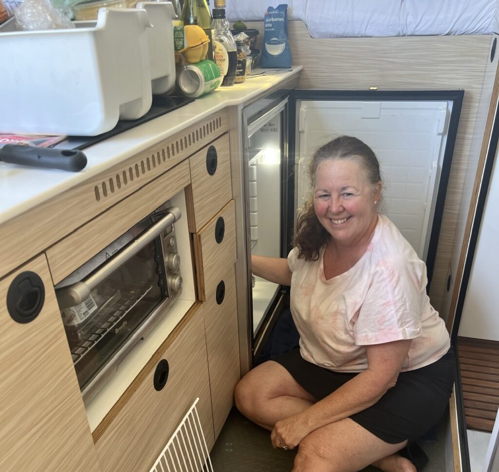
4. The kitchen is functional, fridge big enough ( having a remote compressor helps considerably ) and the induction cooktop has been amazing. I had nagging doubts we’d have enough battery power to run it but that simply has not been an issue. With 480 a/h of lithium batteries, 700 watts of solar up top ( and 300 watts of external solar ) with a 40amp DC/DC charger we are always powered up having “plugged in” of necessity only twice while in Australia. We went heavy on power, with a 3000 watt inverter, and can run multiple appliances at once ( hot water is electric as well ). Even our portable 120v A/C unit on a really humid night !
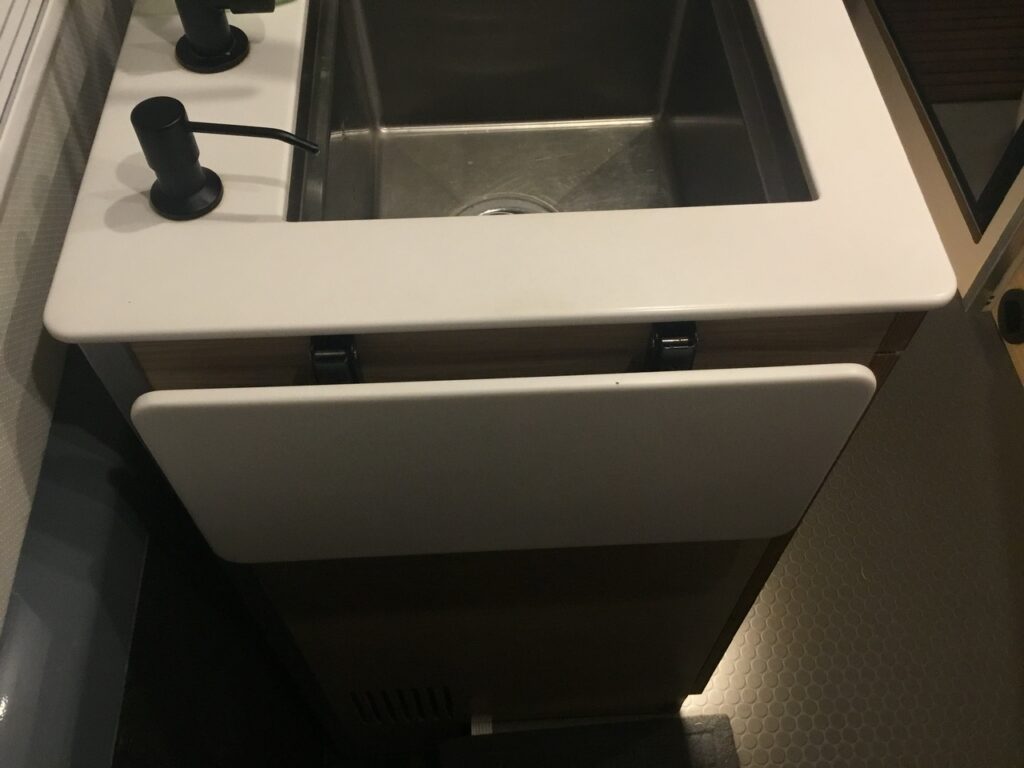
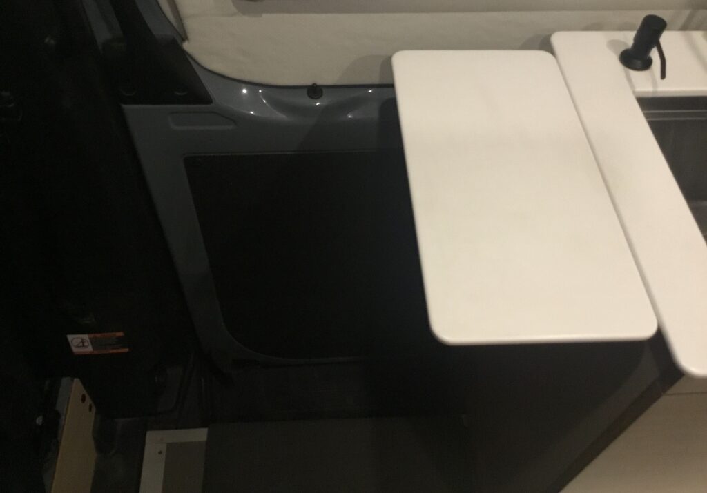
An already spacious kitchen counter can be further extended by raising the dinette table and turning it 90 degrees.
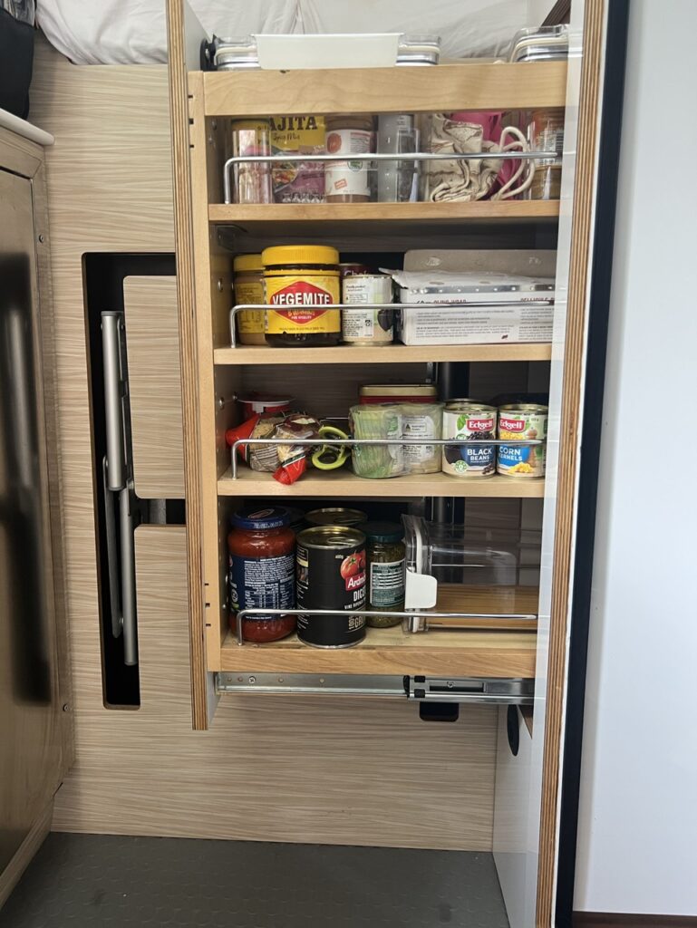
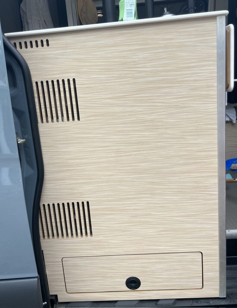
5. Slide out pantry was difficult to install but makes inaccessible space accessible and holds lots of our dry food – worth the effort to put in and an indispensable feature !
Slide out “pantry” ( out ) : makes practical use of an otherwise tight space between the shower and bed.Slide out pantry ( in ). Steps to our bed recess into the wall area and are much better than a ladder ( which many use ).
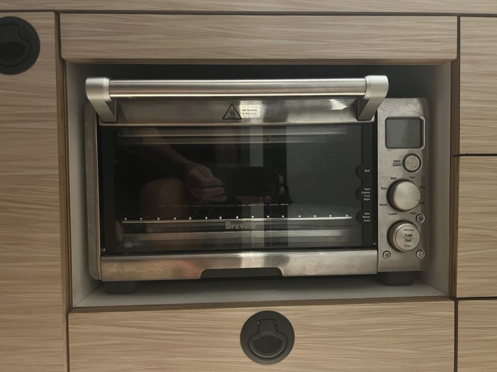
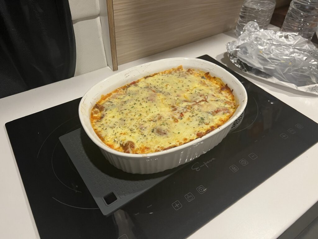
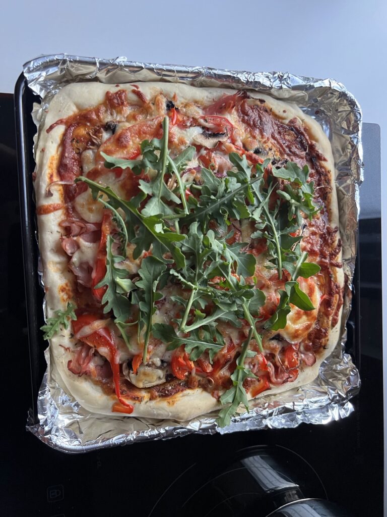
6. The toaster oven is used multiple times a day ( we have no microwave ) and it’s a call we’re glad we made. I’m blown away by some of the meals Lois has made with it – we can even bake bread !
So glad we added this. Worth it for the toast and Vegemite each morning alone – but it does so much more !
7. Storage in any van is at a premium but we have plenty given that we opted NOT to bring bikes in the end. So far, we’re happy with that call – if we can’t walk somewhere the van is so easy to set up and pack up that we are easily able to drive where for larger rigs this is more of a challenge. Hence, less need for a bike.
8. Awning style windows are excellent and, versus sliders, can be left open in the rain, which is a practical feature. They cost more but in our view are well worth the money.
9. Most importantly, given our two water tanks ( 175 litres in total ), extra fuel capacity ( almost 200 litres in total ) and large battery/solar set up, we can go “off grid” for extended periods almost never needing campgrounds. It provides great independence and flexibility especially in outback areas. We have REALLY appreciated these – three HUGELY important features.
Things We Dislike/Might Change:
Not that these things bother us much at all and we really likely won’t even make the changes, but, if we are splitting hairs:
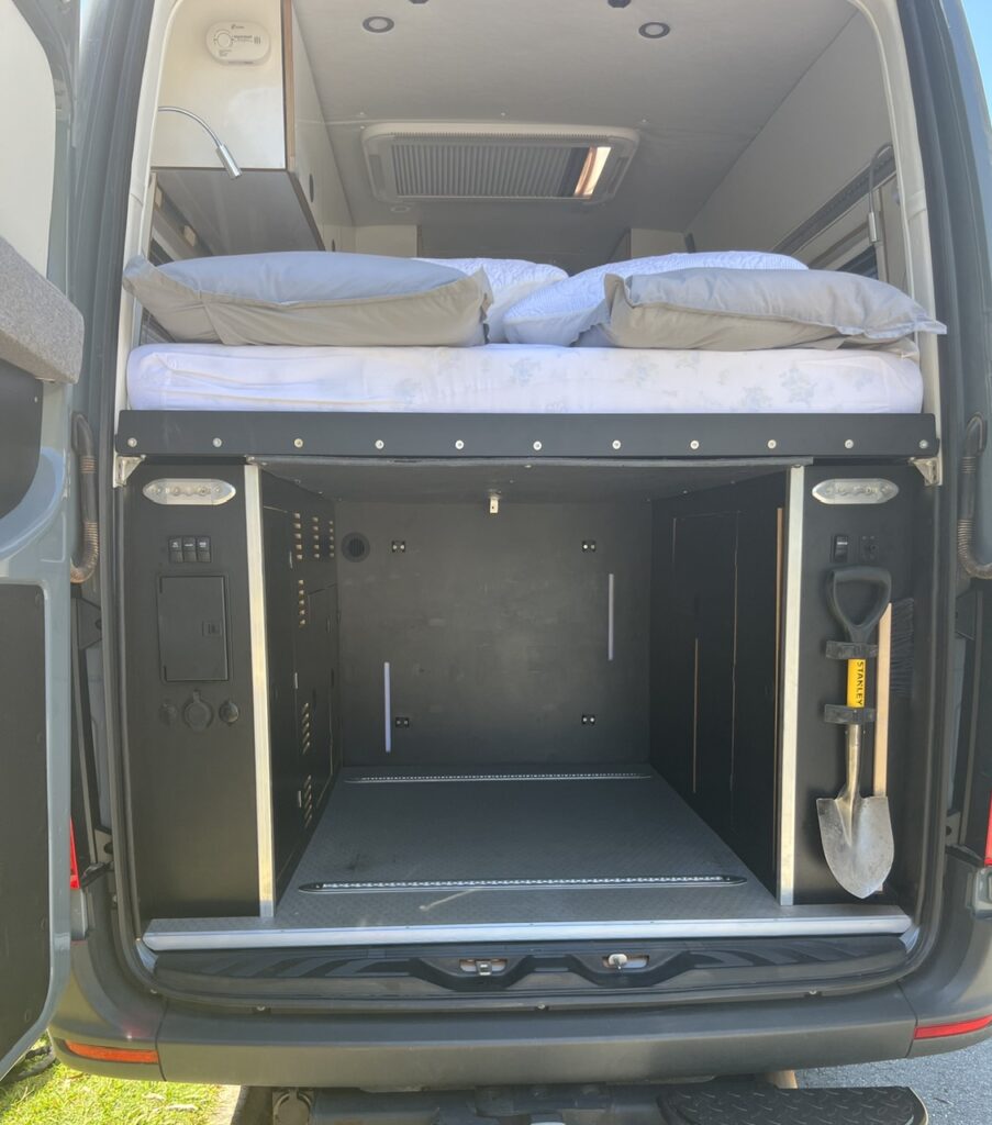
1. Garage is huge – bigger than it needs to be ( though many would love that ! ) and we just don’t carry much junk, so I would perhaps lower the bed a few inches to reduce the “wasted” space in the top area of the garage. We were foolishly talked into ensuring the base of the bed was at least 36 inches above the floor of the garage in order that pretty well any current model bicycle could stand up in the garage (with the front wheel off). We figured that we “may” be buying bikes, so bought into that theory. In reality, we didn’t buy the bikes, we don’t miss the bikes, and we don’t think we’ll ever get them, so we have more storage where we don’t need it and a little less where we could use it more. Minor grievance I suppose and a bike lover would undoubtedly want it just as it is. Indeed, when we meet them they drool over our garage. Storing bikes externally not only presents a HUGE theft risk but also effectively lengthens a vehicle that is already almost 7m long, dramatically impacting angle of departure. Not something we would sacrifice when “off-roadability” is a key aim of the van.
Garage is large, and heated ( duct in top left corner ). With all water ( fresh and waste ) stored inside the van we can travel comfortably in any weather and still use the sink, shower and toilet. Already been invaluable.
2. We have more AC electrical plugs than we ever use – so some are wasted ( but we do use ALL the DC/USB outlets we installed ). You just don’t need many of these AC outlets we have found.
3. Kitchen counter extender ( Lois whines to me about this a lot ! ). I designed it shallower ( so we could enter and exit the van while it was still raised ) and slightly narrower than the counter itself (so we were less likely to accidentally “hipcheck” it as we walked by). It serves both tasks admirably but Lois still wishes the extender was just a bit longer ( it would actually be very easy to replace – perhaps when we get home if she is still complaining about it ! ).
Counter extension down….……and up ! Note there’s room for van access even when up – helpful if you want to enter or leave while it’s covered in clean dishes.
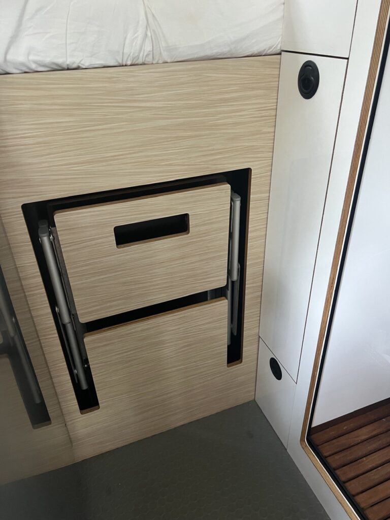
4. Could have used more shoe storage – used this natural space under the kitchen cabinet but access is not as practical as it could be. We need to completely open the door to get our shoes ( annoying if it’s raining ) so we usually put them elsewhere.
Shoe storage cabinet – generally NOT used for shoes !
5. It’s too tall for a shipping container so we need to use a car carrier to ship it. Normally this is the cheaper shipping option of the two but of late that is not the case; that, and the fact that with a car carrier you have fewer route options means shipping has ( and likely will continue to ) cost us more than we had originally expected. Not a deal killer, but, in fairness, a potential negative ( depending on where you intend to go of course – travelling domestically it’s a non-issue so would not bother 95% of van livers – but it bugs me ! ).
Life On The Road
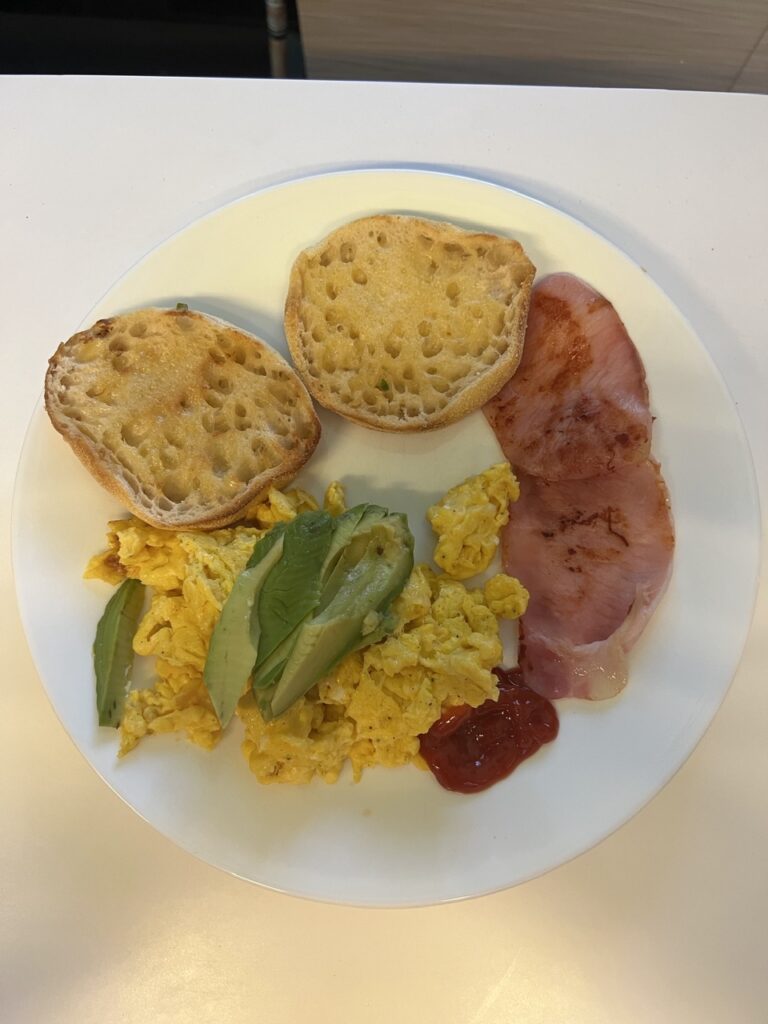
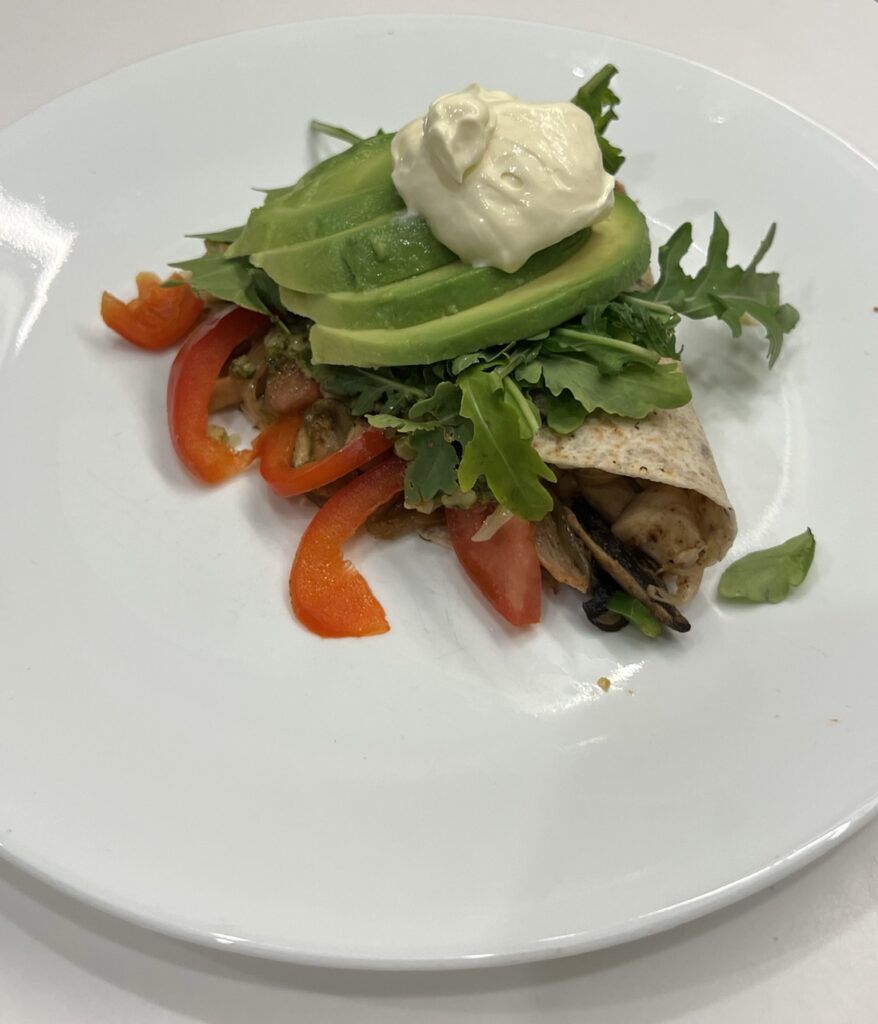
So, that’s about it for our van likes and dislikes. As for “life on the road” generally we have settled into pretty regular routines and both of us manage to stay busy. Each of us have specific “chores” (some we like and some we don’t !). Apart from the fact that Australia is vastly different than South America, our daily routines in the van are much the same as they were in the truck camper. We don’t rush, we get up late, stop often for morning and afternoon tea’s and try not to drive for long periods at a time. We have the facilities to cook just about any meal we can at home – here are some examples:
Lois used the toaster oven to make this delicious baked spaghetti dish. Delicious !…..and this pizza.A typical breakfast.A light dinner where we tried to go “healthy” ( well, minus the big dollop of cream anyway !)
There are of course the things we love about being on the road in our own vehicle – sleeping in as long as we like, taking our time to do just about anything, meeting lots of new people, changing plans on a whim, and knowing that just about every day brings something new (& quite often something exciting ). Some look at our rig and are stunned at what a big van it is . Others ( usually in much larger traditional motorhomes or caravans ) consider it too small. It’s amazing how easily one adjusts to living in a confined space ( albeit, much easier when the weather is agreeable ! ), but then again this is not our first rodeo and the Sprinter is much bigger than any of our previous overland rigs – to us it actually feels kind of palatial ! We are not into towing ( anything, ever ) and to have a vehicle any bigger just makes driving/parking more problematic ( and shipping it internationally even MORE prohibitively expensive ! ). It’s no Jeep of course, but we can go ( and have gone ) so many places (with the 4×4 version and it’s higher ground clearance) that many other vehicles can’t. We have paid close attention when camping and our set up and take down process is easier, and the time required, significantly less than many others we see. Those are important considerations for us but may not be for some others – in the van world it’s very much different strokes for different blokes ! With a huge sliding door and insect net we can ( and do ) cook and eat inside enjoying the comforts and convenience that brings while still feeling like it is “outside” – when the flies and mosquitoes are bad that is especially nice. There are absolutely no “cooking smells” in our van since it ventilates so well.
While cooking is one of the fun parts, there are also those annoying things that are part and parcel of life on the road – cleaning being one of them ! Emptying cassette style toilets is another – always a “Jeff” job ! And yes, we know about composting toilets ( popular among some younger folks ), but we are not fans. The cassette style toilets are as popular here in Oz as they are in Europe (and are becoming in North America) and we find them simple and easy to use. Would not change this.
Just some of the stuff we store/carry. A clean out, reorganization is required about every month – a “Jeff” job.High quality marine grade compressor fridges are great and very efficient- but do not have auto defrost functionality. About once a month we defrost it ( a Lois job ). Ours is a 130 litre Vitrifrigo.
More generally speaking there are certainly days we miss home, our friends and family ( and especially our new granddaughter ! ) but we FaceTime daily and have committed to more frequent trips back in the months/years ahead. We really don’t feel out of touch. I’m a total news junkie and love the fact that I now have time to read so much of it. Frankly, this blog has also been a wonderful tool for “keeping in touch” with many people ( so keep the comments rolling in – we answer every one ). We enjoy creating it each week, treat it like a travel diary, and look forward to it being something we can read to our grandkids in the future. In the meantime, if it inspires even one or two readers to get out on the road and explore the world, we are very happy to encourage that…!
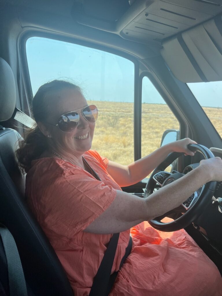
Apologies for the “Must Love Dogs” movie title appropriation this week but for the last segment of our travels I don’t think I could find a more apt appellation. On a particularly long, dull and monotonous stretch of highway east of Winton, Lois, taking a spell behind the wheel and getting a little bored herself, turned to me, shaking her head, and said, “Must love driving !” ( thus reminding me of the movie title ). While normally I do, I’ll confess that the last few days ( as happens from time to time ) really stretched even my enthusiasm for some of the seemingly endless roads of outback Queensland.
“Must love driving !”Travels last week.
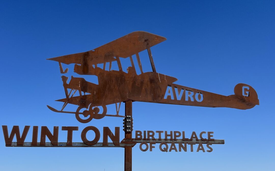
But first, Winton. If the towns of Bedourie, Boulia and Cloncurry were a little light on for things to see and do, then Winton, just a little further down the Landsborough highway, certainly made up for them. A much bigger, and seemingly more prosperous place, Winton’s local council has combined astute tourism management with some incredible geographic, business, and even “prehistoric” luck in developing a thriving tourism model. Of all the recent places we have passed through this is one, in our opinion anyway, where you would want to spend more time – so we did.
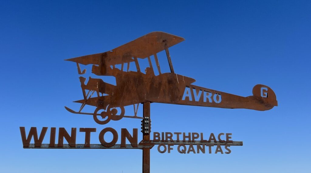
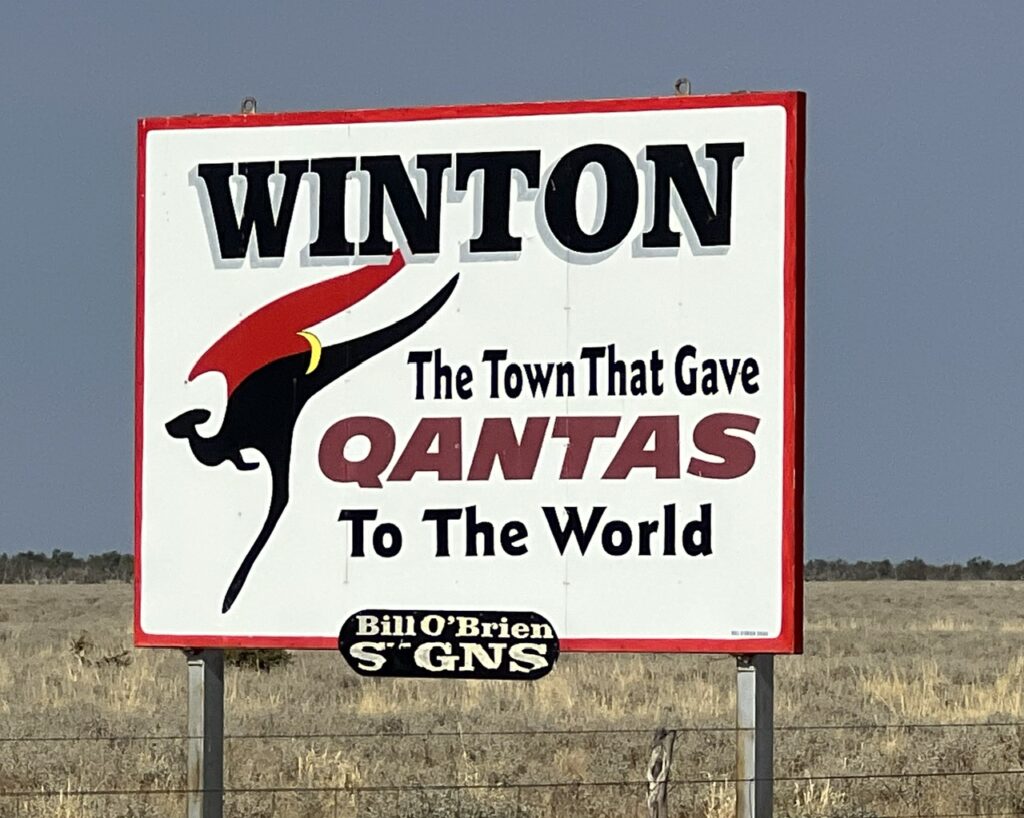
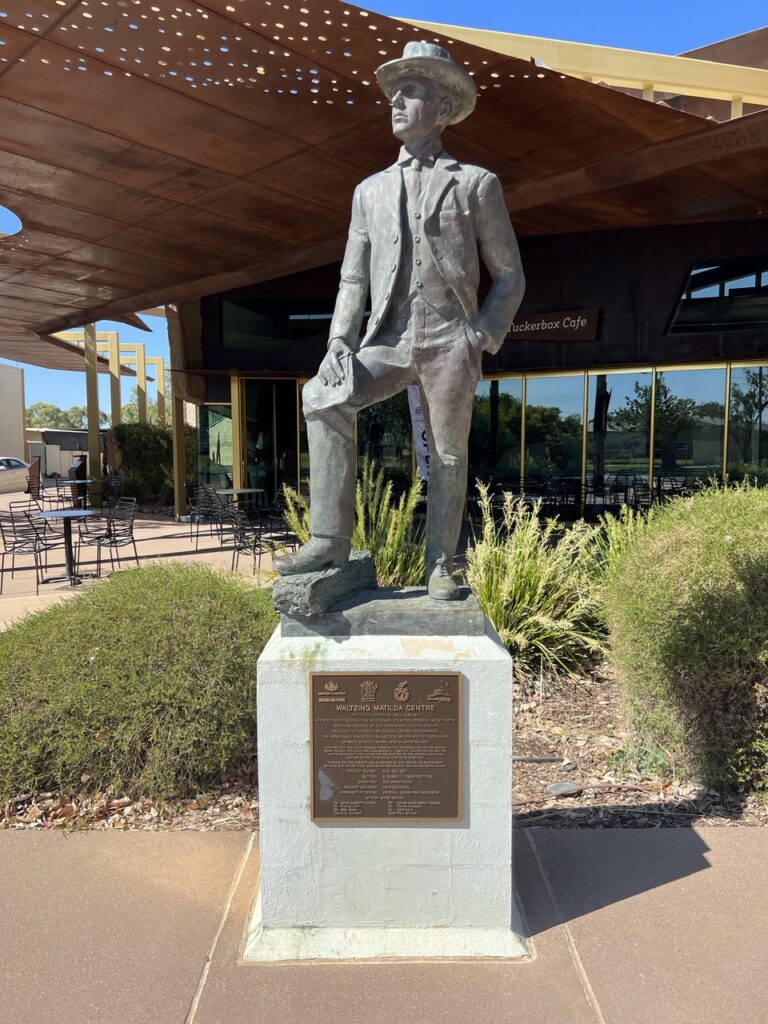
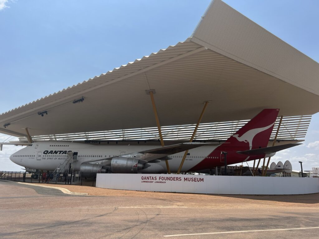
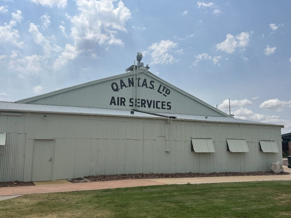
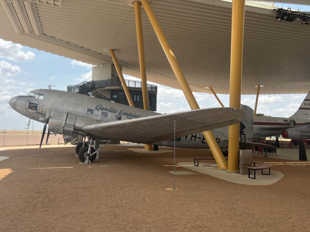
Much is made in Winton of the town’s connection to QANTAS. It was founded here in 1920.
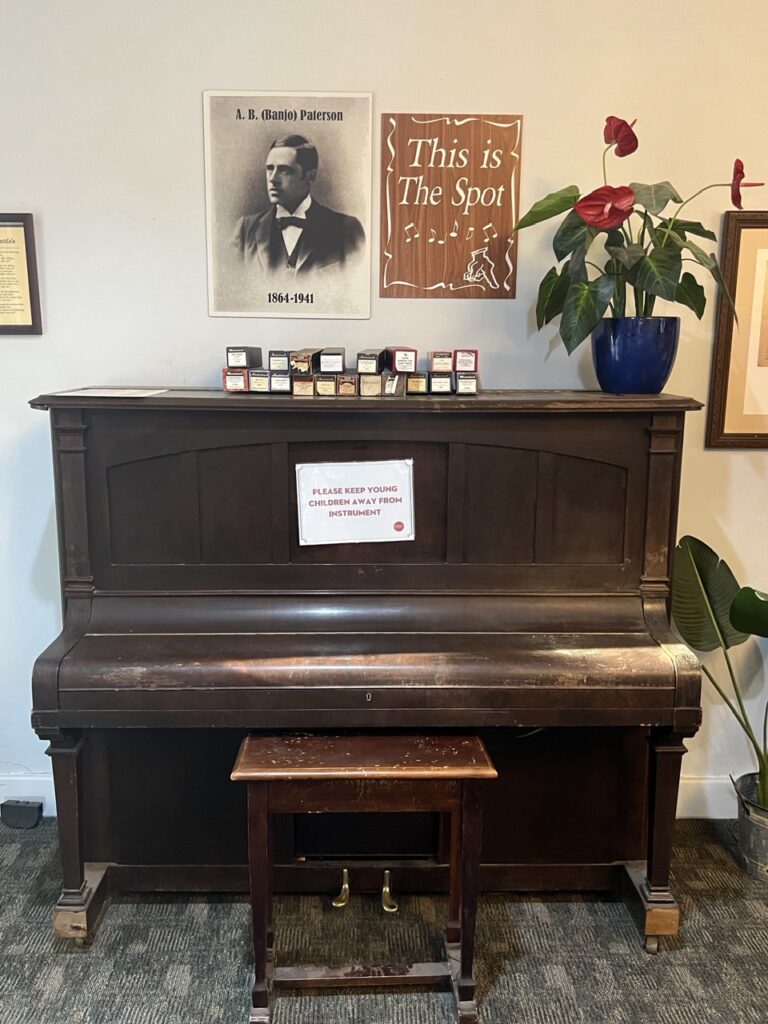
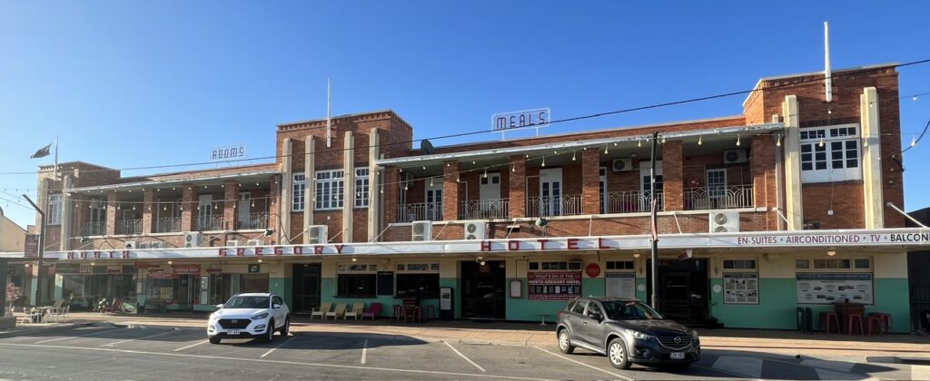
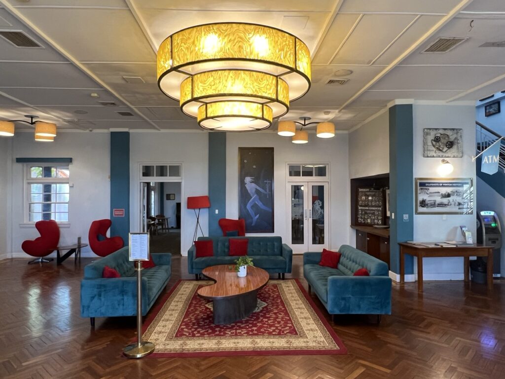
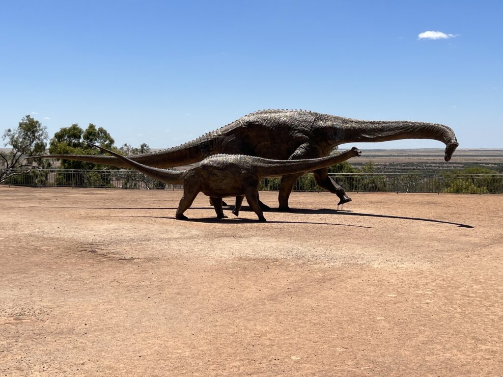
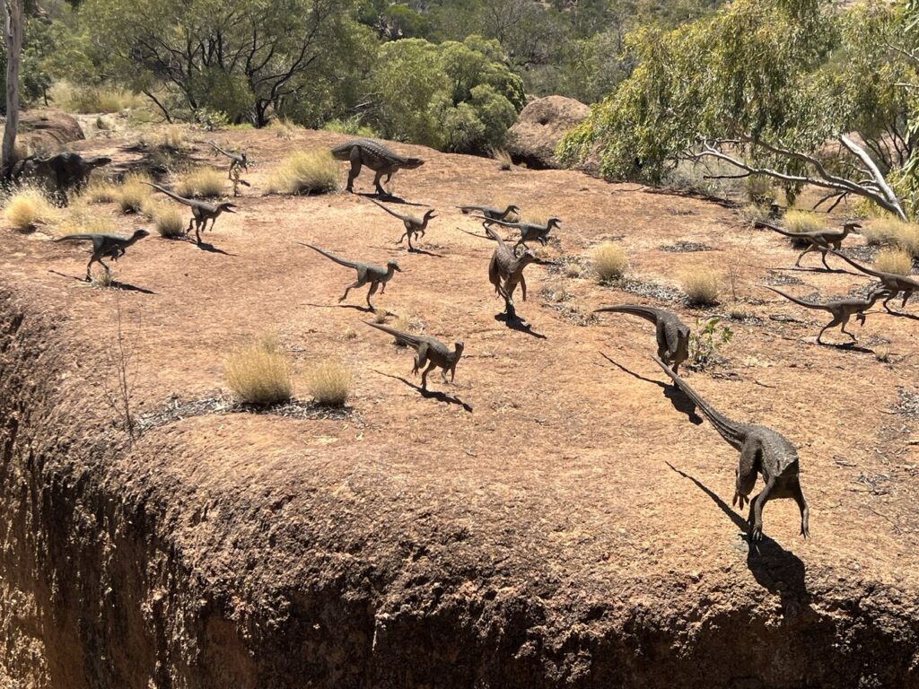
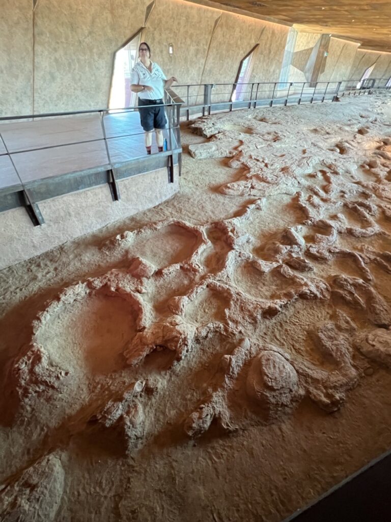
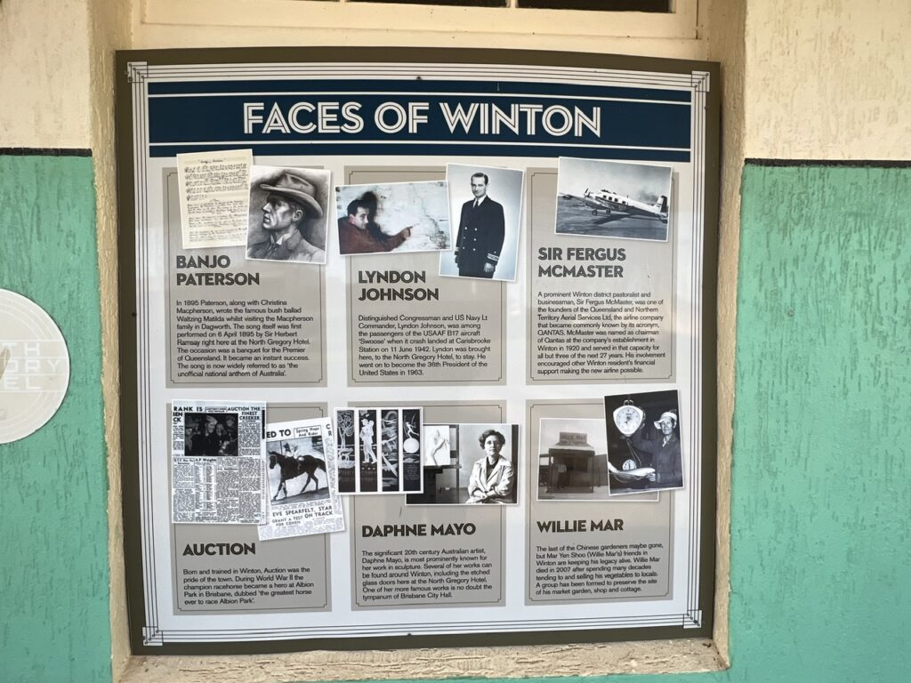
The main roads from Cloncurry, Hughenden, Longreach and Boulia all converge in ( or near ) Winton so as a natural transport crossroads geography has been kind to it. Aviation history has also left its mark, Winton being the town where Australia’s QANTAS airlines was formed back in 1920 – and there is plenty in town to mark that event. Winton, beyond its fame relating to opals, also claims to be the first place in Australia where legendary Australian poet, Banjo Paterson, performed “Waltzing Matilda”, the words being drafted while he worked on a station ( ranch ) near the town back in 1895. Admirers come from all over Australia to visit the Waltzing Matilda Centre here and stand in the North Gregory Hotel where those famous words were first heard. More recently though, the discovery of dinosaur footprints near Winton has led to the construction of The Australian Age of Dinosaurs Museum of Natural History – we thoroughly enjoyed the tour and got a great education on what the area was like millions of years ago. Different from the dinosaur experience in Eromanga and on a much larger scale, well worth the time an effort – the centre will be massive when it’s all complete.
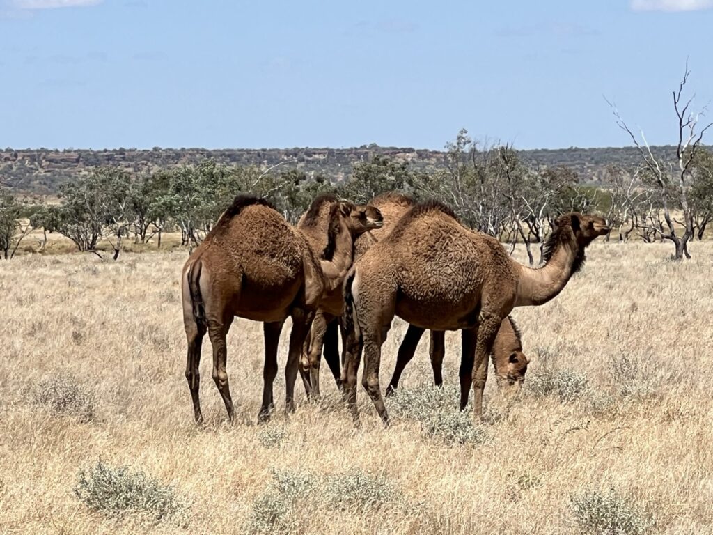
…and again, in case you missed it on the way in to Winton !The great man himself, an Australian icon, AB ( Banjo ) Paterson.The spot, supposedly, by the piano, where Banjo Paterson first recited Waltzing Matilda.Winton’s art deco-themed North Gregory Hotel. Much of Winton’s history revolved around this hotel ( in its earlier iterations ).Inside the foyer of the North Gregory Hotel with its distinctive Art Deco style. It’s also one of the many outback pubs that welcomes campers in their large rear yard. Made for a great stay.Outside display, dinosaur museum, Winton.Outside display, at the dinosaur museum, Winton.Dinosaur footprints, museum, Winton.Who’d have known that US President Lyndon Johnson had a Winton connection? He stayed at the North Gregory Hotel after his plane crashed nearby in 1942.On the way out of Winton we saw wild camels. Introduced in the early days of Australia and used by explorers to cross the deserts, many are now wild and can be seen in remote areas.
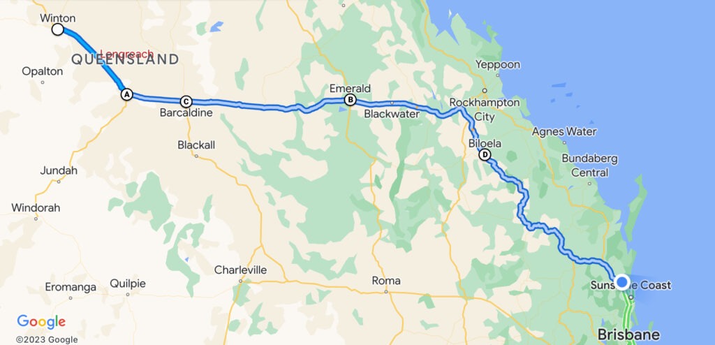
From Winton our route was more or less directly back towards the coast (though still a long way off), with only nearby Longreach having any kind of significant attraction (an impressive QANTAS museum ) that piqued our personal interest. Emerald, Barcaldine, Blackall, Biloela and Gympie were the othe places we passed with flat plains, rolling hills, long coal trains, and the occasional extremely wide-load vehicle being our constant companions. A consistently pounding crosswind just made for more challenging conditions. Not sure why but this particular part of the journey just did not turn our crank, so to speak- we actually enjoyed the barren desert more. Alas, perhaps I’m being a bit harsh and it was really just a bit of extended driving fatigue – that, and the inescapable travel fact that returning from somewhere is just never as much fun as going there. The distances in outback Queensland are indeed immense, and, while I don’t know why, it just seemed to take much longer for us to get back to the coast than it did when leaving Brisbane en route to Birdsville. Fortunately, as we move southwards from here, the really long drives are now behind us. We’re both looking forward to shorter driving days and more sightseeing.
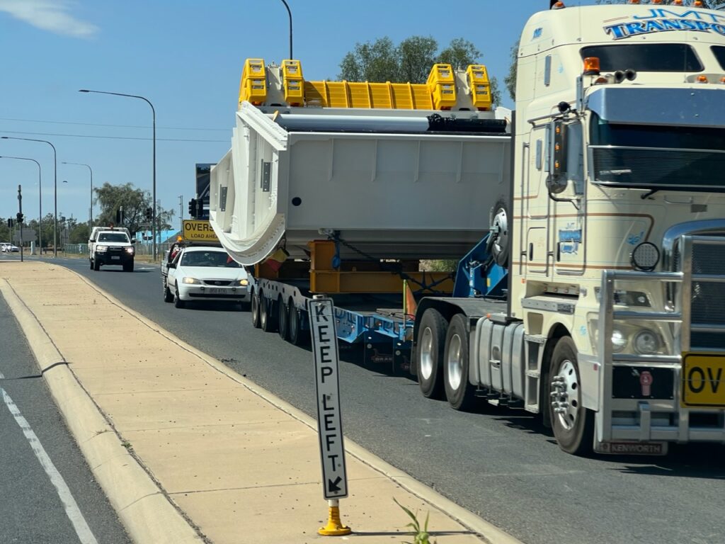
“Wide Load” – 8 metres wide and coming at you !
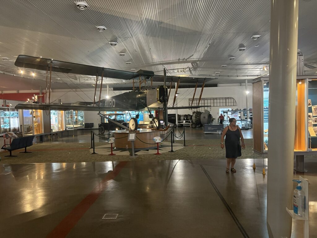
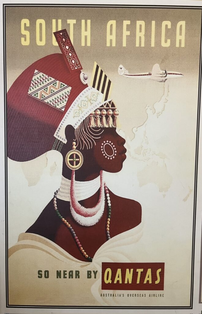
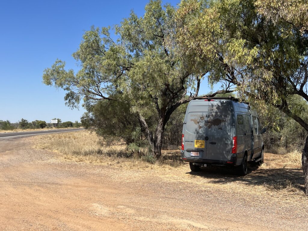
Wide load passing – get off the road !And again…One of QANTAS’s earliest ( and now retired ) 747’s.An exact replica of the first QANTAS plane.The original hangar – note they still used periods then to indicate that Q.A.N.T.A.S. began life as an acronym for Queensland And Northern Territory Air Services, only years later morphing into the “QANTAS” we all know today ( and, for non-Aussies, explaining why there is, uncharacteristically, no “U” in QANTAS). A classic old DC3.Loved the nostalgic travel posters.Not only was it windy driving in this area it was also very hot- here, finding a rare bit of shade to pull over and enjoy a morning tea break.
Next week, while we spend most of our time visiting friends and family, we’ll take a break from the “pure travel” bIog and touch on a topic that quite a few have asked us about, and which may be of general interest to other regular readers – the question of “How is life in our van ?” I’ll review the van itself and how we like it, but also cover, in a bit more detail, just what daily life is like in general, “on the road”.
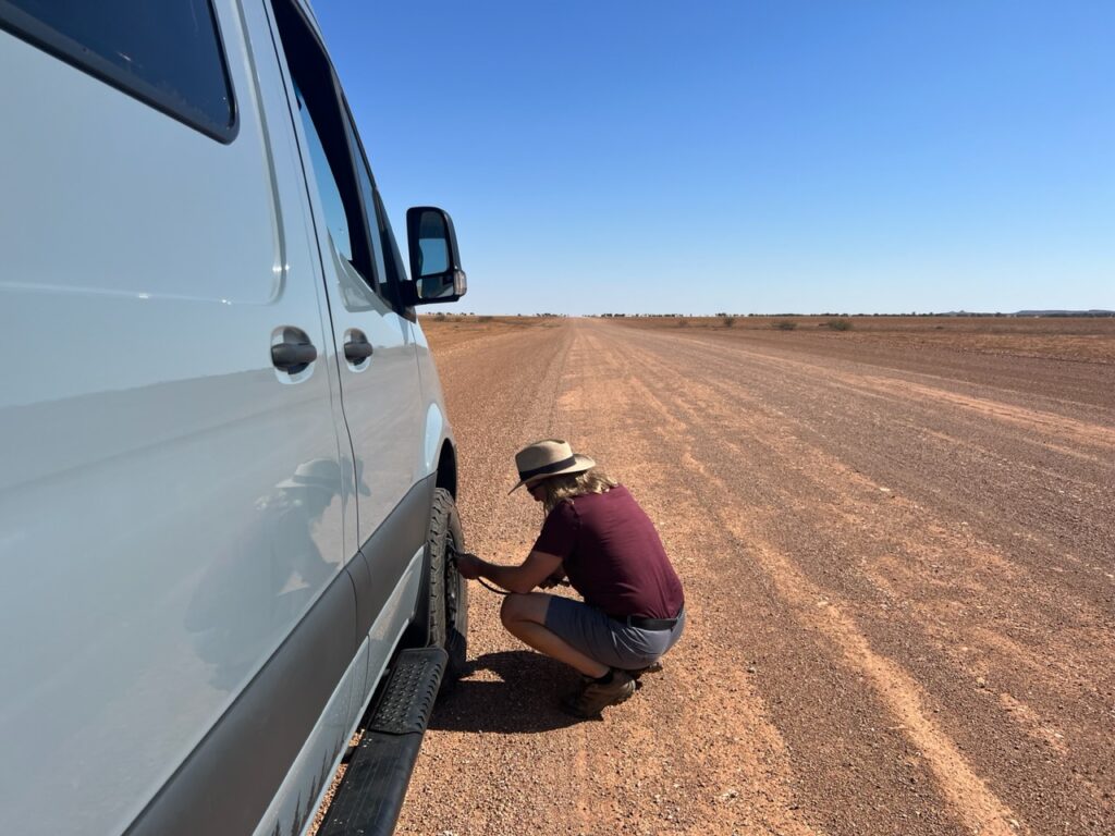
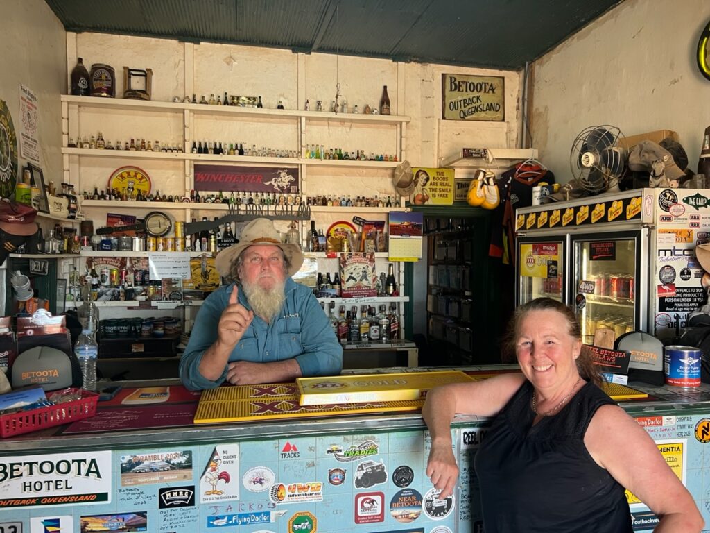
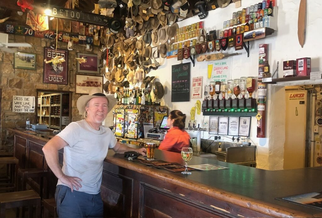
Having left Eromanga and prior to reaching Birdsville we had been strongly advised to make a short diversion – a pit stop at the Betoota Hotel. Every Aussie has heard of Slim Dusty’s famous “Pub With No Beer” – Betoota is, in effect, a pub with no town. Betoota is the Betoota Hotel. Our host at the FoxTrap Hotel back in Cooladdi had insisted we stop in and see “Robbo”, the owner of the Betoota Hotel; “He’s a great character, offers free camping, $5 cold beers and can fix anything that breaks down”, we were assured. Hoping not to test his skills in the latter category we decided that his pub’s interesting history and affordable charms still made for a worthwhile stopover. His WikiCamps reviews were sensational and having now spent a night there we can absolutely see why – a great host, hilarious storyteller, and knowledgable on all things “outback”. Our advice ( if you’re coming to these parts ) ? A stopover at the Betoota Hotel is not to be missed !
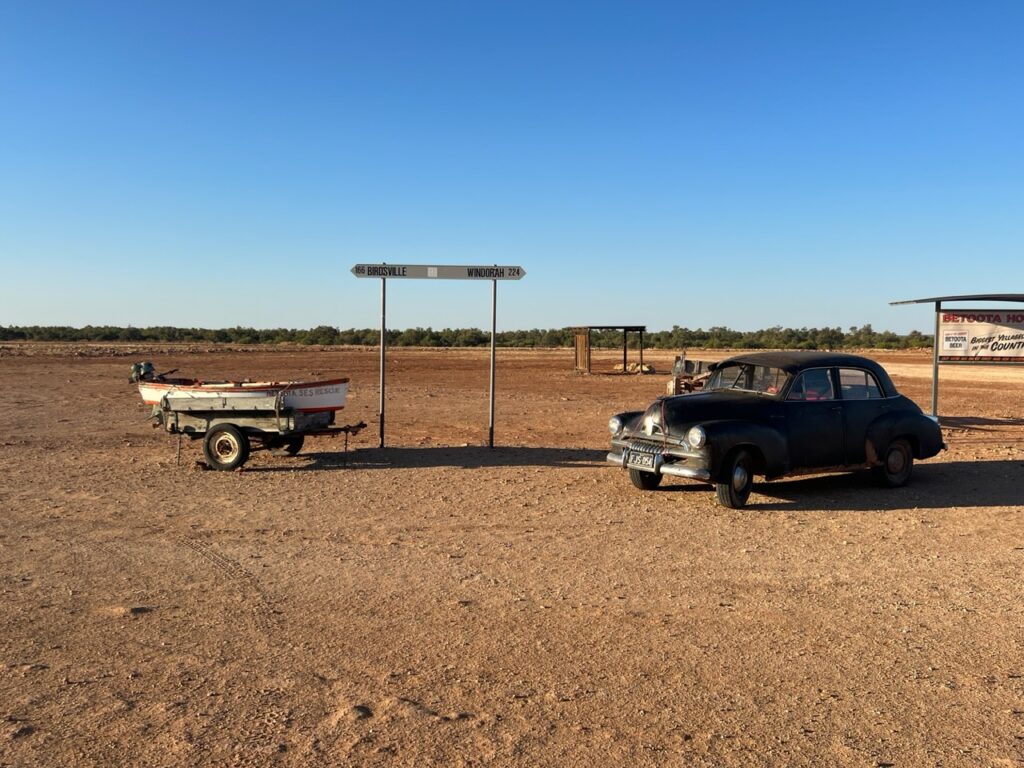
Recent travels.Lowering tire pressures for the gravel road to Betoota.Betoota Hotel.Lois at the bar of the Betoota Hotel with the proprietor, “Robbo”.Mid way between Windorah and Birdsville lies Betoota. A classic old Holden car on the right and a ( mock ) emergency services rescue boat on the left ( almost never any water nearby ! ).
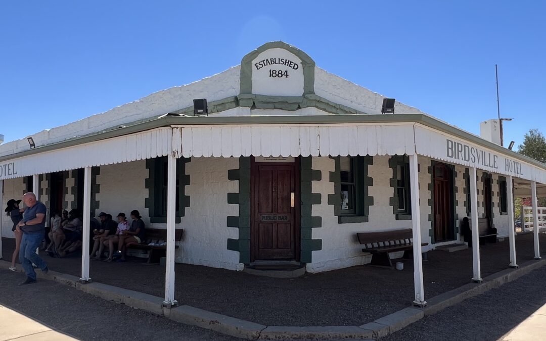
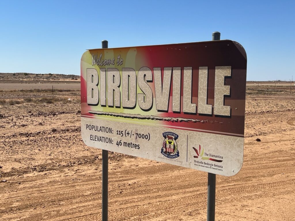
According to some, “You haven’t done the outback until you’ve been to Birdsville”. Or perhaps that was just a line created by the owners of the town’s eponymously named hotel – it being probably THE most recognized pub in the country, and, quite honestly, a major outback attraction in its own right. However desperate ( or not ) your desire to reach Birdsville, it draws travellers from far and wide, and, for a variety of reasons, is just one of those places most Australians ( and some international visitors ) have on their bucket list – it certainly was on ours.
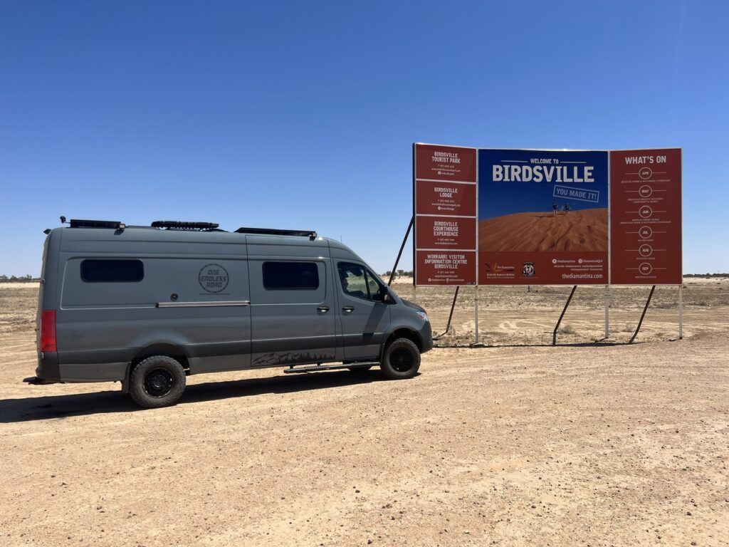
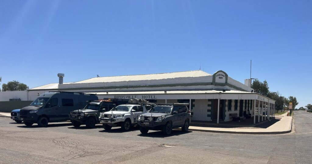
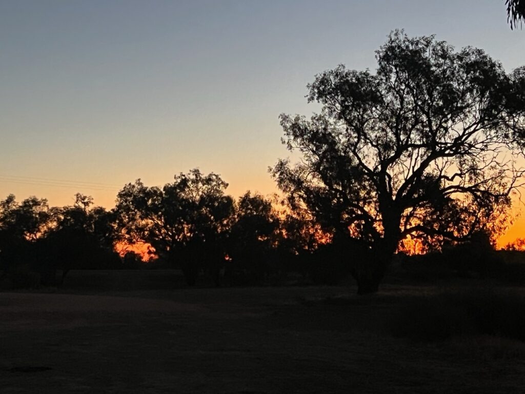
A big welcome sign on arrival in Birdsville says “You’ve Made It !” ( almost suggests that many don’t ! ).Birdsville is normally a sleepy place but the population explodes during the Birdsville horse races and the Big Red Bash.Parked up, Birdsville Hotel, Birdsville.Sunset, camping at Birdsville.
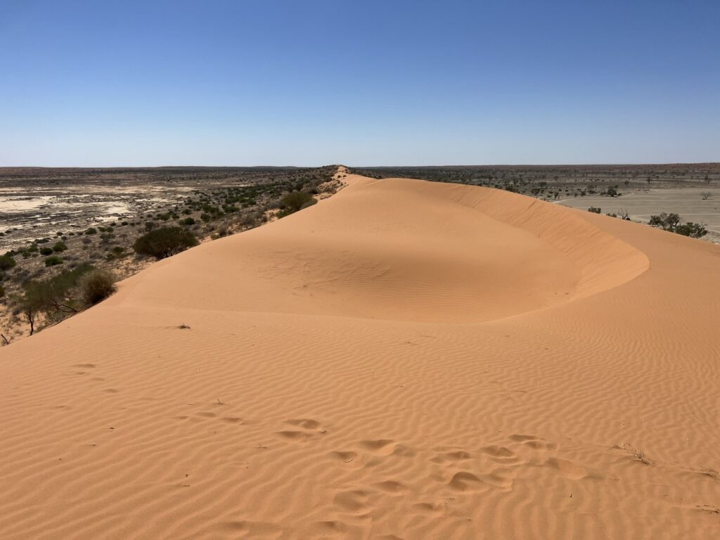
Not an easy place to get to and far from everything, if you are not flying in ( and most don’t ), you’re coming up the Birdsville Track from the south, down the Eyre Development Road from the north, or – as we were – on the Birdsville Development Road from the east. From Betoota it was an easy two hour drive into Birdsville leaving us most of the day to explore the town – a town of 80 people ( which swells to 7,000 during the races ) does not take long to explore so we tacked on a trip out to Big Red ( the massive sand dune on the edge of the Simpson Desert and venue of Birdsville’s famous Big Red Bash). No, we did NOT take a run at Big Red in the Sprinter ( we know its limitations ), a walk to the top being more than enough and itself a struggle in 38 degree heat.
View from the top of Big Red sand dune, Birdsville.
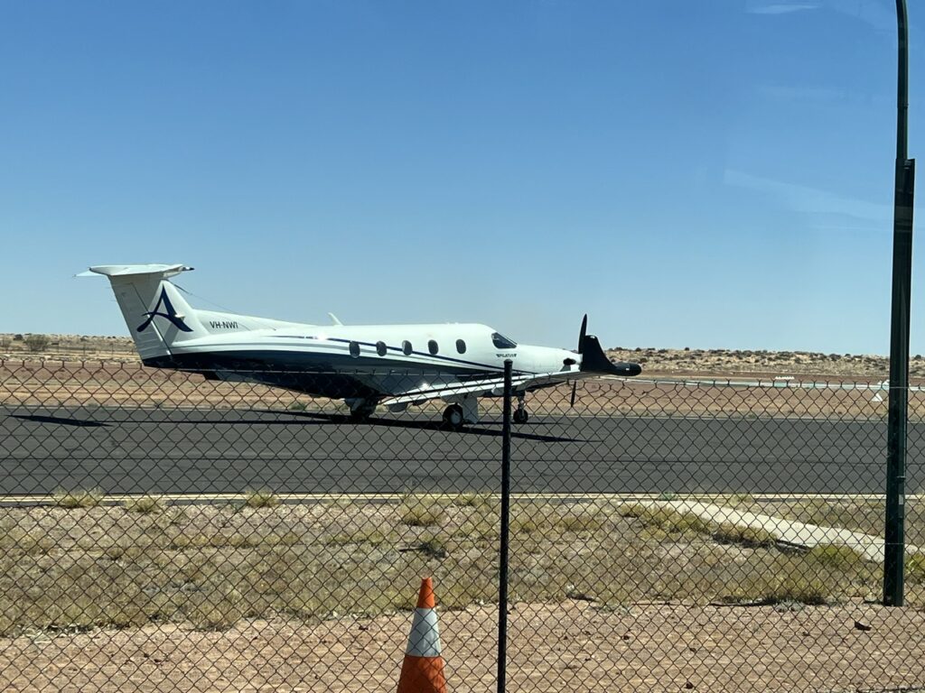
Central to the Birdsville experience is a pint or two at the pub – not difficult when it’s air conditioned inside and 38 degrees outside ! There is a ton of history there, usually a caste of interesting locals and at all times a throng of curious travellers passing though like us. Not all make the long drive, we discovered – parked just across the street from the pub’s front door was a small airplane that had just dropped off a dozen or so revellers; they were on some type of outback plane-based pub crawl it seemed. A couple of quick pints, a slew of selfies and they were off to another outback locale. No breathalyzer to worry about at least !
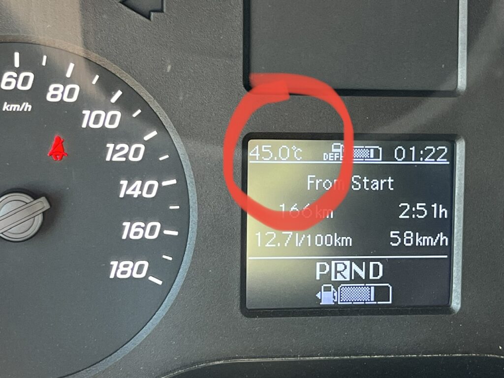
Came a long way for this drink !!!!!!Plane at Birdsville airport taking off with a group that were doing an outback pub tour.Did I say hot ? I meant, HOT !!! While it “only” touched the high 30’s outside in late September, inside the van was a blistering 45 degrees having been left in the sun while we went for a drink.
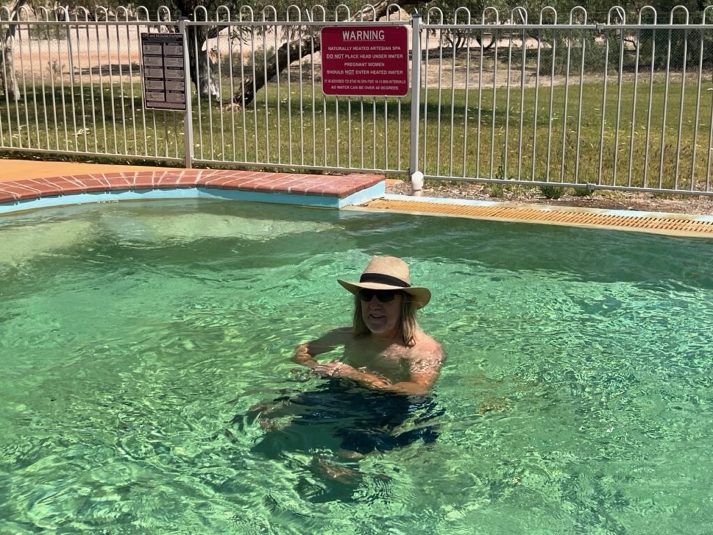
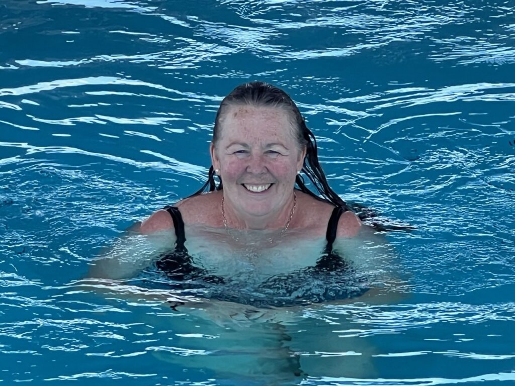
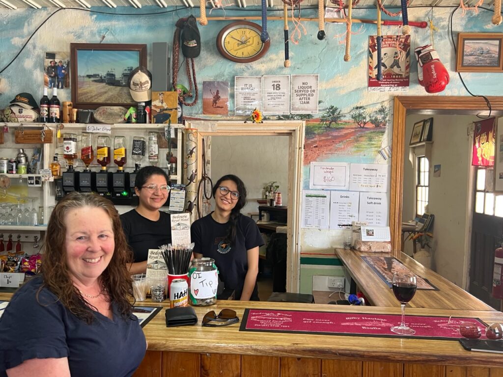
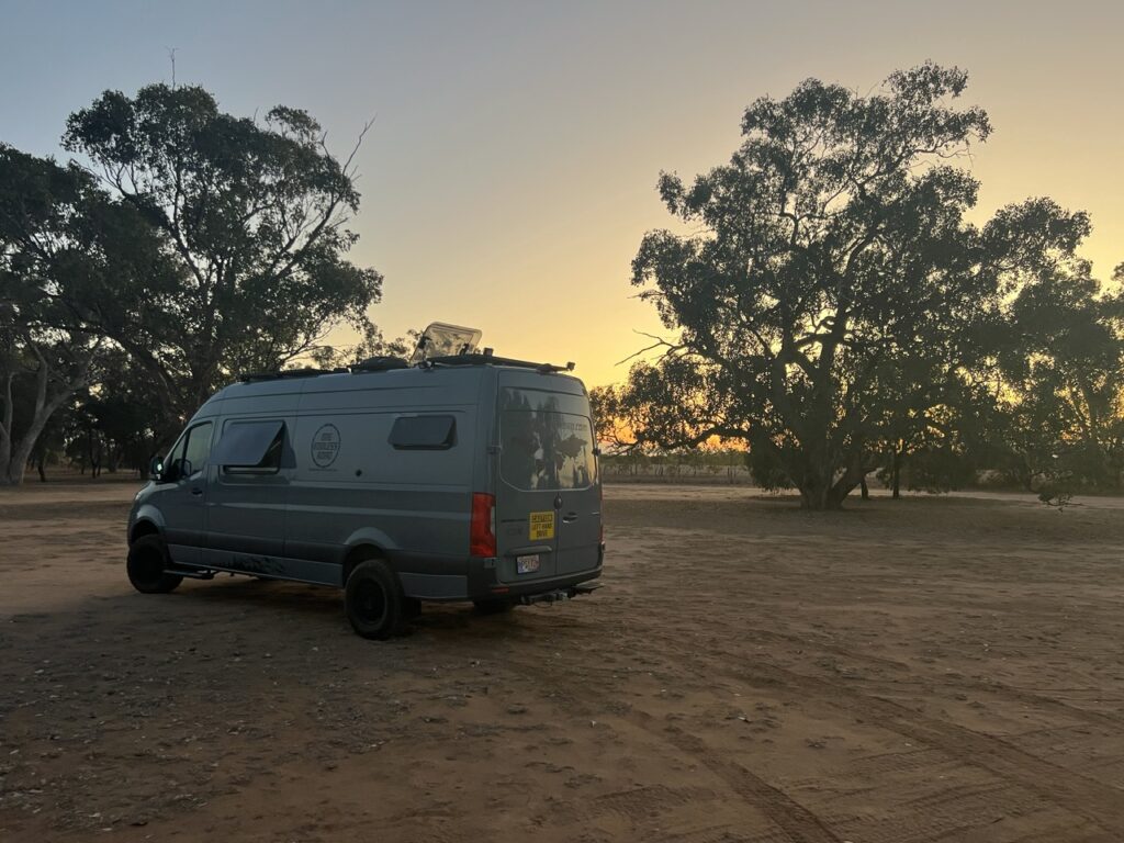
It being almost the end of season there were not as many visitors in town as we’d expected – it was, in fact, rather quiet. We’d find things much the same in other communities as we meandered north ( notable was the fact that what traffic we did see was all coming south with the imminent arrival of the wet season further north ). Leaving Birdsville we continued north, ultimately to Cloncurry over the next few days, and the scenery was little changed – flat, dry, often stoney desert for as far as the eye could see. And hot – always hot. It could have been worse – a month or two from now and the occasionally “uncomfortable” heat would become constantly “unbearable” heat – and stifling humidity. Still, we enjoyed some excellent remote camp spots and surprising attractions in the area’s smaller communities – a great thermal pool in Bedourie and some wonderful repartee with locals and a couple of South American bar tenders in Bedourie’s famed Royal Hotel. Lest you be thinking our travels have morphed into one big pub crawl, they haven’t ( though there are more pubs ahead ) – you simply don’t pass through these parts without experiencing their pubs, quite often camping at them, and always an integral part of the outback’s charm !
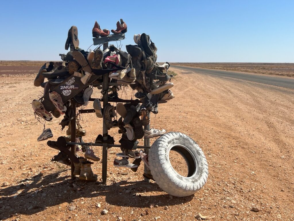
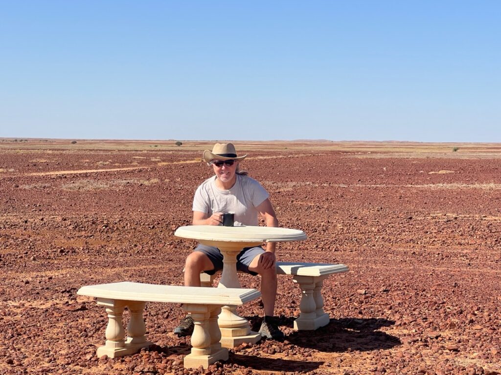
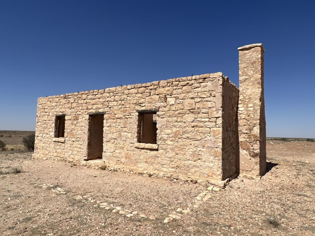
Someone started a “shoe tree” in the middle of the desert. It’s grown !Seat and table, sitting in the middle of the desert, north of Birdsville. Some wag placed these here as a joke many years ago. It’s just an odd sight in the middle of nowhere ! Stopped for a cup of tea there.Carcory ruins, north of Birdsville. All that survives of an original old homestead..The artesian spa in Bedourie was scalding hot .Lois was a bit smarter and stayed cool in the regular pool !Approaching Boulia one crosses the Tropic of Capricorn. Sadly we did not get to see the famous Min Min lights during our stay.
Just as we’d found in South Australia, and Western Australia, the whole outback pub/hospitality industry in Queensland heavily depends on young foreign workers, locally (and colloquially) referred to as “backpackers”. These days they come from every corner of the globe and all seem to revel in the experience. It certainly adds an interesting international element to the outback experience.
Lois in the Royal Hotel, Bedourie. Valerie, from Peru and Michelle, from Ecuador behind the bar adding a little international touch to this outback pub.
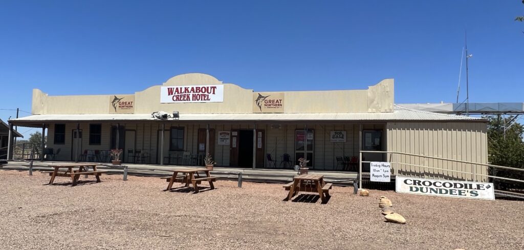
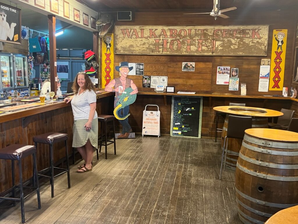
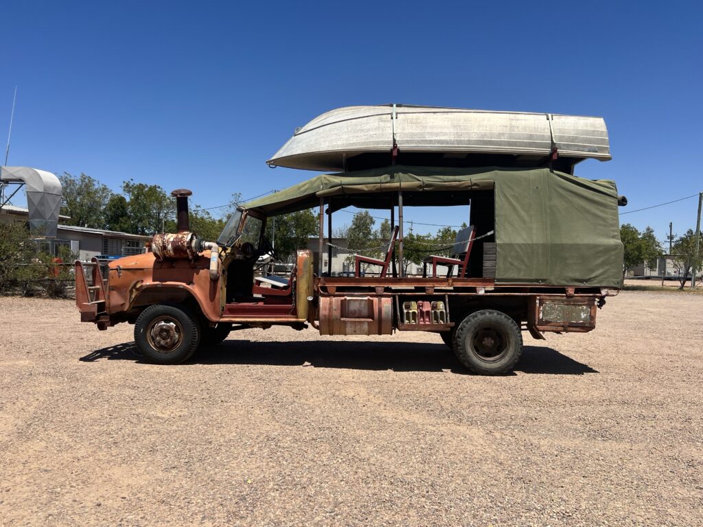
While Winton was our next major port of call, tiny McKinlay definitely warranted a stopover first for it was here that the mythical “Walkabout Creek Pub” ( of “Crocodile Dundee” fame ) is located. It’s a huge draw with lots of movie paraphernalia still visible, most notable Wally’s hunting truck which, incredibly, still runs ! We shared a few drinks with the owner and other customers and “got the skinny” on different aspects of the movie. Hard to believe it has been almost 40 years since that classic movie first hit the cinemas.
“The Walkabout Creek Hotel”.The bar – Walkabout Creek Hotel. Mick Dundee eternally holding up one end of the bar, crocodile in one arm and a cold one in the other !Remember this one ? Wally’s original truck from “Crocodile Dundee”.
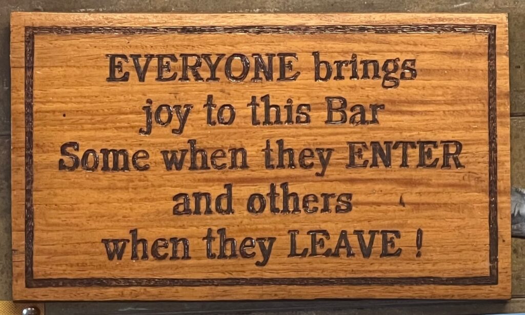
Will leave readers this week with a profound thought on pubs from the bar at the Walkabout Creek:
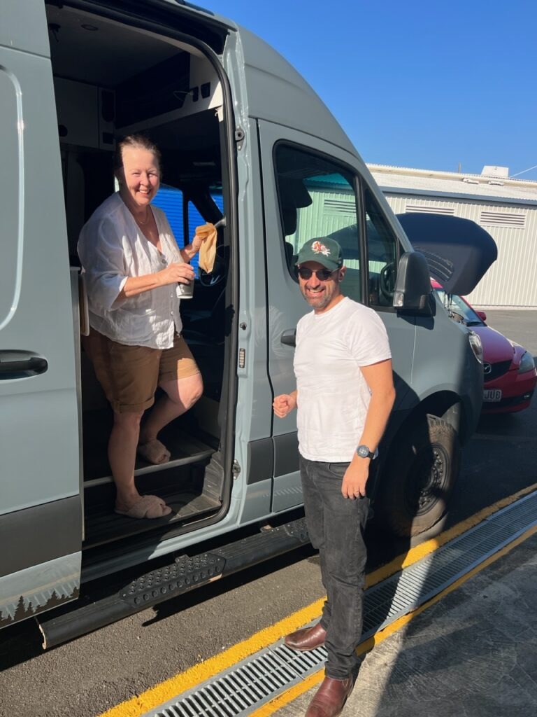
There are times on any journey when things don’t go quite as planned right from the get-go. Sadly, such occasions often portend further complications as the trip unfolds – our return to Brisbane was just such an experience. Or is it the “rule of three’s” – the old adage that misfortune usually comes in threes ? We’d recently had Covid, we had then been forced out of our home by fires – was there one more to come ( hopefully not as dramatic at least )? It seemed there was just a bit more drama in store before we could drive out of Brisbane in our van, picking up where we left off 7 weeks ago, heading to historic Birdsville.
After a minor mishap in Brisbane we were soon back on the road and heading for the “Outback”. Destination Birdsville.
Our plane was late out of Kelowna, which led to a very tight ( potential ) connection out of Vancouver. In fact the flight out of Vancouver was itself 40 mins late. No chance to pick up that time en route to Sydney since the flight was turbulent and the captain changed the route putting us even further behind. Need not have worried as it turned out – the onward flight to Brisbane was canceled anyway and the best alternate flight to our scheduled 10.00 am departure was one at 4pm. Yikes! Exhausted already after 18 hours travel and now another 6 hours sitting around at the airport ? Alas, if only a delayed flight was to be the extent of our struggles.
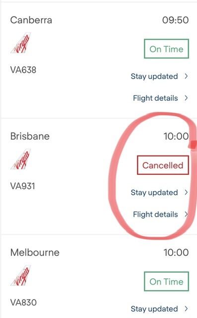
Appeared to be just one Virgin flight cancelled that day……..OURS !!
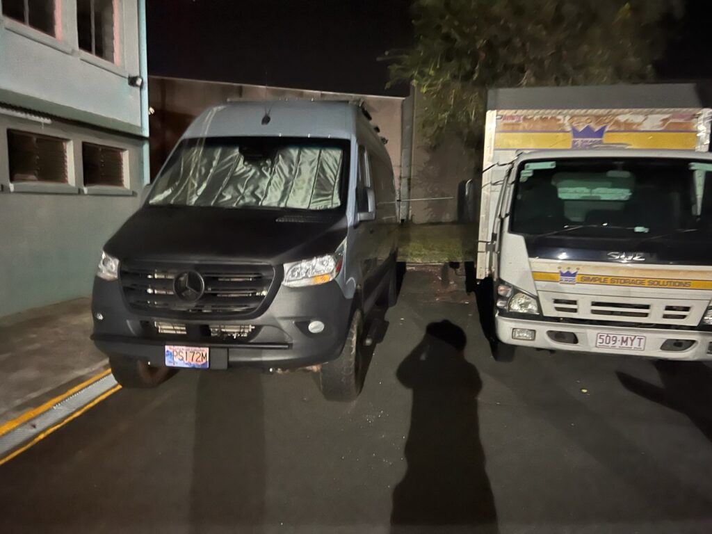
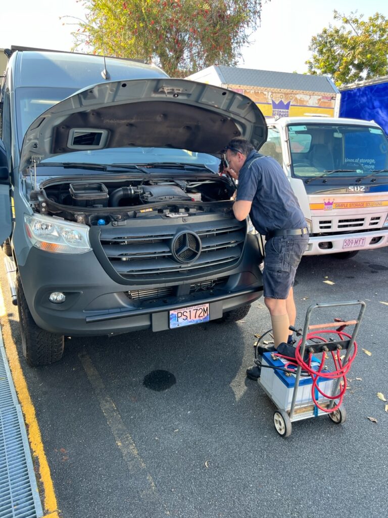
The Brisbane flight at least took off close to the scheduled time and we Uber’d from Brisbane airport to our van which was in storage nearby. Dark already as we pulled in, our general excitement soon gave way to despair – the van could not be opened. It appeared that, after almost 7 weeks in storage the battery was so flat it could not even generate enough power to open the electric door locks on the van. We used a manual workaround to actually open the doors so at least we could get in, and, if needed, lay down and get some much needed sleep. First thought was to call the RACQ ( the Queensland equivalent of our CAA ) who ( supposedly ) offered a reciprocal jump start service. Not so fast – according the RACQ, such service is only afforded to Australian registered vehicles. Ours is from Canada – no dice, she claimed. We opted to sleep in the van overnight and try for a jump in the am, being simply too exhausted to further argue the point.
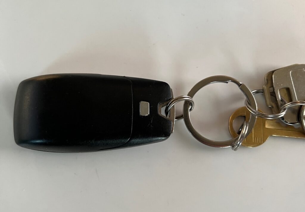
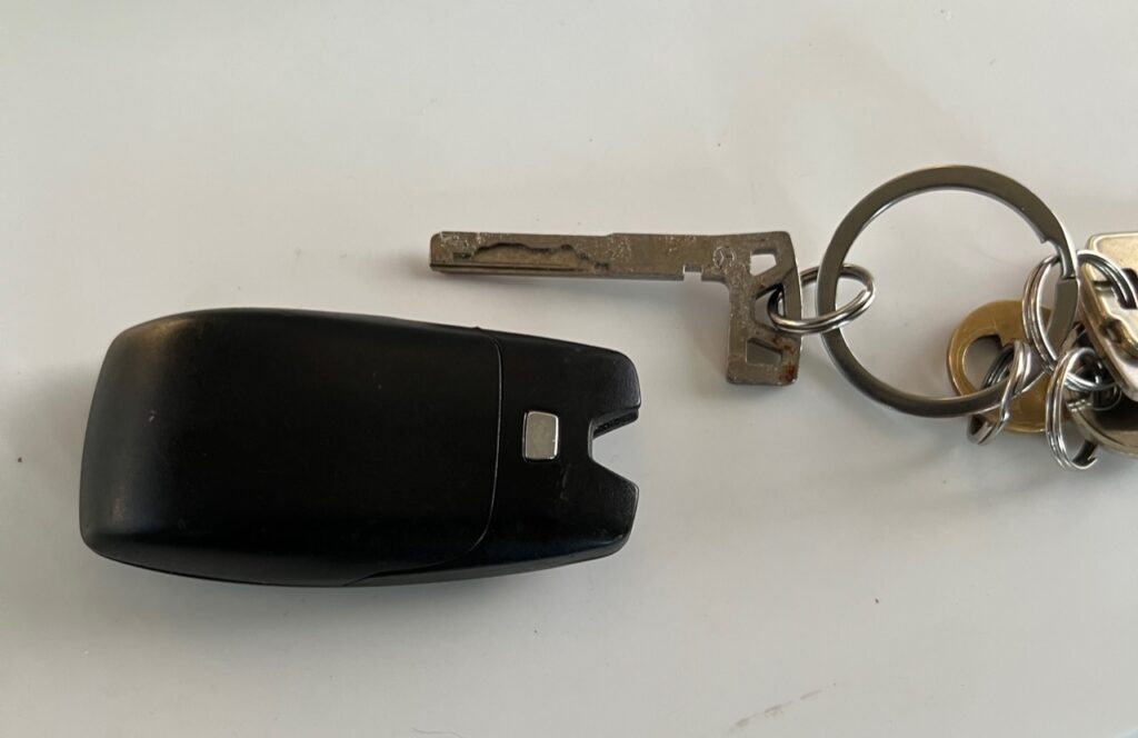
At first sight everything appeared OK with the van. Then we tried to open the doors……Unable to open the doors with the electronic fob, I happened to recall that there was a way to separate the actual “key” from the fob and do it manually. That at least got us inside and a bed for the night.Key – old style !
Fortunately, first thing in the am we could avail ourselves of the services of nearby auto-electrician, Carl Mackey. Carl’s shop was right across the street and he quickly identified a totally fried battery which was able to be replaced so we were soon on our way. Seems, rather miraculously ( so far anyway ) that anytime we’ve had major auto drama there’s been a guardian angel hovering nearby ( may it be forever thus !! ).
Prior to calling the auto electrician, our nephew in law, Luke ( who arrived with coffee ! ) gave it a good college try with jump starting.Fortunately an experienced auto electrician was ( literally ) across the street.
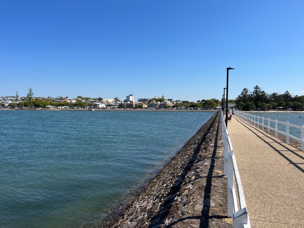
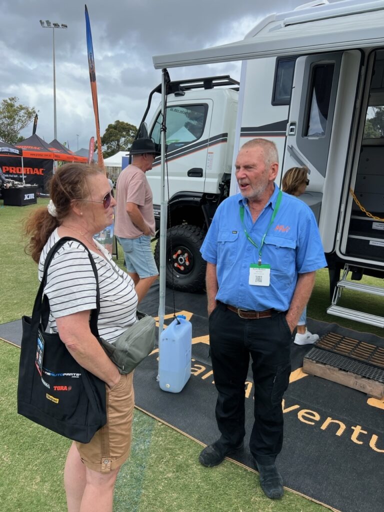
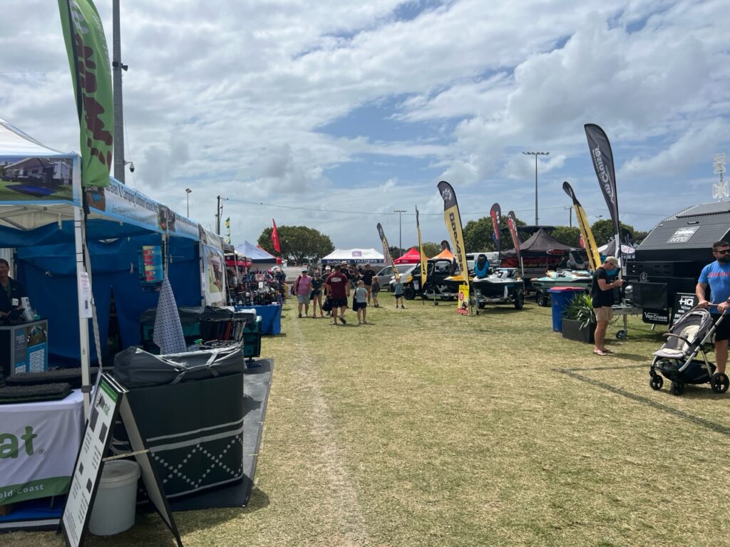
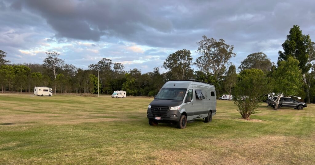
Van now operational, an overnight visit with our niece, Shannon and her family in Wynnum (Brisbane) gave us time to get the rig road-ready and for us to load up on supplies for the long journey west that lay ahead. Not, however, before a short detour north to the Sunshine Coast Camping and RV expo where we both explored the exhibits and made the personal acquaintance of veteran Aussie Overlander, Kym Bolton. Kym owns Australian Expedition Vehicles ( aav4x4.com.au ) and has overlanded much of the globe, most recently returning from 4 months in Japan with his 4×4 Fuso. He was a fount of information on matters relating to upcoming overland trips we hope to complete after Australia – his company makes an awfully impressive overland rig, too !
Iconic Wynnum Pier.Doing a little unwinding by the beach in Wynnum. ( Brisbane ).Lois, chatting with Kim Bolton of Australian Adventure Vehicles.
Beyond our chat with Kym it was interesting to contrast what’s popular in the RV/camping/4×4 space in Australia vs what one sees in the US/Canada where we have attended many such overland-style shows. One striking observation is that the traditional caravan ( “trailer” to North Americans ) still reigns supreme here, albeit very heavily beefed up for SERIOUS outback travel. We continue to be just blown away by how many we see. Vans, built or customized for off-road travel ( such as ours ), seem far less common although they are growing in popularity. Fifth Wheels are all but non- existent here whereas they are a dime a dozen in the US/Canada. A change we have noticed in the last 10 years in Oz is the re-emergence of traditional full-sized US trucks here ( RAMS are everywhere, Silverado’s quite common and Ford F150’s starting to appear). No threat yet, though, to a market still absolutely dominated by Toyota Hilux’s, Landcruisers and Ford Rangers !
Everything recreational was on display – boats, campers, trailers, vans, and accessories.
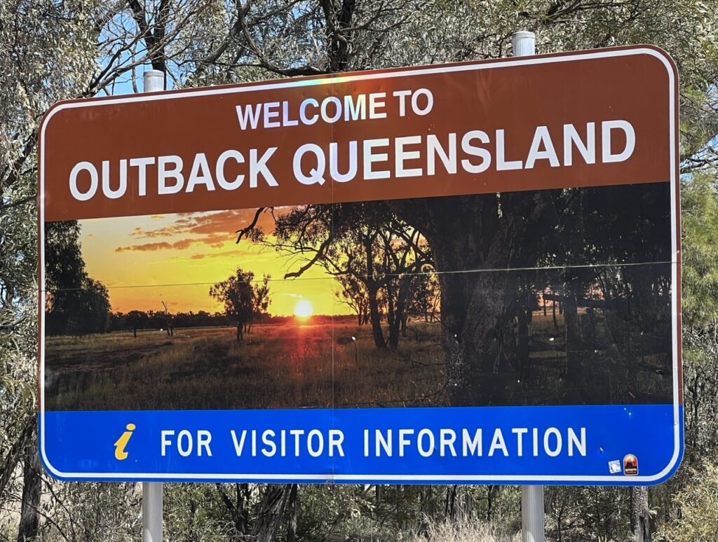
Now it was time to turn directly west, with about 1600kms between us and historic Birdsville, our next major destination. Over the next week the route took us from the Sunshine Coast ( Moolooloobah ) out through the Glass House Mountains and over the Great Dividing Range through the Darling Downs, Western Downs and then into what officially becomes the Queensland “Outback”. It was a wonderful drive through typical Queensland towns like Kilcoy, Blackbutt ( both of which have legendary bakeries ), Dalby ( hometown of Margot Robbie – yes, THE Margot Robbie, she of “Barbie” fame ), Roma and Charleville. Many of these places offered scenic diversions and/or historical points of interest, along with excellent municipal “bush” camping options; we must say that Queensland really does this exceptionally well – our personal camping experiences here vindicating everything we’d heard about in advance.
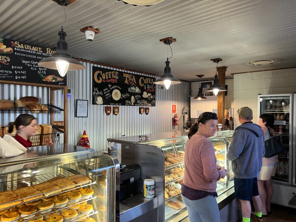
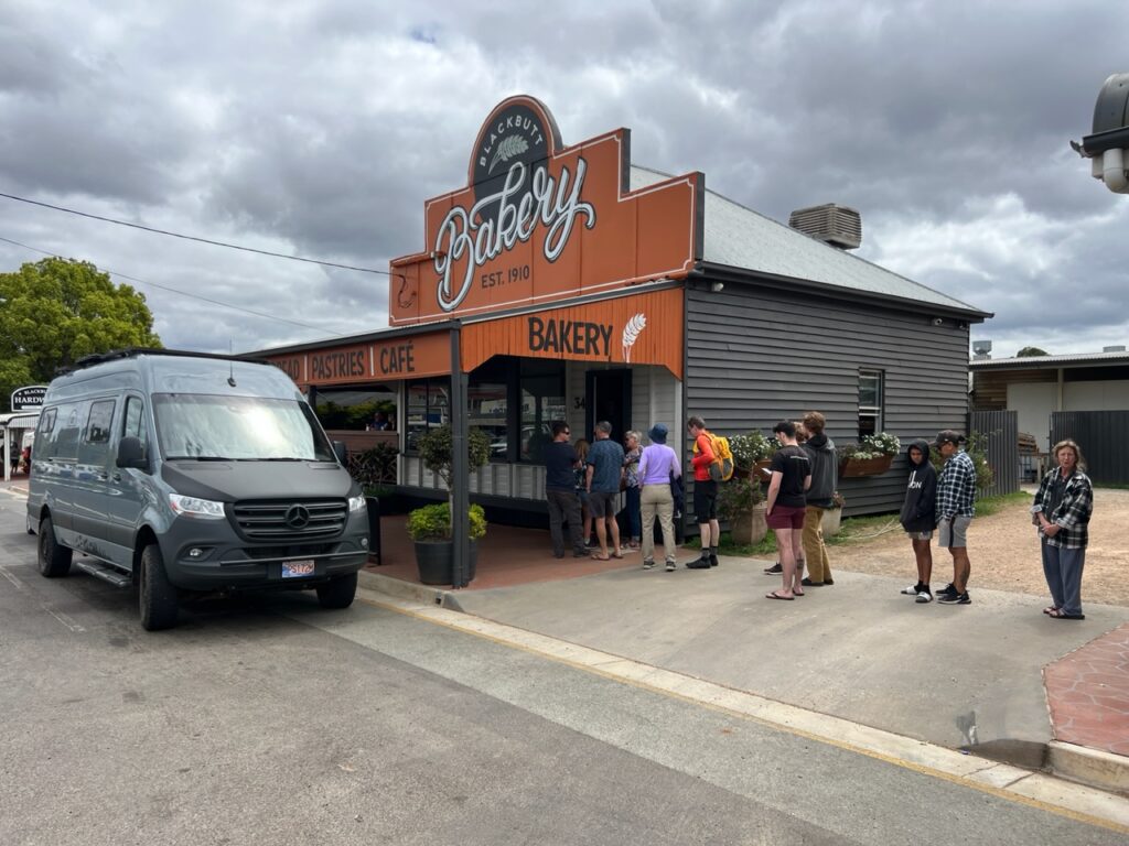
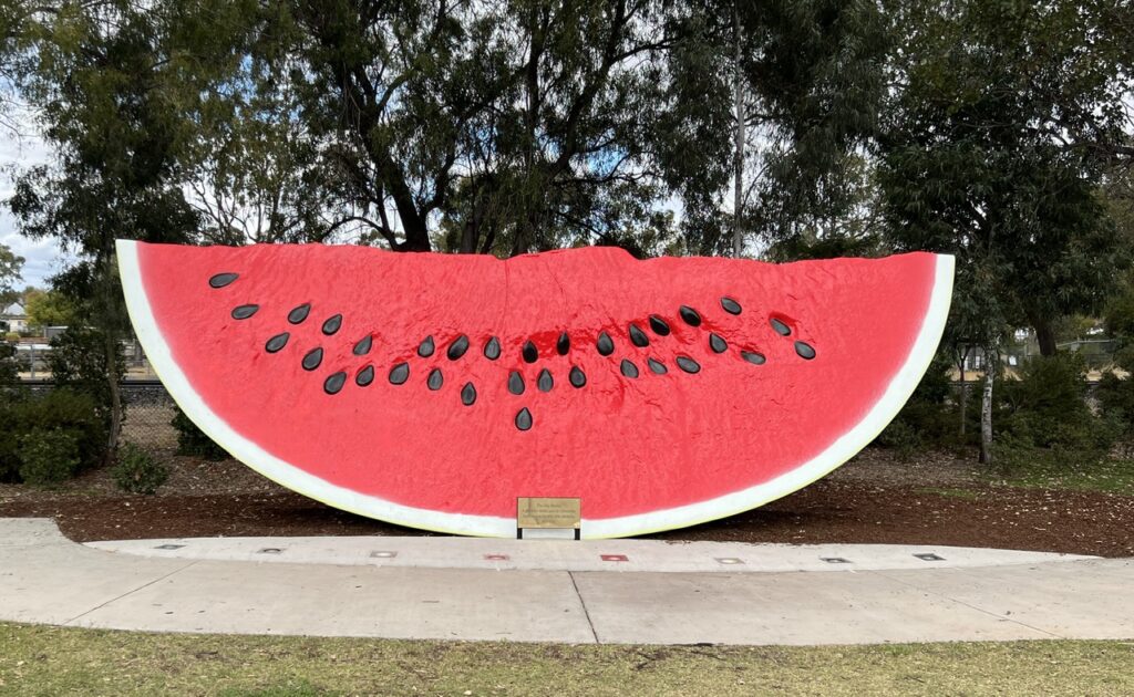
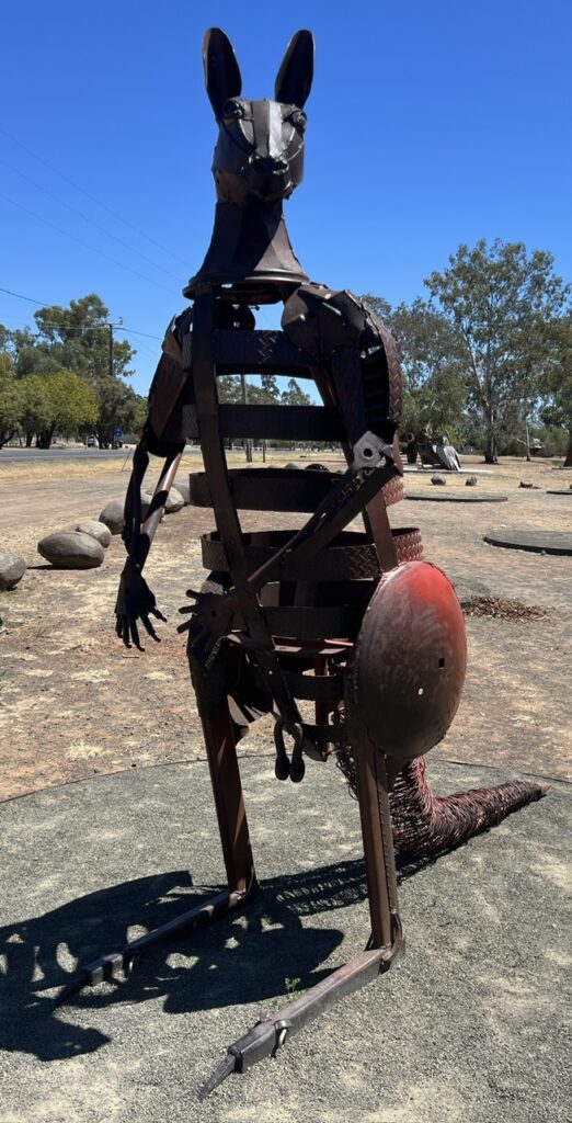
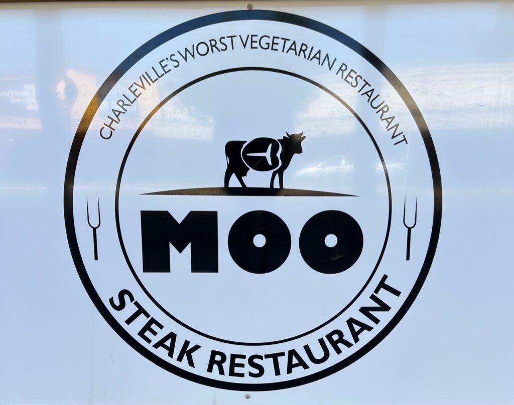
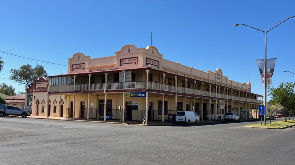
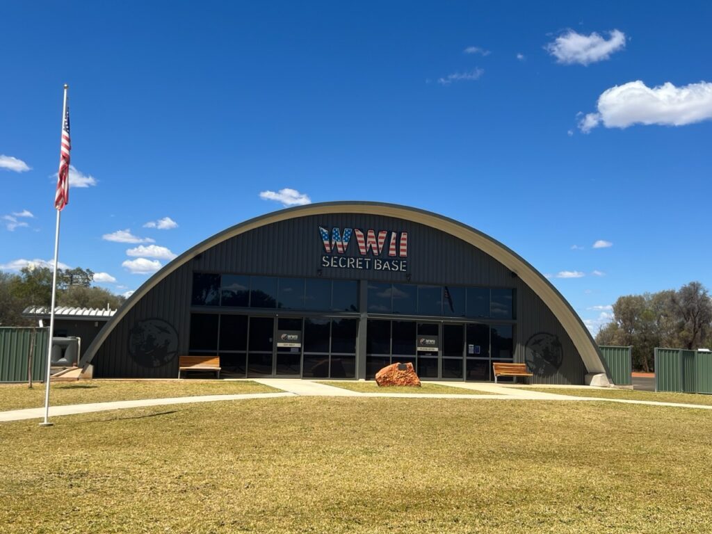
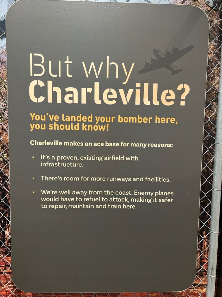
Kilcoy had a very popular little bakery – one of the pure delights or travelling rural Australia is finding these little local treasures.A long line up outside the Blackbutt Bakery, drawing crowds for over 110 years. The sausage rolls were the best we’d ever tasted. Ever !!!!!Australia’s iconic Kookaburra.The town of Chinchilla – famous for, among other things, the “Big Melon”. Well, a slice of melon at least !Approaching Roma. Long straight roads and massive coal trains.Roma has an interesting collection of eclectic outdoor metal art.Roma and nearby towns are famous for their “bottle” trees.And the “outback” begins !The camping in Charleville was indeed dusty – but hey, it was level and there was lots of room !Some local Charleville humor !Charleville’s most historic landmark, the Hotel Corones.Charleville was the location for a major US Air Force base during WW2. An excellent local museum recounts exactly what life was life here at that time.In case you wondered “Why Charleville ?”
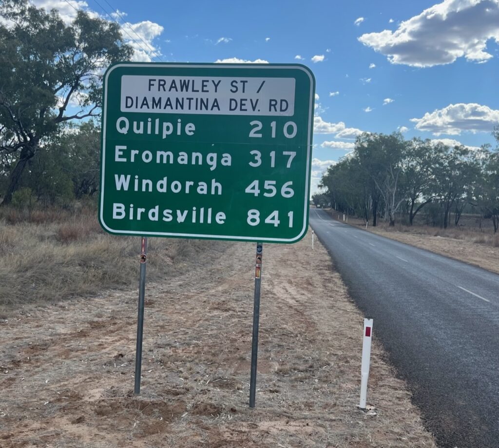
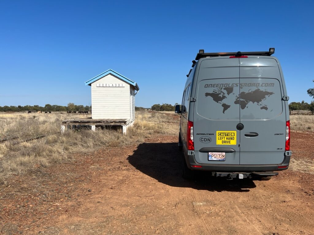
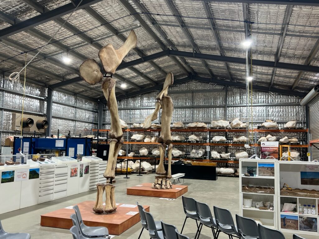
From Charleville ( practically speaking the last town of any size heading west ), the road, while still sealed, narrows considerably, at times being just one lane wide necessitating half the van off the bitumen when passing any oncoming vehicle. There was now a substantial reduction in road traffic and the towns ( settlements ) grew correspondingly smaller. Cooladdi, and Eromanga made for some interesting visits with overnight stops, the Natural History Museum in Eromanga being especially noteworthy. Who’d have known that giant dinosaurs once roamed these parts ?
We’d been driving for days but Birdsville was still a long way away.Cooladdi, considered Australia’s smallest town ( population 3 ). Like so many places an old rail siding is all that remains of what was once a thriving town. View from Baldy Top Lookout near Quilpie. The surroundings ( apart from this hill ) are as flat as the eye can see.Eromanga has an amazing Natural History Museum showcasing the extraordinary collection of dinosaur fossils that have been recovered in the area. Millions of years ago this part of Australia was a gigantic inland sea.
Next week we continue our journey- destination, Birdsville !
The PanAm completed in April, 2022 and with the truck camper sold, we shipped our new Sprinter van to Australia in late 2022. We travelled there through all of 2023 and into 2024 before shipping it up to North East Asia where we travelled for 4 months between Korea and Japan, before shipping it back to North America. It’s our plan to continue exploring the world in 2025.