True to form, Baja remained intensely hot for our last few days there – there would be no respite from the humidity either. Our route to La Paz ( point of departure for mainland Mexico ) took us north from Los Barriles to another great beach community – or should I say twin communities, La Ventana and El Sargento. We managed to find a great spot at the latter, a campground right on the beach but up high so that it included an amazing view of the bay. That was fine until the owner offered us an air conditioned casita ( small cabin ) for not much more so we quickly transitioned to that – like I said, it was HOT, and a pretty easy “sale” with humidity in the high 80’s ! No kite boarders around, apparently they descend on the place in November, so there were deals to be had. Again we found ourselves the ONLY people there until a local couple showed up late in the day – just incredible to see such beautiful beaches, lapped with crystal clear, warm water – and practically deserted. Such is the off season in Baja.
El Sargento beach and campground Our “casita” ( small cottage ), El Sargento beachView from the casitaLukewarm waters of the Sea of Cortez, La Ventana
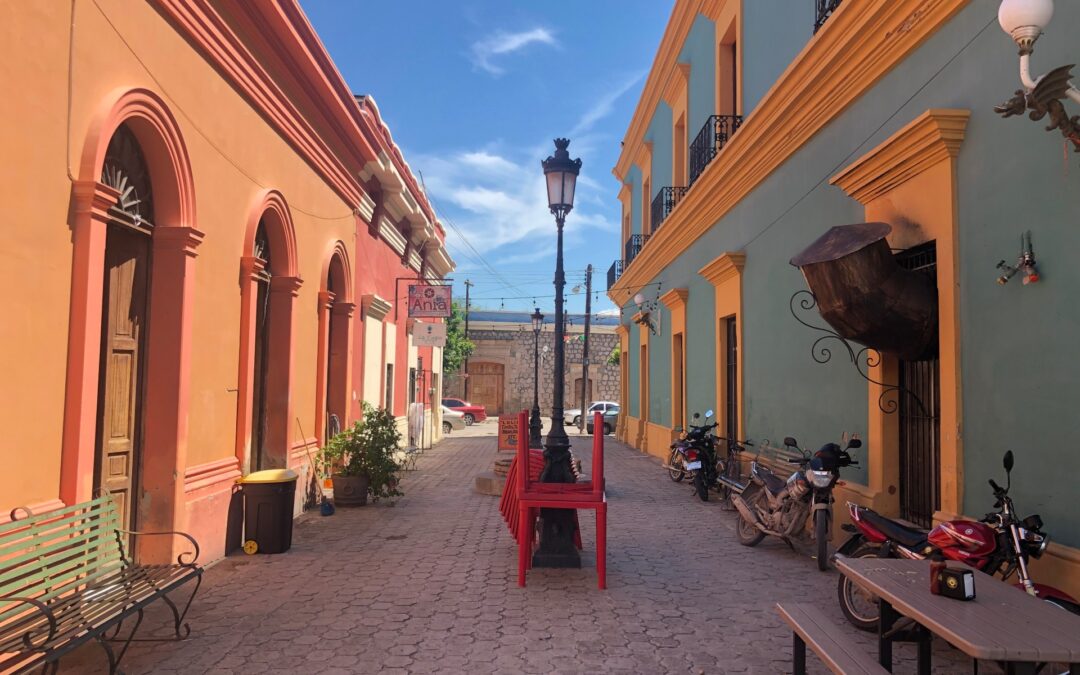
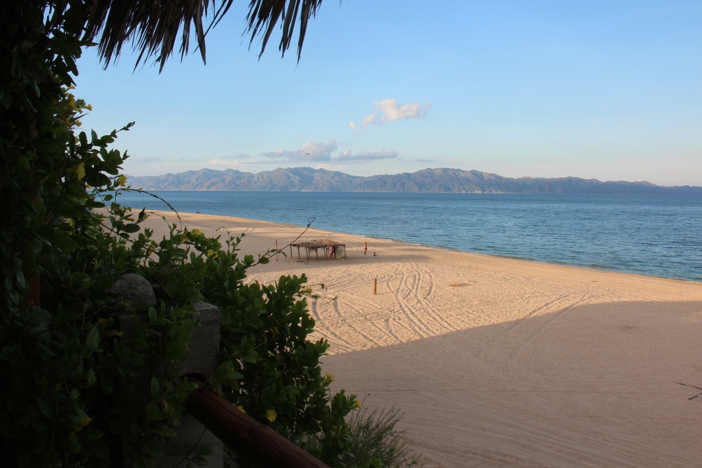
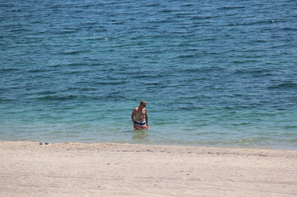
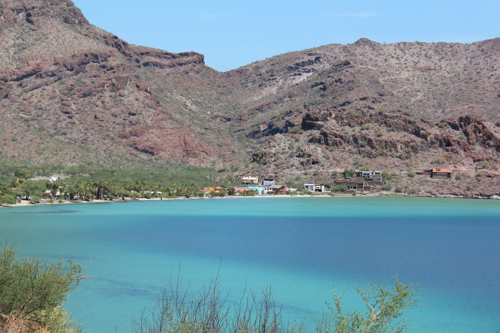
Despite the off season, we could not rely on just driving on to a ferry so chose a departure date in advance and decided to spend a few down days in La Paz, the capital of Baja California Sur. The city was actually a real surprise – not at all on Mexico’s top places to visit but well laid out, with history dating back to the times of the Spanish and one of the prettiest Malecon’s ( seaside boardwalks ) we have seen so far. More of a big-town feel with no apparent high-rise “Centro” . It gave us the opportunity to do some exploring, catch up on some shopping that needed to be done, walk the Malecon, sort out the ferry and visit its two famous beaches – Balandra and Tecolate. The former, where we spent more time, was stunning, as the pictures below attest – the latter, not so much ( but perhaps it was the dune buggy’s buzzing by at 120 km/h much of the time we were at Tecolate ! ).
Nice to have a pool in this weather….La PazColonial- era church, La PazColonial-era building down town, La Paz“La Paz”Tecolate beach, La PazLunch break at Tecolate beach, La PazStunning Balandra beach, La PazLois, at Balandra beach, La PazPrime location ! Balandra beach, La Paz
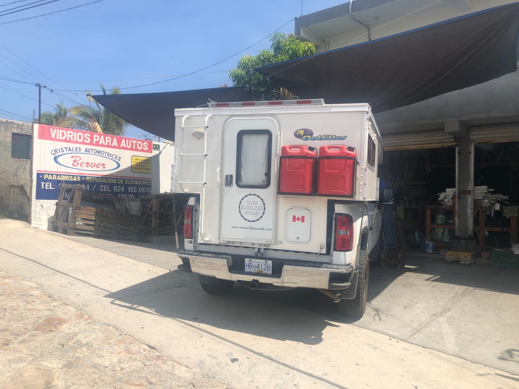
Leaving La Paz started out well – managed to get to the ferry terminal, check in, do the vehicle weight check, and clear the Aduana (customs) as expected . As a side note, Baja is one of those special economic zones and in some respects operates almost autonomously of the rest of Mexico – as such, when leaving, and crossing to Mexico proper, the procedure is somewhat like crossing the Mexican border all over again; passport checks, food inspections – the whole bit. It was when we got to the actual ferry – as in, ready to drive on – that we got an unpleasant surprise. I was told I need to go back and “change my ticket” – as I drove off the weigh scale earlier, someone had decided our truck with pop-up camper was in fact a “motor home” ( yes – a whole new rate class ). Protestations to the contrary were having no impact, Lois already on the ferry ( passengers board on foot ), and time ticking by options were limited. We were cut a little slack in the end- they decided it was just a “mini” motor home – but the cost had still more than doubled. The sad irony here was that we have occasionally lamented not having the space of a bigger motor home ( as unsuitable as it would be down here ) – on this day we wanted to have a truck / camper, but apparently we don’t !
Measured up, and…..yes, it’s definitely a “mini motor home” ! Of course…..
Six hours later the ferry was docking in Topolobampo ( port for Los Mochis) after an uneventful and very smooth crossing. The only other foreigners on board were a French couple who were wrapping up their own independent 3 week holiday in Mexico – interestingly, the wife’s first question to us was “Have you met many other travellers ?”They too, were shocked at how few were down here.
We’d been on the fence about whether to visit Barrancas Del Cobre ( Mexico’s famed Copper Canyon ). By all accounts, a world class sight, and larger ( by several times ) than its more well known northern neighbour, the Grand Canyon in Arizona. We ultimately decided to go for it and headed to El Fuerte, a convenient jumping off point for “El Chepe”, the train that takes you through the canyon and on to Chihuahua. El Fuerte is a pretty little town itself – another of Mexico’s “Pueblo Magicos” and with any interesting history and some great historical architecture. Sadly, our Wednesday arrival meant an almost two day wait for the next train on Friday and by then the weather had turned seriously bad high up in the mountains with a forecast for four more days of the same. Mexican Independence Day was fast approaching, this cramping our accommodation options ( we would not have our vehicle with us ) and with Lois having just been treated for an intestinal infection, it was decided the Copper Canyon excursion would have to wait – we expect to be in Mexico many times again in future and would do it in better conditions. Perhaps a different call if we were in a more far flung corner of the world for us – but for this, we could easily return.
Centro, El Fuerte ( “The Fort” )Preparations for Independence Day, El FuerteBumped in to these students who were anxious to practice English with usParts of the fort , El FuerteSide street, El Fuerte
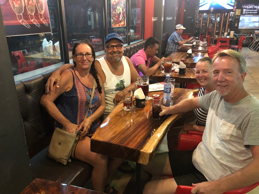
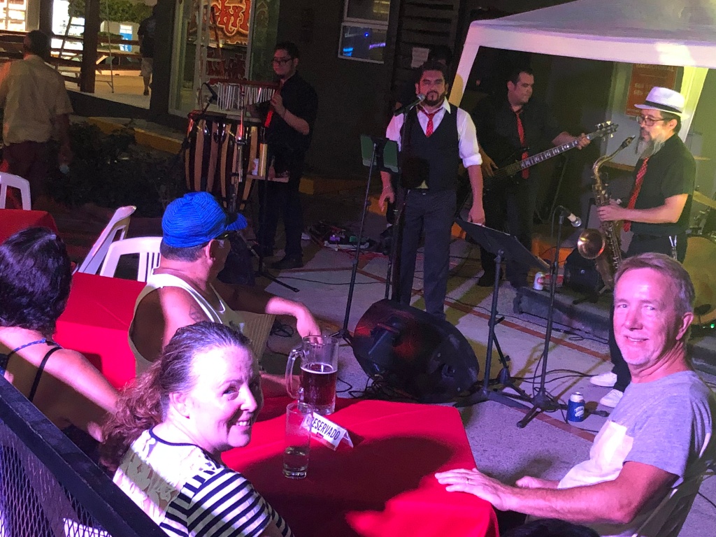
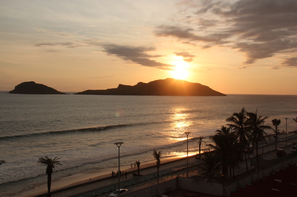
Fortunately, Mazatlan was the next stop on our travels south and a long anticipated visit with an old colleague of mine awaited. Pauline ( who worked with me many years ago ) had moved to Mexico 8 years ago from Canada. She was living with her fiancée Ted, in Mazatlan and had been waiting for us hoping we could join them for a few days, ideally over the Independence Day celebrations – a very big deal in Mexico ! A full days drive from El Fuerte got us to their beautiful condo right on the beach. Fantastic to catch up with them both, and to rest up for a few days – our reunion was celebrated with a night out at their favourite restaurant, watching a live band and a late night walk on Mazatlan’s 18km long Malecon – well, not all of it just quite yet – but perhaps over the next couple of days !
Another city sign – we seem to be collecting these. We love the colors!With Pauline and TedOut for dinner – live band playingView from their deckGreat location, right on the beach, and with a poolSunset from Pauline’s condo in Mazatlan
Regular “Mexico-goers” would attest that the southern half of the Baja peninsula offers more for the traveller than the north. Having now visited both we’d certainly agree. The north, frankly, for the most part for us was more of a means to an end – the part you had to travel through to get to the south. Ask anyone who has been here and names like San Jose Del Cabo, Cabo San Lucas, Loreto, Todos Santo all come to mind. Not many head to Tijuana, Ensenada or El Rosario. There are nice spots, for sure, several of which we enjoyed, but the main attractions ( and most of the tourists as well as Mexican government tourism investment pesos ) are found in the south. You don’t need to be here long to see it.
Flowering desert plants en route to Todos Santos
Leaving Loreto last week, the Transpeninsular took us up over the Sierra de la Giganta – in no time we had left the coast of the Sea of Cortez and were at a higher, cooler elevation which differed markedly from the mountain range further north – a whole lot greener. Once over the range, the terrain levelled off, with the curvy bends changing to long, straight flat roads that took us through the centre of the Baja and back generally towards the west coast, passing the towns of Ciudad Insurgentes and Constitucion before heading east again towards the outskirts of La Paz then our final 90kms, again crossing the peninsular, to the town of Todos Santos on the Pacific coast.
Lois trying to block the heat on one of our hotter desert drives
The oppressive humidity of the east coast fresh in our mind, we’d looked forward to Todos Santos and cooler Pacific breezes. While it delivered on that, we found Todos Santos leaving much the same impression as when we visited 7 years ago – a bit of a let down. The campground was, without doubt, the most eclectic, run-down, and simply odd places we’d ever stayed at. One of the residents told us he was in the “Witness Protection Program” – yes, that kind of place ! Had there been other choices ( there weren’t ) we’d have gone there. It was incredibly quiet, and not especially clean – pretty much just as we remembered it. The almost uniformly friendly and welcoming Mexican people ( we’d met so many ) were harder to find. A general indifference you might say. A big attraction here is the ( supposedly ) original Hotel California ( of The Eagles fame, where, “You can check out any time you like, but you can never leave” – that one ! ). We walked in and said to the concierge “So, this is the ‘real’ Hotel California, eh ?”, to which he hastily replied, “Well, we can’t prove it”. Kudos for honesty, I suppose but probably not what his boss would want to hear. And so it was with Todos Santos, just generally underwhelming.
Having at this point been 5 weeks in the camper we decided it was time for a break – a holiday from the holiday as it were. The days were great – an air conditioned truck, and sights to see but with humidity oppressive and a lot of things to be caught up on we decided to take a few days off and check in to a nice hotel in San Jose Del Cabo right at the bottom of the Baja. We were long overdue – the original plan was a nice hotel once a week and after almost 11 weeks on the road we were yet to check into a hotel anywhere. Cabo San Lucas itself was not appealing and very touristy so San Jose Del Cabo it was. A full 3 days of relaxing, relaxing and relaxing – not being on the move was bliss !
Los Cabos – approaching San Jose Del CaboMain square, old town of San Jose Del CaboThe food was awesome – teppanyaki in San JoseLoved the Chetraui store in Mexico – automated wine tasting !
One of the things we’d needed to attend to was some vehicle maintenance- a few days earlier we’d gotten a small chip in the windshield and needed that repaired. Left alone it surely would have widened and I did not fancy the prospect of replacing a whole windshield in Mexico or Central America. Fortunately a repair shop was found and our friend had us all patched up and on our way in less than 30 minutes. His work appeared good – I suppose time will tell – for now the “patch” was almost invisible.
In the ‘shop’ for a quick repairRepairing the crack in our windshield
Having reached the bottom of the Baja the next move was north with the great beaches of the Eastern Cape to be explored, along with Cabo Pulmo Marine Park. The road north took us past the Tropic of Cancer – not sure how, but we had obviously missed it on the way south ( we certainly crossed it – perhaps it was not marked very well ). From our start in the Arctic, this would be our second significant “latitudinal marker”, the Arctic Circle being the first. Next one, the Equator, in ( unsurprisingly) , Ecuador !
Following our handy iOverlander app, a great, quiet, secluded beach was mentioned at La Ribera, a mild detour from our route north – it more than met expectations; a clean, white sandy beach, well sheltered and with lots of locals using it ( always a good sign ) . The local Policia advised us we could stay for the night and that it would be “tranquillo, mui tranquillo”. Indeed it was- just us, some fisherman and the seagulls.
La Ribera beachWe were on our ownLooking east – just not the same sunsets as the Pacific side, obviously !
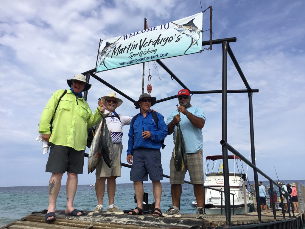
Others we had met advised us of Los Barriles, just a bit further north, and with many white sandy beaches we checked into a full service campground for a few nights. The pool was a nice relief- we were getting used to them – and most of the next couple of days was spent close by. Los Barriles is known as a snowbird favourite and we saw ( and met ) many – also a few Brits who were here for the famous tuna and marlin fishing. While not in evidence during our stay, apparently in November the place is packed with kite-boarders and ranks as one of the top 10 locations in the world – clearly there is more wind in November than in September !
Finally, a shaded camp site – scarce as hens teeth in Mexico ! Los BarillesBeach at Los BarrilesCampground at Los Barriles was part of a hotel – hence the poolAnd requisite beach-side bar
Los Barriles also provided us some time to think about our upcoming crossing of the Sea of Cortez. Few travellers fancy the drive all the way back up the Baja and fortunately a ferry exists just north in La Paz which gets travellers to the mainland in 6 hours. The Mazatlan route was not running ( low season ) so it would be to Topolobampo, 4 hours to the north. Having booked it for Tuesday next week we left ourselves a few more days to explore La Ventana and the Bay of Balandra before heading into La Paz for the crossing.
And a very warm welcome to Mexico it was – in more ways than one ! A stifling hot day at around 38 degrees but wonderfully welcoming and friendly Mexican authorities who made the border crossing a breeze. On display at all times was the typical Mexican charm and friendliness that international visitors invariably receive when arriving. No line up – we were automatically ‘approved’ via their red light/green light system and drove right across ! Were it not for our need to disclose that we would be there longer than 7 days and also exploring beyond just the Baja peninsular, that would have been it. The T.I.P. ( temporary import permit ) for the vehicle required a $400 USD deposit ( the amount is based on the age of vehicle – newer means more expensive ), refunded when we left as long as we did not stay more than 180 days. We also paid $30 USD each for our tourist cards because of our extended stay. The documentation process was seamless, if a little repetitive, and with a wad of papers in hand, 45 mins later we were on our way. We spent much longer getting in to the US ! While one can travel the Baja without a TIP, we will need one when we ferry from LaPaz to Mazatlan and others had advised that it was simply much easier and faster to do it as we entered in Tecate. Also nice to have that administrative detail out of the way early.
Was this part of ………the infamous “wall” ? Border crossing at Tecate
Tecate, on the US side, is a proverbially sleepy “one horse town” while on the Mexican side it is a much bigger place. We were easily able to re- stock our supplies ( having thrown out our remaining meats, veggies and cheeses before crossing – a complete waste as it turned out, since the Mexicans never asked if we had any with us ). The supermarket was stocked with everything we needed, including all the pancake mix and maple syrup Lois insisted we buy before leaving the US – “Jeff, I know they don’t have this stuff down there”. Well, we now have 10lbs of the former and a full litre of the latter – should see us through to Christmas !
Plenty of this stuff in Mexico as it turned out !
The goal on day one was to get in to Mexico, get the TIP, get stocked up, get cashed up ( ATM’s everywhere – and in English ) so with all that done before lunch it was on to Highway 3, the “Ruta Del Vino” through the Vallee de Guadalupe and on towards Ensenada. The original plan was to stay at a campground near Guadalupe – as we stopped in we noticed it was right on the highway. Having had our fill of sleepless nights in such places, we checked another spot nearby on iOverlander – it referred to a great winery ( “L.A. Cetto”, founded by an Italian in 1928 and one of Mexico’s oldest ) that offered tastings and wine sales (of course!) and through its participation in the Harvest Host program, allowed visitors to stay overnight. We had experienced the same routine at Tillamook, back in Oregon ( the Blue Heron Cheese Factory ) so knew the drill well. Not only was the wine tasting a lot of fun, and the wine good, but the young server there ( Adrian ) also gave us some great Baja tips and was very excited to tell us he was about to head off to Canada for 2 weeks. Not just Canada, not just BC, but right to our home town of Kelowna where he was going to work in the same capacity at the “Off The Grid” winery – talk about a small world ! And, we had the winery to ourselves for a night. Peaceful, quiet, and watched over all the while by their 24 hour guard. The drive through the Ruta Del Vino was scenic but otherwise uneventful – in fact, until just before we got there we had no idea Mexico even had a wine industry so we were amazed at all the vineyards- this is where most of their wine comes from.
Lois at LA Cetto winery with AdrianGrapes at LA CettoCamped at the wineryLA Cetto winery
In Ensenada we picked up a new SIM card and were astonished at how generous and flexible they are in Mexico – lots of data ( 3 MB ) along with unlimited calls, and texts within Mexico, the US, and Canada with no contract all for 200 pesos ( $10 USD ) – you cant touch that where we live ! Ensenada itself is not especially appealing – we knew we had to get further south for the good stuff so used the rest of the day to get through the series of small, dusty towns that line Highway 1 to the south. It quickly became obvious that it would be pretty slow going on the Baja, at least the northern half; seemed like we spent most of the day in the truck ( we actually didn’t ) and only travelled 200kms. Lots of road work, lots of towns but the scenery did start to improve with glimpses of the coast here and there.
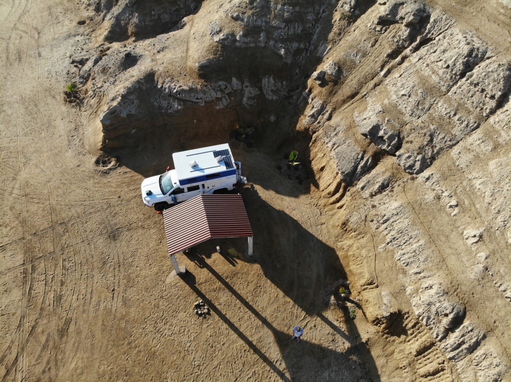
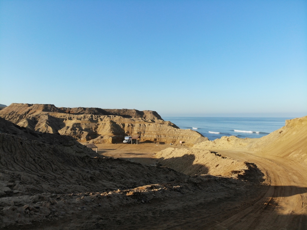
While our first night camping near San Quintin was not especially memorable ( except for the sunsets – such beautiful sunsets here ), a short drive the next day had us just north of El Rosario where we pulled into a site that other overlanders had raved about. Canyon Camp was a privately owned piece of beachfront in a secluded canyon whose owner appeared to be preparing it to be a formal campsite. Meanwhile, overlanders were welcome to use it at no cost. Complete with basic toilets, palapa and BBQ areas, it was indeed a great find. Bonus – we had it all to ourselves for the time we were there save for a visit by some local fisherman and the owner’s brother who had come to water the palm trees. Truly memorable spot – beautiful, quiet, easy to get to and with no city lights in the area it was a wonderful night just to star-gaze. Managed to get the drone out and got a couple of great shots from above before a minor mishap occurred and the drone went off on its own – fortunately landing safely on land and not in the Pacific !
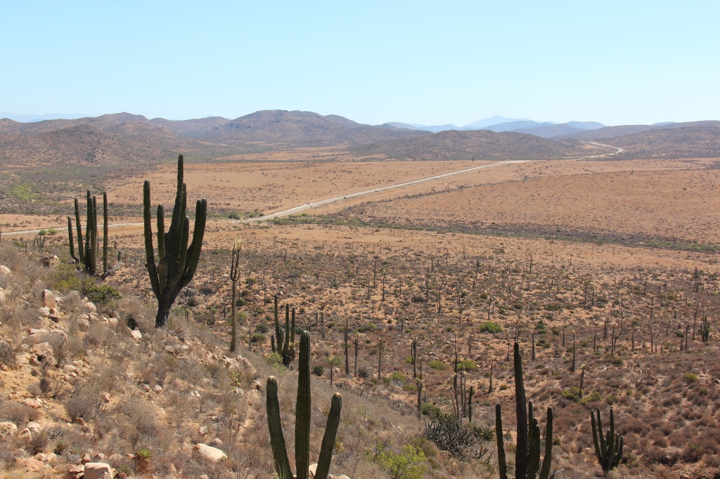
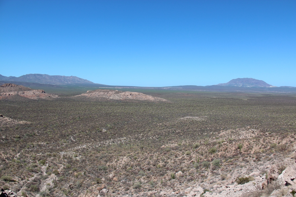
While we could have stayed longer at Canyon camp, we had left ourselves short of some necessities so drove on the next afternoon making our way south on the “Transpeninsulare” ( the main, and really only, road through the Baja ) through what one might describe as the spine of Baja – a long stretch down the middle, neither the Pacific ( to the west ) nor the Sea of Cortez ( to our east) visible most of the time. Very typical Baja scenery in this part – dry, rocky hills, lots of cactus everywhere, very hot and very long stretches between towns. There is a real abscence of shade trees here so, absent a good air conditioner it is hard to escape the heat. At least in this part of Baja it was ‘dry’ heat. That would soon change !
Lots and lots of these !
The town of Guerrero Negro divides the Baja peninsular in two – to the north, Baja California and to the south ( an hour ahead and on Mountain time ), Baja California Sur. Apart from being the beginning of generally better quality roads than in the north, it is as non-descript a place as you will find anywhere and was no more than a pit stop and simple overnight here….Mulege and the famous beaches of Bahia Conception lay just beyond.
Welcome to Baja California Sur ( south ), Guerrero NegroTypical southern Baja sceneryA small part of the long straight stretch, Guerrero Negro
Mulege is somewhat of an oasis town and very popular with gringo “snowbirds” ( retirees escaping the northern winter ) but they come down in November – not August. It’s easy to see why – in Mulege, as pretty as it was with palm trees and cobblestone streets, it is stiflingly humid this time of year. Brutally so in fact. That and the blitz storm at 2.00 am made for an unpleasant layover. We’d load up next morning and explore the beaches, where, we figured, it “had to be” cooler. The beaches were stunning indeed – and, again, we had them all to ourselves. At every turn on the road south a new vista opened up more white sand, more palapa’s, more stunning turquoise sea – and no people. If you wanted privacy, this was indeed your place ! Some friendly locals advised us that the Sea of Cortez side of Baja, not getting a true ocean breeze, is always hotter and much more humid than the Pacific side. The humidity here was not going to change so we decided we’d spend our beach time on the west coast – lots of options further south !
Typical scenery, Guerrero Negro to MulegeCampsite at MulegeYou can get this close to the beach at Bahia ConceptionPerfectly clear and warm water – and the air temperature was 38 degrees The turquoise waters of Bahia ConceptionCoyote beach, Bahia ConceptionScenery en route to Loreto from Mulege
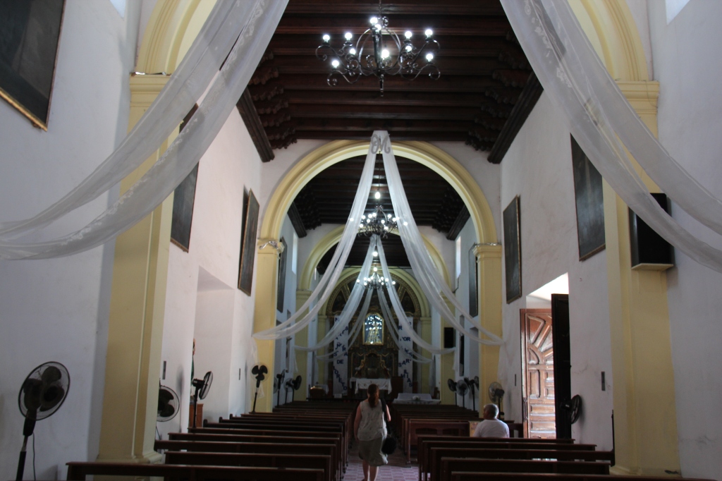
Prior to getting to the southern beaches of Cabo San Lucas, Todos Santos and others, we did get to enjoy a restful couple of days at what must rate as one of Baja’s real gems – the town of Loreto. Picturesque, easy to navigate, filled with history ( the original Spanish settlement on the Baja occurred here in1697 ), great food and friendly people it was delightful. Making life much easier for us, the campground was located right downtown – a 1 minute walk to the Malecon, town square and all the sights including Loreto’s signature 250 year old “Mission”. A great spot for those who like a laid back feel and who want to walk everywhere.
Loreto, downtownHotel LoretoOriginal Loreto churchInside the church, much still original
Our week drew to a close in Loreto – we’d really enjoyed this place, and got great tips on the southern Baja from Ed, a resident American living in Loreto. Ed had a peculiar talent rare among Americans ( in fact, rare even among Australians ) – he played the didgeridoo! After beers one night he said he’d surprise us – not in a million years did I expect to hear an American play the didgeridoo !
Ed, playing the didgeridoo !
We’re always on the lookout for interesting signs and while we don’t generally pay much attention to local graffiti, this one caught our eye – as we all know, much of the western USA once belonged to Mexico and the fellow who scrawled this one certainly had a creative solution for Mr Trump’s problem with unwanted immigrants from the south; check this one out !
Too many Mexican immigrants in the US …? How about this !
Last post had us arriving in San Francisco, or rather Sausalito to be more precise. Sausalito is a cosmopolitan little community known for its vibrant art scene and great restaurants, just over the Golden Gate Bridge. Popular with “yachties” ( because of the marina ) and day tripping tourists from San Francisco, the ferry ride between the two gives great views of the Golden Gate Bridge, Alcatraz island and the city itself of course. Staying in Sausalito kills many birds with one stone as it were. Finding a campground in or near San Francisco is a real challenge – but our handy little iOverlander app alerted us to a great, somewhat legal, ‘stealth’ spot right by the marina in Sausalito . Accommodation issue solved !
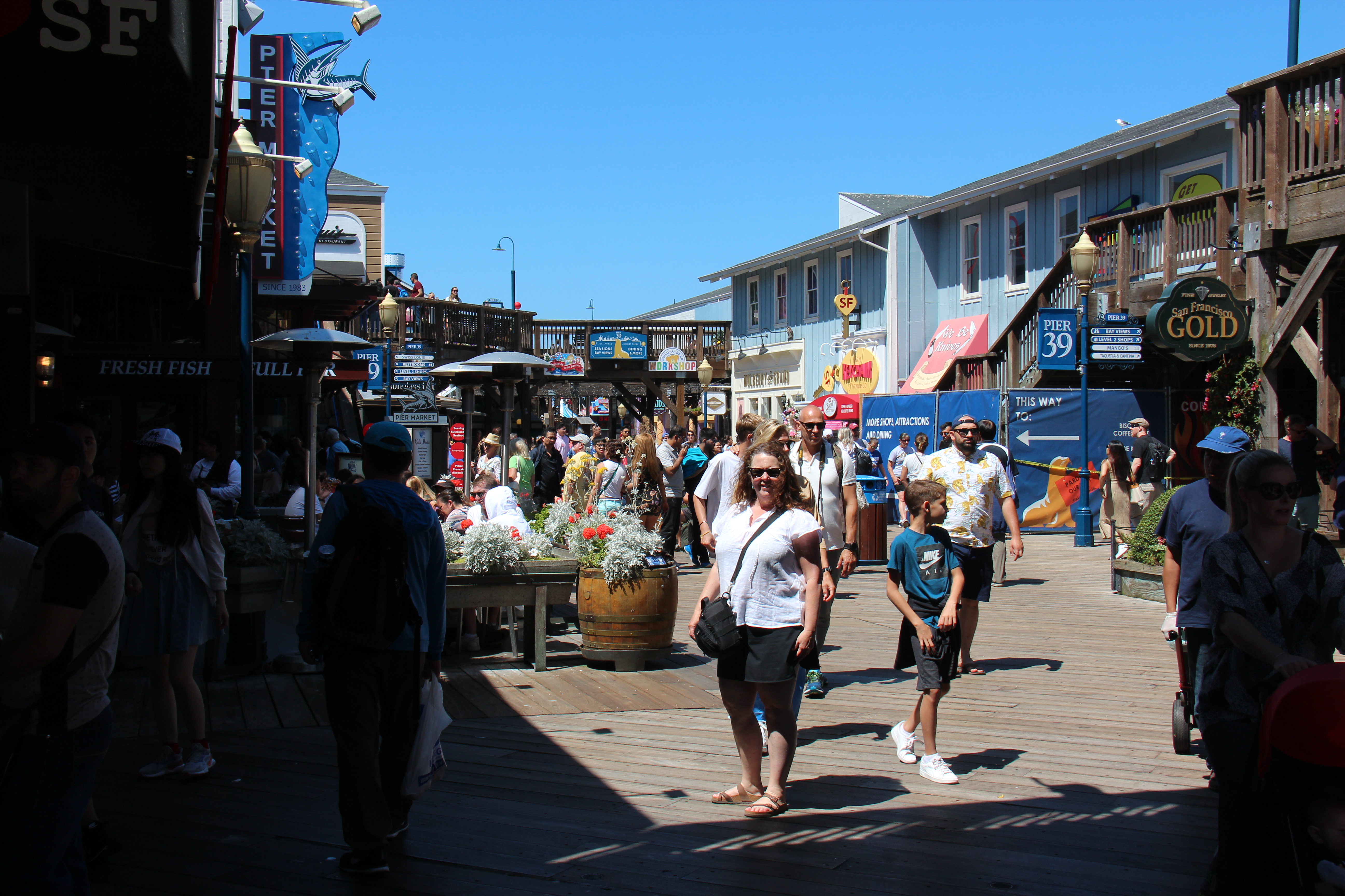
Crossing San Francisco Bay, Golden Gate Bridge in backgroundGolden Gate from Sausalito ferryAlcatraz Island in the morningCable car on Hyde StLois at Pier 39Only in California…..Cable car
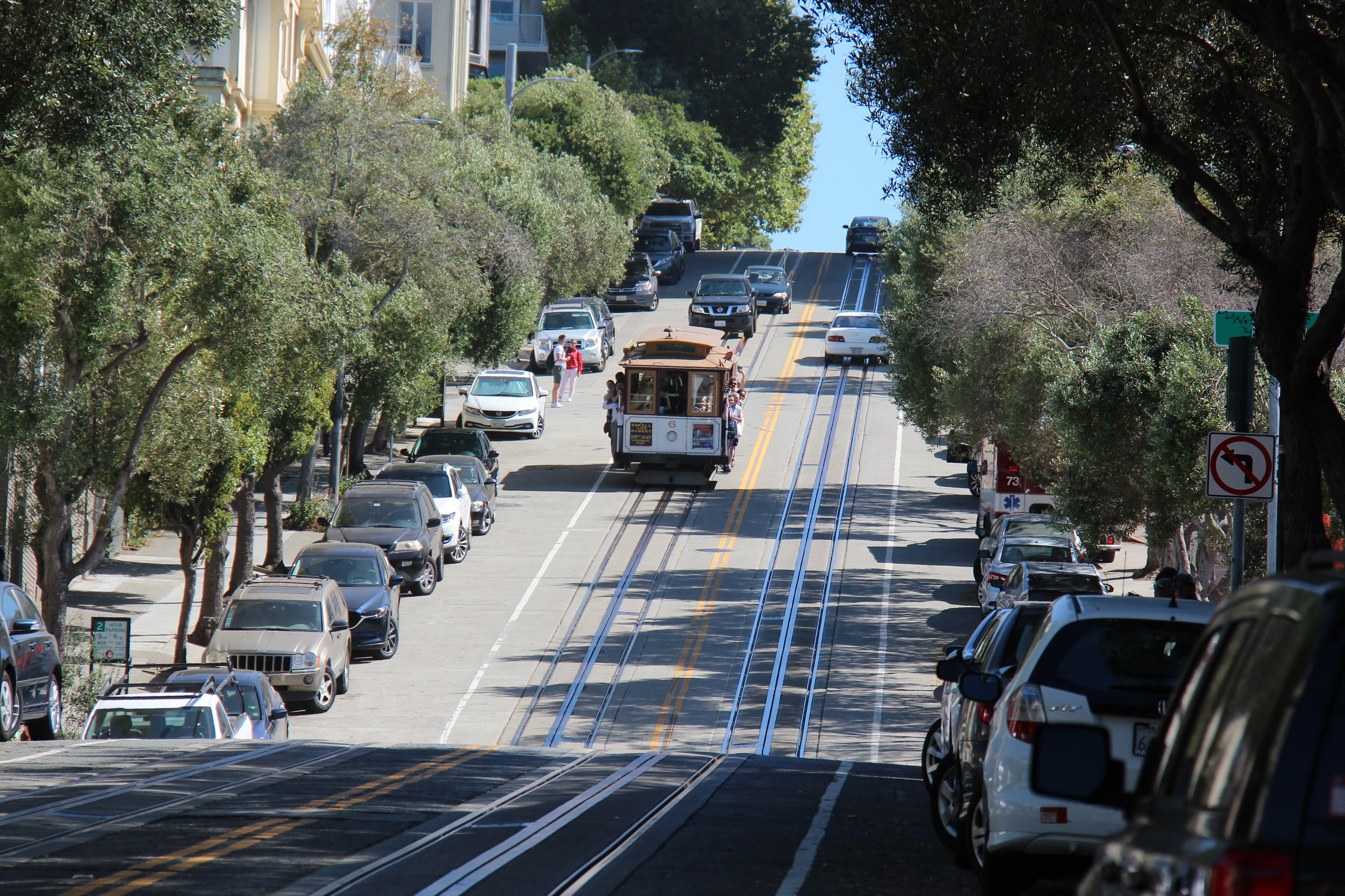
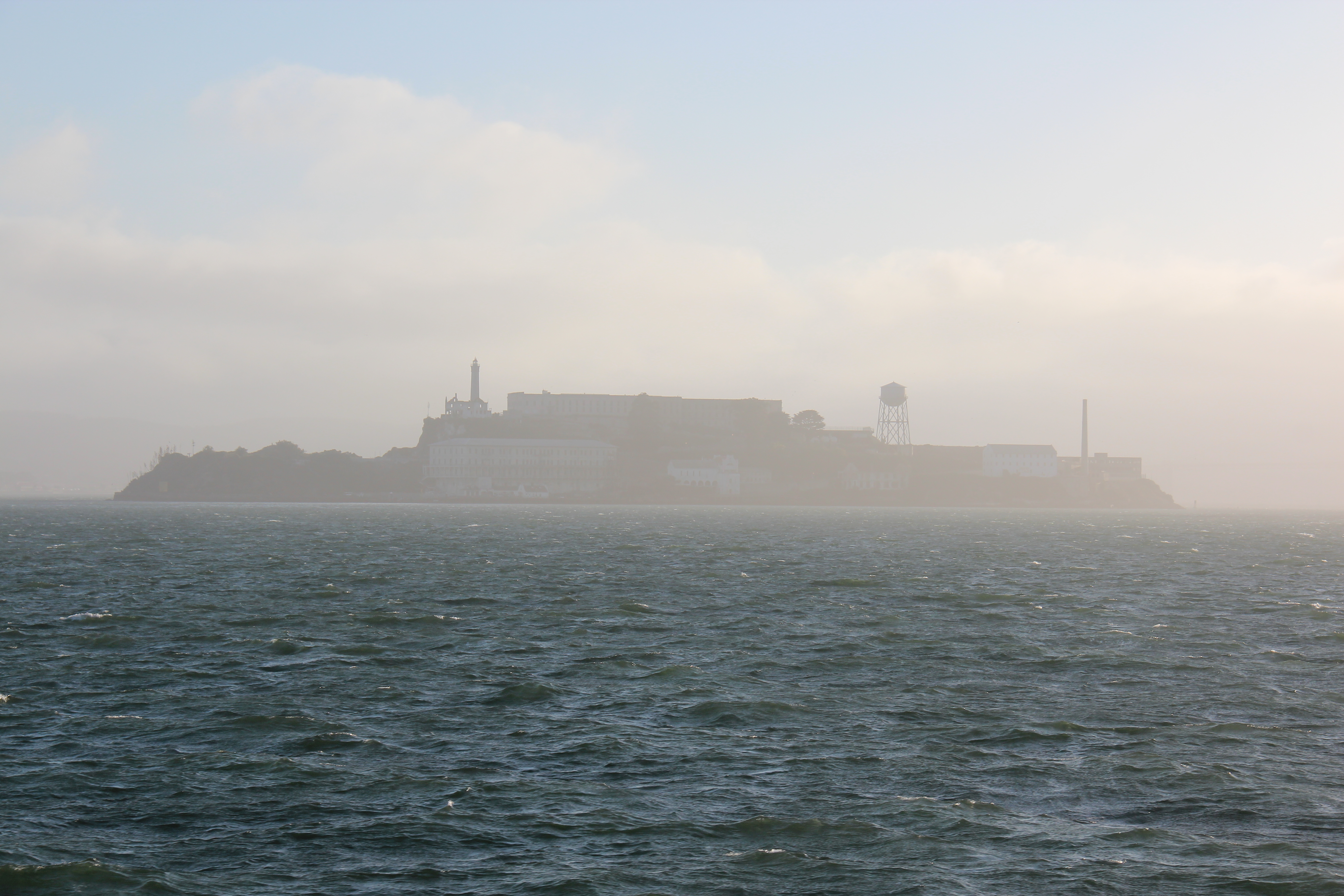
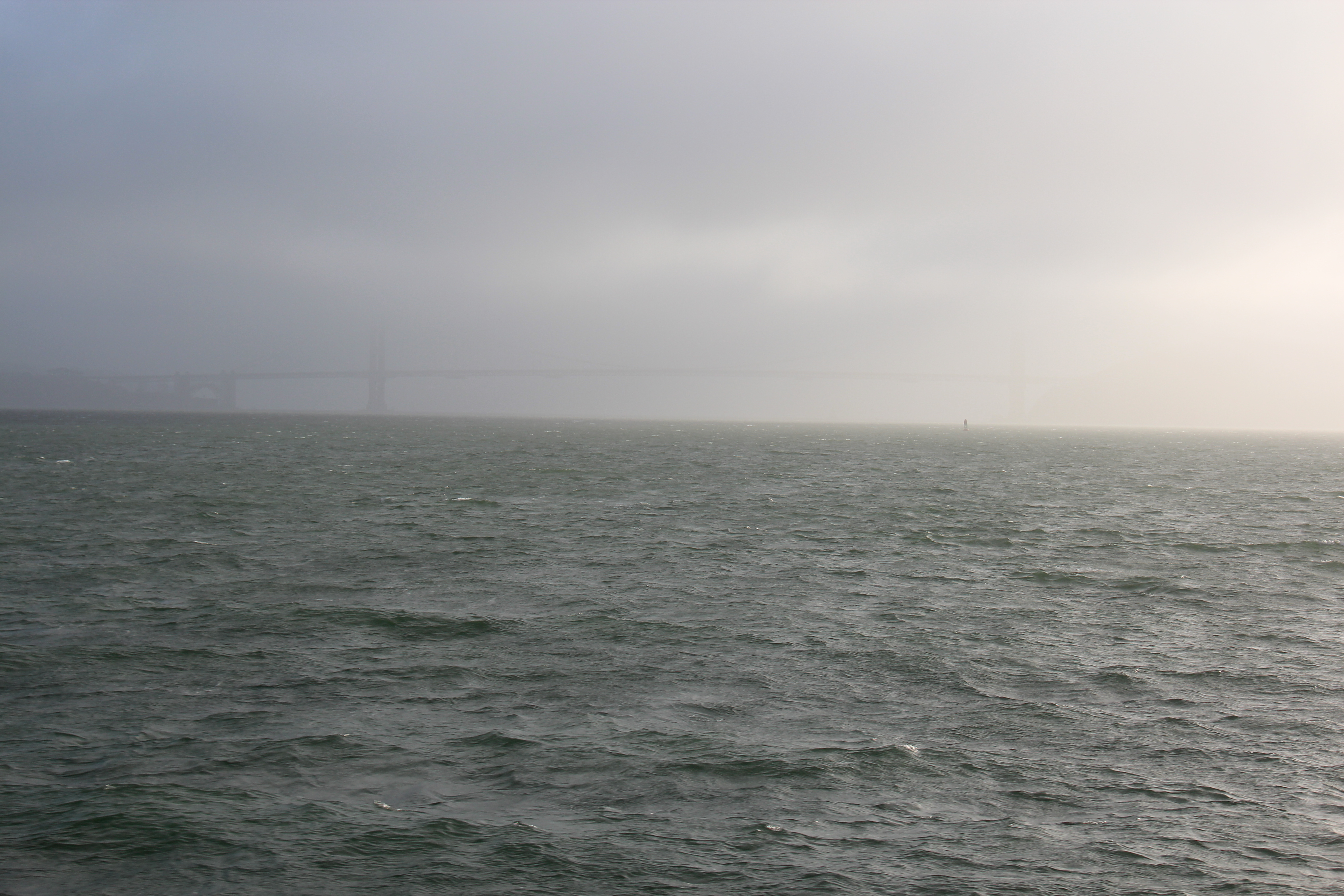
Famous for its generally cooler, often changeable and invariably foggy weather, San Francisco delivered all those elements for us during our stay. Great views of the Golden Gate from the ferry ride across San Francisco Bay and close up views of Alcatraz as well. During the two days we were there, we explored many of the popular sites – Fisherman’s Wharf, Ghiradelli Square, Union Square, Chinatown, waited ages for, then rode ( ever so briefly ) a cable car and walked up and down some of its famously steep streets. And they are steep ! As expected, it was incredibly full of tourists and long waits were common. The ferry ride back to Sausalito provided a taste of the thick San Francisco fog giving Alcatraz an eerie silhouette and almost completely enveloping it’s famous golden bridge….the contrast is visible in some images below. A totally unexpected bonus was a ‘Friday in the Park’ concert in full swing as we arrived back in Sausalito – which we happily participated in before heading out to dinner.
Eerie Alcatraz in the afternoonGolden Gate barely visible on the way back due to thick fog
As we left we took in some scenic close up bridge views from the north side, all the while battling fierce winds before crossing it in our vehicle. I cast my mind back to what it must have been like in 1943 when my dad sailed under it in a troop ship from Australia en route to Europe during the Second World War – it had only been completed 7 years earlier.
Great views from the north side looking south – note the windUp close view of a Golden Gate cable – much thinner than I expected
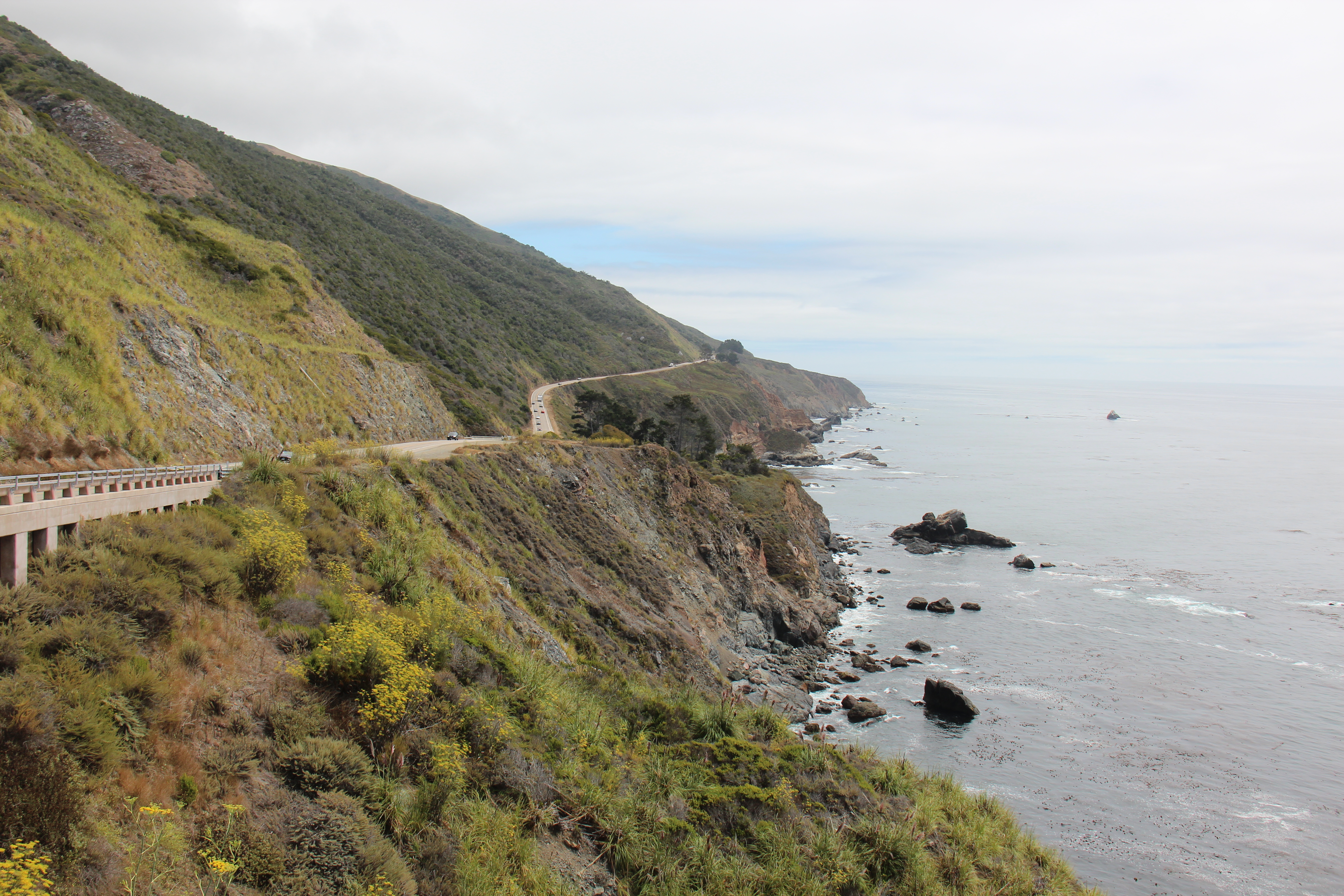
The route south out of San Francisco took us through Golden Gate Park, The Presidio and some of the suburbs and beach communities in the south. For a big city, it was refreshingly easy to get out of. Continuing our plan to stay off the interstates took us along the much more scenic but ( at times ) tortuously slow and ( often ) windy routes 1 and 101 more or less continuously to the Mexican border. Slower yes. Worth it ? Absolutely ! Lots of pit stops to sight-see along the way, we spent a full week ambling south ending up in San Diego. The idea was to try to and keep our days generally to 200 miles or less giving plenty of time to explore and soak up some of the coast’s spectacular views and to visit its charmingly enchanting smaller communities. Our run of luck with great campgrounds continued ( we never booked anything in advance ) and we were able to get into some great California State Parks in Santa Cruz, and Morro Bay ( the latter, right on the ocean, was a definite favourite ). Santa Barbara was the exception to that rule where the only suitable campground we could find turned out to be wedged between the 101 and an Amtrak line; deafening and not a mistake we’ll make again. Why so many are located close to busy freeways always amazes me.
Beach at Carmel – water still cold in August !Rocky coast near CarmelCoast near Big SurSun about to set at Morro BaySunset at Morro BayMorro Bay in the evening
Carmel By The Sea, already famous, was made more so after Clint Eastwood spent some time there as mayor ( and was probably the highlight among the towns we stopped at ). The whole coast from Pebble Beach to San Luis Obispo is highlighted in yellow on maps ( indicating a scenic drive ) and it offered some stunning vistas especially between Carmel and Big Sur. White knuckle stuff at times, but beautiful ! Santa Barbara ( just north of LA ) was another great spot, and probably the last relaxing part of the coastal drive because it gets heavily populated and consequently very congested after that – traffic in LA was, and generally is, a nightmare ! We were delayed by a major accident so deferred some planned shopping until further south in San Diego – as we’d both been to LA several times before, this time the strategy was simply to safely navigate out.
Camped here near Oceanside – Guajome State Park
As our week wound down time was spent in the San Diego area prepping for crossing to Mexico – travelling with a vehicle and for an extended period, there was a significant amount of administrative preparation needed and some vehicle servicing required as well as stocking up with essentials that, history had taught us, could be tough to find south of the border. Like a good Boy Scout, one should always ‘be prepared’ ! One such task involved making multiple copies of all our documents, reviewing vehicle importation guidelines and, most importantly, arranging Mexican auto insurance. We had been well versed on this by others and on comments we’d read in iOverlander. We knew that our Canadian insurance was invalid there ( so had to cancel that once we had crossed ) and also knew that it was most advantageous to buy a 6 month policy ( even though we did not see ourselves being in Mexico anywhere near that long ). We were reminded by the company we bought it from of what to do in the event of an accident and of Mexico’s adherence to the ‘Napoleonic code’ ( essentially, in an accident, one is guilty until proven innocent ☹️ ) unlike the English common law on which our system is based ( thankfully, innocent until proven guilty ). Let’s just hope we don’t have any occasion to need it !
Camped at Potrero, just a few miles from MexicoThis was outside our camper when we woke up – got to watch where we step !
At our final night in the US, in the tiny community of Potrero, just beside Tecate ( our border crossing ) we enjoyed a few beers at our campground with a young New Zealand couple on the same broad route south as us. I expect, and hope, our paths cross again in future on the long road commonly known as the “Gringo Trail” !
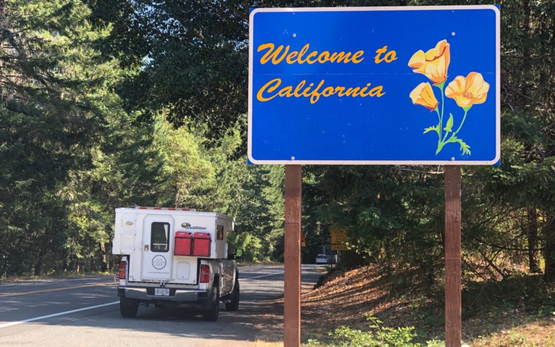
While Oregon had really “wowed” us, California also offered up an enticing array of sights and experiences. Bigger ( much bigger in fact ) and more well known, the “Golden State” advertises itself on marketing literature as a place to “Dream Big”. Perhaps…….however, our first impression was more one of “spend big” ! In truth we had been well warned by Californian’s we had met back at Cape Perpetua to expect to pay more in California – considerably more – for everything ! Indeed, a dollar more a gallon for gas, campsites at $35-45 versus $25-$29 in Oregon and of course, a sales tax on everything ( where there was none in Oregon ). Fortunately we had loaded up on pretty well everything we could to limit the impact. Beyond that, as always when on the road – grin and bear it !
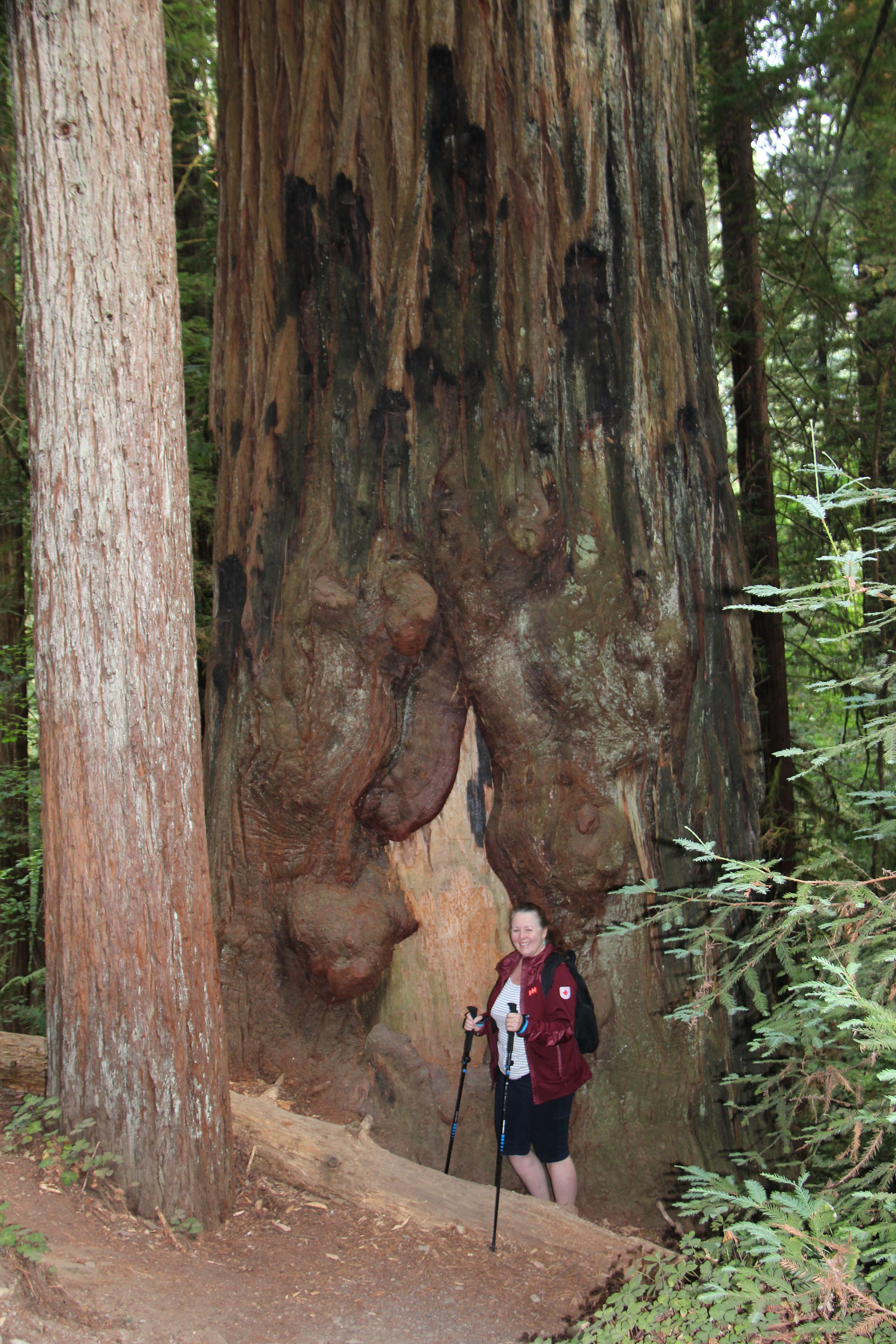
Entering California via the Redwood Highway from OregonA winding section of Howland Hill Rd, Jedediah Smith Redwoods State ParkLois in Jedidiah Smith Redwood State ParkThe 1500 year old, aptly named, ‘Big Tree’Roots of a fallen cedar
Coming from the north the redwood forests were our first taste of California ( in fact, they start in Oregon – the main road south is known as the Redwood Highway ). As anyone who has seen them can attest, they are massive and truly awe-inspiring. Standing next to one a ‘man’ seems tiny by comparison. The Jedediah Smith National Forest in Cedar City, the Avenue of the Giants further south on the 101 all provide ample opportunity to hike through them or simply stand and view them in amazement. The simply named ‘ Big Tree’ in Humboldt State Park is over 1500 years old and another ( which we did not see ) is recorded at over 2200 years old – started growing before Christ was born !
California coast near KlamathCalifornia coast near Gualala
After a couple of days focused on the redwoods, we explored the coastal road (Highway 1 ), which, quite literally, hugs the coast for a few hundred kilometres and provides a close up view of beaches, rocky headlands and some great camping opportunities. If not quite as stunning as Oregon’s, California’s coast did offer the benefit of a few degrees more warmth and was generally absent the thick fog that shrouded the coast of its northern neighbour. That said, the roads reached new heights of “windy-ness” ( is that a word ? ). Very slow going in many places.
NapaBeringer Winery, St Helena, Napa ValleyEntrance to Castello di Amorosa, NapaGrapes, Napa
Cutting back east at the small town of Jenner we climbed over a low mountain range and passed some eclectic Californian small towns and enjoyed the best burger ever at a Forestville classic – Carr’s Diner. On through Sonoma ( known for it’s wines ) and through to the Napa valley ( world famous for theirs ). Explored the towns and vineyards of the valley starting in Calistoga in the north, ending in the town of Napa itself in the south. Beautiful, but packed with tourists. Napa may have a few years head-start on us in the Okanagan valley with their wine industry ( they started there in the 1800’s ! ) but the setting lacks the backdrop beauty of our majestic Okanagan lake. To us, vineyards without the big lake just seemed to be missing something ! Lois had really been looking forward to the wine tasting and very much enjoyed the servings at Beringer, one of the oldest in the area. Being high season it was busy everywhere – so we only visited a few.
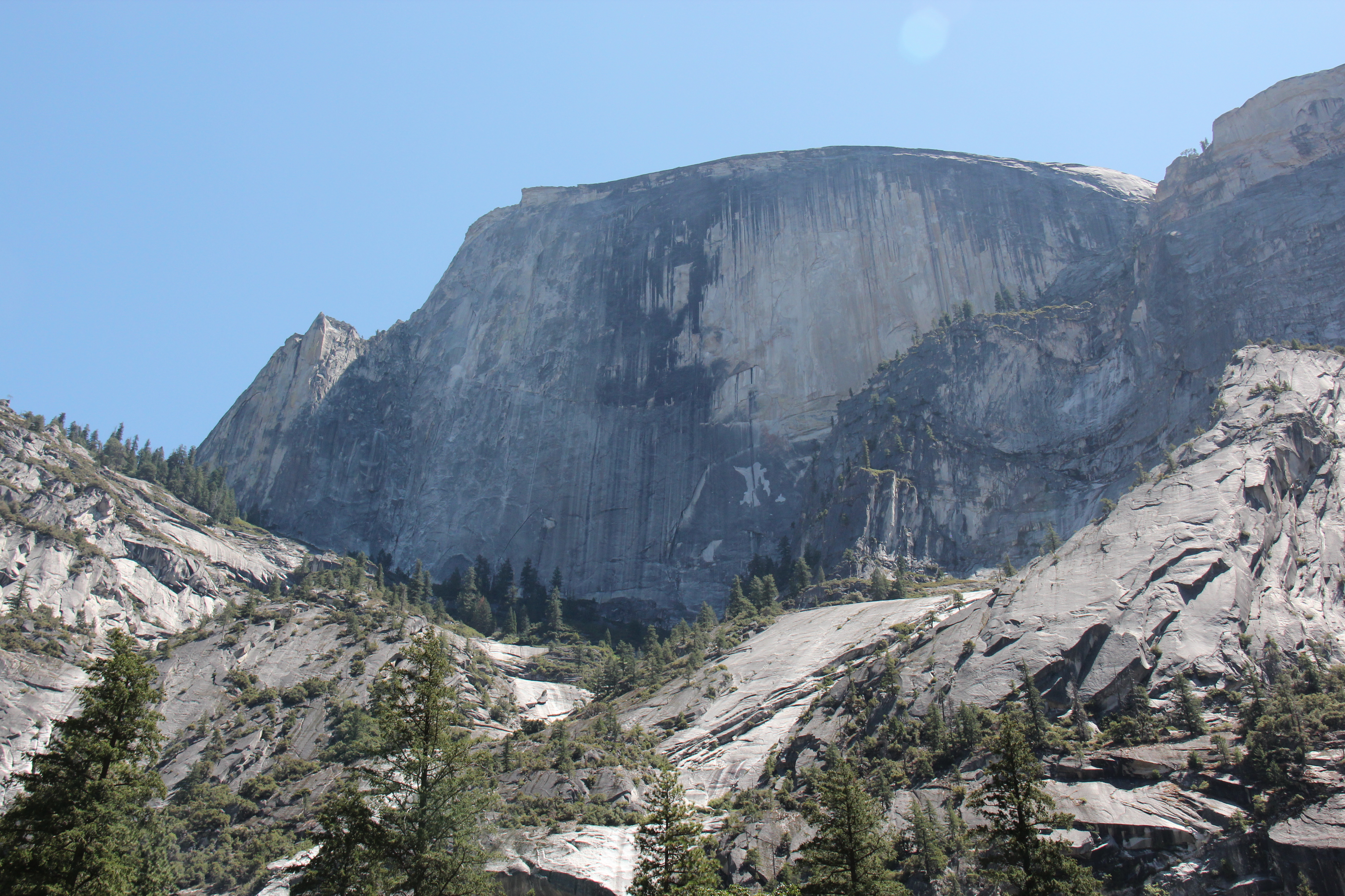
“El Capitan” in YosemiteYosemite Falls – late summer, so the flow was not strong ☹️Bridalveil Falls, YosemiteThe “Half Dome”, YosemiteA stream at low shutter speed, near Mirror Lake, YosemiteDitto aboveCamped with a friendly Dutch couple, just outside Yosemite
Prior to exploring San Francisco which was now just to the south of us, it made sense to visit Yosemite National Park first, about a 4 hour drive east. Can’t believe we actually deliberated on going – but we did. In short, a truly amazing park, arguably the most famous in the US ( certainly one of ). The pictures above will be recognizable to many – ‘El Capitan’ and the ‘Half Dome’ get lots of attention but the hikes ( we did a couple ) and other sights made for a memorable couple of days. Crowded to the extent we had to ‘boondock’ both nights but no problem finding sites just outside the park….normal for the middle of summer and a fun experience itself.
Boondocking, Yosemite
Our week closed out with the drive back towards San Francisco – and it was a hot one – 42 degrees as we drove through Stockton in the dry interior of the state. The plan was to get close to the city, and commute in to downtown to do the sights over a couple of days – planned to camp in the funky and popular Sausalito area, just over the Golden Gate bridge.
Next post, an update on the sights of San Francisco and beyond !
Prior to crossing the Astoria bridge into Oregon, we had enjoyed a surprising last day in Washington. With so much heard about the beauty of the Oregon coast we figured southern Washington must be almost as good and were keen to explore the south west corner of the state.
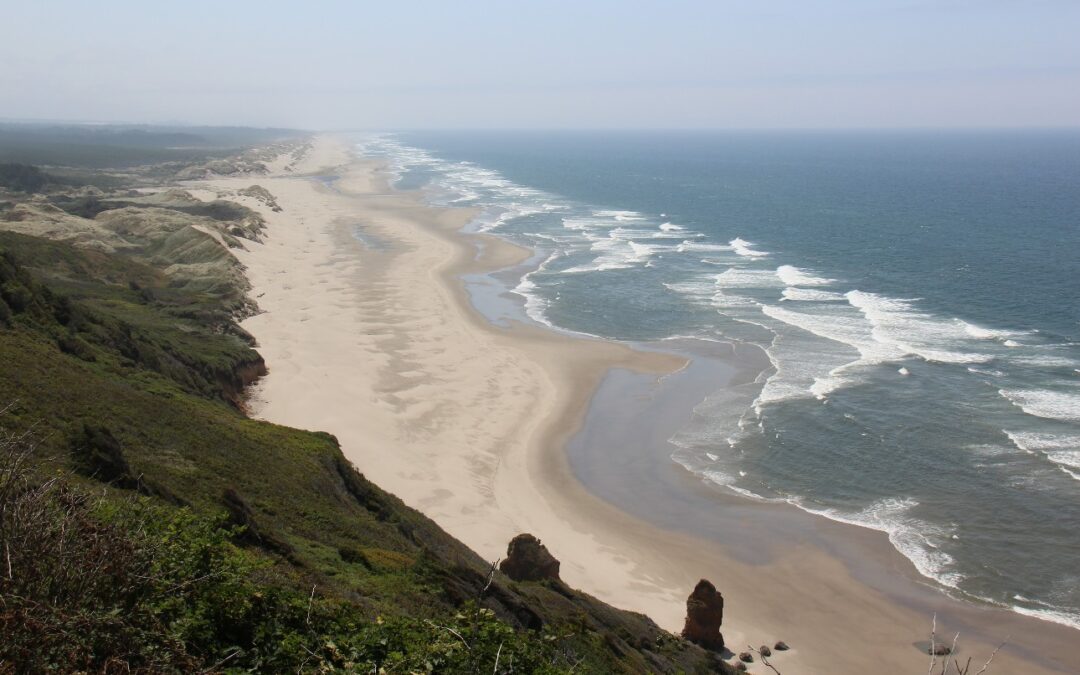
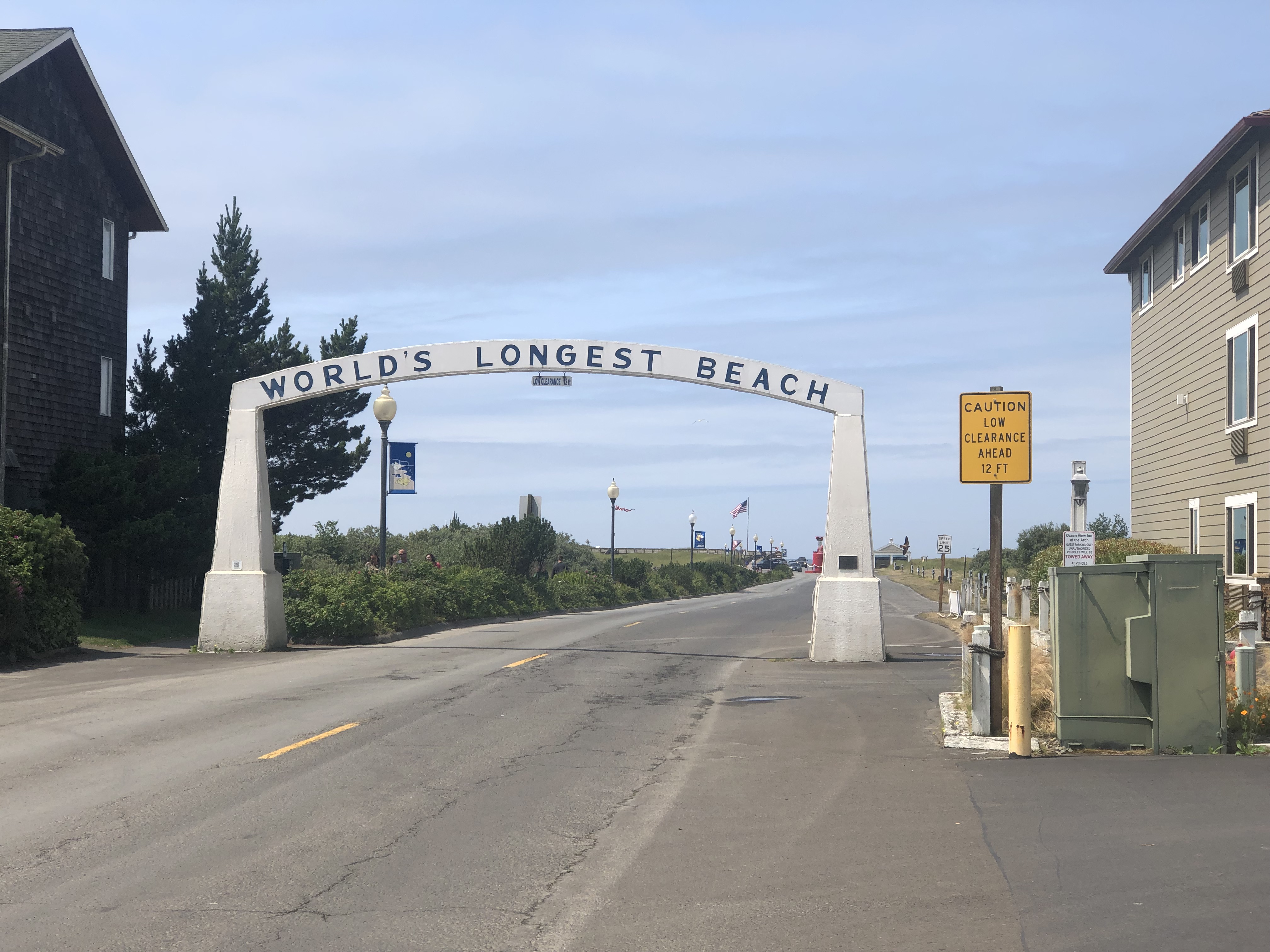
Staying on the 101 brought us to the coastal community of Long Beach ( I think we just liked the sound of the place ) and we used the morning to explore its ( obviously very long ! ) beach. A giant sign at the entrance described it as the “World’s Longest Beach”, and while, yes, it is indeed long, I think there are a few others that lay claim to the same honor ! An unexpected bonus was the ability to actually drive on this beach ( rarely possible, but it’s allowed there ). I’d wanted to test the truck’s ability to handle soft sand so this provided an opportunity to do that. Tide charts in hand we ventured out on to the beach in the hour that remained before our beach road would be covered in sea-water. Note to self – the weight of the camper, especially when full of fuel and water, makes a BIG difference to how the vehicle moves through sand, and while getting ON the beach was easy, getting OFF did require slipping it into 4WD. Just a brief moment of panic as the tide started rolling in !
On the beach at Long BeachSand sculpture at Long Beach
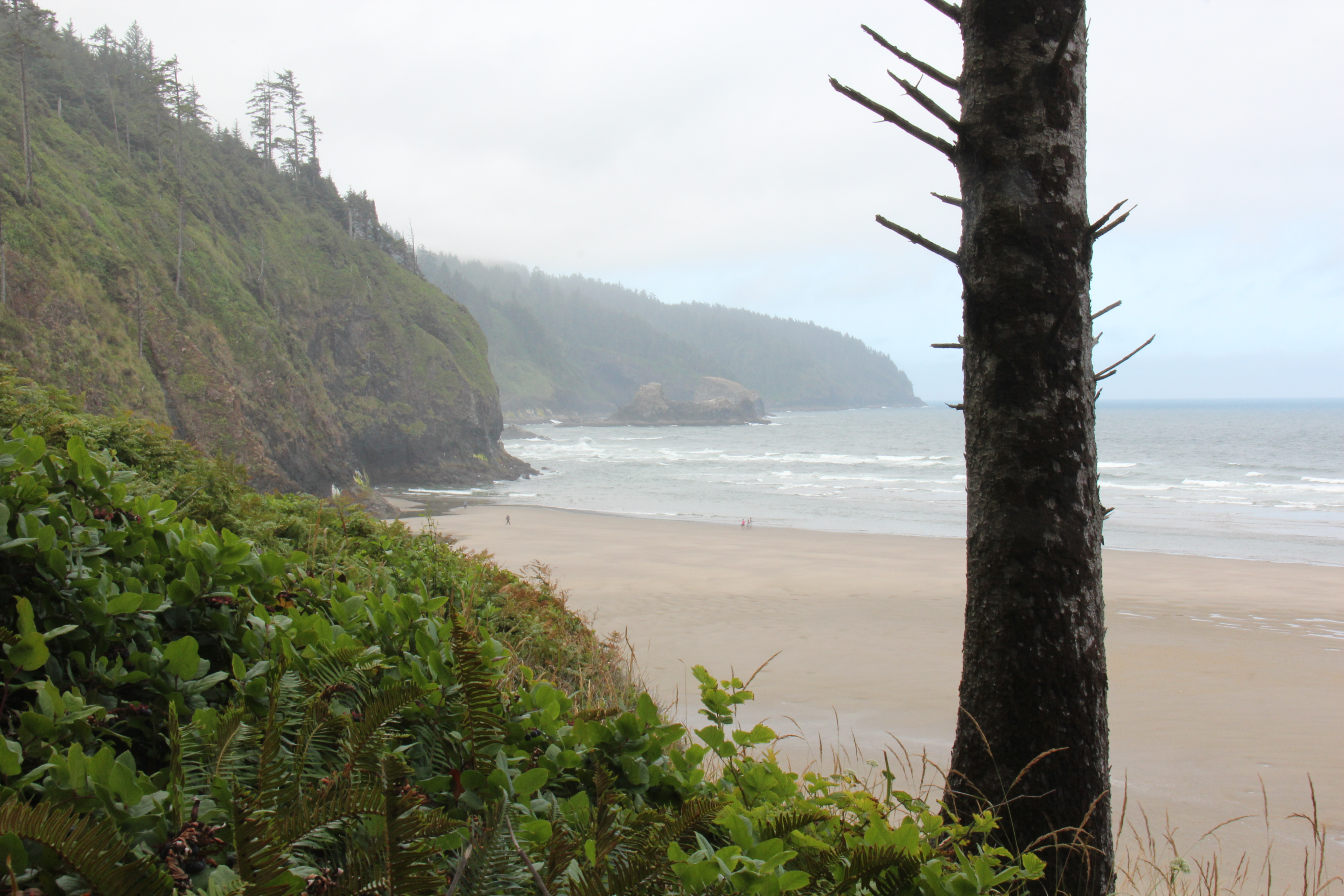
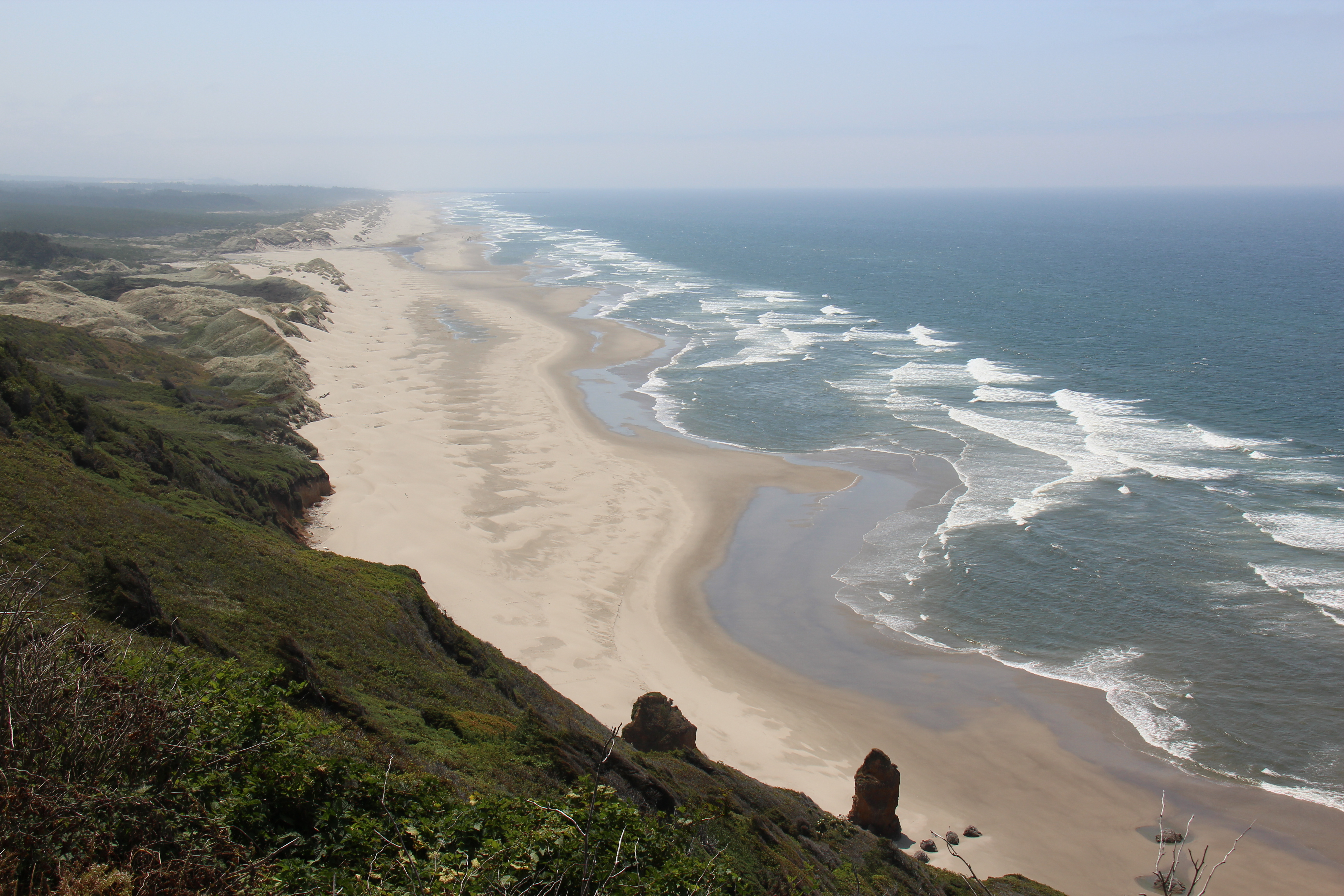
The next few days had us slowly wandering south through the towns of Seaside, Cannon Beach ( perhaps the most beautiful of the Oregon coastal towns ), Manzanita and beyond – lots of rocky cliffs and long stretches of beach all the way down through Tillamook, Cape Lookout, Newport, Yachats and on to Florence. From Florence onwards the coast changes dramatically and is more or less continuous sand dunes right through to Coos Bay. The historic town of Bandon was as far south as we went on the Oregon coast – and spent the night at Bullard Beach state park.
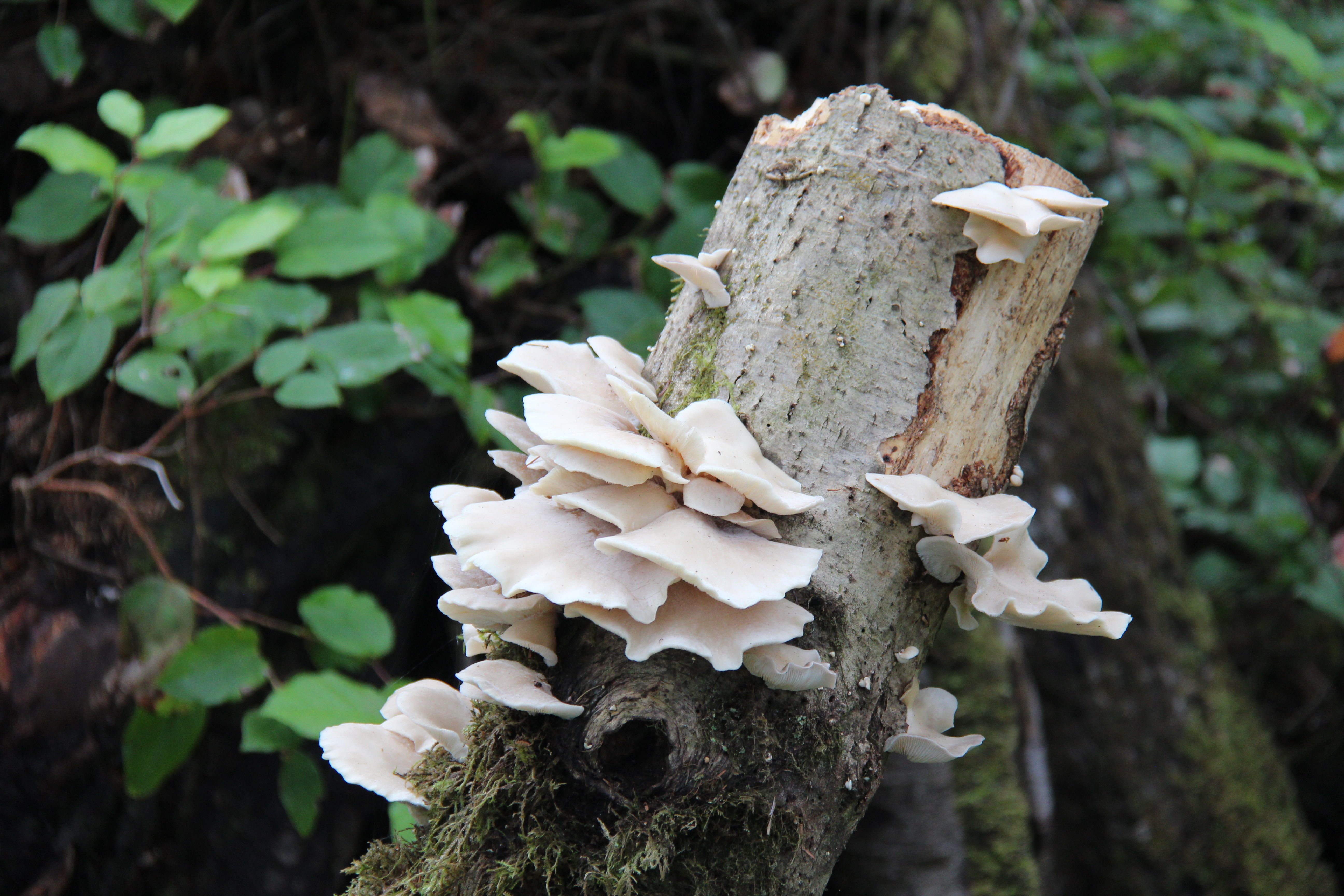
Great place to camp in Tillamook – camping is free as long as you shop there and the Brie cheese was delicious !Windswept and always misty, the Oregon coast with a view to Cannon BeachRustic town of Cannon BeachCape Lookout, where we campedFungi along the trail, Cape LookoutBeach at Cape LookoutView of Oregon coast near Cape PerpetuaCamping in Cape Perpetua National ForestView of the coast near Florence
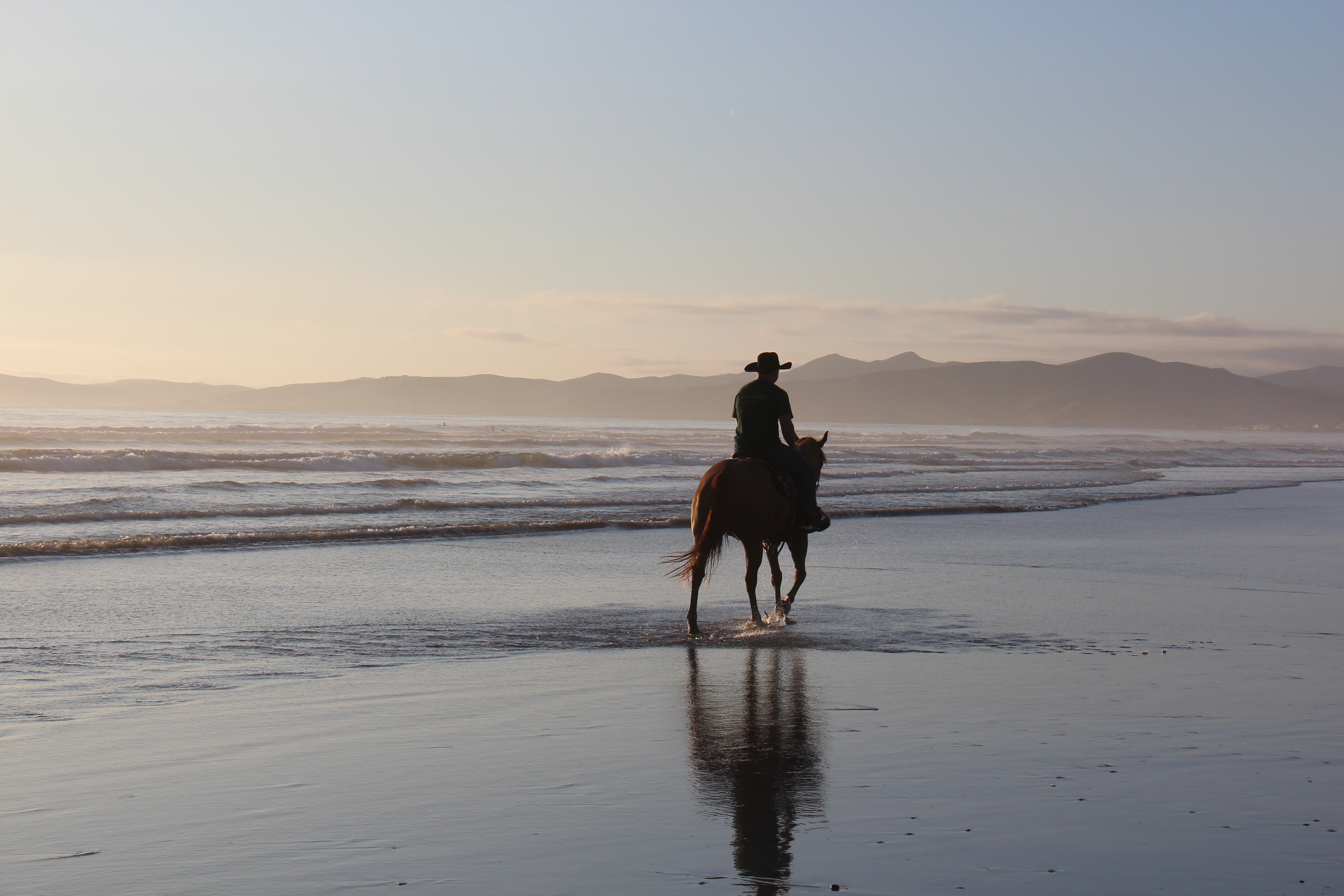
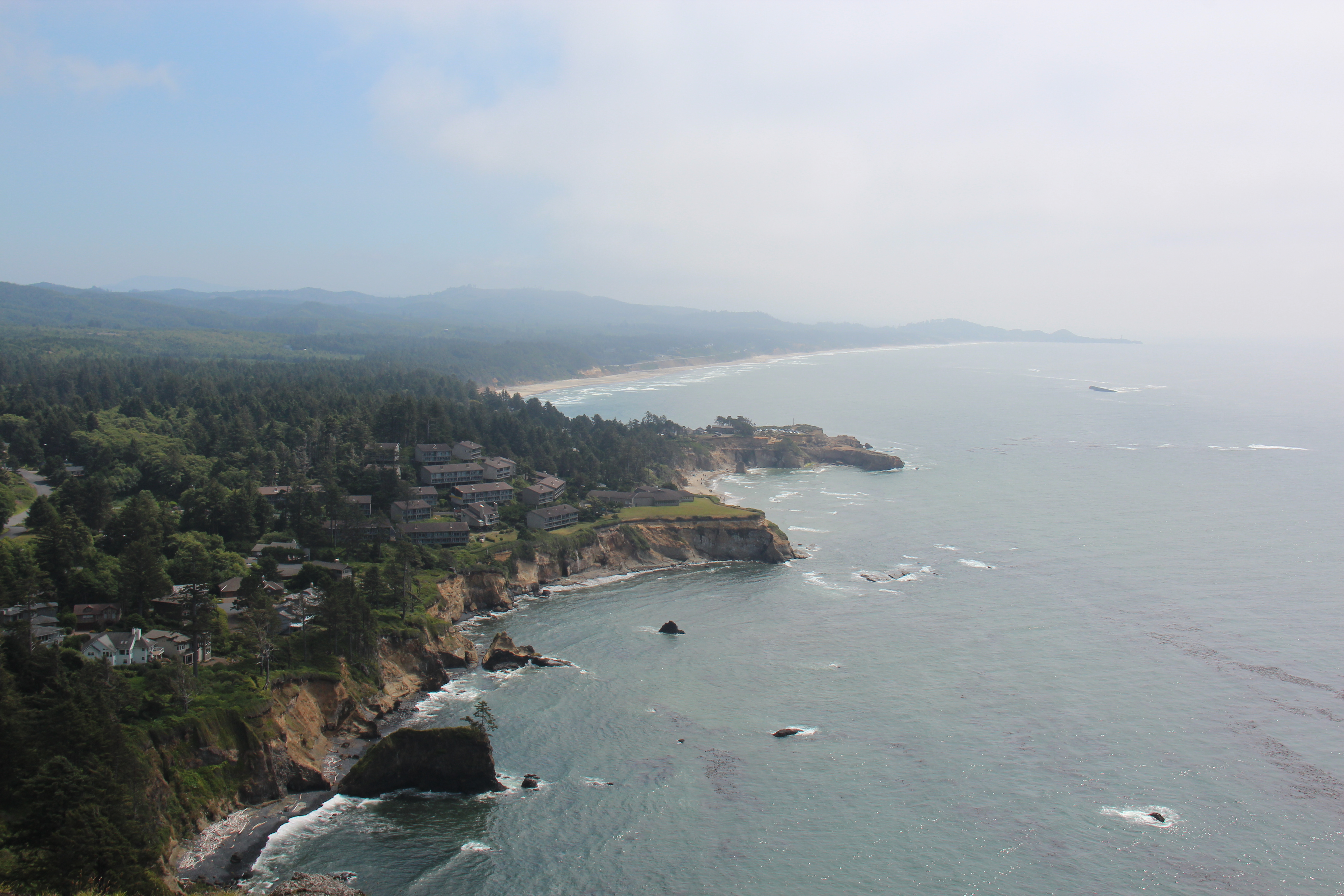
The state parks are truly impressive in Oregon and have been one of the highlights of our stay – exceptionally well run, clean, very well equipped and reasonably priced – hot showers at every one of them ! .They are also invariably located in some of the most stunningly beautiful parts of the state and as a result are blessed with amazing views and a variety of great hiking trails, many of which we sampled. We stayed in three; Cape Lookout, Cape Perpetua ( technically a federal park but equally beautiful, clean and well run! ) and the aforementioned Bullard Beach. I’d recommend them all. For horse lovers, Bullard Beach ticks an additional box – it’s even set up for ‘’horse camping’’. If you have no idea what that is, neither did we until curiosity got the better of us and we drove down the road that was sign posted for horse camping – here is what we saw…..yes, a regular campsite with an enclosure for your horse and a bit of extra room for your horse float. They cater to everyone here ! Definitely a first for us.
Yes, really……..horse camping !Campsite plus horse enclosure. And the horse.
The coastal mist and fog did not surprise us about Oregon ( and lent itself to some excellent photo ops ) but we were caught unawares by how cold it was ( at least on the coast ) and how normal this seems to be in August – it was the middle of summer after all. On more than one occasion we commented on this to locals only to be assured that, “No this is pretty typical for Oregon!”. Considerably warmer in Vancouver, Canada and it is over 500 miles north ! Not to worry, our next move was 170 miles inland to Crater Lake – surely it would be warmer there.
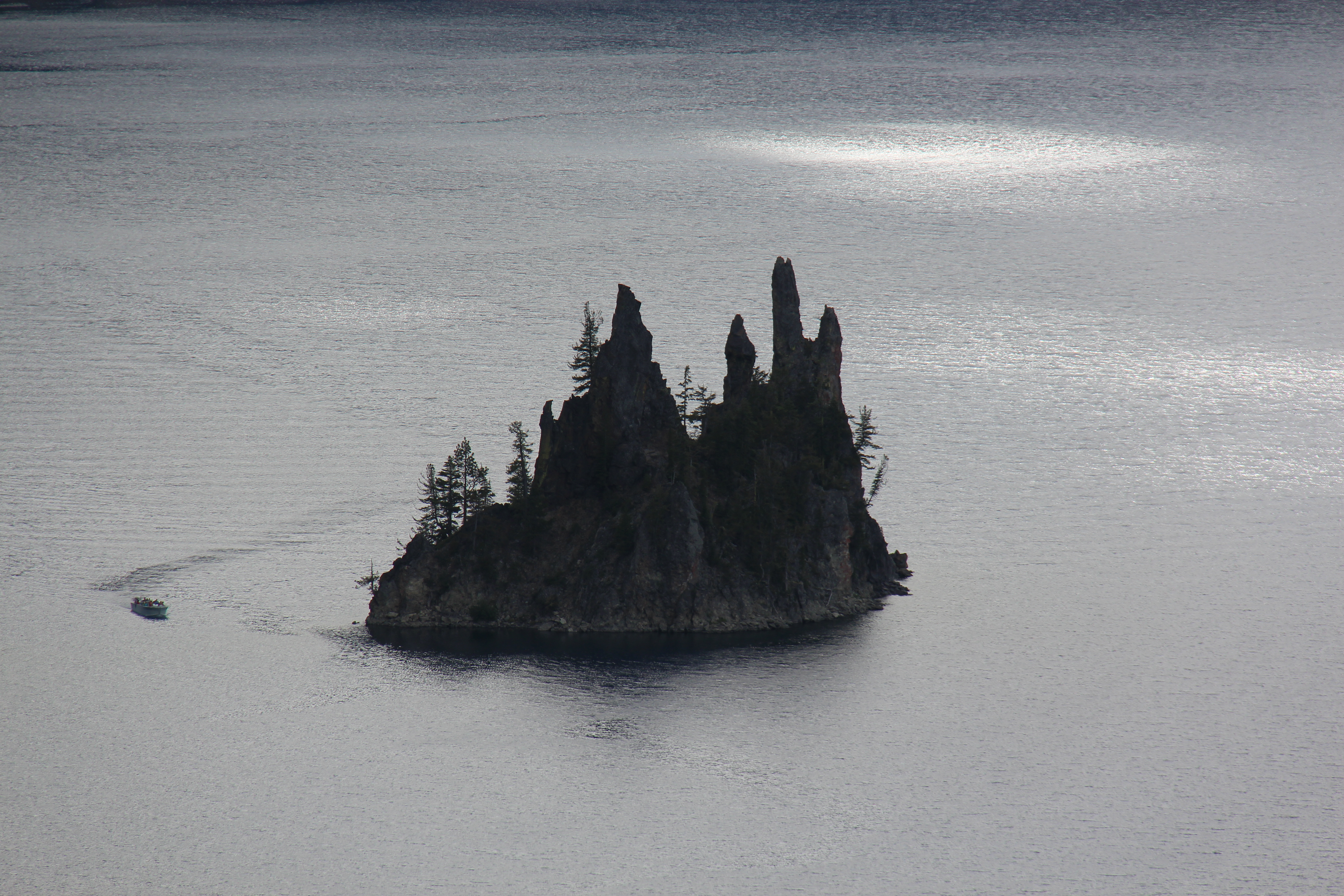
Crater Lake with view to Wizard IslandView from the north, Crater Lake; note how clear the water isCrater Lake, looking west“Phantom Ship” island, Crater Lake
Three things stood out for us at Crater Lake – it was stunningly beautiful ( a vivid deep blue colour and is reportedly one of the clearest bodies of water in the world ); it was, finally, much warmer ( despite being at a dramatically higher elevation, approx 6,000ft ); and the drive to it after Roseburg and from it, almost to Medford, was incredibly scenic – something we did not expect. I’ll let the Crater Lake pictures speak for themselves but definitely a sight not to be missed when in these parts. Snagged a great campsite right on the water at nearby Diamond Lake to top off a great detour inland from the coast.
Campground on Diamond Lake, near Crater LakeOur BBQ shelf has proved very handy !Sunset at Diamond Lake
A week had flown by in Oregon and our time there was coming to an end. A good day’s drive back to the coast would have us in Crescent City, California, home of the giant Redwoods – more on that in our next post !
The PanAm completed in April, 2022 and with the truck camper sold, we shipped our new Sprinter van to Australia in late 2022. We travelled there through all of 2023 and into 2024 before shipping it up to North East Asia where we travelled for 4 months between Korea and Japan, before shipping it back to North America. It’s our plan to continue exploring the world in 2025.