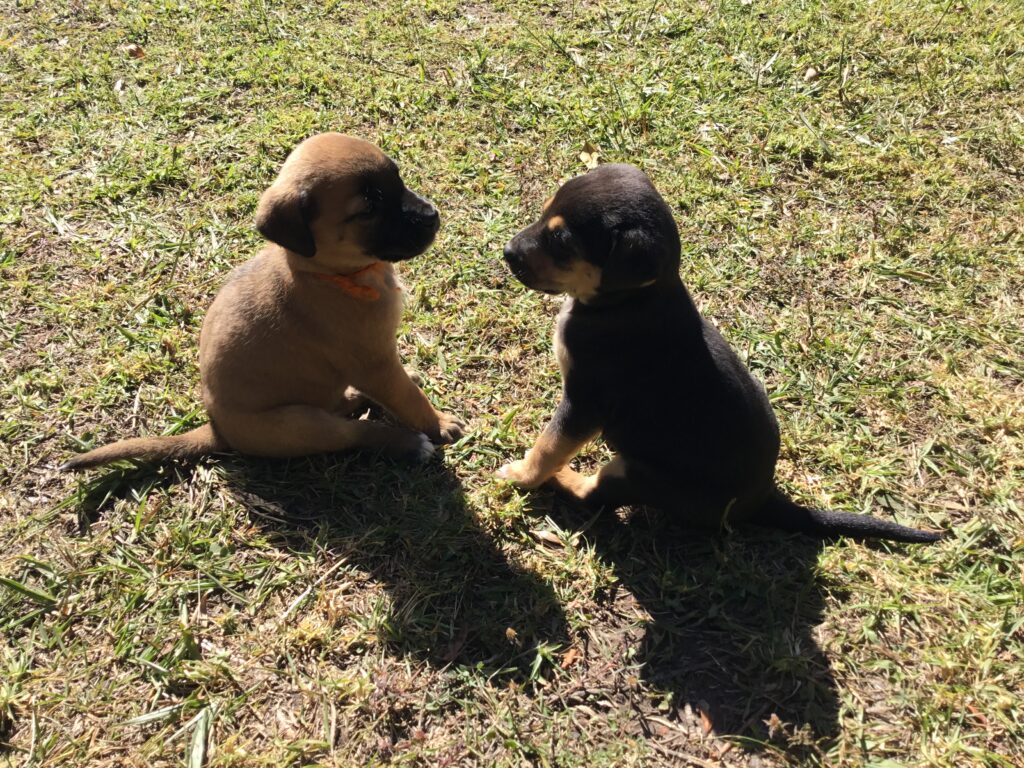
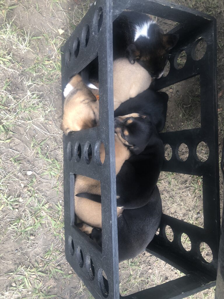
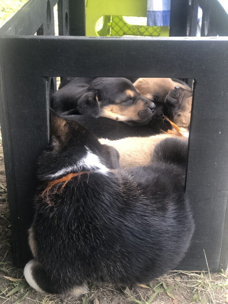
Just last week our departure from Canada was delayed ( twice ) due to sub zero and we were two days late into Colombia. This week the weather could not have been better and having made our way back up to charming Villa de Leyva, and picked up our vehicle, we eventually set off for Colombia’s famed “coffee triangle”. On our arrival back in Villa we discovered that a new litter of puppies had been born – ever so cute, they took a particular liking to our step box !
New arrivals at Villa de Leyva campgroundNew puppies ! They loved our steps boxThey just couldn’t all quite fit !
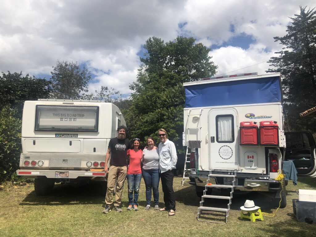
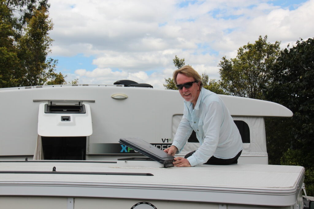
Just prior to leaving Villa de Leyva, however, we were in for an unexpected surprise. As I was finishing off a little repair and replacement work on the camper a familiar overland vehicle pulled into the Renacer campground. “Familiar” only in that we had seen pictures of it before and spoken with its owners via a Facebook overlander group – turns out it was James and Claire Young ( www.thisbigroadtrip.com ), fellow travellers from Kelowna and themselves well into their own journey to Tierra Del Fuego ( already 2 years on the road in fact ). While we each knew the others were in Colombia, we had yet not made specific plans to connect – simple serendipity brought us together. Talk about a small world ! An enjoyable evening of catching up followed and some note/tip sharing in the morning before we parted, along with a young Dutch fellow on a motorbike heading the same way – quite likely all to connect again at some point.
Two overlanding couples, both from Kelowna, both in Villa de Leyva. The Young’s are two years into their tripInstalling the replacement vent lid
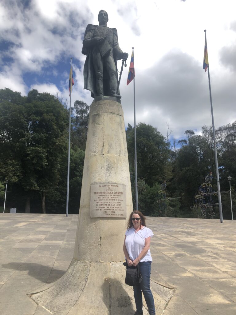
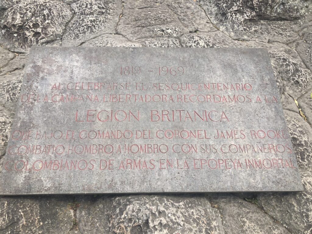
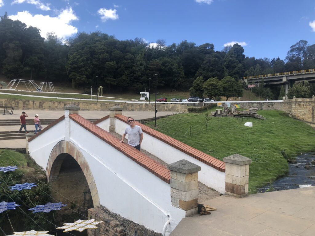
En route to the coffee triangle, one passes a famous Colombian landmark – Puente Boyaca ( Boyaca bridge ). Scene of a famous battle in 1819 that secured Colombia’s independence from Spain, we decided it was worth a stop being right on the highway. One unexpected discovery for us was the plaque commemorating the involvement of a band of British and other foreign mercenaries, the “Legion Britannica” who helped secure the victory. A little history lesson for us.
Puente BoyacaIn memory of the Legion BritannicaPuente Boyaca
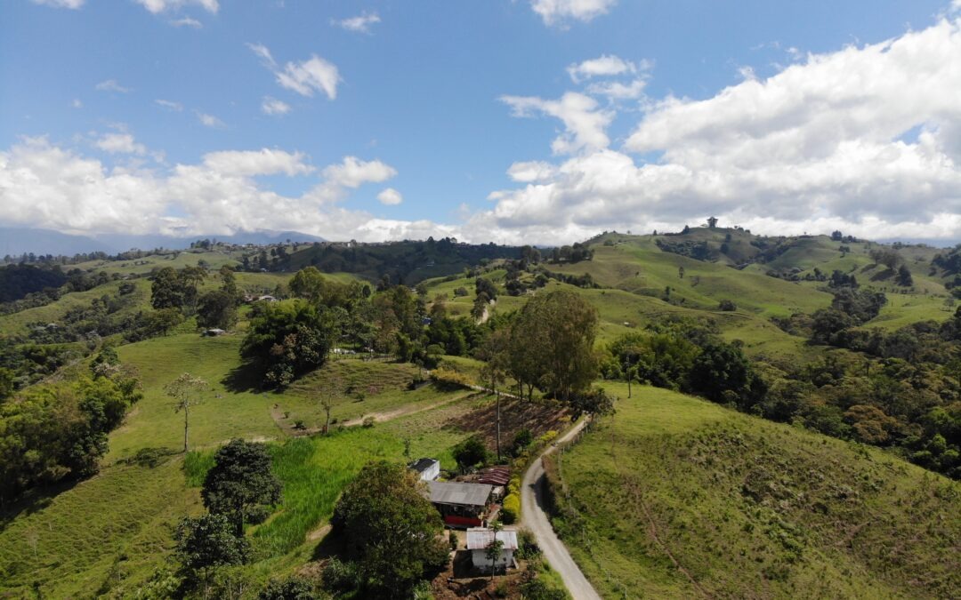
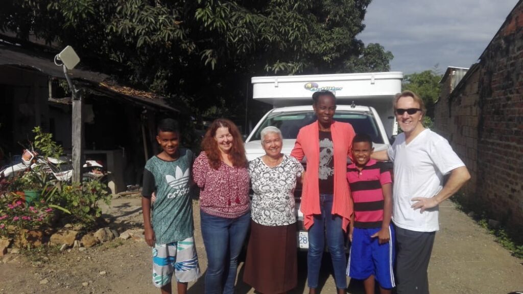
It would be an almost 15 hour drive to the coffee triangle ( the towns of Salento and Filandia to be more precise ) and while we expected the trip to be uneventful, while en route fate provided us one of the most memorable ( yet simultaneously heart-wrenching ) experiences of our trip to date. Traffic was brutal putting us well behind schedule – with darkness closing in we were forced to find a campsite in the small town of La Mesa. There being no campsites in La Mesa, in desperation we approached the owner of a “parqueo” ( parking station ) to ask if we could park overnight. While unusual, he agreed, and he ( Luis ) and his wife, Rosa, made us feel very much at home. Simply charming people. Turns out he was a minister and he and his wife had just accepted a family of refugees from Venezuela – the family had walked out of Venezuela ( as many were doing ) but had been robbed on the road, losing all their cash, documents and many possessions. Imagine – basically destitute, with two teenage kids and unable to work in Colombia and the kids unable to attend school. They had been there several months. The tales they shared were shocking. What was once the richest country in South America was now a failed state, an economic basket case, and 4 million Venezuelans were living outside Venezuela – many in Colombia.
Daicy and her two boys from Venezuela. Rosa’s husband Luis took the picture
As we left La Mesa, thinking how fortunate we were to be from safe, developed first world countries ( and counting our blessings ) we decided to “pay it forward”. The minister had bailed us out when we were stuck, so we made a donation to the Venezuelan family – happenstance had afforded us a the opportunity to do so. Daicy, the mother, was in tears and the younger son hugged Lois tightly as we left. It was not until a few hours later, when we got an email from Daicy, that we understood why – turns out they had no money for the next meal. I know we all donate to worthy causes ( as we should ) but it’s not often you get to do so in quite as direct a manner and to hear the personal story behind the situation. To say that this chance meeting, the awareness it gave us, and impact it had on someone in such desperate need, would be a cherished memory of our time on the road would be an understatement. It certainly made the things we often complain about seem pretty darn trivial.
Our route this past week
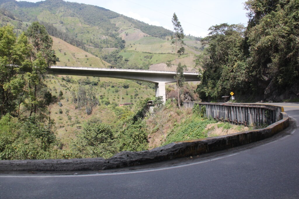
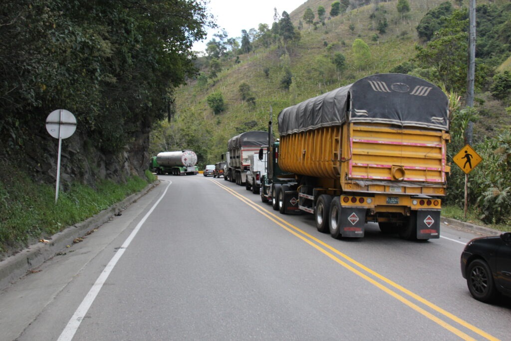
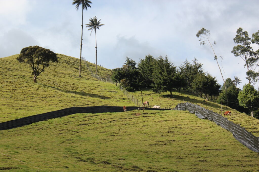
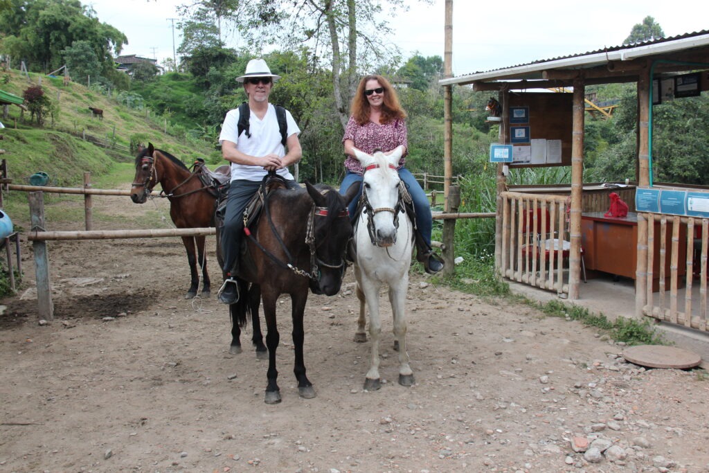
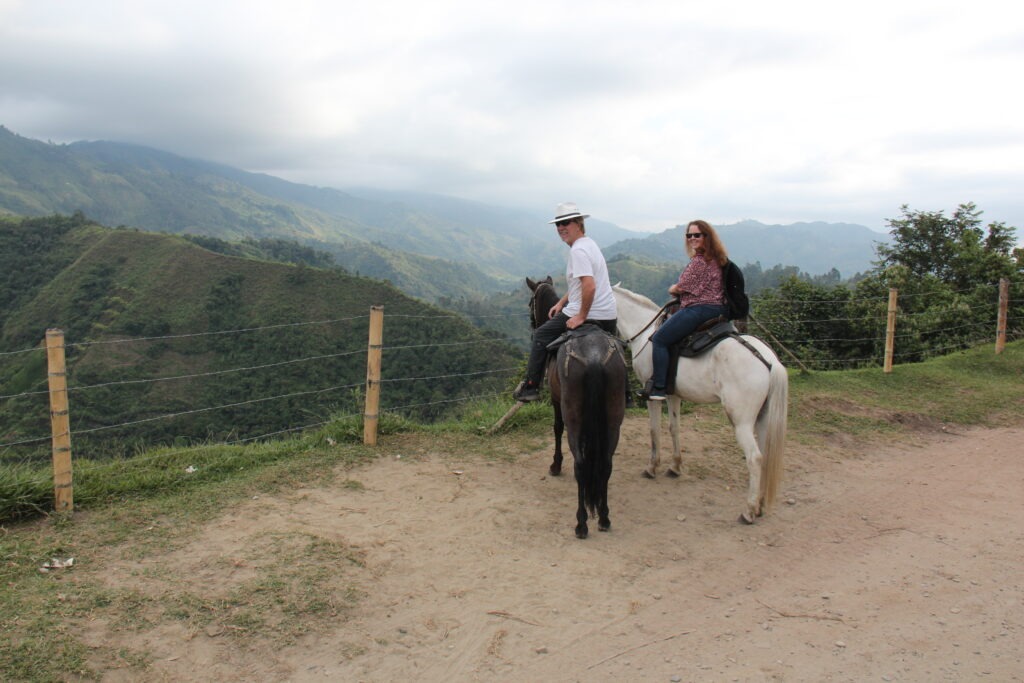
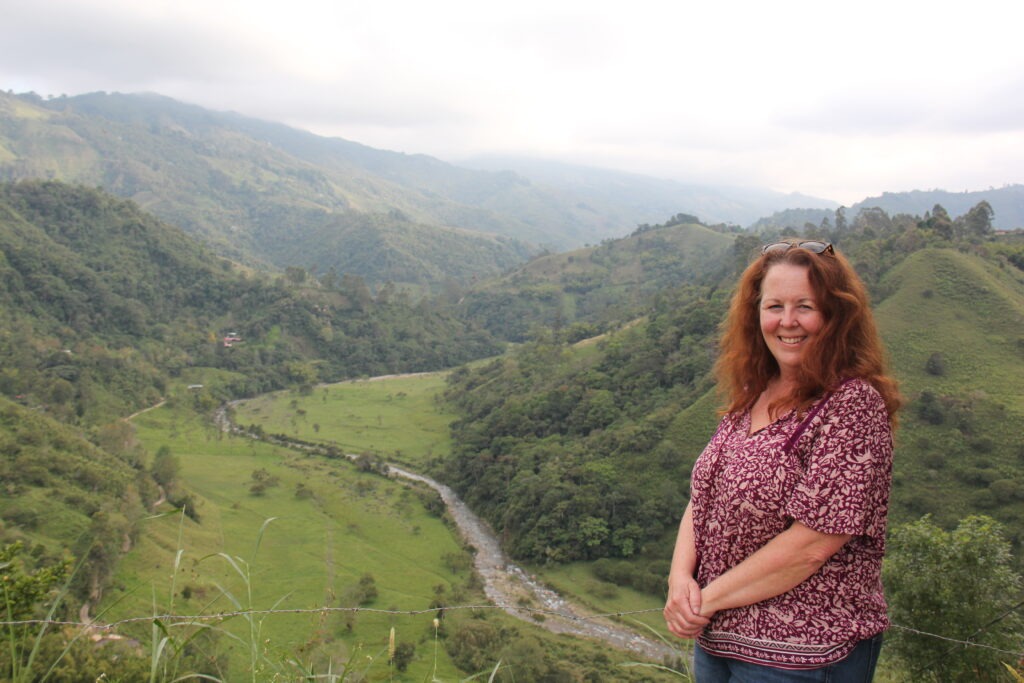
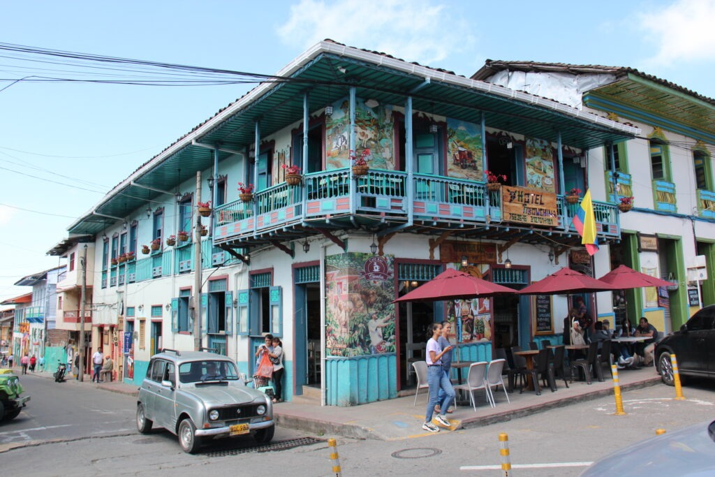
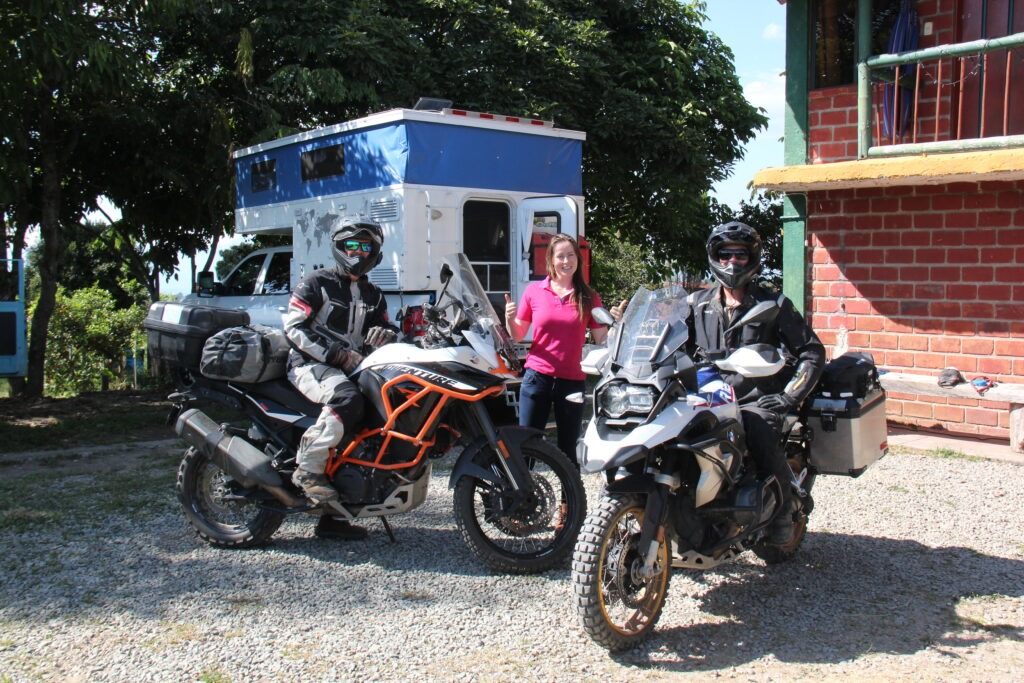
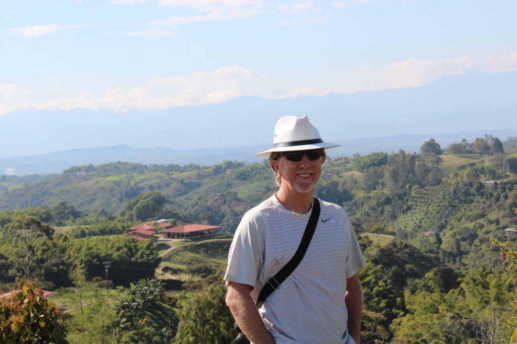
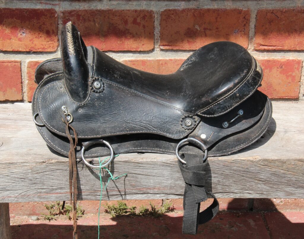
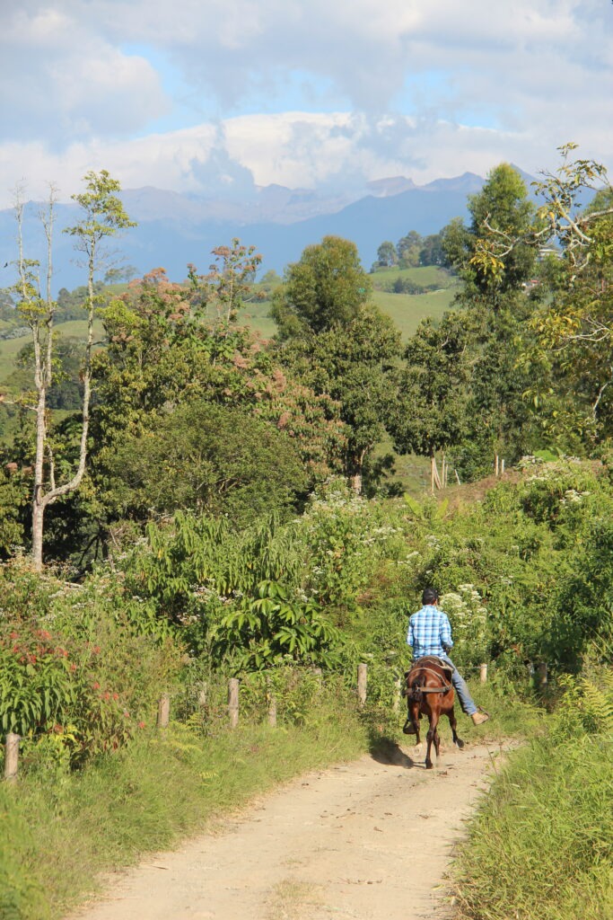
The second day’s drive, again, was tortuously long ( with windy, elevated roads heavily used by commercial trucks ). Just 239 kms took us 8 hours but did provide stunning scenery all the way to the town of Salento, right in the heart of Colombian coffee country. Salento is extremely colorful and reminded us of Guatape, near Medellin. Even tried our hand at horse-riding with the coffee farms making for a spectacular backdrop. Caught up with yet more motor cycling overlanders while there – this time a Pole and his friend from Vietnam, both headed the same way as us; destination Ushuaia. People definitely travel from all over the world to do the Pan American !
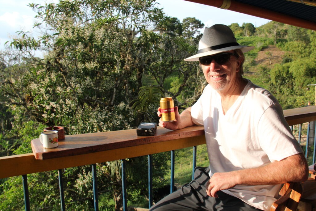
Old and new. Lots of hairpins now, but a new elevated highway coming – they need it !We endured lots of this…….Typical scenery on the road to SalentoTypical street in Salento -lots of colorWe met these two bikers in Salento, one from Vietnam and the other from Poland. They are on an 8 month trip from New York to UshuaiaGuaduales campground in Salento which is also a horse riding businessThe horse-riding was fun. First time for meView from the ridgeLois during a break from horse-ridingTime for a beer when we got to the half way mark !
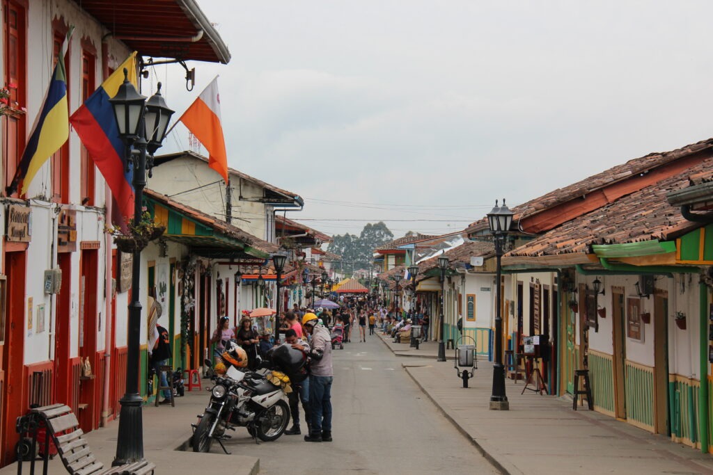
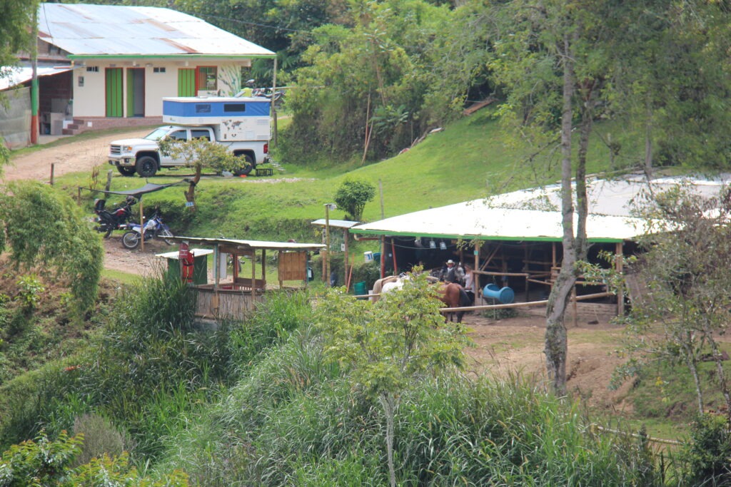
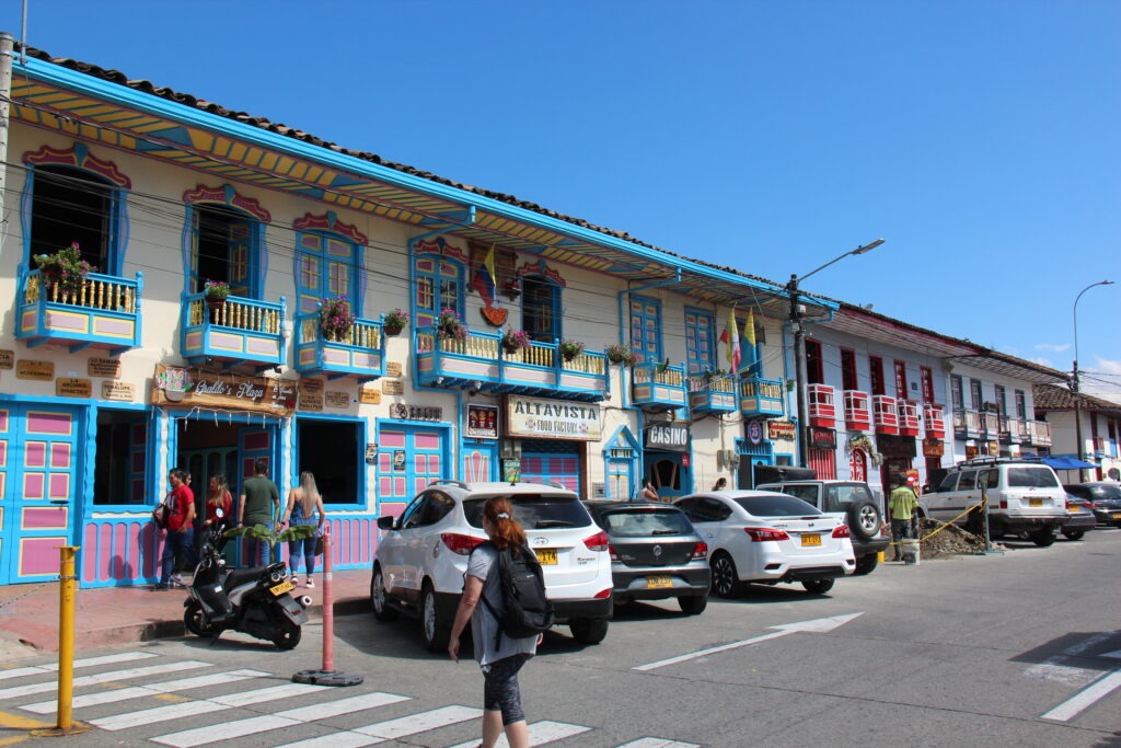
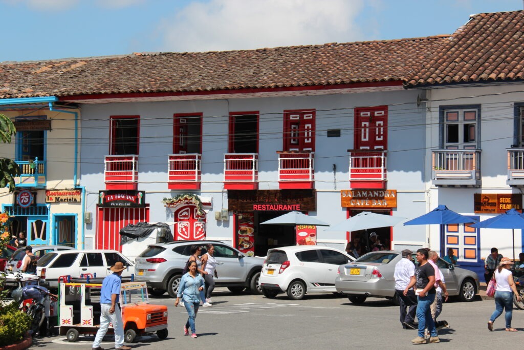
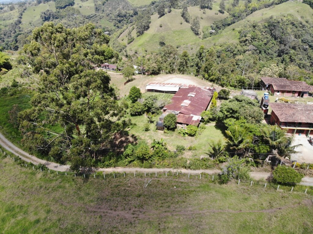
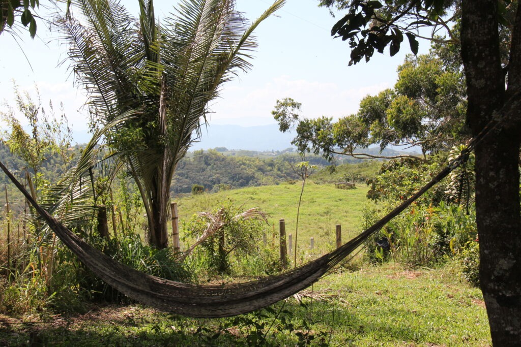
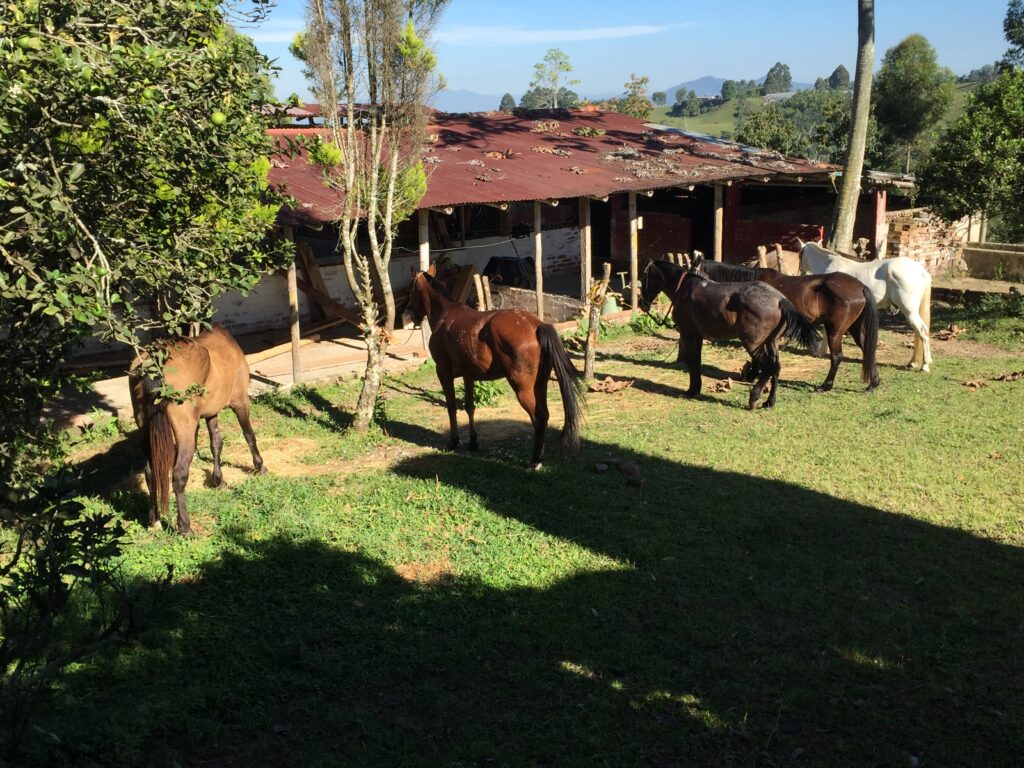
Filandia was our next stop. Beautiful in its own right but also renowned for one of the most popular overlander camping spots in Colombia – Finca Steelehorse. Read the interesting background here ( www.steelhorsecolombia.com ) but suffice it to say a prettier natural setting would be hard to find anywhere. Run by a couple of ex-overlanding Brits it’s the kind of place you come to for a day and often stay a week – I’ll let the pictures tell the story:
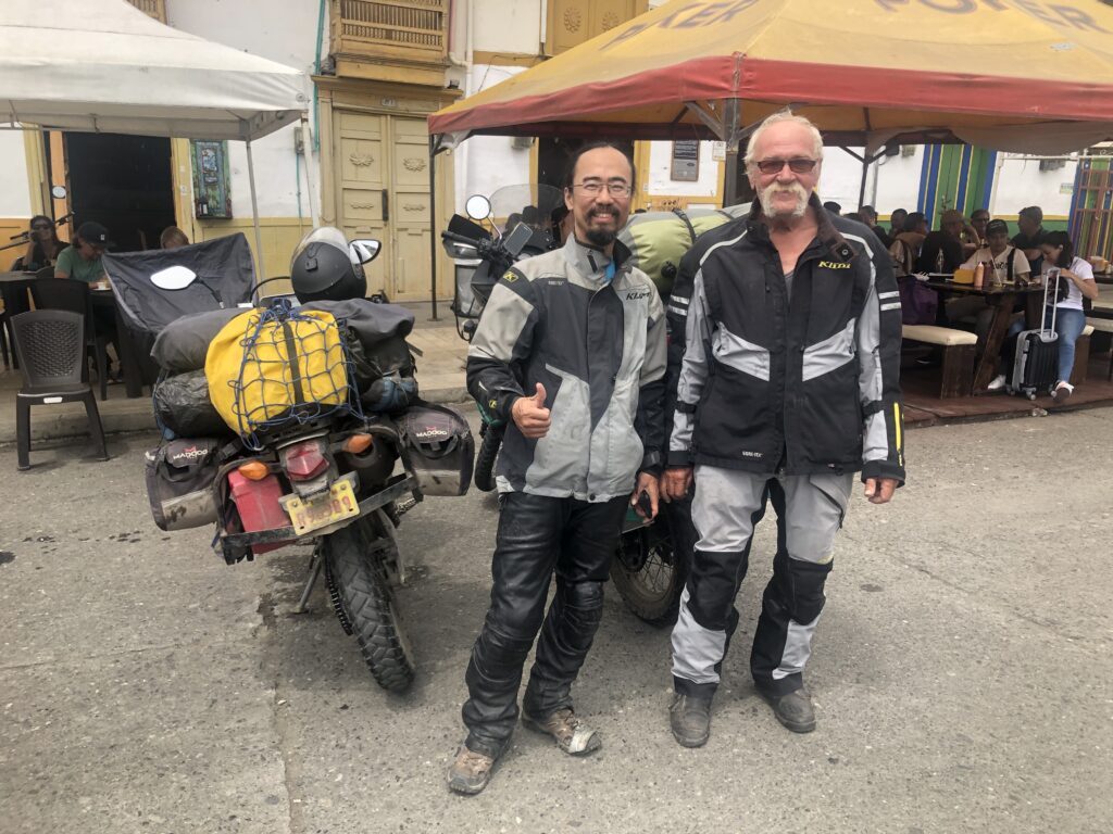
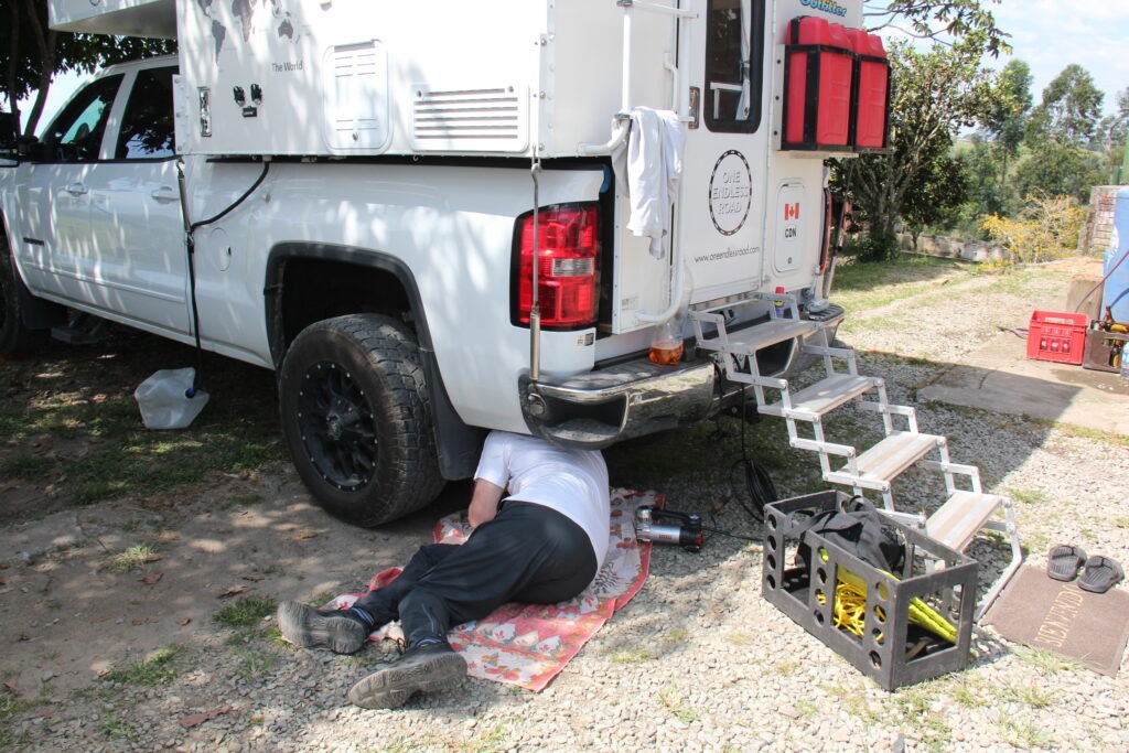
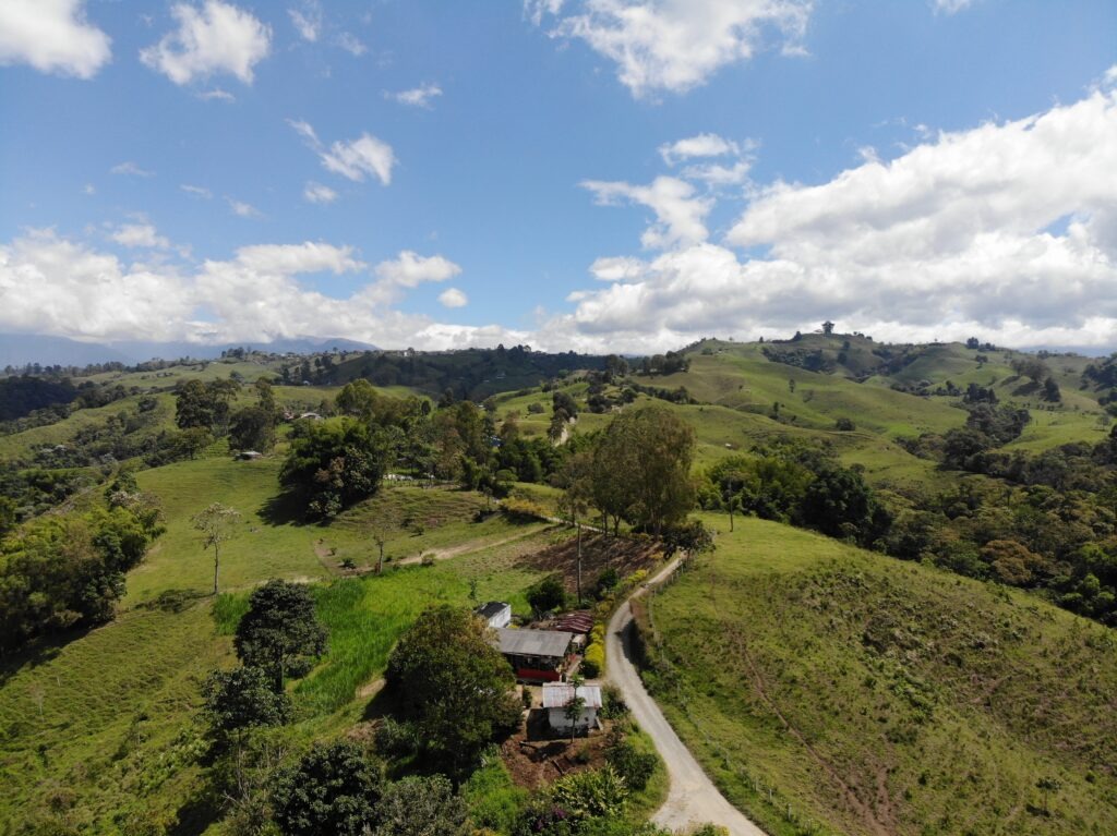
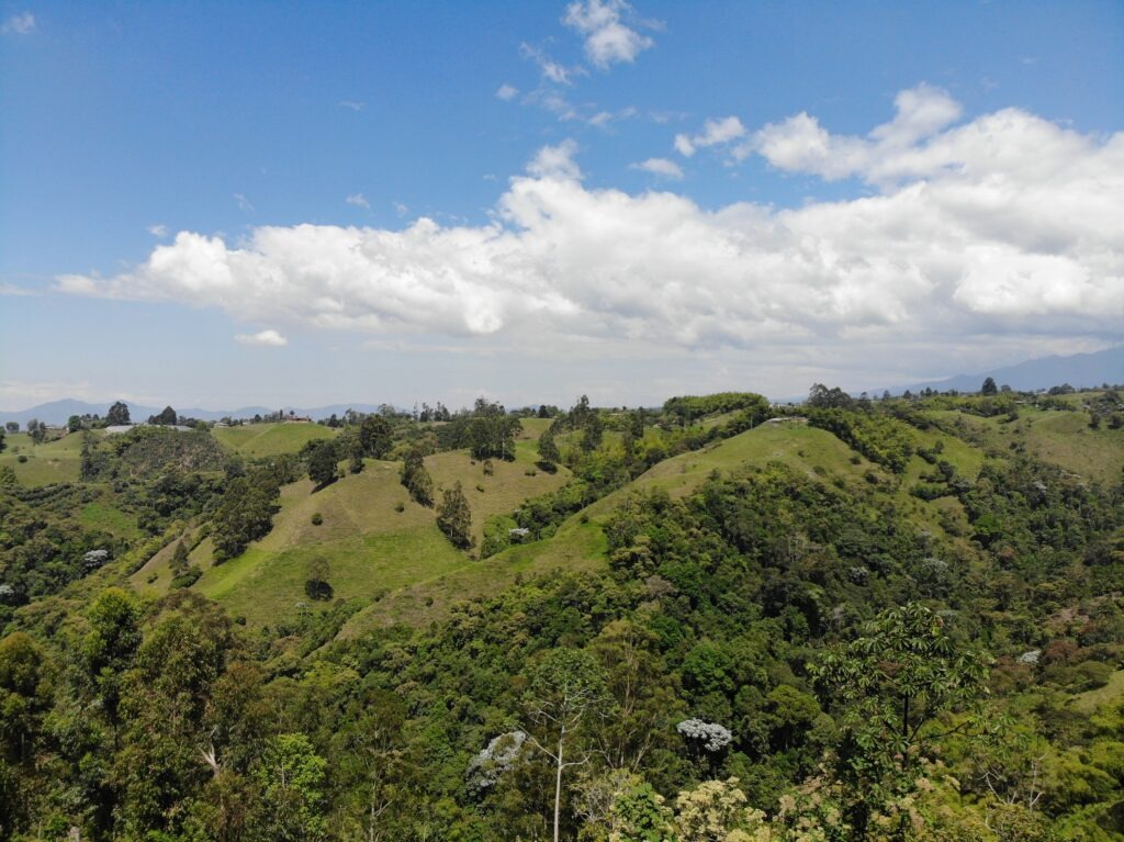
Filandia town squareFilandia town squareFilandia town squareEntry to Finca Steel HorseRik, from Holland, and Allan, from Alberta, Canada crossed paths with us in Filandia. They hope to be in Ushuaia by March. Yvette, the British owner of Steel Horse, is in betweenA little vehicle maintenance – possible leaking air bag – ughh !Aerial view from above Finca Steel Horse to nearby farms – our drone is back in the air !View from Finca Steel HorseAerial view of Finca Steel HorseFinca Steel Horse – a great place to relaxNearby coffee farmsIt’s all about the horses !Filandia, a great place for horse rides and walks around the coffee farmsThe horses at Finca Steel Horse
There is some blogging to catch up on, some drone flying practice to be done and a whole bunch of other overlanders to share travel tips with. The weather is divine – we just might stay a while…….!
Happy New Year to all our readers ! Lois and I sincerely hope you enjoyed the Christmas season as much as we did.
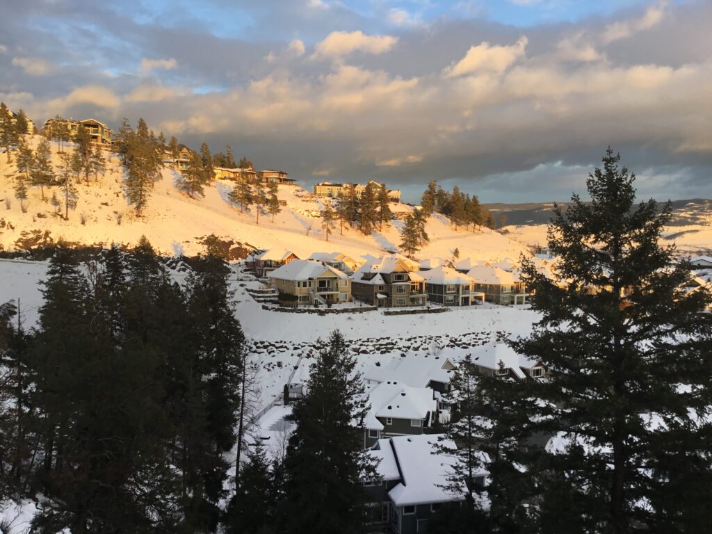
Christmas day view from our home
As of our last post we were leaving Bogota and preparing for a 4 week trip back to Canada to spend the holiday season with friends and family. The trip back to Canada, and our month spent there, could not have gone more smoothly; the return to Bogotá – well, more on that later. Let’s just say we would not wish the last few days on anyone !
Flights back went smoothly, all were on time and it was wonderful to see everyone, catch up on news at home and share a few of our own tales from the road. Almost 8 months into our Pan American adventure and comments from those we speak to are about evenly split – either “You must be nuts”, or “What a fantastic experience” ( with likely a good percentage of the latter group probably secretly thinking “They actually must be nuts” ! ). Hey, we get it….it’s not everyone’s cup of tea.
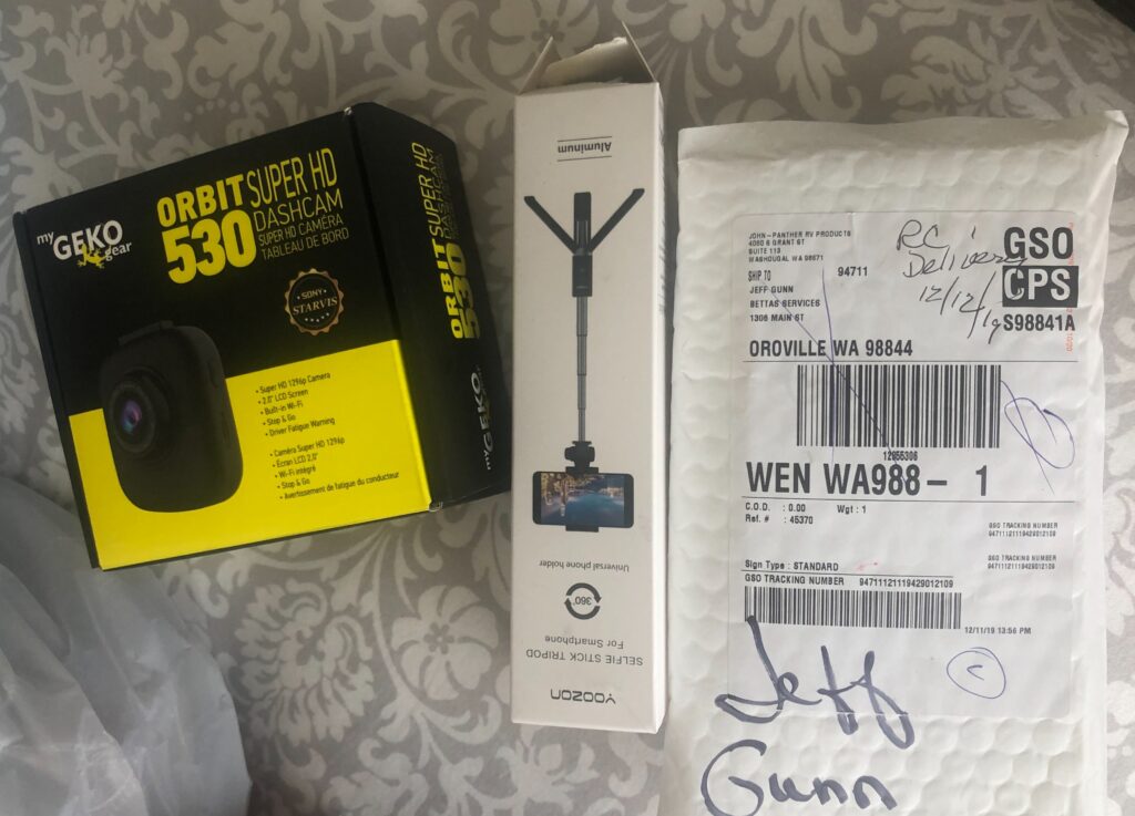
While the social side of our time away occupied most of our time, some time was spent shopping for essential new items (and a few replacement parts ) for the camper ( what did we do before Amazon ? ). I also had to get some further training on blogging ( readers may notice we upgraded the website ) and flying the drone ( nearly lost it last time I had it in the air ). Many thanks to Sue Ross, my amazing WordPress coach, and to Chris Woods who braved a freezing cold day to set me straight on the finer points of flying a Mavic Air !
While things have, touch wood, been going generally smoothly with the camper, we’ve managed to get a few holes in the gauze screens, worn out our toaster and lost a few special screws from our SMEV stove. In addition we had completely broken one of the two roof top vent lids ( message to self – don’t leave them wide open on really windy days ) and had to replace one of our two, 100 watt flexi solar panels. Procuring the latter two items in a size to fit the existing spaces proved quite challenging ( our camper now approaching 5 years old ) but we managed in the end ( Andy, thanks again for the custom trimming on the solar panel ).
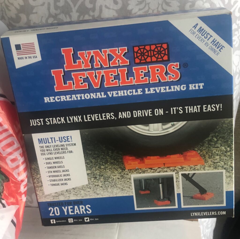
Extra parking levellers – we often forget them when we leave a campground !
In addition to replacement parts, we made a few additions. With almost 80,000 kms on the original brakes, much criss-crossing of the Andes ahead and our vehicle not exactly being ubiquitous in South America, a replacement set of brake pads seemed a prudent move. Power supply will also soon be an issue – once out of Ecuador ( our next stop ) the voltage changes from 110 ( with North American style plugs ) to 220 ( with different plugs ). To date, on the rare occasion we need to charge with shore power it has been a simple matter of plugging in to any standard outlet ( which are all just like home ). That luxury stops when we cross into Peru so, like any good Boy Scout, one best “be prepared”. Rather than a heavy, and expensive, step-down transfer, ( for something we will rarely need ) we opted for a lithium-compatible battery charger with the option of a 220v input ( the adaptors we have already ). This should ensure that on the rare days where we have no sunshine ( for the solar unit ) and the vehicle alternator charge is inadequate, we can still get a full charge into the battery. One must have one’s creature comforts !
Dash cam, selfie stick, and stove parts
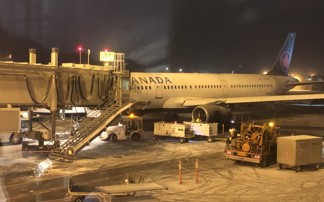
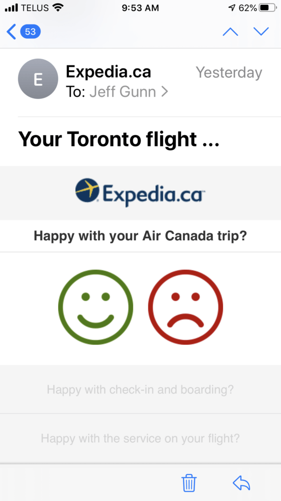
Thus equipped, and with 4 weeks having flown by, packing began for the return trip. While the weather had been unseasonably mild during our time in Kelowna ( generally in the mid single digits – positively balmy for Canada in December ! ), Monday delivered the leading edge of a cold snap, and a heavy snowfall that swept the country. That would be just the beginning. Our route back called for a stop in Calgary, overnighting and then an early connection to Toronto Tuesday morning and on to Bogotá arriving in Tuesday night.
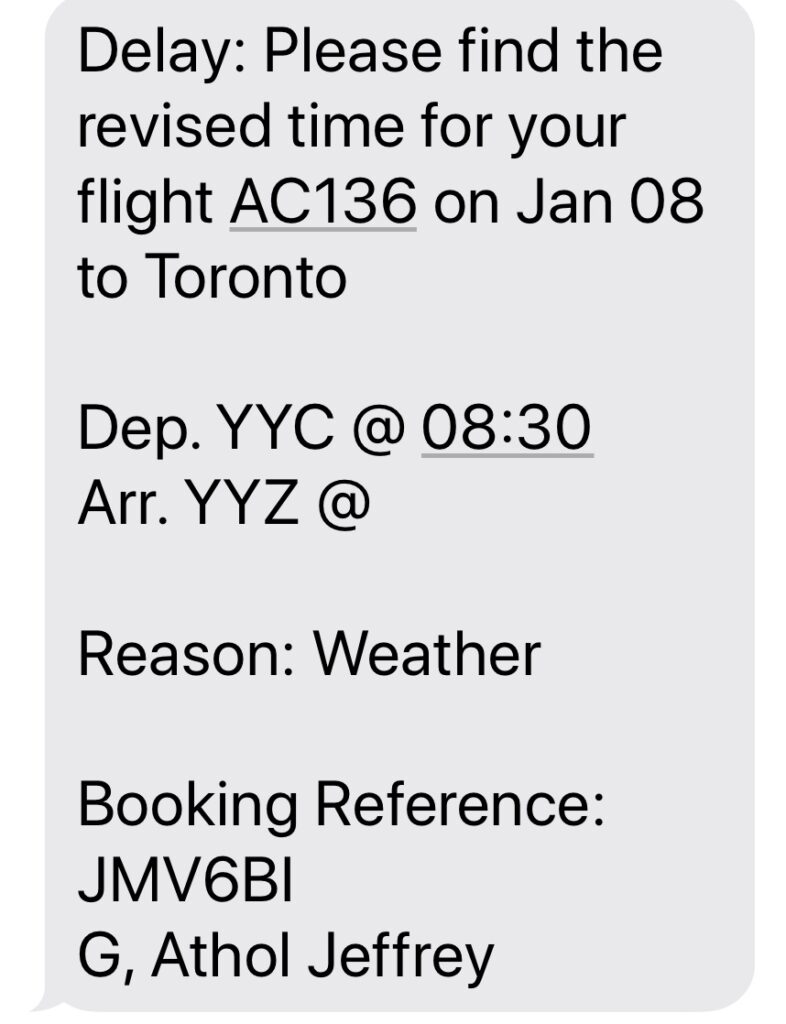
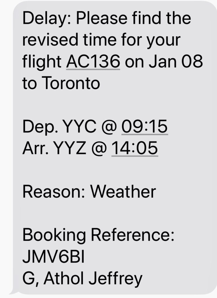
Turns out the small Dash 8 that took us to Calgary had a weight and balance issue – as luck would have it our three bags were included in those that got left in Kelowna. Air Canada would put us up in a hotel and our bags would meet us in Toronto or Bogotá. No such luck – “weather” it seems, is the escape clause airlines use to avoid comping passengers for a hotel, so we were on our own. Sadly, Tuesday was lost as a travel day too, since our bags could not get to Toronto in time for the flight to Bogotá – a day lost as a result.
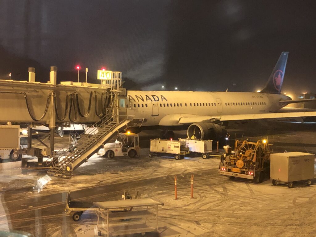
Our plane from Calgary to Toronto, stuck with frozen flaps
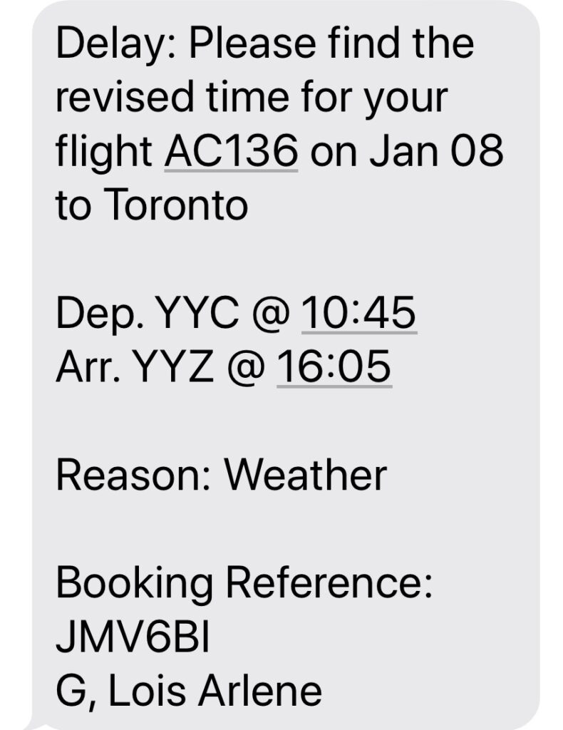
Wednesday looked great – all passengers boarded the plane and it appeared it would even depart early. Then the captain advised that we had an “unusual” problem and would all have to get off the plane. He advised that the captain who had parked our plane the night before had left the “flaps” down when they should have been up ( or was it vice versa ? ) and that, with all the ice in -10 degree weather they could not move them.
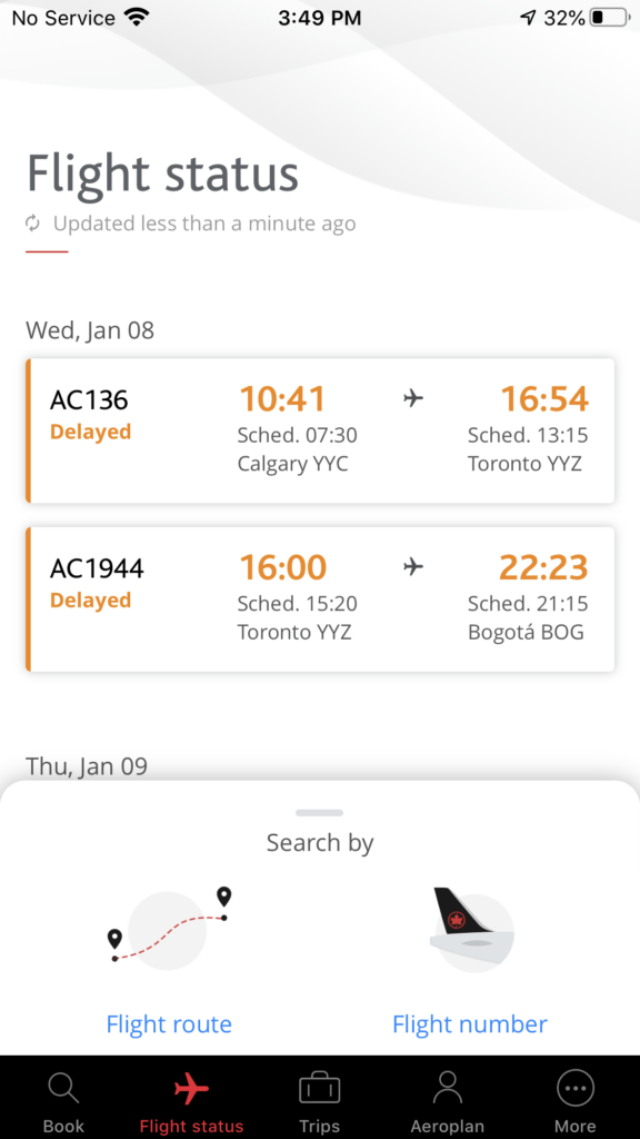
Long story short, our 07:30 flight left at 10:41 arriving in Toronto just in time for us to miss the connection to Bogotá. Ughh ! Another night in a hotel, and again, “on our own” since Air Canada also deemed it “weather related”. So, tired, and frustrated, we took another hotel and waited yet another day.
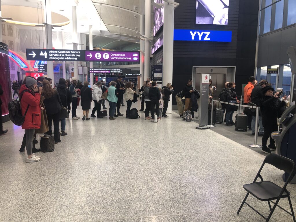
First text from Air Canada….Then this…..Then this…..And finally this !Which meant that we would miss our Bogota connection……Line up to complain ( to no avail ) at Pearson airport when we got to Toronto !At least we got to tell Expedia what we thought about the flight !
Things started turning up Thursday – we were assured our bags were indeed now in Toronto and re-tagged for the Bogotá flight. The flight left on time and this time actually arrived 12 minutes ahead of schedule ( a nice change ! ) – we were, finally, back in Bogotá. Twenty minutes later we had our bags, and solar panel in hand, shuttled to the hotel. Feeling a little sorry for ourselves after a long and tiring trip down we splurged on a Hilton – hey, there would be plenty of nights ahead in a truck camper !
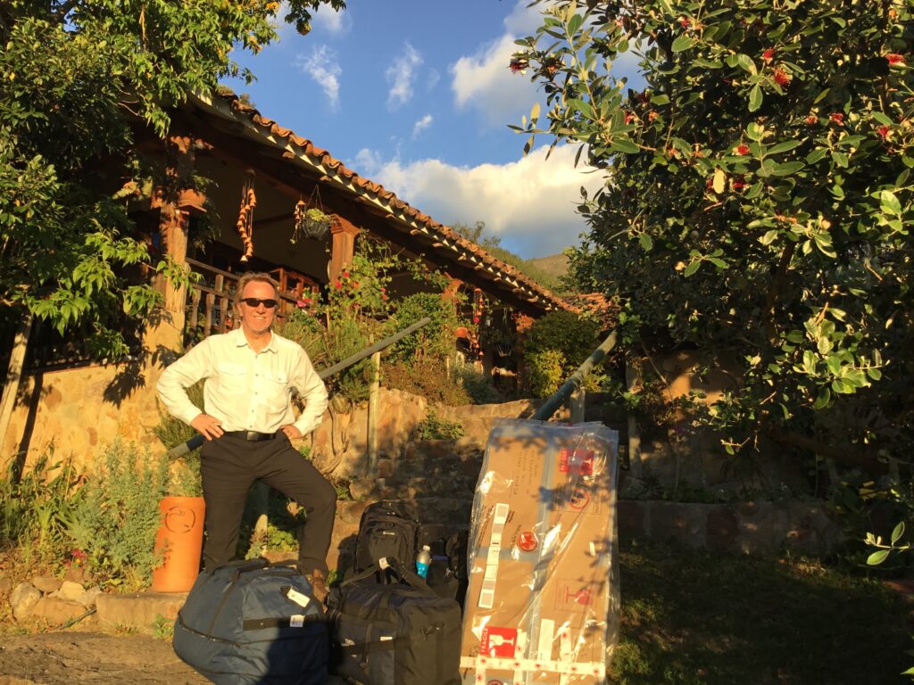
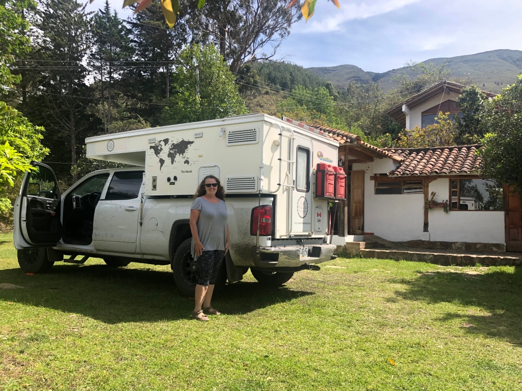
The weather in Bogota was perfect – sunny and 25 degrees, which almost tempted us to stay another night but we were anxious to get back to Villa de Leyva, to our vehicle, so we could unpack, install our new parts, and generally get ready to hit the road again. The truck/camper was found just as we had left it, much to our relief.
Back in Villa de Leyva – our fragile solar panel survived intact !
With a weekend ahead to get re-established in Villa de Leyva, get repacked and do some minor repairs, we would, with any luck be ready and very happy to finally get ( please excuse the Willie Nelson reference ) “on the road again” !
From Cartagena, Medellin was our next port of call in Colombia. As the crow flies, not a great distance at all but not too far north of Medellin we were already climbing hard and entering the northern edge of the Andes mountains. Add to the mix a steady stream of heavy trucks, slow buses, a period of torrential rain and you can see why just 670kms on the map translates to 15 hours of driving !
Our route to Medellin When it rains in Colombia, it rains hard – visibility near zero as we left Taraza en route to Medellin
In the ‘80’s and early ‘90’s the mere mention of the city of Medellin conjured images of drug and gang violence. It was at the time one of the most dangerous cities in the world. Definitely a ‘no go’ area. The death of Pablo Escobar in a shootout with police in 1993 was the beginning of a revival for Medellin. Indeed it is now held up as a model of how to combat gangs and drug violence. The problem, of course, has not completely disappeared but no longer do its citizens live in perpetual fear and it is considered one of the safest cities in Colombia these days. An impressive transformation we thought, and, a city now on every Colombian visitors list.
Once the rain stopped the scenery was wonderful
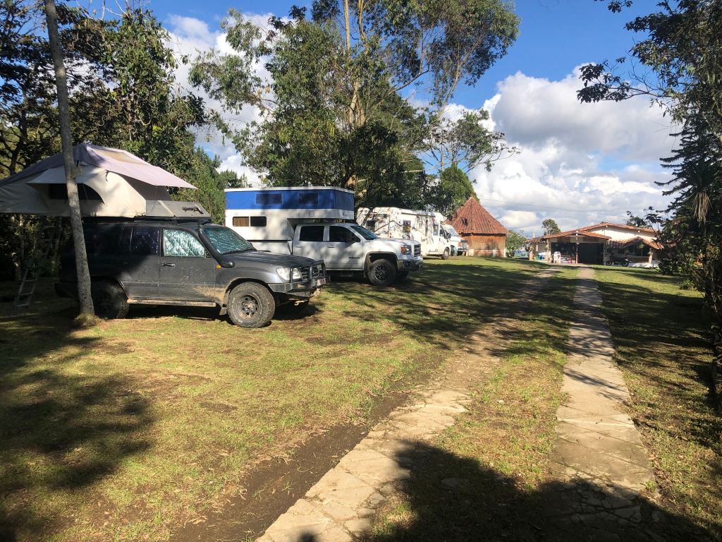
Our campground, El Bosque, was outside the city in the eastern highlands and one of the nicest places we have stayed on our trip so far. A beautiful setting, on the edge of a national park, with great amenities, nice and cool ( being a full kilometre higher than steamy Medellin ) and with super friendly staff. We were not alone, with a French couple and two Belgian couples also staying there – one of the Belgian couples had been on the road 12 years ! Definitely THE place to stay for Overlanders in Medellin but the drive to get there, through the heart of Medellin’s insane traffic during Friday rush hour was definitely stressful and not for the faint of heart.
Belgian, Canadian, Belgian and French Overlanders at El Bosque campground, outside Medellin
The shortest route to downtown Medellin from our place was by cable car – an excellent way to commute to the downtown since there was no way we were driving back there ! The views over the city were amazing as one drops a full kilometre to the downtown area passing over the very barrios that were once Escobar’s heartland. Medellin offered up a beautiful day and we spent our time exploring the downtown sights and wrapped up our day with a walk through the Botanical Gardens – worth it for the flora and fauna alone but an added benefit was the escape it offered, in the middle of the city, from Medellin’s relentless noise – not a place to go if you crave peace and quiet!
View of Medellin from lower down on the “MetroCable” ( cable car )View upwards over the barrios on the east side of Medellin View of Medellin from near the top of the cable carOne of Medellin’s more eclectic buildings“Adam and Eve” bronze sculptures by Medellin’s very own Botero, downtown MedellinPedestrian area, downtown MedellinThey make fine coffee ( unsurprisingly ) and an excellent hot chocolate !Some flora…….…and some fauna at Medellin’s Jardin Botanico
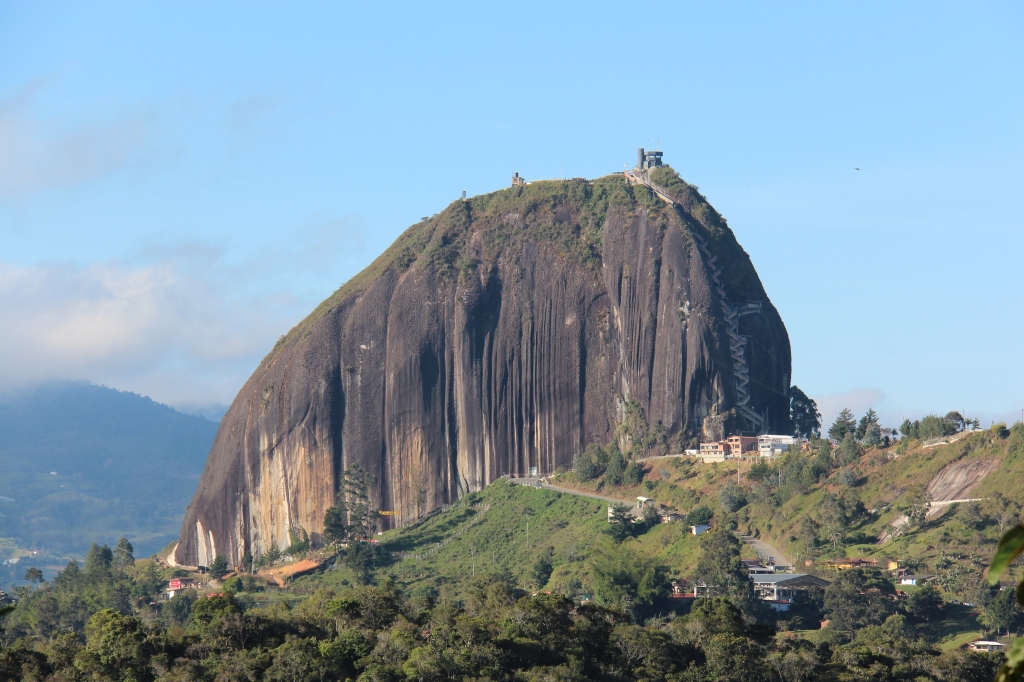
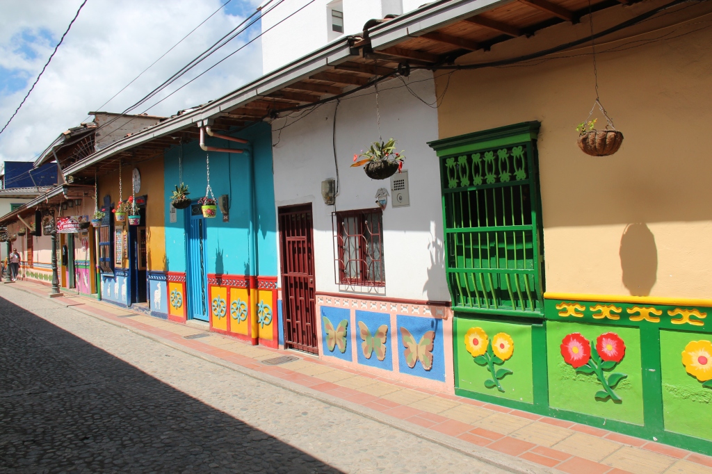
Just east of Medellin is a locally famous area of lakes and mountains centred on the town of Guatape. Heading east it seemed like a logical place to break our journey. While a little on the touristy side, the town and surroundings are indeed beautiful – not just famous for the lakes but the huge rock bluff ( El Penon ) that protrudes 656 feet straight up and is visible for miles as you approach the town. Colombia is justifiably famous for its colorful towns but Guatape is probably THE most famous of all Colombia’s town in terms of being “colorful”. Seems every house and business is trying to outdo the other and it does give an amazingly vibrant overall feel to the town as evidenced in the pictures below.
El Penon, Guatape Colorful homes, GuatapeFountain, GuatapeCobblestone street, GuatapeGuatapeGuatapeView of lake, Guatape
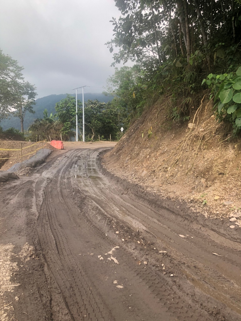
Leaving Guatape we got yet another lesson in relying on Google Maps – as in you can’t always ! Our route, ostensibly the shortest and quickest ( the latter does not always follow the former in Colombia ), turned out to be anything but and included 3 hours of bone shaking surface – potholed, gravel strewn mud covered and occasionally flooded at times barely wider than the donkey path it likely once was ( and we saw more of those than cars on it ). Given the remoteness and altitude ( at times over 9,000 feet ) we were concerned how we would ever get out if we had any vehicle problems- fortunately the truck handled it all with ease, even if it looked the worse for wear afterwards.
Google Maps indicated route 60 was a highway all the way – not so !“Highway” 60, east of Highway 45Same road, in a bit better conditionSome strange shaped peaks up at 9,000 feetOur altitude app – useful in Colombia !Truck was ready for a wash when we got to Villa de LeyvaFound a great “auto lavado” ( car wash ) run by two young refugees from Venezuela – you see many of them in Colombia. Did a great job cleaning it up.
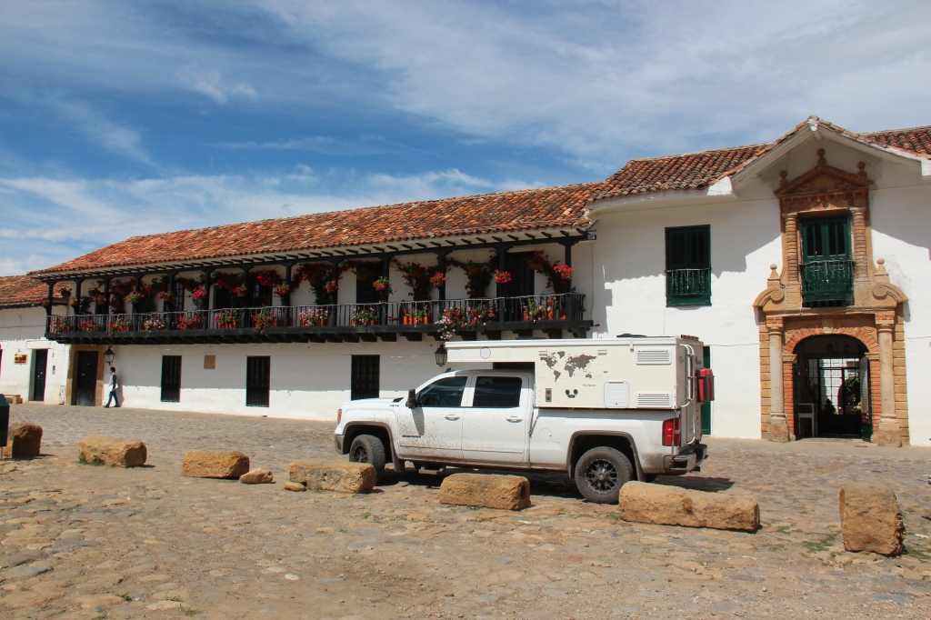
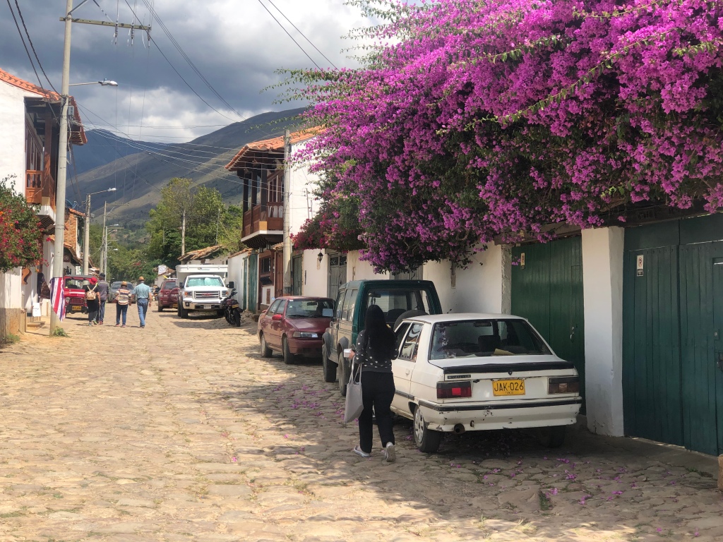
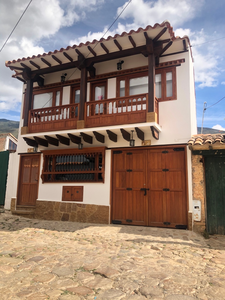
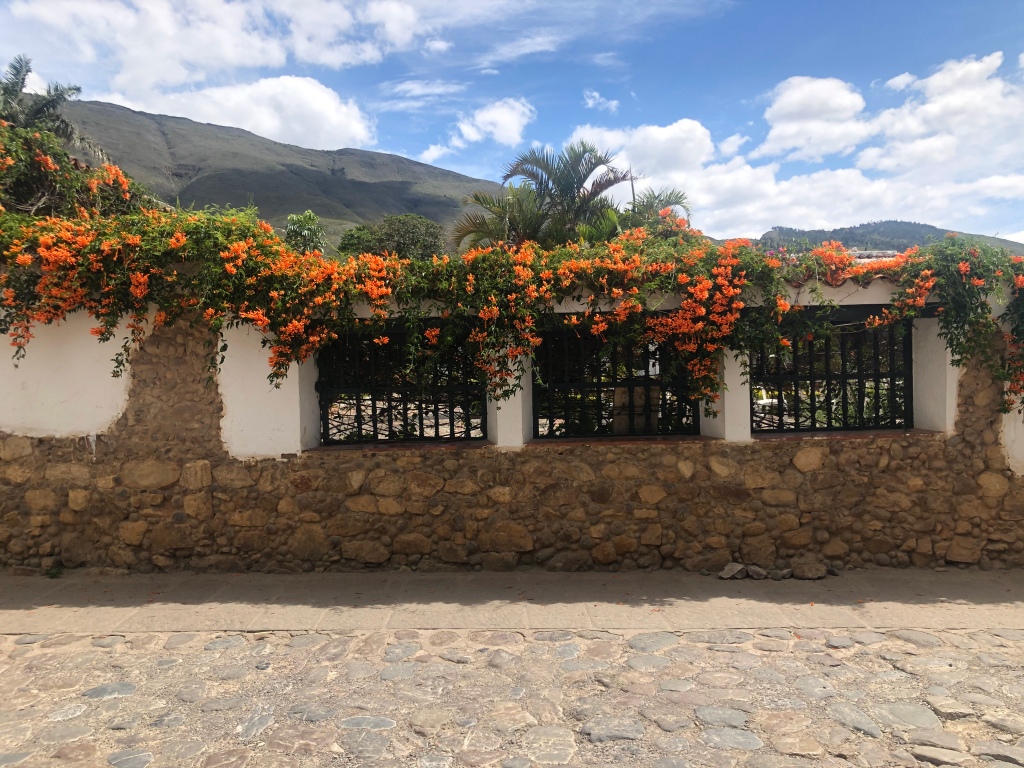
Arriving in Villa de Leyva quite late as darkness fell ( something we never do as a rule ) it was no problem to find the Renacer campground and first impressions were definitely in line with the high expectations set based on others who referred us there. A classic Colombian villa set on the edge of a mountain with great views and a relaxed vibe- we quickly elevated it to the top of our best in Colombia, edging out El Bosque in Medellin. Villa de Leyva, considered Colombia’s most picturesque and original colonial town did not disappoint either. While it was sheer hell getting here ( at least via the route we took ) we’re glad we made the detour to do it. A great place to spend a few days unwinding after a rigorous journey to get there – our stay further enhanced by the opportunity we had to spend some quality time with Peter and Heike, a German couple who were doing the same Pan American route as us ( also in a truck camper ) but doing it south to north ( as many Europeans do ). They picked our brains on Central America and Mexico and we theirs on countries that lay ahead for us in South America.
Plaza Mayor, Villa de LeyvaSame plaza, looking the other wayAnd one more viewParked in the main square, Villa de LeyvaSide street, Villa de LeyvaEven new construction fits the “colonial” themeThe flowers here were extremely colorfulLois at Renacer campground, Villa de Leyva
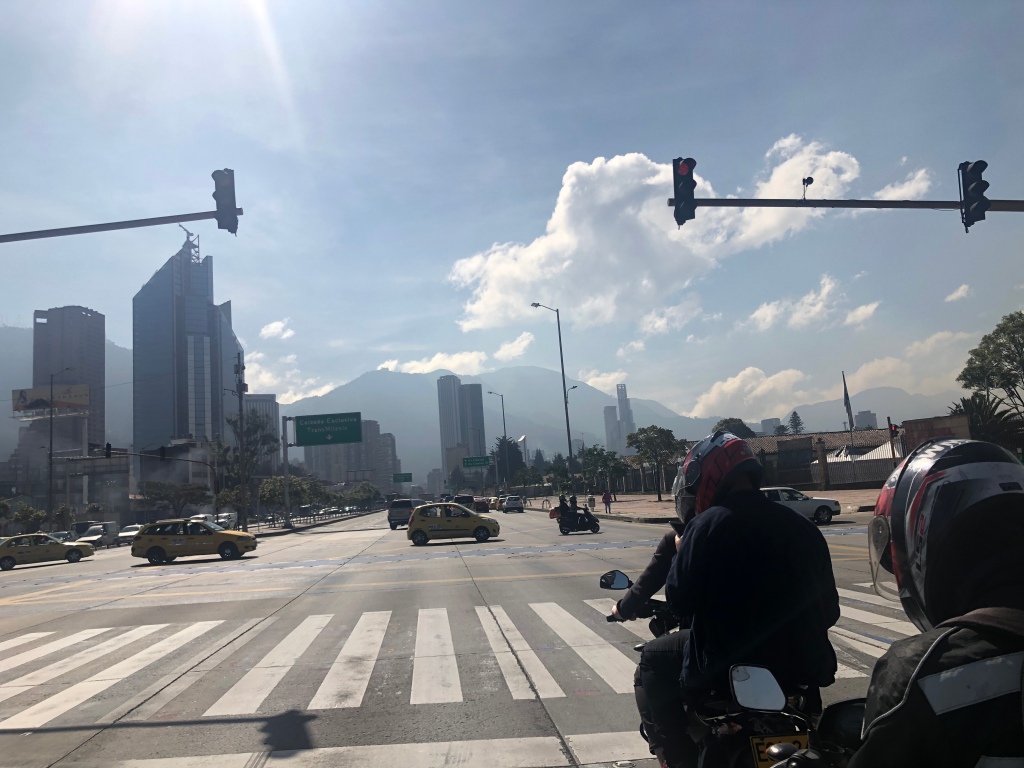
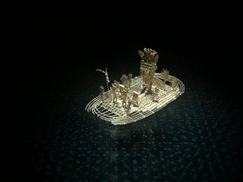
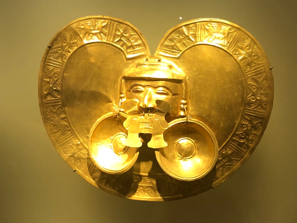
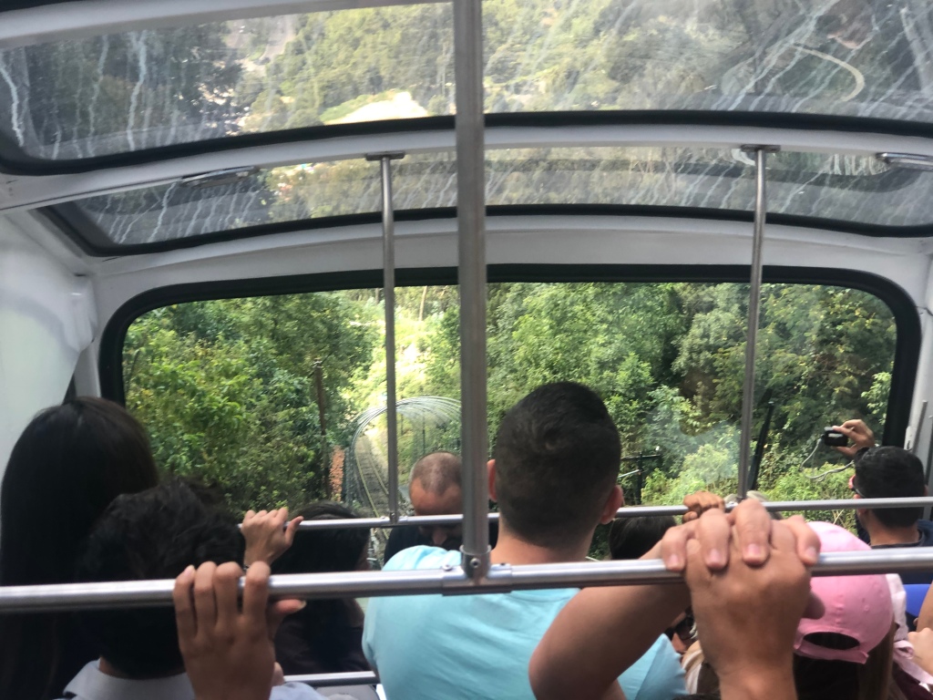
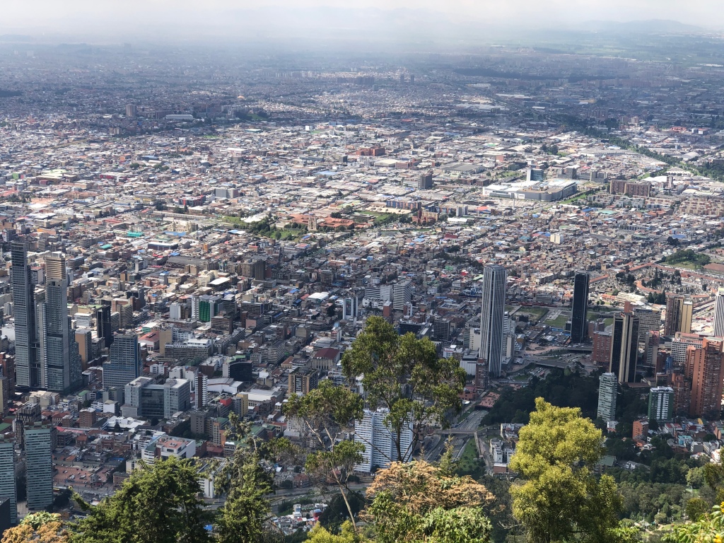
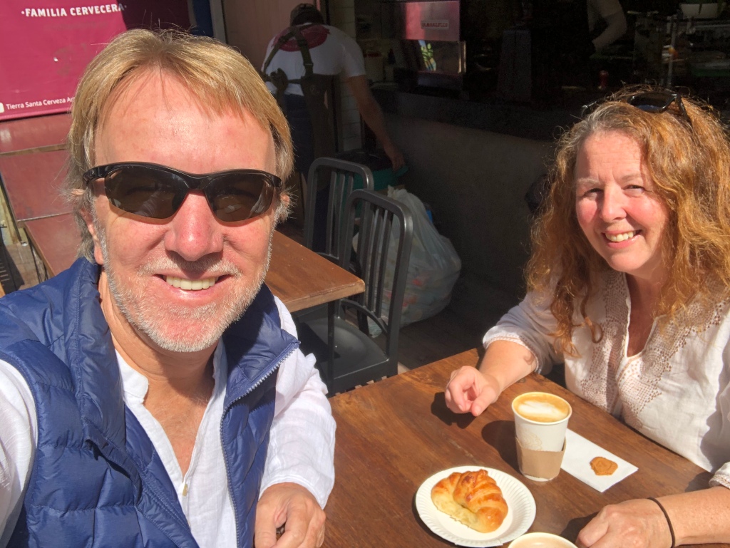
“Villa” is one of those places that’s tough to drag yourself away from but after 3 days there we left for Bogotá, excited to be heading home in just a few days. Bogota had seen a national strike the day before so all the traffic that was not on the road on Wednesday caused volumes to double on Thursday – getting into the city was brutal. With really only a full day at our disposal we limited our sightseeing to the world – renowned Gold Museum (one of the best museums we have ever been to and deserved of its exceptional reputation), some downtown wandering and an excursion on the city’s impressive funicular train up to nearby Monserrate ( treated ourself to a great lunch at the restaurant up top on our last day in Colombia and took in the spectacular views over Bogotá ). We would of course be returning to Bogotá in January – plenty of time for the other sights then.
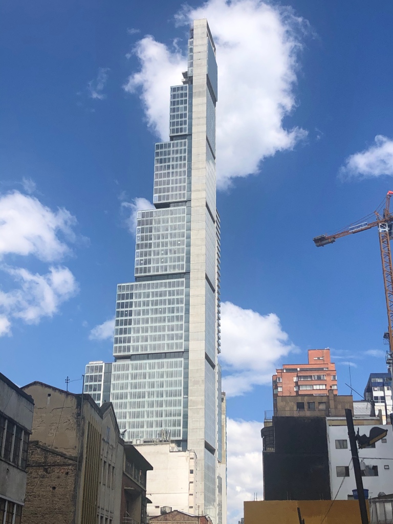
Heading in to Bogota’s downtown for some sightseeingJust one of the many ornamental gold articles in the Bogotá Gold MuseumAnother, a miniature raft, incredibly intricateMore from the Gold MuseumPanama was not the only city in Latin America with fancy high rise buildings !Funicular rail up to Monserrate View of Bogotá from the topUs…..enjoying a final Colombian morning ‘fix’ and beautiful sunshine in Bogotá before flying to the freezing north !
To all our faithful readers we sincerely hope you have been enjoying travelling along with us – we love hearing from you so keep the comments coming ( we always reply ! ). Enjoy the Christmas and New Year season with all your loved ones and we will be back at it in January ?. Feliz Navidad !!
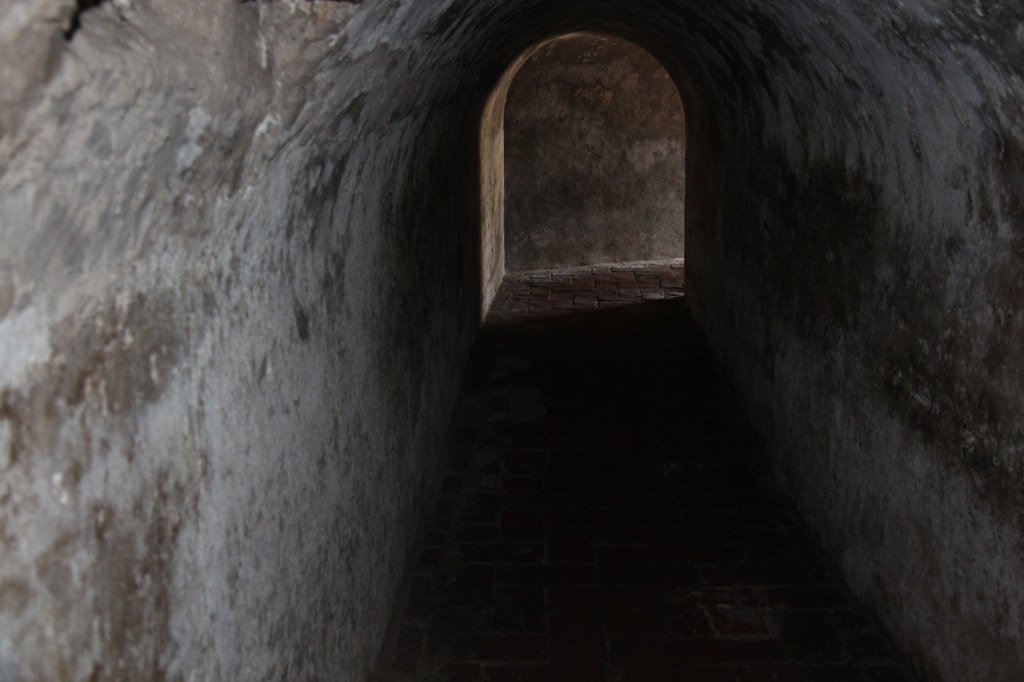
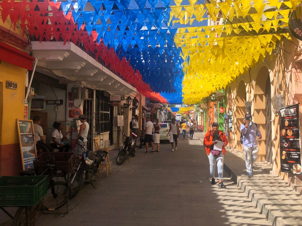
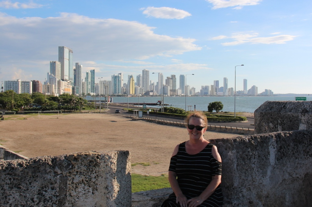
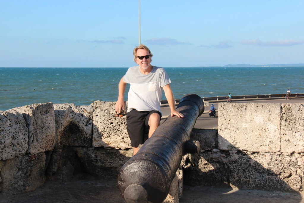
Cartagena continued to delight us while we waited both for our shipping buddy, Cassey – who sailed from Panama to Colombia on a yacht- and of course the container that held our vehicles. In the days while waiting for the unloading of the ship there was time to explore Castillo San Felipe ( one of the more impressive Spanish forts we have seen in the Americas ), to sample Colombia’s legendary Carribean beaches ( Isla Baru in our case ) and simply wander the old town fortifications and myriad streets and alleys inside it. Added to the great sights was the great weather; while Panama delivered rain on at least part of every day, Cartagena was sunny, hot and dry every day we spent there. It’s the kind of city where people often stay longer than expected; as it transpired we would fall into that category – and quite happily so.
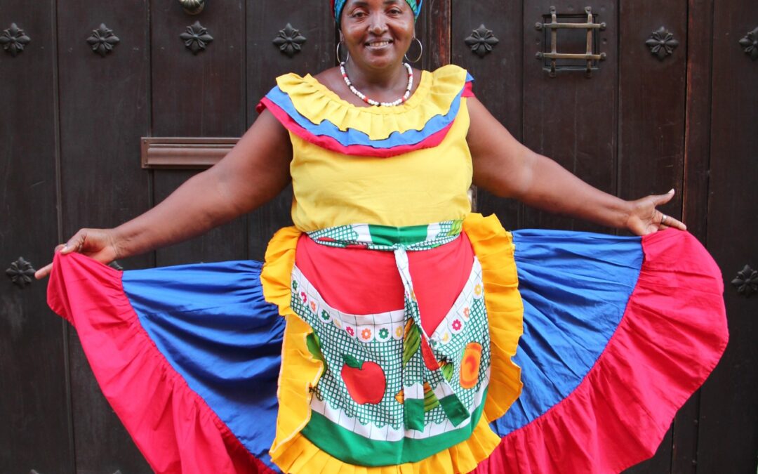
The city attracts people from everywhereAn entrance to the old town through the original wallsCastillo San Felipe Castillo San FelipeOriginal cannons, Castillo San FelipeTunnels, Castillo San FelipeCartagena is famous for its murals, such as this oneColombian fruit seller in traditional wearIsla Baru, south of Cartagena Isla Baru
While we were enjoying Cartagena, Cassey was making her way across the Carribean on the sailing yacht “Amande”. The highlight of that trip and the reason many overlanders choose to sail, rather than fly, to Colombia is the San Blas islands. We had heard lots about them – Cassey’s pictures below ( these are not ours ) will give a taste of what the San Blas islands offer for any of our readers that may be contemplating a visit. Carl, Renee, Victor – you might want to consider it !
Cassey’s yacht, the “Amande” in the San BlasCassey relaxing in the San BlasThe Amande, anchored in the San Blas
The Stella Walvis Bay sailed into Cartagena port ( with some precious – to us – cargo on board ) exactly as scheduled at about mid day Saturday. The plan was to hit the shipping terminal by early Monday afternoon as Cassey’s yacht was scheduled in by late morning (we could do nothing over the weekend of course ). That would allow us get all the import clearances, fee payment, vehicle unloading done and out by Tuesday afternoon. Well, not everything went exactly to plan. A container ship under power can pretty accurately predict its ETA – not so a yacht reliant on winds ! Due to poor wind conditions the yacht was delayed almost a day so we were set back a day as a result. That said, Cartagena is a nice place to be stuck and we occupied our time easily with the aforementioned activities and sights.
Night scene, old town, CartagenaOut for dinner, old town, above a town square
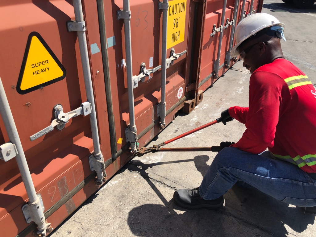
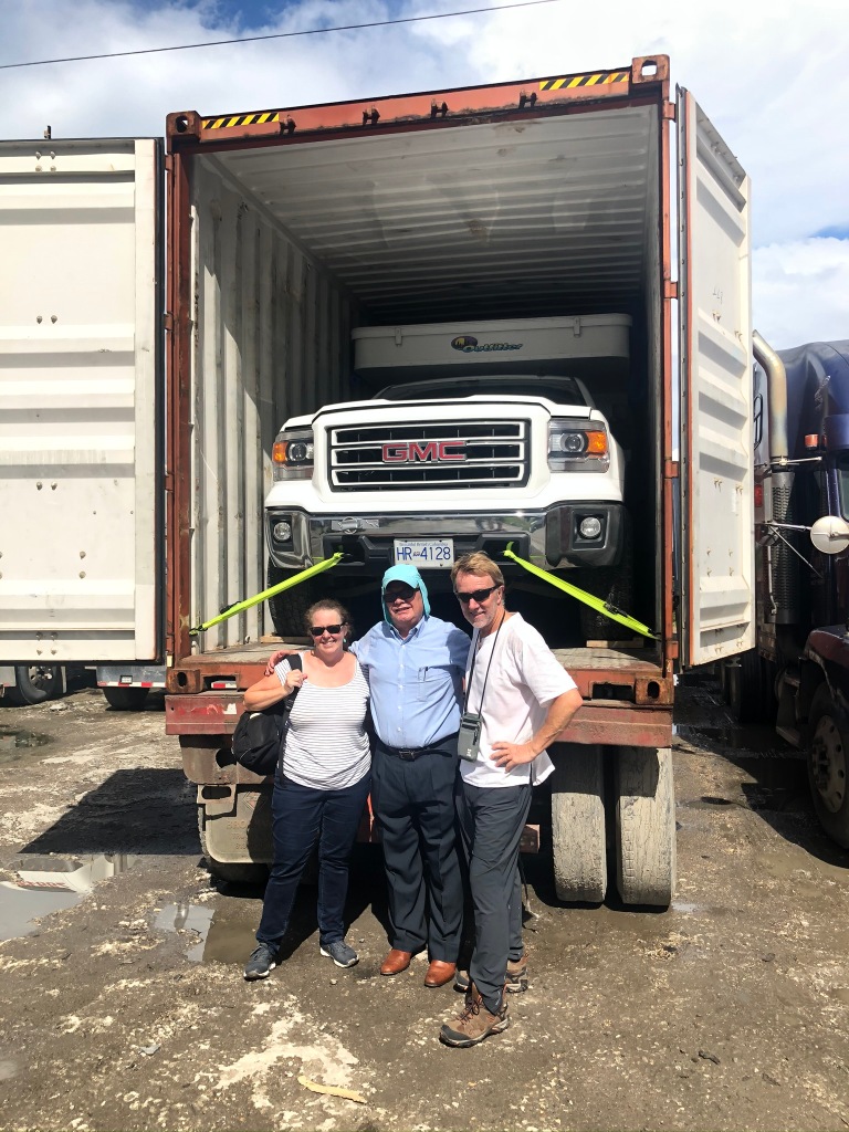
Once Cassey arrived we got down to the retrieval process. It is indeed quite a “process” but our shipping agent provided a detailed and accurate step by step guide and we managed it ourselves over the course of Tuesday and Wednesday. Naturally, the most exciting part was opening the container – I’d admit to some fear and trepidation ( it’s not uncommon for vehicles to move around in a container and with just inches between the camper and solid steel container walls, I was bracing for the worst). Such fears were unwarranted – the container doors were opened and both our vehicle and Cassey’s Westfalia were exactly as we had left them in Colon, Panama. We breathed a collective sigh of relief.
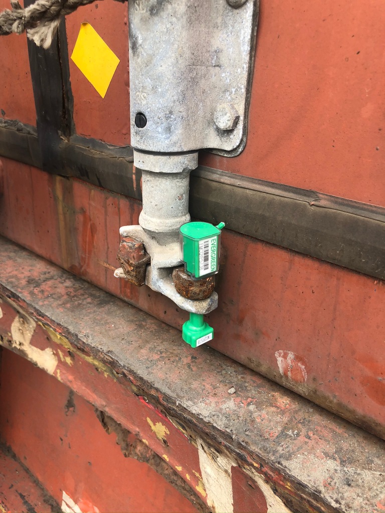
Entry to the port of CartagenaPort worker breaking the container seal put on in Colon Magic moment – opening the doorsUnstrapping the vehiclesGetting them out, unlike getting them in, was a snap !
Much running around remained after the initial inspection, including getting a temporary vehicle import permit for Colombia but that all went as expected. Cutting a long story short, by 3pm on Wednesday afternoon we were both driving our vehicles out of Cartagena port and were very pleased with ourselves. Our shared 40ft hi cube container had cost us significantly less than half what a RoRo crossing would have – and gave us the peace of mind of total vehicle security from start to finish. To the handful of Overlanders who we know read our blog – folks, if you can swing a shared container, and make the dates work it’s definitely the way to go.
Many inspections and checks – this one for the VINFinally, the most import one, the right to leave port ( Salir de la terminal ) !
Sadly, while Lois and I and Cassey had successfully completed the shipping process and essentially travelled together for almost 2 weeks, now our paths would diverge. Cassey of course had more exploring to do in Cartagena while Lois and I, with a week there already under our belts, were anxious to head south towards Bogotá. We bade our farewells but know our paths will likely cross again.
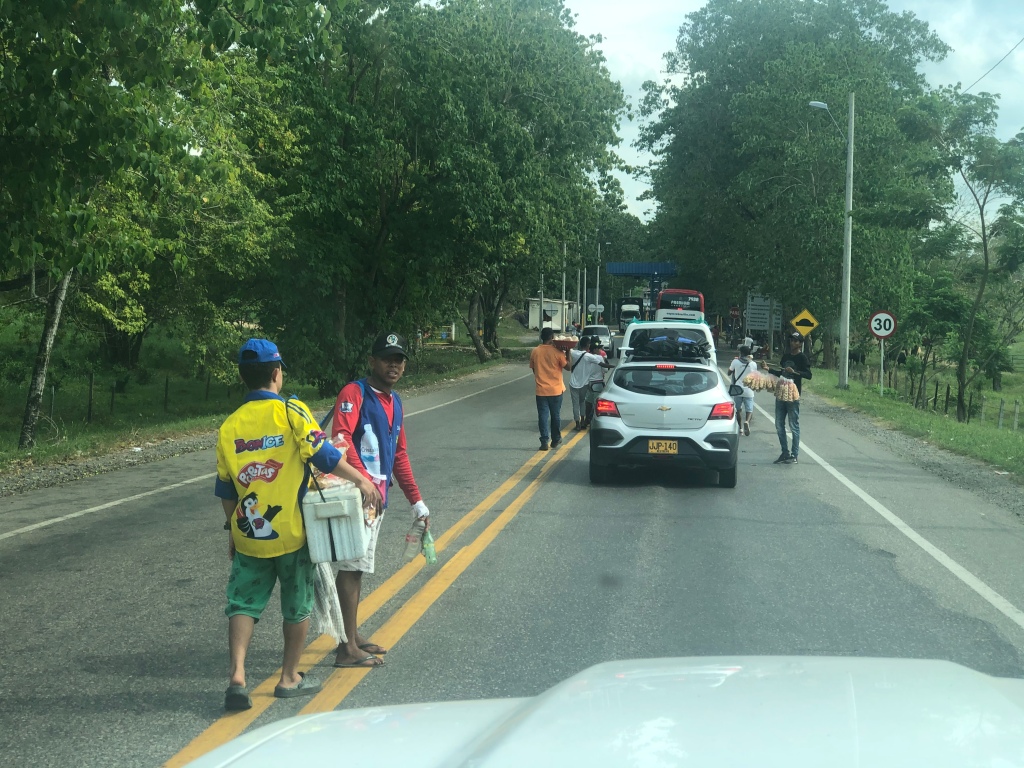
Driving out of Cartagena towards Bogotá Looking for a campsite – decided this area was probably not good !Shot this through the windscreen – a Colombian guy “hitching” a ride on a container. This vehicle was driving down the highway !Lots of tolls in Colombia – at every toll hawkers sell anything and everything – this is a typical scene
Considering we are scheduled to fly back to Canada on December 6 ( for a month at home with our family – which we are very excited about ), our final week here would need to be carefully planned out. With Bogotá almost 3 days drive south and planned stops in Medellin and the colonial town of Villa de Leyva ( where we would store the vehicle ) on the way, further exploring of Colombia will need to wait until our return in January – at which point we should have lots of time !
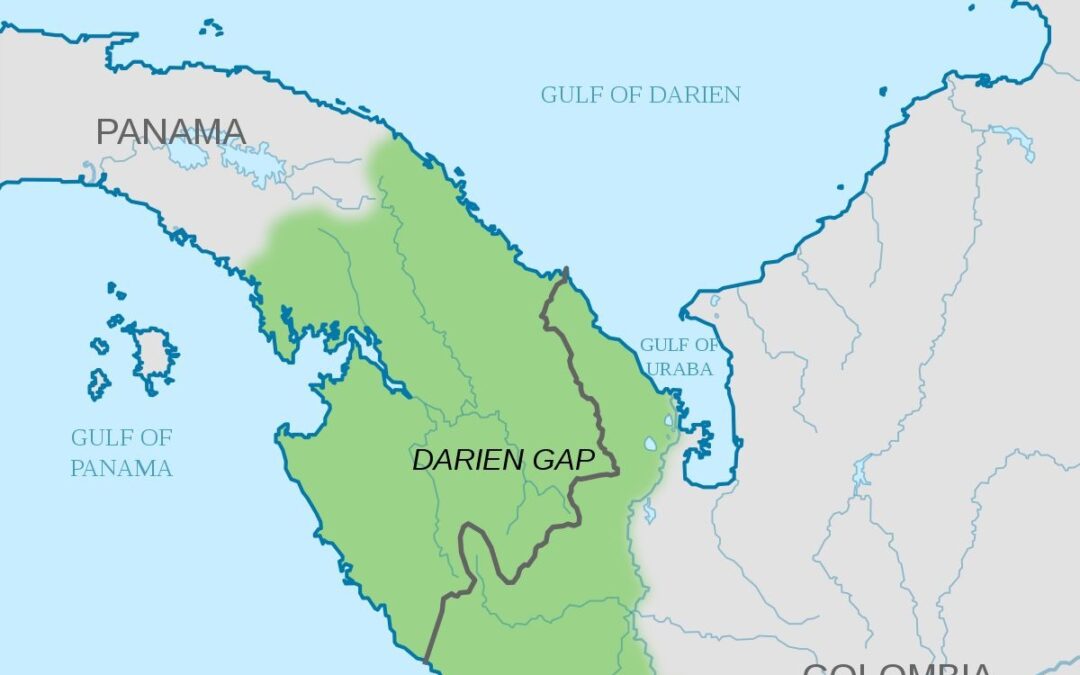
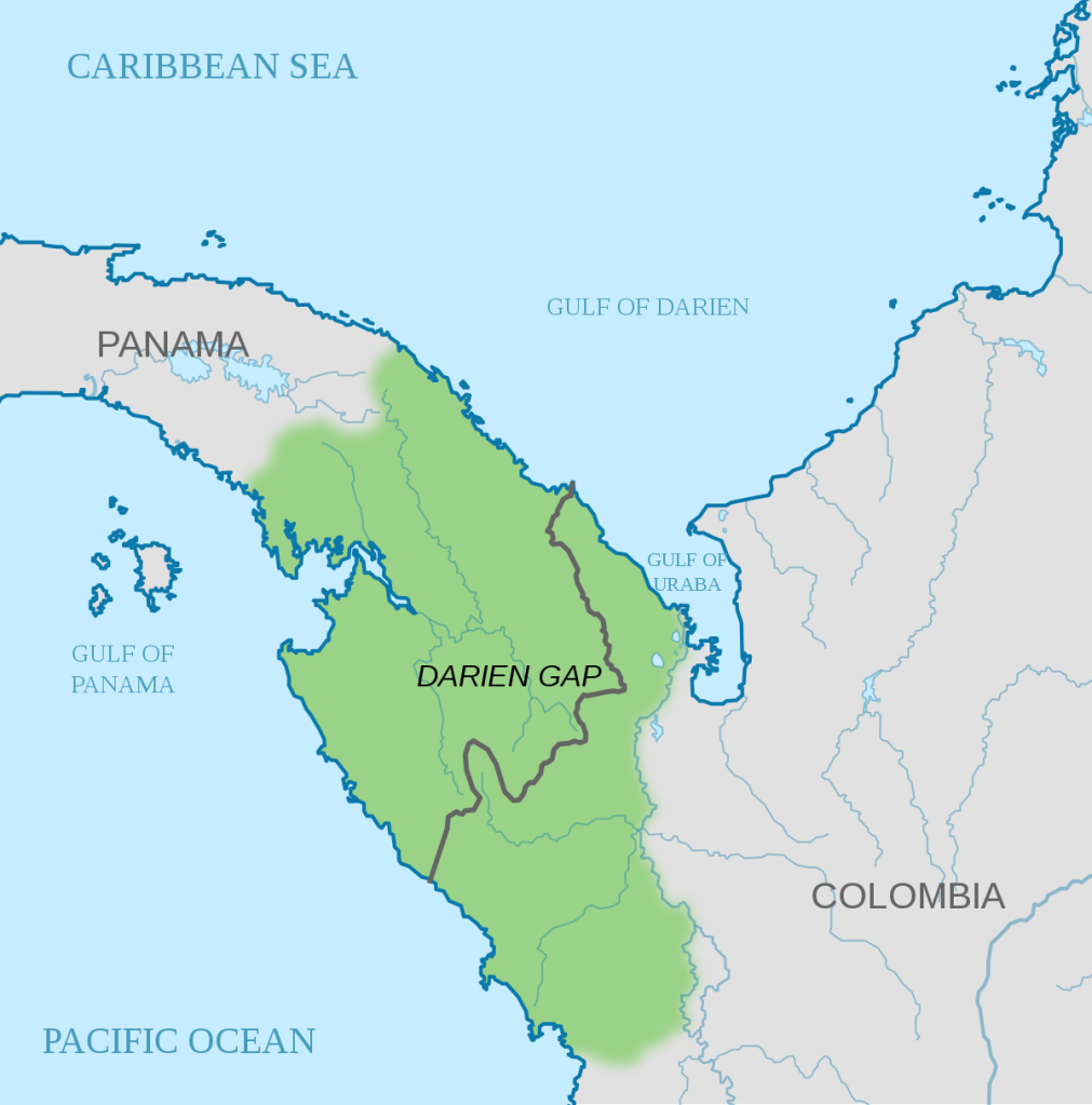
Quite simply, this was done the only way it could be. One cannot drive this impassable 70 or so miles of the PanAmerican Highway – the part between Panama and Colombia. Vehicles must be put on a container ship or “RoRo” carrier, and drivers and passengers must fly or sail between Panama and Colombia. It’s not cheap, it is stressful, and most Overlanders will admit that getting through the process is one of the biggest headaches on the 30,000km journey from Alaska to Argentina. We are now half-way through and hope to have a full ( and hopefully successful ) report to share by our next blog.
While other capital cities in Central America ( aside from San Jose ) were passed by, time spent in Panama’s capital city absorbed almost half our stay in the country – partly by design and partly by necessity. As noted last week most of a full day was spent doing a required vehicle export inspection. Following vehicle inspections, the next step in getting our vehicles around the Darien Gap was driving them to Colon ( on the Atlantic / Caribbean side of Panama ) for loading on to the container. Once it was confirmed that Cassey’s VW Westfalia and our truck/camper could both “technically” fit in a 40ft high cube ( a container that is a foot higher than normal ) deposits were paid and we committed to shipping that way – no turning back now !
The Maersk ship “Stella Walvis Bay” would take our vehicles to Colombia
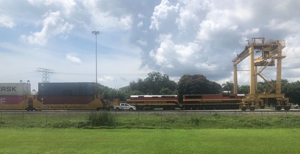
Driving to Colon was easy, the road more or less paralleling the Panama Canal and rail line all the way- odd to look out and see the occasional ship passing through what from the road looks to be continuous jungle ! Early Monday morning we met Boris, our agent, and were taken to the loading area. We’d seen the seedy side of Panama City while doing the vehicle inspection – now we saw the sketchy part of Colon. It’s not a terribly safe city at the best of times and let’s just say we were happy to be escorted around the port area for the loading process. As run down and decrepit a city as we had seen anywhere on our travels to date.
Panama Canal Railway
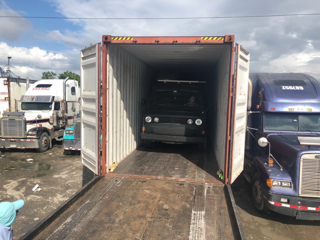
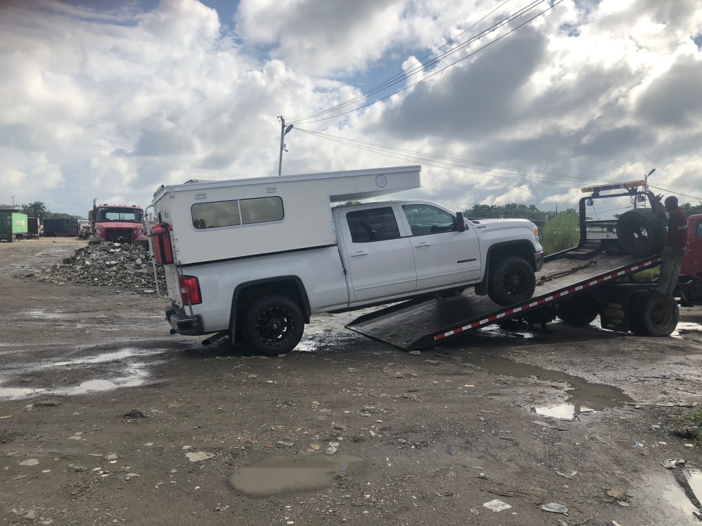
I was quite nervous about loading – while Cassey had a VW Westfalia ( a considerably narrower vehicle than our own ) our truck only had 3” clearance on each side. Complicating matters, it had to be reversed into the container ( so I could climb out the passenger window once loaded) – and do most of that without the aid of side mirrors which, of course, had to be folded in so the vehicle would fit. As it turned out, it all went well due largely to the skills of the loaders who positioned the flatbed truck ( on very rough ground ) so that it was perfectly aligned for the reverse manouvre into the container. A huge sigh of relief when it was all done ! Following the signing of a raft of customs and shipping documents, final payment was made at which point we suddenly found ourselves without our vehicle – our home – for the first time since we began the trip over 6 months and 24,000 km’s ago. On Thursday, November 21, our vehicles would sail for Cartagena on the “Stella Walvis Bay”. We would be on our own for at least a week while it was loaded, shipped, unloaded and cleared through the respective Panamanian and Colombian processes ( only two days of that would be actually at sea as the two ports are quite close ).
Cassey’s VW went in first, followed by oursStep 1 – drive on to a flatbed truckStep 2- get backed up to the edge of the container – driver has to keep it perfectly alignedStep 3 – use side mirrors and the helpers signals to back in straight, about half wayStep 4 – as you get further in, the mirrors need to be retracted – just watching hand signals at that point !I wedged a couple of “noodles” in between the camper and container to protect against rocking damageOn both sides – but it’s doubtful they will remain in placeStep 5 – once the truck is all the way in, driver climbs out the window, and then…….Step 6…the helper, who guided me from behind, slides out UNDER the truck !Step 7 – all done, time to celebrate with Boris !Step 8 – final step, seal the container !
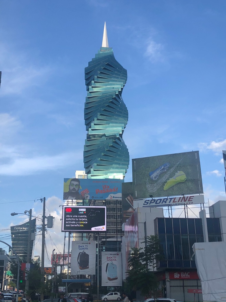
Cassey, our container buddy, left us at this point – for the next 5 days she would sail on a yacht through the San Blas islands and connect with us on Monday morning ( all going well ) so that we could begin the vehicle retrieval process together in Cartagena. Lois and I travelled back to Panama City to spend a few relaxing days exploring ( it was a city that, despite heavy rain for parts of most days we were there, we really enjoyed ). A luxurious hotel room, pool, great restaurants in abundance and central location all helped. It has to be the most modern city in Central America, with a slick subway, famous “old town” and one of the most stunning skylines anywhere. All this on the doorstep of the Panama Canal.
“The Screw”, one of Panama’s more famous buildingsOthers nearbyStreet scene near our hotelWalking old town, Casco Viejo, skyline in the backgroundClassy home, Casco ViejoColorful houses and remnants of the old walls, Panama City Ruins in the old town, Panama Lots of bright color, Casco Viejo, PanamaStreet scene, Casco Viejo, PanamaPanamanian guy trying to hustle the ladies for a walking tour of Casco ViejoInside Panama Canal Museum
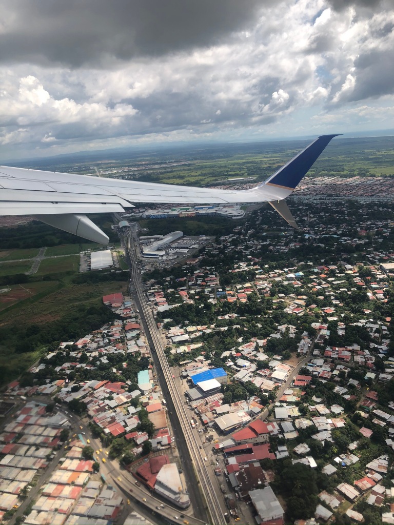
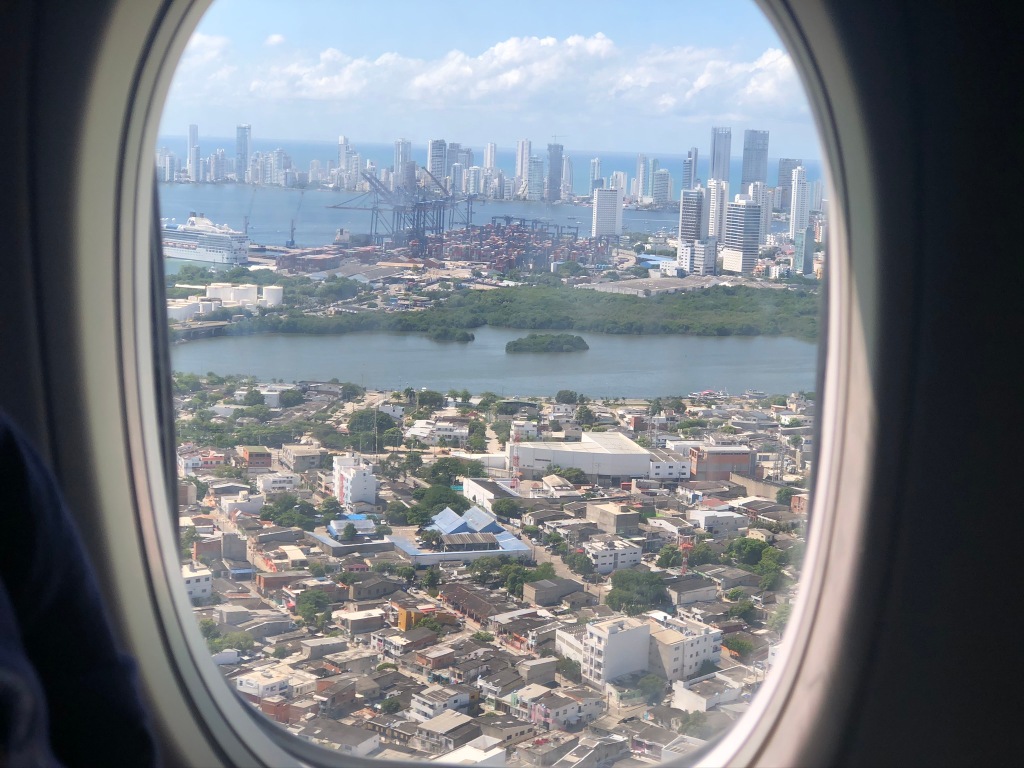
By midweek our time in Panama was over and we made the short 1 hour flight to Cartagena. Could not have been a smoother flight and immigration process, and by early afternoon we were sitting in Cartagena’s old town enjoying lunch. One of the most popular Colombian cities to visit and it’s easy to see why; a Miami-like skyline on the shores of the Caribbean, fascinating walled old-town dating to the Spanish era and a very lively entertainment and cultural scene. We will need at least 5 days here waiting for our vehicle and I don’t think it will be a problem to pass the time – so much to explore !
Leaving Panama, Copa Air to Cartagena, ColombiaCartagena from the airHopefully next week we will be able to find our container….down there…..somewhere !Cartagena, old townRenovated buildings, Cartagena old townTypical street, Cartagena old townColorful umbrellas, Cartagena old town
Thursday was spent exploring the old town, savouring the awesome coffee shops and sourcing some good restaurants ( can’t beat Tripadvisor ! ). It’s a city where there is always something going on – we managed to catch a Michael Jackson impersonator doing a ( very good ) rendition of “Thriller” in Plaza la Trinidad right in the heart of the old town. Our week closed out enjoying Colombian craft beer at a popular little bar at the aforementioned Plaza. Cartagena is definitely an easy place to like!
Lots of mural art in Cartagena – some with special effects at nightMJ – ThrillerBack street, old town One of the many historic doors, old townCartagena, old town looking to cityCartagena, walled old town, looking to Carribean sea
The PanAm completed in April, 2022 and with the truck camper sold, we shipped our new Sprinter van to Australia in late 2022. We travelled there through all of 2023 and into 2024 before shipping it up to North East Asia where we travelled for 4 months between Korea and Japan, before shipping it back to North America. It’s our plan to continue exploring the world in 2025.