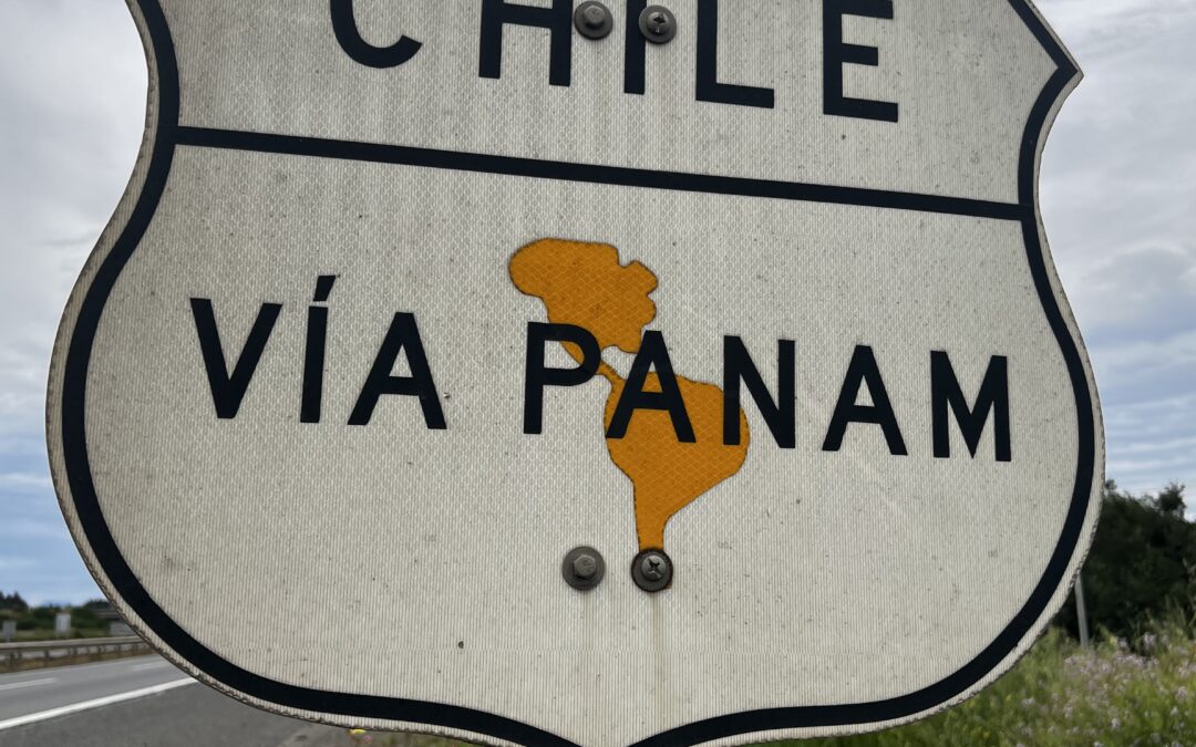
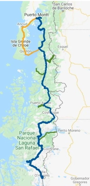
Begun in 1976 under the direction of then dictator, General Augusto Pinochet, Chile’s legendary Carretera Austral ( Route, or in Spanish “Ruta”, 7 ) is considered one of the country’s most ambitious infrastructure projects. Prior to its construction most of Chile’s Patagonian land transportation had to cross the border into Argentina. It opened in stages with the last 100kms to Villa O’Higgins not opened until the year 2000. Plans exist to extend the road further south ( as far as Puerto Natales ) in the years ahead.
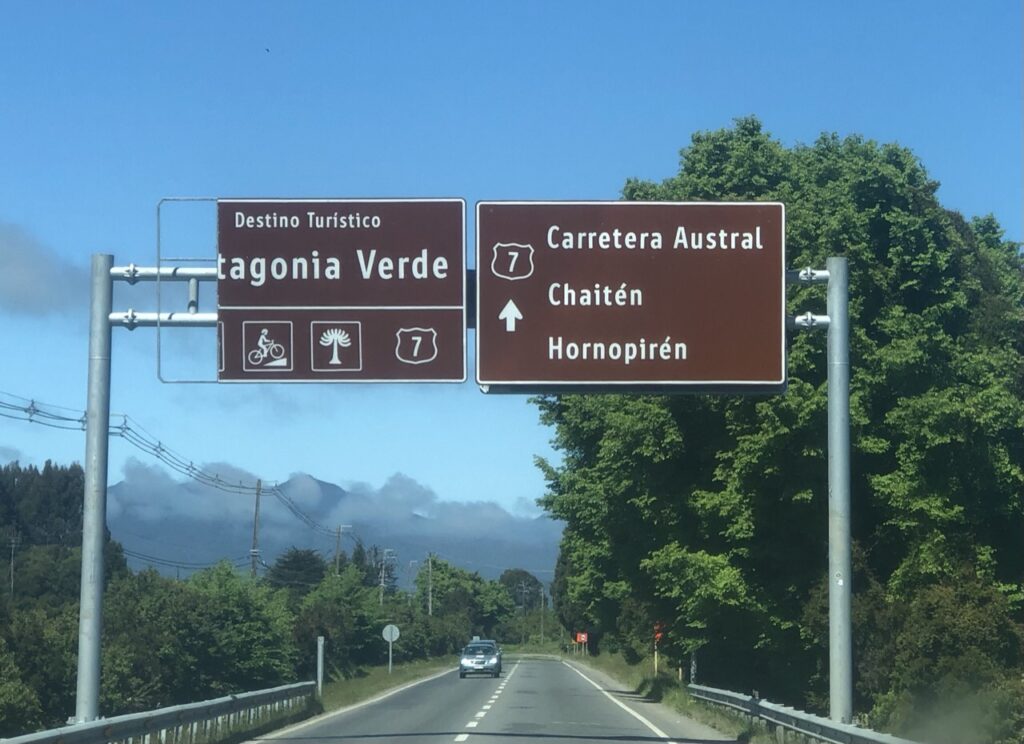
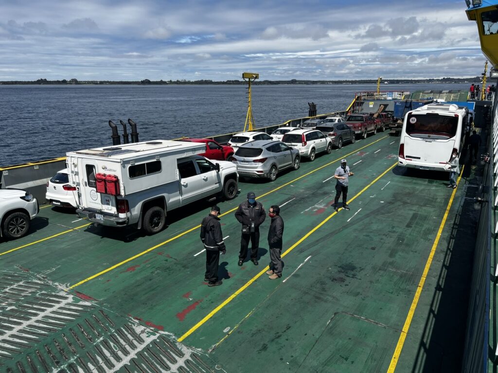
From Puerto Montt, travellers have the option of driving south east through Hornopiren with a couple of short ferries then connecting to the mainland town of Chaiten, or taking a ferry direct from Puerto Montt to Chaiten, or, a third option ( and the route we chose ) travelling southwest through the rural and more remote island of Chiloe as far as Quellon at which point a ferry makes the 4 hour crossing east to Chaiten. Since all roads/ferries lead to Chaiten it is to all practical intents the real beginning of ‘Ruta 7’. Before heading over to Chiloe we did venture down Route 7 about 50 kms – the drive was scenic and it took us to a highly recommended camp spot ( Puerto Montt’s options were not that appealing ).
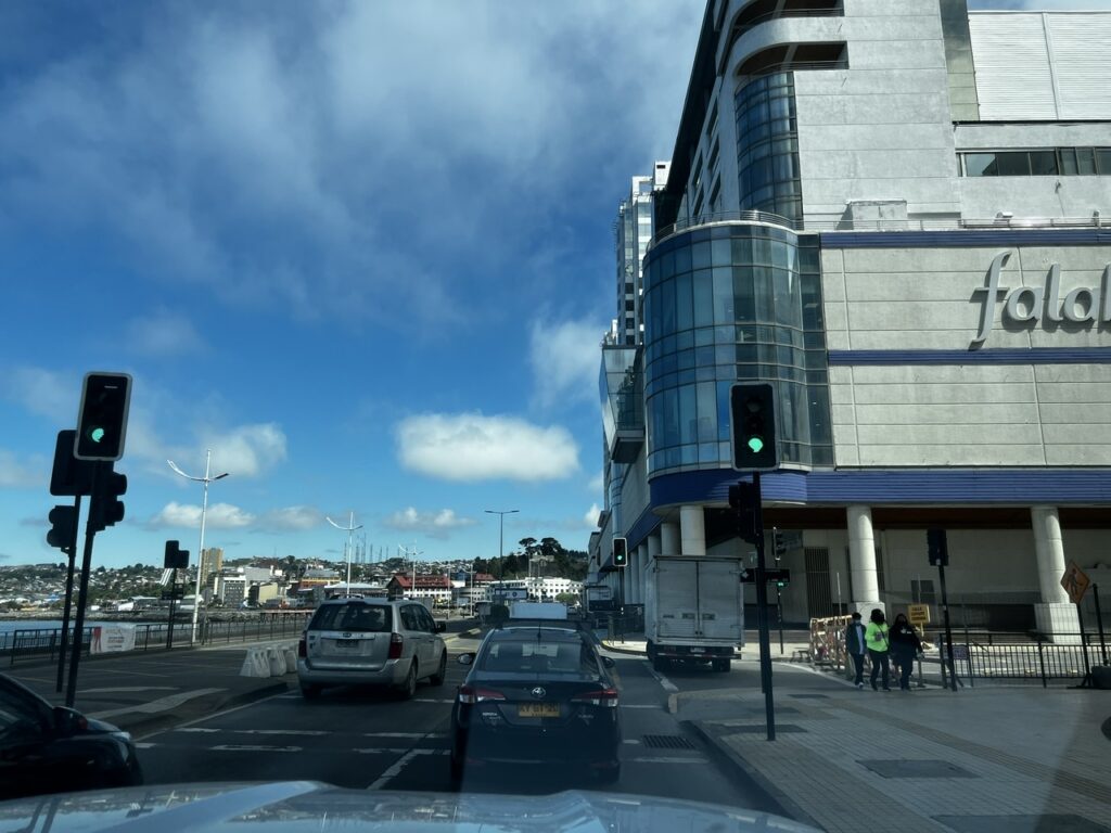
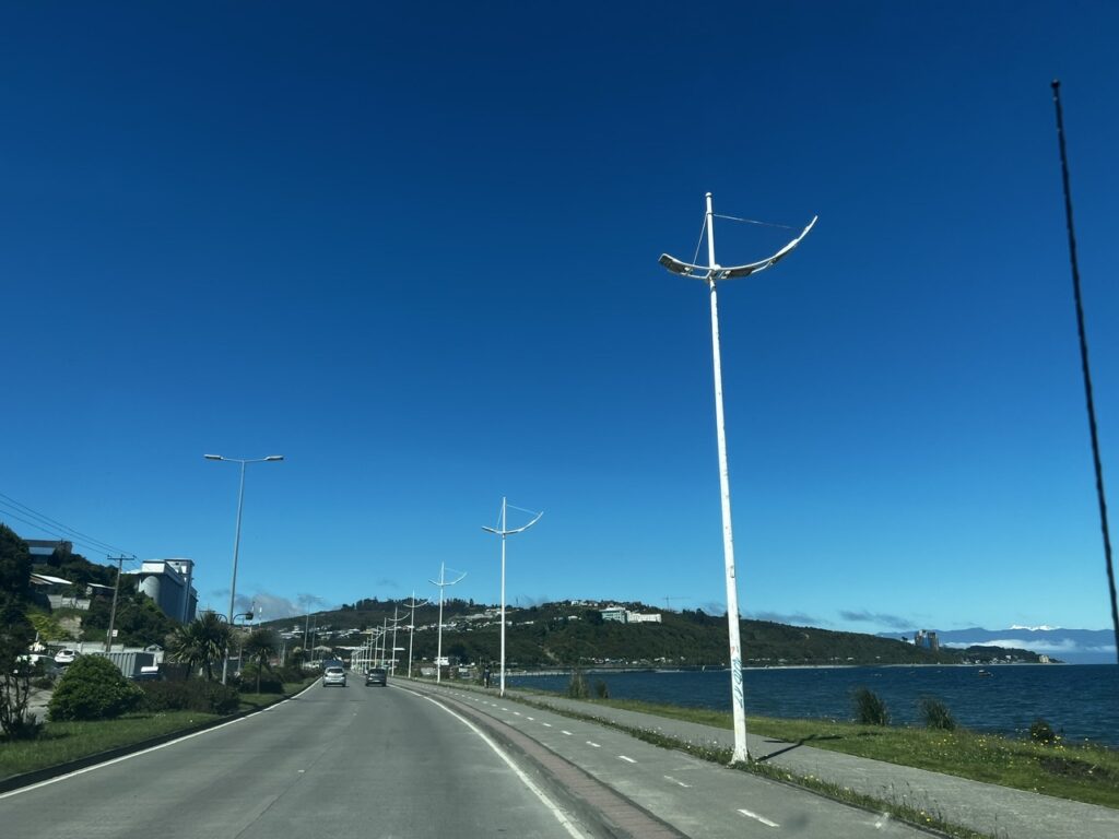
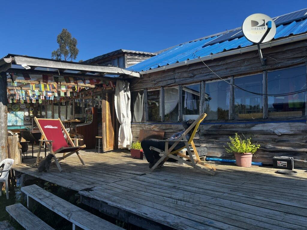
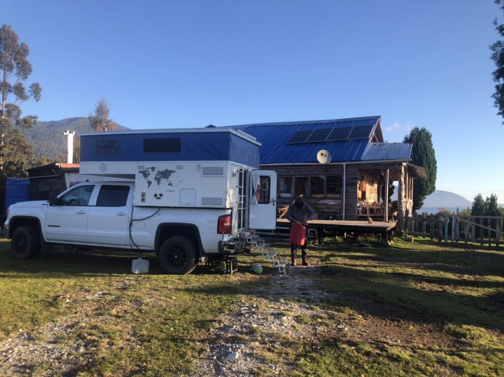
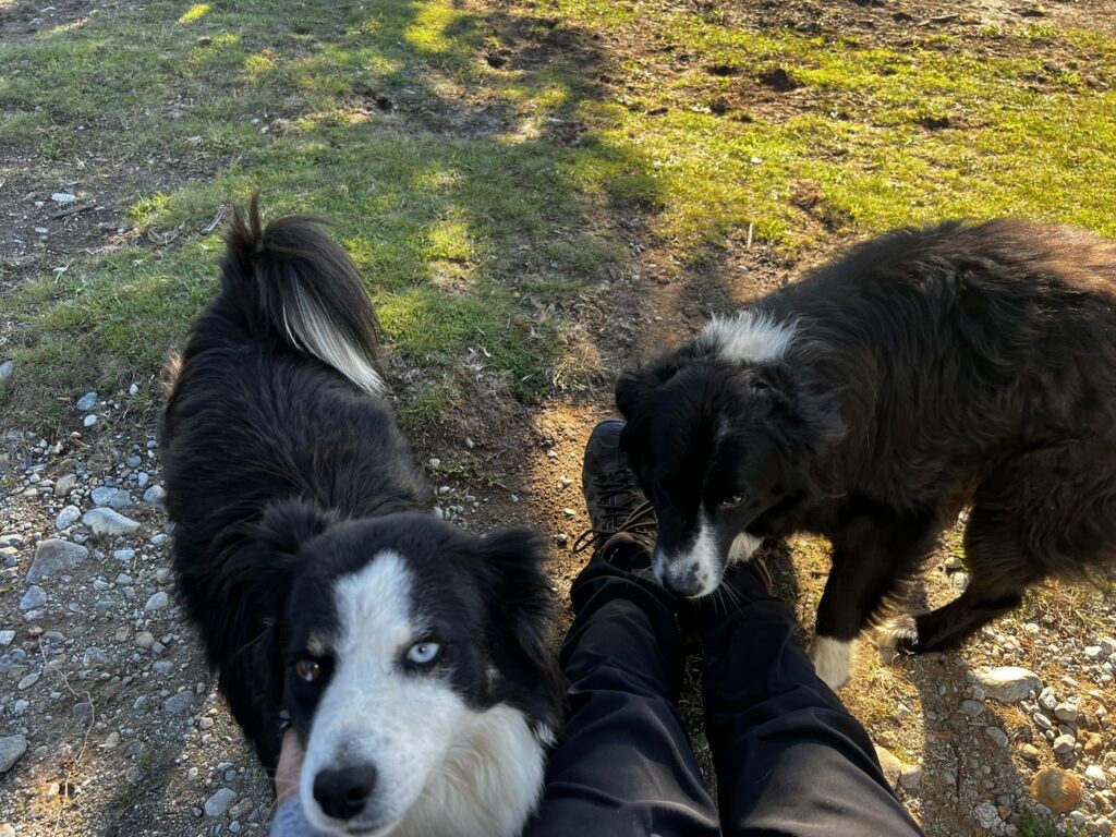
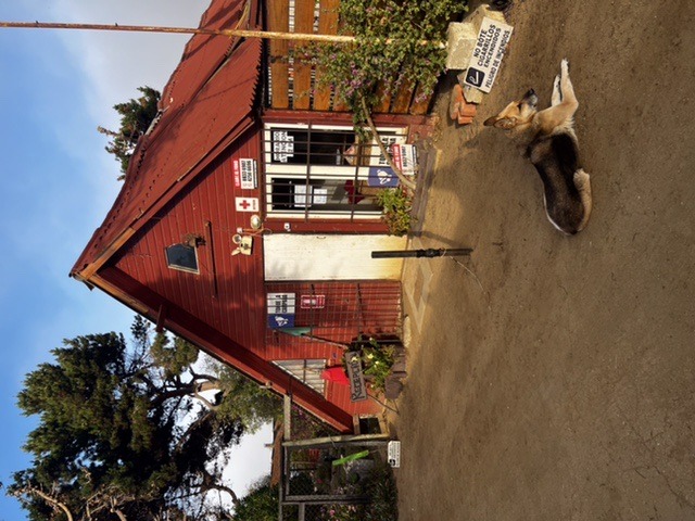
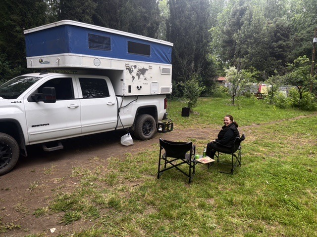
Driving through Puerto MonttDriving southeast from Puerto Montt along the waterfront, the very beginning of Route 7Further down Route 7…the road still sealed at this stageThe eclectic campground we stayed at near Puerto Montt. Run by a lovely old Chilean couple and shared a with a menagerie of friendly animals We had time to do a little cleanup here. I took the opportunity to ensure our spare fuel cans were clean as we might need them further south. Rumour has it that fuel stations can run dry on the Carretera. Our range without external tanks is only 600 kms, less when heavily loaded and on hilly rougher roadsThe dogs loved us !
Chiloe island has a unique feel and distinct local flavor. More rustic, smaller towns, and miles and miles of rolling green hills, it reminded us at times of New Zealand ( albeit with fewer sheep ! ). Travel was slow with lots of construction and we managed to make a full day of the relatively short trip down from Puerto Montt. While the island offers countless side excursions and an impressive national park there would be more of that on the Carretera so our trip was limited to catching some of the sites in Castro ( capital city ) and some extensive stocking up of supplies in Quellon’s larger supermarkets – every guide we referenced suggested taking as much with you as you could carry given the limited options in Patagonia. Speaking of Patagonia, google “Where does Patagonia begin” and you will read that Chileans consider anything south of Puerto Montt to be Patagonia while Argentines reckon the boundary to be a bit further north in San Carlos de Bariloche – by either measure the Carretera Austral falls squarely within Patagonia.
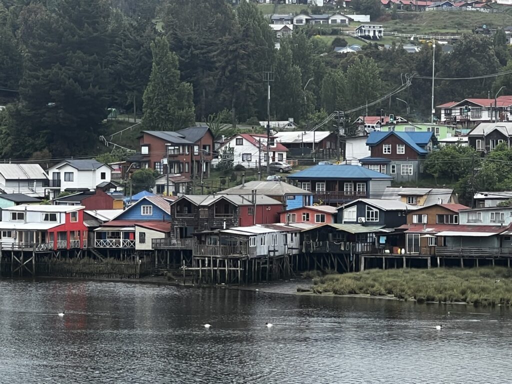
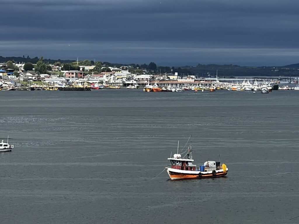
Ferry crossing to the island of Chiloe. Luckily we just made it, the last ones onCastro, capital of Chiloe, is famous for its “palafitos” or colorful stilt houses. As we travelled south the houses almost all seemed to be made of wood and tinView across the bay to Quellon harbor from Los Paicos, where we camped on our last couple of nights on Chiloe Stocking up on the “essentials” in Quellon
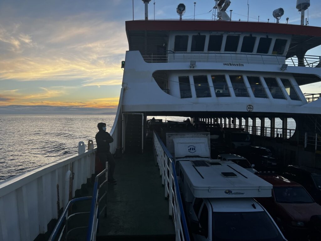
A pattern had emerged shortly after booking our flights back to Chile – we book, they change the flight, we rebook, they change the flights, we rebook….and on and on. There were 5 of these before actually getting to Chile…! Seems the Covid era impacts ferries as well – the original crossing to Chaiten ( from Castro ) was rerouted to Quellon, then the departure time was changed from 2pm to ( the ungodly hour of ) 11pm, then once again back to 7pm, before ultimately departing just after 8pm. One must stay flexible and always “tranquillo” as they like to say here.
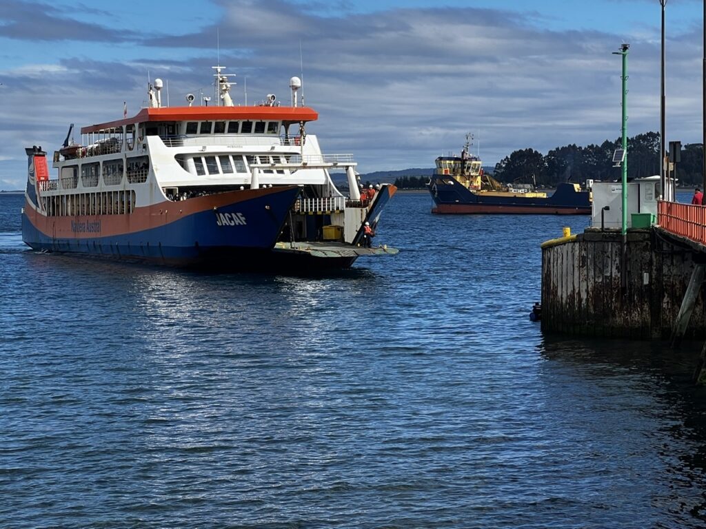
The ferry to Chaiten – 4 hours to cross the Gulf of Corcovado to the mainlandA nice sunset across the gulf as the ferry departed Chiloe
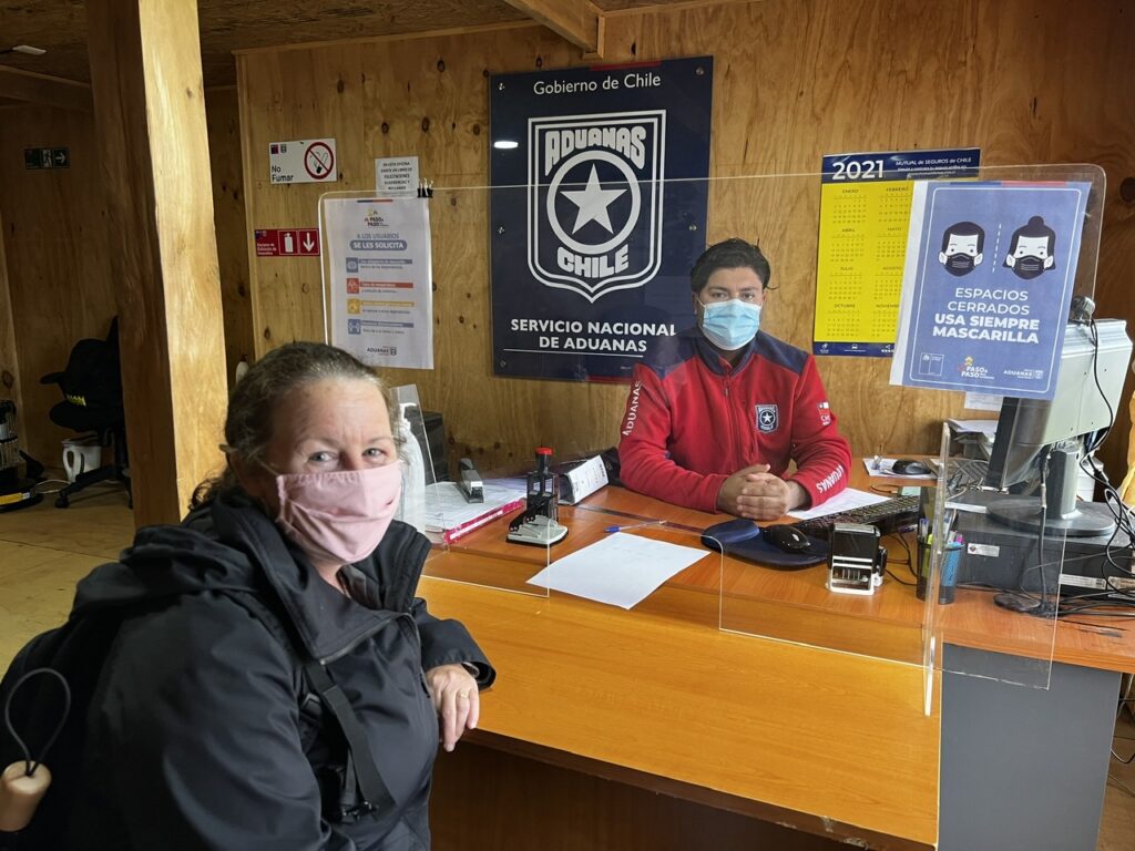
Chaiten is a rough, frontier-like town, and really just a jumping off point for destinations further south and the nearby national parks. The kind of place you can walk around in less than an hour, we used the (mostly rainy ) day to do some minor repairs, deal with a some computer issues and a last bag of laundry ( in what would likely be many rainy days ahead starting with dry clothes seemed prudent ). Most importantly, tiny Chaiten had a small ”Aduana” (Chilean customs) office and we popped in on the off chance it may be manned ( several others, in larger cities, had not been ) as we were quite desperate to address the nagging issue of our vehicle TIP ( temporary import permit ). Having left Chile suddenly, minus our vehicle, the original TIP had expired almost 18 months ago and we foresaw potential issues ( and possible penalties ) when exiting Chile and crossing to Argentina. Absent a sympathetic hearing here we’d be explaining this to a border official in a few weeks and completely at their mercy. Fortunately a most obliging Aduana agent ( Hector ) fully understood our plight and promptly made us “legal” again until January 2022 ! A huge stress gone.
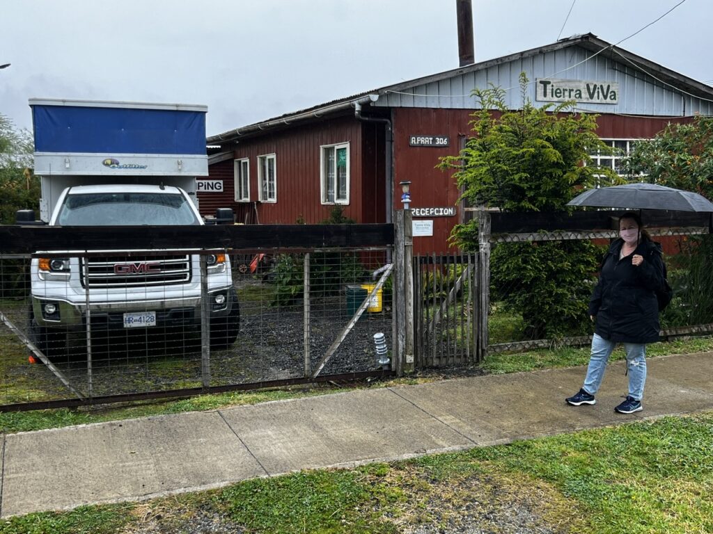
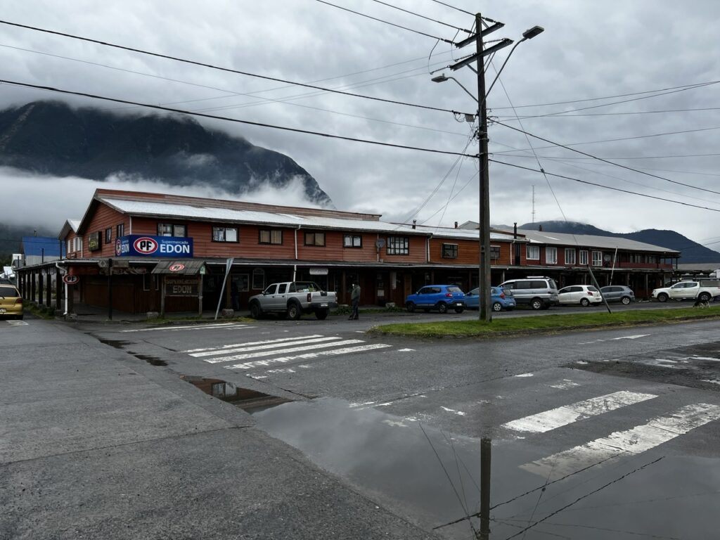
It helped I am sure that we were almost certainly his only clients that day – he seemed happy to have visitors !In the abscence of formal campgrounds, “camping” in Chile, especially in the remote corners, often means this ( squeezed into someone’s backyard ). Cozy, yes, but the steaming hot showers and strong wifi got Tierra ViVa rave reviews Downtown Chaiten – reminded us of northern BC communities with the wide open streets and often inclement weather
Based on some local recommendations from Andres, our host at Tierra Viva, we first went a little north on the Carretera before turning around and heading south. The road bisects Parc Pumaulin Douglas Tompkins, one of the more well known on the Carretera, a park established substantially due to the work of North Face ( outdoor gear ) founder Douglas Tompkins who spent significant time in the region.
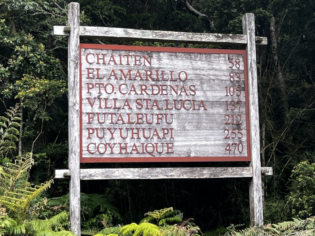
Our day started at Caleta Gonzalo, a small ferry port 58km north of Chaiten. Sign shows some of the stops on the route south
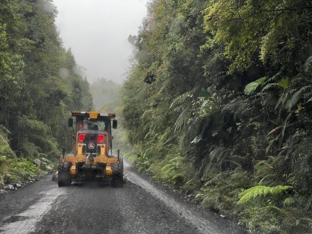
Noticed the first signs of what would be ongoing work on this road. Part gravel, part asphalt regardless it traverses difficult terrain and rock/mudslides are ever present risks – the road continues to be a work in progress.
Getting there was slow, lots of roadwork and mostly narrow gravel roads on this day
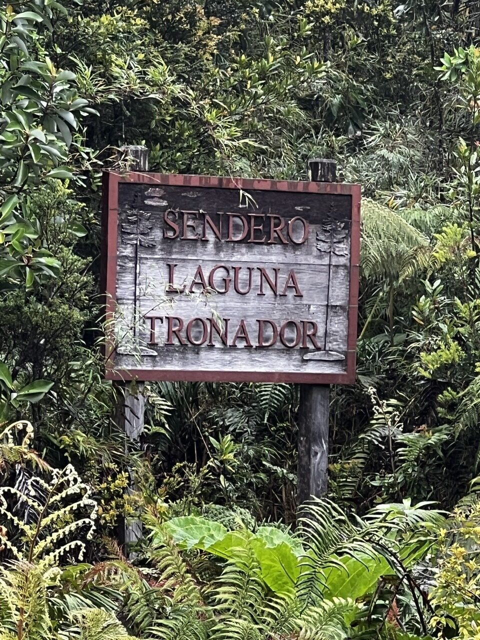
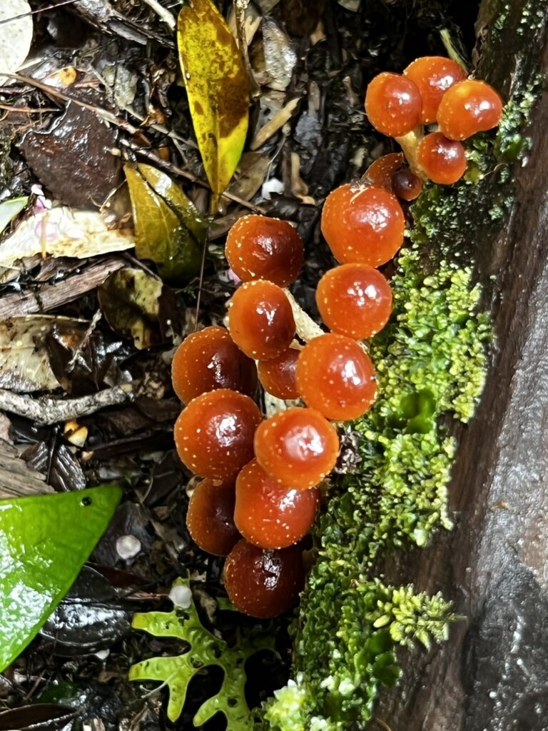
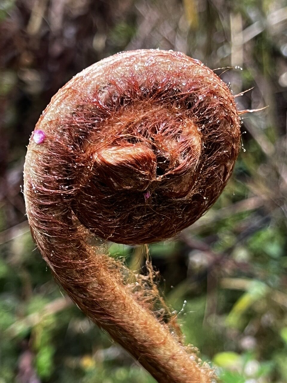
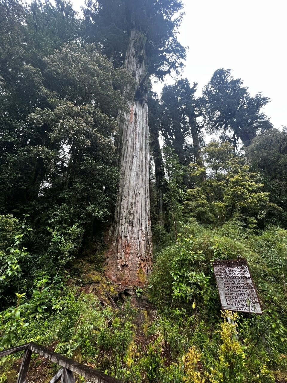
Andres’s recommendations both of the Sendero Laguna Tronador hike and the Sendero Cascadas Escondidas (waterfalls) hikes were well worthwhile and it was great to get out and stretch our legs on a couple of fairly short hikes. The giant alerce trees are indeed impressive ( related to North American sequoias, and can reach 4,000 years old ). We also came across a bunch of other weird and wonderful plants. Very reminiscent of Vancouver island and parks on the Oregon coast ( visited earlier on the PanAmericana).
First hike, to check out the alerce treesThey are not mini tomatoes !….and along the way uncovered some weird ( to us ) plant life !Old growth alerce trees, some were massive
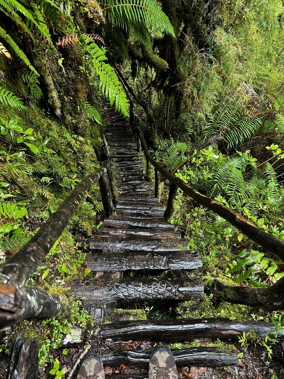
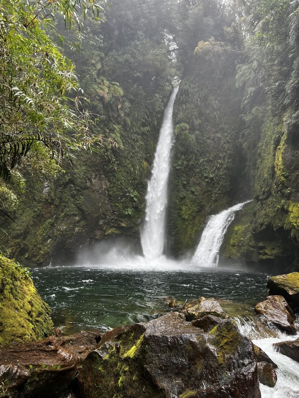
While very misty, it wasn’t exactly raining and we managed to see the two sites in pretty good conditions though in some cases rudimentary ( and almost vertical ) “ladders” had to be navigated to get to the falls; the destination justified the trek
A very slippery hike !The falls were impressiveSome smaller falls further south
Futaleufeu was an easy drive and with better weather predicted there we made for this quaint little town near the Argentine border. The vehicle needed an airing out in some hotter weather after days of mist and light rain – any regular campers will know the feeling! The Futaleufu excursion was not just for the weather but also to soak up what is one the Carretera’s most popular “detour” drives and to take the opportunity to speak to border agents about the status (now and in December ) of the crossings to Argentina. The earlier good news we had heard about ALL frontier posts being open as of December 1 appears to have been a miscommunication so we needed factual and accurate information straight from the horses mouth so to speak. Absent more border posts opening in the south we would not simply be doing the Carretera Austral southbound but in all likelihood northbound as well making for a very circuitous route to southern Chile and Argentina.
Scenery got more interesting after the Futaleufu turn-off Typical of the narrow one way bridges Visibility had improved enough to see the tops of the mountains
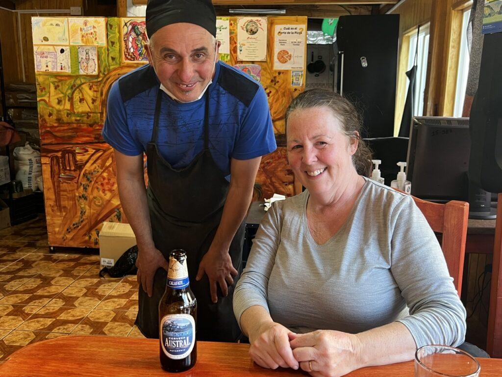
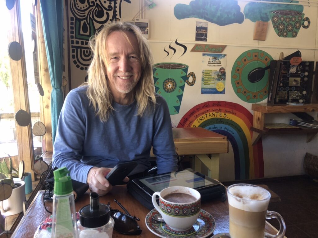
Futaleufu was predictably charming – an outdoorsy rafting/hiking/biking mecca, the town also had some great coffee shops and excellent food. Pizza de Fabio was highly recommended for his artisanal pizza and Fabio did not disappoint!
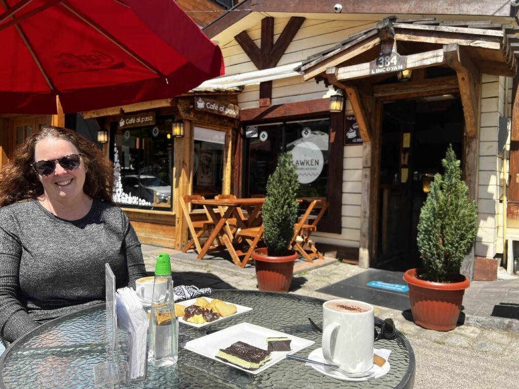
Lois with Fabio, owner of Pizza de Fabio. The Pizza Andina was delicious, washed down with ( what else ? ) an Austral beer !First stop next day – a coffee shop recommended for its cappuccinos ( Lois’s favorite )Took advantage of the wind and sunshine to air out our bedding . Things can quickly get damp in Patagonia regardless of the season.And there is that name again
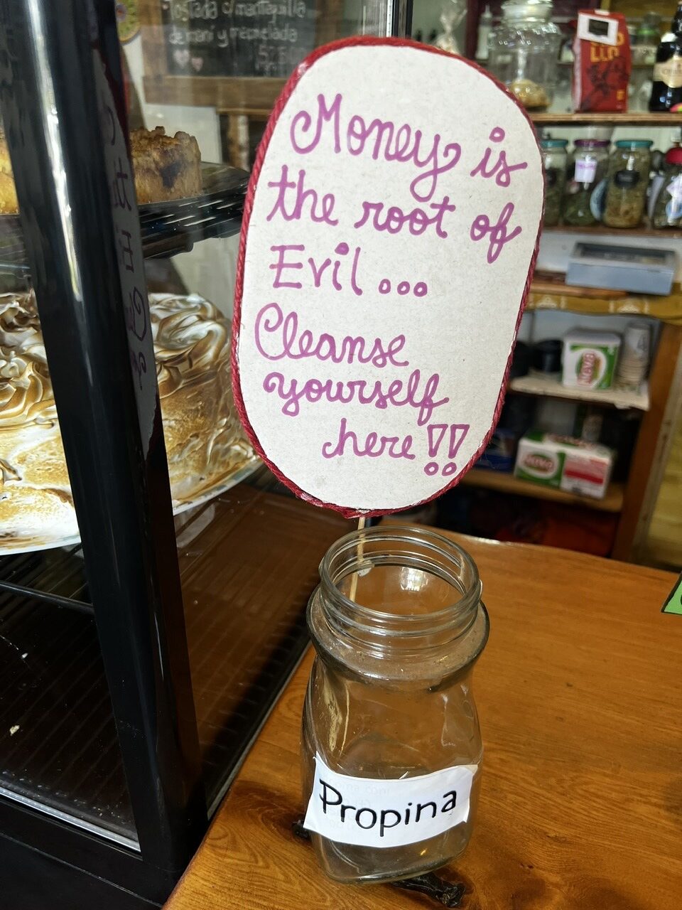
The Chileans have a great sense of humour – loved this sign in a shop we visited 😊
So we had the delicious cappuccino and then “cleansed” ourselves ! Hint: “propina” means tip !
Following our discussion with the Aduana ( border officers ) in Futaleufu there was cause for optimism that at least one Chilean/Argentine border in the south will open by January 1 (currently none are ). In the week ahead there will be time to work that into our travel plans such that we can, very hopefully, still make it all the way to our goal of reaching Tierra Del Fuego.
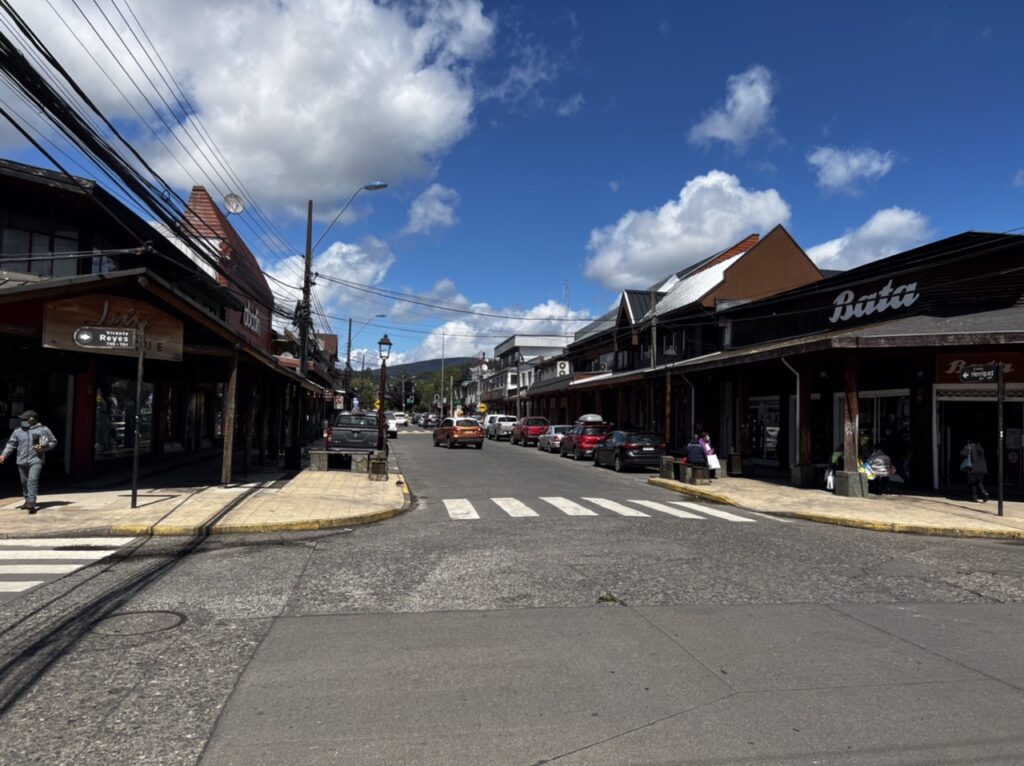
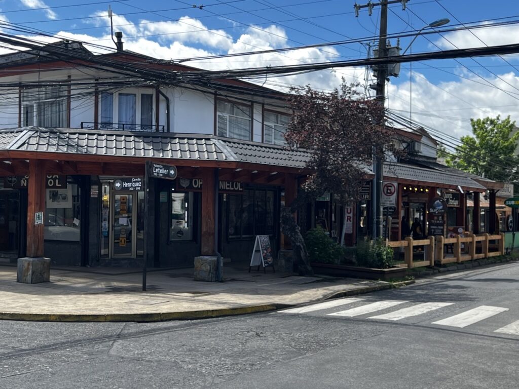
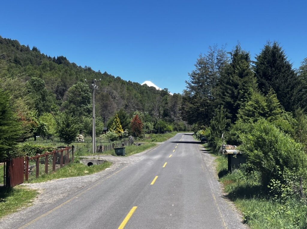
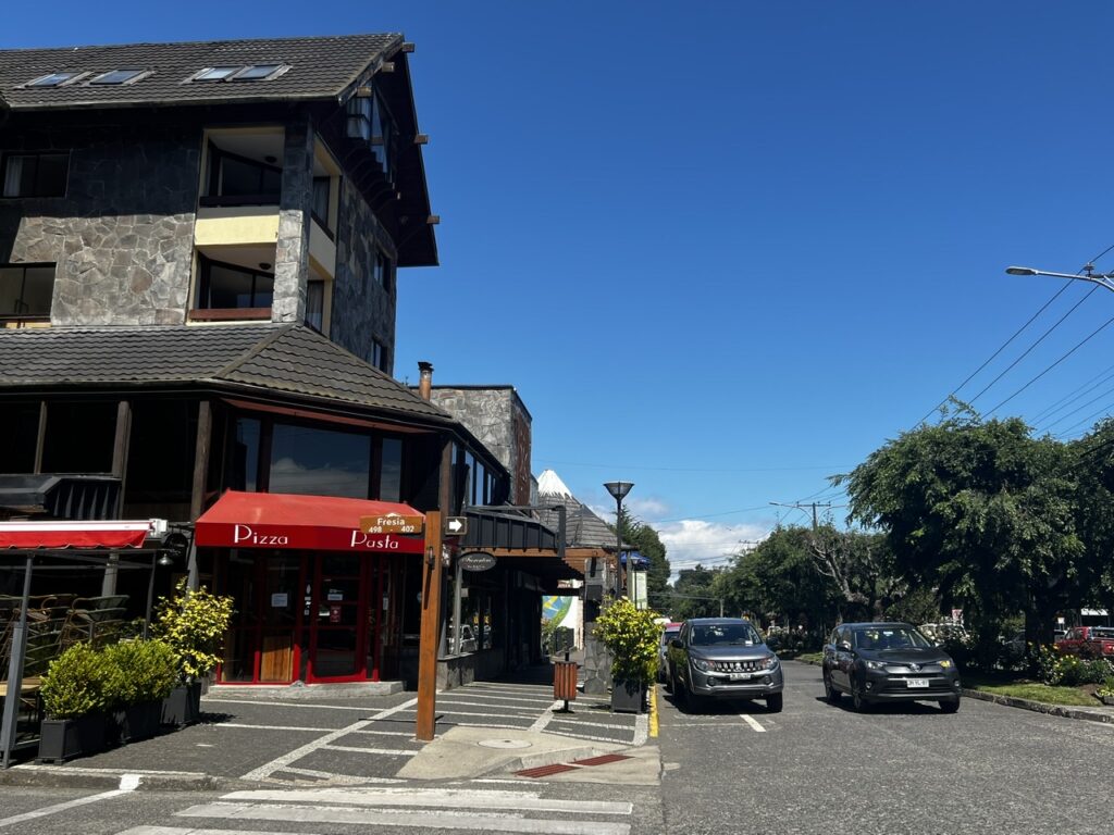
From Los Angeles ( Chile ) the Lakes District was only a few hours drive south. Long, straight, smooth highways almost all the way made for an effortless drive, first to Villarrica, and then on to Pucon. Two of the gems in the Chilean Lakes District these two towns attract Chileans in droves. We spent almost 5 days in the area and can see why it is so popular. Reminded us very much of Banff/Jasper….just had that kind of feel. Sampled some of the best coffees and sweets so far and had the usual amazing Chilean hospitality especially where we stayed.
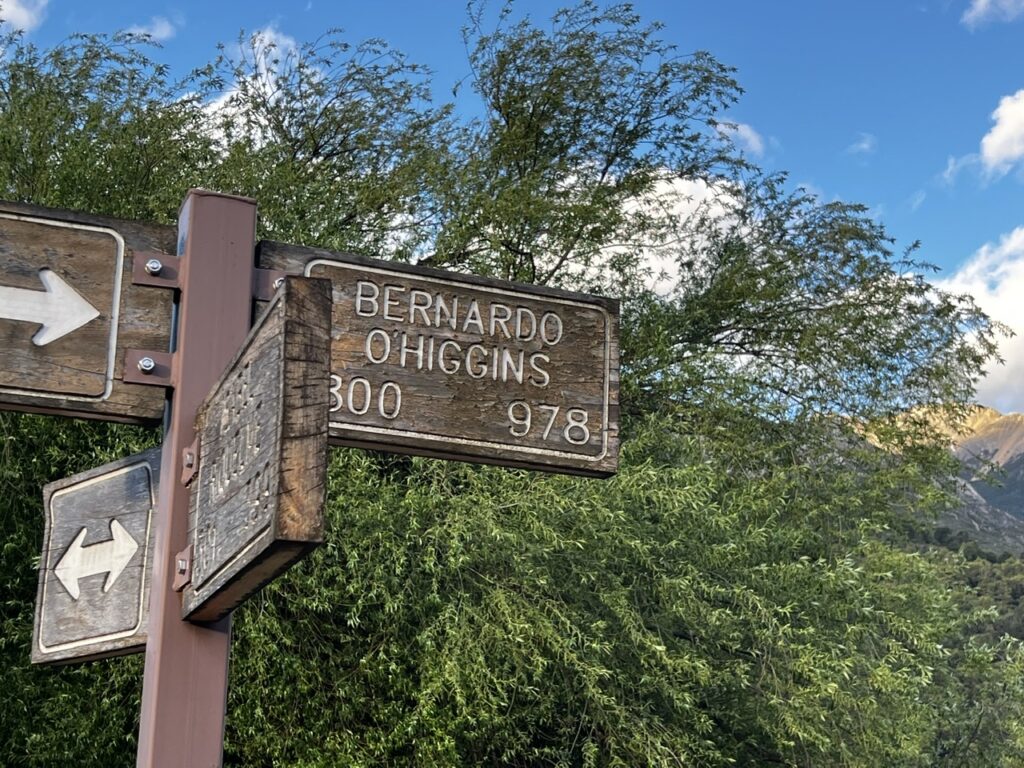
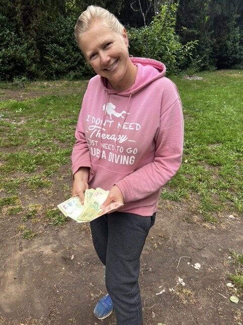
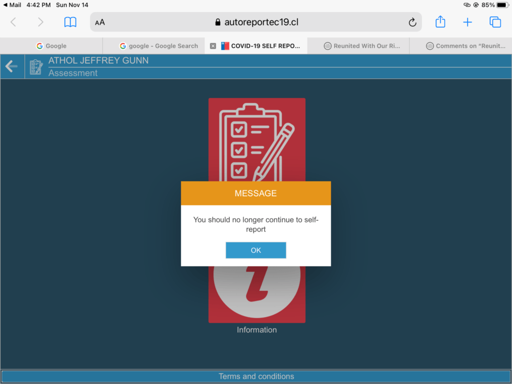
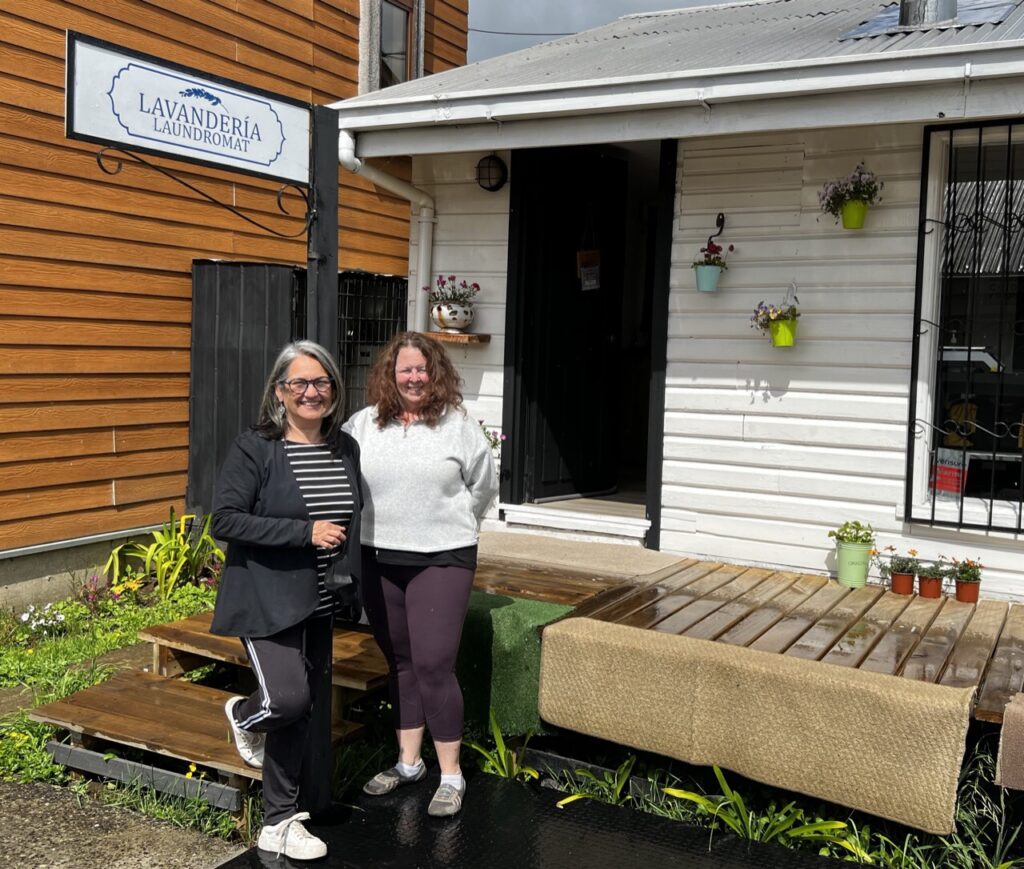
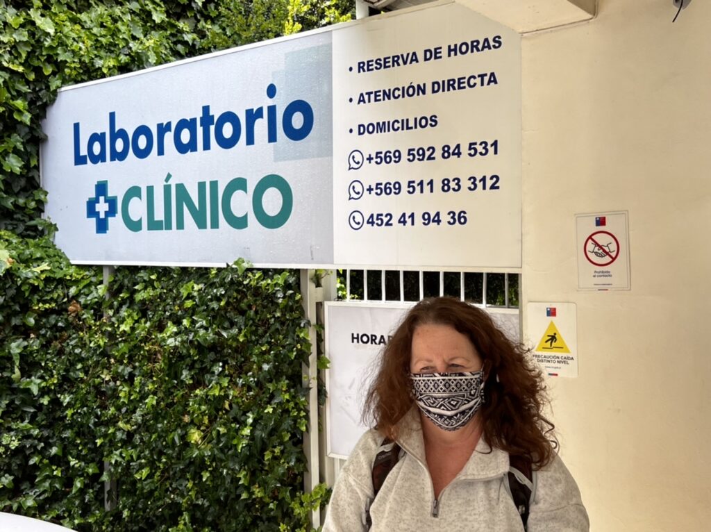
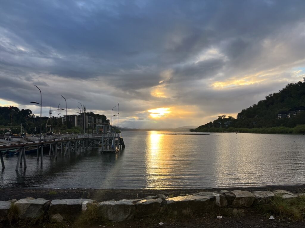
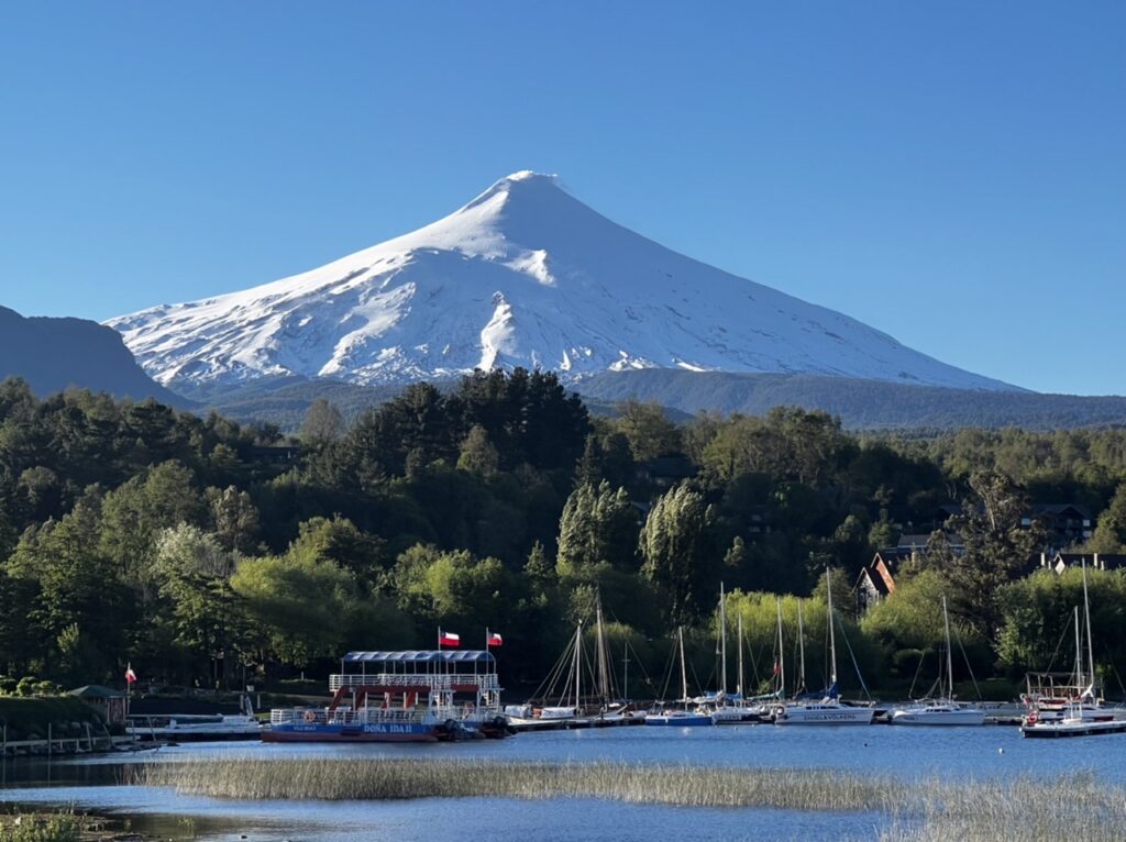
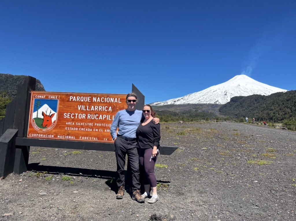
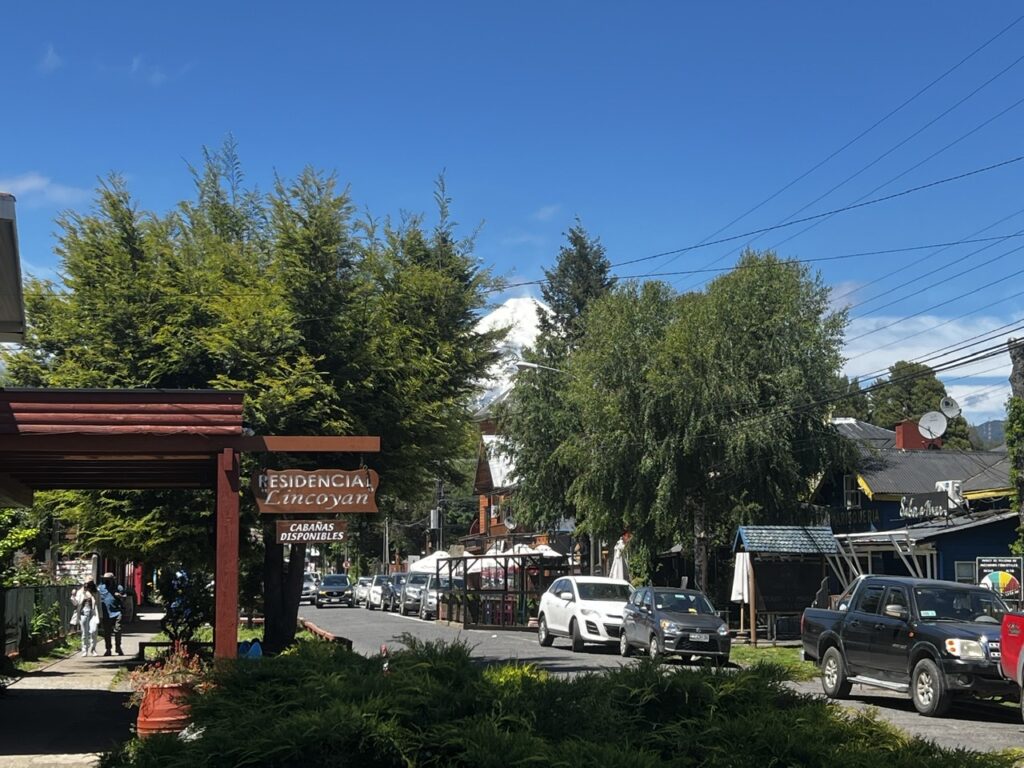
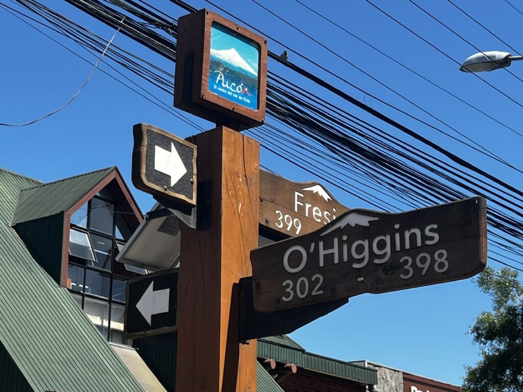
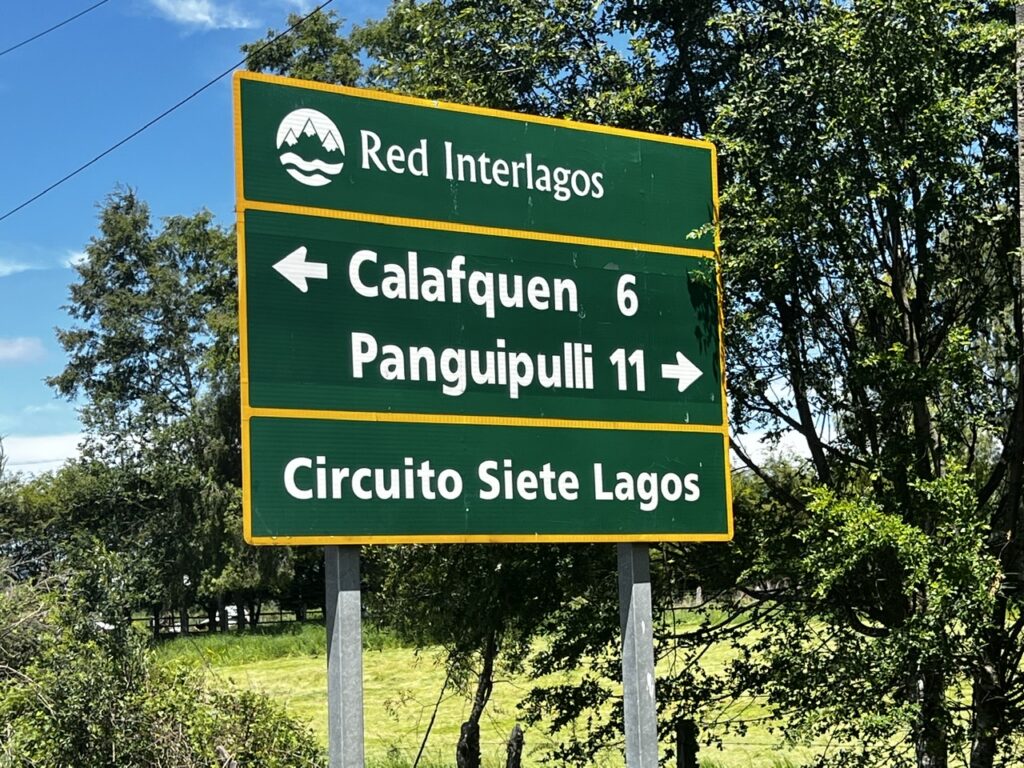
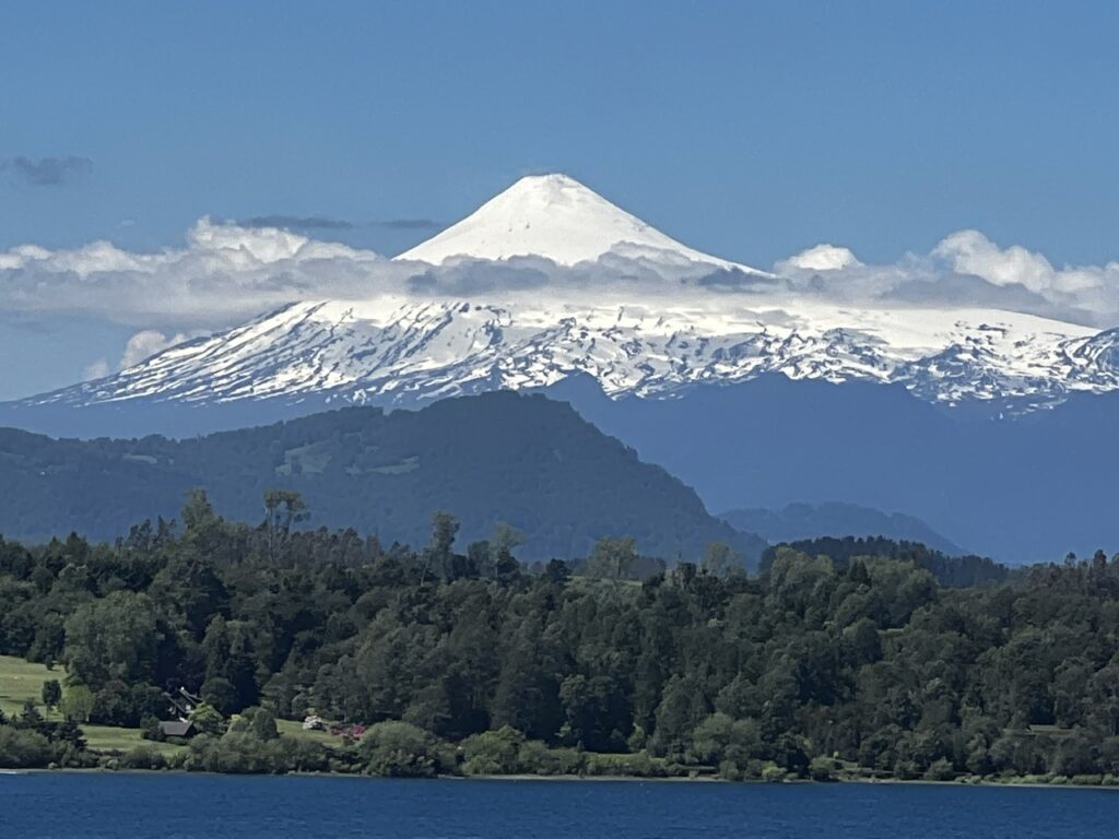
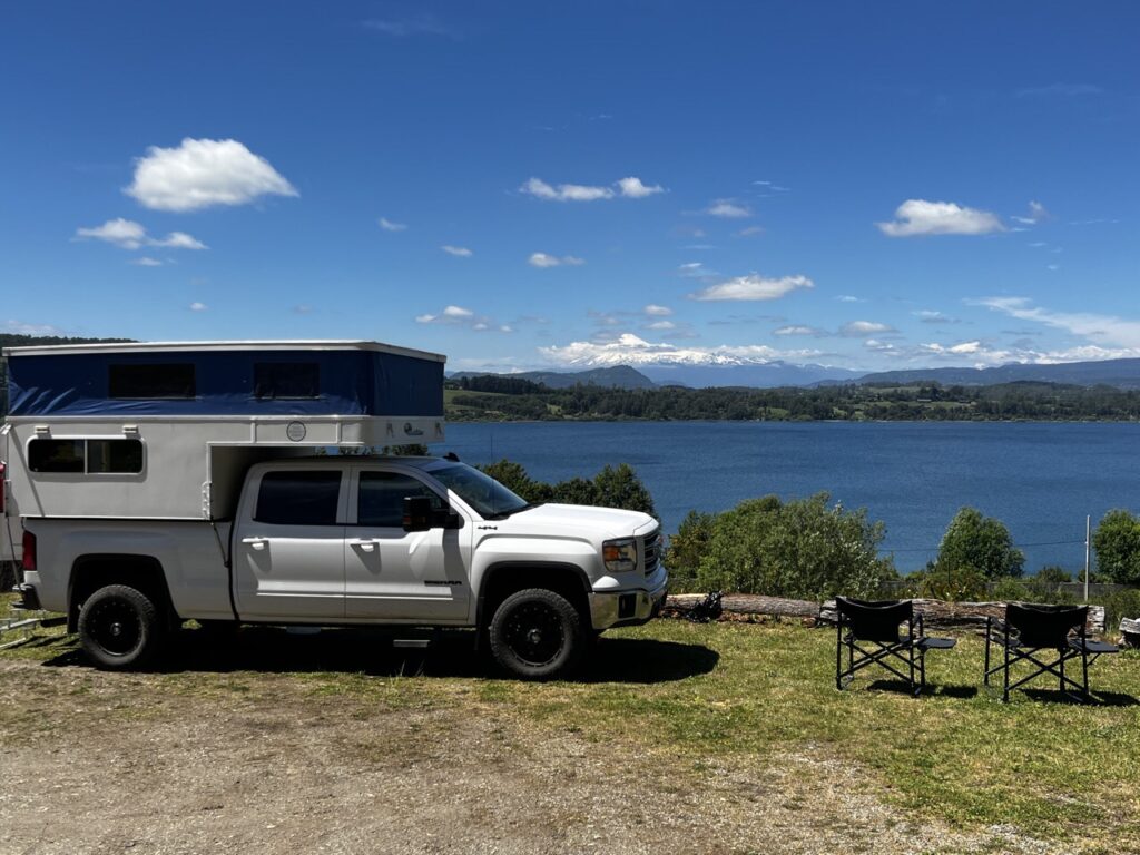
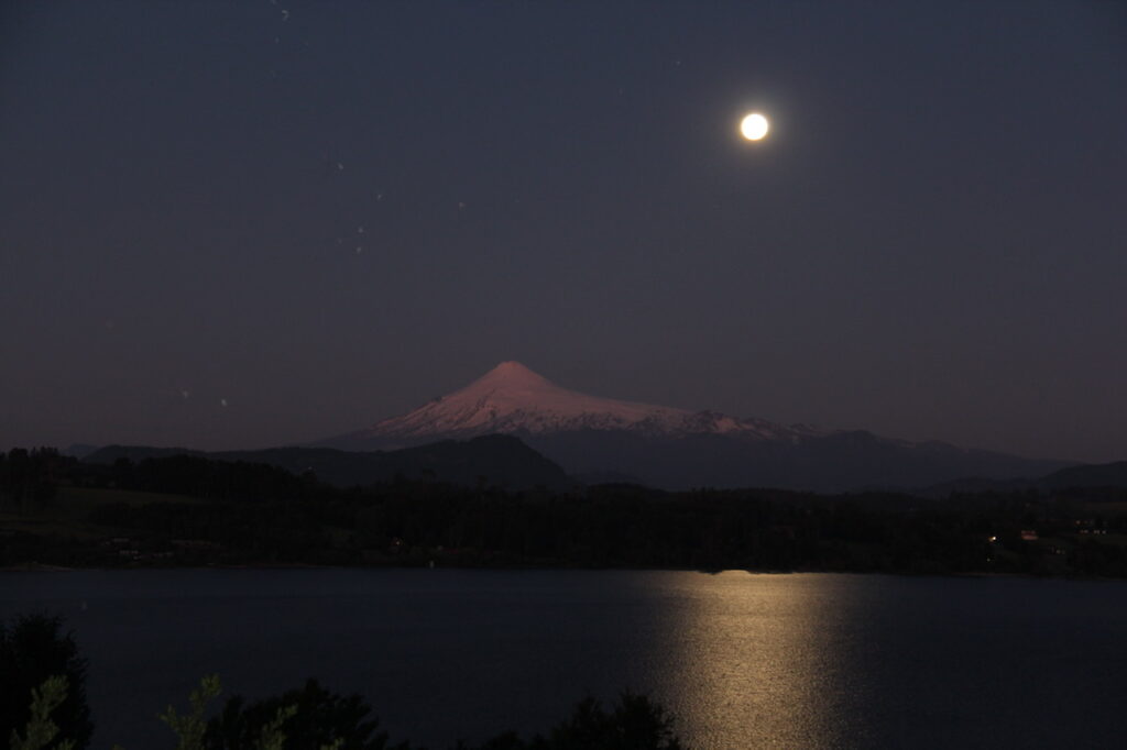
Prior to leaving Los Angeles ( Chile ) we took all Nienke’s Argentine pesos off her hands. Would come in handy if we crossed into Argentina at a remote locationPan American highway signs began to reappear in ChileFinally, 10 days into our time in Chile and no longer did we need to self report possible Covid symptoms !Rodrigo hosted us at his cabanas in Villarrica on our first night, he had studied in Winnipeg and warmly welcomed some impromptu Canadian guestsStreet scene in VillarricaStreet scene in Villarrica Patricia, who owned the laundromat in Villarrica was a godsend. Helped us through the Chilean health process. Another fluent English speaker, she and her family had lived in Canada in the 70’s after fleeing the Pinochet regimeWhile in Villarrica we needed to do a test to guarantee to the Chilean health authority that we really had been vaccinated. Required to extend our health pass to 90 daysSunset in Pucon where camped on the waterfront one nightView to Volcan Villarrica from the Pucon waterfrontOur camp “site” one night in Pucon. Overlanders had mentioned this little gem so we sought it out. A stunning view to wake up to but a disturbed night of sleep. We moved on…..Rural scene in the Lakes District. A snow-capped volcano around every corner it seemed Volcan Villarrica Street scene, Pucon ( parking was impossible ! )Great cafe/coffee shops in Pucon, we sampled a bunch. So tempting !The name “O’Higgins” appears all over Chile and he was a legendary historical figure ( with an Irish background ). Many streets and plazas bear his name.Andrea (with “Blackie” ) who hosted us for a few days in Pucon. Camping Copacabana, one of the best campsites we have been at.Street scene in PuconWe spent several days just roaming around the Lakes District, partially following the “7 Lakes Circuit”Volcan VillarricaStopped in at Panguipulli as we left the lakes area. A dynamic view from our hillside spot in the afternoon…..…and a stunning night view after dark on a beautifully moonlit night
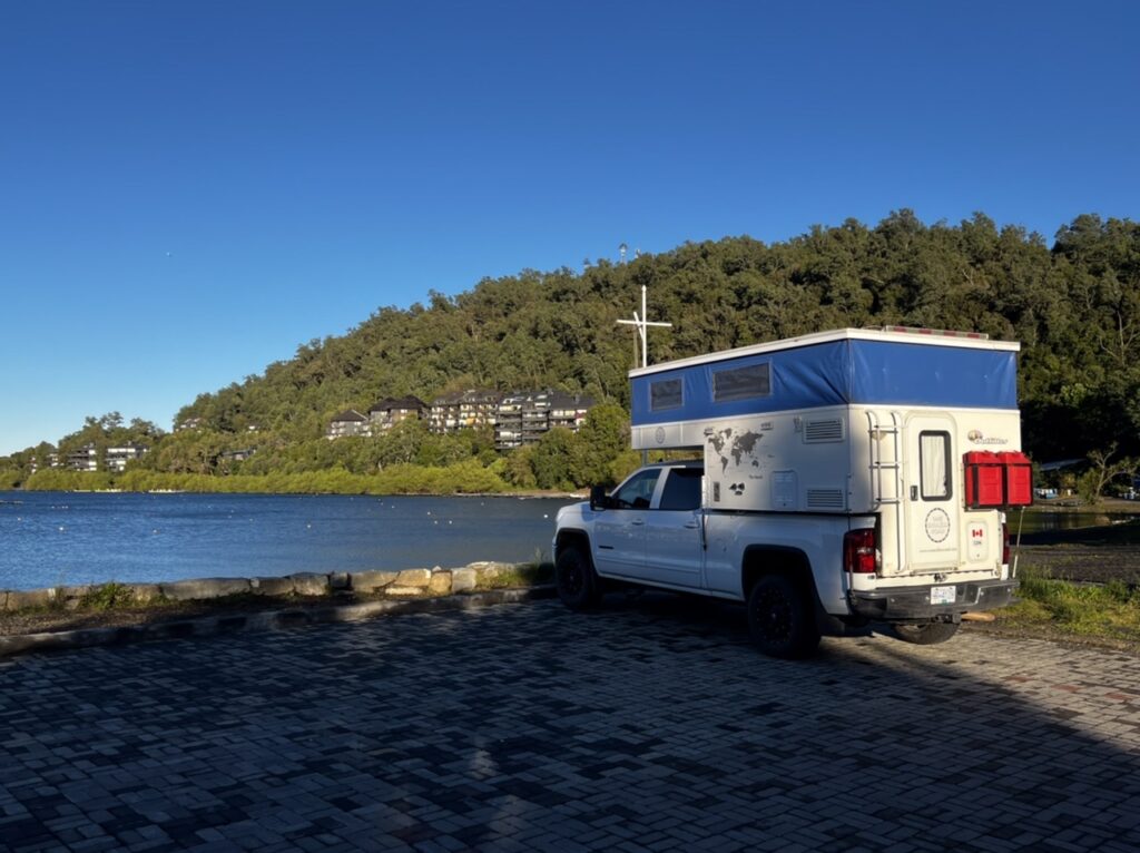
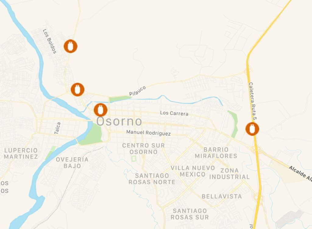
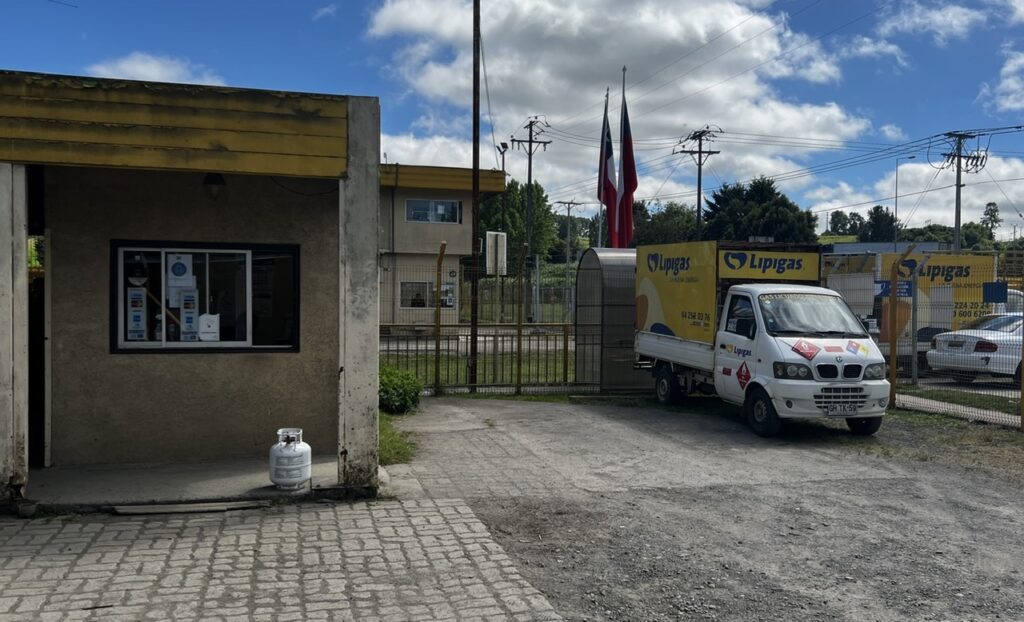
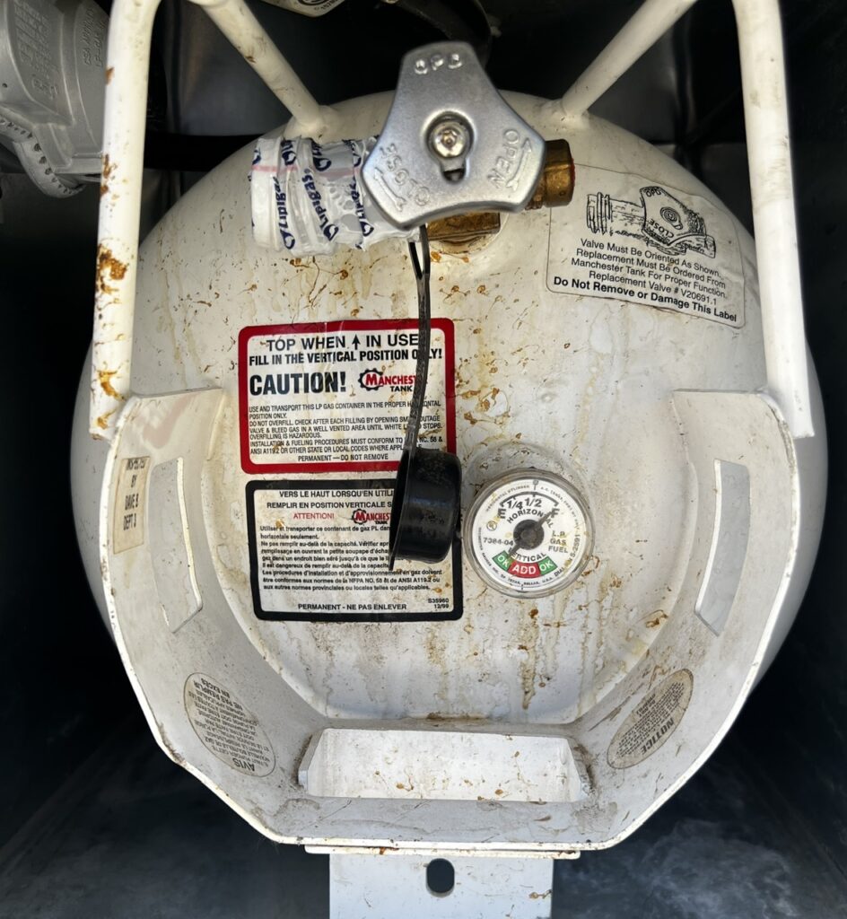
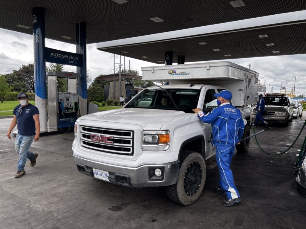
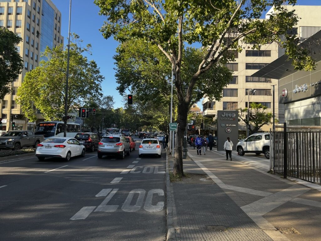
Our week closed with a drive on to Puerto Montt, a southern port city in Chile and the official beginning of the Carretera Austral. En route a pit stop was made in Osorno since our trusty iOverlander app had identified a propane depot that could apparently fill our North American tank ( and we running precariously low with some extended remote travelling ahead in potentially colder weather ). Osorno was, in all likelihood, our last kick at the can until we crossed the border into Argentina (probably well into December). Fortunately the gods were smiling on us……success with the first one we visited !
IOverlander listed 4 possible locations for propane, two of which had in the past filled North American tanks…..fingers crossed they would help us. We tried the one near the highway first.Happiness is….finding a propane depot that “might” fill your foreign tank. The different fittings in each country make it a real challenge on the PanAmericanaSheer delight is….actually getting it filled !
All going well, next week should have us on Chile’s famous Carretera Austral. We are scheduled to take the ferry from Quellon ( on the island of Chiloe ) to Chaiten where ( in practice ) this legendary road journey begins…….
Chile’s famous Ruta 7, or Carretera Austral ( Southern Highway )
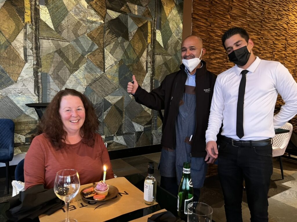
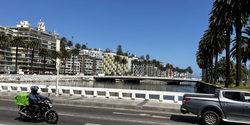
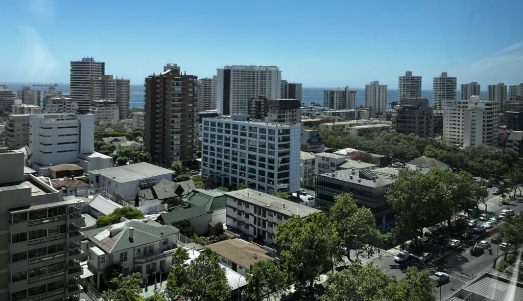
Vina Del Mar had been a great place to transition back in to Chilean life. Beautiful warm days, excellent shopping, and – I’d be remiss if I didn’t mention it – incredibly hospitable hotel staff. They simply could not do enough for us and all commented on how thrilled they were that tourism here was “coming back”. Enjoyed a special dinner on our last night as it was Lois’s birthday the next day – as soon as the waiters became aware of that some cupcakes and cookies were promptly delivered to us and the two of them serenaded Lois with a rousing “Happy Birthday to You !”
Lois getting a birthday treat
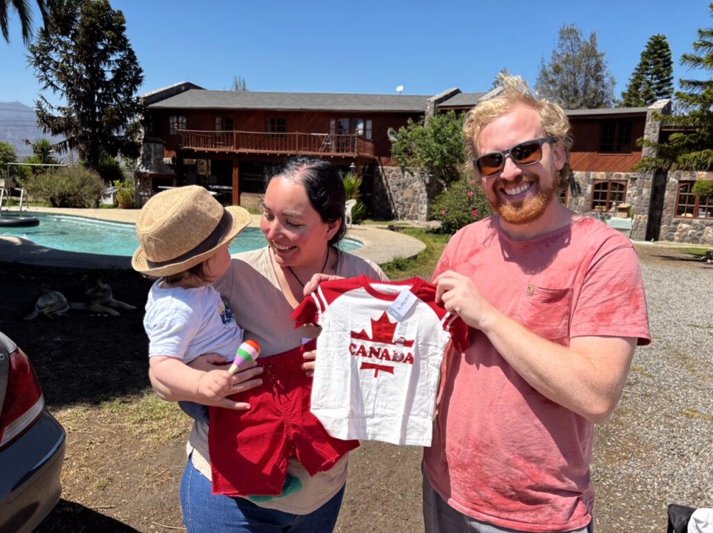
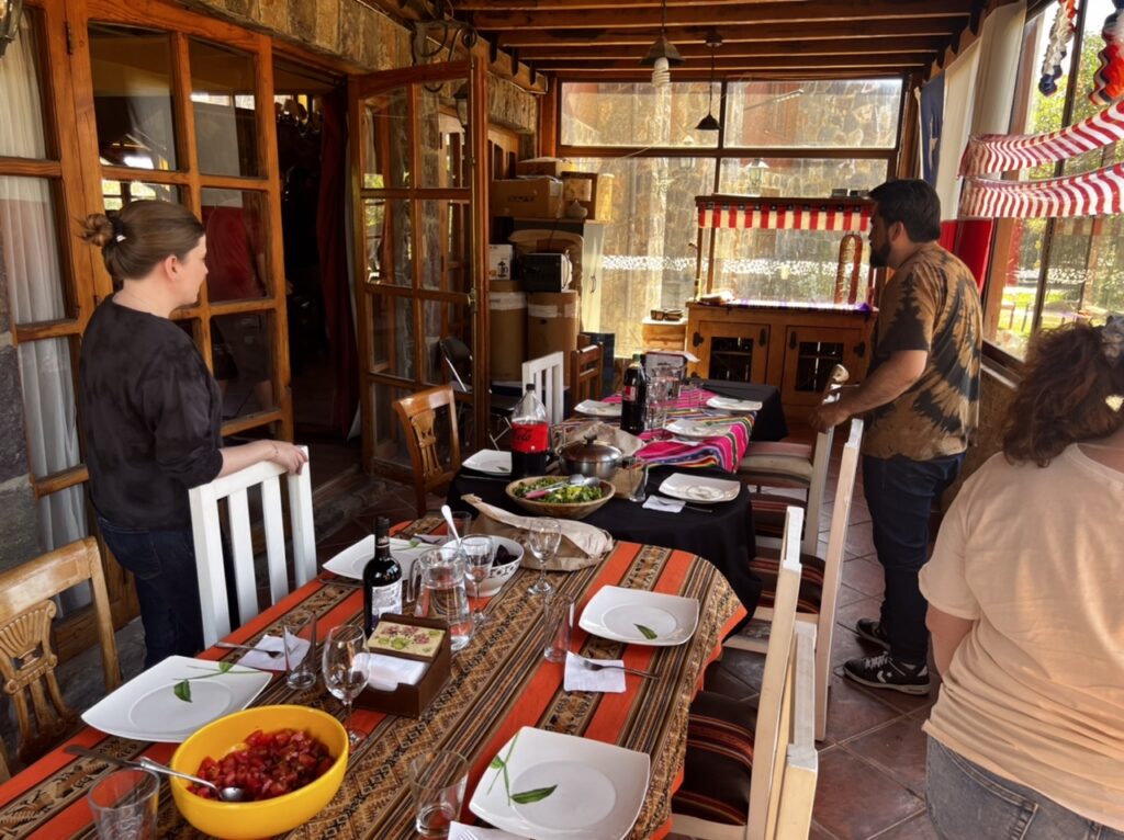
Our “man in Chile”, Juan Pablo, arrived Sunday morning and it was truly wonderful to connect with him again after last seeing him in late March, 2020. He had become a father, started a new business, and, as it turned out, did a fantastic job of taking care of our vehicle ( and almost 30 others ! ). Quillota was only an hour or so away so we took a slightly more scenic route up the coast. He had kindly washed the vehicle and it truly did look just as we’d left it. Some cleaning to do inside, lots of re-packing and ultimately a new battery ( we would replace it a day later – after 18 months a dead battery was to be expected ) but within a few hours we were ready to at least get moving. Juan Pablo would have none of it and insisted we stay for a full Chilean family lunch ( which starts late and runs almost into a North American dinner )…..course, after course, after course !!! Delicious, filling, and supplemented with interesting conversations with the whole extended family. Star of the show was of course their new baby boy, Andes ( yes, like the mountains ) who captivated us all. It was one of those get togethers you just did not want to leave. A global pandemic had brought us together as strangers and here we were about to leave but certainly now as good friends – COVID did give us some silver linings.
Juan Pablo, his wife Daniella and their son, Andes Preparing for a Chilean feast
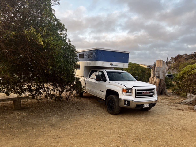
The general direction now was simply…….south ! Santiago lay immediately ahead and having explored it fairly extensively on a previous visit the plan was simply to navigate around it. Chilean elections were just 2 weeks away and the city had seen protests and threats of road blocks so not something we wanted to get tangled up in. Our trusty iOverlander app ( absolutely THE most essential travel aid in the repertoire) helped us locate a small private campground near the coast on a route that would later take us through Chile’s Colchagua valley, one its most famous wine growing regions. Unsurprisingly we were the ONLY campground guests, a pattern that would repeat for the rest of the week.
Camping Las Cipreses, El TaboEl Tabo
From the rustic town of El Tabo, our route took us through the grimy port city of San Antonio ( only for the sake of procuring a new vehicle battery ) before getting dramatically more scenic on the approach to Santa Cruz. What did strike us was both the relative absence of campgrounds in this area, or, where they did exist, the fact that they were closed. COVID impact ? Too early in the season ? Either way, finding a spot to camp would be be a tad more challenging for the next couple of nights. In any event as most often seems to happen, a solution was found and we found ourselves ( again ) the only guests, this time in a private’ gated, “Tiny Cabins” development with total run of the place…!
Marco, replacing our dead battery in San Antonio
It only made sense to make full use of the facilities ( space, security and privacy ) to do a total re-clean, and re-pack of the vehicle merging all the things we’d left behind with an even bigger pile of the things we’d brought back, only to realize that some serious, shall we say, er, “consolidating” was in order.
Parked at Tiny Cabins, Santa CruzBattery was not the only thing we replaced. I carried a spare cabin air filter so changed that tooA most serendipitous discovery
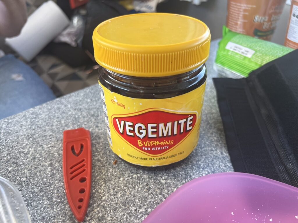
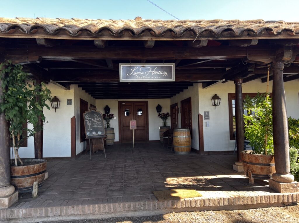
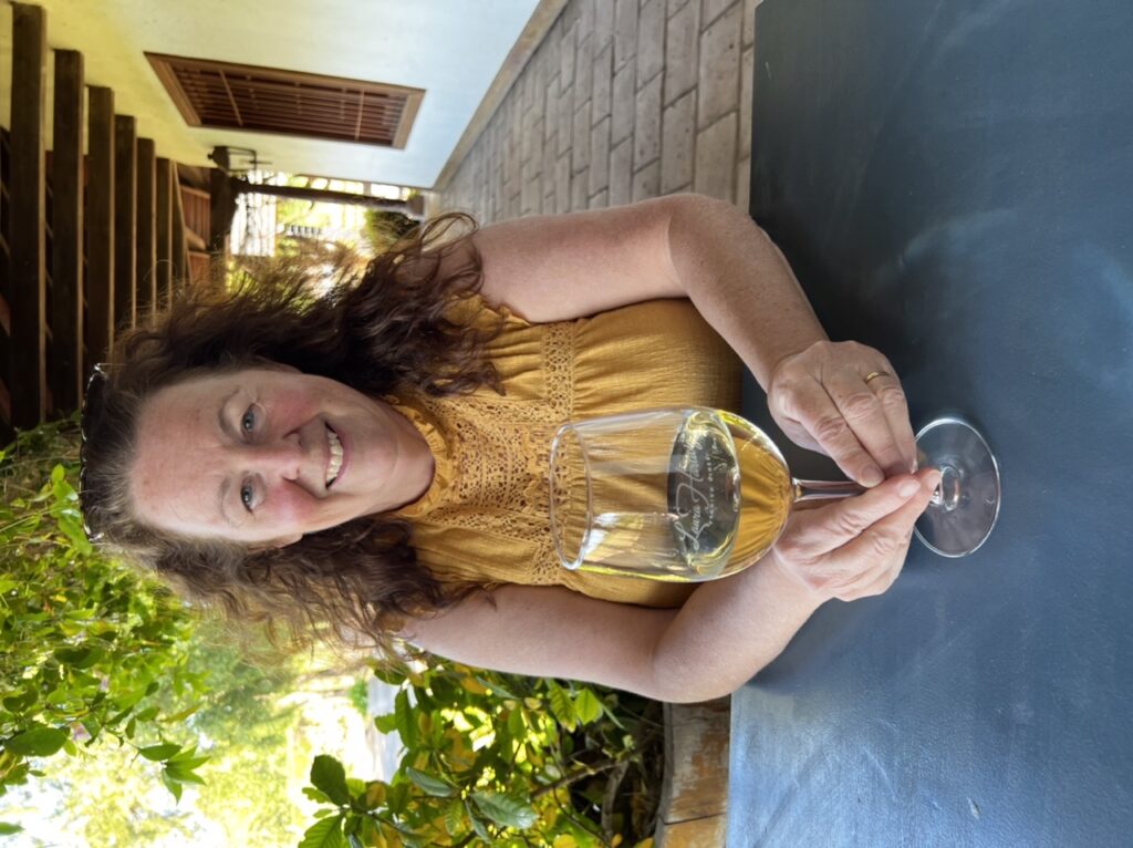
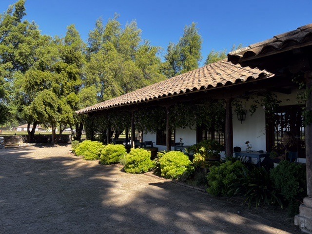
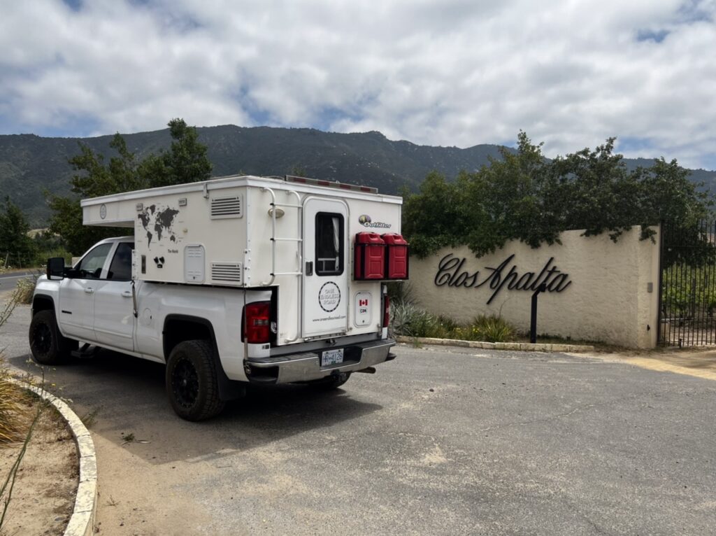
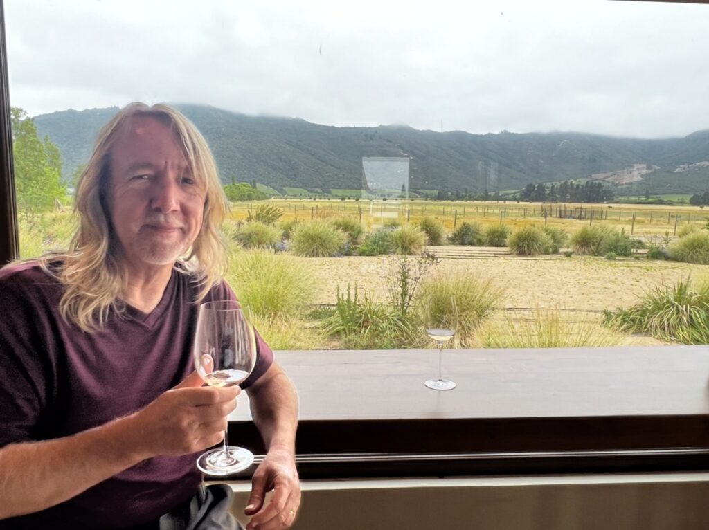
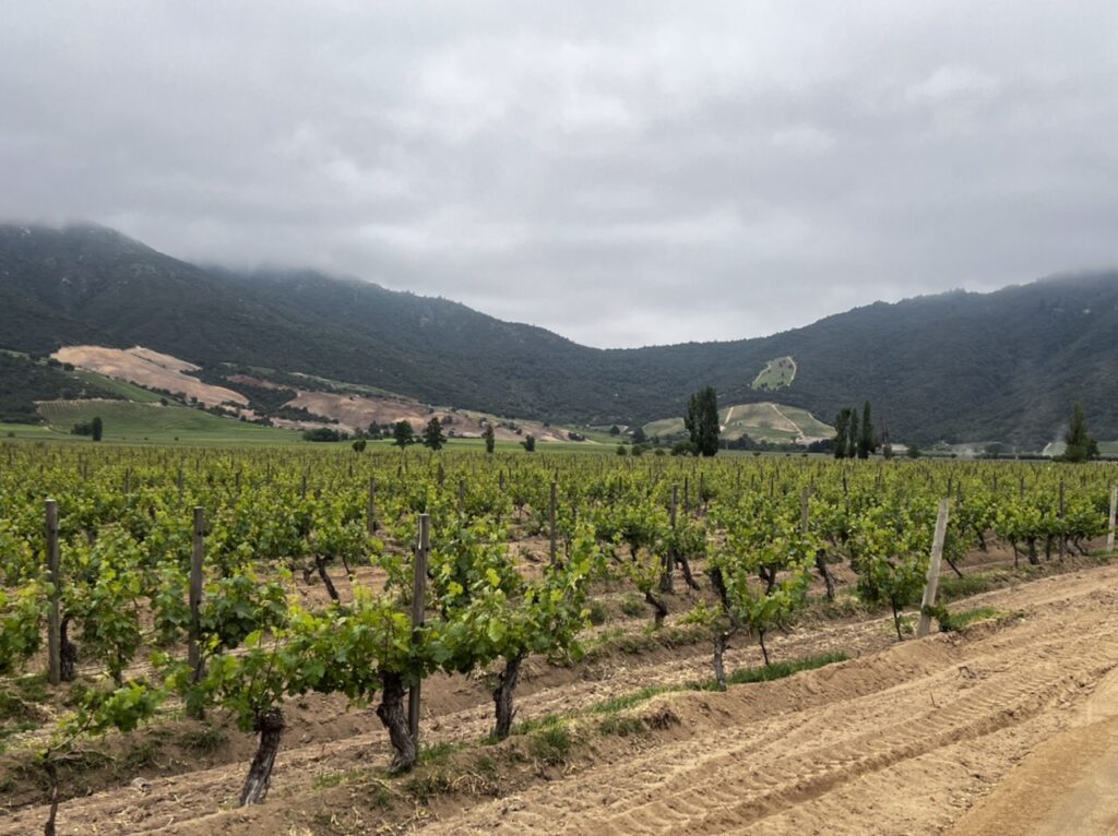
While Santa Cruz does not offer easy camping accommodation it does deliver great wineries, restaurants and a real “Napa Valley-like” ambience. Hugely popular with Chileans, it’s an easy place to just linger……so, linger we did for a couple of days, one touring the wineries of Laura Hartwig, then the amazing Clos Apalta, followed by a second day just unpacking , cleaning, the re-packing the camper – it had been so long since we left Chile that we had forgotten how much stuff we left in the camper. One little gem we ( well, “I”), did uncover in the process was an almost full jar of pure Australian gold……..Vegemite ! Absolute heaven, and enough to last me a good few months used sparingly ! Lois suggested it was the aroma of Vegemite ( she hates it ) that kept the mice out of the camper !
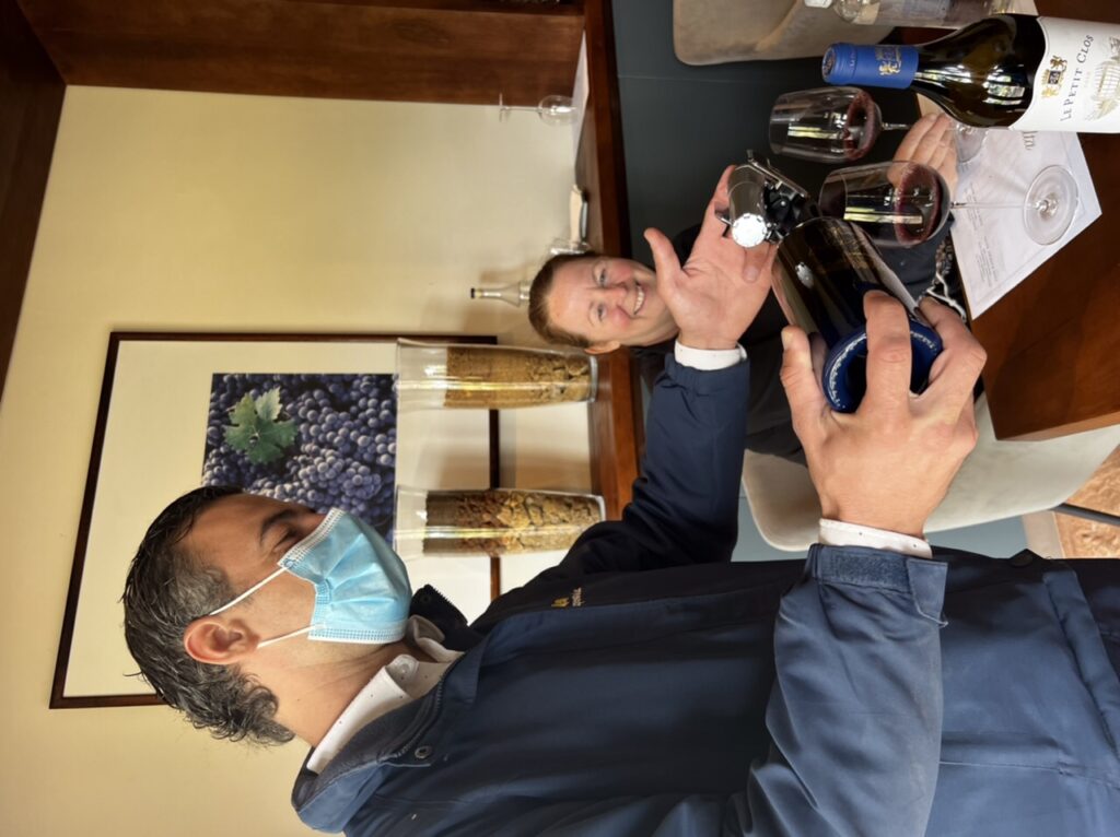
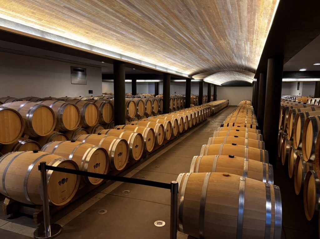
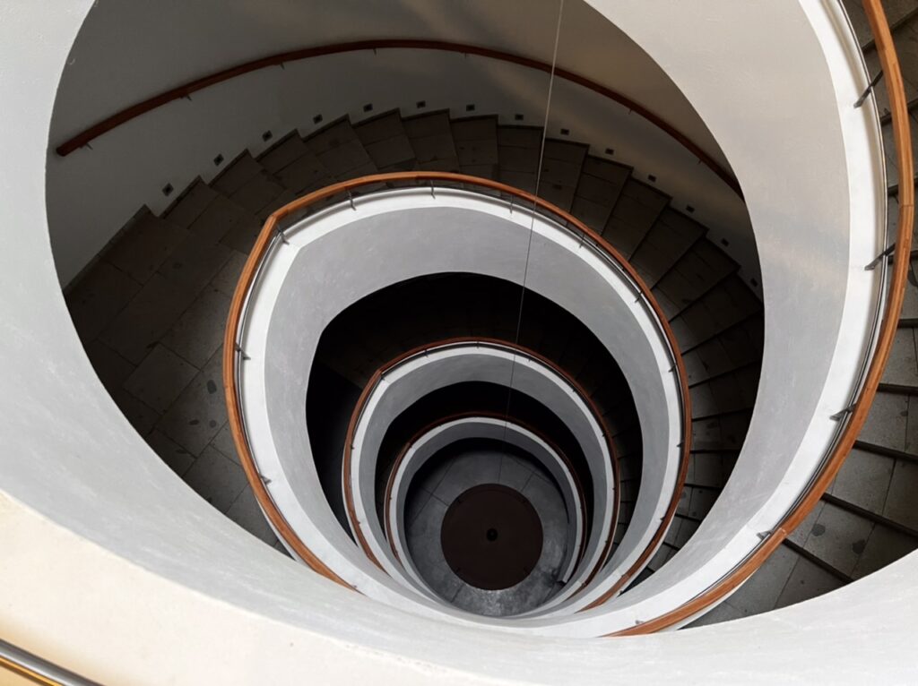
Laura Hartwig WineryLois sampling a Laura Hartwig wineLaura Hartwig WineryClos Apalta WineryLois sampling a Clos Apalta redClos Apalta cellar The staircase to the six level Clos Apalta underground cellar. It was dug out from stone over 6 years and is one of only a few such in the worldJeff, with a whiteThe vineyards
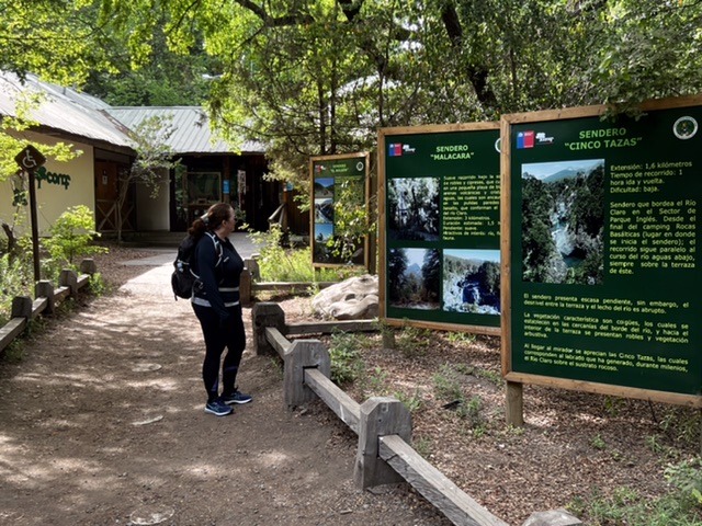
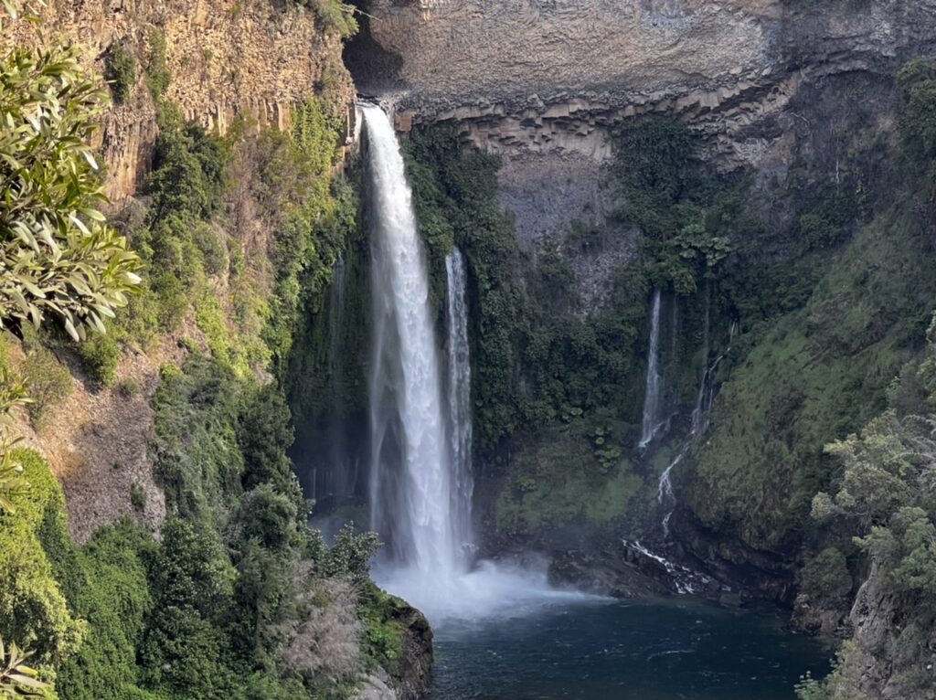
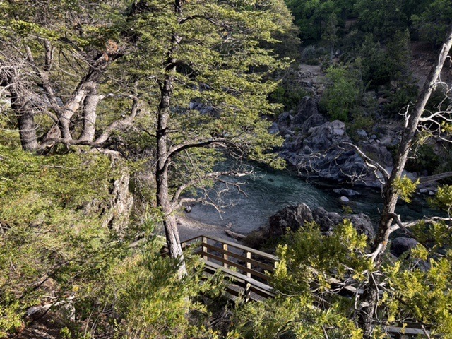
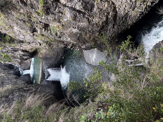
More than a couple of Chileans had recommended we visit Siete Tasas ( 7 Cups ) National Park and being that it was not a big detour on the way south we made our way there. Great place to stop for a couple of days, enjoyed a long-needed 8km hike and realized a second thing that also became immediately obvious – how absolutely out of shape we were ! Once again we were pretty much alone albeit in a beautiful setting right on the Rio Claro.
Lois at the Siete Tasas National Park entryWaterfall, Siete TasasCamping at Siete TasasRio Claro, right beside our siteThe Siete Tasas cascading “cups”
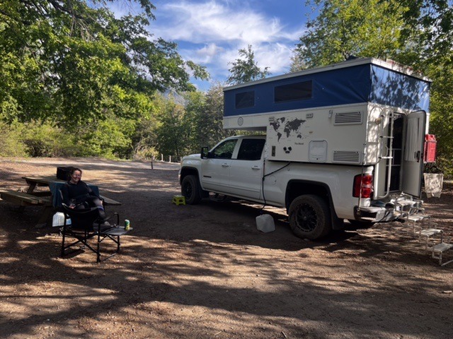
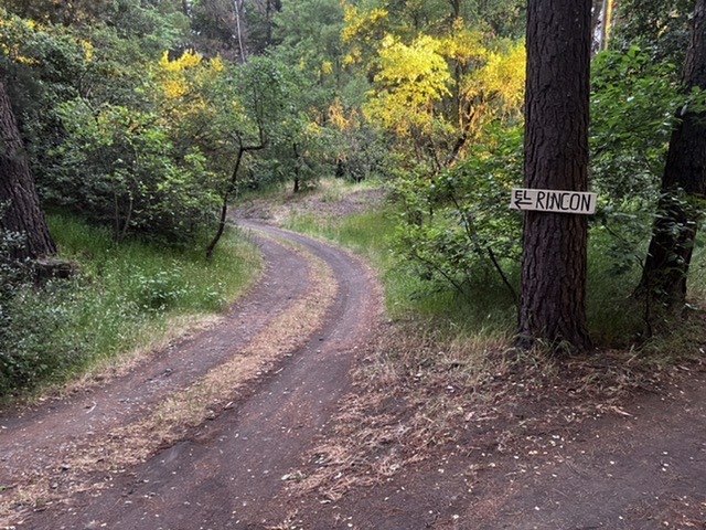
While the next stop on our route was Chile’s Lake District ( centred on Villarica and Pucon ), it was a bit of a stretch in one day so we broke the journey at a great Eco Camp ( El Rincon ) just north of Los Angeles ( Chile’s Los Angeles ! ) hosted by Don and Carla, two expat Americans who have created a little slice of heaven in the Chilean countryside. Great spot, great hosts and we finally met our first other foreign travellers ( a Dutch couple ), ironically however on their way home to Holland. Enjoyed a night together sharing drinks, and tales from the road. Bliss……….
Road to El RinconCamping at El Rincon They still wash your windscreen and pump your gas here…….and wear a uniform !
Please excuse the MacArthur-like analogy but, 1 year, 7 months and 14 days after beating a hasty retreat from Chile in the face of a global pandemic, finally we “have returned” ! Never in our wildest thoughts ( back in March 2020 ) did we expect we would be away that long. Fortunately, the time back in Kelowna was quite productively spent and the upside was that it was wonderful to re-connect with so many friends and family during our time at home. But, global travel is most definitely back “on” and we are genuinely thrilled to be on the road again ( well, almost ! ).
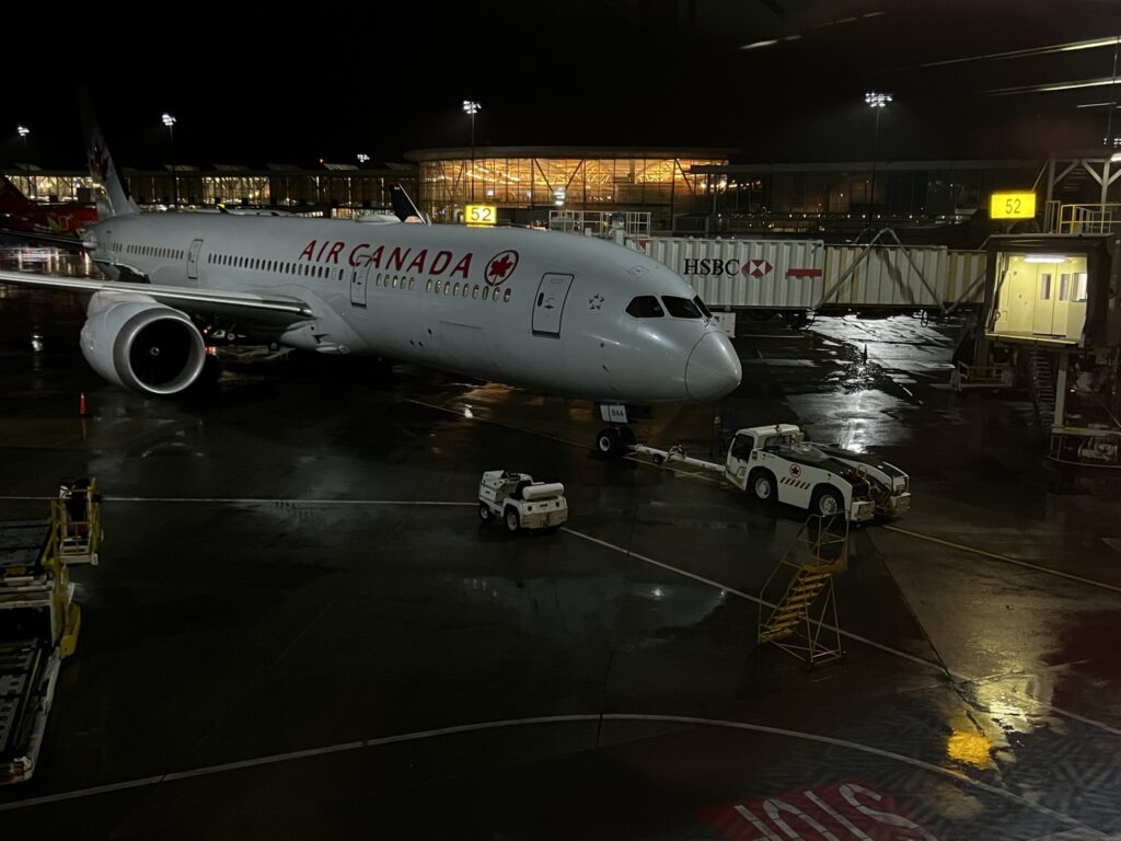
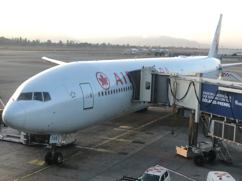
Last time time we saw a sight like this the plane was bringing us home from Chile. Our plane at Vancouver airport
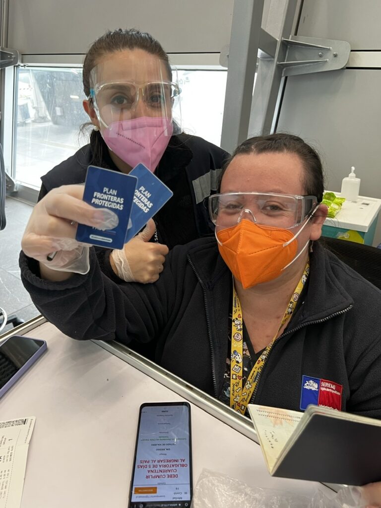
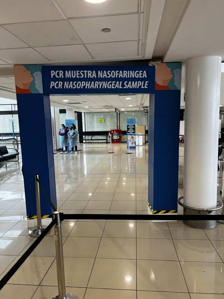
On November 4th, after a tortuous, stressful, circuitous and incredibly tiring 44 hour journey from Kelowna, BC, Canada, we landed at Santiago International airport in Chile. Trust me when I say there were days when I wondered if the world would ever get back to ‘normal enough’ for that to happen. For those ( like I ) who have been engrossed in how the world has tackled COVID, Chile ( after a very rough start ) quickly moved into the big leagues and tackled the vaccination of their population with gusto. Currently one of the most vaccinated nations in the world with almost 80% fully vaccinated, they are actively doing 3rd shots ( boosters ) and have opened up to foreign travel, albeit with some fairly rigorous requirements. As such we feel comfortable being here and have now seen first hand how impressive and organized their process is for ensuring foreign travellers do not risk the success they have had in fighting COVID 19. Travellers need to be double vaccinated, compete comprehensive declarations on-line prior to arrival, have adequate medical insurance ( covering Covid ) and be prepared for 5-7 day quarantine on arrival ( waived if you pass an obligatory, but free, PCR test on arrival in the country with results delivered in a maximum of 24 hours – ours came in 9 ). For the first 10 days in the county you complete a daily attestation as to your health with a simple an easy to use app. So, they pretty well have it all covered ! The airport process was well organized, friendly, and easy to navigate. Slick……..
Friendly Chilean airport staff guiding us through the COVID protocols on arrivalAirport staff ready to do the nasal swabs. Fast, friendly and results same day !
Readers who have traveled on long, multi-stop international flights in the new COVID world will know what I mean when I say – air travel sure isn’t what it used to be. Unquestionably the most drawn out, nerve-wracking, tiring, bureaucratic and at times painfully frustrating experience we have ever endured during our many years of air travel and we are certainly glad it’s now behind us. The stress multiplier, these days anyway, is the need for a negative PCR ( Covid ) test taken before you leave home and now required to enter many countries ( Chile being one such). The labs take 30-48 hours to provide a result ( in our part of Canada anyway ) and you ( typically ) need to be in the destination country ( or at least on the last flight sector to that country ) no later than 72 hours after the test was taken. When you consider our flight time ( with layovers ) was 34 hours you can see that it gets a little, ummm, shall we say….tight ! I won’t bore folks with the intimate details but a heads up to those planning long, multi- sector, international flights now that the world is opening up – it’s a nail biter, and make absolutely sure you have all your ducks ( or should I say “docs” ) in a row. Not for the faint of heart.
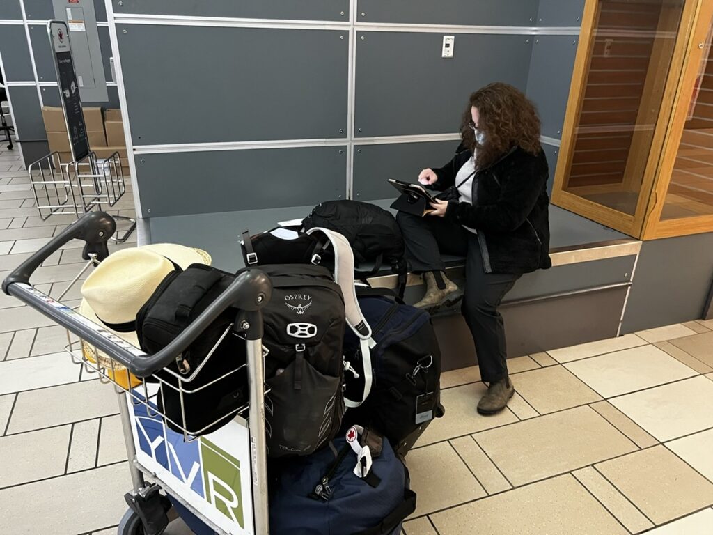
Lois doing some last minute on line documentation for the Chilean government so we could board our flight in Vancouver. When we left Houston ( our last stopover ) for Santiago 6 people were denied boarding due to inadequate documentation. Ouch ! Bags were removed from the plane and we left an hour late
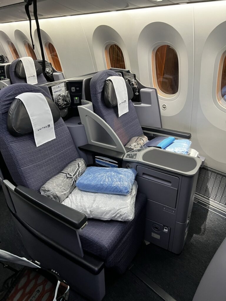
We had anticipated some of this and to ease the pain of the extremely long return journey, and the associated rigorous COVID protocols, we had at first decided to overnight in a hotel en route to Santiago. Sadly the 72 hour rule precluded that ( our PCR tests would then expire before we arrived ) so the only other option was a business class flight ( getting soft, I know, I know, but we convinced ourselves we deserved a break ). And hey, we had the points, why not use them ? Pretty reasonable on a one way flight actually. Those delightful airport lounges, and very comfy fully-reclining, wide seats on the plane really made a difference this time (though I am concerned Lois may get used to it ! ).
We are very used to walking right past these seats when boarding a plane- nice to be sitting in them this time !
Now that we are back in Chile, we are excited to complete the Pan American highway ( destination Ushuaia ) and beyond that further exploring in Argentina, Uruguay, Brazil and possibly eastern Bolivia. Our goal is to do that by April / May next year. It’s unlikely we will tackle the Guyana’s – a loooong way north and having lost so much time to Covid ( and with a wedding coming ) we just have to make some decisions on what our travel priorities are. More on that in the months ahead but our immediate plan is to travel Chile’s legendary Carretera Austral and other parts of Patagonia en route to Ushuaia. It’s tremendously exciting and has always been one of, if not THE, primary goals of this whole journey.
On a more personal note, I mentioned a wedding above. Lois and I were thrilled to learn that our daughter is getting married in September 2022 so that means we will almost certainly be back in BC all through our Canadian summer next year helping plan that. The plan beyond that is to continue overlanding later in September next year and we are currently weighing up possible destinations – so many countries, so little time.COVID cooperating of course !
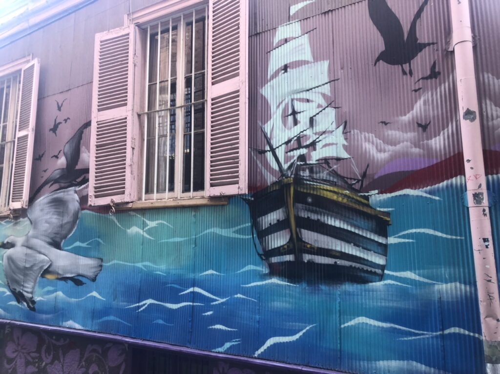
Stay tuned, and thanks for staying with us during COVID- I hope this finds all our readers well and, like us, chomping at the bit to get on the road again…………! I’ll close with a few pics of our first couple of days back in Chile, spent around Vina Del Mar and Valparaiso. We expect to pick up the truck on Sunday this week and start heading south right away.
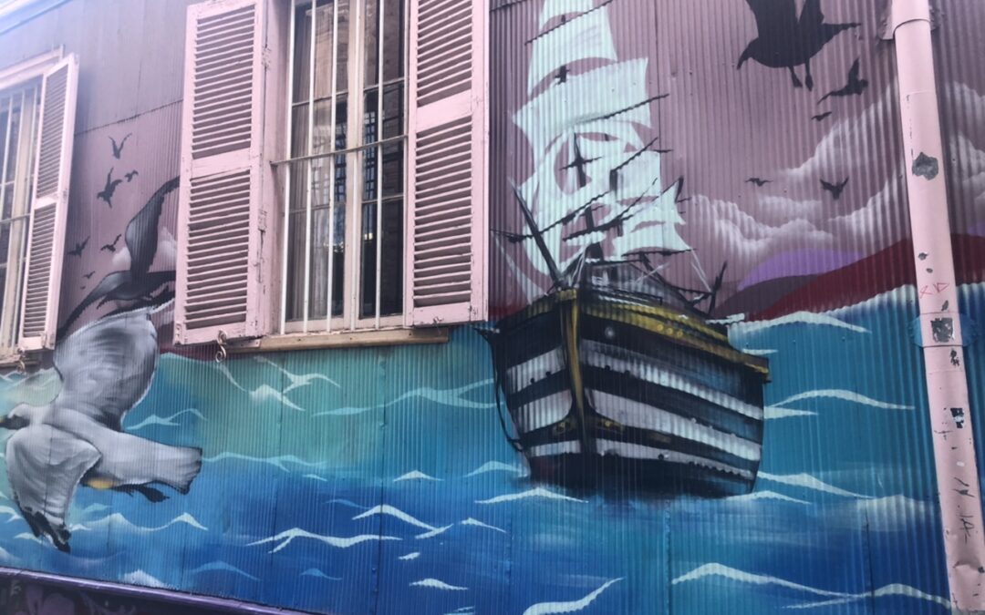
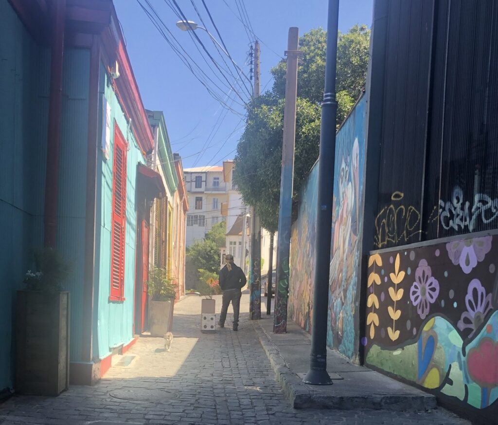
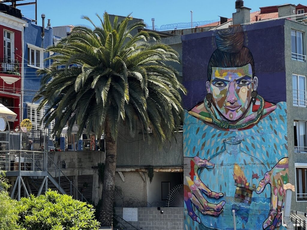
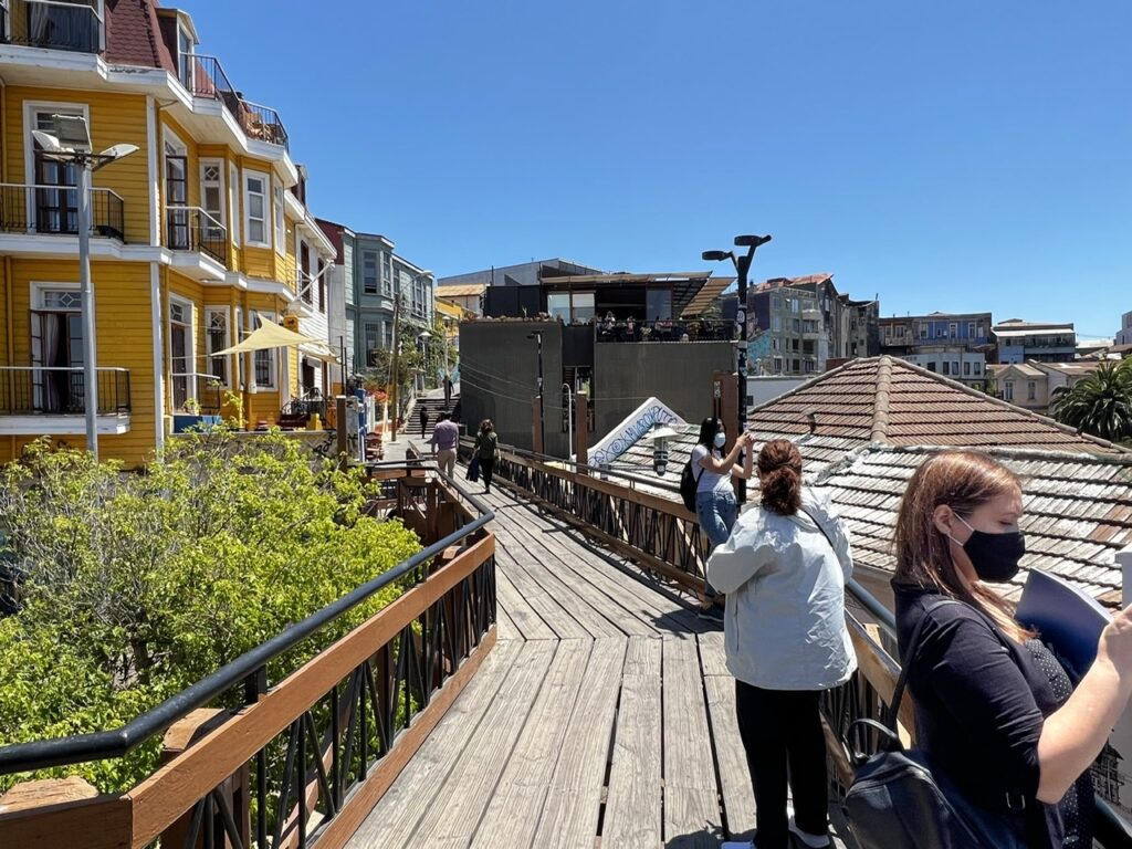
Street scene in Vina Del Mar Vina Del Mar Vina Del Mar from our hotel Valparaiso murals Valparaiso backstreet murals and colored houses Valparaiso muralValparaiso neighbourhood of colorful houses up above the Queen Victoria funicular – very steep in “Valpo”
“How time flies” as the old adage goes. If you can believe it, this coming week it will have been fully a year that has passed since we hurriedly packed up some necessities, stored our truck/camper in a little town outside Santiago, and jumped on the next plane to Canada – March 21, 2020 to be exact. Readers may recall this image headlining that final ( for 2020 anyway) “Exit from Chile” blog post:
Our plane for the sudden trip home – fortunately we left when we did, it became much harder just a week later
Much has changed in the world in the last 12 months – and who could have imagined it playing out like it did ? While we are not out of the woods yet, with vaccinations in full swing globally, let’s hope we have turned the corner and that life can, in the coming months, start returning to normal.
We’ve been with this pandemic for so long now that it’s easy to forget what “normal” was – remember, life before masks, intermittent lockdowns, social distancing and copious daily applications of hand sanitizer ? It’s also amazed us how quickly everyone has just gotten used to this ( albeit temporary ) “new normal”. Interesting as well to look around the world and see how different countries have tackled it – there have certainly been some surprising outcomes.
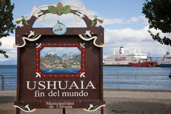
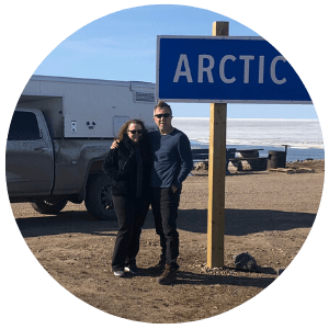
It seemed like the one year anniversary of our hasty retreat from overlanding in South America was a good time to update readers on what has since transpired for us, what we are working on, and when we plan ( or should I say, “hope” ) to be back on the road – with 38,000 kms of the Pan American highway under our belt we have about 5,000 kms still remaining to reach our destination of Ushuaia. When it comes to the PanAmerican highway this quaint Argentine town on the island of Tierra del Fuego at the very bottom of South America marks ( quite literally ) the end of the road. Or, as the the Argentines call it, Fin del Mundo – the end of the world.
Ushuaia, Argentina – the end of the PanAmerican Highway
Given that we have not yet been vaccinated, and won’t be until at least July, travelling right now is not viable. Unfortunate, because now is the ideal time to be in Patagonia and travelling the Carretera Austral considering it’s their summer. It’s just not a place to go in winter ( in fact much of it shuts down ) so if you don’t get there by April at latest one is simply best to wait until the southern Spring – which is October’ish.
That, in fact, is exactly what we plan to do – assuming all is good on the COVID front, assuming we are vaccinated and assuming the world is back to a semblance of normality, we would depart Canada sometime in September, fly to Santiago, pick up our truck and continue the journey. The loose, and I stress “loose” ( if COVID has taught us one thing it’s not to plan too far ahead) idea is to spend 4-6 months travelling to the bottom, then working our way back up the famous Route 40 in Argentina through to Eastern Bolivia, southern Brazil, and on to Uruguay. It’s not likely, having lost this much time, that we will loop all the way back up to northern Brazil or the Guyana’s but we will see how it unfolds. When our time in South America is done we will ship the vehicle home and sell it ( unless anyone out there wants to take a great overlanding rig off us in South America and do the reverse Pan American – it can been done ! ).
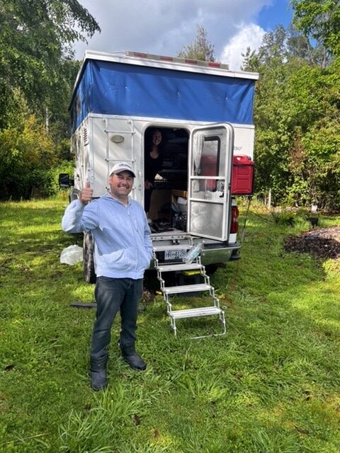
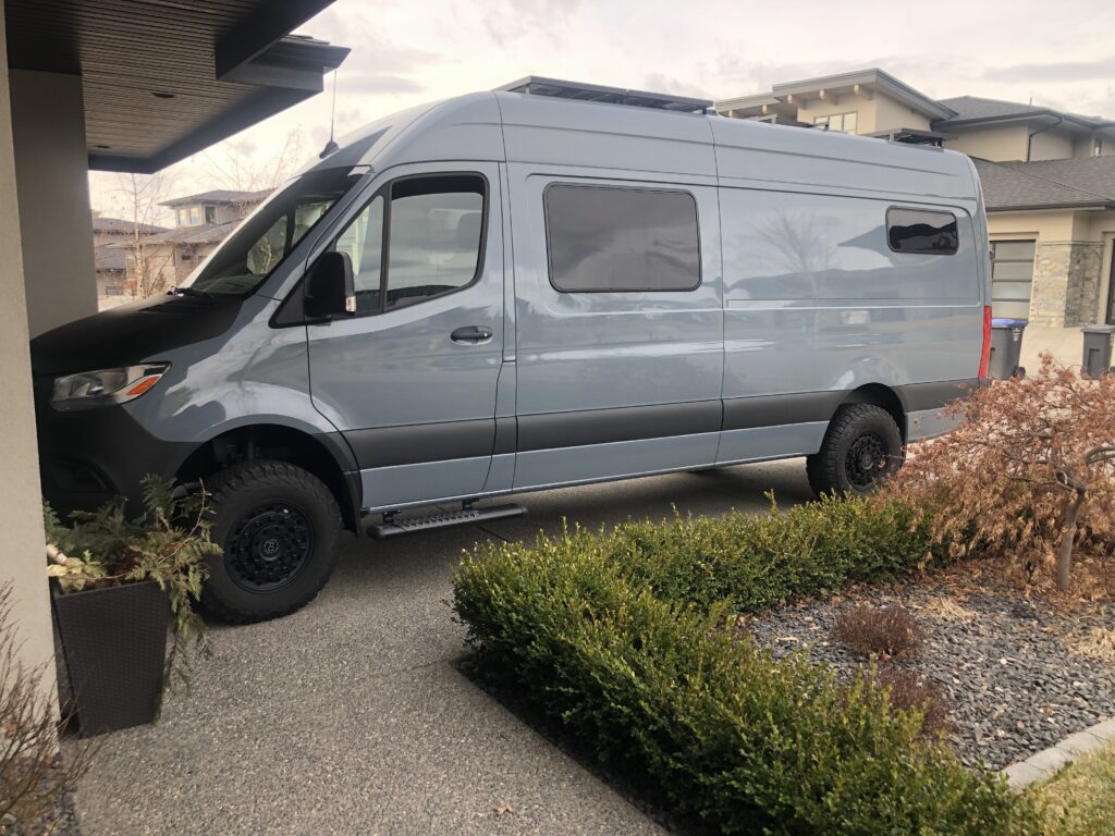
But, “Why would you sell it Jeff – there is much more of the world to explore, and surely you’ll need your overland rig?”, you might think. Indeed, there is much, much more to explore and we hope to continue overlanding for quite a few years yet, but COVID ( and basically suddenly having nothing to do ! ) inspired Lois and I to start a new project. In what might best be described as a rush of blood to the head, late in 2020 we somewhat spontaneously purchased a Mercedes Sprinter 4×4 and set about camperizing it for future overland travel. The “project” is about a third complete and we hope to have it done by this ( northern ) summer allowing us to travel in it through July and August around Canada. We will then store it here until we return from South America. Future travel will be in the new van. Here is a glimpse of how it looks so far ( we do need a name by the way so send us your suggestions ):
The new project – camperizing our Sprinter
The truck/camper has been fabulous and we could easily have continued on in it but we could not pass up the opportunity to do a van build-out when we had this much time on our hands. Essentially, we just moved the purchase forward a few years – a Sprinter had always been something we had coveted and we were actually very close to buying one when we bought the truck/camper back in 2015.
The wonderful Spring weather we are enjoying in British Colombia right now is a welcome change from the cold of mid-winter ( especially for those of us refitting a van in their driveway ! ). We are all looking forward to the coming summer and ideally a less restrictive life. Wherever you are as you read this, both Lois and I hope you are well and that your community, state, and country is getting on top of COVID. We look forward to starting the weekly blog again as soon as we are on that plane to Chile. Until then, stay healthy, and stay safe !
Postscript:
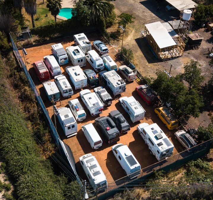
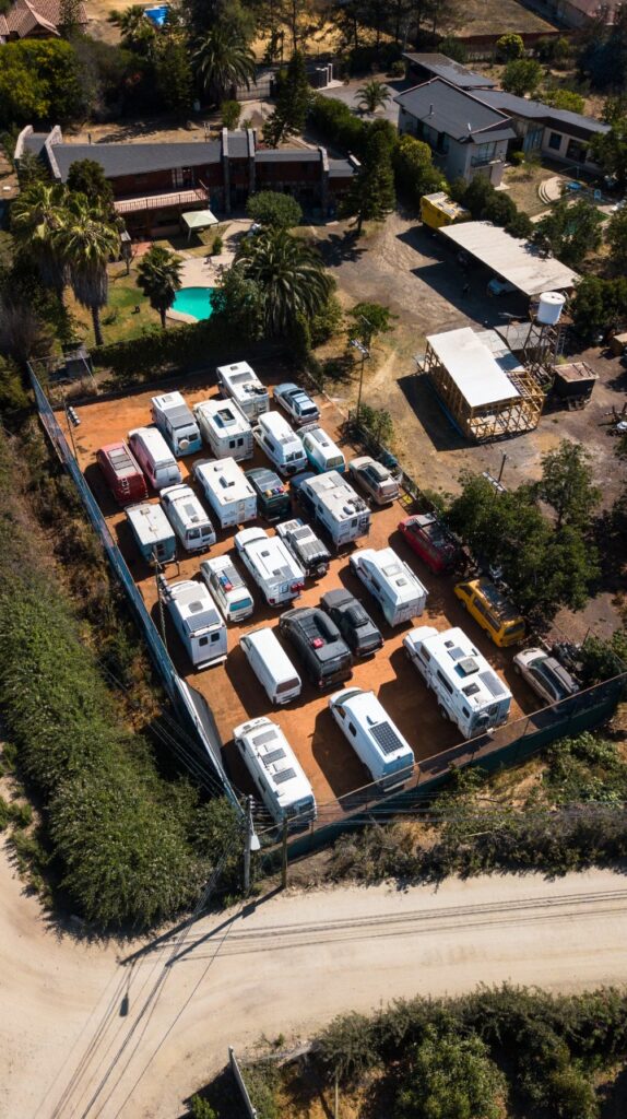
For those who have wondered ( and some have asked ) this is where our truck/camper is – ours is pretty much right in the middle ( making it more secure we tell ourselves, lol ). It gives you some idea of how many people are ( or were ) overlanding in South America at any one time ( we often speculated on that ). This is just in one part of Chile but there are doubtless thousands of overland vehicles parked in places like this all over South America
Our vehicle, along with almost 30 others, stored on the unused clay tennis court of a friendly Chilean overlander
The PanAm completed in April, 2022 and with the truck camper sold, we shipped our new Sprinter van to Australia in late 2022. We travelled there through all of 2023 and into 2024 before shipping it up to North East Asia where we travelled for 4 months between Korea and Japan, before shipping it back to North America. It’s our plan to continue exploring the world in 2025.