Very unfortunately it appears that, last week, all subscribers to our blog who use @gmail.com email addresses had their weekly blog link diverted to their junk/spam folders. Probably half our subscribers use gmail so it affected many of you. So if it’s ever not there just open your junk folder and you’ll see it, or simply go to our website www.OneEndlessRoad.com and look under Recent Posts ( it’ll be there ). I have been advised that it could be the good folks at Google tweaking their Spam filters ( which usually means it will catch some stuff it should not ). However, I’ve also been advised that it could have been caused by content in the blog – unlikely, since there was nothing unusual in that edition – pretty much like all the others !
On the assumption it may have been caused by blog content, I am sending out this “one off” blog post with no commentary, and no pictures, to see if it gets through as per normal. I’ve also included a link to last week’s missed post “Onwards to Broome “ as well as this week’s post ( “The Gibb River Road” ) in case the same thing happens again: see below
To ensure that you will always get it, it might be a good idea to add OneEndlessRoad to your Contacts and include our 1endlessroad@gmail.com address in the email section so that the Google system recognizes this as a legitimate email address.
I’d love to hear from any gmail.com subscribers just to know that you got it…..just put a comment in if you don’t mind. If there is a Google/gmail guru out there in our subscriber base who can advise me on how to prevent this in future, I’d love to hear from you !
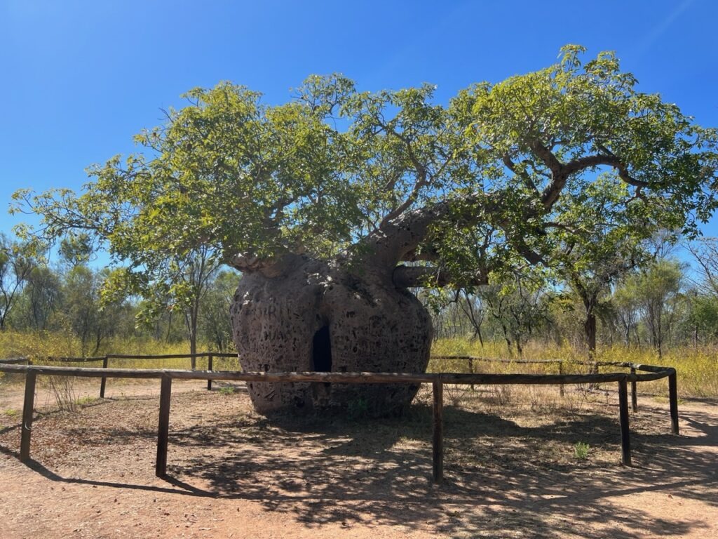
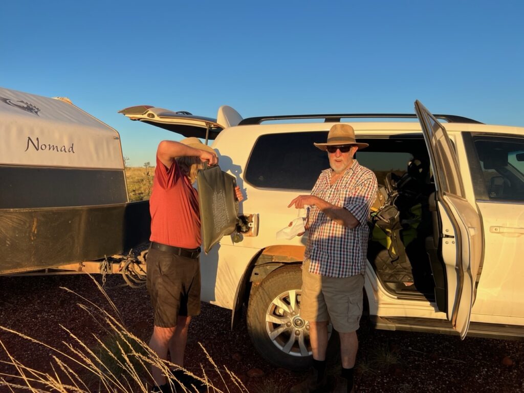
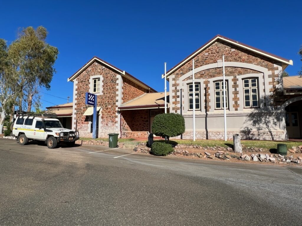
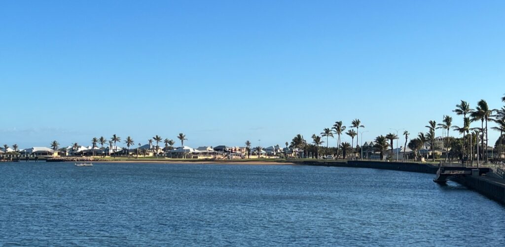
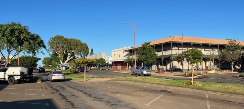
Prior to leaving Derby , we took in some of the local sights – it’s small, there’s not much there and it seemed extremely quiet on the Saturday when we arrived. There’s an interesting jetty where one can observe the scope of Derby’s famously varied tides, a unique boab tree once used as a prison ( yes, really ) and a few other lesser attractions – key needs for us as we considered our options on to Kununurra were food and fuel – we’d need lots of both as there were long driving stretches ahead.
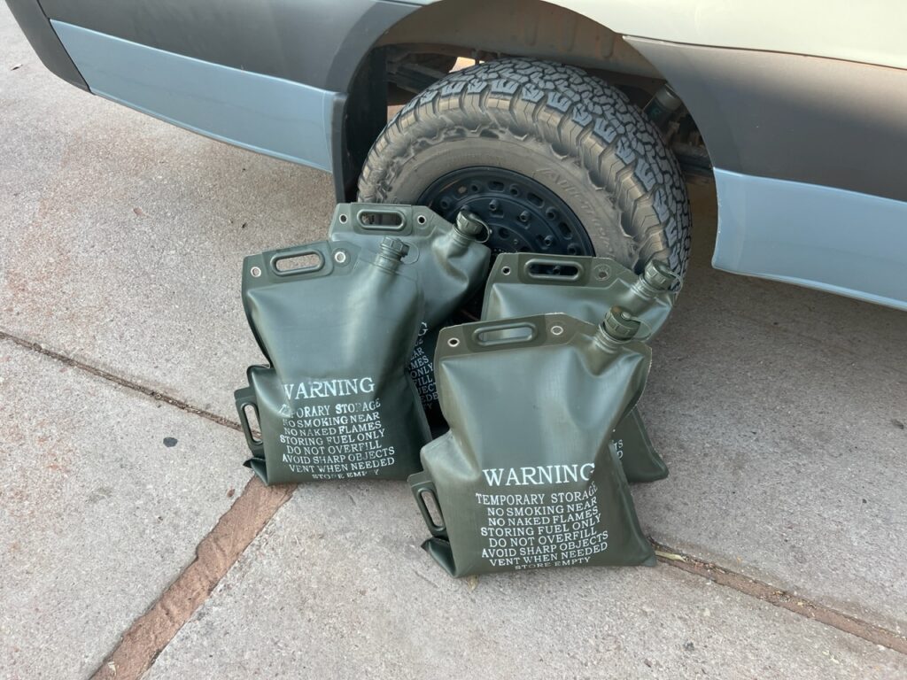
Loading up with extra fuel – each bag holds 20 litres.Boab “prison” tree, Derby.
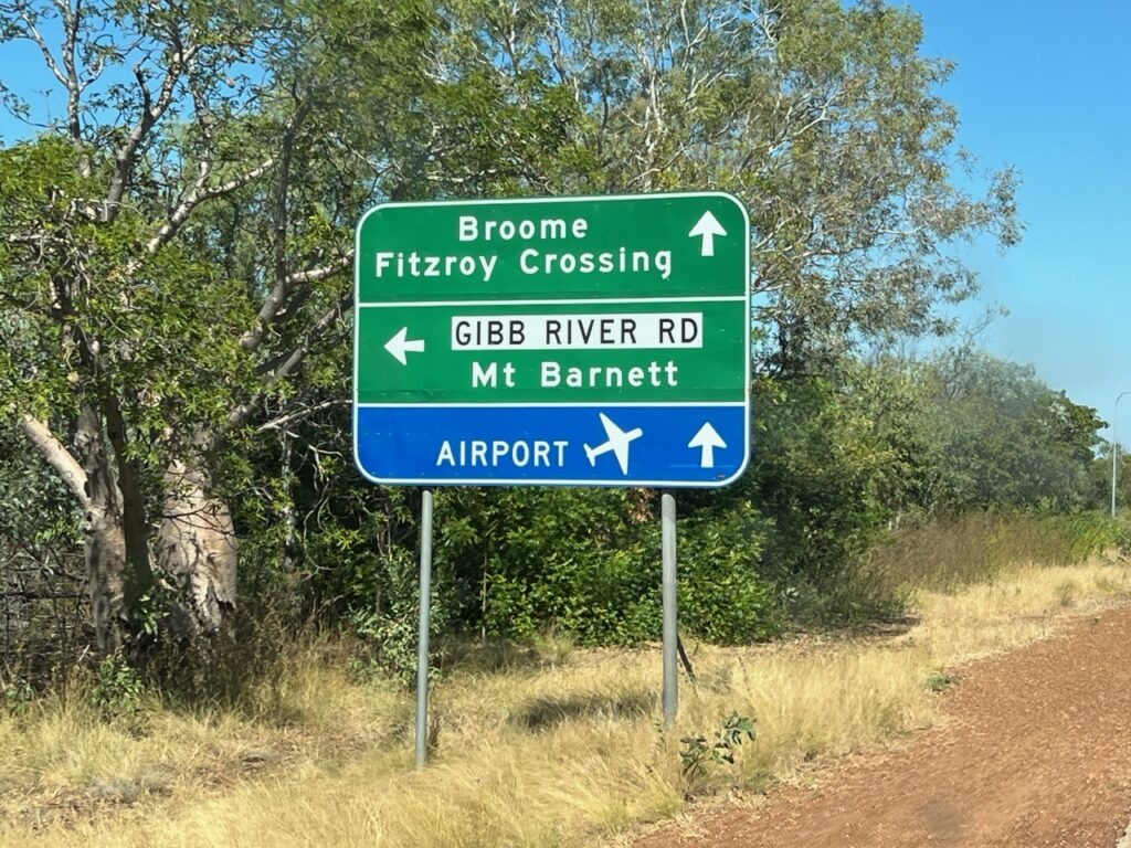
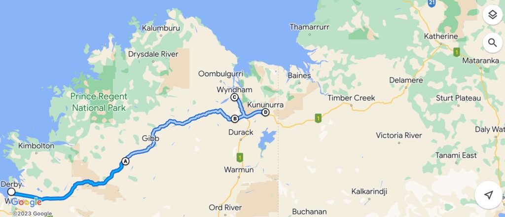
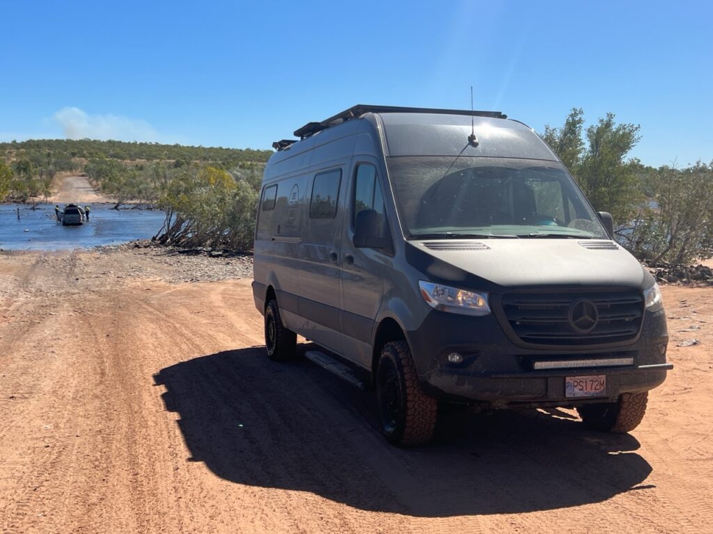
Barely 5kms outside Derby the road forks. Straight ahead and Highway 1 takes you on to Kununurra; to the left, lies the legendary Gibb River Road ( just west of Kununurra the two roads converge again ). The “Gibb”, actually shorter and definitely more scenic, but strewn with teeth chattering corrugations from start to finish. Highway 1 slightly longer, but blacktop all the way, albeit a far less interesting road. Crunch time upon us, a decision we’d been mulling over since we arrived in WA had to be made. Unlikely to ever come back this way, the van ready to go, and us wanting to do at least one other outback track that might better challenge the van’s capabilities, the decision was made – we’d tackle the Gibb River Road !
Decision time – The Gibb, or…..?The Route……
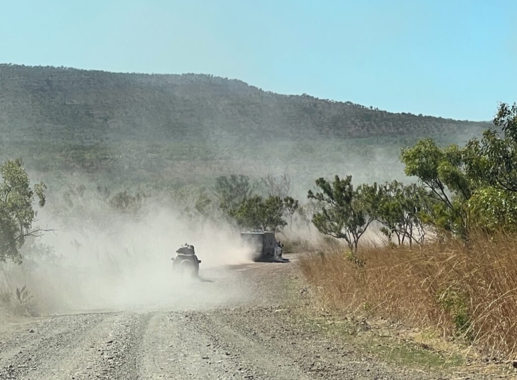
At over 650 kms in length, the Gibb is a multi-day affair. Some do it in 2 days ( possible ), some take a week. Certainly if one checks out all its extensions and diversions those “days” quickly turn in to “weeks”. We spent 5 days on the Gibb, following the main track and making diversions as required to visit the most popular gorges en route ( there are many ) but left the longest diversion out ( as many do ). The Gibb tempts you with an initiation of blacktop but that soon gives way to hundreds of kms of unsealed surface ( interspersed very periodically with very short sealed sections). Consistent blacktop would not be seen again until we crossed the Pentecost River just a short distance from the end of the road.
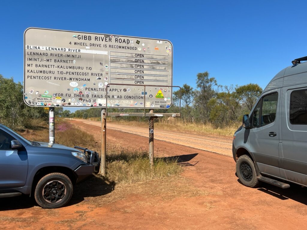
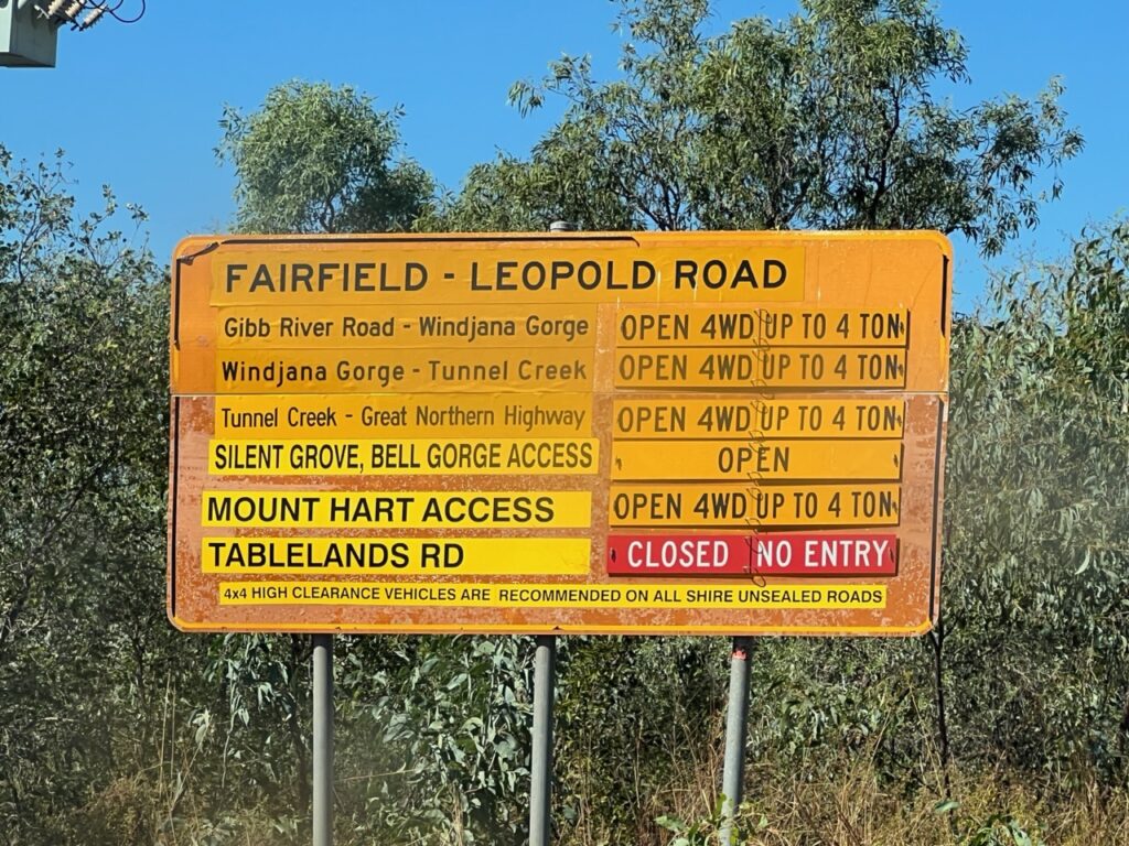
Checking that all sections were open.Restrictions in some sections.More detail on the route. We opted not to take the “road” to Kalumburu. A German we met described it as hellish.
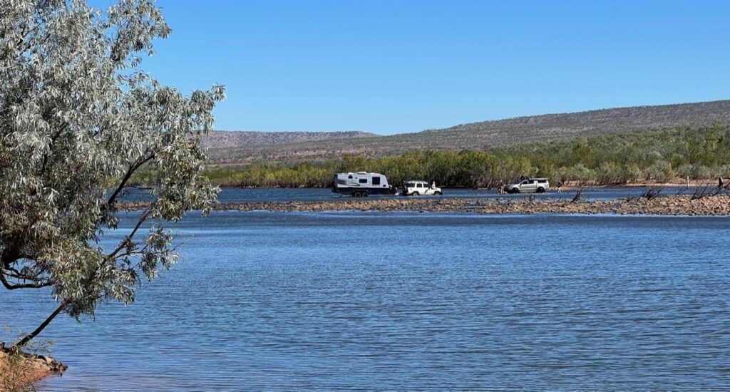
The Gibb for us fortunately went pretty smoothly- we’d heard of ( and seen with our own eyes) several vehicles carried off the track on a flatbed truck. We would go on to see several with nasty flat tires, cracked screens and 3 camperized vehicles get stuck crossing the crocodile infested Pentecost river ( all needed to be winched out ). None of the above for us – apart from a couple of decorative rubber caps for our hitch and side steps being lost reaching Adcock Gorge, we survived the Gibb unscathed. A relief to make it through, and very glad we took on the challenge, we’re also glad it’s now in the rear view mirror. A difficult road it’s not- there is no inherent danger, no steep cliffs, no huge potholes or the like – but it will shake you hard – very hard – all the way, just more or less very uncomfortable. And, hence, very tiring.
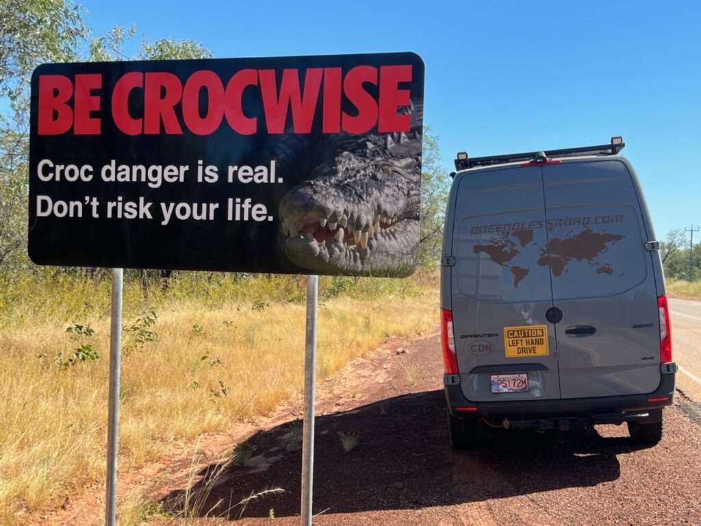
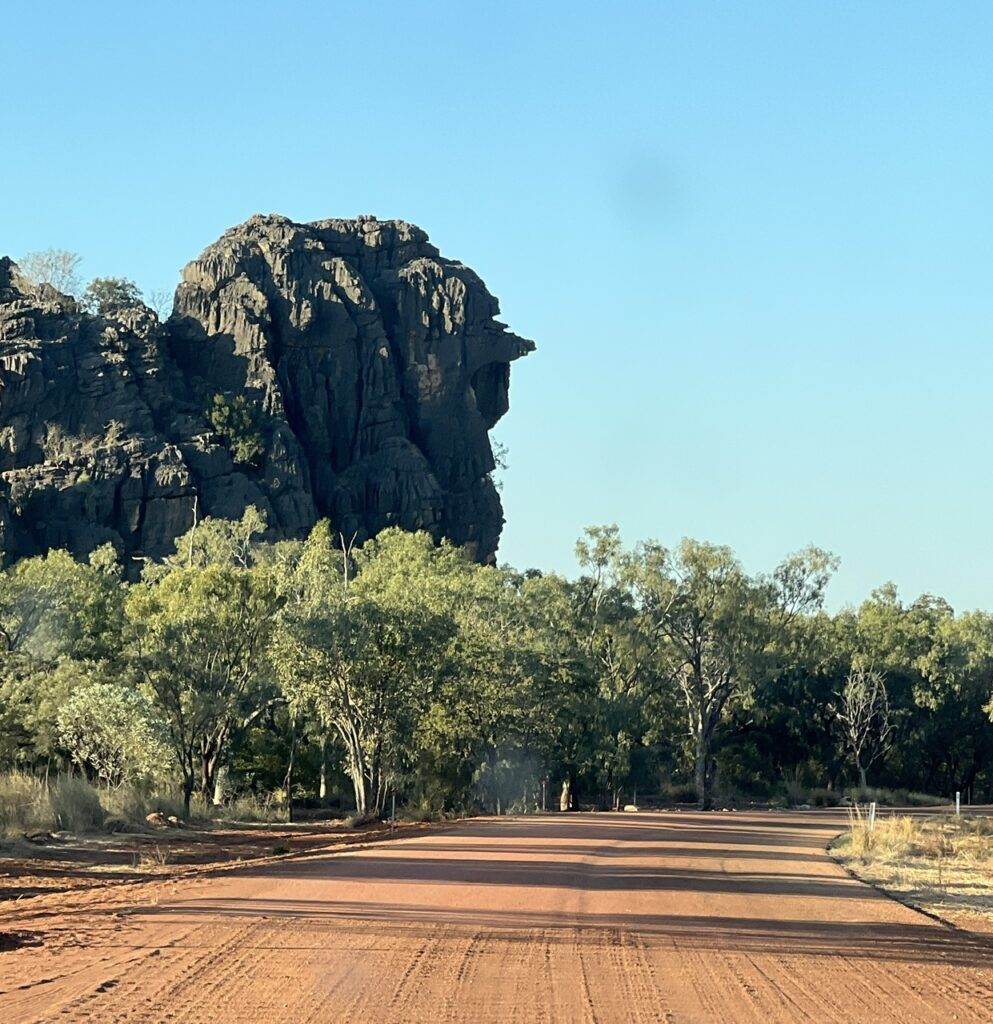
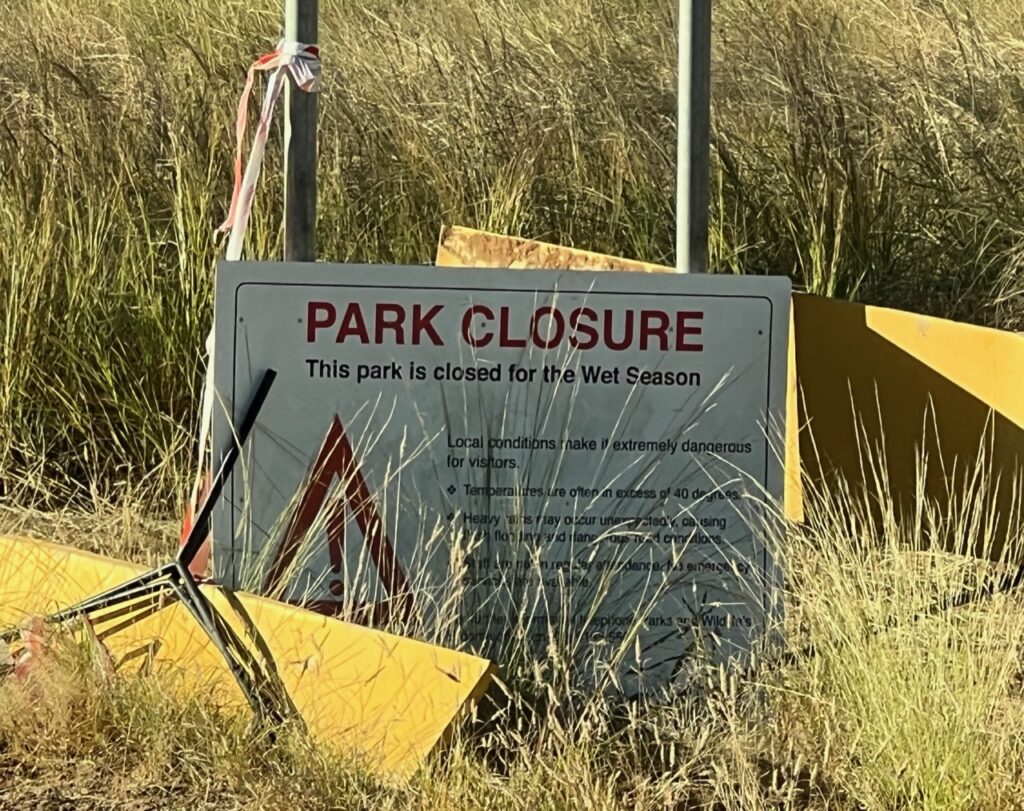
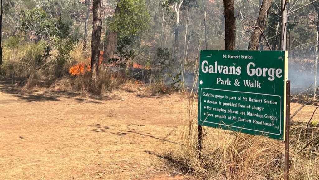
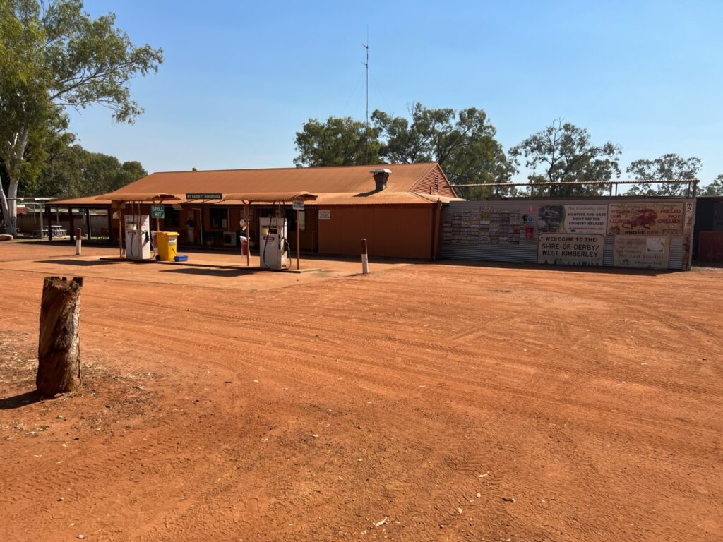
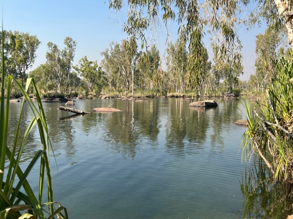
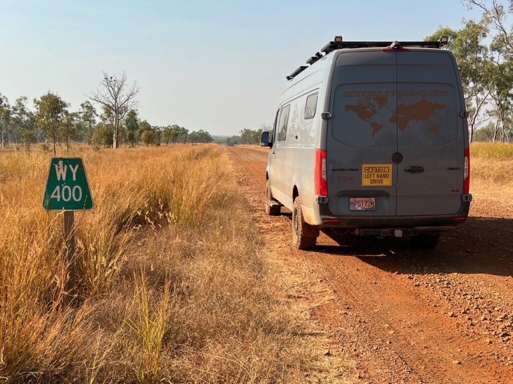
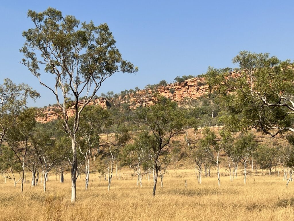
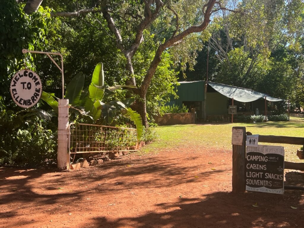
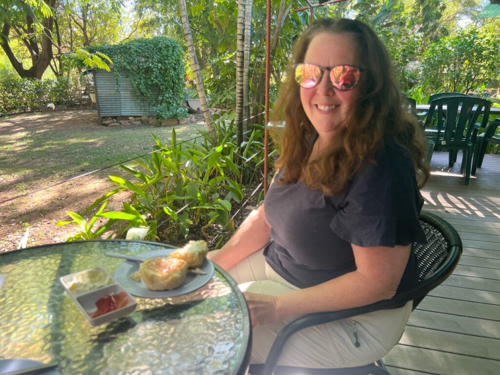
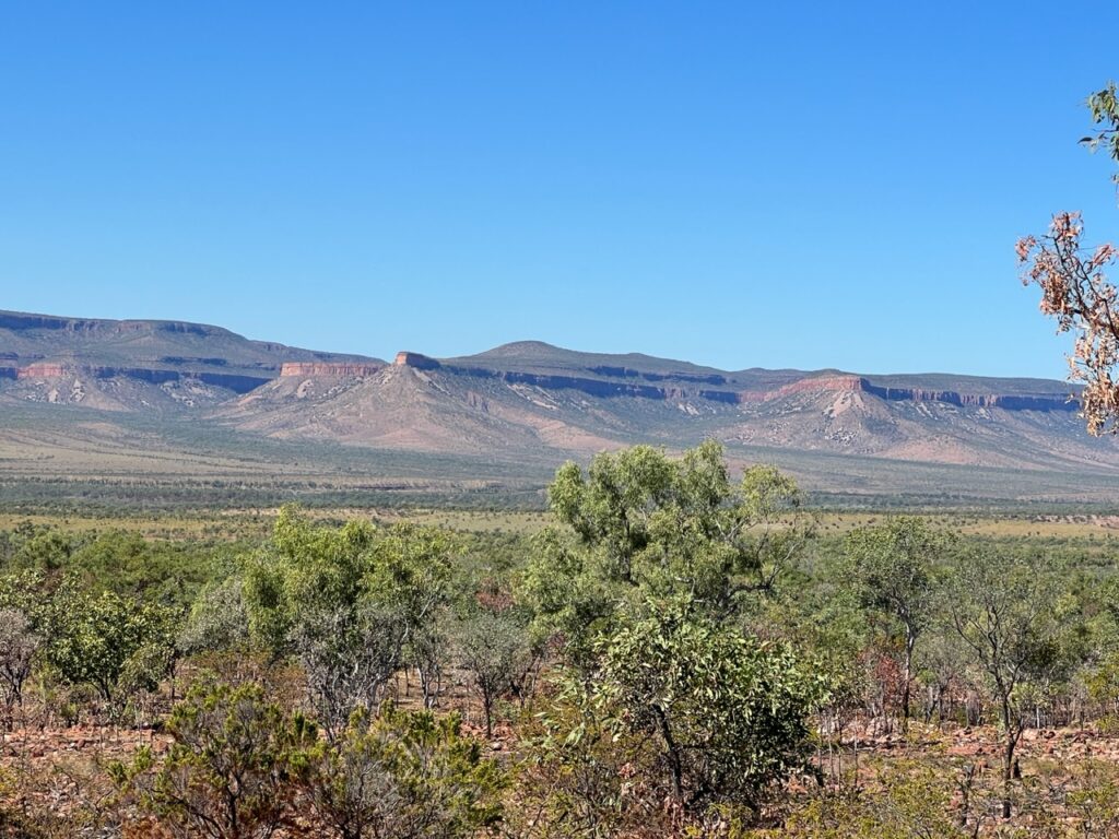
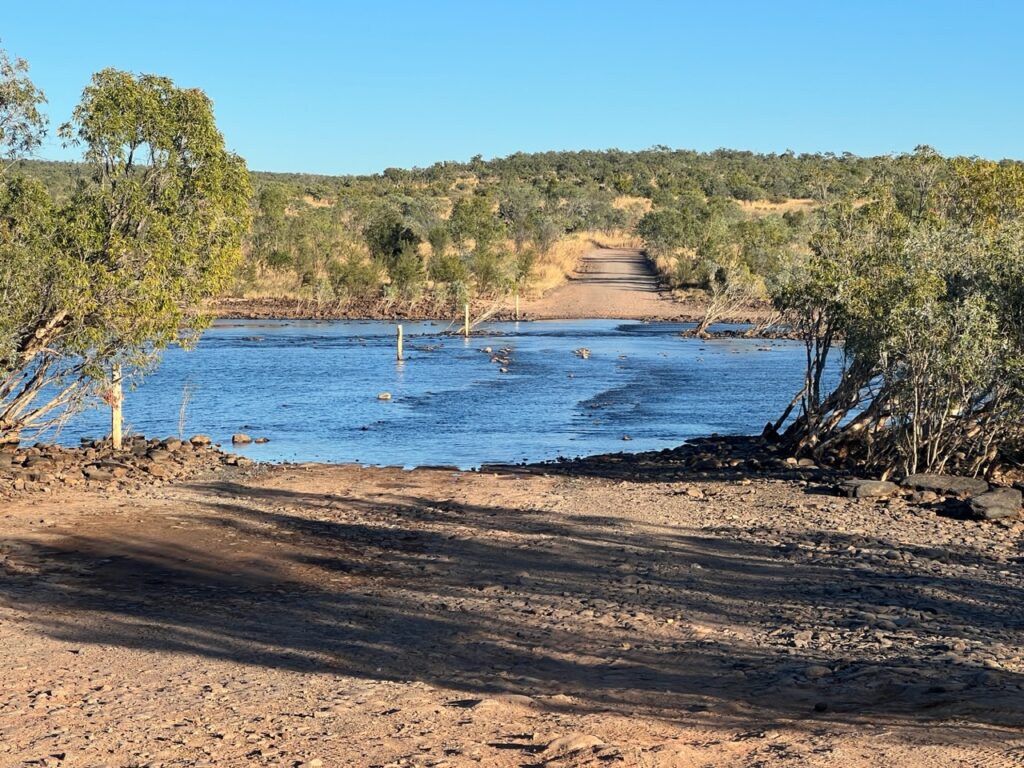
Typical scenery early on.There are numerous reminders like this in the north – the danger is real and fatalities do occur.The beginning of the unsealed section. There would be lots more of this !First attraction on the Gibb: Queen Victoria Rock – a stunning resemblance !Drove all the way to Windjana Gorge only to find it was closed. Road to it was open, the gorge itself was closed – ughh !Likewise for Galvans gorge, one of the better ones; it was closed due to controlled burn off when we arrived 🙁Adcock Gorge access. Rough !Adcock Gorge – the road in was a heavy duty 4×4 track. Most difficult part of the Gibb that we drove.Adcock gorge.Mount Barnett Roadhouse – civilization in the middle of the Gibb!Manning River, one of the few places it was safe to swim ( no crocs ! ).“WY” is Wyndham – still a loooong way to go !Typical scenery in the middle of the Gibb.Ellenbrae station accessEllebrae – an oasis on the Gibb.Everyone stops at the Ellebrae station for their famous hot scones – worth two creek crossings and a rough drive in !At times it was busy…….! And almost always dusty, but…….…..periodically there were short sections of blacktop. A welcome relief!One of many creek crossings on the Gibb.Typical clattering when on the rough stuff – corrugations and rocks.Typical road….Northern end of the Gibb, near the Pentecost River.Scenery near the Pentecost River.
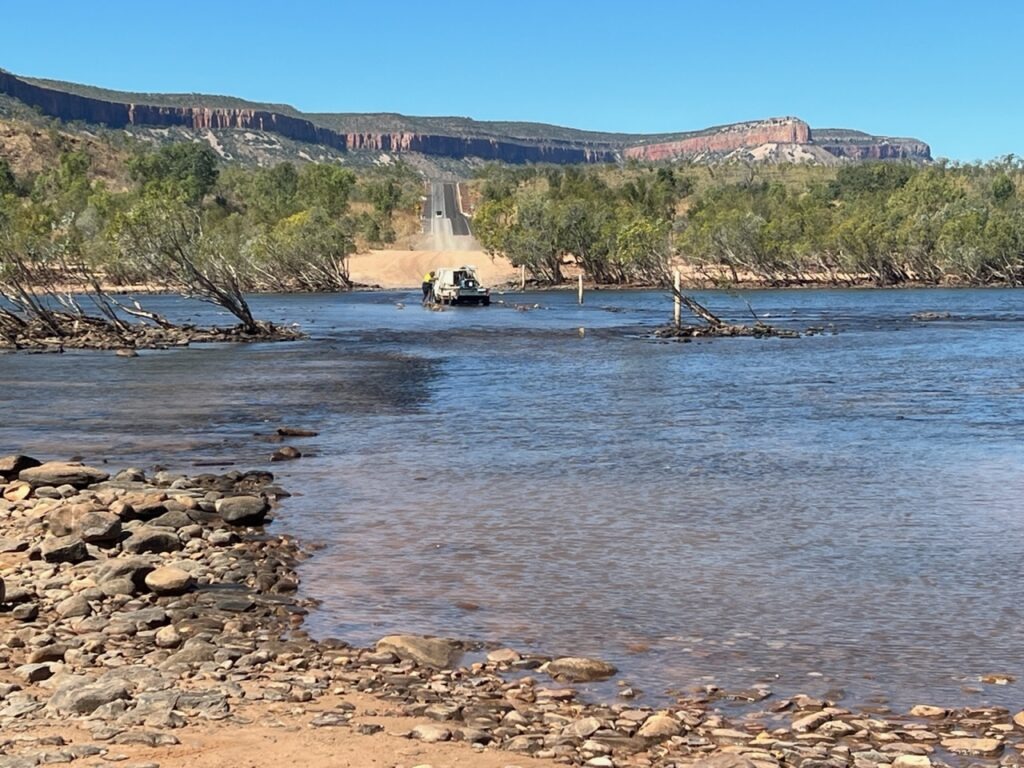
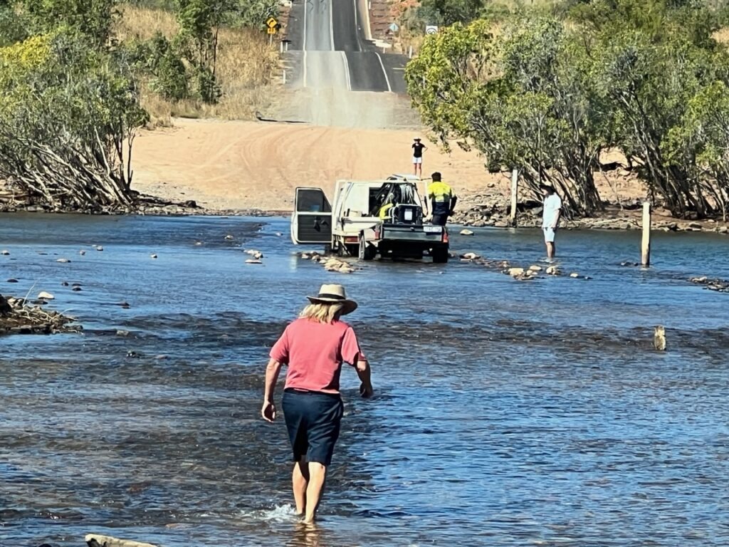
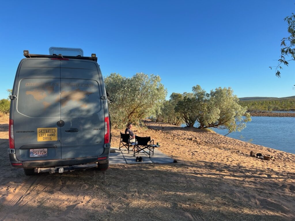
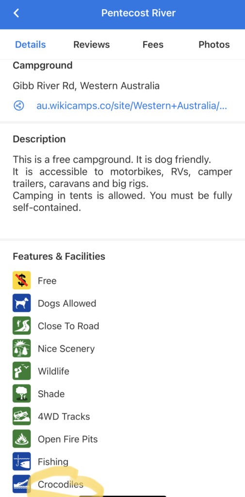
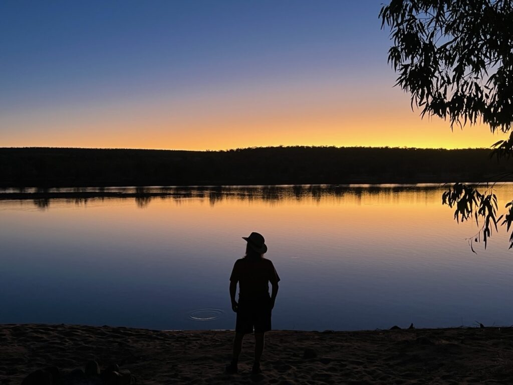
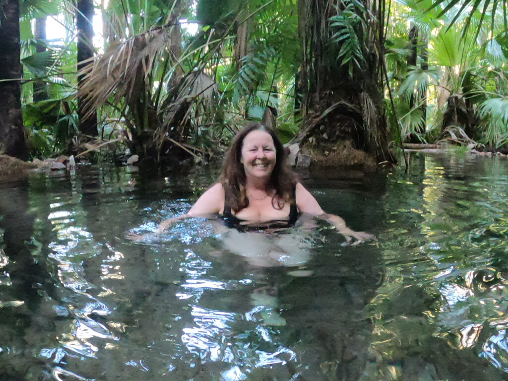
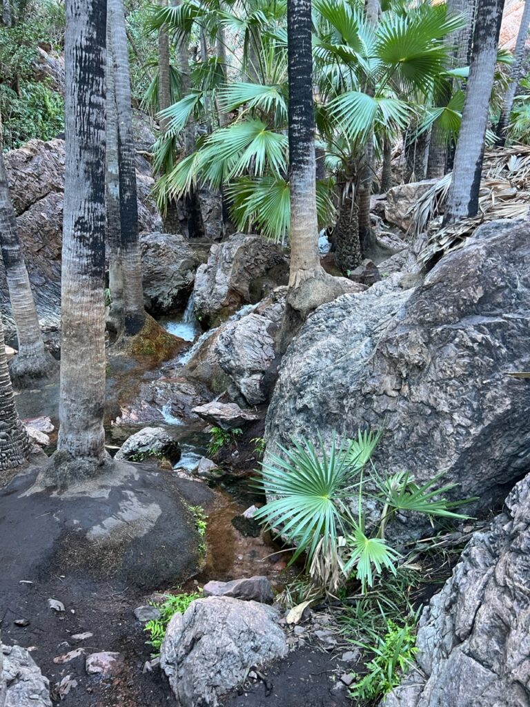
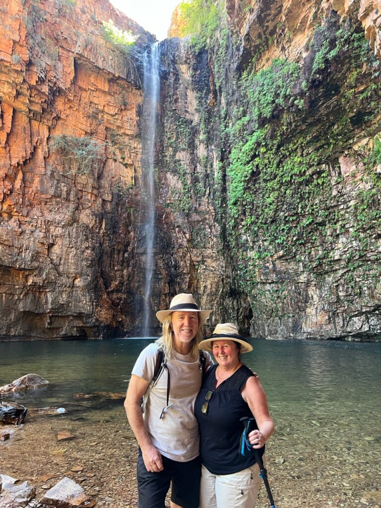
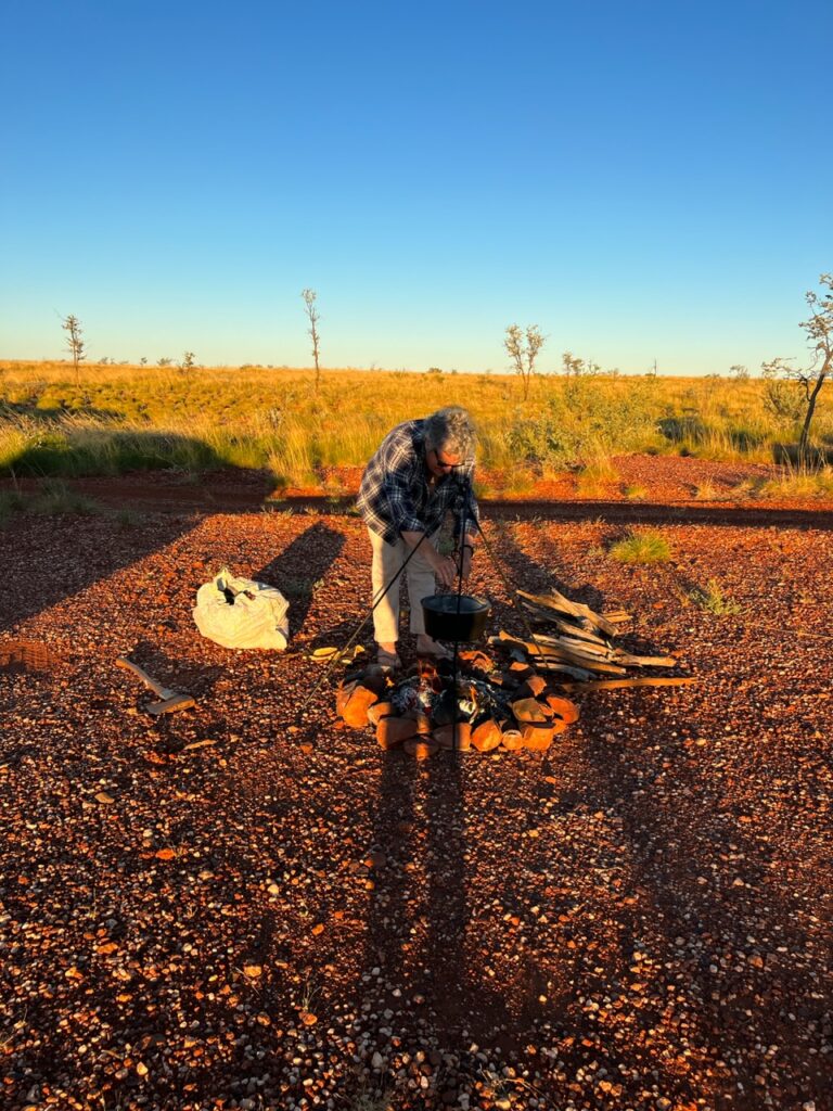
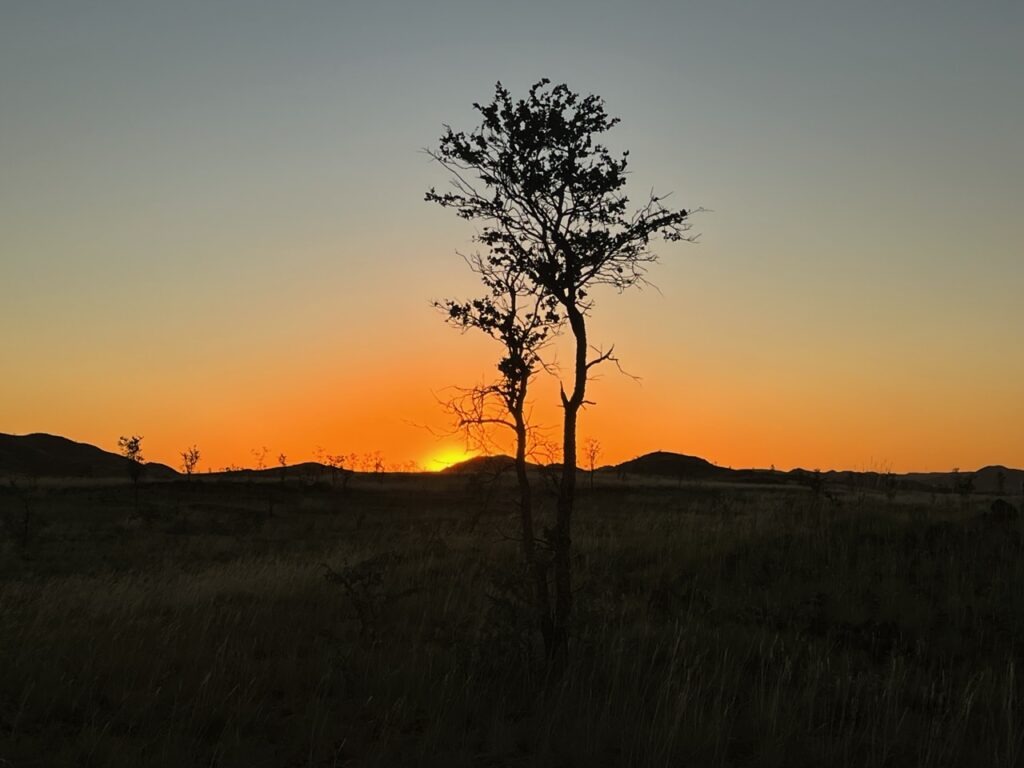
Pentecost River, as we arrived. No one there.The guy behind us drove around us while we sat, pondering whether to “walk” it before driving through. He got half way, then bogged a rear wheel. He was stuck in the middle of the Pentecost( ultimately needed two other trucks to winch him free).Discretion being the better part of valour, I decided to walk the crossing before driving it to see where the deep points may be. We simply kept to the left, driving right past the guy who was stuck.Crossing the Pentecost.…and the final step.Safely across ! The guy we allowed to go ahead of us still stuck in the middle. Two more would get stuck later the same day.SUV and caravan, stuck on the Pentecost River crossing.Camping on the Pentecost River.Stayed well away from the edge !Sunset on the Pentecost. Gibb River Road almost complete.Rainforest trail to Zebedee hot springs.Zebedee hot springs, El Questro.Zebedee hot springs, El Questro.Emma Gorge – nicest one we visited.
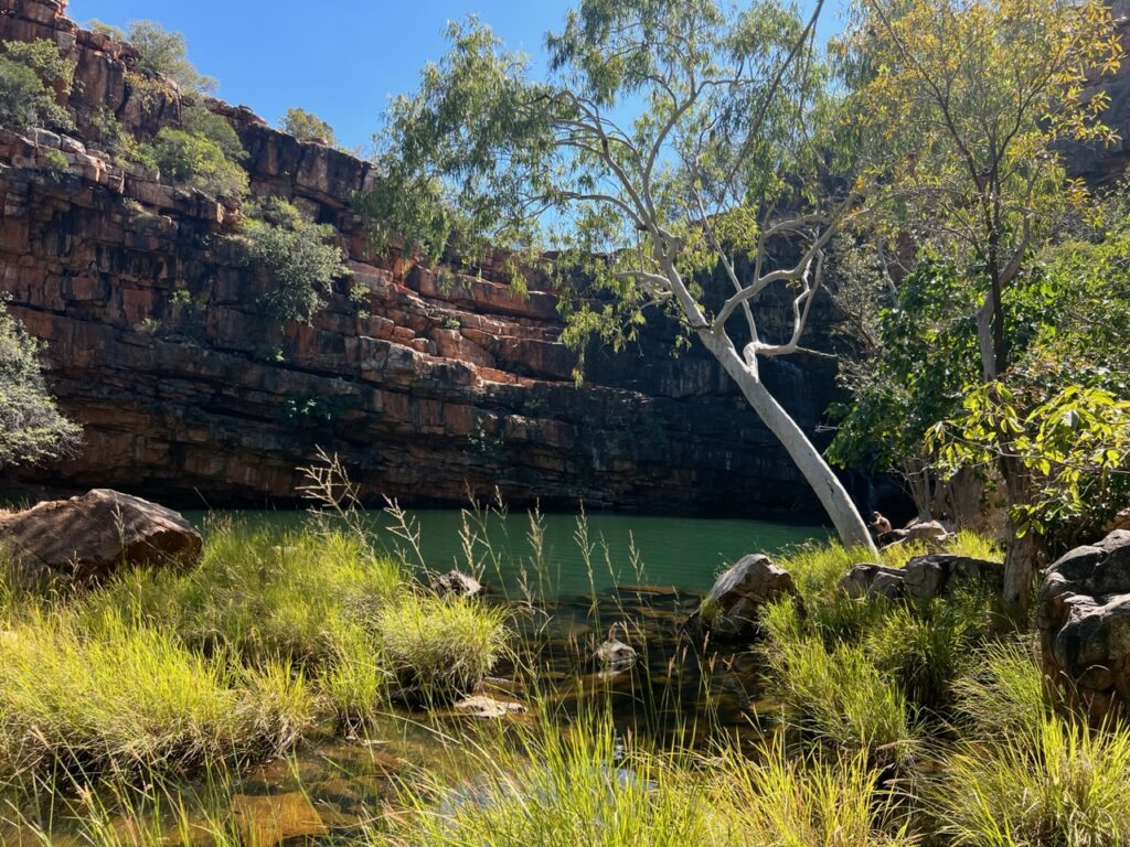
Emma Gorge – highlight of the Gibb ! Refreshing swim was wonderful.
I was asked how the Gibb compared to the Oodnadatta Track ( they are about the same length ). In terms of surface quality, the Oodnadatta “Track” was much closer to deserving the title of “road” whereas the Gibb River “Road” could more aptly have been called a “track”. There was some lengthy respite from severe corrugations on the Oodnadatta – none such on the Gibb. Traffic ( or lack thereof ) probably explains the difference – we regularly passed cars and trucks on the Gibb ( sometimes being behind a line of them even ) whereas we could count on our hands the number of vehicles we saw on the Oodnadatta. We only camped alone once on the Gibb (lots of people around), while we never camped with anyone else on the Oodnadatta. Among the many thousands ( tens of thousands ? ) of campers on the road in Australia ( and there are many ! ) the Gibb River Road seems to be on the bucket list of most – certainly anyone with a 4X4 vehicle (which is required).
It was an unforgettable drive- we met some great people en route and the many gorges ( for which it’s famed ) dotted along the route provided a welcome distraction from the heat and dust. Oh, yes, dust – lots of red dust !!!! Sadly several of the gorges were closed ( one to flood damage, another to fire, and a third required a vehicle capable of fording a 1 metre deep creek- sadly beyond the capability of our snorkel-less van ). Bells Gorge we chose to skip due to the uncertain creek depth. That all said, Adcock, Manning and Emma Gorges were open for us – Emma being the definite highlight of the trip. Truly an impressive sight.
Setting out on an adventure like the Gibb – and it was an adventure – you set certain milestones and one of the biggest was successfully crossing the Pentecost River. It’s only 50 or so kms from the northern/eastern end of the journey but can be problematic if too deep to cross. I’ll confess it was on my mind all the way through ( as it is for most on the Gibb ) since it’s an awful long way back if you can’t get across – a thought we absolutely dreaded ! While we would watch 3 campers get bogged in the middle of the Pentecost River (needing to be winched out ) we ultimately cruised through with ease – never have we been so happy to be on the “north” side of a river in our lives!
The finish line !!
Till next week…..
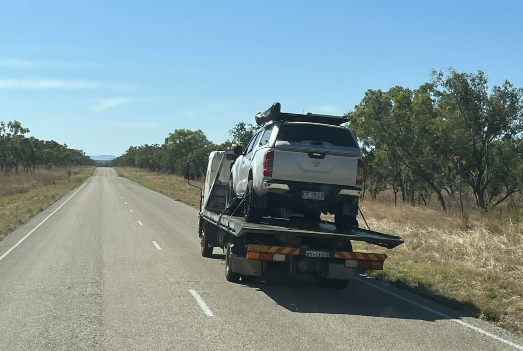
Not all survive the Gibb – a Nissan truck being carried off by flatbed truck.
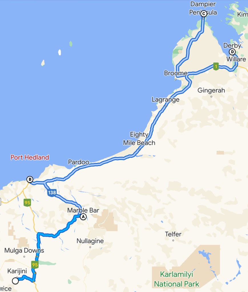
Hard to top Karijini but the week ahead did offer up a couple of great treats: a wonderful rendezvous with my brother and his wife just outside Marble Bar, a stopover in Port Hedland, and a delightful few days in trendy Broome.
Our travels since the last post.
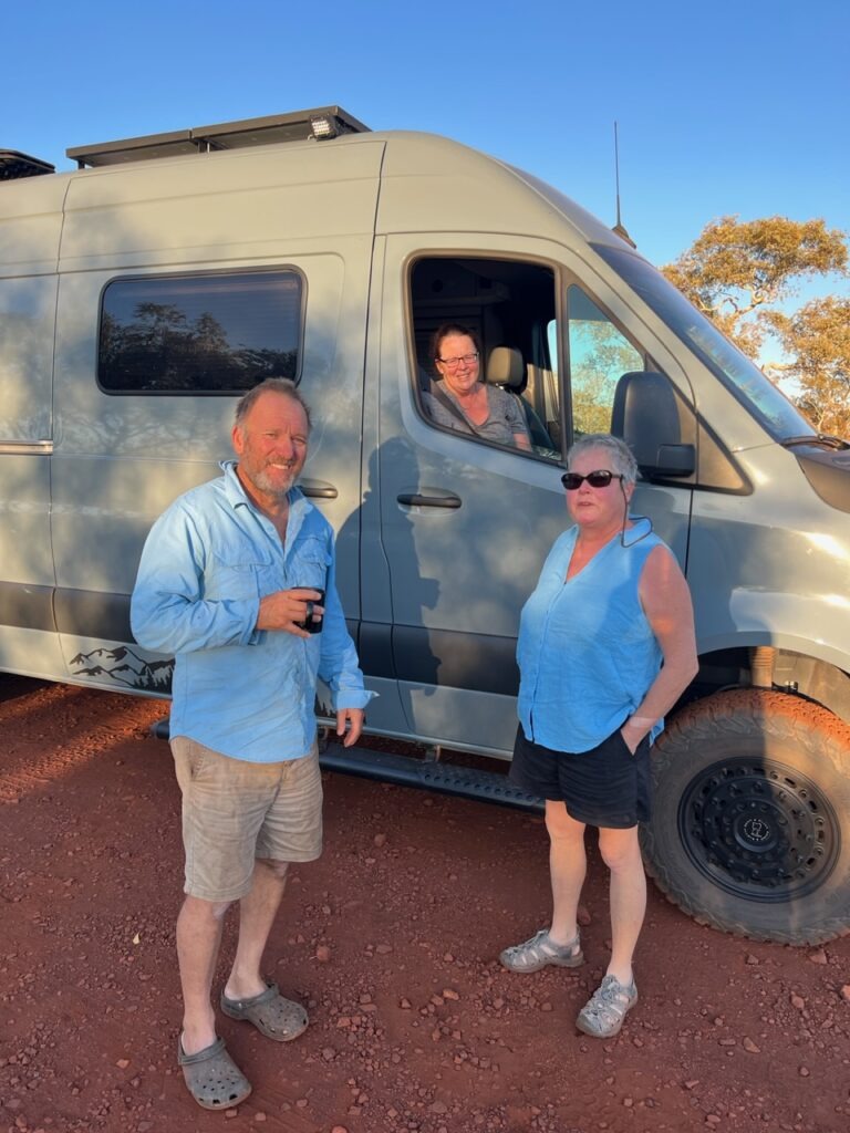
Over the preceding months we’d remained in close touch with my brother, Ian and his wife ( Anne ) in the hope that, just possibly, our paths may cross in northern Western Australia. They habitually travel in these parts at this time and, as luck would have it, they’d reached their destination of Nullagine just a few days before we were to leave nearby Karajini. A rendezvous would indeed be possible and (Australia’s hottest town) Marble Bar ( more or less in between us ) would be the venue.
Road train, en route to Marble Bar.We had left Karijini but were not yet done with oversize vehicles.
Spent a wonderful couple of days together trip planning, reminiscing and generally just hanging out – Anne, the camp pot was awesome ! Really nice to wind down and just be stationery after a pretty hectic previous week where we’d been constantly on the move. Delighted to be able to bring some diesel fuel to the rescue as well ( Marble Bar had not, technically, run out of diesel but the pump that delivers it was inoperable). Ian was able to reach us by phone just prior to us leaving Karijini to advise they could not get fuel in Marble Bar, so we threw a couple of extra fuel bags in the van. Problem solved ! Only thing worse than a “Pub With No Beer” in the outback is a fuel station with (effectively ), no fuel !
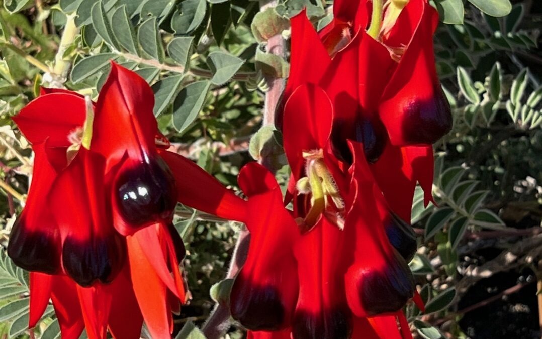
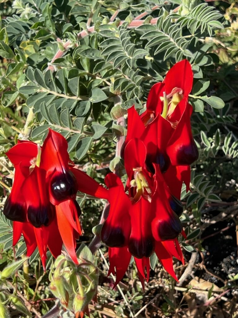
Jeff, filling Ian’s vehicle with diesel. “”I’ll never hear the end of this !” he’s thinking !Anne, preparing a delicious “welcome” camp dinner.Nice to have access to a Starlink system – high speed internet anywhere in the world !Beautiful sunset, camped at Marble Bar.Camping at Marble Bar.Classic old style buildings in tiny Marble Bar, from the days when it was much bigger.Sturt’s Desert Pea – a beautiful wildflower common in the area.
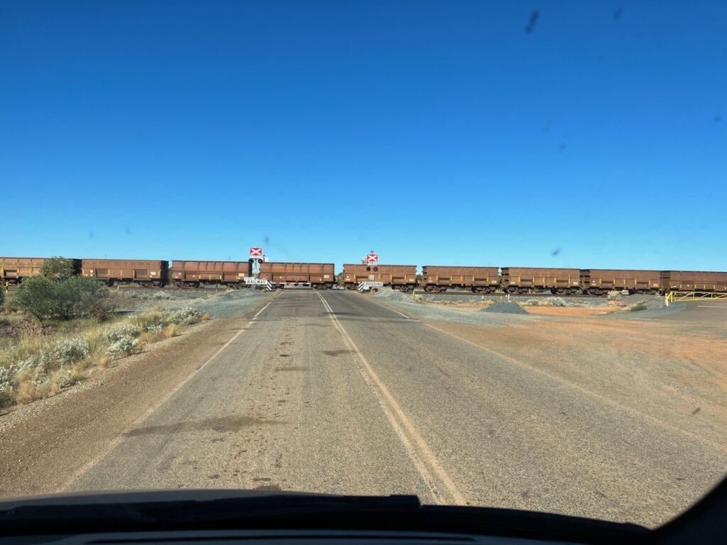
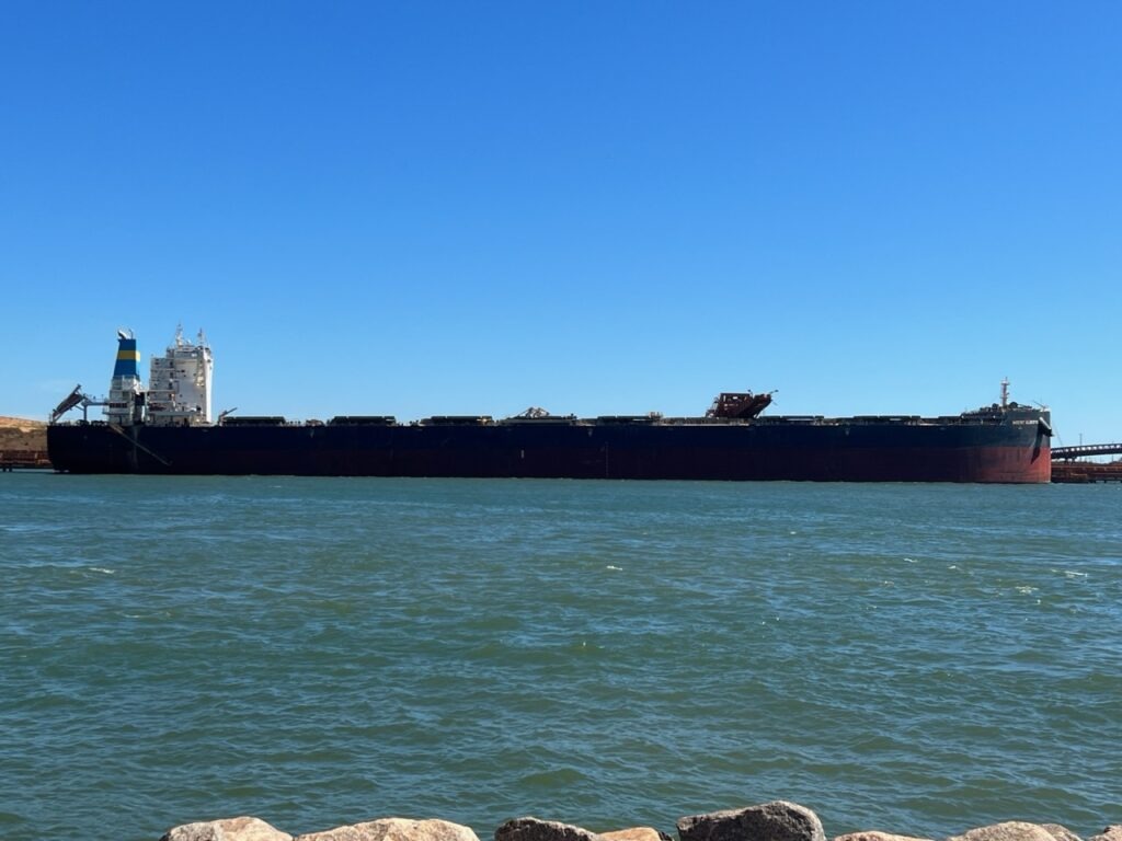
Port Hedland was the only place of note between us and historic Broome, the pearling capital of Australia. Not a town of any intrinsic beauty ( and coated in red dust from all the iron ore that is shipped through it ), it is though, veryinteresting to see the scale of mining in the area. Four privately owned rail lines pretty much constantly drop ore at the port and just as quickly it is loaded into giant bulk carriers for the blast furnaces in Asia. The scale is indeed immense – each train can be over 2kms long and the fully loaded ore carriers glide out of port every 15 mins or so. They proudly boast it’s the largest bulk loading port in the world in fact.
Iron ore train, en route to Port Hedland. These can be 2.5kms long!Train crossing, near Marble Bar.In Port Hedland the comings and goings of massive ore carriers is an attraction – gives an indication of just how much of the stuff comes out of the ground.The carriers are huge !
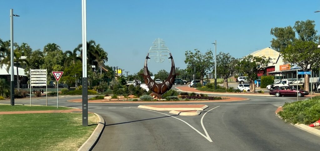
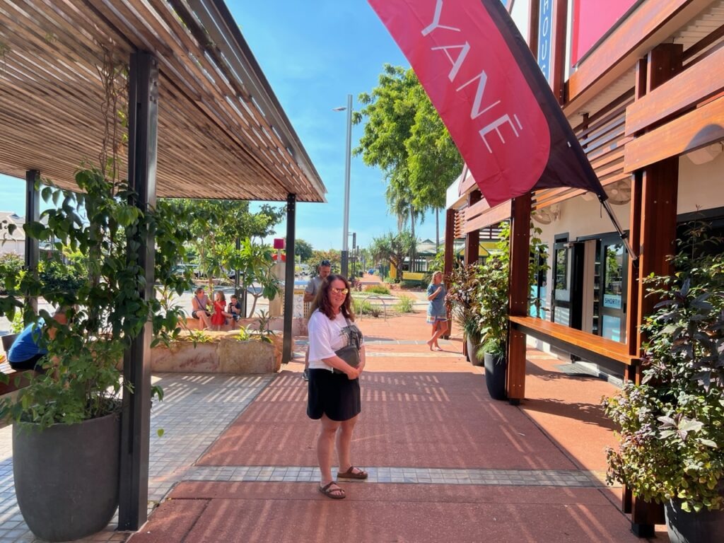
Almost 700kms north east along what had to be THE most boring stretch of The Great Northern Highway that we’ve driven, lies trendy Broome. None of that section of highway follows the coast and to make matters worse we battled a fearsome headwind and the acrid smoke of seasonal burn-offs for much of the day. Historic ( and now trendy ) Broome is the worthy reward for those long, lonely miles and it’s immediately obvious why Aussies ( and now many international visitors ) are flocking there- the climate is perfect, the setting ( on beautiful Cable beach) is stunning and the revitalized downtown is boutiquey with a vibe reminiscent of fashionable Byron Bay on Australia’s east coast. It seemed half the town walked to the beach each day to watch its famous sunsets. Really enjoyed the place.
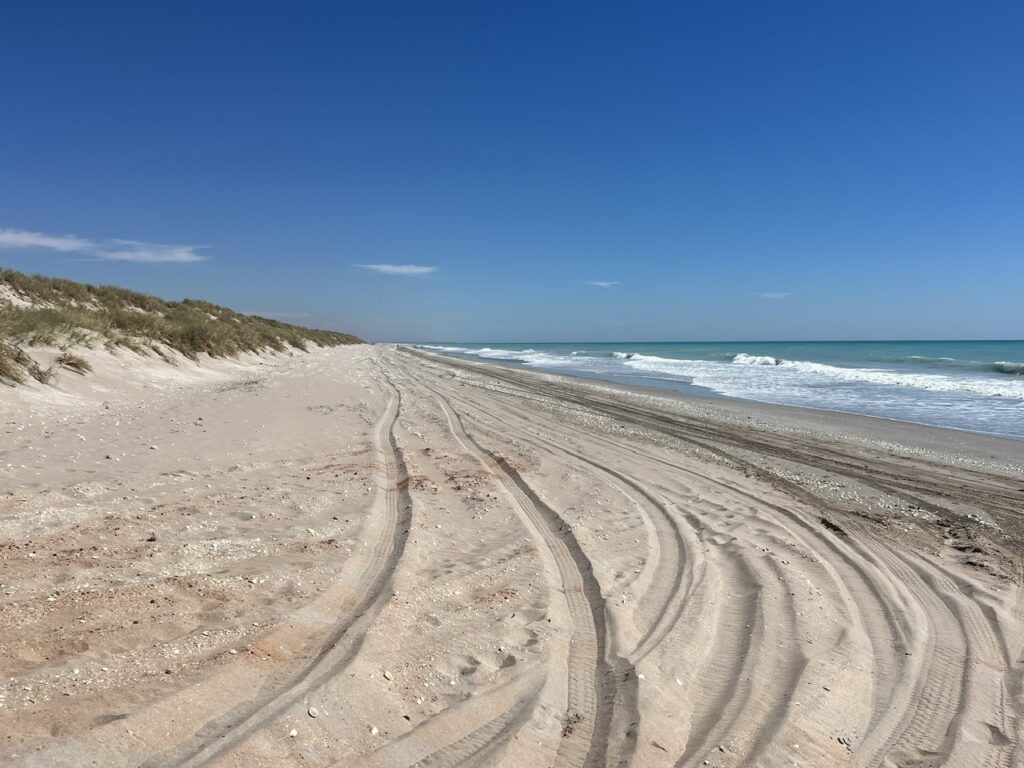
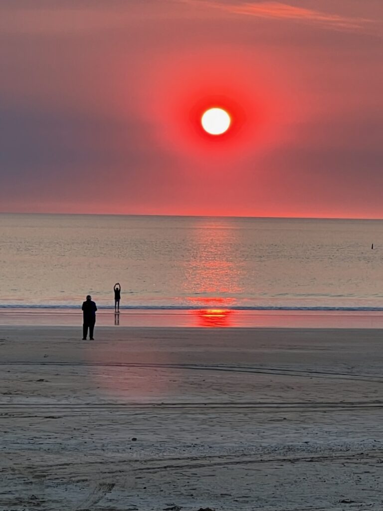
The long, lonely road between Port Hedland and Broome. 80 Mile beach, near Broome.Downtown Broome.No wonder Broome is popular this time of year !This famous old outdoor theatre still operates. Over 100 years old. Broome.Lois shopping, Broome.Cable beach, sunset. Broome.Broome, sunset on Cable beach.
It would have been a much smarter move in hindsight to have simply enjoyed one extra day relaxing in beautiful Broome , but, foolishly ignoring the advice of our camping neighbour we opted to make the 5 hour, 420 km round trip on to Cape Leveque. There are precious few places we regret visiting but the trip to “almost” Cape Leveque was all for nought – the final 5 kms of the road to the Cape ( the principal attraction ! ) was closed ! We should have listened to our Broome camp neighbour ( serves us right ! ).
Dead end ! We drove 420kms return to see Cape Leveque – road closed 5 kms from the end 🙁
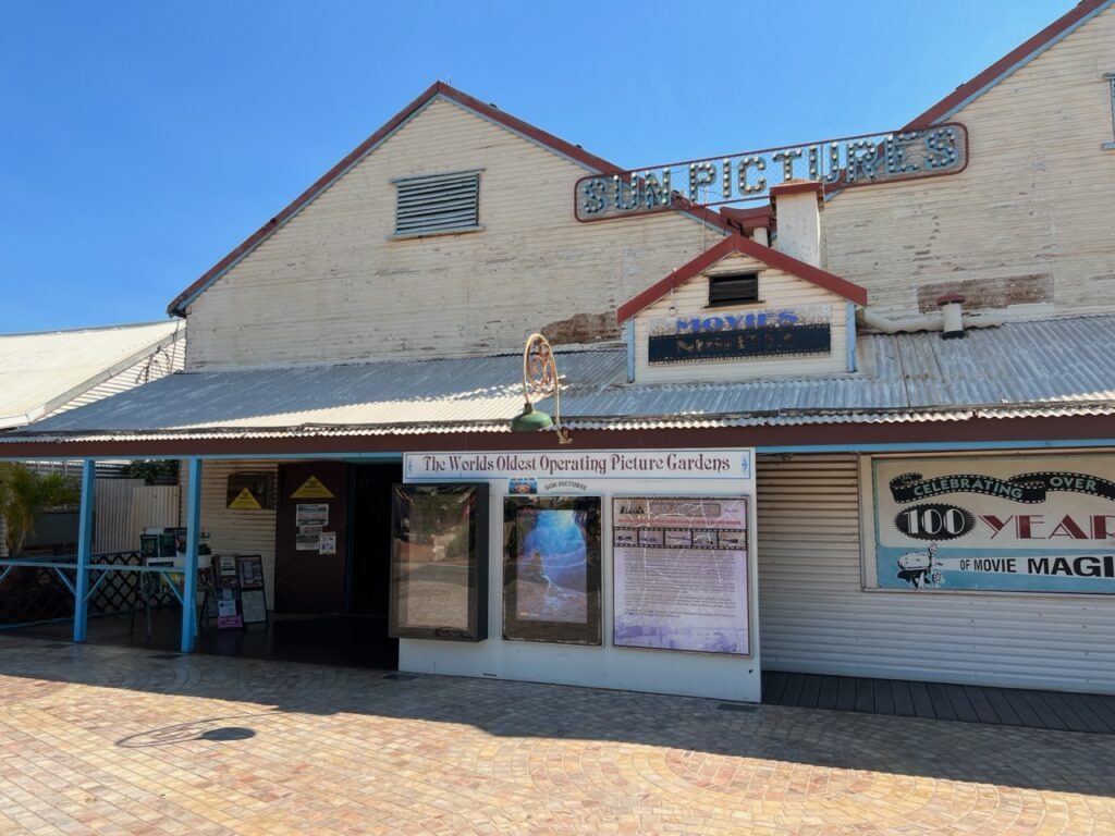
Beyond Broome, it was a short hop to Derby, jumping off point for the legendary Gibb River Road. More on the legendary “Gibb” next week !
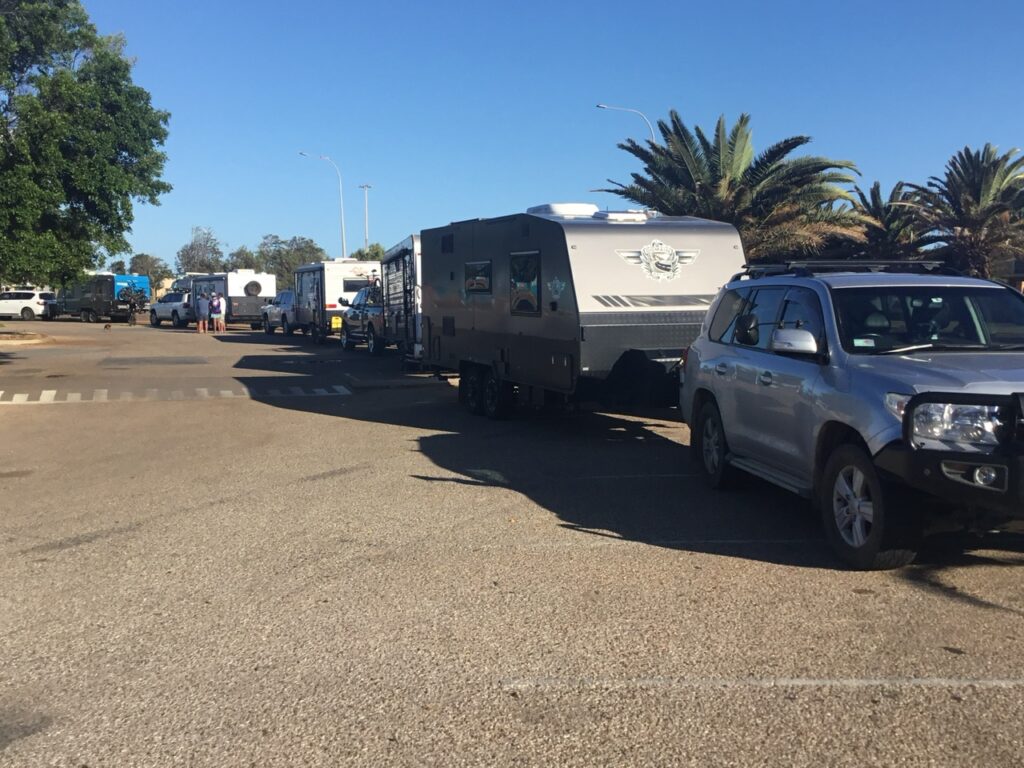
Fueled up for the long run to Derby and on to the Gibb River Road. An extra 80 litres. Our collapsible fuel bags have been a life saver.
Working our way steadily up the Western Australia coast two things became readily apparent. First, there is, at this time of the year, basically a complete mass migration to the north-west coast of WA involving travellers from all over; Western Australians, Australians from the east, and – in very significant numbers- travellers from abroad, especially young European working holiday makers. Secondly, after the whale shark experience in Exmouth, everyone ( and I mean everyone) was heading to Karijini National Park. Following a pit stop at the very impressive Bullara Station ( a working station/ranch ), Karijini was top of our list as well.
Our route this past week.
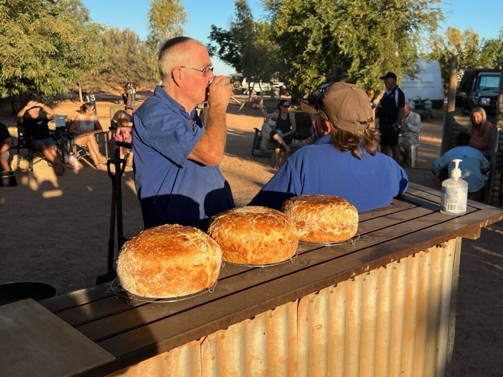
Bullara gives travellers a taste of life on an Australian outback “station” ( North Americans would consider it a big ranch ) – complete with all the usual wildlife, farm stock ( principally cattle ), amazing “damper” and some of the best hot scones ( replete with strawberry jam and cream ) we’ve tasted in a long time. Far from any city lights it was an excellent place to star-gaze as well.
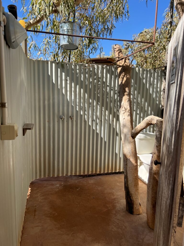
A warm welcome on arrival at Bullara, however the camp host was a bit shocked to see the steering wheel on the “wrong” side !Damper maker and local legend, “John” from the UK.Camp showers – rustic, but hot and strong !
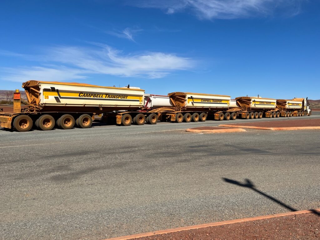
In addition to hordes of travellers descending on Karijini, the road is also shared with specialized heavy transport vehicles which carry very large pieces of mining equipment- some as much as 7.5 metres wide ( meaning it effectively blocks both sides of a two-lane road). Passing them is a challenge and we would soon be put to the test as we encountered just one such vehicle on the way into Tom Price. Our two way radio ( hitherto considered no more than a souvenir ) suddenly became indispensable as we communicated with the pilot car as to when and how to safely overtake. Needless to say overtaking a 7.5 metre-wide vehicle leaves precious little margin for error – see the next two video clips Lois captured as we made the maneuver:
Approaching a 7.5m wide “oversize” on a bridge.The passing maneuver – white knuckles all the way !
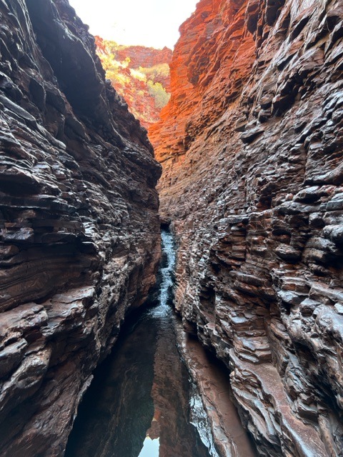
Karijini is located just east of Tom Price. On the advice of the many, many people who counselled us about this park we set aside 4 days (3 nights ) with a plan to tackle all its major hikes and found we had time to do them all- certainly all the ones that we wanted to do. Some were tough, and tiring, but absolutely worth the challenge – it lived up to ( probably even exceeded in some areas ) the very lofty expectations we’d developed in the preceding weeks. It was, simply awesome ! I’ll say no more but leave our pictures and videos to tell the story:
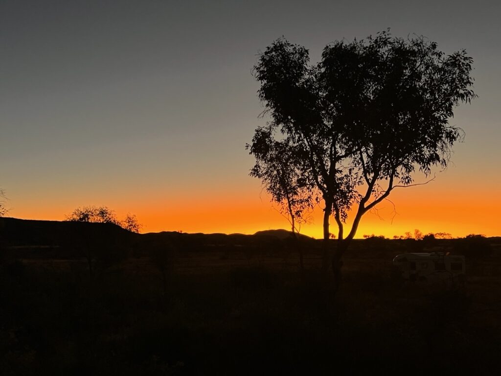
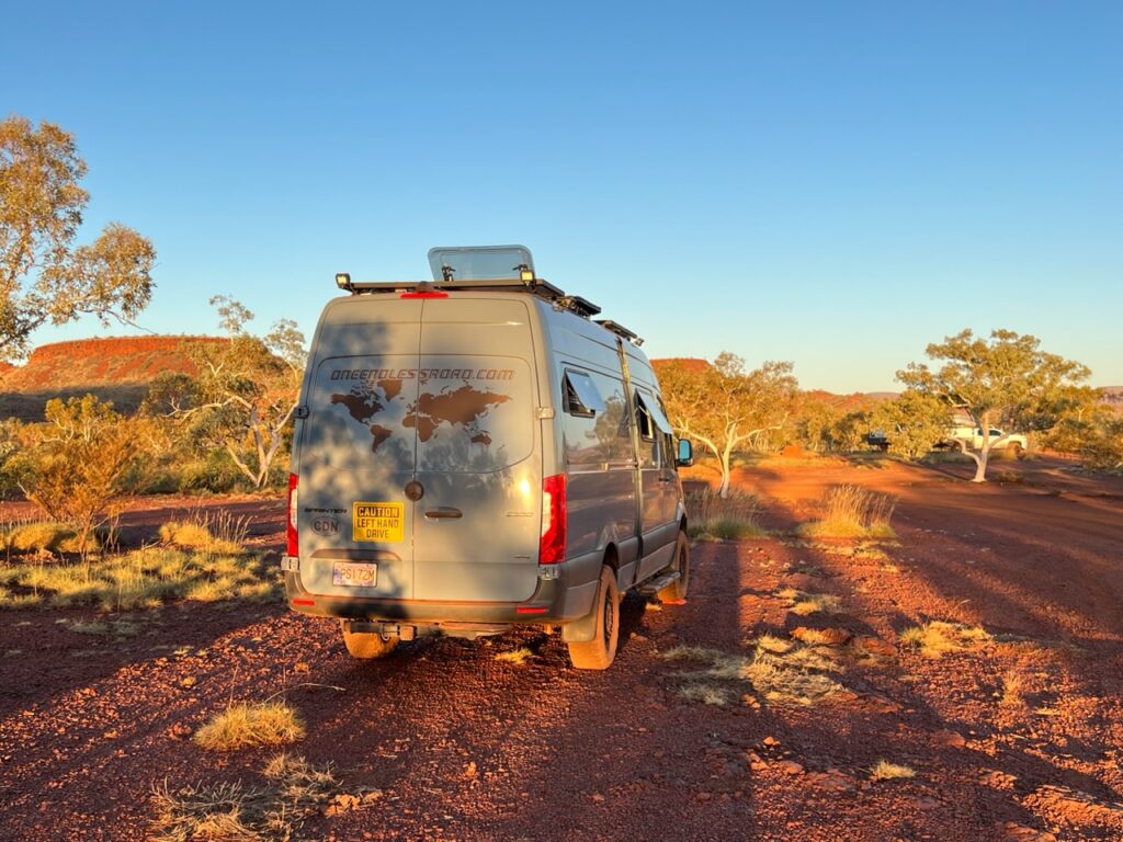
Tom Price camping sunset.
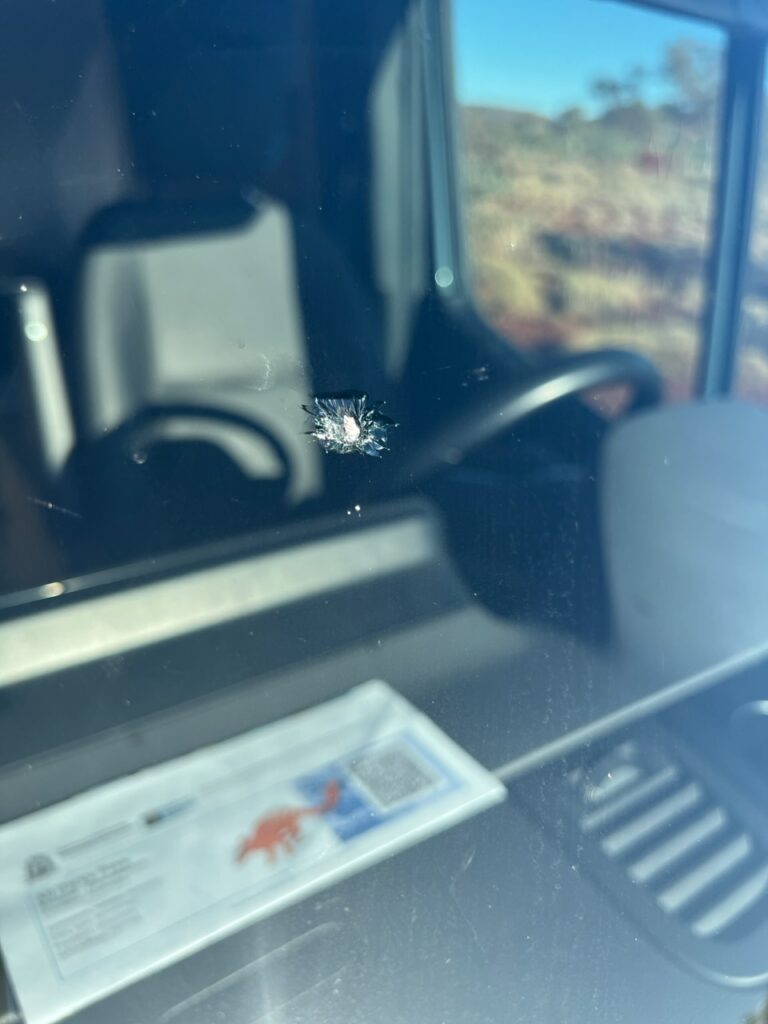
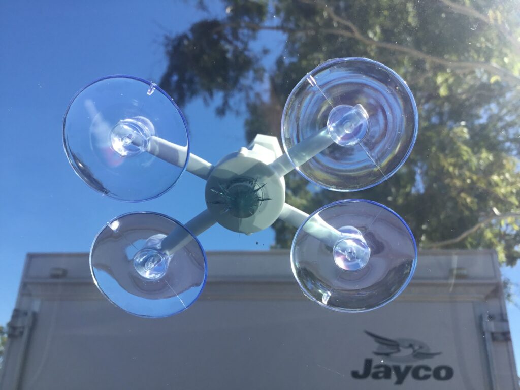
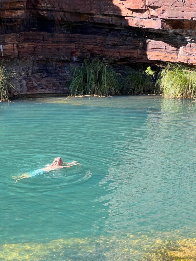
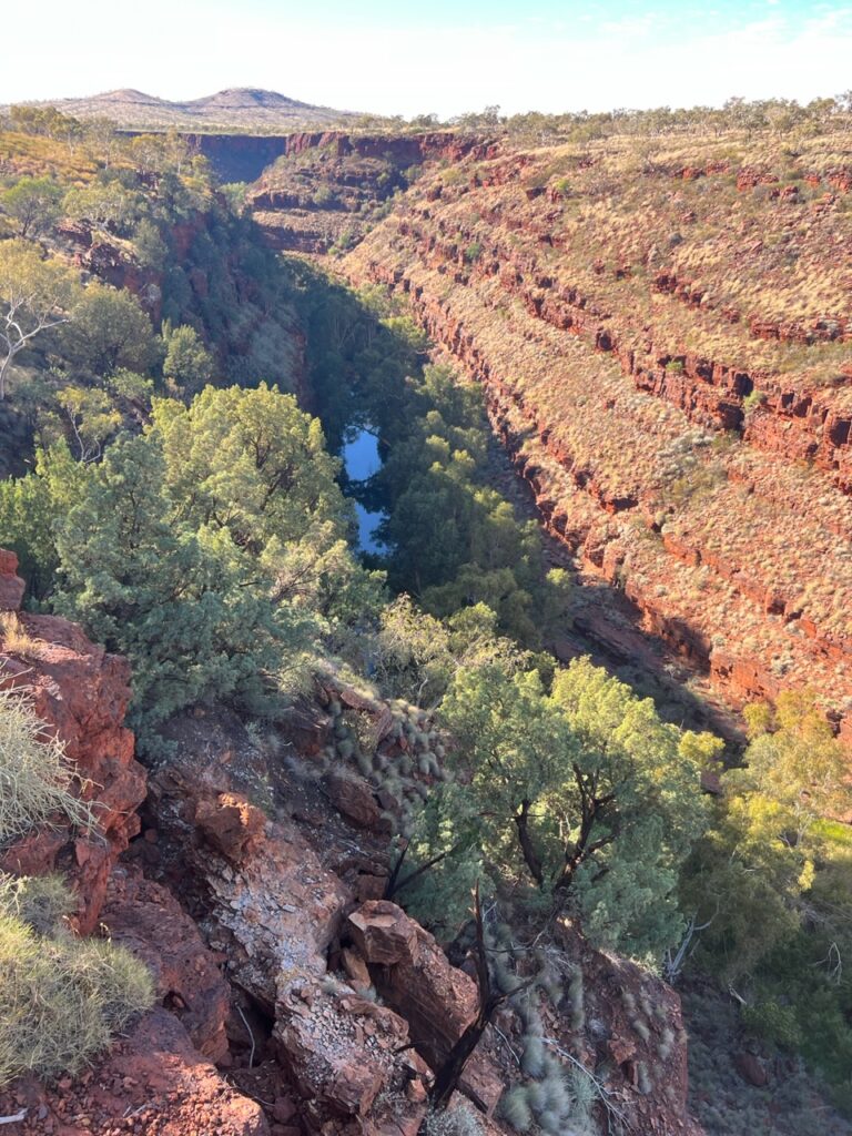
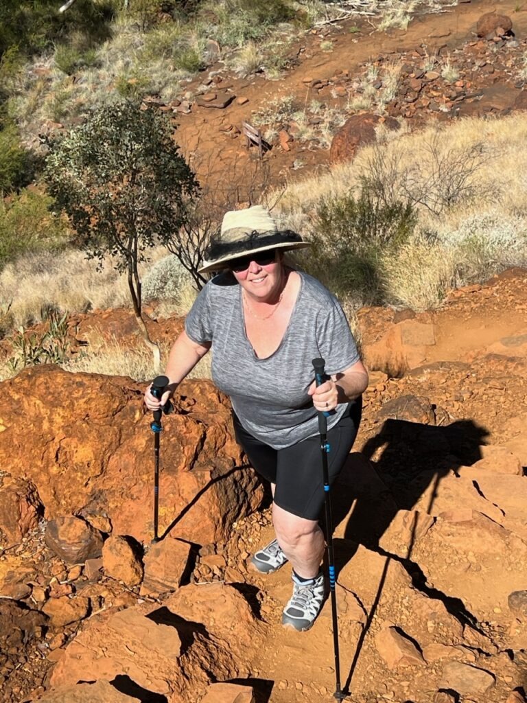
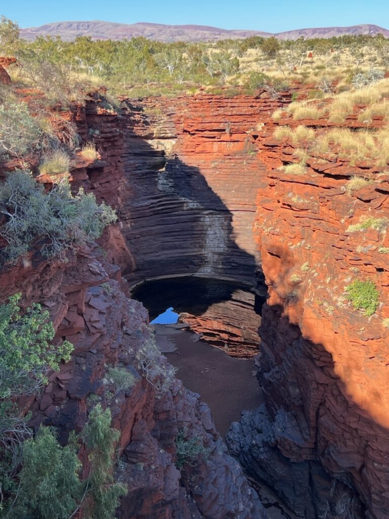
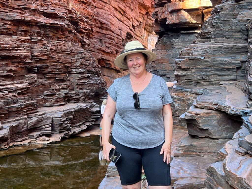
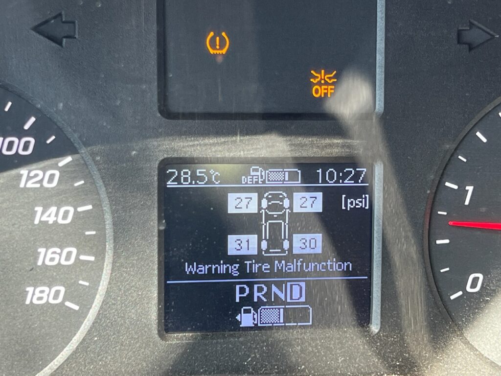
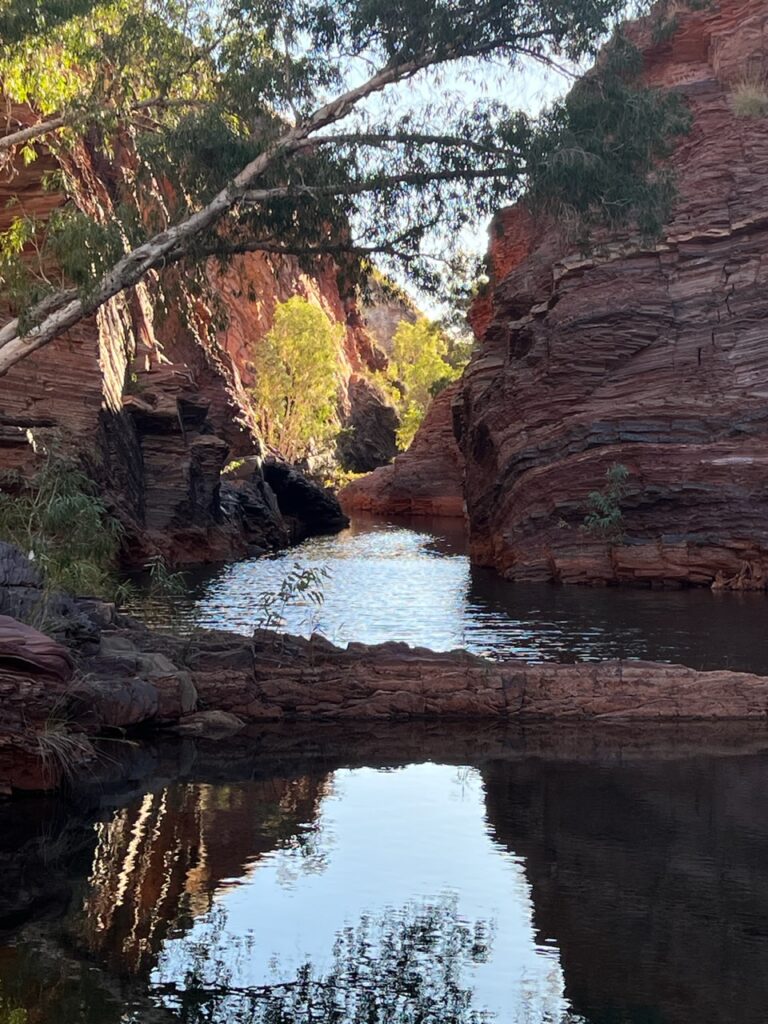
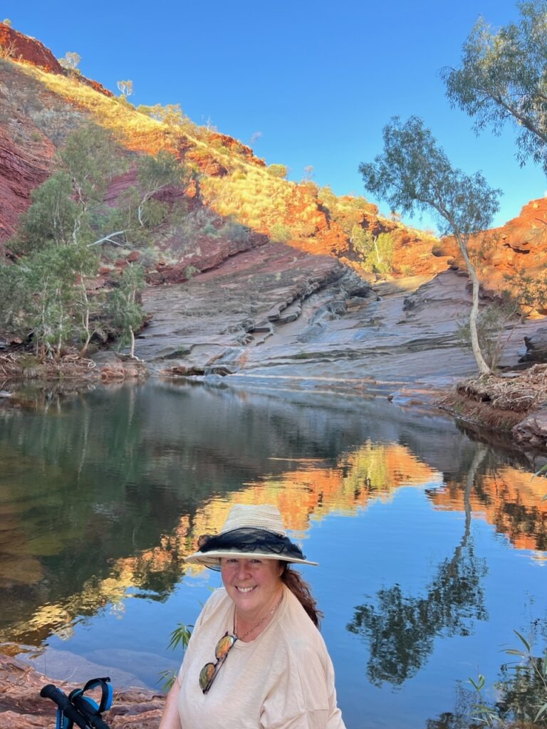
Caught up with Grant and Sue at Dale’s Gorge – he, an Aussie, she a Canadian, together 35 years. A very similar story to our own. Grant had just completed the holy grail of Australian outback tracks, the Canning Stock Route. Fellow campers were in awe…..!Picked up this delightful little “souvenir” on the road into Karijini. No one to do a repair in Tom Price, so I bought a kit and tackled it myself.Quickly repaired with a do it yourself kit from the Autopro store ! No one else in town would touch it. So far it’s holding !Swimming in the pool beneath Fortescue Falls, Dale’s Gorge, Karijini NP. No croc’s this far south.Dale’s Gorge.Lois, last steps out of Dales Gorge.Dale’s Gorge, Karijini NP.Dale’s Gorge.Fortescue Falls, Karijini NP.Joffre Falls, Karijini NP. No “falls” as such in the dry season, but a stunning circular visual.Success at the end of a hike. Joffre.Bottom of Joffre Falls.Corrugated roads, Karijini NP.Some parts of the park were not paved – the gravel roads were in very rough shape with tough, deep corrugations. Needed to reduce tire pressure well below manufacturer specs, hence the “malfunction” warnings.Karijini NP.Walking to Handrail Pool, Weano Gorge, Karijini NP.
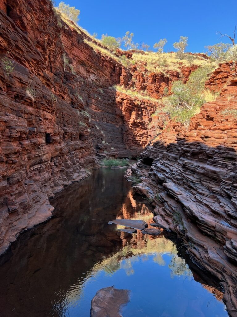
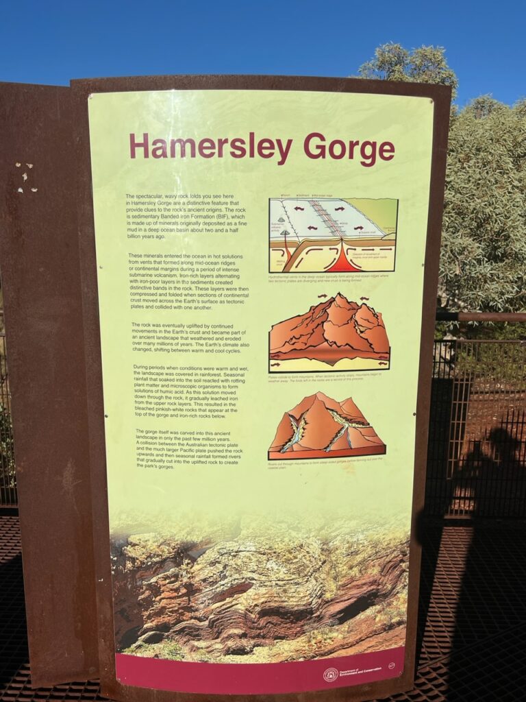
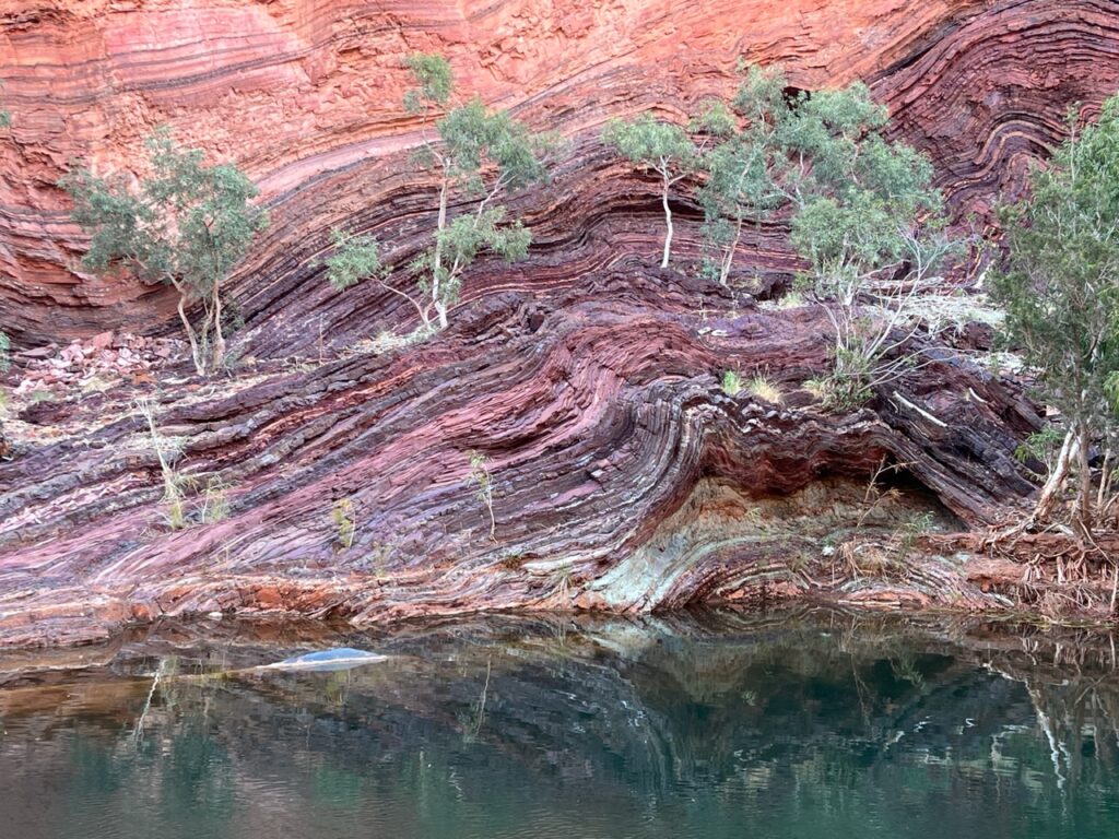
Handrail Pool, Karijini NP.Weano Gorge, Karijini NP.First water obstacle on the way to Kermit’s Pool, Hancock Gorge, Karijini NP.Narrow waterfall, deep in the gorge..Narrow section !Kermit’s Pool at the end of Hancock Gorge.Camped at “Buddha’s Retreat” just before, Hammersley Gorge. The lighting just begged for a photo !The geological history of Hammersley Gorge, Karijini NP.Hammersley Gorge, Karijini NP.Hammersley Gorge.Hammersley Gorge.Trying to dodge severe corrugations on the far side of the road, leaving Hancock Gorge.
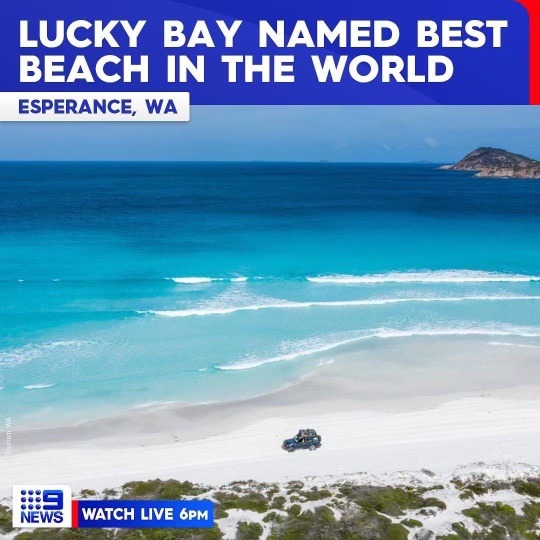
Undoubtedly the best national park we have seen so far, we felt Karijini was truly impressive. The problem now – how do you keep raising the bar ? While we might not be able to raise the bar any further as far as national parks go, we just caught wind of a rather outstanding award bestowed upon a certain beach I was raving about last month when we visited Esperance ( in WA’s south west ) – Lucky Bay. Just named the most beautiful beach in the world. Can’t beat that !
Readers might recall me raving about the pristine beauty of Lucky Bay ( Esperance ) a few weeks back. Just voted the most beautiful beach in the world ! https://www.worlds50beaches.com/lucky-bay
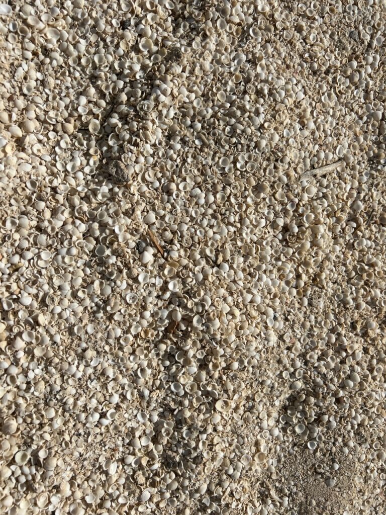
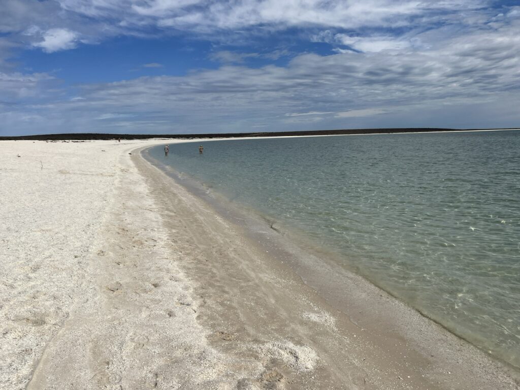
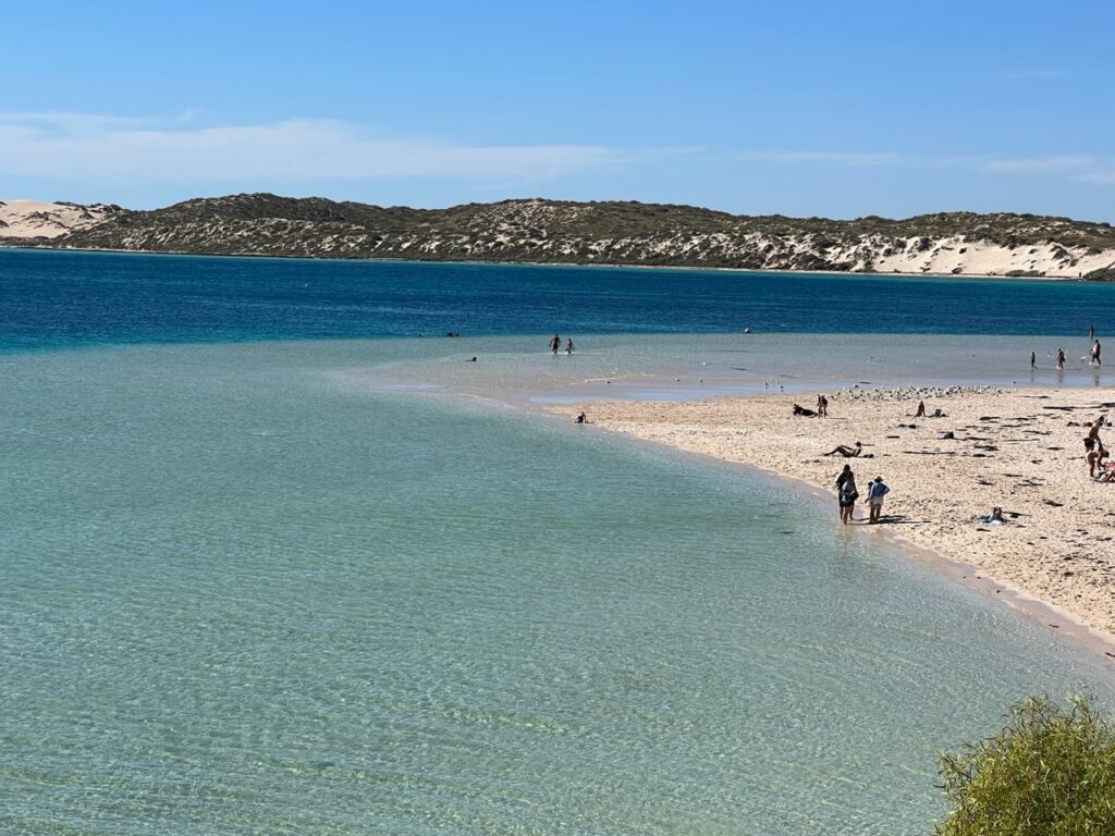
Repacked as best we could at Billabong Roadhouse ( amazing how a male and female differ as regards what stuff needs to be more “accessible” 😊 ), the compass was set due north for Shark Bay. Like Kalbarri, Shark Bay ( and its many attractions ) loomed large on our itinerary – the dolphins at Monkey Mia being the first stop. En route one passes remarkable Shell Beach, a beach formed entirely with shells – the beach setting is stunning itself, perfectly crescent shaped with the “sand” not being sand but in fact tiny shells simply adding to its unique character.
Resting up, Billabong Roadhouse, after a complete clean and “repack”.Arriving in the Shark Bay area. Our time spent mostly in Monkey Mia and Denham, we barely scratched the surface of what it has to offer.Close up of the “sand” at Shell beach.Shell Beach.Shell beach
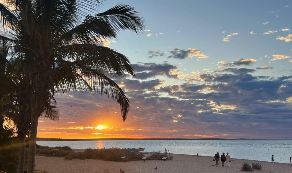
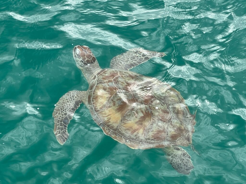
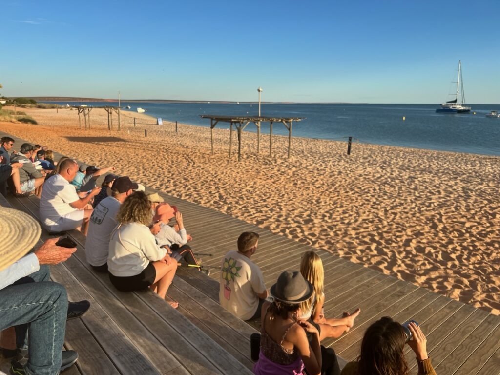
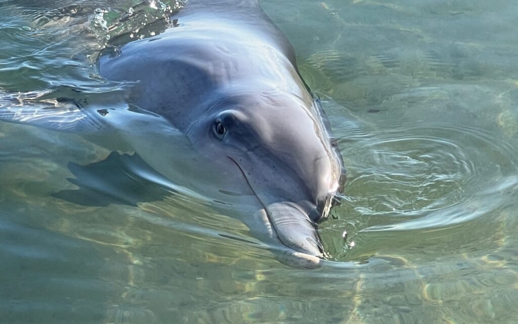
At first appearance, very resort”ish” (and not our usual style), the RAC campground at Monkey Mia was a great attraction in itself. Right on the waterfront in the heart of Shark Bay, (and with emus walking freely all over the park), it had a very relaxed vibe with all features and services being first rate. The main attraction, the dolphins, did not disappoint and true to form turned up for their feeding at 7.45am just as the crowds formed. They would come again throughout the morning and some lingered, frolicking by the shore, well into the afternoon. Giant turtles could also be seen either from the jetty or when snorkeling, delighting adults and children alike. Lest folks be thinking it seems counter to conventional wildlife wisdom to “feed” dolphins, this is a very controlled experience – they are only given 10% of their daily needs to ensure they continue to hunt on their own. Indeed, the viewing experience itself was delayed while one dolphin aggressively chased a fish around the shallow waters until it was caught.
Sunset, Monkey Mia.Visitors at our campground !Ever wondered how an emu takes a bath ? Now you know !Green turtle, Monkey Mia.Green turtle, Monkey Mia.Waiting for the dolphins, Monkey Mia.Dolphin, right at our feet, Monkey Mia.Up close.And again.
From Shark Bay it’s is a fairly easy drive north via Carnarvon where we overnighted and stocked up with supplies for the longer drive north on to Exmouth and Ningaloo Reef. Not a place folks usually spend a lot of time but it does have a nice waterfront and some of the major stores we needed to access that we wouldn’t be able to in the coming weeks. Locals told us had we been here a month earlier we’d have had the best viewing of a full solar eclipse in the Southern Hemisphere ! You can’t win them all I suppose, but not sure I’d go too far out of my way to see that anyway !
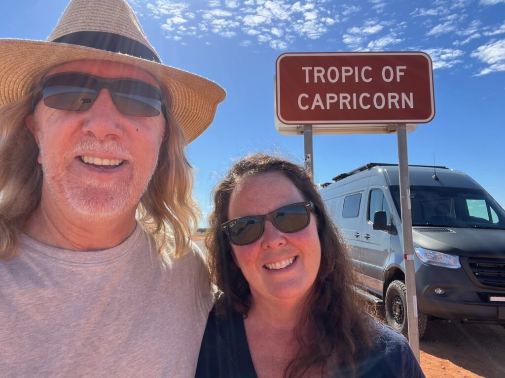
Carnarvon waterfront.Downtown Carnarvon.Woolworths car park, Carnarvon. Just a small group of caravanners stocking up ahead of the long trek north. It is unbelievable how many are on the road up here.The sound of Australian galahs…deafening! Carnarvon campground.Crossing the Tropic of Capricorn, just north of Carnarvon.
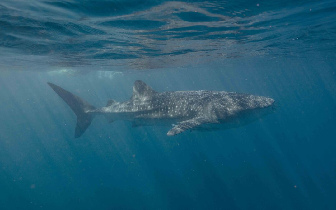
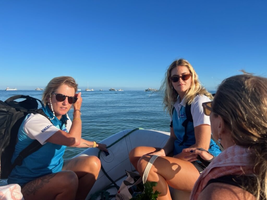
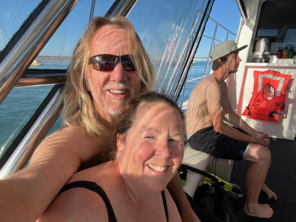
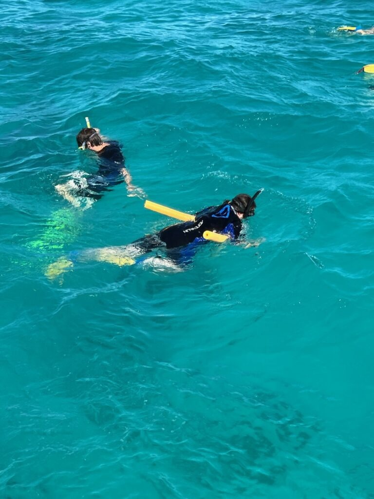
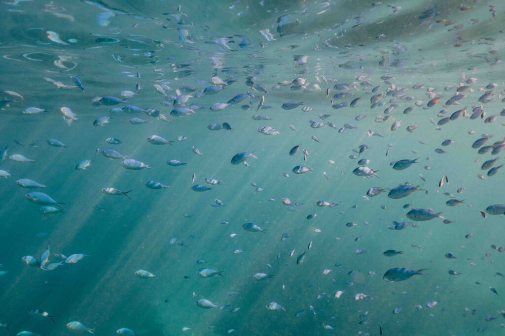
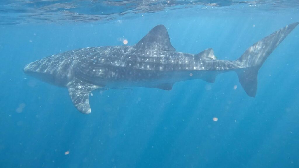
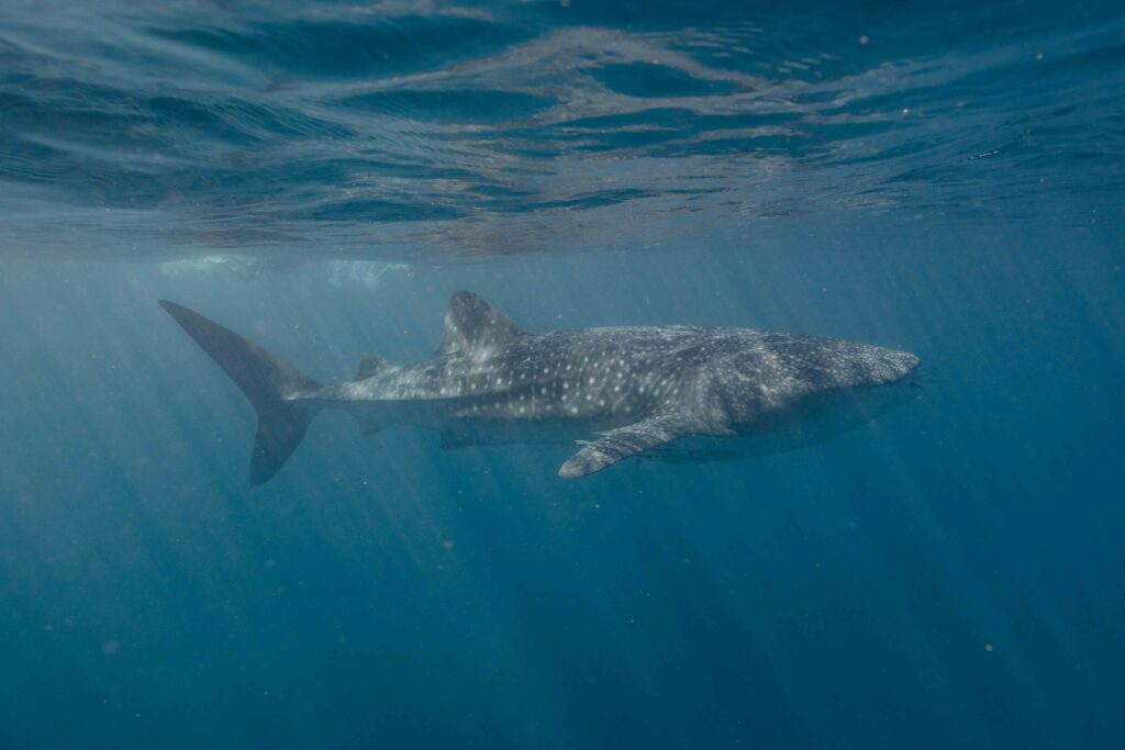
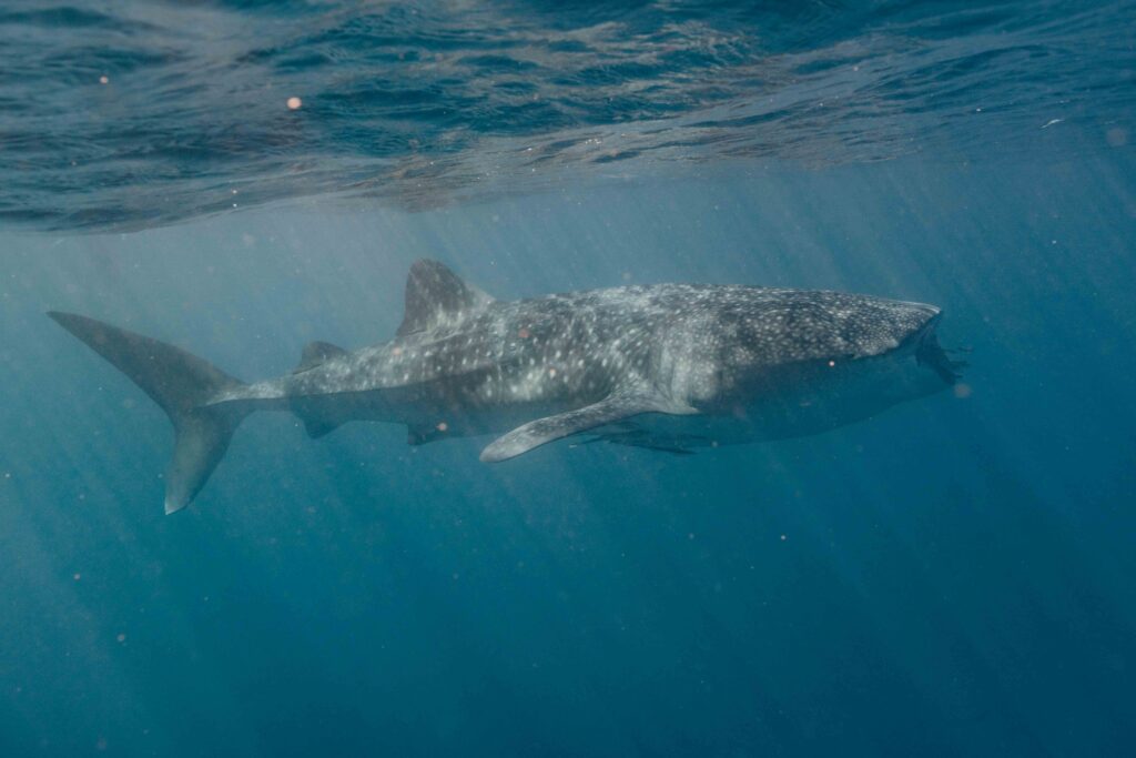
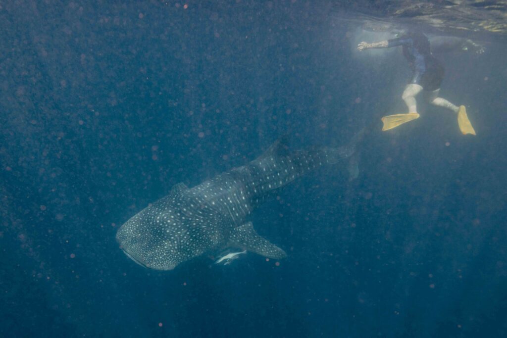
From dolphins and sea turtles at Shark Bay to whale sharks further north on the Ningaloo reef near Exmouth this week has literally been one marine extravaganza after another. Exmouth ( and nearby Coral Bay ) are renowned for the reliable appearance of giant whale sharks at this time of year. Feeding in the shallow, warm waters near the edge of Ningaloo reef, these marine leviathans lumber along just below the surface feeding mostly on shrimp and plankton. Despite their giant size and shark-like appearance, they are quite harmless. But, wow, are they big ! Technically the worlds biggest fish, a whole industry has been spawned ( if you’ll excuse the marine analogy ) taking snorkelers out to swim with the sharks. Probably the most popular attraction in the area, it’s not cheap ( $475/day ) but what an incredible experience it is . We were told not to miss it so stumped up our credit cards and went out for the day – very glad we did. An unforgettable experience to jump in the water, mask on, look down and see this enormous creature just slowly glide past you barely metres away. As the old MasterCard ad used to say – priceless!
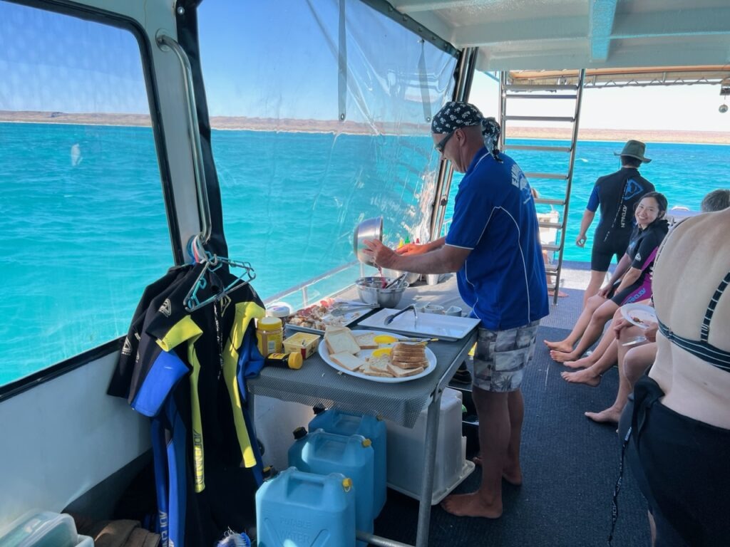
Cat, our photographer and Leah, our guide, taking us out to the tour boat.Selfie time, on “Ningaloo Blue”, swimming with Whale sharks tour.Lunch on the boat.Lois, snorkeling, prepping for the Whale shark session.The view as soon as we jumped in the water. And then, a Whale shark – up close !Whale shark with some of the snorkelers from our group behind.Whale shark swimming with its mouth open, catching small marine creatures.Lois, at one point just a bit too close to the shark !Apologies for the poor quality on this, my first attempt with a GoPro. Tough to film and swim simultaneously!Credit where credit is due – this clip shot by Nicolas, a French guy on our boat. Better angle!
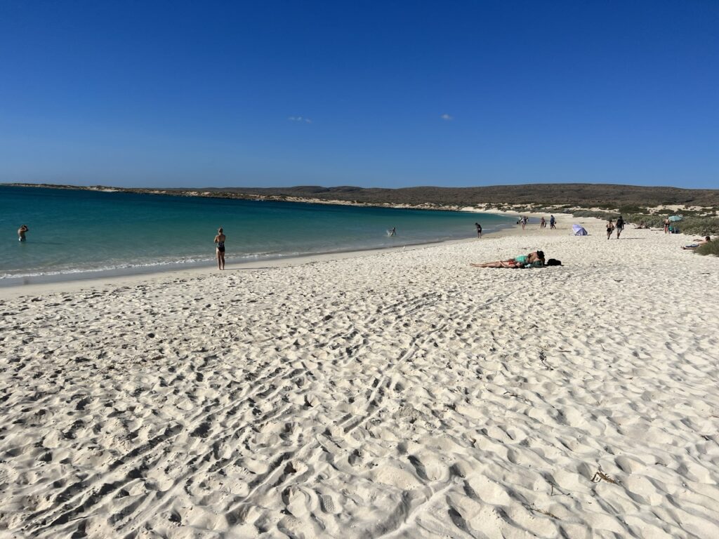
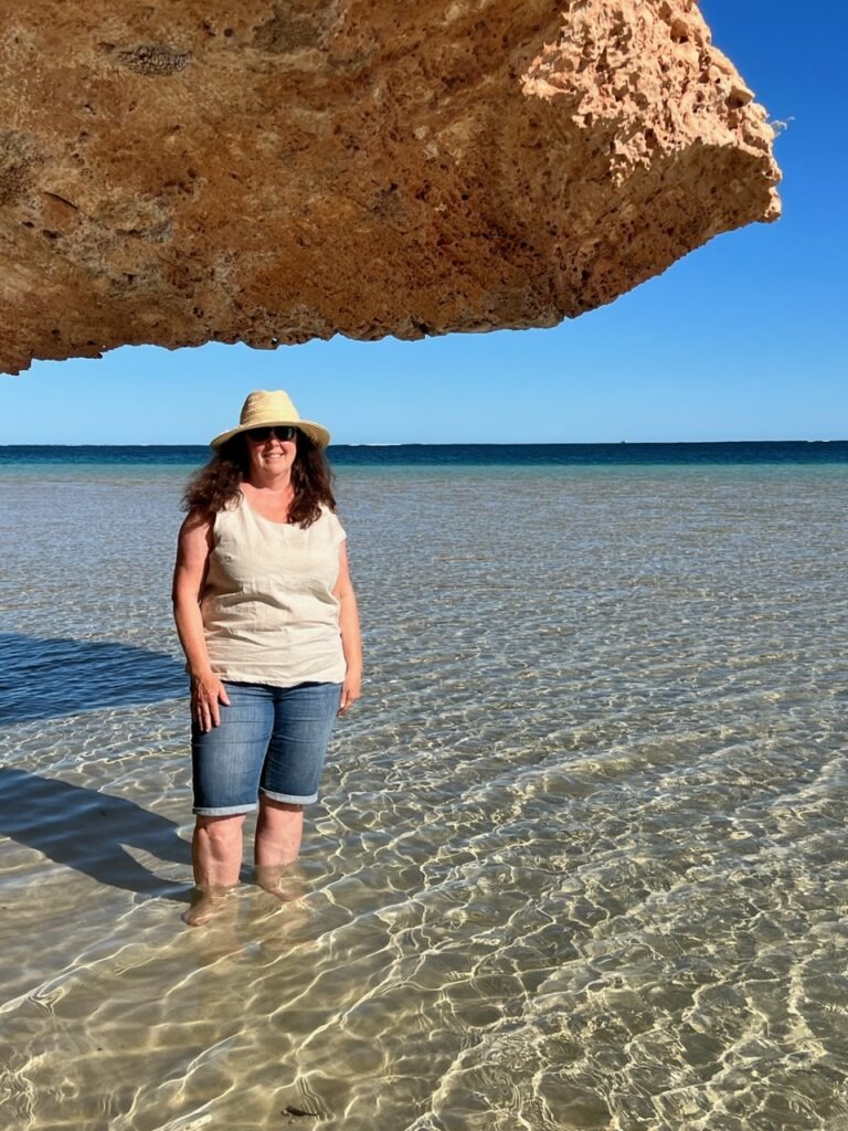
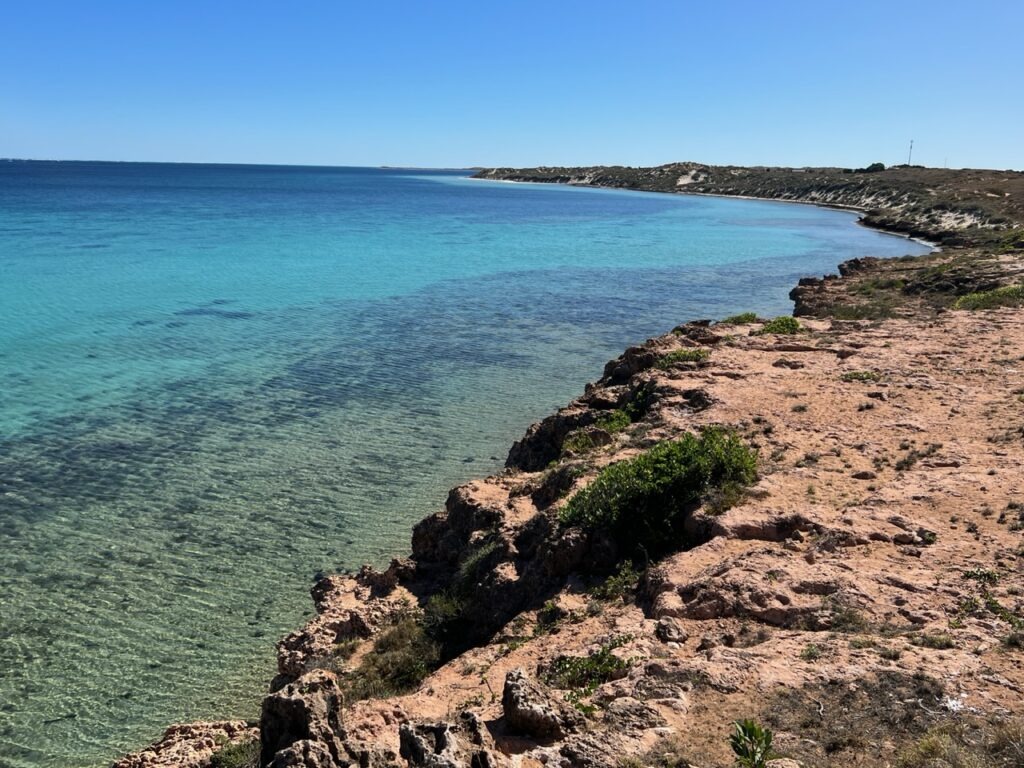
If swimming with Whale sharks was not enough, Exmouth is right beside Cape Range National Park, home to some of the most beautiful white sandy beaches and first class snorkeling sights in WA. With the water so warm we sampled several, Turquoise Bay being our favourite.
Stunning Turquoise Bay, Cape Range National Park, Exmouth.
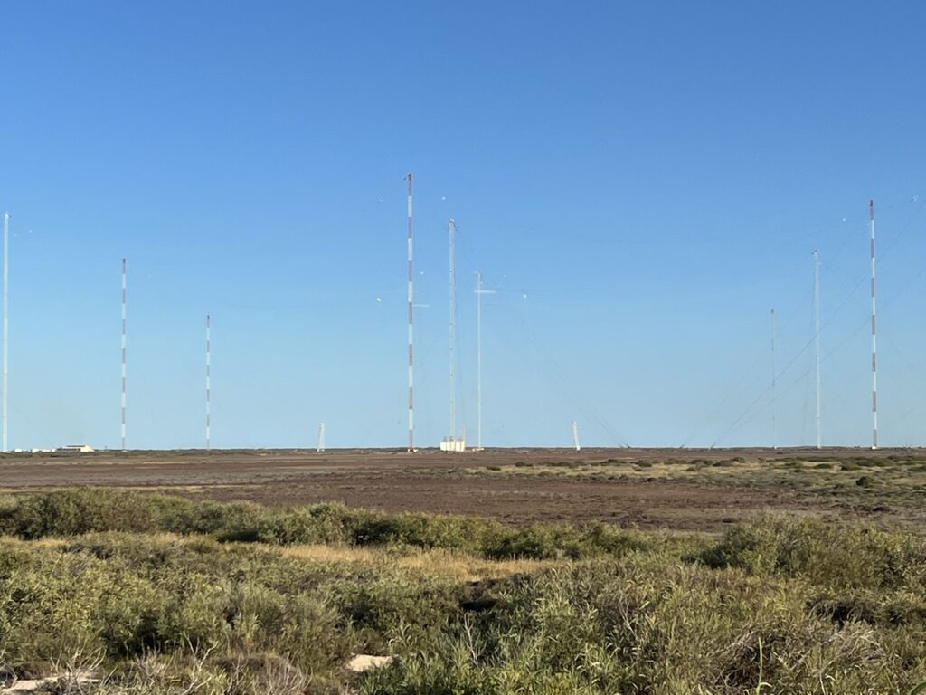
Exmouth itself is actually a relatively “new” town. A base for certain military actions against the Japanese ( who then occupied Singapore and Indonesia ) during WW2, Exmouth really started to grow in the ‘60’s after the Americans set up a military base there – at one point over 2,800 active serviceman lived here. The VLF ( Very Low Frequency ) communications tower system, constructed back then is still actively used today, albeit with just a handful of US personnel and now mostly run by the Australian military.
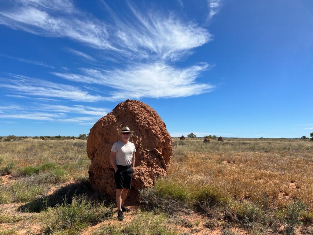
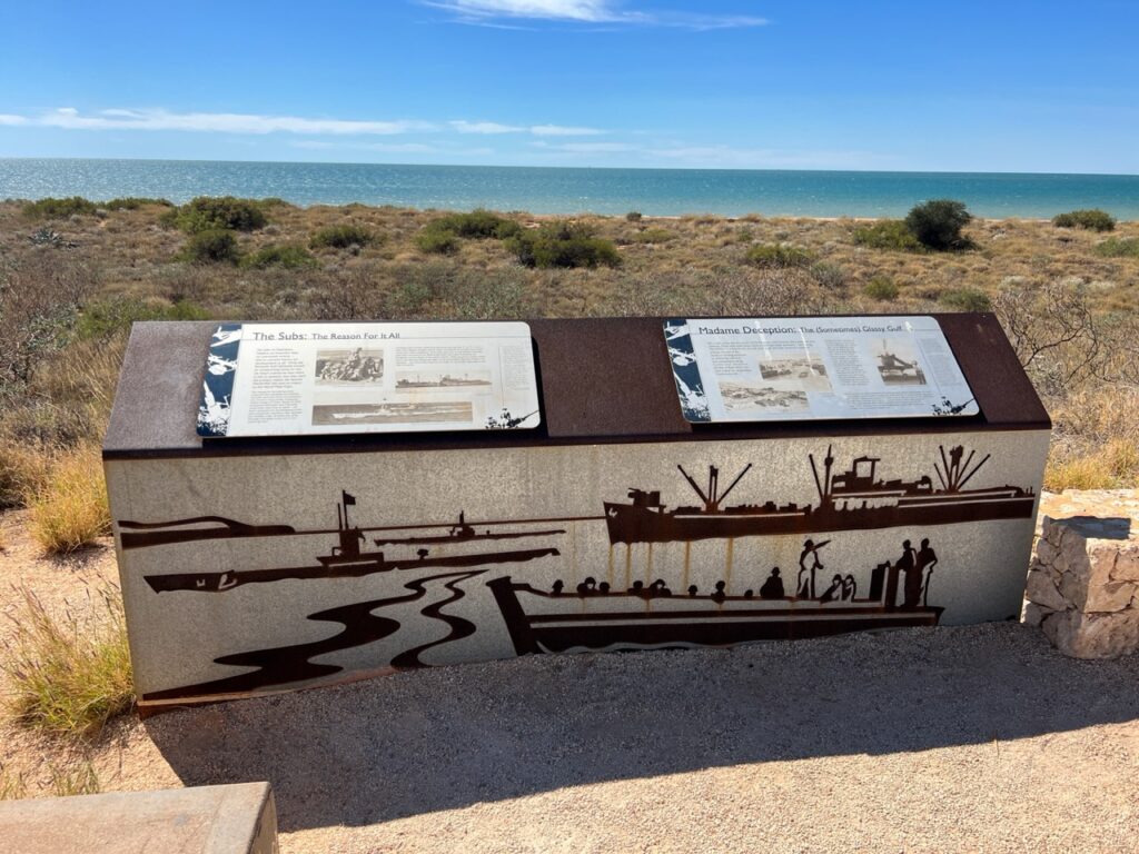
The VLF tower system just outside Exmouth In front of a giant termite mound, near Exmouth. Thousands of them in that area.Some of the WW2 history of Exmouth is highlighted at this memorial just south of the town. A particularly interesting story is the amazing mission to Japanese-occupied Singapore of the MV “Krait” which sailed from Exmouth.
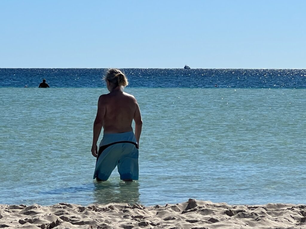
Coral Bay, just down the coast offers the same whale shark adventures and one of the most beautiful beach settings on the peninsula – I’ve never seen more caravans ( trailers ) crammed into a coastal caravan park than we did in Coral Bay. A prettier beach would be hard to find and we enjoyed wandering the coastline and swimming in its crystal clear warm waters.
Lois, Coral Bay.Jeff, Coral Bay.Coral Bay.Coastline just north of Coral Bay.
All good things must end, however ( as the saying goes )and our time on the coast with some amazing marine life would soon give way to other attractions inland – next week we’ll explore the canyons and gorges of one of Australia’s most amazing natural wonders – Karijini National Park.
Till then,
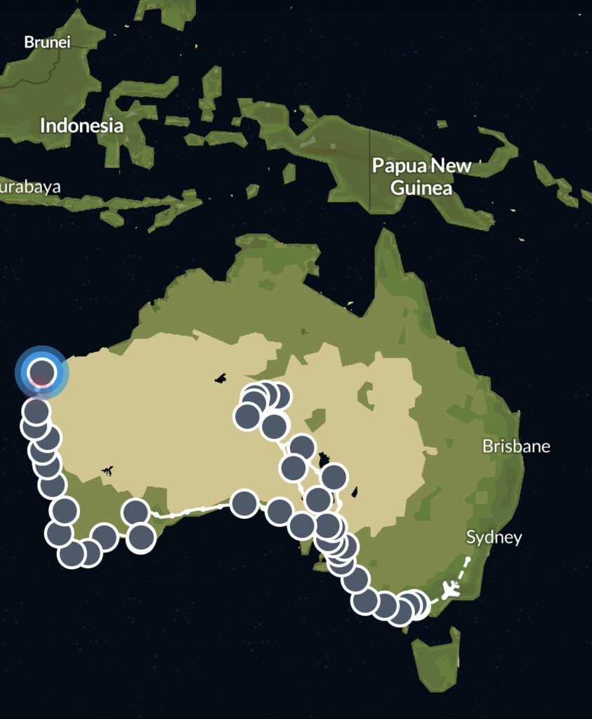
Close to 5 months since we left Canada, but just over 3 months in Oz. We’ve been tracking our progress on an app called PolarSteps ( from Melbourne anyway ) – handy to look back and see the route we’ve taken……
The PanAm completed in April, 2022 and with the truck camper sold, we shipped our new Sprinter van to Australia in late 2022. We travelled there through all of 2023 and into 2024 before shipping it up to North East Asia where we travelled for 4 months between Korea and Japan, before shipping it back to North America. It’s our plan to continue exploring the world in 2025.