Seems like yesterday that we touched down here in Kelowna, and yet, here we are already preparing to blast off back to Australia. In reality we’ve been back almost 7 weeks – longer than we had anticipated but there were a few, er, shall we say, unexpected “curve balls” put in our path. Expecting simply to come back and have a relaxing month with our children, friends, and of course our adorable new granddaughter, things didn’t go quite exactly as planned.
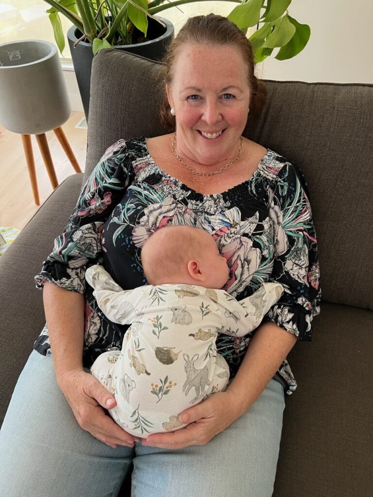
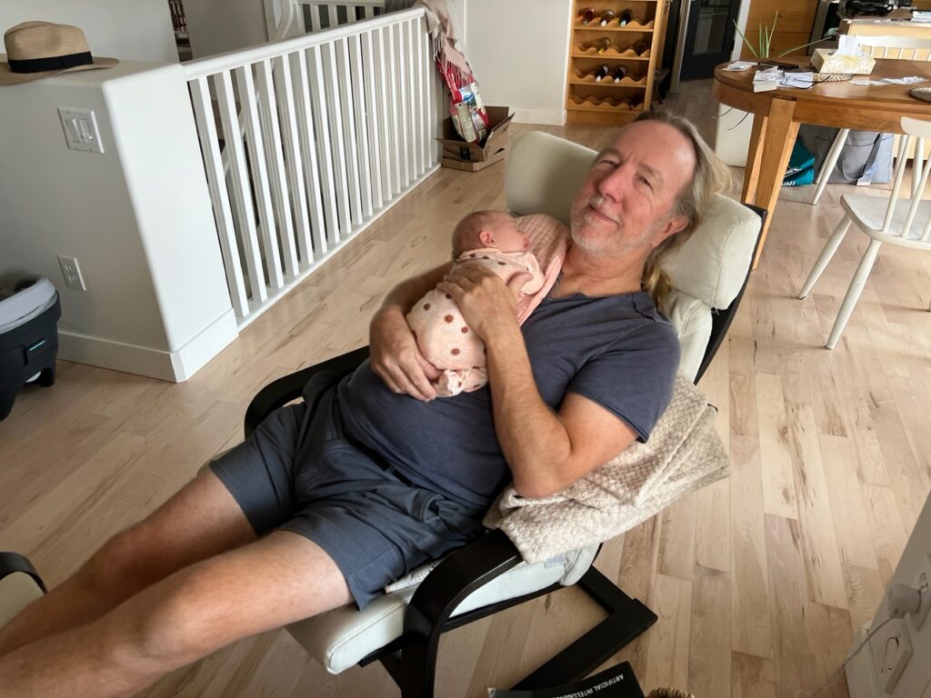
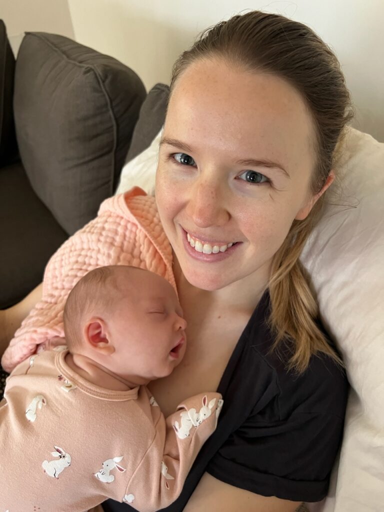
Grandma and Hadley. Seemed this was her favourite resting place !Grandpa and baby.Mum and baby.
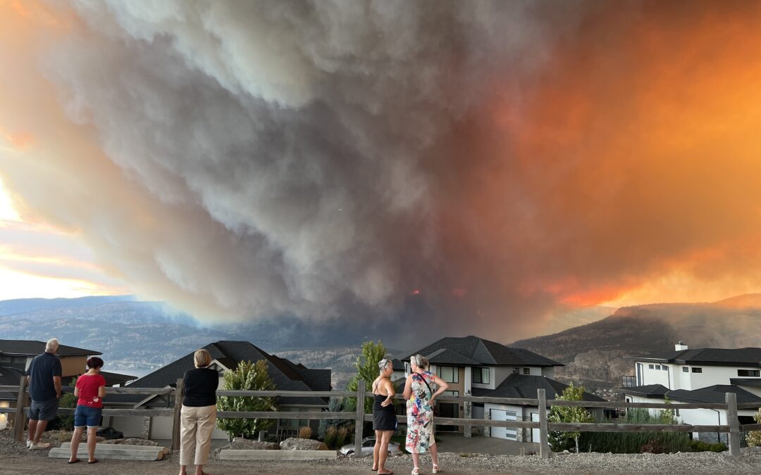
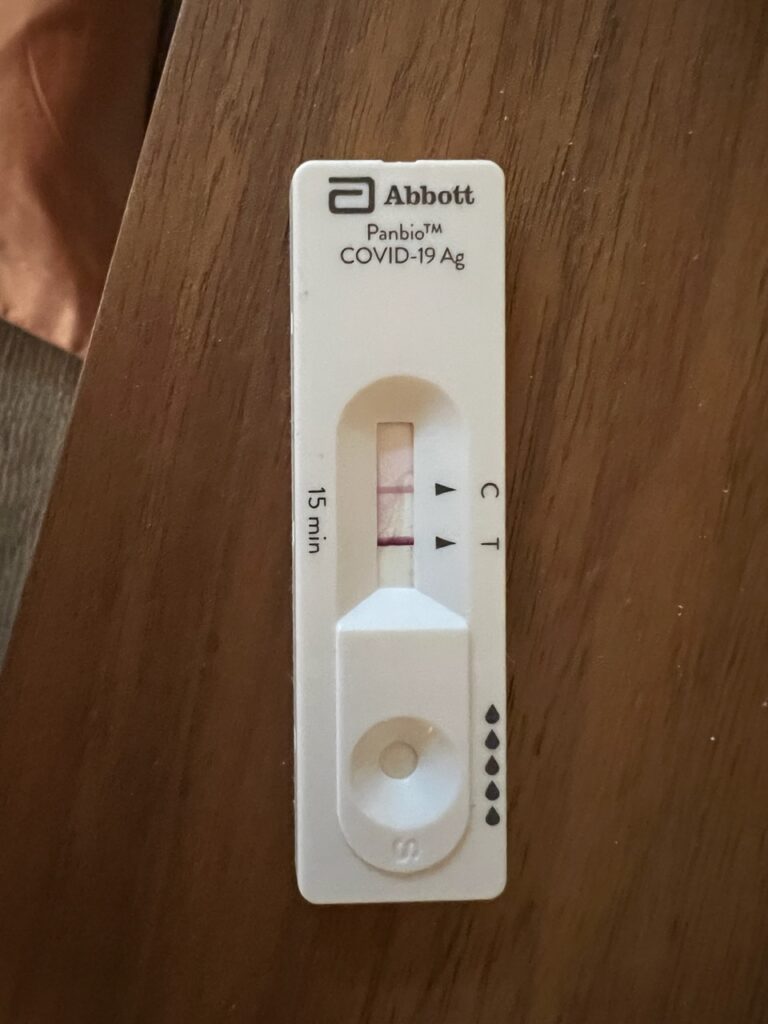
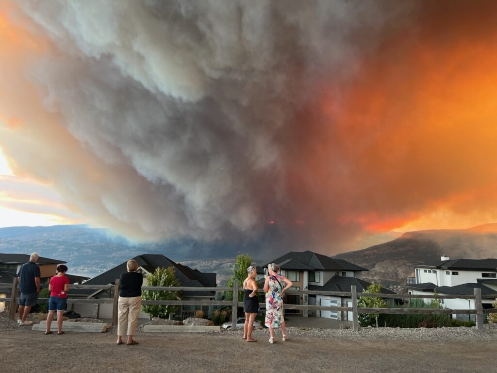
Two days after arriving I came down with Covid ( a mild dose ) and two days after that Lois got it from me ( she unfortunately being sicker, for longer ). Needless to say that eliminated any further immediate one on one time with our new baby – with isolation, followed by masking (after the RAT tests showed negative ) we lost about 2 weeks all told. Fine, we thought – having successfully dodged it for 3 years while half the world had gotten it we knew it would come our way sooner or later and at least we had it in the comfort of our own home. Well, almost all of it while at home. Lois was still in the final days of testing negative when another calamity struck – we were caught up in the Kelowna fires and evacuated from our house for a week ! Did someone break a mirror ? Fortunately our home ( and most others in Kelowna ) survived the fire scare but it was a frightening disruption we certainly did not need. Our thoughts were very much with those that lost homes and of course, our eternal thanks to our amazing firefighters ! A special shoutout to the friends and family that took us in for the evacuation days ( Sue, Mark, and Jackie – thank you ! ) – thankfully we emerged unscathed. Nothing like an evacuation order at 10.30 pm to throw your erstwhile tranquil life into complete chaos !
The dreaded RAT test. No one wants to see two lines !Between the houses in the foreground and the mountains in the background is Okanagan Lake, probably 2kms wide at that point. The fires, which started in West Kelowna ( across the lake ) were so strong that burning embers crossed the lake and started multiple fires on the Kelowna side ( near us ). Here, our neighbours observing the fire – a few hours later we would all be evacuated.National newspaper headline showing the Kelowna fires. They came frighteningly close to our own home.
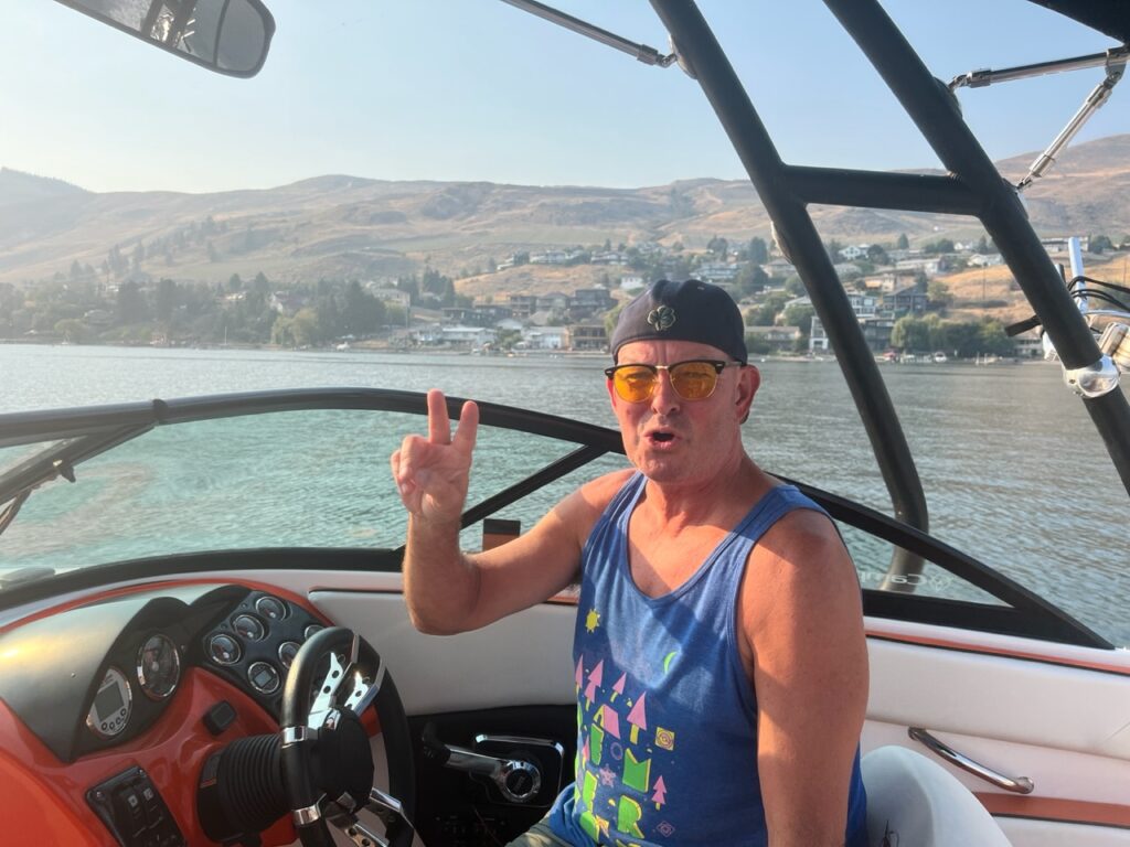
With our precious baby time cut short we made the obvious decision to extend our stay and have enjoyed every minute. Freed of the shackles of Covid infections, not only could we enjoy every minute of grandparent time but we were also free to join family and old friends/colleagues and enjoy our Okanagan summer – even if it was rather smokey from the residual effects of the fires. We’ll miss our little Hadley greatly but have sworn that future trips home will be more frequent, even if a bit shorter in duration.
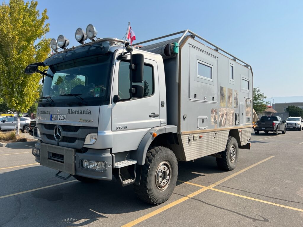
Managed to get out on the lake with my old boss, Mike. A little smoke still evident in the background.While doing some shopping in Kelowna we noticed this very impressive German overland rig, making us a little homesick for ours. It’s just an accepted fact among overlanders that the Germans almost always have the coolest rigs !
There’s been no travel here in Canada to speak of but we are truly excited to be getting back in our rig and to exploring the remaining parts of Australia which we expect will take us well into 2024. Western Queensland, the NSW coast, some detours into western NSW and on to the many parts of Victoria we’ve not yet seen, before travelling to Tasmania in the New Year should fill out our itinerary nicely.
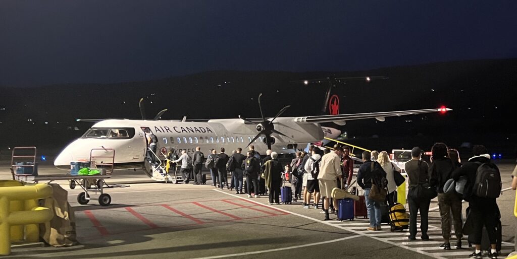
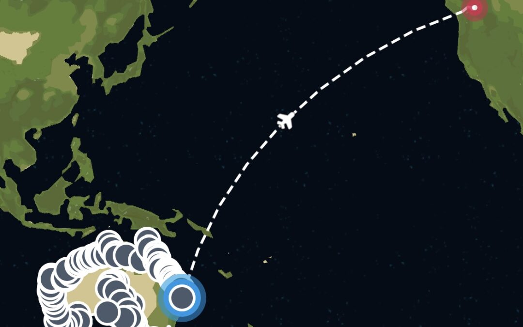
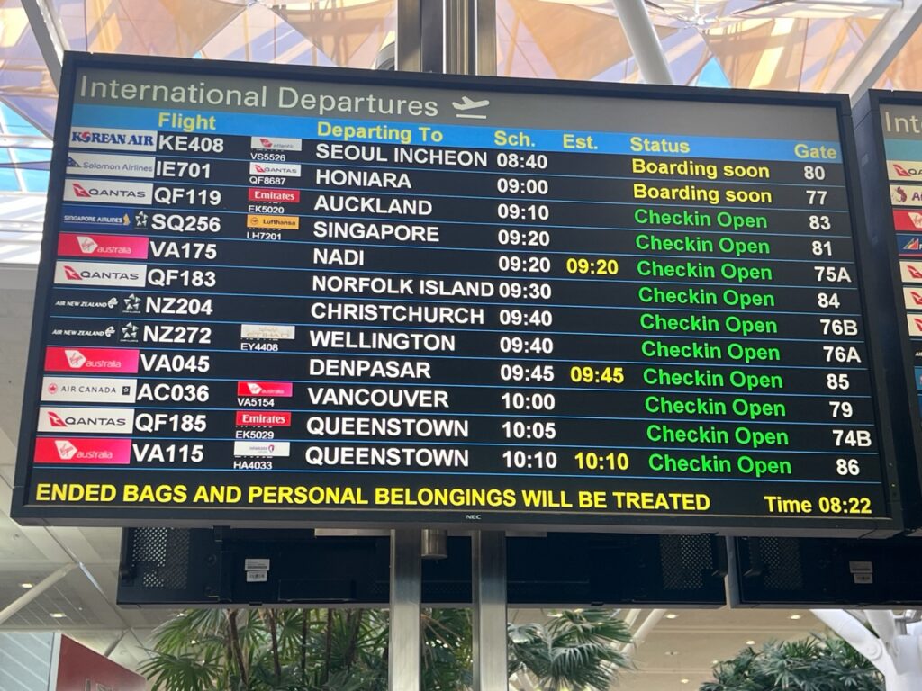
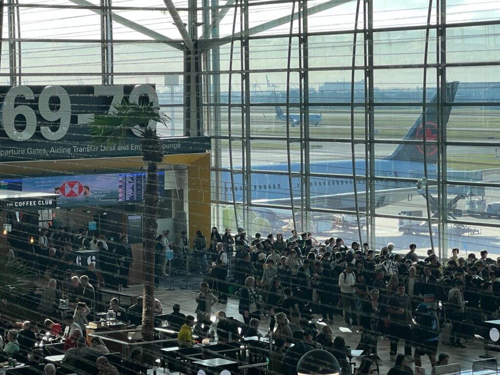
It was with very mixed emotions that we got ready to board the flight to Vancouver and then on to Brisbane. Leaving had never been this hard before. It would, ultimately, be a very long flight to Brisbane.Could not swing a direct flight back to Brisbane, but instead had to go the long way around via Sydney.
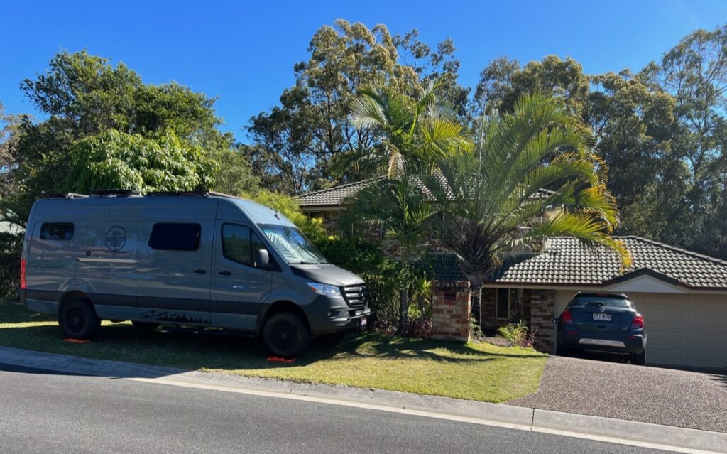
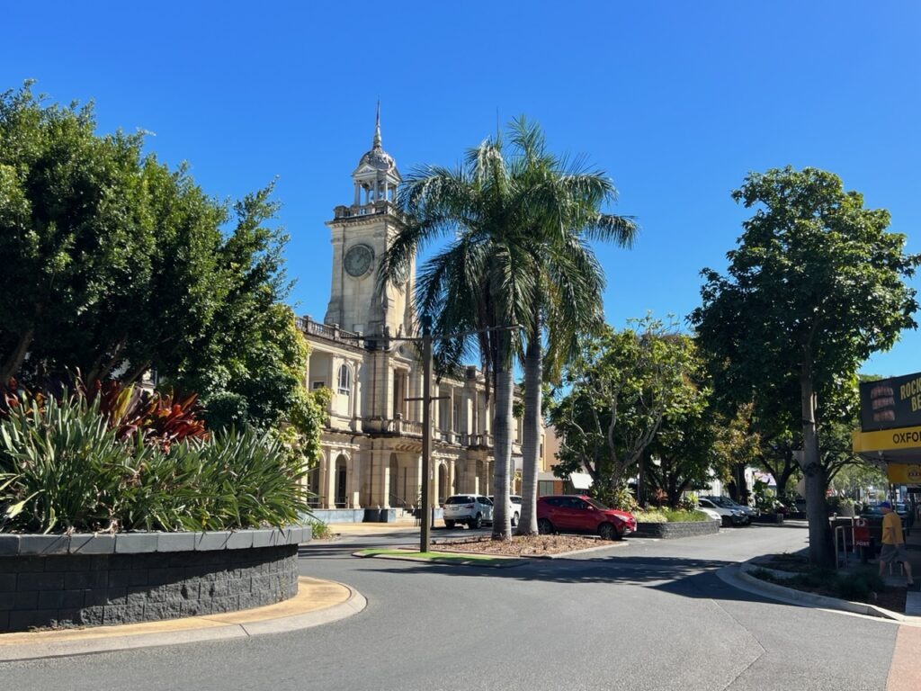
Farewelling my brother in Dicky Beach it was an easy 1 hour drive to Brisbane. It’s a place we have always enjoyed visiting and we had ample tasks to occupy our time while we waited a week for our flight back to Canada to spend a month with our kids and friends there. There would be a few sights in Brisbane, a bit of vehicle maintenance, the need to seek a vehicle storage solution while we were away and, finally, a wonderful opportunity to catch up with nieces, nephews, a cousin and one of my oldest childhood friends.
We bid farewell to Tim and Maree and left for Brisbane. Wonderful stay, guys, thank you !Brisbane – our first big city in quite a while.
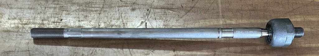
Vehicle first. Our regular readers may remember the big jolt when we hit a thick tree root on the very last few kilometres of the Cape York track. It was enough to shake our camera and we really felt it in the van.
The Cape York “bump” that damaged our right front tie rod. It needed to be replaced.
No obvious damage at the time but, later, in Rockhampton during a routine tire rotation, the technician noticed the front wheel which took the impact had a little bit of “play” in it. Very driveable, he assured us, but, based on his further inspection, said it was likely a fractured nylon piece in the tie-rod and the tie rod would need to be replaced. The Mercedes dealer in Rockhampton had the part and, while he confirmed it was almost certainly the cause of the issue, lamented that they could not do the job for two weeks ( not our first such service challenge on this trip ). We would have to do it when we got to Brisbane and had more time.
Slight “play” in the front wheel as a result of the Cape York knock.
A good thing as it turned out. A local European parts specialist here in Brisbane supplied the exact same ( German-made ) part, directed us to a specialist suspension shop for the install and finally over to Bob Jane Tires for the wheel alignment. All wrapped up in the course of a half day’s running around, with great service from all involved and at a fraction of the cost ( and delay ) we would have experienced at Mercedes Benz in Rockhampton. Nice to have it all sorted out.
The new tie rod.Installed quickly and reasonably by the good folks at Pedders.
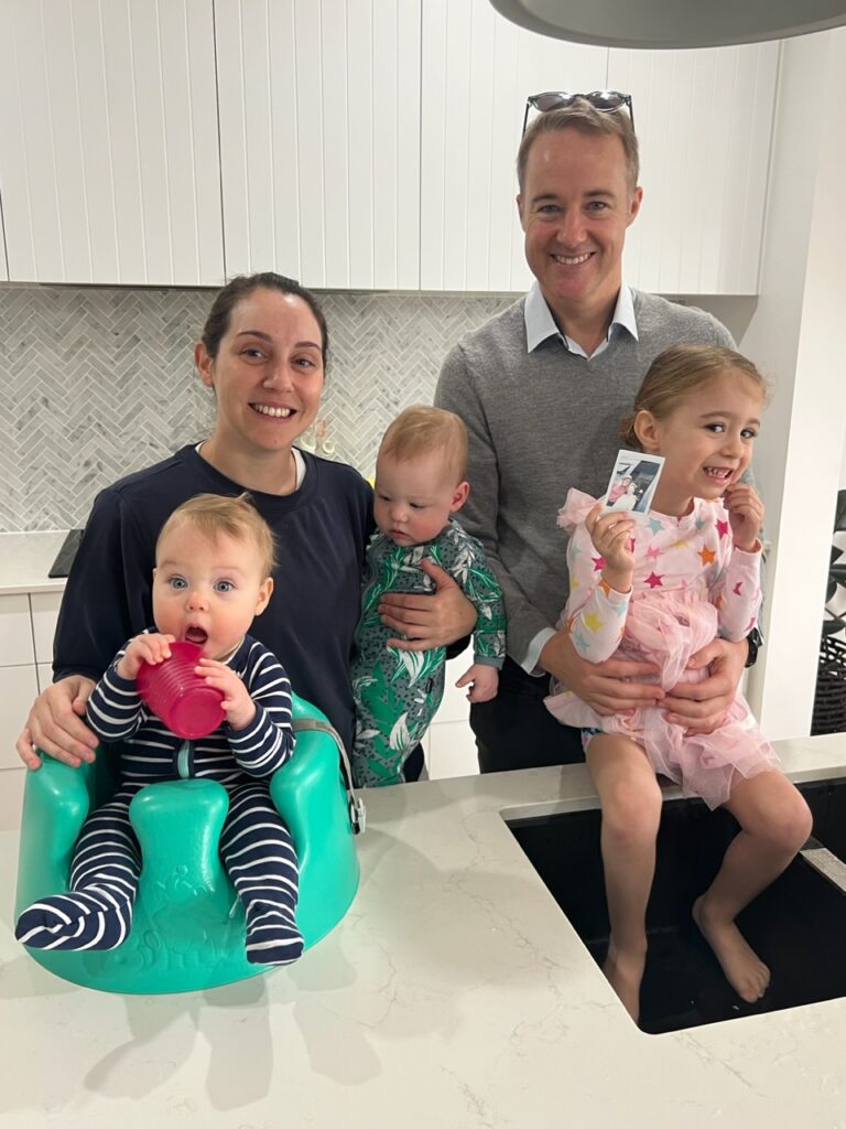
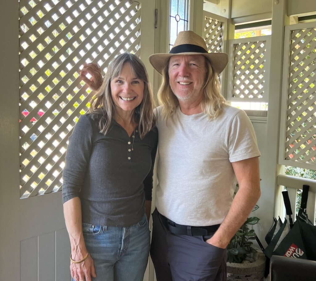
Now on to family. My niece, Shannon ( and her family ) and nephew, Caleb ( and his ) both live in Brisbane – both have moved since we last saw them and both have had beautiful additions to their young families. On the few occasions we do pass through Brisbane we usually have little time for any meaningful visits so it was wonderful to spend a couple of relaxing days with both, to get to know their newest young ones and catch up on the goings-on in their worlds. Likewise with my long-time friend, Tim ( and his wife Ros ). For once we had time to do more then just catch up for a quick coffee or beer as we blew through town. Great to reminisce and also do a little exploring together around some of the parts of Brisbane we’d not seen before.
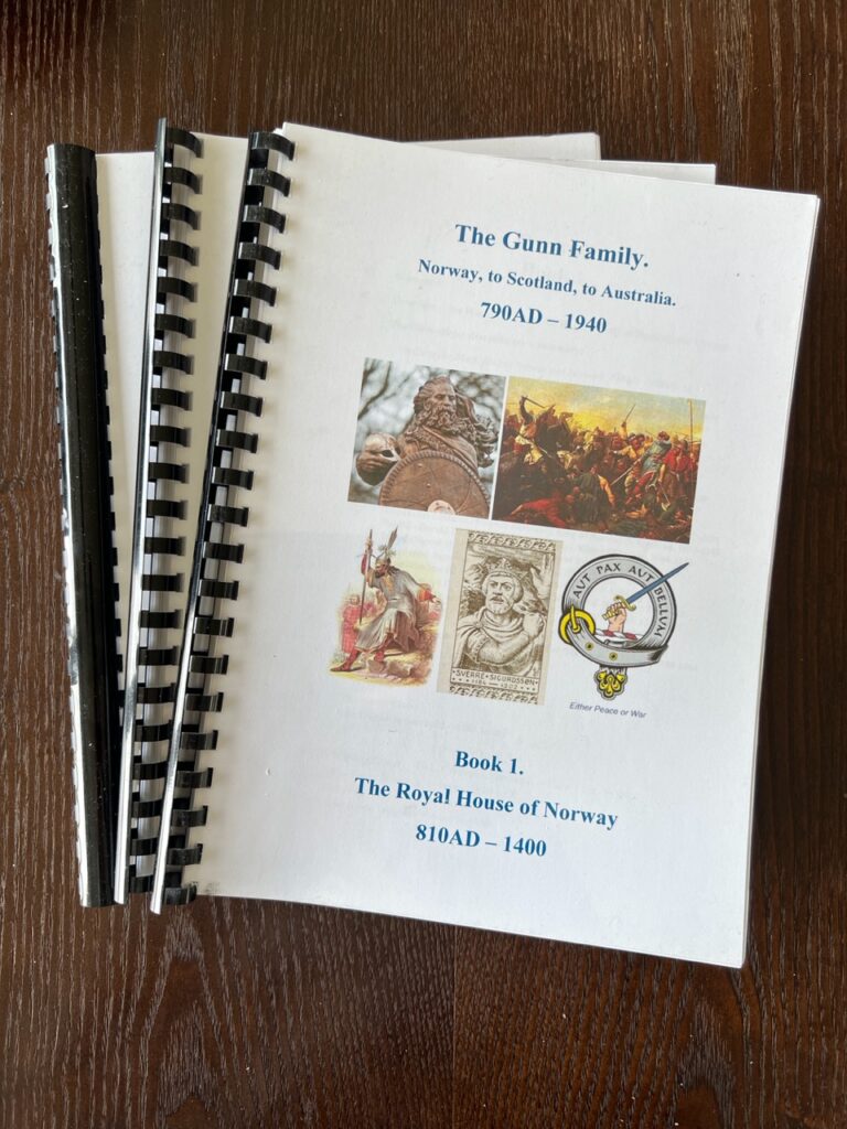
Lois with some of the kids – intrigued by our “house” !Lois, going over the merits of the Sprinter with Shannon’s neighbours. One already owned a Ford Transit van and the other was about to buy a new van and do a self build. Lots of questions…!My nephew Caleb, wife Jess and their delightful family. We needed practice with babies so the visit with them was helpful in more ways than one !Parked up at my friend, Tim’s. Our first visit to their beautiful home in Brisbane.My cousin Carol, whose husband Lee has done a three volume history on the “Gunn” genealogy. Seems our roots are inextricably linked to Norse Vikings ( centuries prior to out more recent Scottish heritage ). She kindly supplied me a set – thanks Carol !Makes for fascinating reading ( well, at least if you are a Gunn ) !
One last task while in town was to find secure storage for the vehicle while we would be away. After some crazy quotes from a few places we managed to find a good option in a gated commercial facility not too far from Brisbane airport. Pleased with that and now able to travel with some additional peace of mind ( a condition of our Carnet – the vehicle temporary import permit – was that the vehicle be secured, not on a public street, and not be driven by anyone else while we were out of the country ). Check, check and check !
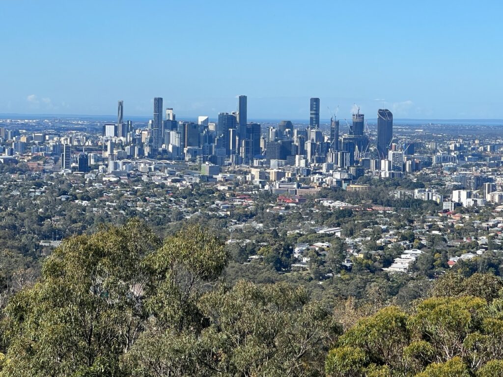
View of Brisbane from Mt Coot Tha. We travelled there with Tim.
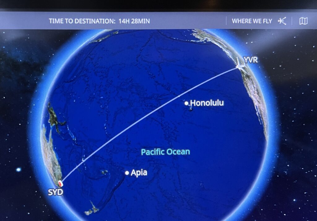
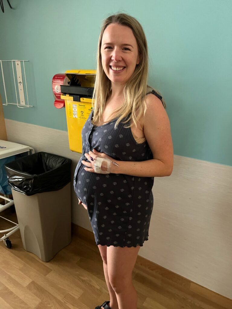
With our daughter’s delivery date known ( she was going to be induced ) we could now schedule our planned departure so as to ( hopefully ) coincide as closely as possible with the expected delivery. Vehicle dropped at the storage centre and bags packed we Uber’d to Brisbane airport for the 13 hour flight to Vancouver and then on to Kelowna.
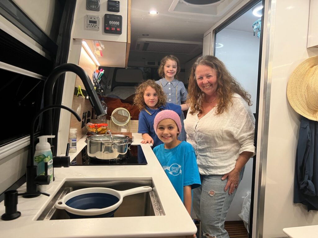
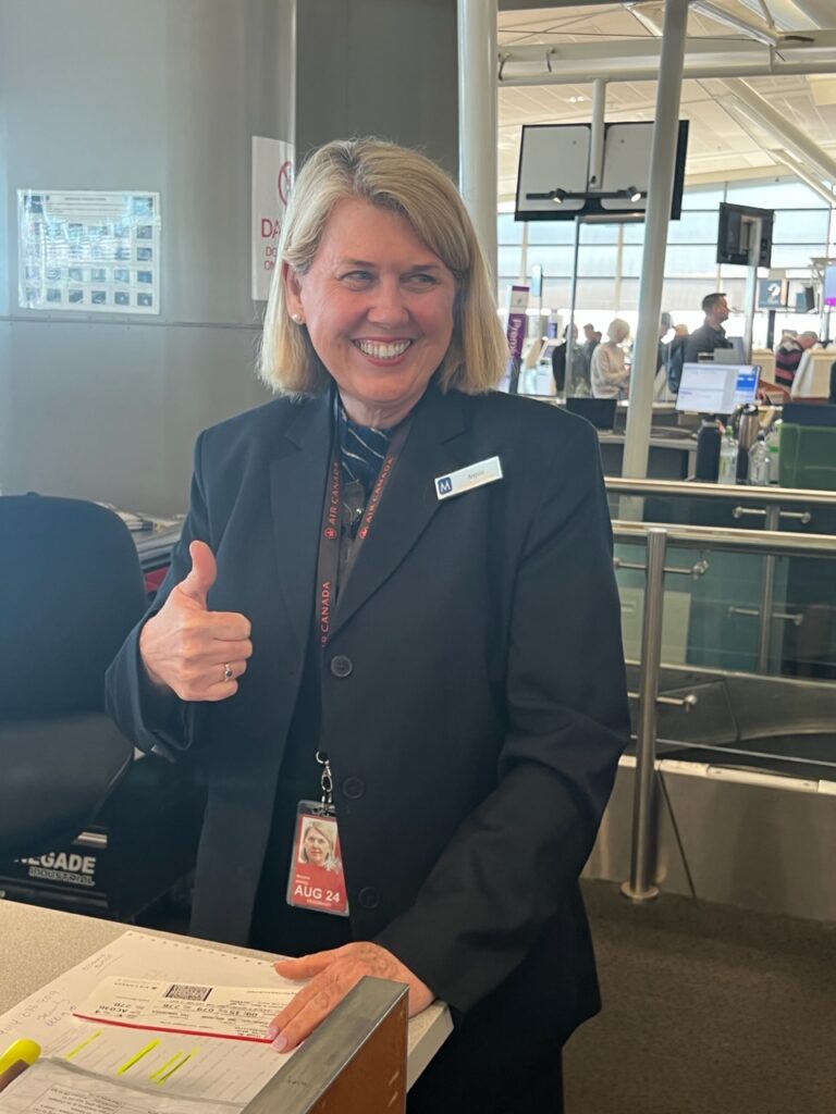
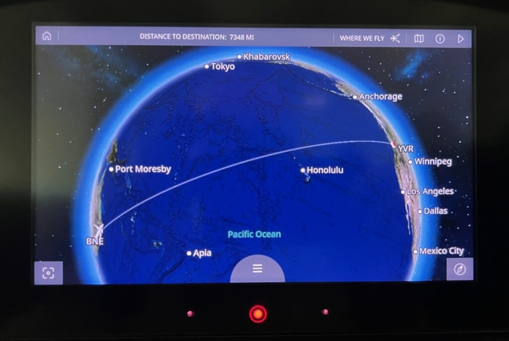
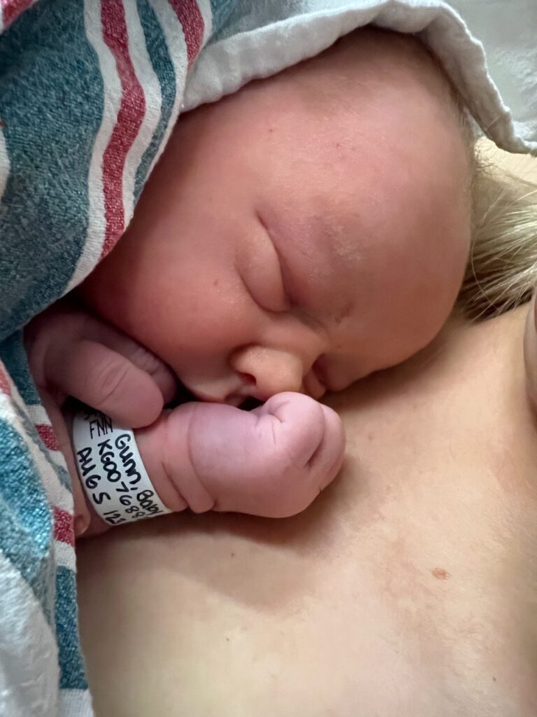
AC36 was our flight home. Enjoyed 5 movies ( since I didn’t sleep a wink ) for the 13 hour trip…!We were on standby for this particular Air Canada flight………..and we were very grateful to Angela at check-in for making it happen. A 100% full flight and she got us the last two seats. We were seated miles apart on the plane but “beggars can’t be choosers” ( as they say ) and we were just ecstatic to make it. Got home to see our daughter both before and after the delivery. Who could ask for more ?The world seems so small when you see it on the seat display.Timing is everything and the gods really smiled on us. We arrived home in Kelowna at 10.00 am August 5th and saw our daughter, Jackie, in the hospital as soon as we got off the plane. She delivered beautiful, healthy, baby Hadley just before 5pm the same day.Our beautiful bundle of joy, just a few hours old……And, dressed up to leave hospital, Hadley Charlotte Van Vliet, ready to be doted on !!!
So with all that excitement and lots of eagerly anticipated baby-time coming up in the next few weeks, we’ll take a summer “pause” on the OneEndlessRoad blog and get back at it just before returning to Brisbane in September.
To all our regular readers, thanks for tagging along with us, and to all our local friends and family, we look forward to catching up while we are back !
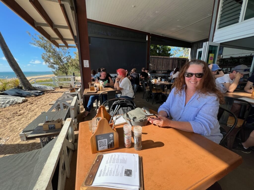
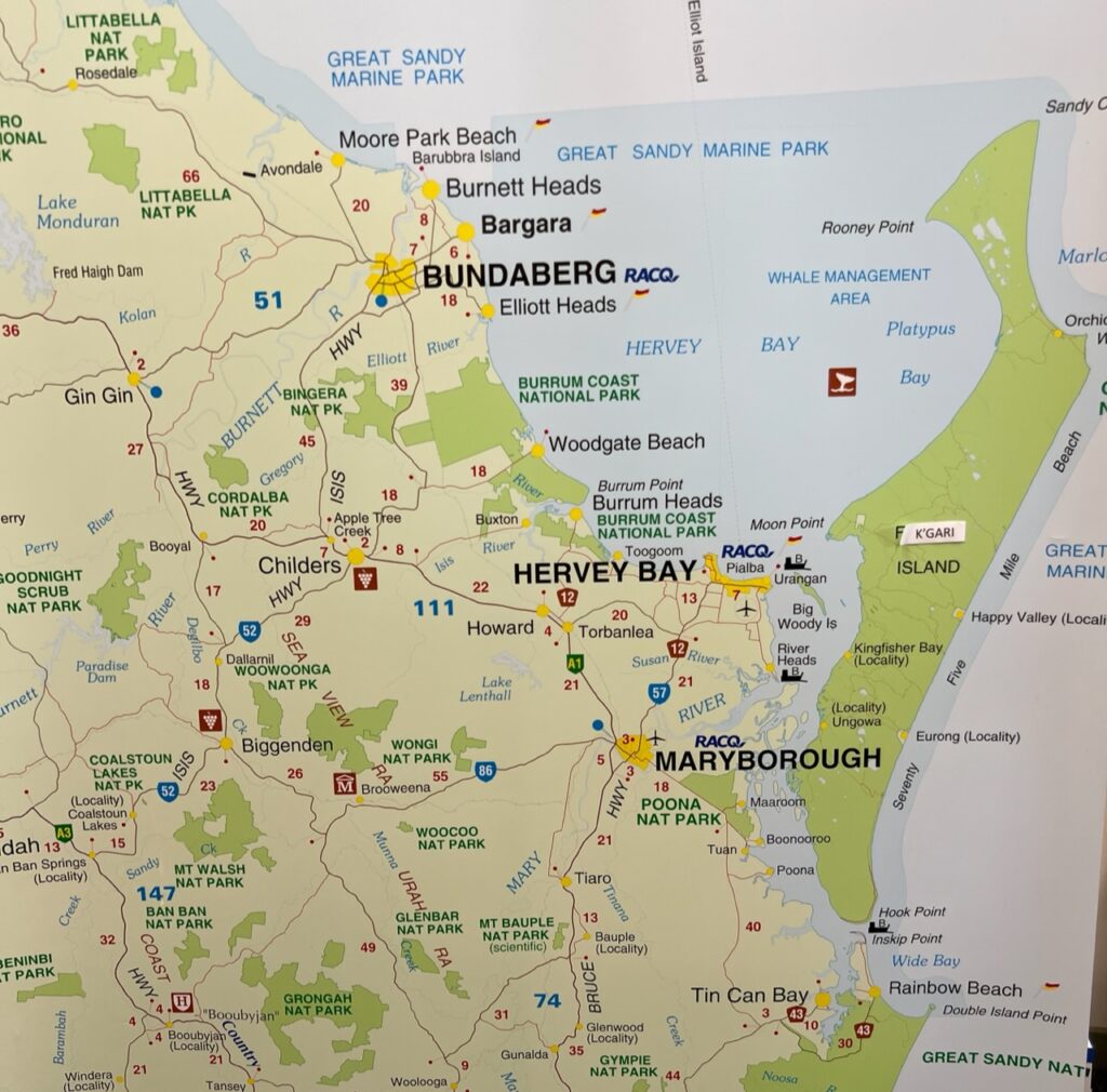
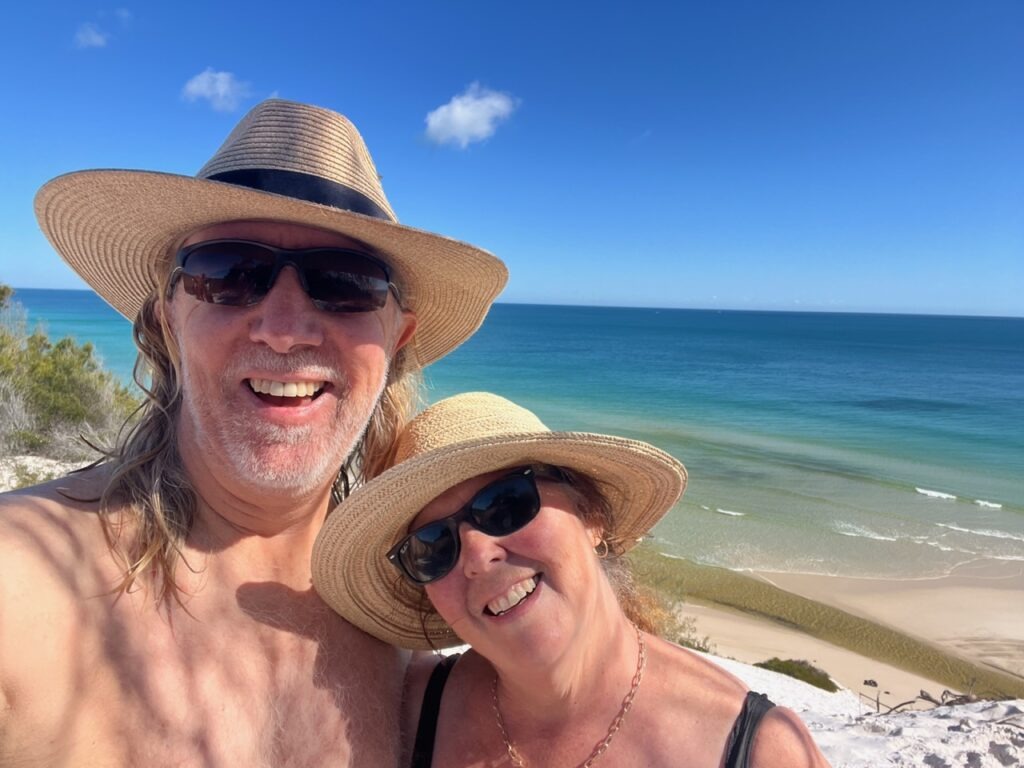
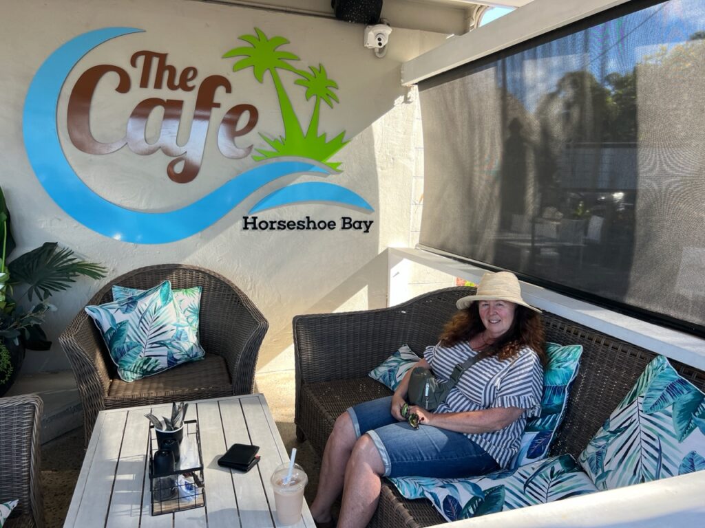
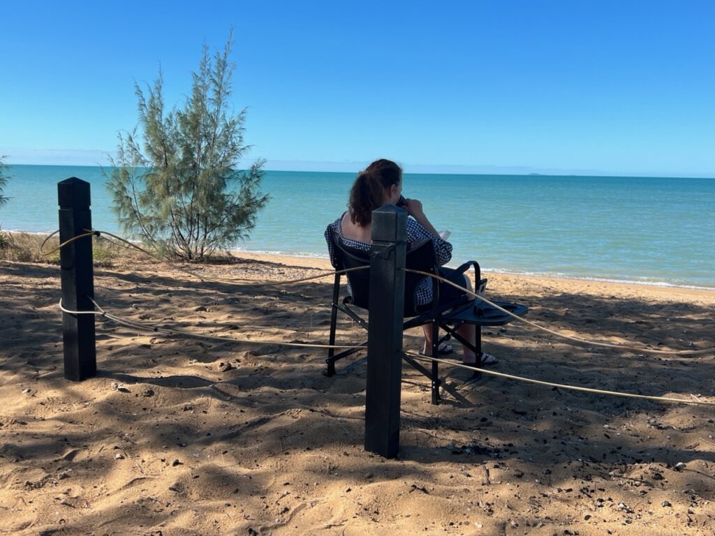
Popular Hervey Bay is literally just a hop, skip and jump from Woodgate – it’s always been a popular draw, especially for sun-seeking retirees, and remains as busy as ever. This time, for us anyway, it represented the perfect jumping off point for a whale-watching trip to magnificent Fraser Island that Lois had planned for my birthday ( thanks Lo ! ).
Enjoying coffee and a shake at Enzo’s, on the beachfront,Hervey Bay.Downtown Hervey Bay.
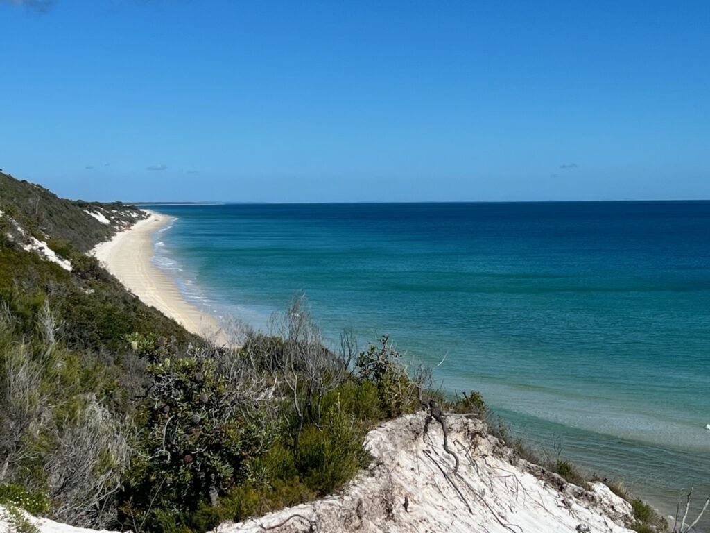
The world’s largest pure sand island, Fraser ( or K’gari as it’s now called ) is accessible only to high clearance, high/low range 4×4’s and while our rig technically met all those requirements, we were strongly advised that it was too long and possibly too heavy to properly navigate the soft sand and very narrow, rutted, tracks that cross the island. We’d been extremely lucky on the Gibb and Cape York tracks so decided that an ounce of “prevention” might best thousands of dollars of possible “cure” in the event an on-island extraction ( as they are known ! ) was needed should we get stuck.
Map of the area around Hervey Bay.
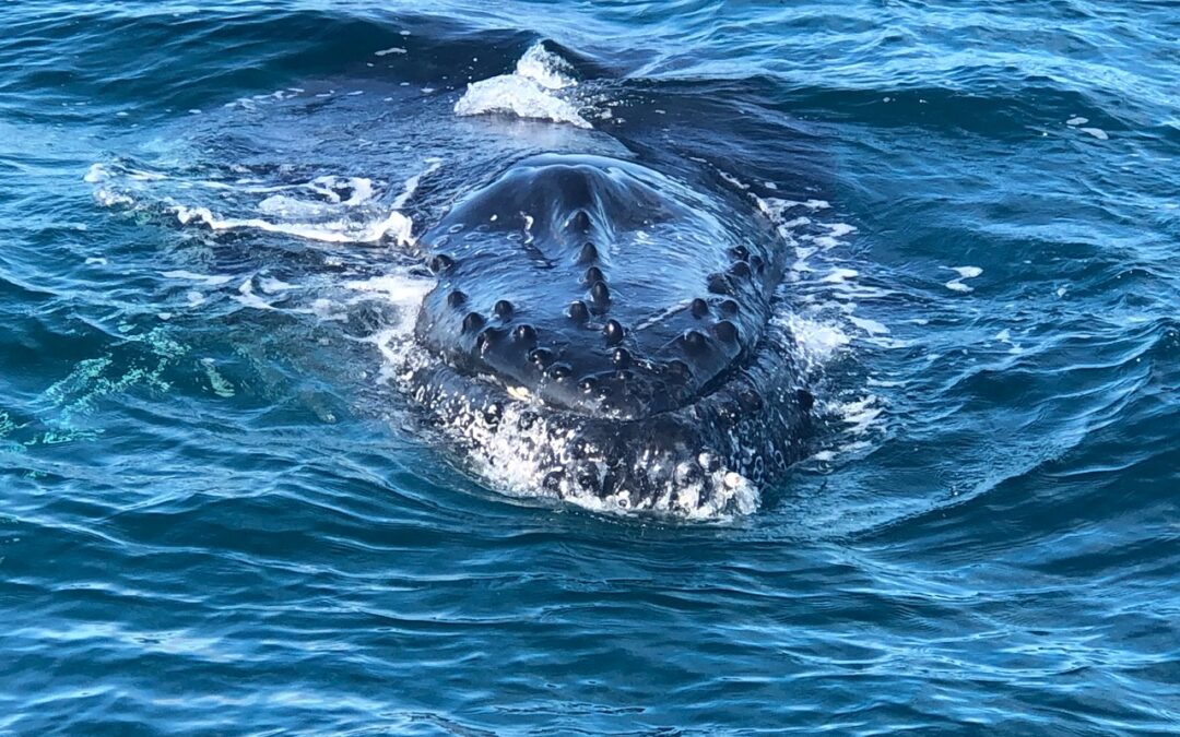
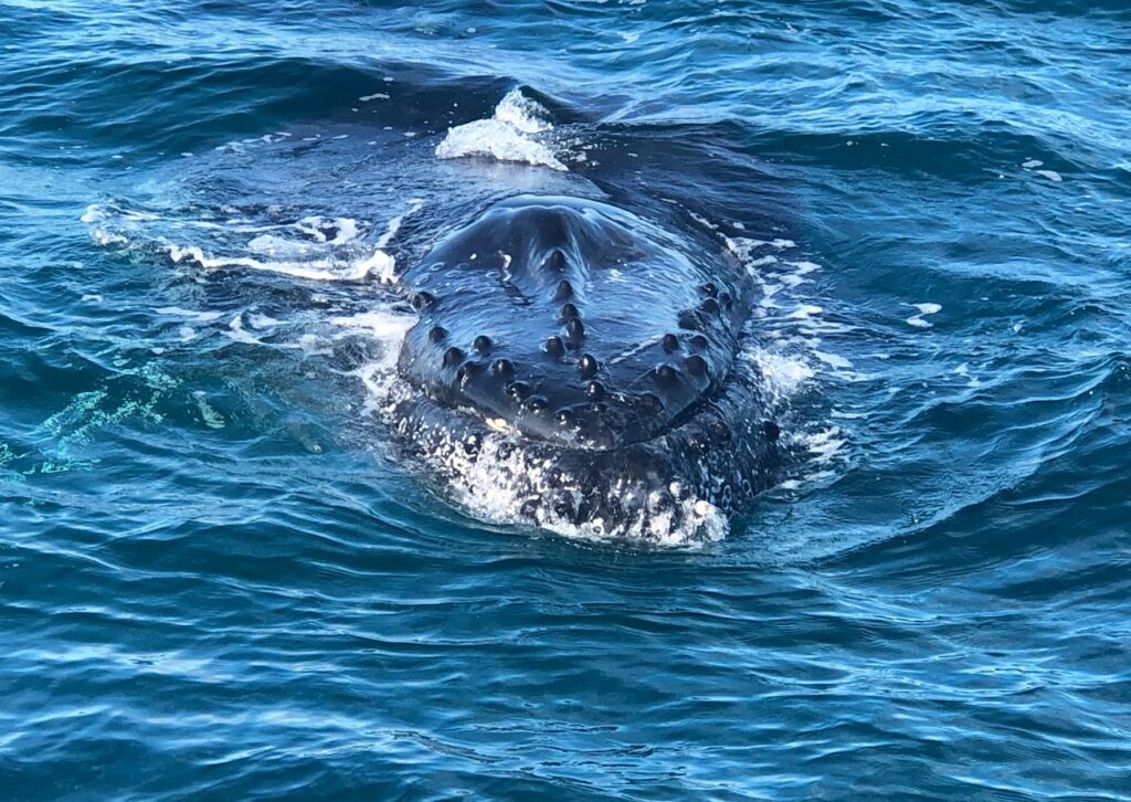
Turns out that was probably one of our smartest decisions – the next day we took a full day “Whale watching/Remote Fraser Island” tour that gave us not just a great taste of the island ( and a more remote, less-travelled section of it, no less ) but an absolutely fantastic whale watching experience. Having done them before and only ever seen dorsal fins at a distance and tell-tale “blows” from afar, our expectations were, shall we say, “managed”. Fraser Island was the draw, the whale watching would just be a bonus we thought. The island was certainly impressive in its own right ( we can see why people love going ) but the whale watching just blew our expectations away. Best birthday gift ever ! I’ll let the following pictures/videos tell the story. As people who normally avoid tours like the plague we are pretty discerning when we do them, yet we both felt this experience was absolutely 5 star ( +++ !). Thrilled we did it and, (having seen the sand tracks), were happy to have left our rig behind for the day !
West coast of Fraser Island from the sea.View of Fraser Island from atop the sand dunes.The tour gave us plenty of time to climb the dunes, and…………paddle in the creeks along the coast.Happened to just be a perfect day weather- wise.The view inland to Fraser Island.A couple of 4×4’s using the few hours available ( between tides ) to drives along the thin strip of beach.. mess up the times and you ( quite literally ) run out of road ( beach ) to drive on.Humpback whale surfacing just metres from our boat !The whales up close.Whale, frolicking near the boat.And more…..And more. We have never been so close!We had a brief opportunity to see them from in the water.
Hard to top that we thought, and even if we don’t ( and probably won’t ! ) it was a great interactive experience and something we welcomed after what had (more or less) been a bit of an extended sightseeing-only couple of weeks beforehand. But, that’s travel, the exciting parts usually get mixed in with the more mundane, and it’s the more mundane parts that help make the more exciting parts, well…….exciting !!
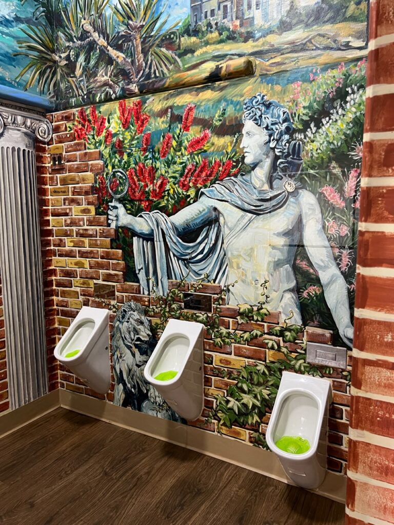
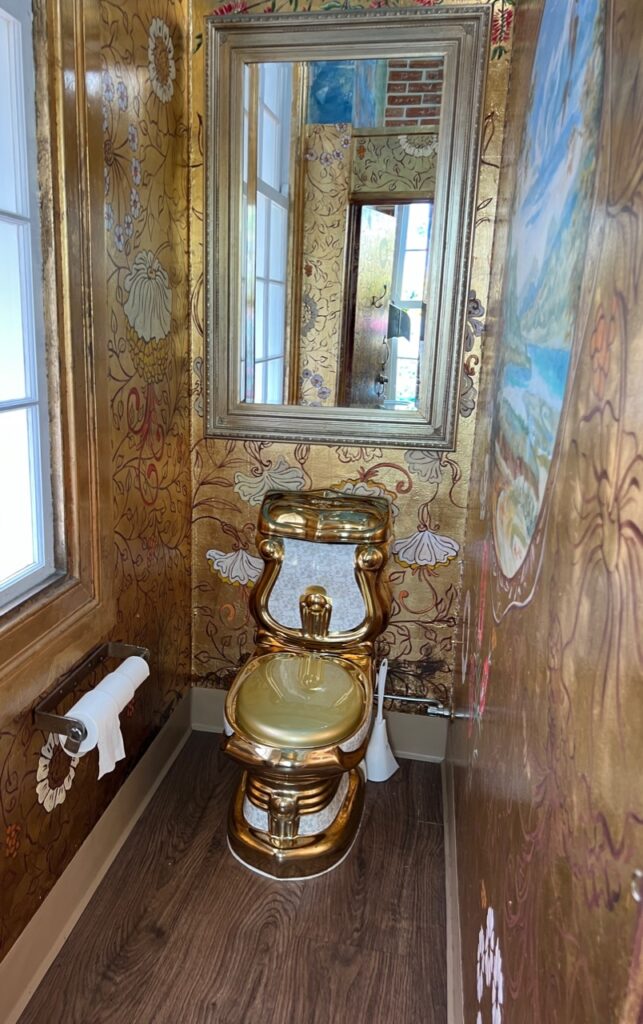
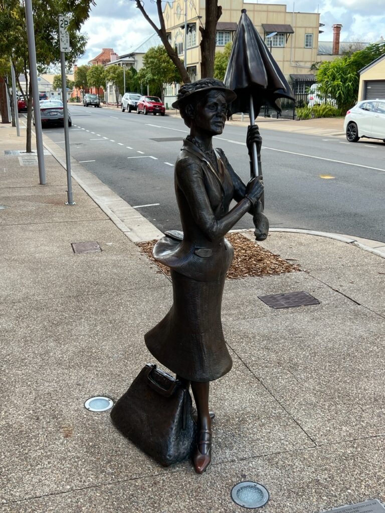
Leaving Hervey Bay after a few days, historic nearby Maryborough was a nice change of pace; this famous river port was at one time a major point of entry for immigrants to Australia and much remains ( often beautifully restored ) of its storied past. A great walking route shows off its touristic charms – the most stunningly ornate toilet you’ll ever see, an abundance of cool murals, and the home where P.L. Travers ( author of “Mary Poppins” ) was born, among them. Who’d have known ?
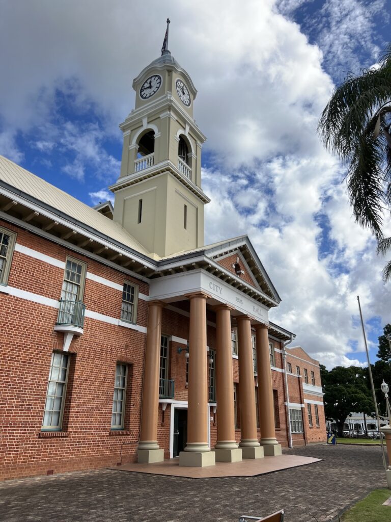
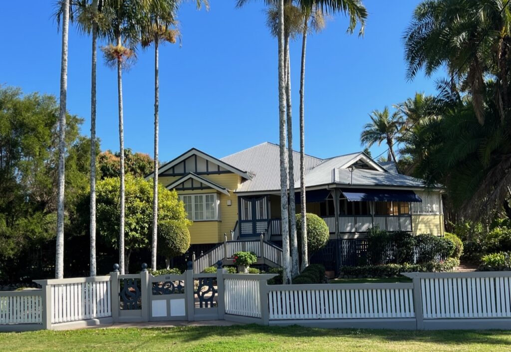
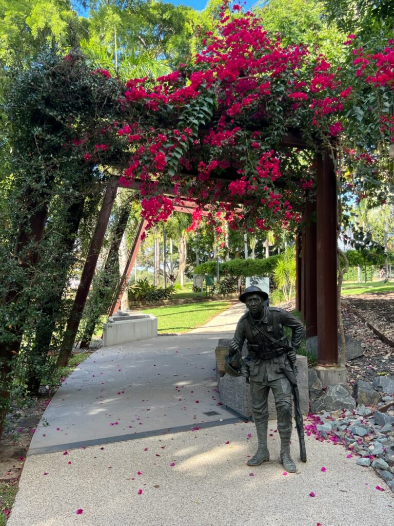
Bumped into Chris and Jo, owners of this massive Isuzu 4×4 ( GVM 9 tonnes ) as we were leaving Hervey Bay. Truly a heavy duty “go anywhere” rig !Uniquely, the vehicle ( an older diesel ) will also run on used vegetable oil. They collect it from restaurants, filter it through their on-board centrifuge and store it in a separate 200 litre “fuel” tank. At almost 30 litres per 100 km you would want to be picking up the odd free tank !!!!City Hall, Maryborough – the style reminded us of so many city halls in the US Deep South.Maryborough is a very pretty town and has a lot of well restored traditional old “Queenslander” homes.The first room you see in Maryborough’s “Cistern Chapel” ( a parody of Rome’s Sistine Chapel )…….……then you see this one ! Surely Maryborough is one of few cities in the world where people come to see a toilet !Maryborough has an excellent military museum and there are many impressive monuments to our fallen soldiers dotted throughout the city’s beautiful parks.In Maryborough much is made of the fact that P.L. Travers ( author of ‘Mary Poppins’ ) originally hails from Maryborough.More Mary Poppins……..……and yet more Mary Poppins !
After a stop in trendy Noosa Heads, we wrapped up the week arriving at another of our favourite stops during any trip to Australia – the home of my brother, Tim ( and his wife, Maree ) in Dicky Beach. Years back they made the wise decision to relocate to this delightful corner of the Sunshine Coast, just a block from the surf ( and surf club ) – the usual warm welcome mat was rolled out and it was great catching up and simply relaxing with them over the next few days.
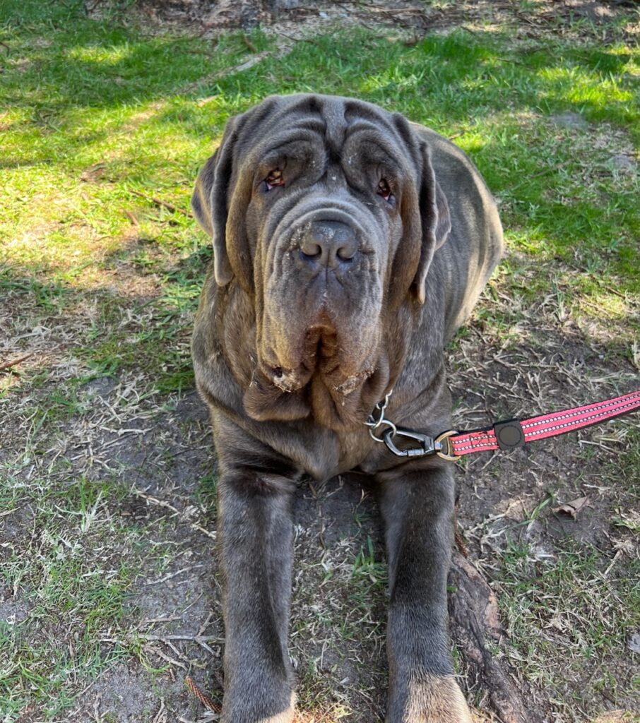
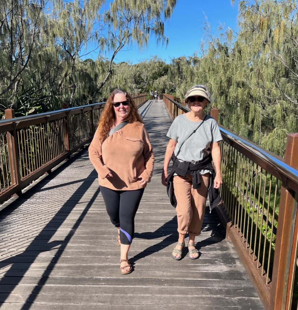
Busy downtown Noosa, trendiest spot on the Sunshine Coast !Parked up at my brother’s place in Dicky Beach.On Sunday morning walks around Dicky Beach you sometimes see the most beautiful breeds of dog – here a massive Neapolitan Mastiff. He was adorable and got lots of attention.Lois and Maree enjoying a morning walk on the seaside pathway between Dicky Beach and Currimundi Lake.
Speaking of family, we’ll soon be getting back to the excitement of reconnecting with our own children in Canada and pretty soon a much-anticipated new “family” member as well ! Brisbane is just an hour away now ( with a direct flight to Vancouver ) so we are pretty much on standby at this stage, just waiting for “the call” !
Rested up after our stay at delightful Carmila beach, the Bruce highway took us further south and on to wonderful Woodgate beach, just south of Bundaberg.. There were of course a few very worthy pit stops between the two which made for a busy and, in the end, a very enjoyable 10 days or so.
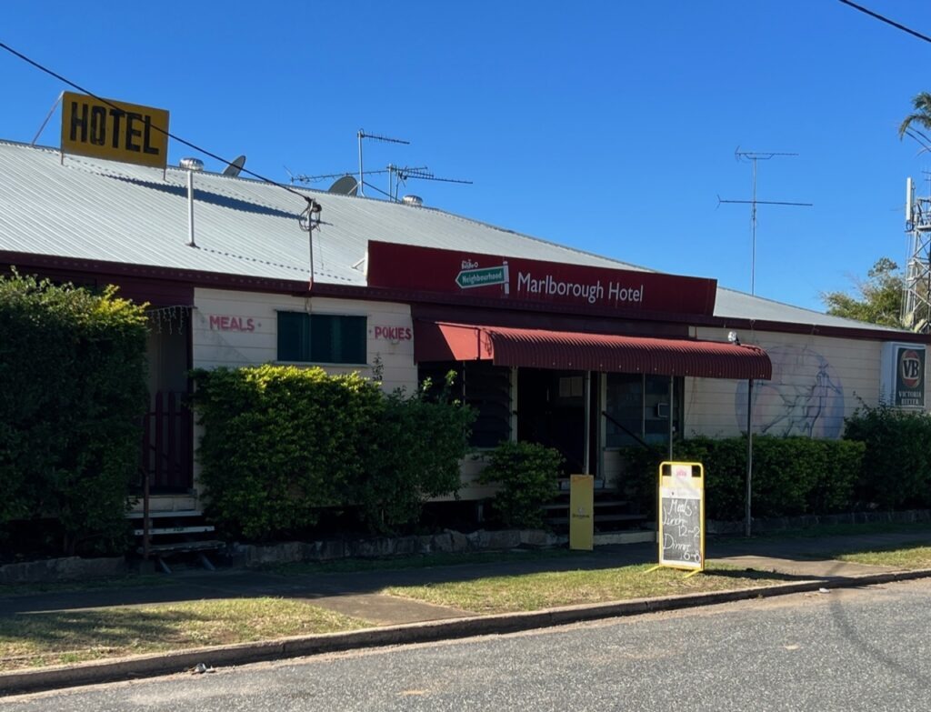
With 100% success ( to date ) pub camping, historic Marlborough ( and the Marlborough Hotel ) seemed like a logical overnight break en route south. Great food ( again ), great company and an excellent old pub with great facilities – what’s not to like ? The pubs have become one of our favourite places to park up.
Historic Marlborough Hotel.Another very popular “pub” park up – the Marlborough Hotel, Marlborough.
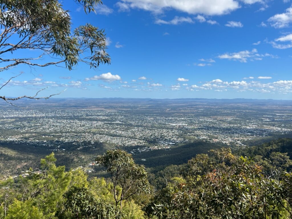
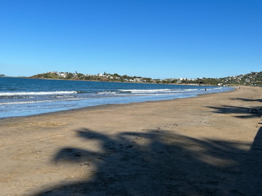
Rockhampton was the next major centre southbound – lots of history and character in its downtown and and every kind of big box store you could imagine. Nearby Yeppoon is the getaway coastal ( beach ) stop for all Rockhamptonites so we made a point to add it to our itinerary. Nothing especially famous there but a nice lookout and beautiful beach – Yeppoon is one of those places that folks from the cooler southern parts of Australia love to holiday/retire in; warm enough year round, yet lacking the brutal summer humidity that afflicts the cities further north. We could see the appeal !
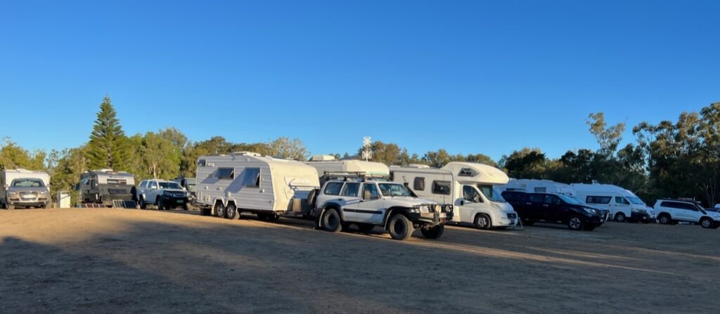
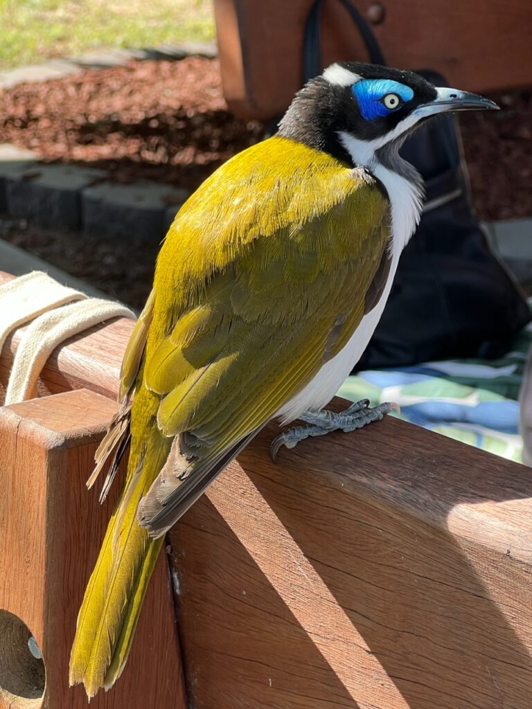
Historic ( and tropical ) Rockhampton.Beautiful Kershaw Gardens, downtown Rockhampton- The council provides free camping right beside this this park in what is one of the most sought-after park ups on the Queensland coast.Kershaw Gardens free-camping, downtown Rockhampton. Full, always, and usually by noon.Beautiful Blue-Faced Honey Eater, RockhamptonView of Rockhampton from Mt Archer NPSelfie, Yeppoon.Beach, Yeppoon.Waterfront Esplanade, Yeppoon.
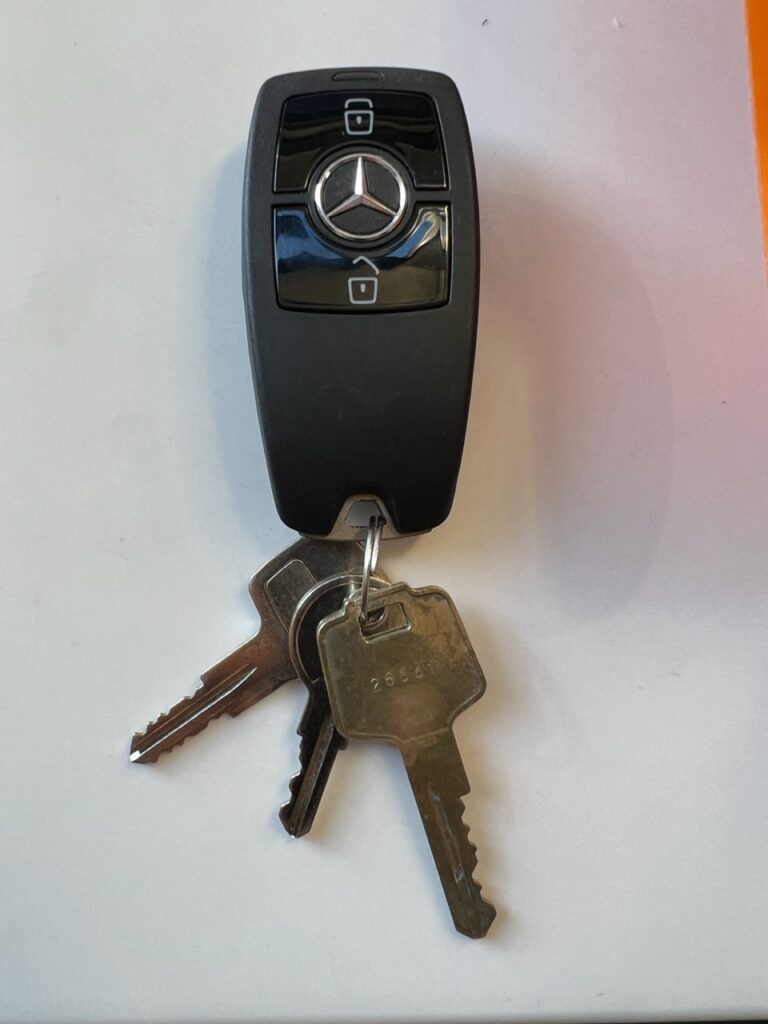
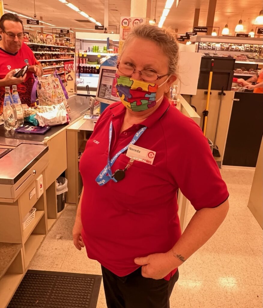
While back in Rockhampton there was a moment of sheer panic when I had somehow lost the vehicle keys while we were shopping in the Stocklands mall. Running back to the mall and retracing the steps of our various store visits initially yielded no keys. I then went to the front desk of the last store we had shopped in ( Coles ) to show the Customer Service lady a picture of my keys ( I had it on my phone for reasons I can’t recall ). She smiled, turned to a drawer behind her desk, then looked at me and said, “ Do you mean these ?”. Mercifully a kind shopper had seen them on the floor and handed them in 15 minutes before . Sadly, he’d not left a name or number so I could not reward, nor even thank, him. One of those things I’ll just have to pay forward I suppose! We are certainly crossing paths with some very kind strangers.
Our keys, recovered !!!Nereda, the lady in Coles who saved me !
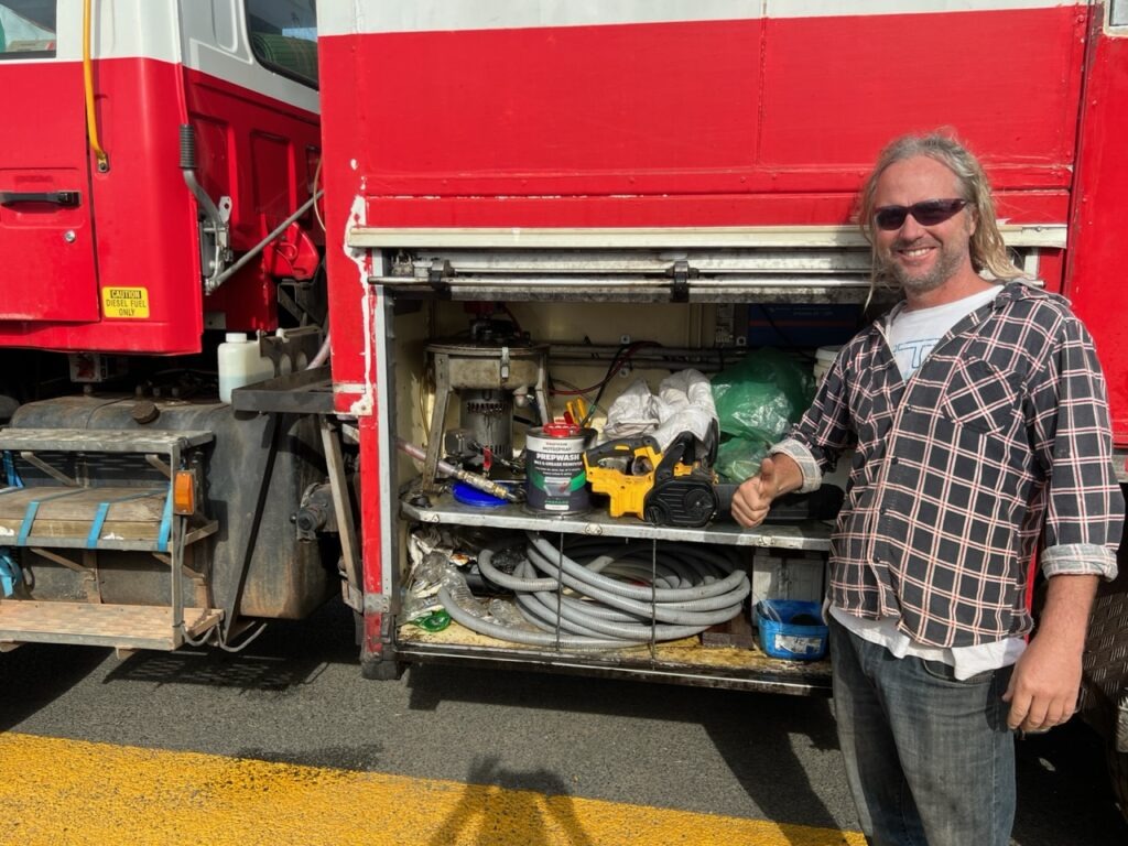
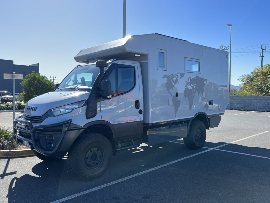
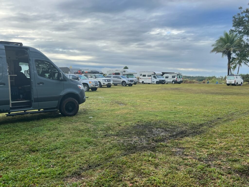
Leaving “Rocky” ( as it’s affectionately known ) we noticed an Aldi store. Needing a few supplies ( and loving their selection of discount European chocolates ) we popped in. Parked up, literally beside us, was a very European-looking overland rig ( a 4×4 Iveco Daily with custom “box” on the back). Upon closer scrutiny the rig was indeed sporting German plates and a large “D” ( for “Deutschland” ) emblazoned on the back. We’d by now been in Oz for over 6 months and had yet to spot a single other foreign vehicle (much to our surprise) especially since we had done a pretty well travelled “tourist” route. If there had been more out there, you’d think we might have seen some ! There just obviously are not as many people doing this as I had expected.
Uwe and Silke’s Iveco Daily 4×4, Rockhampton
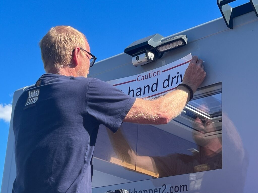
Turns out we had more in common with Uwe and Silke ( the owners ) than the fact we were both travelling in foreign rigs in Australia – we had both previously done the Pan American highway, both come in to Australia on car carriers, we had both used the same shipping line ( Wallenius ) and both had taken exactly the same route, via the US East coast, Panama and NZ. We got off in Melbourne, they in Brisbane. While we waited almost 6 weeks for ours to unload/clear quarantine they waited only 3 ( they’d only been in the country 4 weeks – perhaps it was a sign that shipping delays were improving ? We hope so ! ). We enjoyed a long chat, swapped personal details and traded tips – always a very enjoyable part of meeting others on the overland trail.
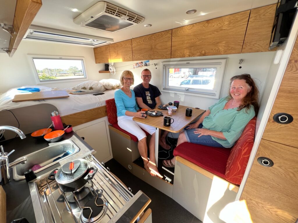
Inside. Very spacious !.Uwe borrowed my extending ladder to paste the required “Caution, Left Hand Drive” decal on the rear of his van
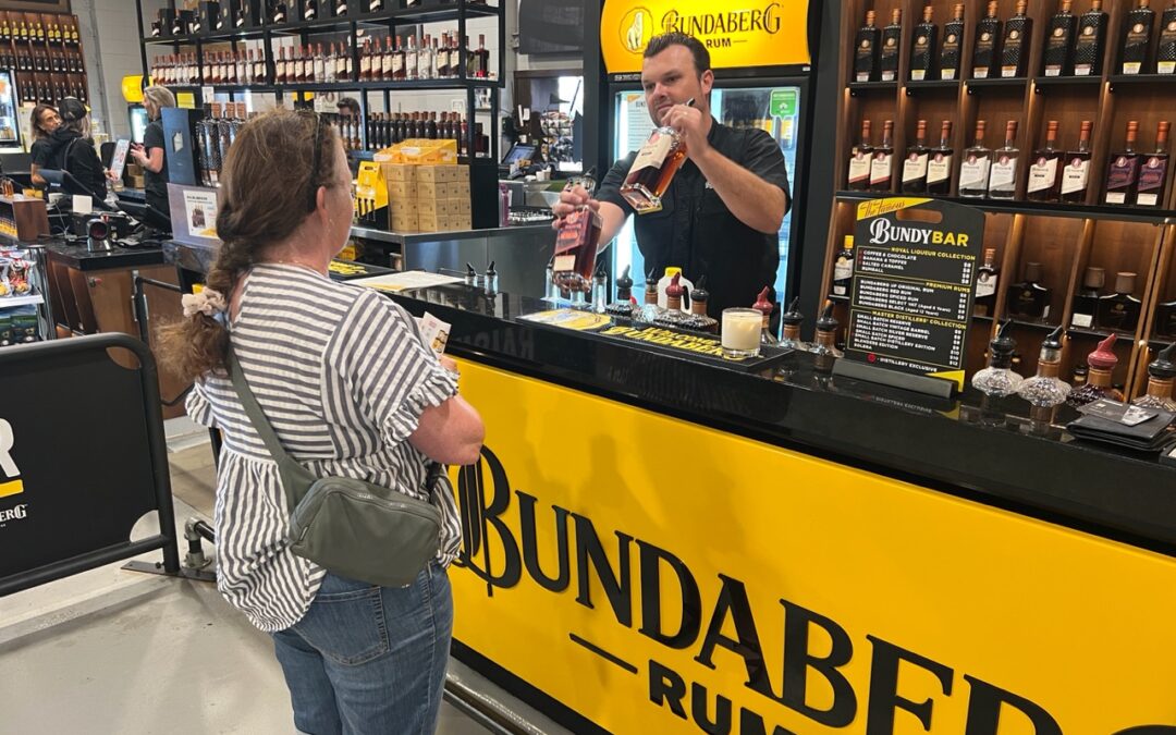
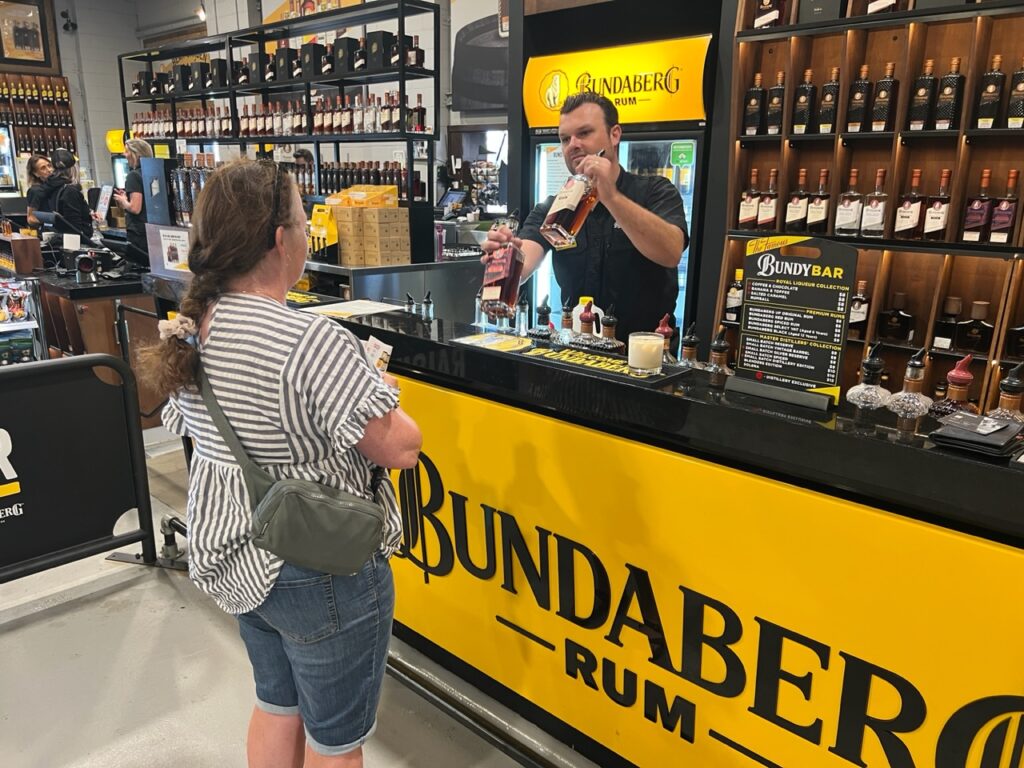
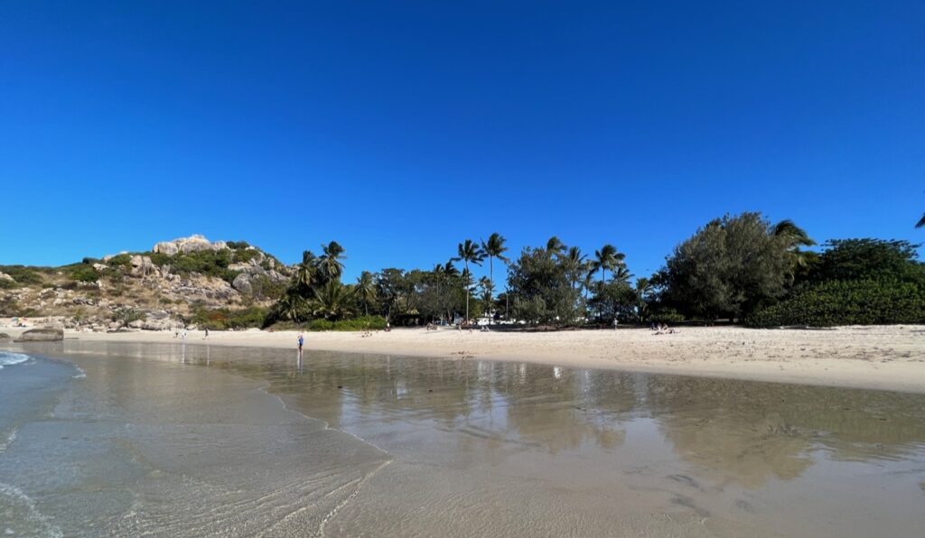
Bundaberg ( and more specifically, nearby Woodgate beach ) were places we’d been excited to revisit. The requisite “Bundy” rum tasting at the famous Bundaberg Rum distillery complete, followed by a tour of the town we headed straight out of town for a couple of days R and R at nearby Woodgate. Still as picturesque as ever but like so many places, especially post-Covid, formerly tranquil Woodgate is seeing an influx of residents drawn to its great weather, long, golden beach and quiet surf, shielded as it is by its proximity to northern Fraser Island not too far offshore.
Lois, sampling some “Bundy” rum.
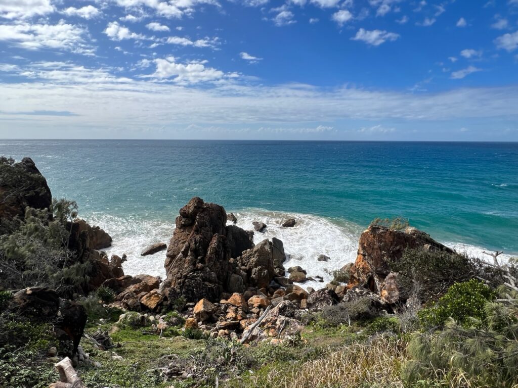
As we closed off this blog we’d made it to well known Agnes Water and the town of 1770. We’d been a bit underwhelmed by both places after our previous visit ( perhaps because they both get so much hype ! ) so decided to stop in again. Agnes has a fantastic beach ( and quaint town ) and 1770 a beautiful lookout but beyond that, unless you are a keen fisherman, or flying out to Lady Elliot island ( the most southerly extremity of the Great Barrier Reef ), there’s not a great deal to do. Despite enjoying a pretty cool eco-camp spot this time around, our second visit probably didn’t much change our first impression – definitely “nice” but plenty of spots in Queensland we liked better.
View from 1770 coastline.1770
With popular Hervey Bay literally just down the coast, we are pretty confident that next week’s sights and activities will offer more things to our liking. I’m promised a surprise by Lois – who knows what awaits ???
Till next week….
Postscript : Some Lucky Breaks
Occasionally you look back and think how lucky you were ( or were not ) to be at a certain place at a certain time, and two such instances recently came to light.
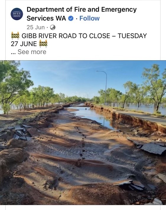
The Gibb River Road would normally not be closed in June but this year unseasonal heavy flooding caused the road to be cut making for extraordinarily long detours for those caught up in it ( news alert below): very glad we got through ahead of the closure – it’s a looooong way to go to have to turn back !
Lucky we travelled the famous Gibb River Road in May/June. Last week we heard that unseasonal rains had closed the road in the middle of high season. The road was just destroyed – shows how difficult it is to maintain these outback roads.
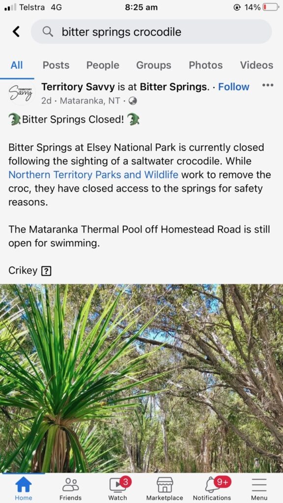
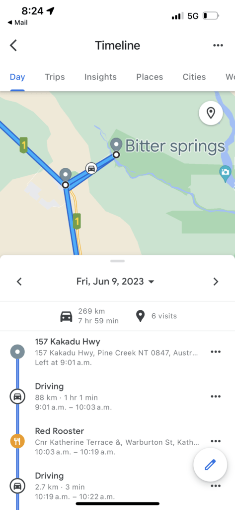
In the second, a saltwater crocodile ( yes, those are the nasty ones ) was recently spotted in the Bitter Springs thermal pools at Mataranka ( NT) forcing their temporary closure. It’s a place that’s normally full of tourists and school kids, some of whom were there at the time. We’d been there ourselves just a month or so ago so the news of the sighting and immediate closure struck pretty close to home. We’d always wondered how officials knew that “salties” were in some places and not others – clearly there’s a bit of guesswork in that. See story below ( we actually pulled up our GPS tracker to confirm we’d swum in those pools and not the other Mataranka hot pool – indeed we had !).
Saltwater crocodile sighting in popular tourist thermal pools.Yep, it was the one we’d been swimming in !
With only a few weeks to travel before a planned (northern ) summer break back in Canada, the weather app has taken over as our “compass” of sorts. Simply put, our aim was to maximize the hot weather at a time when both the season and direction we were headed would be gradually putting more cooler stuff in our path.
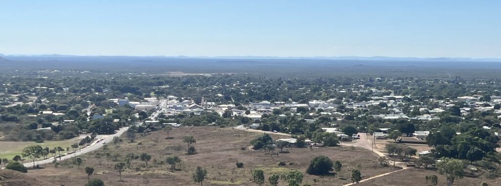
Our recent travels.View of Charters Towers.
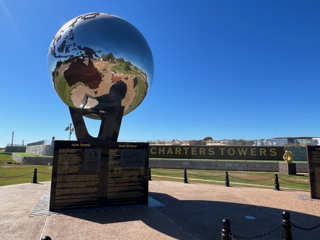
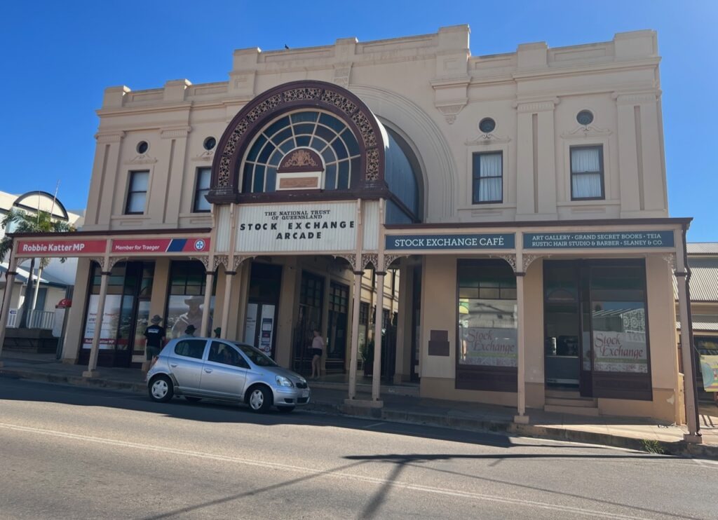
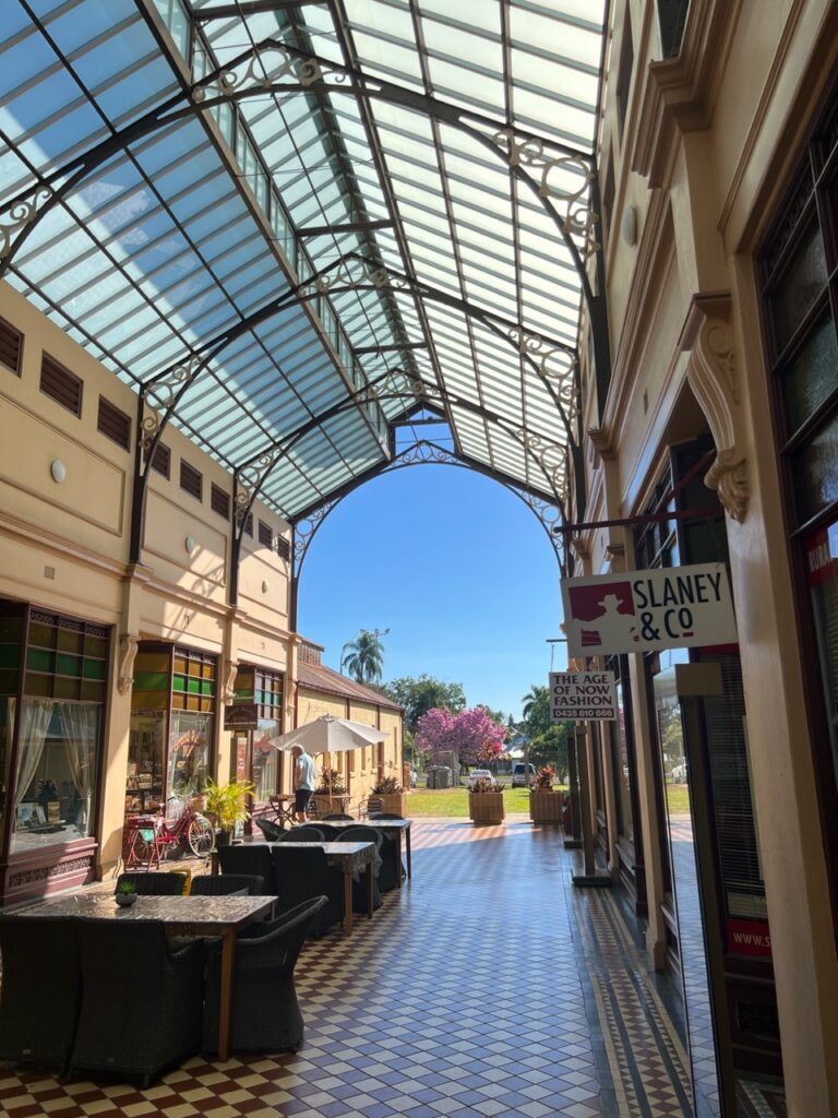
Prior to following the Bruce highway south, a short detour was made ( west) to the old gold mining town of Charters Towers. It met the “hot” test and the “historic” test – fortunes were made and lost in this town during the gold rush era ( and it still emanates affluence today with three large active mines driving the local economy ). Who would have known ( we didn’t ) that this small town once had its very own stock market ! The town is vibrant, prosperous, the locals super friendly – and it has one of the best visitor centres we’ve been to.
Back in the day Charters Towers was among the world’s top gold producing areas.There’s an impressive park that showcases its importance at that time.The classic old building that once housed the Charters Towers Stock Exchange.Much of the building has been tastefully restored.
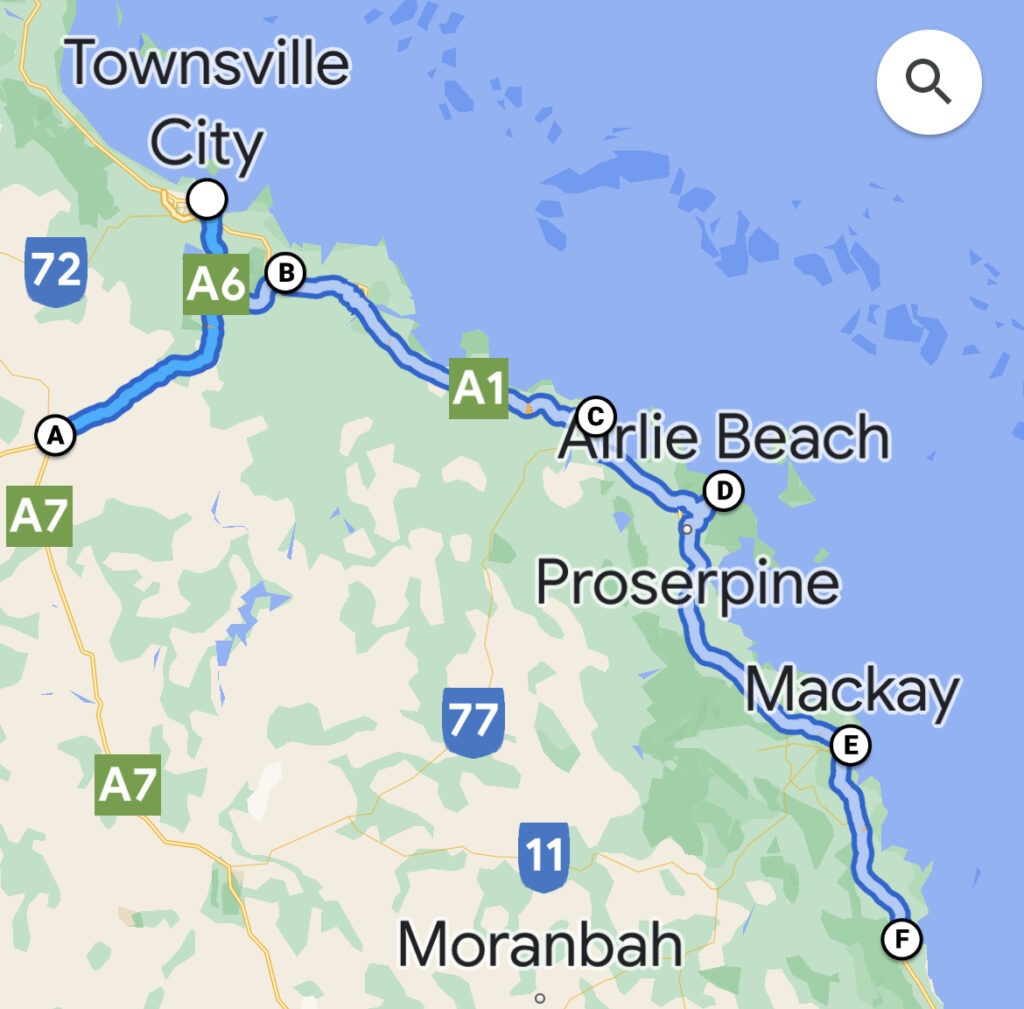
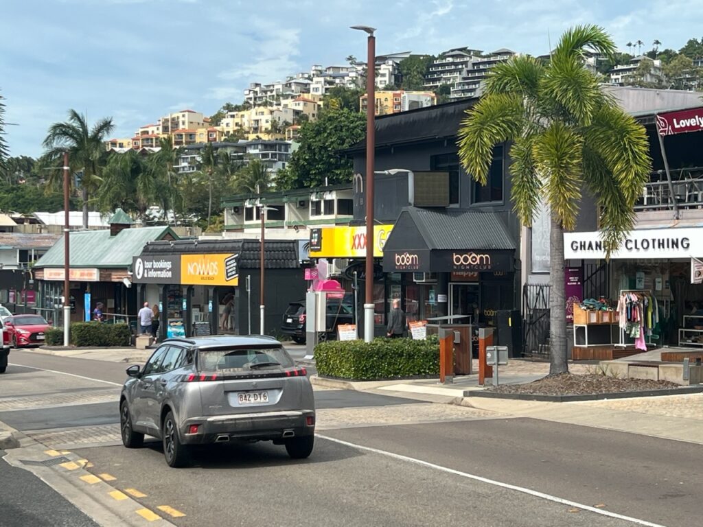
Ducking back to the coast our route took us through Bowen ( one of Queensland’s most under -rated coastal towns ), Proserpine, Airlie Beach in the Whitsundays, and then on to Mackay. The good weather held for us in Bowen but by Proserpine the clouds were gathering and we only got an afternoon of the good stuff at Airlie Beach before the rains came. And came. And came ! Not “supposed” to be rainy season but there are exceptions to every rule. This was the exception! Disappointed with the Whitsundays weather, especially, since it meant our hopes of taking the tour boat out to pristine Whitehaven beach were dashed thus missing it’s main attraction- in three visits to this immensely popular town ( two in high season ) we have never had a clear run of weather . Perhaps we’ll get better weather further south, where we hope to get to stunning Fraser Island.
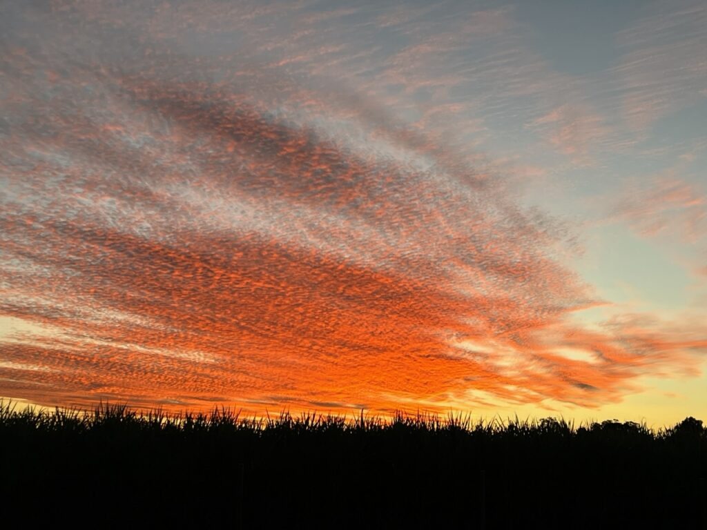
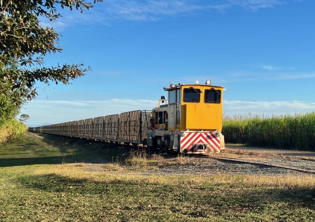
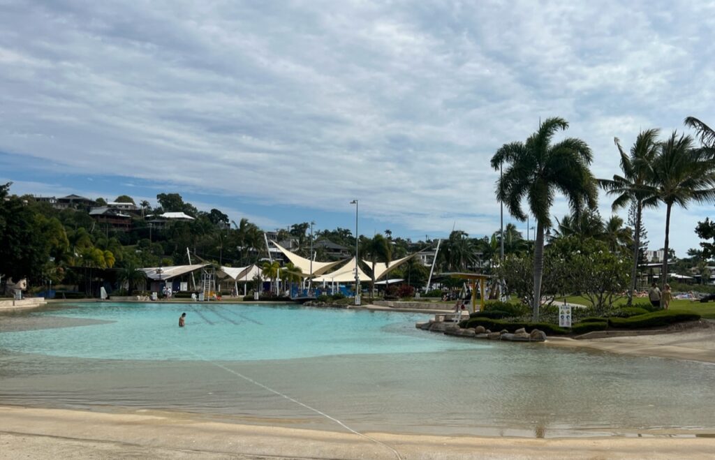
Tranquil Horseshoe Bay beach, Bowen.A little relax time. We have found some of the nicest cafe’s on the coast- here at one in Bowen. Looking for nice coffee shops has become part of our regular routine.Arrived in Proserpine in time to catch an unusual sunset….….and one of these unique little sugar cane trains passing our campsite the next morning.Downtown Airlie Beach. It’s become a trendy spot.Airline Beach’s waterfront “beach-like” public pool. Clouds were already coming in.Airlie Beach is a great spot but we can never seem to be there when the weather is good. We arrived on a Sunday afternoon – nice, but did not love it enough to wait 4 days for the weather to turn, and then only modestly for the better.Camped near Airlie Beach. Miserable weather !We had this for a couple of days on and off. Could not outrun it.
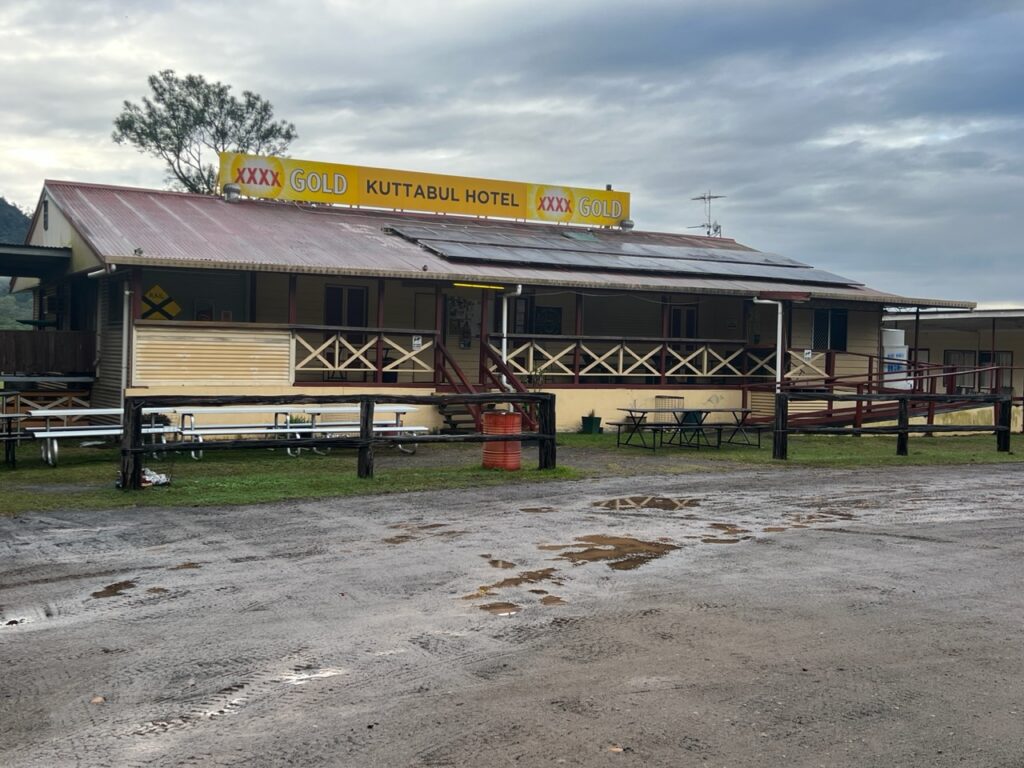
During the week we added a few hundred kms to our trip, exploring as we went, and, as always, looking for interesting park-ups ( camp spots ) where we could. We have had some wonderful (and memorable) ones on our travels – one such was the Kuttabul Pub just north of Mackay. Hugely popular with campers, it was a great layover with some of the best pub food we’ve tasted – very much living up to its reputation. “Pub camping”, as it’s known, is very popular right across the country – stay free as long as you eat/drink at the pub.
Approaching Mackay the rainy weather was still with us. Camped here at the legendary Kuttabul Hotel.Humid, colder, and soggy ground – when camping is no fun. Kuttabul Hotel.
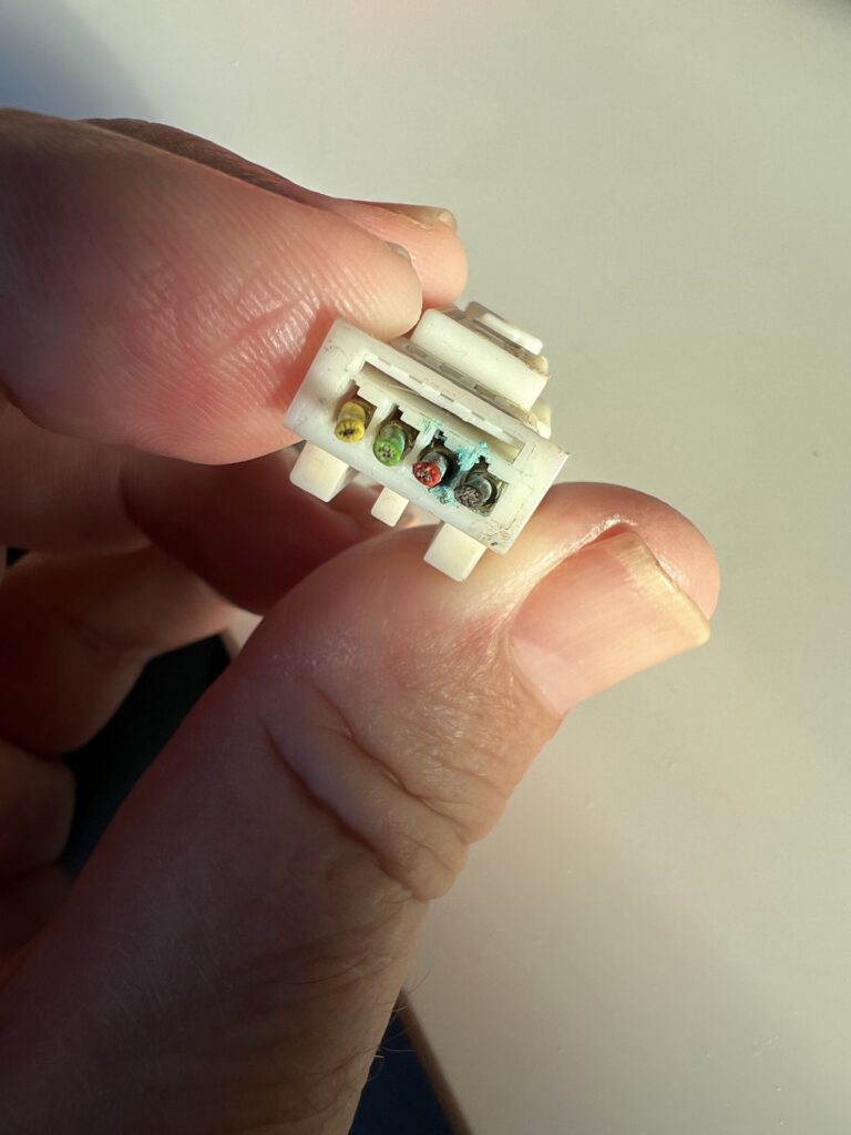
Waking up to a miserably wet morning, about to depart we had a moment of sheer terror as all the instruments on the dash of the van went blank. Like……BLANK. Not a single thing illuminated as the van was started. It started, fortunately, and we drove the 40kms into nearby Mackay very nervously as it alternated between complete darkness and then suddenly lighting up like a Christmas tree. Fortunately, there was a Mercedes dealer in Mackay, which we made our first port of call. They helpfully saw us on the spot and initially suspected a rodent had nibbled through a wiring harness ( usually a VERY costly and non-warrantable repair). We feared the worst.
Leaving the Kuttabul Hotel for the 40 km drive to Mackay, we had absolutely no visual display on the dash – at all ! An eerie experience. We were probably doing about 90km/h at this point but no way to tell !That neither sounds, nor looks, good ! Yikes !!!!! The dash display briefly came back to life as we arrived at the dealer in Mackay – the look on the technician’s face when he first saw this did not bring us any comfort ! After Cape York we did NOT need this kind of drama.
A few hours of nervous shopping later a call came from the Service Manager – fortunately a very simple problem ( a failed seal had allowed moisture to penetrate an electrical connection – which is warrantable ) with a simple solution ( reconnect with new pins and replace the seal ). All good and we were on our way the same day. A huuuuge relief …!
The culprit !
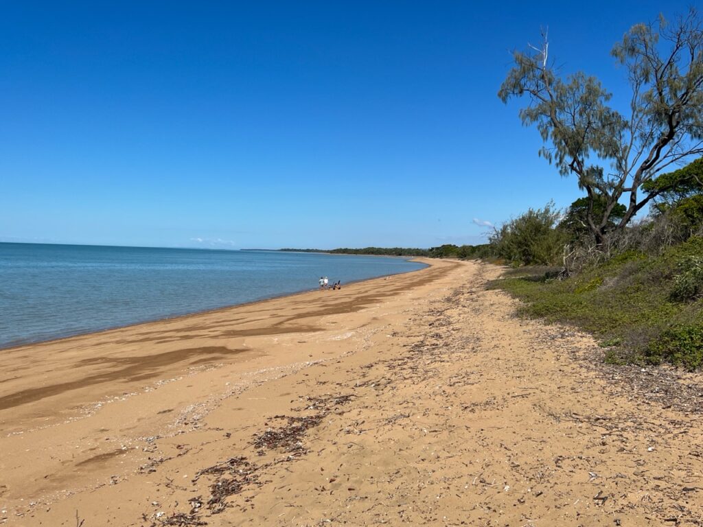
The dash drama behind us, weather now improving we decided to find a beach and just “chill” for a couple of days. Nearby Carmila beach filled the bill nicely – a beautiful, calm spot with few people around. Exactly what we needed. Heaven…!
Beachfront camping, Carmila beach, just south of MackayCarmila beachCarmila beach.
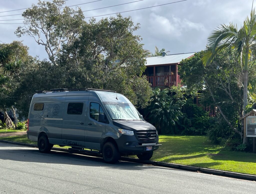
The PanAm completed in April, 2022 and with the truck camper sold, we shipped our new Sprinter van to Australia in late 2022. We travelled there through all of 2023 and into 2024 before shipping it up to North East Asia where we travelled for 4 months between Korea and Japan, before shipping it back to North America. It’s our plan to continue exploring the world in 2025.