
Inari ( Finland ) is only a short hop across Hwy 92 to the Norwegian border at Karasjok. From there it was only a 4 hour drive to the very top of Europe – to some a mystical place, to the Sami people of this region a place of spiritual significance, and to many others ( like us ) simply the remote and foreboding far northern extremity of the continent. We had waited decades for this moment, and here it was just a few hours ( mind you, some very nail biting hours ! ) drive away.
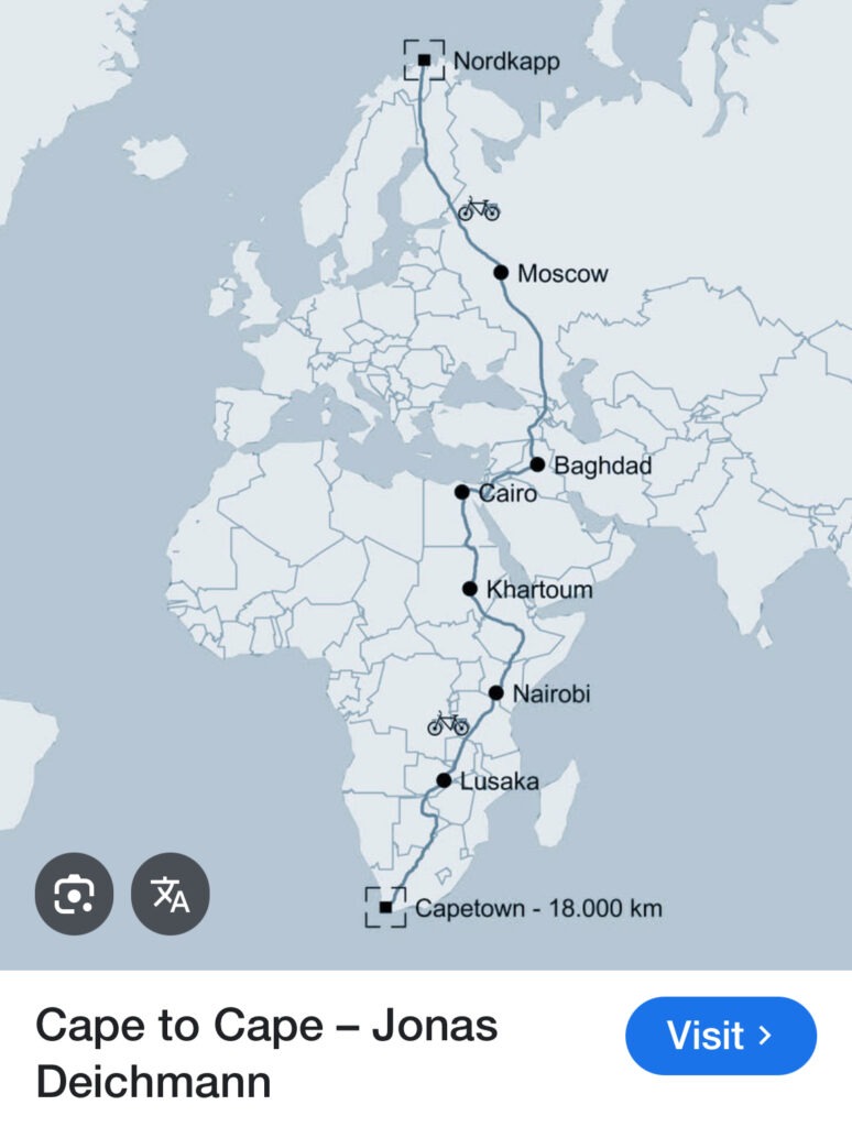
If I’m entirely truthful, the magnitude of the moment was still a bit less than it should ( and could ) have been. Rather than starting in Canada ( as we did ) we should have been starting in Cape Town ( South Africa ) and completing the grand daddy of all overland treks, the “Cape To Cape”. Alas, a global pandemic and a few inconvenient African civil wars put paid to that ( it was to have followed our PanAm adventure back in 2020/21 ). Such is life. But hey, it’s been a heck of a ride from our home in Kelowna, to Baltimore, to Hamburg and on through mainland Europe and Scandinavia to get this far and we are truly excited about this day we’ve looked forward to for so long.
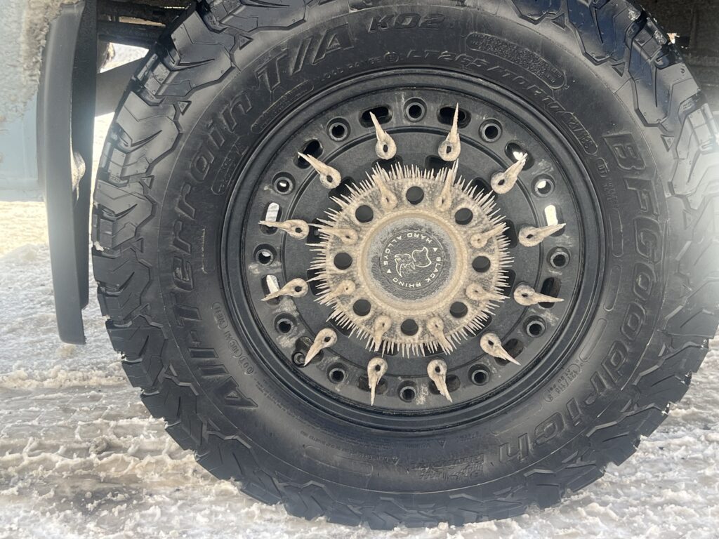
By northern Finland we were already into heavy snow conditions, sub-zero temperatures, howling winds and we knew this last stretch would throw all that at us and more ( narrower roads, icier surfaces, and more challenging visibility) but with our 4×4 set up, good ground clearance, and heavy duty all- weather tires it should not present us any problems. And, with our inside creature comforts we’d be comfortable doing it. The fact that we were in the ONLY vehicle up here without studded winter tires was a tad disconcerting😳.
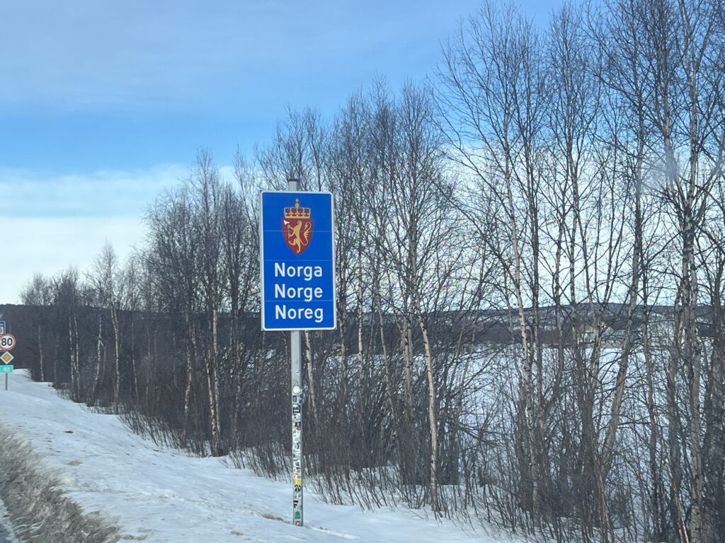
The run to the Norwegian border was uneventful and while we were not required to stop at the border ( a Schengen benefit ) we did pull up and take the time to talk to the very friendly Norwegian customs and immigration lady. Same question we had fired at the Finn’s when we arrived in Helsinki – was there any way that we could use Canada’s historic bilateral visa agreements with the Scandinavian countries to circumvent the limitations of the 90 day Schengen visa rules which all three of these countries now subscribed to ? In short, as polite as she was, she could not deliver the news we wanted. No, after 90 days in Europe, we had to exit one way or another. End of story. Hey, we tried.
Having somewhat anticipated this we had moved a little more quickly than we would’ve liked in this first month in order that we had a little more time up our sleeve at the back end and this last bit of bad news from the Norwegian’s only confirmed to us that the strategy had been a good one. At least it now left us with what should be enough time to do what we wanted to do in the first 90 days- if perhaps at the cost of arriving here in northern Norway just a bit sooner than would have been ideal. So far, no weather issues but this would be the tough stretch.
The biggest difference between Finland and Norway is unquestionably the mountains. As in, Finland doesn’t have any and Norway is absolutely covered in them ! Big, beautiful, high rocky ones, some of which we had to cross to get to Nordkapp. That was one concern. The other was just the extreme latitude and remoteness ( hundreds of kilometres north of the nearest town of any size ) and of course now well above the Arctic Circle. Just how far ?
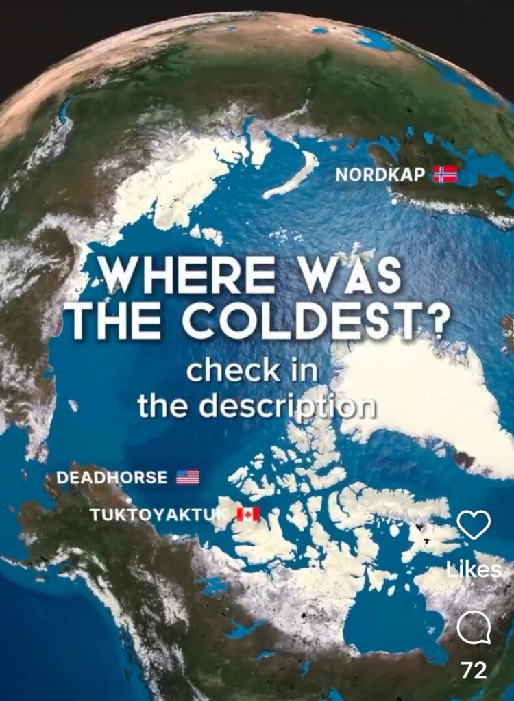
I googled Deadhorse, in Alaska, and Tuktoyuktuk, in Canada’s NWT – the former at approx. 70 degrees north and the latter at just over 69. At Nordkapp we’d be well over 71 degrees. So, way, way, north – officially farther north than we’d ever been in our lives. A few years back the BBC did a story on the E69 ( the road to Nordkapp ), an interesting read (here).
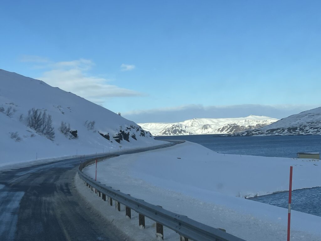
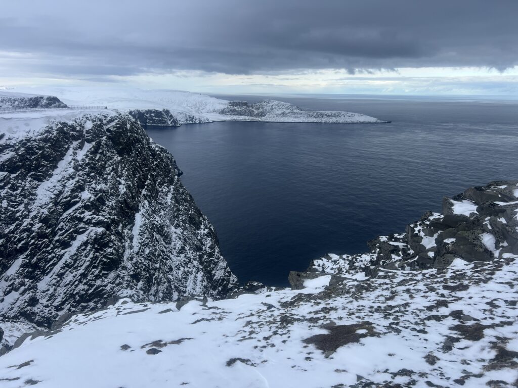
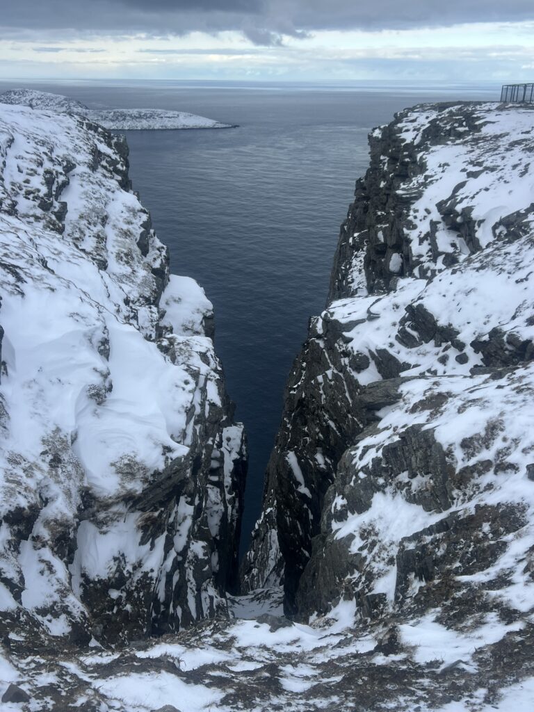
As we saw the terrain change once in Norway it started to actually feel more remote. Fewer vehicles, the roads narrowed, the roads were in parts completely snow-covered and of course we had long since stopped seeing any trees. It was, in places, almost lunar-like.
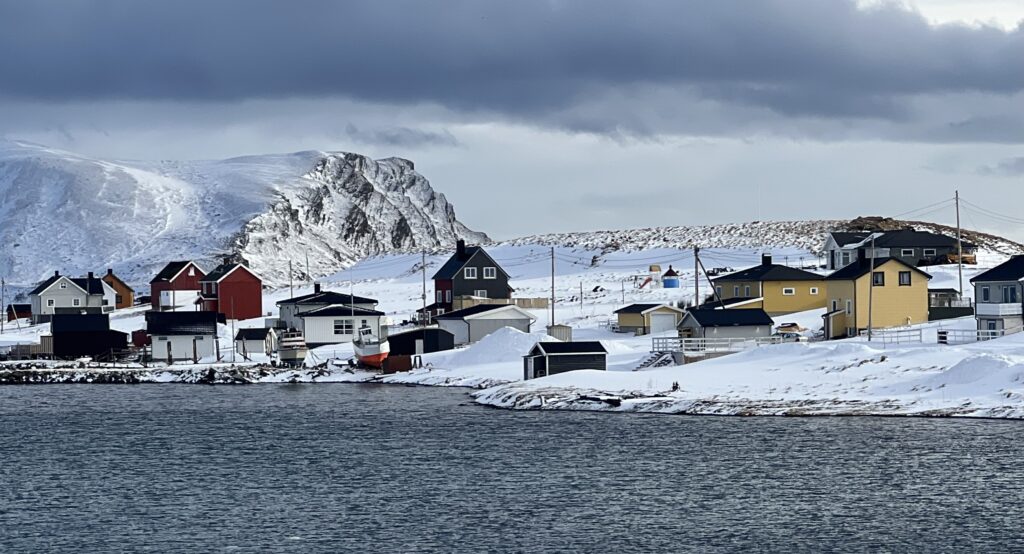
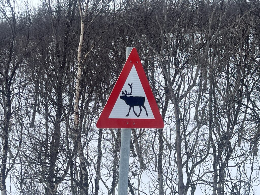
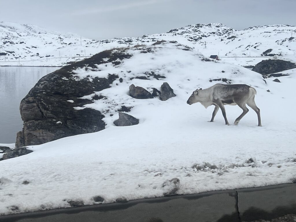
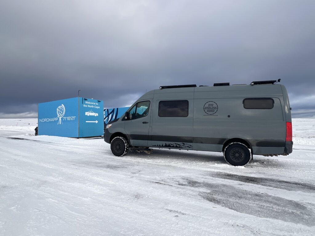
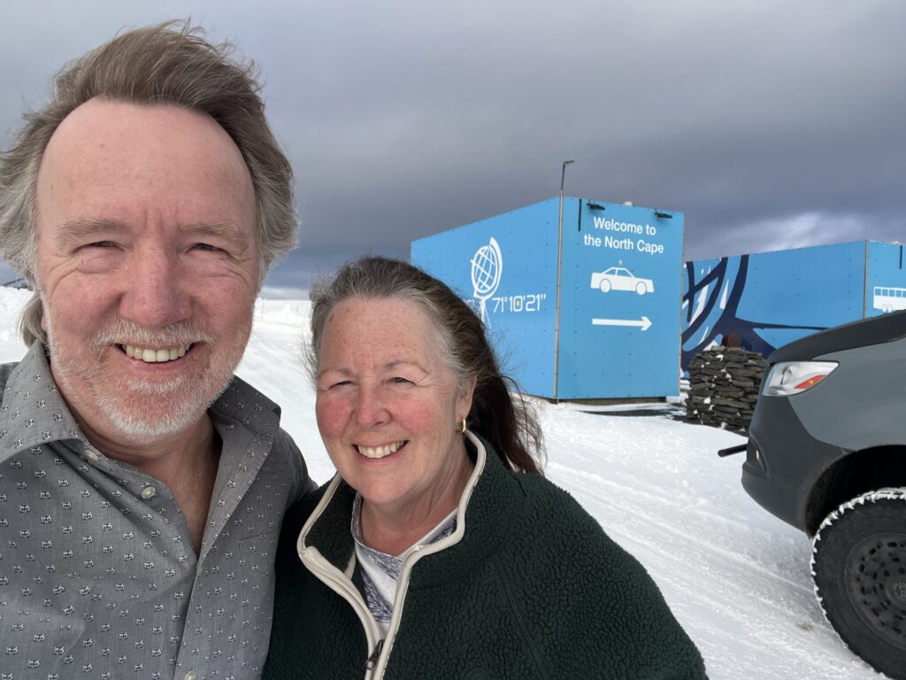
Nordkapp actually sits on the island of Mageroya which is connected to the mainland by a tunnel almost 7km long. It’s long, and DEEP – it actually goes under the seabed. Just another bit of eeriness to add to the moment. We passed the sheer sides of fjords, more ( shorter ) tunnels, some small remote settlements and then the last town of any size- Honningsvag. There were now countless reindeer warning signs ( but no more moose warning signs – they are smart enough not to come this far north it seems ! ).
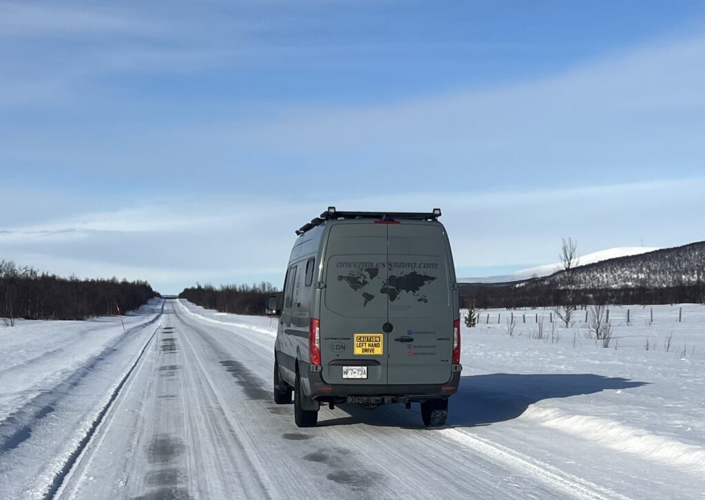
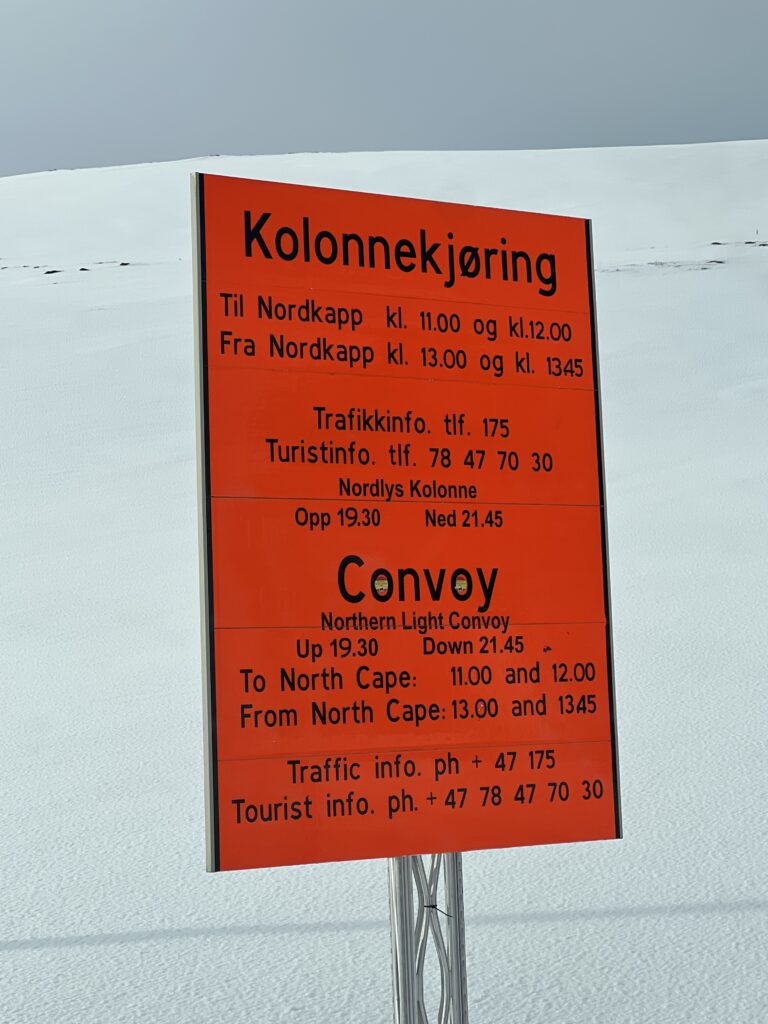
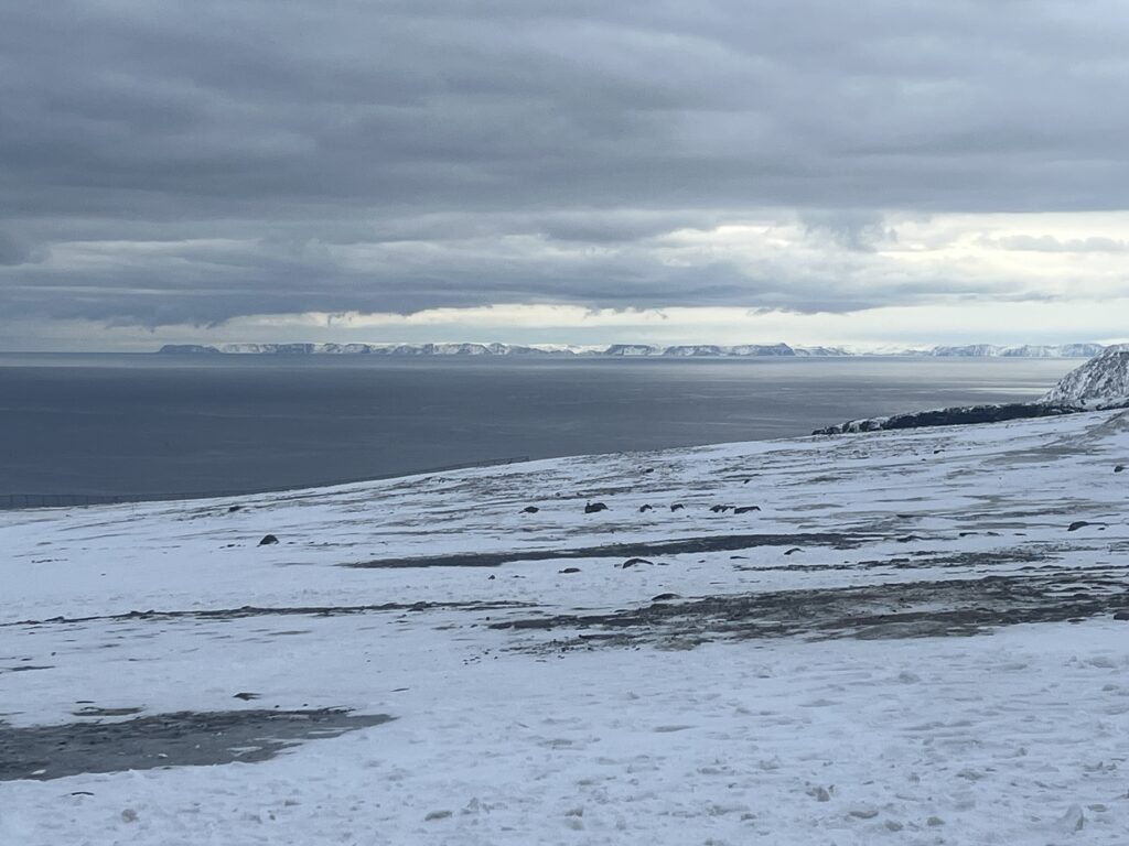
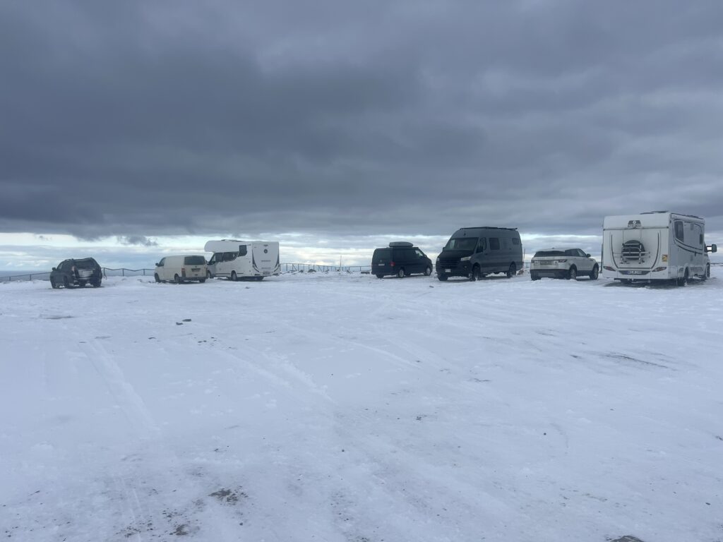
Just outside Honningsvag is the turn-off for the final run to the top – and a warning that we may need to join a snowplough “convoy” which goes only twice a day. The road seemed ok at this point although snow was in places banked up almost 2m high on the road sides, at times making it seem like we were driving in a tunnel with no top. “Fortune favours the brave”, it’s said – we’d come this far without assistance, we’d go it alone.
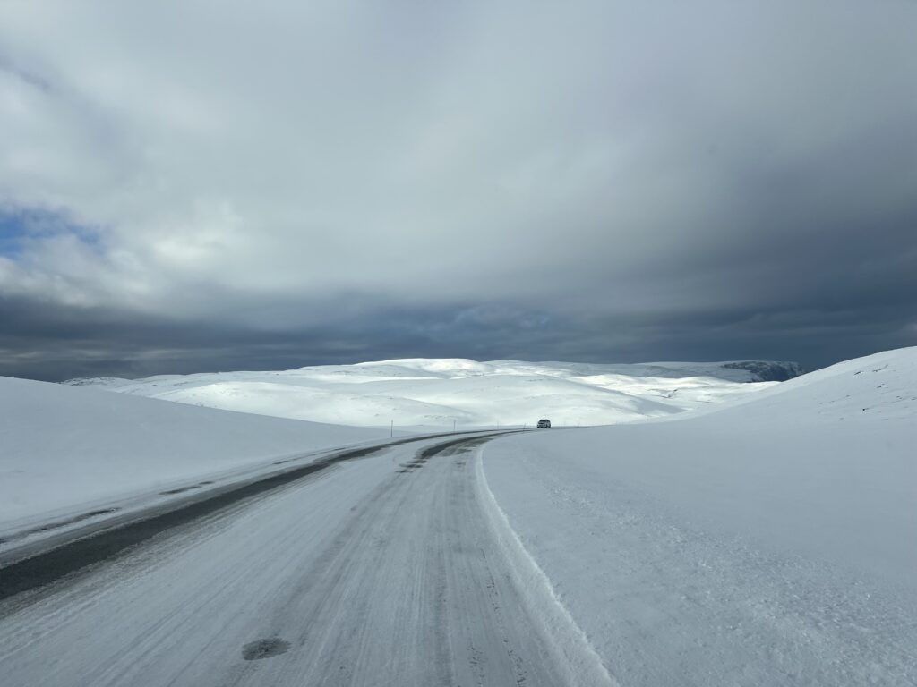
Apart from some steep climbs and descents, some slippery ice here and there and fairly continuous snow drifts, the last 20kms was actually not too bad. Slow, very narrow in places, and with 4×4 engaged all the way to maximize traction, but at no point was it frightening. We had noticed as far back as Helsinki that almost all the vehicles here at this time of year have studded tires and certainly all vehicles this far north have them. We do not since they would be terribly impractical for the other 95% of our journey, but it does mean that we have to exercise. an extra degree of caution on the icy roads up here. Some of the campers did not have 4 x 4 but they ALL had studded tires – and frankly, in these conditions, the studded tires would offer a lot more safety and security than any 4 x 4 system.
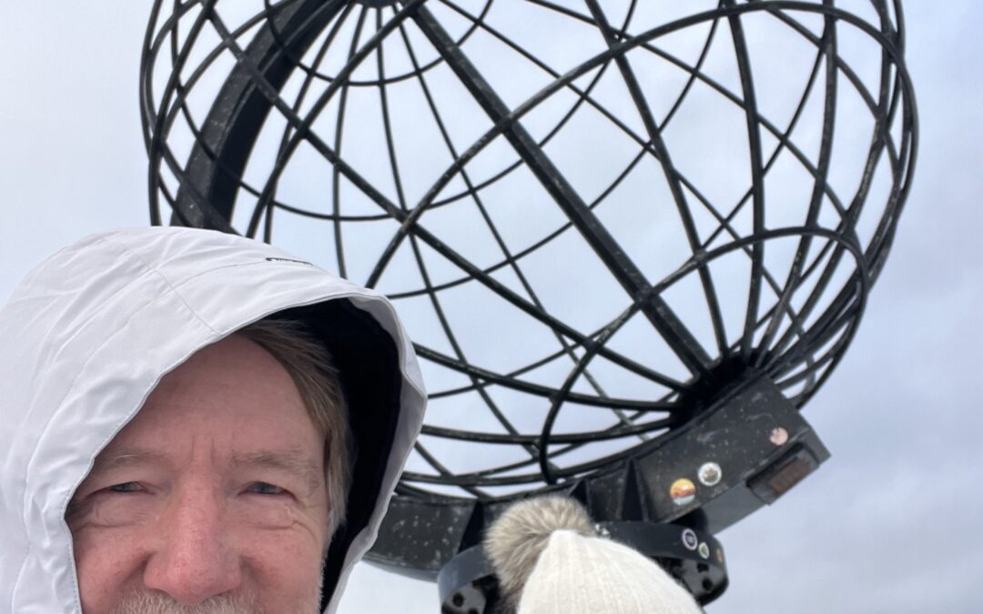
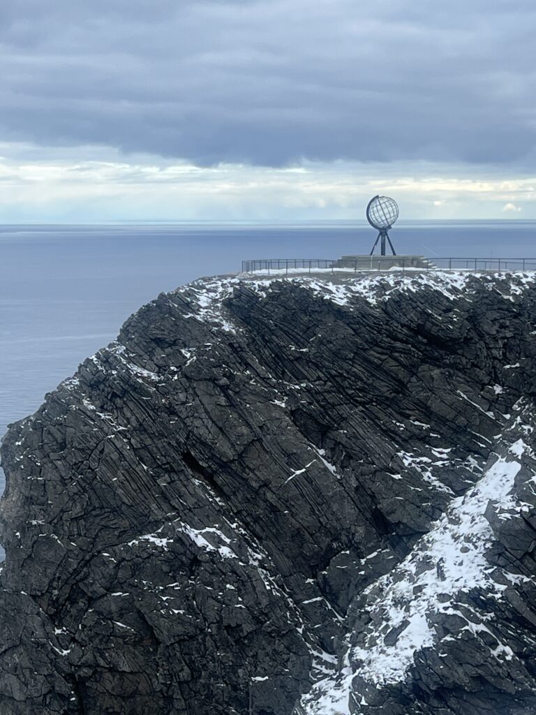
Just after lunch time we could see the unmistakable dome that marks the Nordkapp centre and we pulled in joining the dozen or so vehicles ( most were campers ) already there. We had made it – and I had won a bet. At one point a couple of days before Lois said, said “Jeff there’ll be no one up there at this time of year. There’s no one crazy enough to do it”. She agreed, reluctantly, that nine vehicles counted as just a few more than “no one”, and, like me, began to just soak in the moment – here we were, finally, certainly as far as “drivability” goes, pretty much on top of the world. It felt good, very, very good.
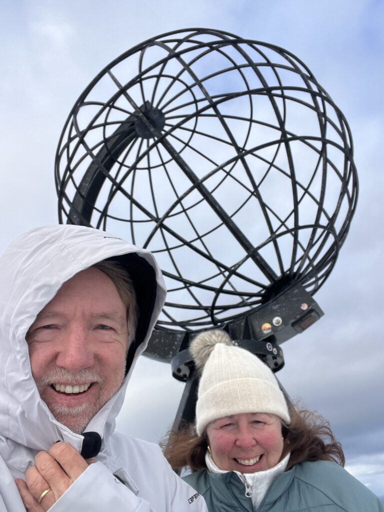
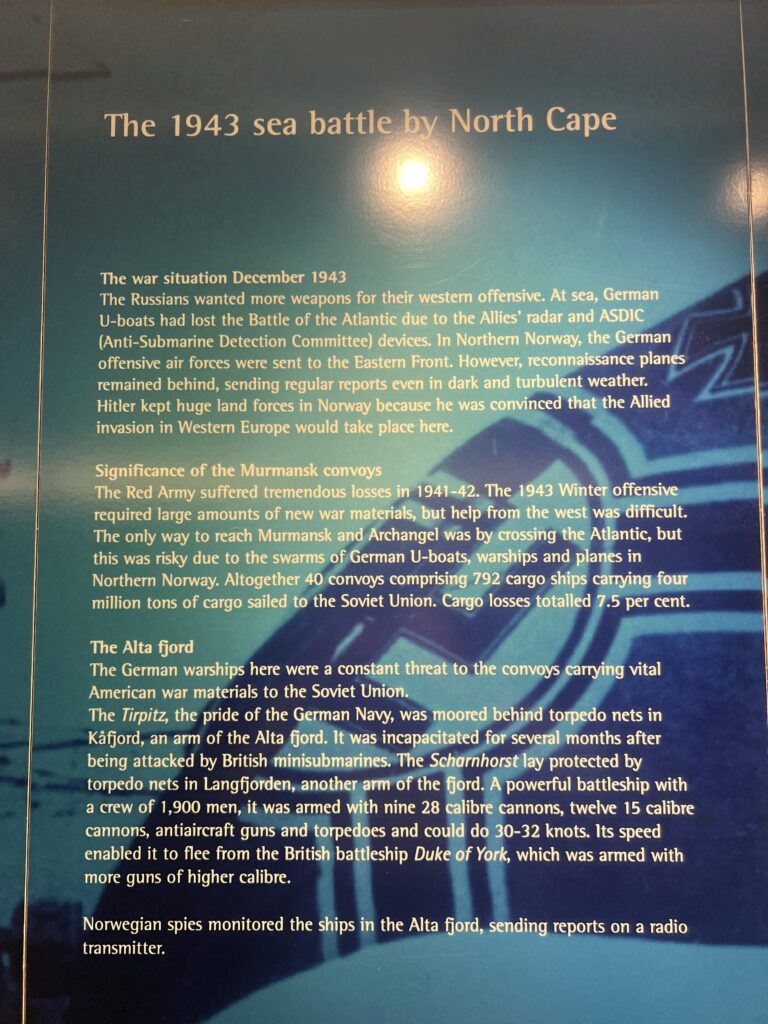
So, you’re here now, you’ve made it to one of those milestone places you’ve long thought about – what’s to do ? Well, much more in summer than there is in early spring, but but there are various monuments to explore sculptures, a museum, a very nice restaurant, a cinema telling the story of North Cape, and lots of history around the place that speak to its early discovery and the many famous people who have come this far. Folks with any interest in World War II history will probably be aware that just off the north Cape a very famous battle was fought between the German and British Navy that resulted in the sinking of the great German battleship, the Scharnhost, and there is a gripping story of the cat and mouse naval manoeuvres that led to it.
We had a full afternoon taking in all that and chatting with others, congratulating ourselves on the achieving of getting here. There was also one unexpected gem – a huge pod of whales passed the cape as we were taking our pictures. Conditions were bad, light was fading and snow was falling, and as we were up so high the whales were far far away. The still pictures just did not turn out as it was very difficult to focus on what looked like small objects on the ocean surface however, the short video I shot clearly shows a couple of the whales surfacing and the spouts of water they created. The holy grail is to be at Nordkapp at this time of year and observe a beautiful aurora borealis ( northern lights ) display – too much cloud on the night we stayed, so we missed that but took the whale sighting as a good consolation prize.
Like most who make it up there in a camper vehicle we spent the night and toasted with a celebratory drink and dinner we’d prepared. Interesting sidebar – we were the only camper van there that wasn’t from Germany, Nordkapp obviously being very high on German travellers’ bucket lists. It then occurred to us that we may possibly have been the only Canadian campervan that’s ever been there !
So, now to head south – the days will get longer, the weather should get warmer and we still have so much of Norway’s beautiful coastline to explore. We are looking forward to it.
Till next week……
Fascinating! Tirpitz, the sister ship to Bismark. You might be close to the test site of ‘LA bomba’!
lol…! Stay tuned next week for a rather frightening repair saga that was, curiously enough, related to the Tirpitz !
Great to learn of your off Season travel to the top of Europe. As one living in Southern Norway the High North has an atteactiveness we reserve for Summer. You show the broader picture. Looking forward to the continuation.
Yes, Ole, it would certainly have been easier in summer, though not half the adventure !And, we got to avoid the crowds this way …😊😊
Another addition to our list! You were brave to go without winter tyres….
Well, they are “almost” winters, known, ( in North America anyway ) as All Weather tires. Pretty much the only practical option when ranging as far (both geographically and seasonally ) as we will be. Great trip in your new rig !
Wow – What an epic trip up north. Congratulations on another achievement ticked off your list. Very interesting reading indeed – but not on my bucket list – I’m certainly not into cold! We haven’t done a winter in 25 years.
Well, we try to avoid them, too, but this was a special exception 😊
Absolutely well done!
Thanks, Garth !