
No matter where one looks around the globe, there’s a “highest”, “lowest”, “furthest south”, “furthest north” ( and so on and so on ) place that folks want desperately to visit. Australia is no exception and of all points on the compass the big one is indisputably the road ( in many parts barely a track ) to the very tip of Cape York – the furthest northerly point on the Australian continent. Having completed a north to south crossing of the Americas it seemed logical enough that, in addition to a “full lap” around the Australian continent we’d at least attempt Cape York while we were this far north giving us a shot at adding the southern extremity later when we revisit southern Australia. In for a penny in for a pound as the Brits say, the decision was made: bring on Cape York!
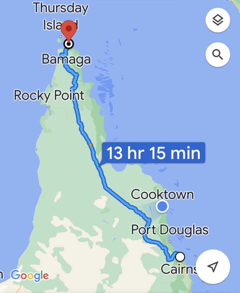
Having arrived in Cairns the week before, and with our sightseeing and resupply done, we felt ready to begin the trip. Critical in the planning process was to beat the Queensland school holidays ( and we had, just ) at which point the track becomes very busy, badly torn up, and vehicle access to the point ( the very tip, or “Pajinka” as it’s known locally ) can actually be a real challenge. With a 1,000 km + drive ahead of us we did not want to be following any more vehicle dust clouds than absolutely necessary and we obviously wanted to be able to drive absolutely as far as possible – ideally, all the way to Pajinka. Like most, our preference was to push hard early, go direct to the top, then meander back down making time for at least a few of the many side tracks that branch off the main north-south route ( officially known as the Peninsular Development Road, or PDR ).
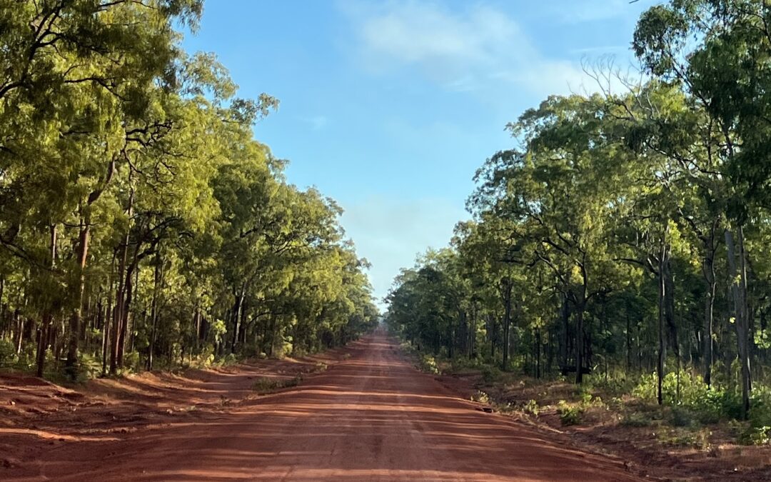
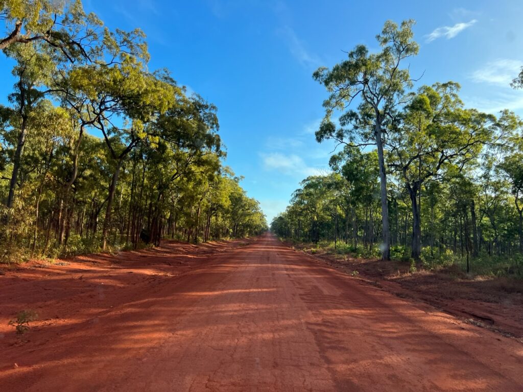
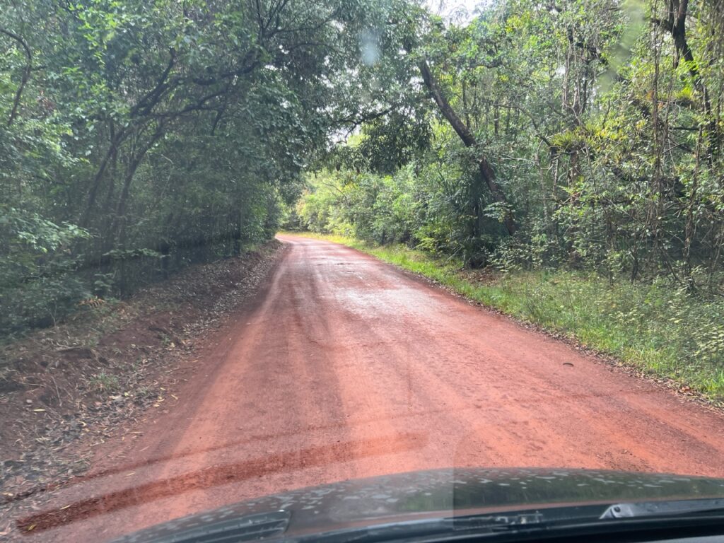
Heading out of Cairns one first passes the coffee producing town of Mareeba ( heaven for Lois ! ), before reaching Lakeland and then on to Laura. This first part is uneventful, a decent road, and the surface is all bitumen. From Laura on, the gravel begins although there are short stretches of bitumen here and there all the way up ( “teasers”, we started calling them ).
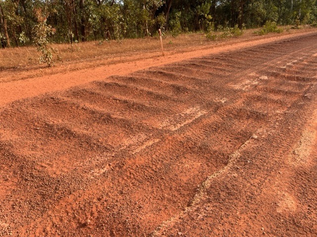
It’s fair to say that many parts of the gravel sections are actually in very good condition – better, in fact, than we had expected. What’s also true is that there are significant parts that are in atrocious condition. If the Oodnadatta Track and Gibb River Road had introduced us to some of the country’s most brutal corrugations ( both wide and deep ), the Cape York PDR was right up there with them in terms of severity ( if not, perhaps, in terms of continuity ). You’d come upon them suddenly, without warning, often hidden by tree shadows crossing the track. We’d slow down anticipating bad ones only to realize there were none, then get caught unawares feeling them when you could not see them. The drive was quite stressful as a result.
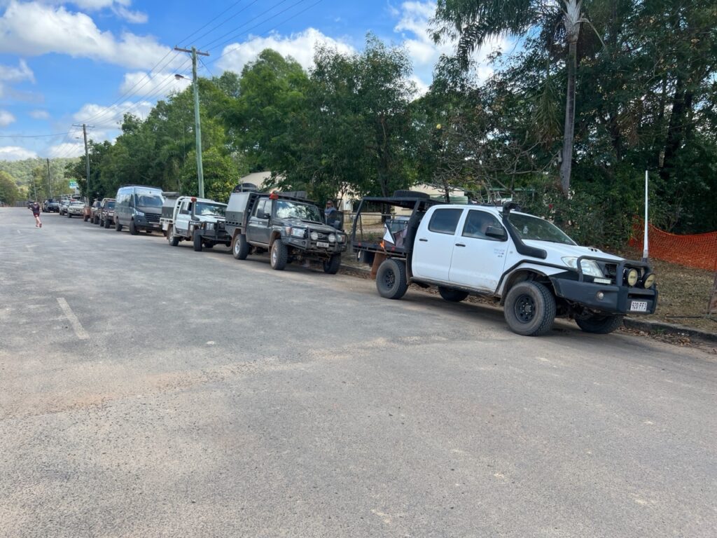
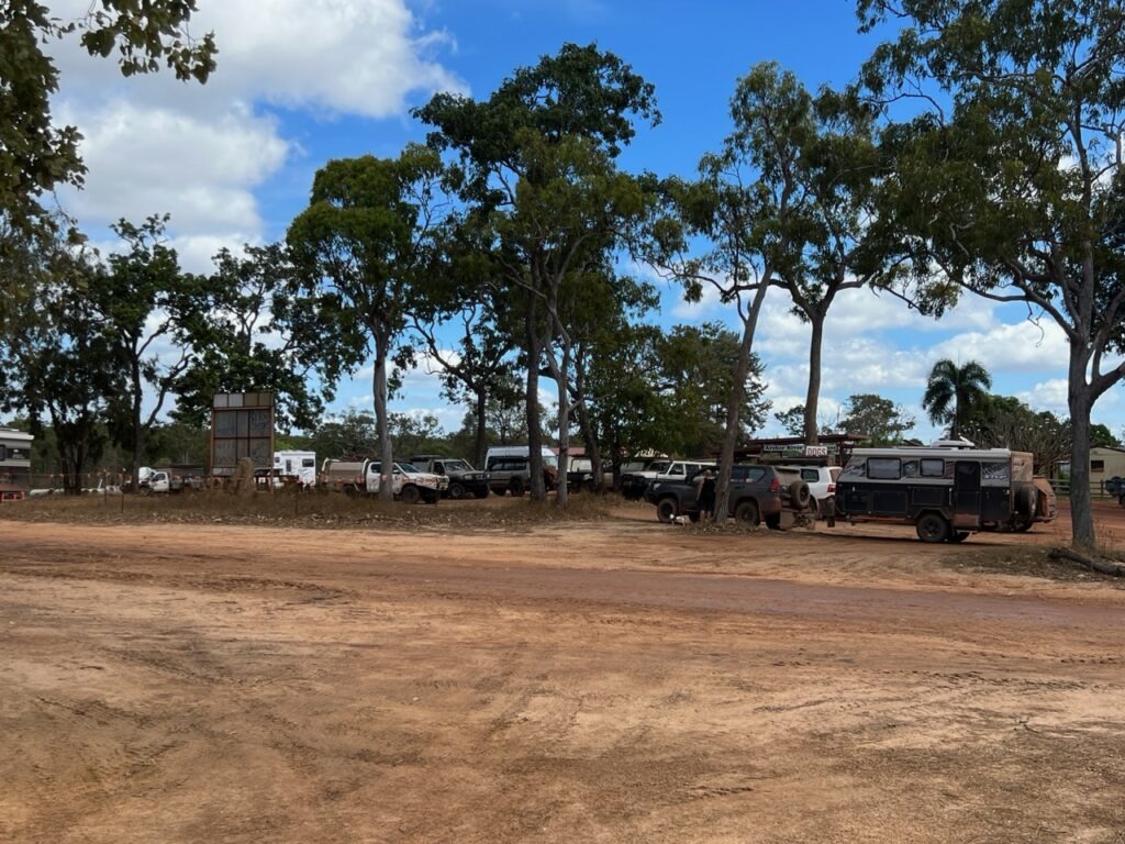
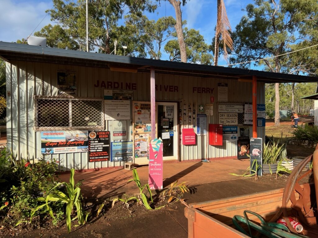
There is no town of any meaningful size after Mareeba but there are several roadhouses where travellers can get fuel and basic supplies en route. These were always interesting pit stops and part of the Cape York experience was stopping in to stock up and chat with those coming south as to the quality of the road ahead and depth of creek crossings ( the topics on every north-bound traveller’s mind ! ). Coen ( mid way up ) and Bamaga ( almost at the Cape ) are really only small villages – one comes with any spares and specific tools one might need ( we would learn this the hard way on the way back down ! ). There is of course the mining town of Weipa but it is well off the main track – one of the detours some choose to make.
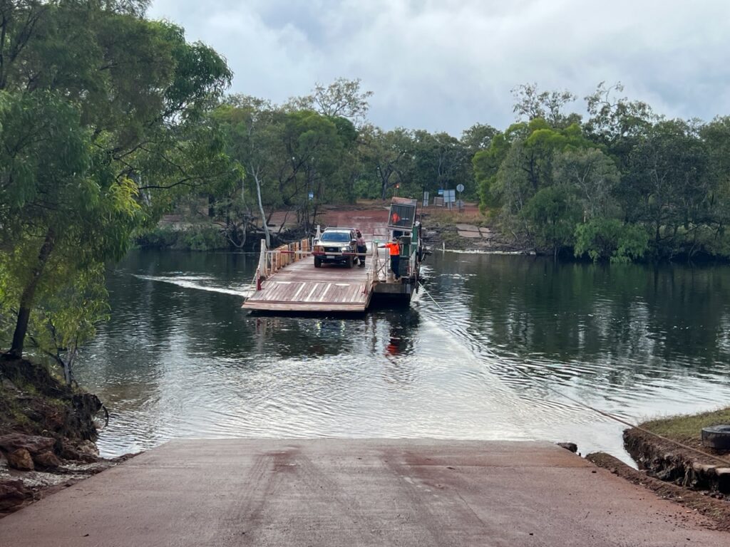
Approaching the very top of Cape York, the Jardine River must be crossed on a ferry – unlike the ( many ) other water crossings It’s simply too wide and too deep to drive through. It’s a simple cable ferry that runs back and forth on demand carrying a few vehicles at a time. You know you are almost there when you get this far, somewhat of a seminal moment – the problem is that the local town council who operate it also knows that you are almost there and, having come this far, NOTHING is going to stop you getting to the top. They are well aware that this little ferry, then, is rather critical to your plans to conquer the Cape and it is priced accordingly – we were on it less than 1 minute and paid $121 ( $108 Cdn / $80 USD ) for the privilege. Towing a caravan ( and most are ) ? You can double that. Talk about a captive market. The stock reply to those who complain ( and everyone does ) – “It’s free on the way back” 😊. Hey, at least the staff were very friendly !
While only a short run into Bamaga, it was probably the toughest section of gravel on the track to that point – perhaps, like horses close to home, it’s where drivers speed up. Consensus among experts is that it’s speed and vehicle size that do most of the road damage – we were constantly shocked at how fast some drove, even on horrendous corrugations ( making them even worse ). Plenty of speed warnings en route and lots of crashed vehicles left where they came to rest – some never learn.
From Bamaga, a rather poorly signposted route leads you out of town for the final 40 or so kms of windy, wet, narrow, corrugated, potholed jungle track to the Cape – no caravans ( trailers ) allowed. At 7 metres ( 23 feet ) long, we were the biggest vehicle on the track and it was, at times, very tight navigating the sharp corners as well as dodging the low overhanging tropical growth. Just one nasty creek crossing presented itself but fortunately it was not as deep as it looked.
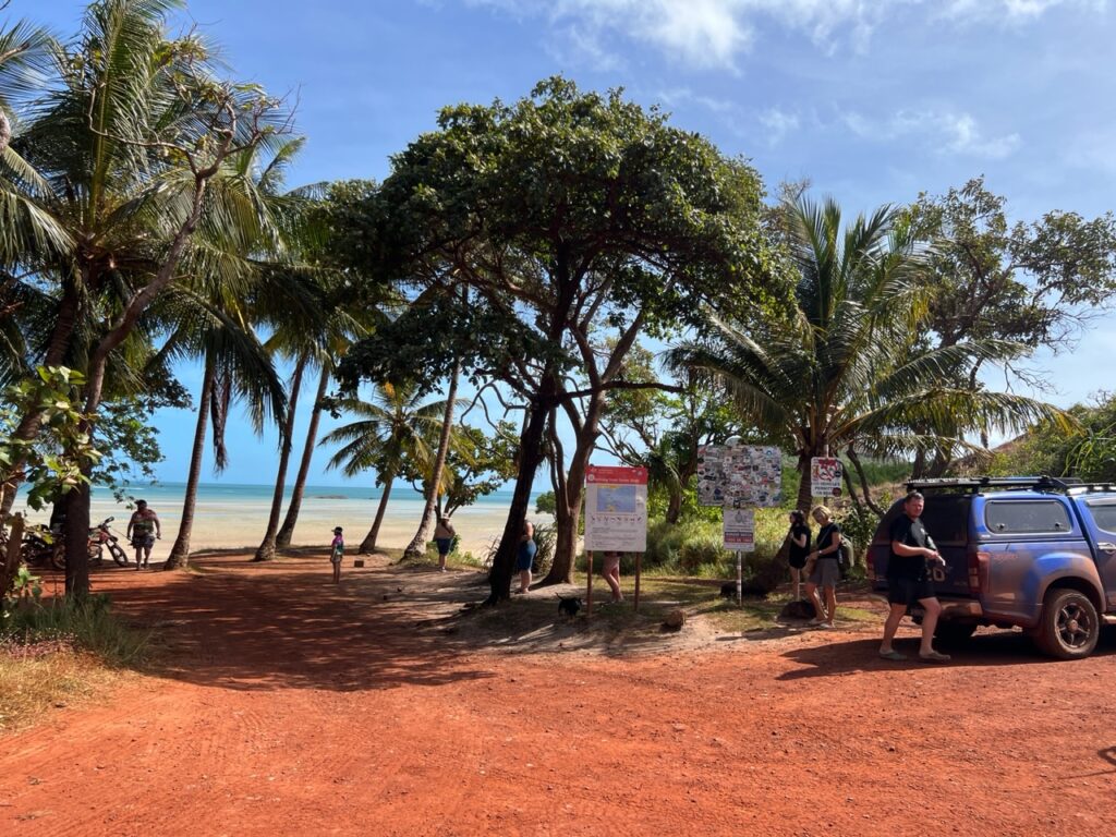
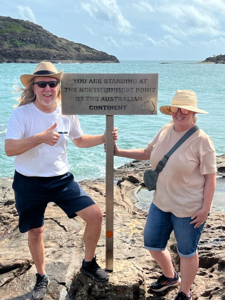
Arriving at the Cape car park ( which was totally full! ) palm fringed Torres Strait opens up in front of you, a very welcome sight after an hour winding though thick tropical jungle to get there. The mood was vibrant, everyone seemed very happy to be here and the sun had just broken though where it had been raining much of the last hour. Just a short walk across the beach ( no swimming – crocs everywhere up here ) and on to climb a rocky headland to Pajinka, the very northernmost tip of continental Australia………we’d made it !
Till next week (and the return trip)…….
Congratulations! Wow the dust! I wonder if your vehicle has cleanable cabin air filters
So much dust ! Good question re filter, and foolishly I had it changed BEFORE the trip to Cape York 🧐
Did the trip come in at 13 hours? I hope the last picture of the two of you by the sign made the trip worth the effort.
Lol !!! 13 hours ? Not close ! Re the picture, I’m reminded that “it’s often the journey not the destination” that is more memorable ! This would be one such case, especially the return – stay tuned for the next blog 😊