
Note: It appears that last week’s blog did not get picked up for distribution for some reason ? We use Mailchimp, which has, hitherto, reliably distributed each weekly update that we produce but seems that last week it had a hiccup of sorts. Anyway, for those that did not get last week’s, this week you get two. Enjoy…….!
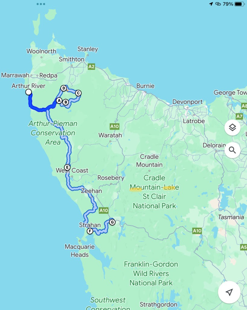
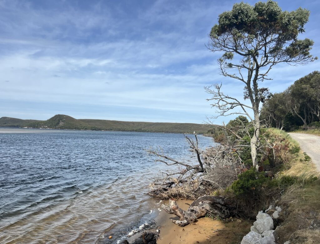
Given its proximity to Arthur River and multiple other traveller reports of it being a worthwhile detour, we opted to drive the “Tarkine Loop” just prior to heading south of the Western Explorer highway. Well worthwhile with some great hikes, sink holes, lakes, and panoramic viewpoints to checkout.
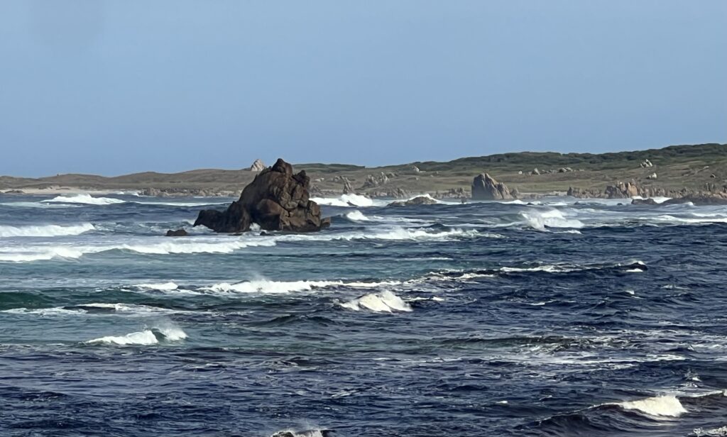
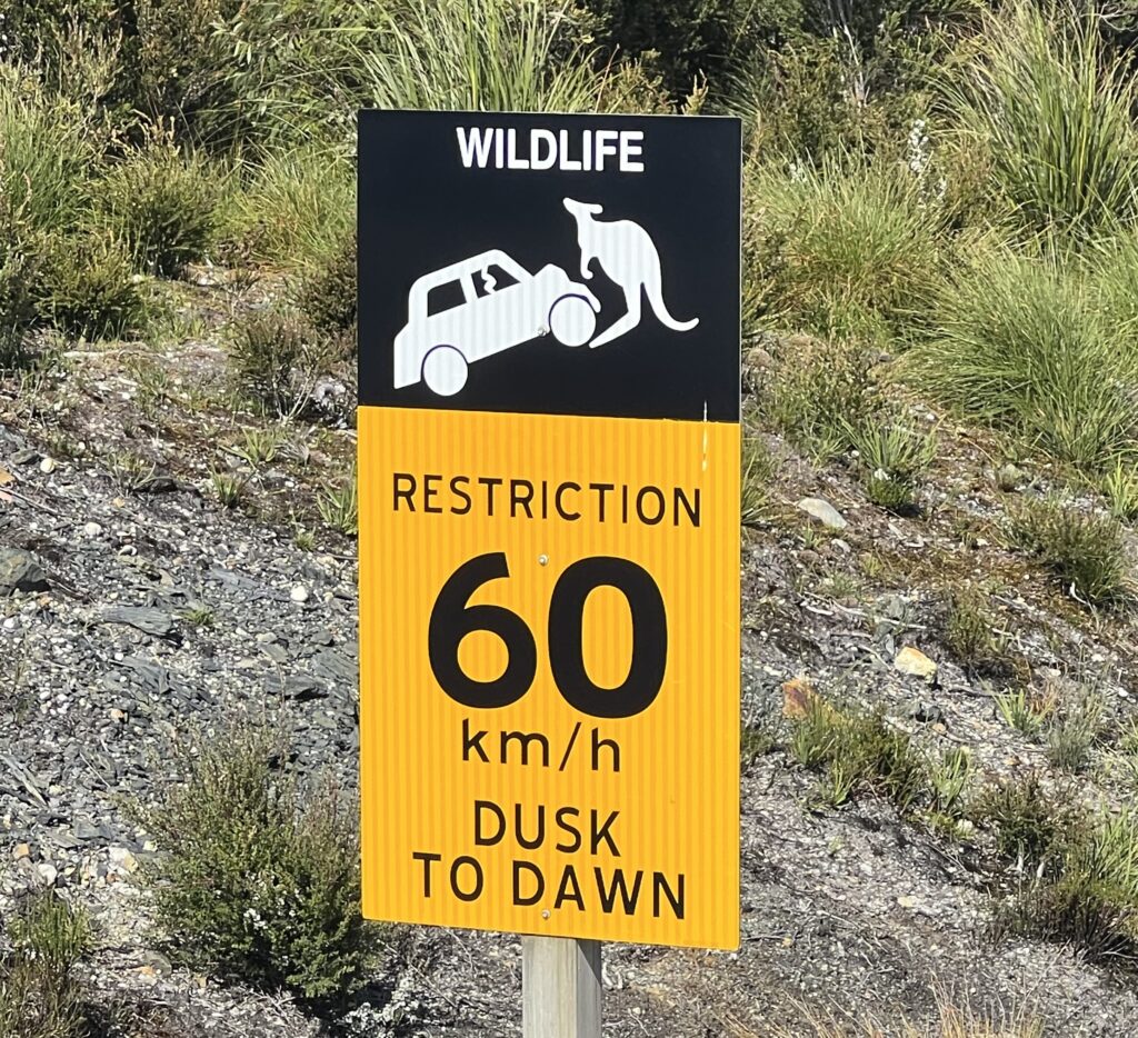
One of the real highlights of driving the west coast, though, is taking a route known as the “Western Explorer” – a remote, hilly, windy, and VERY dusty track between Arthur River and Zeehan. We’d expected far more traffic than we saw and ( quite happily ) had the “road” ( I use the term generously !) almost to ourselves. It can get very beat up after rains and heavy use but timing helped us here as the route had just been graded in advance of the expected influx of summer traffic. With steep hills, sharp corners and dust often obscuring visibility it can be hazardous – as always, driving to conditions is key. In order to tame drivers’ appetite for speed ( 80km/h would be fast on this road ) distances are given in terms of “time” to destinations, rather than the usual kilometres.
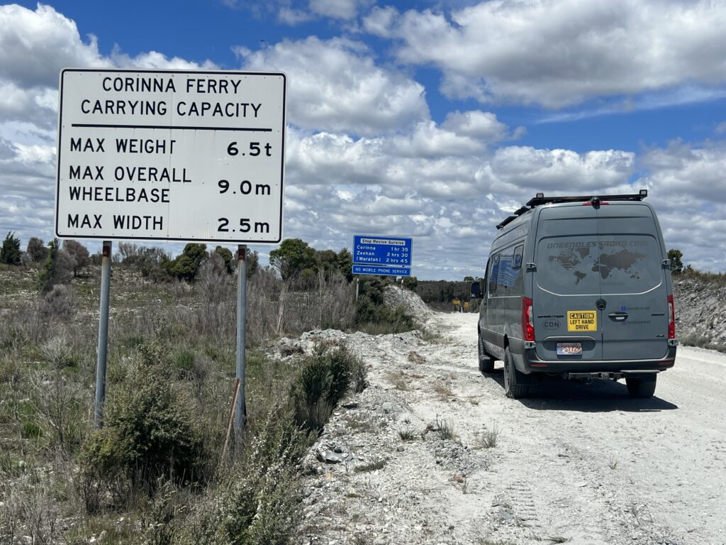
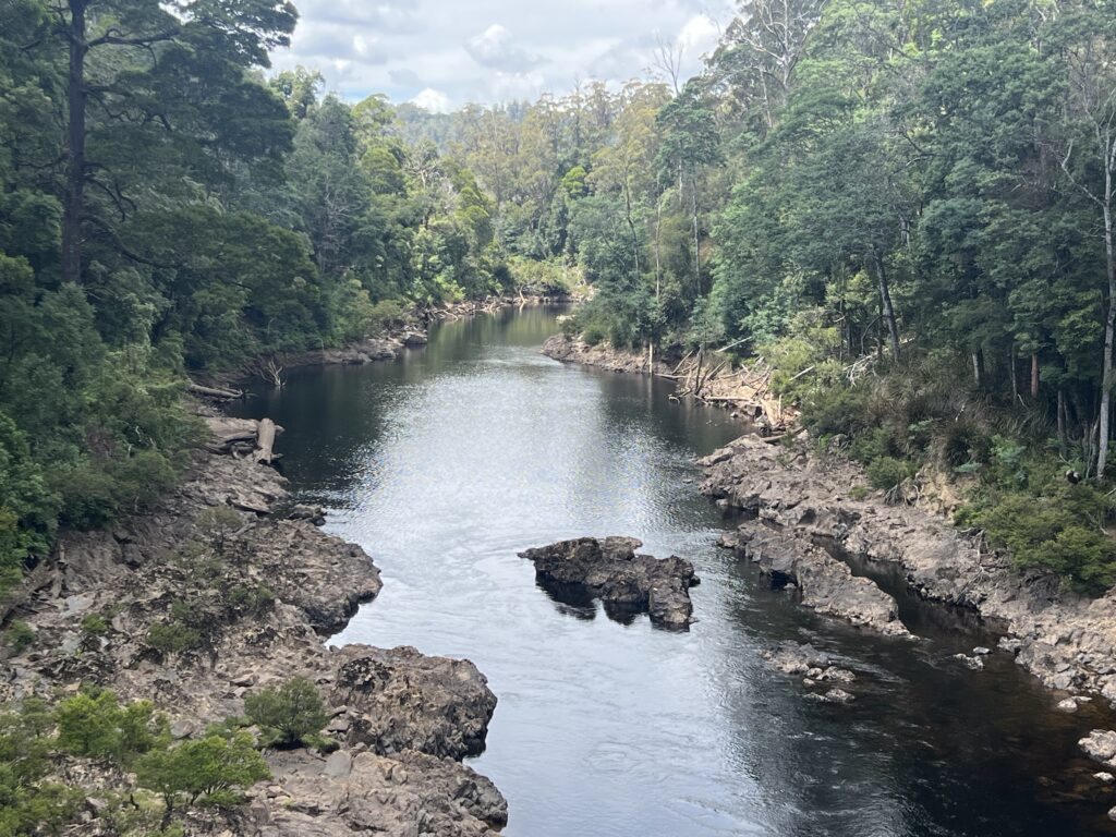
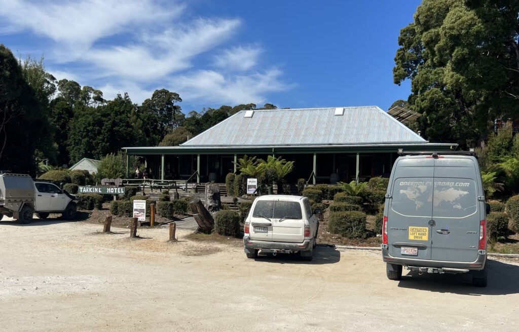
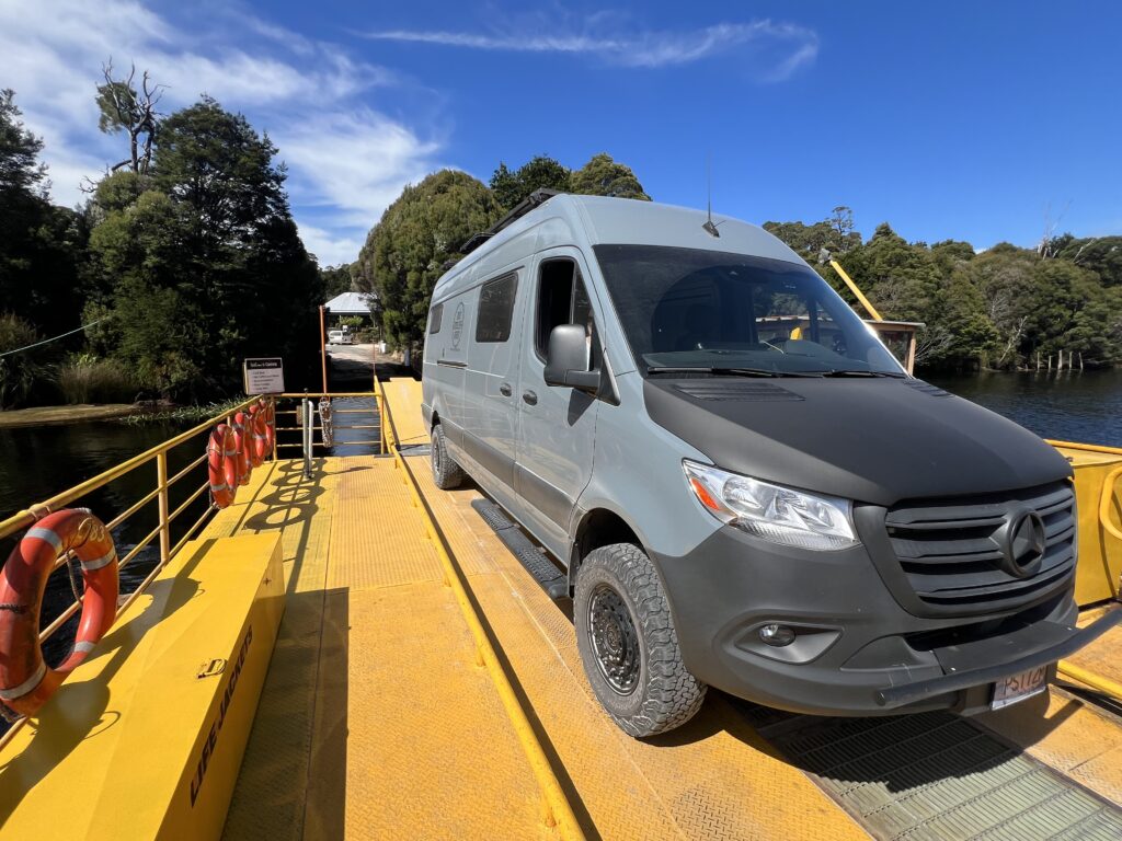
The only settlement of any note between Arthur River and Zeehan is Corinna – not so much a “settlement” even as a ferry crossing with a pub, gift shop, and campground. Being the point where the punt crosses the river though, it is incredibly lush, scenic and a real travellers crossroads – we’d love to have spent a night even, but inquiries as to campsite availability yielded a polite “Sorry, full for the season!”. Popular place !
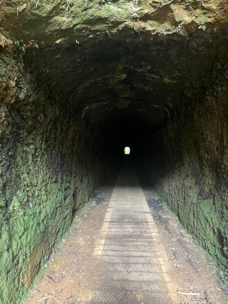
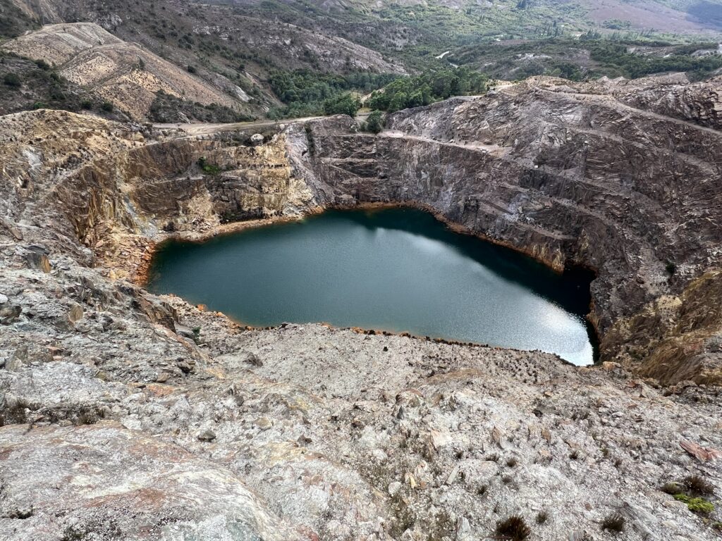
Zeehan was at one point a major mining location but its mining glory days are long gone. Remnants of the mine ( a tunnel carved from rock ) are visible and the road in and out to the tunnel was, well “exhilarating”, shall we say – one lane only and definitely THE narrowest dirt road we’ve been on in Tassie so far. Not for the faint of heart ! Our first time camping at a golf club, but not to be out last, with nearby Strahan offering up the same arrangement the following day ( thankfully this time on grass, not mud ! ).
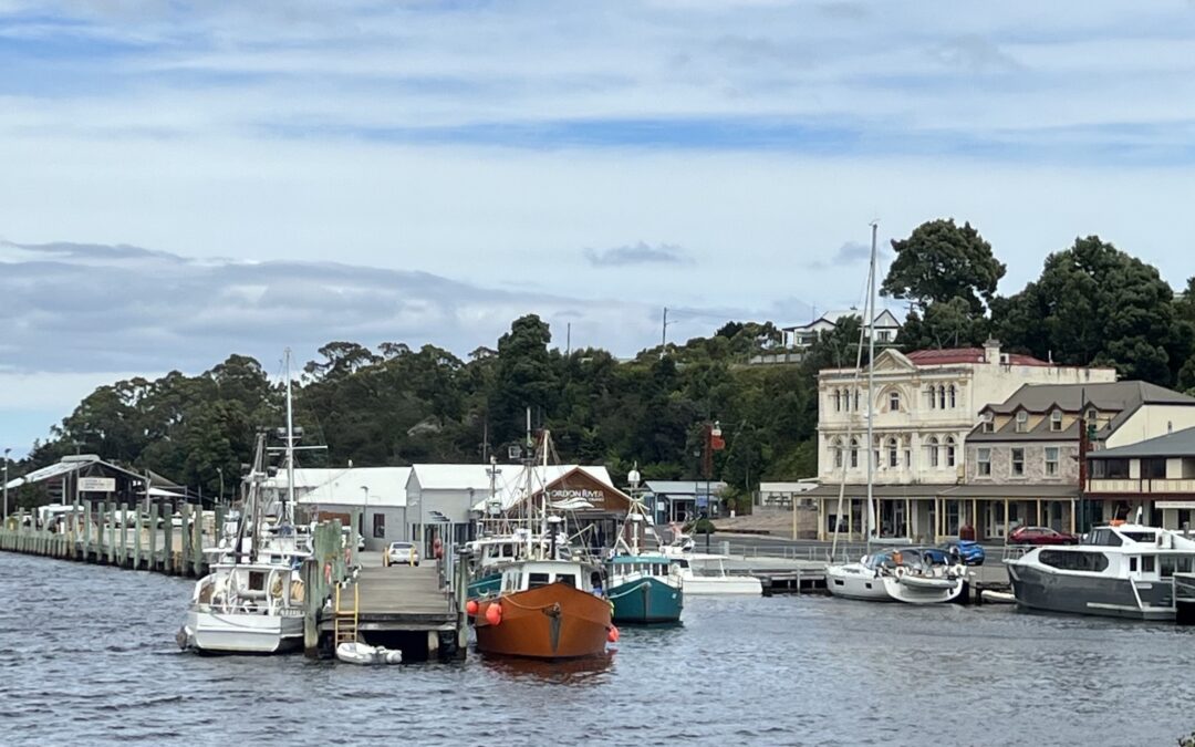
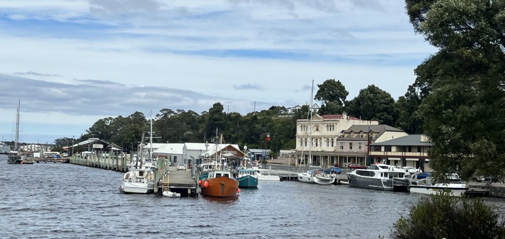
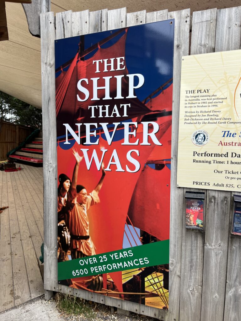
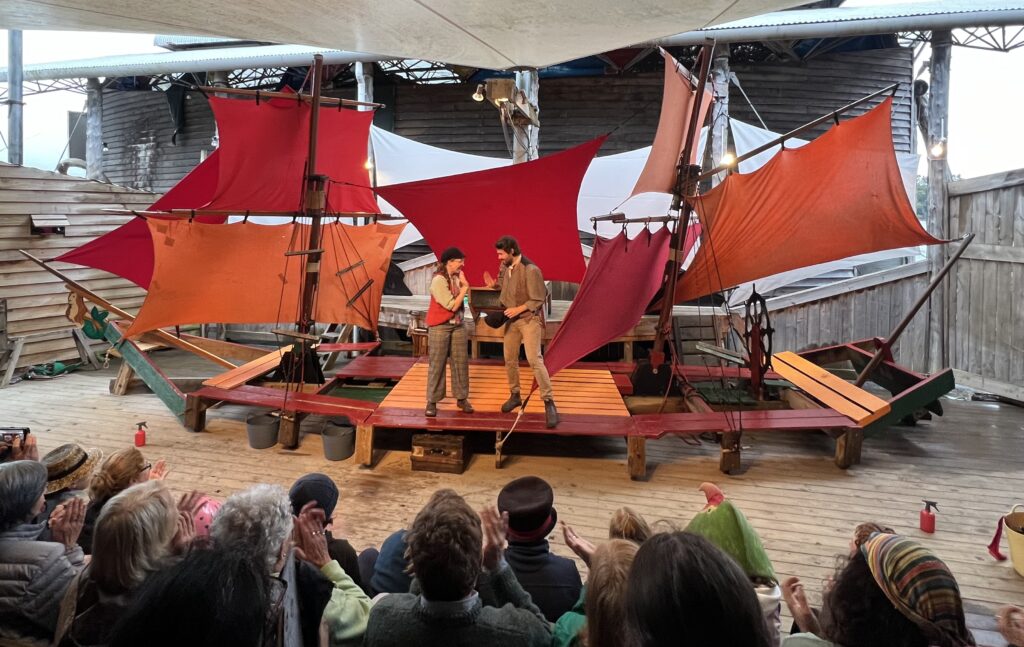
Strahan is more or less the major town on the west side of Tassie, and a beautiful port with a scenic mountain backdrop. A bit like Arthur River in that it is primarily noted for its great hikes and river cruises ( the Gordon River, in this case ), but unlike Arthur River, where the weather was spectacular, in Strahan it was not – sadly just too misty and windy to enjoy any of its outdoor pleasures. Now, not that we are suddenly becoming “culture vultures” ( as my sister called us ) but, given the inclement weather, we thoroughly enjoyed a little indoor entertainment while there – Strahan’s legendary play “The Ship That Never Was” – in fact, it’s Australia’s longest running play, and based on a true story. Not what we expected in Tassie, but highly recommended !
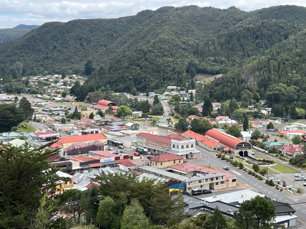
Strahan is as far south as you can go ( by road ) on the west coast and at this point the highway turns eastward towards historic Queenstown. Like Zeehan, Queenstown was originally primarily a mining town ( copper, mostly ) – while it’s still got a solid mining base it’s now morphed into some pretty serious tourism endeavors, with nearby hiking and mountain biking trails bringing tourists from far and wide. Its steam train had been a big draw but track repair means the route is currently a shadow of its former self, only running a fraction of its normal route. We passed.
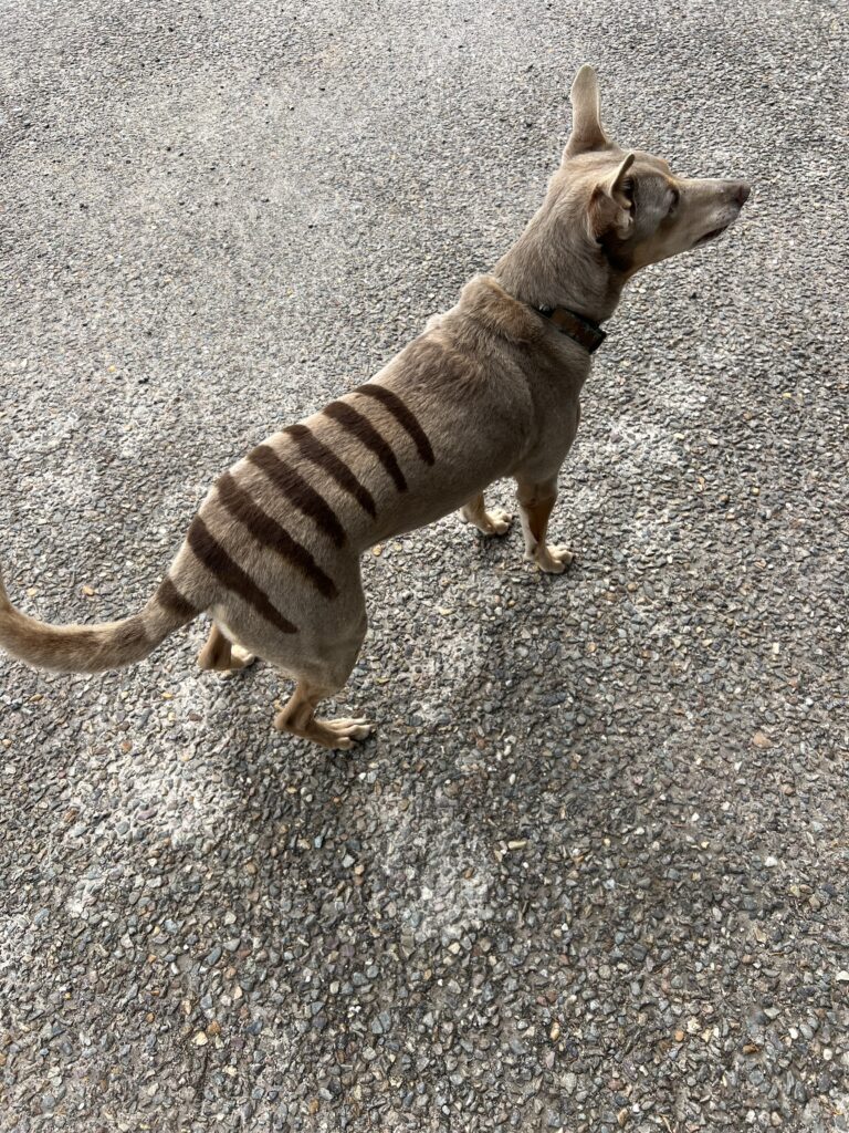
I’ll close this week on a somewhat bizarre note. Not sure whether to laugh or cry, actually. All Australians know of the Tasmanian Tiger – a wild dog like animal native to Tasmania that became extinct when the last known specimen died in a Hobart zoo in 1936. Rumors of sightings appear in the media occasionally but it’s generally accepted that, sadly, they are gone forever. I’ve included a picture of one of the last surviving examples below:
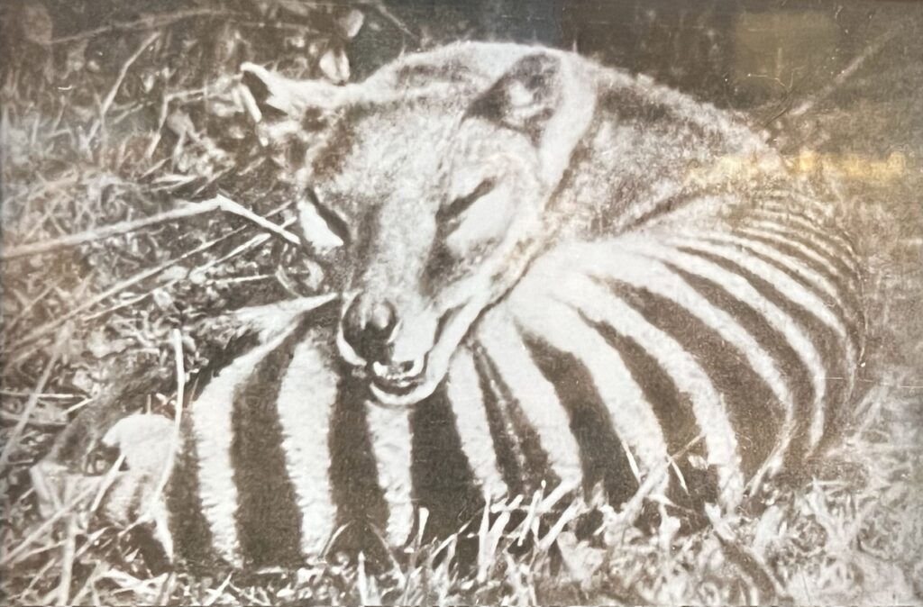
Just as we were about to leave Queenstown, we wandered around the campsite and came upon ….wait for it – a Tasmanian Tiger ( or so it appeared ) ! We absolutely did a double take, both of us knowing there were none known to exist, either in captivity or in the wild. Turns out our camping neighbours must have really wanted one and used a vegetable dye to make their kelpie look like a Tasmanian Tiger. Hmmmmmmm……!
From Queenstown our route onwards will take us across some pretty spectacular scenery, famous lakes and rivers, indeed some of Tassie’s very finest ! More on that next update.
Till next week…..
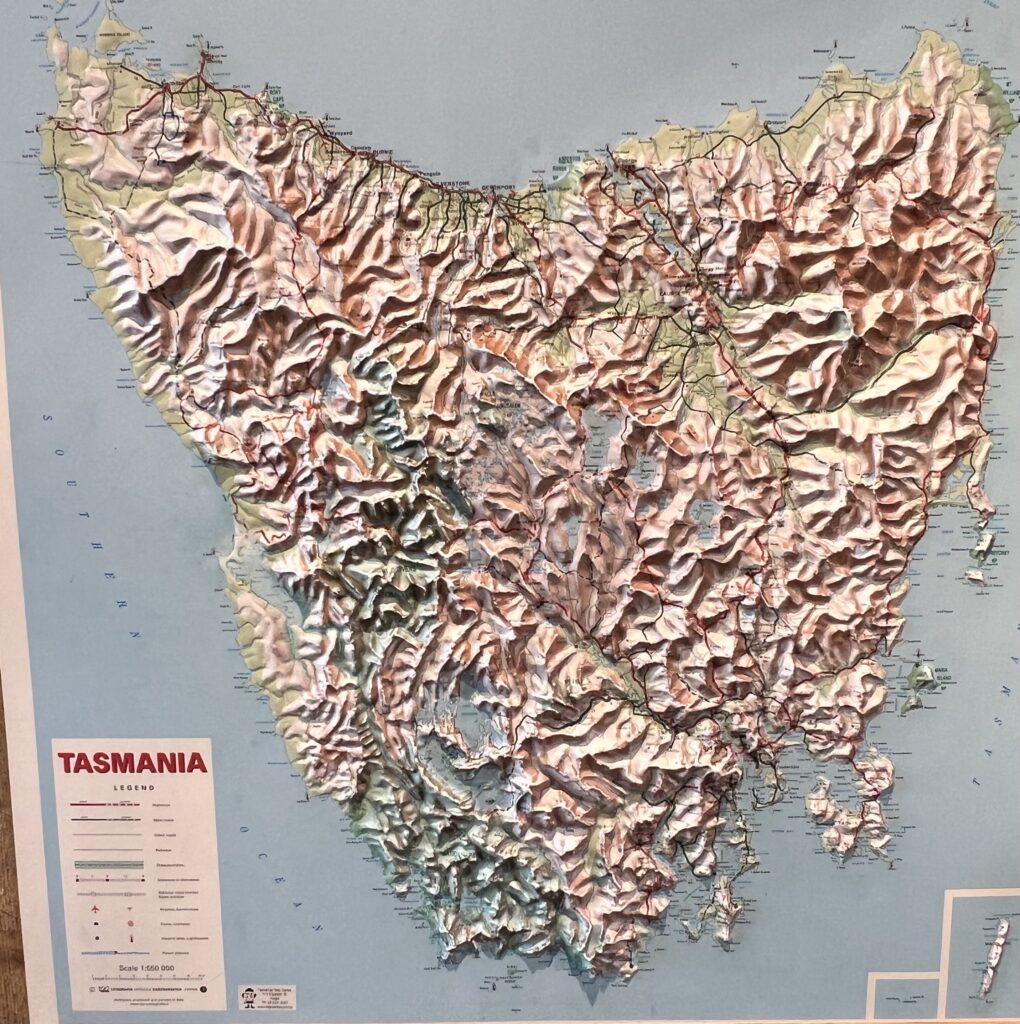
Was wondering what happened when got no new post notifications! Tasmania looks like a crumpled cardboard in topographic view!
Yes, we’re back ! Well, we never really went away, just a technical snafu with Mailchimp which we hope is sorted !
Loved Tassie when we were there, 3 of favourite items from our trip, Cradle mountain, where saw every animal we could including a platypus in the stream. Wineglass Bay, so beautiful, and the Mona museum in Hobart. The MONA even made their own beer and wine!
Enjoy you guys.
Hi Ernie,
Saving Cradle Mountain for last, and WinegLass Bay lies just ahead.
Ahhhhh, MONA. MONA, MONA, MONA. Heard much about it ( always very mixed comments I should add ) and based on it being pretty “eclectic” had decided to pass ( having never attended an abstract museum I’d return to – anywhere ! ). I’m the kind of museum-goer that could spend a week in the Smithsonian, and never tire of war, or history, museums in any city, so figured MONA was just not my bag. Reviews on our WikiCamps app were 50/50 ( scathing or glowing ) so we had decided to pass. Then, we decided, what the heck, we are here, let’s just go – so we went…….and it was closed !!!!!! Oddly, it’s open Thursday to Monday ( we were there on a Tuesday ). Bizarre hours for a bizarre place we thought ( par for the course ).
Thanks for the update!
Safe travels
Ed & Mae
Thanks guys !
HI Guys, Glad your back. I figured you had a malfunction. Tasmania looks alot larger than I thought.
Were you listening to slim dusty on the dusty trails?? lol…….
Lot’s of terrain to explore. Have fun!
Hi Kim,
Yes, minor malfunction ! Seems all good now.
No Slim Dusty, Lois is not a fan!!! Lol
This place looks small but it takes a while to get around !
Hi to Andy and Lois says hi !